5th & Missouri MetroLink Station East St. Louis, Illinois
I like East Louis, Illinois. Yes, it has been hit hard by abandonment but, oddly enough, that’s part of it’s appeal. There’s so much to be done!
East St. Louis is a city in St. Clair County, Illinois, United States, directly across the Mississippi River from St. Louis, Missouri in the Metro-East region of Southern Illinois. As of the 2010 census, the city had a total population of 27,006, less than one-third of its peak of 82,366 in 1950. Like many larger industrial cities, it has been severely affected by loss of jobs in the restructuring of the railroad industry and de-industrialization of the Rust Belt in the second half of the 20th century. In 1950 East St. Louis was the 4th largest city in Illinois. (Wikipedia)
Last week I visited the 5th & Missouri MetroLink Station twice (Monday & Thursday). Thursday was for the grand opening of Legends Restaurant & Sports Bar just a half block from the station. I’d met Mayor Alvin Parks before but I was a bit starstruck by Jackie Joyner-Kersee.
So now they’ve got a nice restaurant in downtown East st. Louis, there might be others but not that I’ve seen. Still, the most common elements around the light rail station are parking, vacant buildings and vacant land. Tomorrow I’ll post about the amazing development that’s taken place around the next station east, Emerson Park, but today is about the 5th & Missouri Station area.
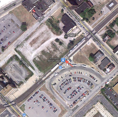
The station opened as part of the original MetroLink line on July 31, 1993, it was the east end of the line. “The station features 322 Park-Ride spaces, including 25 long term spaces.” (Wikipedia). Numerous bus routes serving St. Clair & Madison counties stop at the station.
Access to the platform is via a single point. 5th & Missouri is the intersection at the top of the above map so I’m not exactly sure how that intersection was picked as the name for the station. The railroad right-of-way that was used is equal distance between 5th & 6th, with the entry point facing 6th. The entry to the station is also halfway between Route 15 (Broadway) on the bottom left and Missouri Ave, upper right.
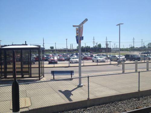
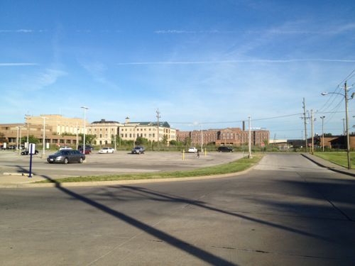
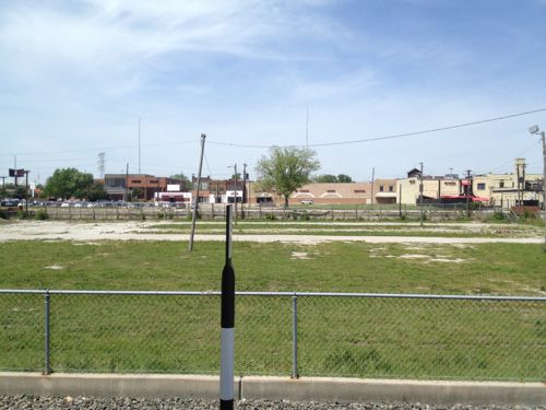
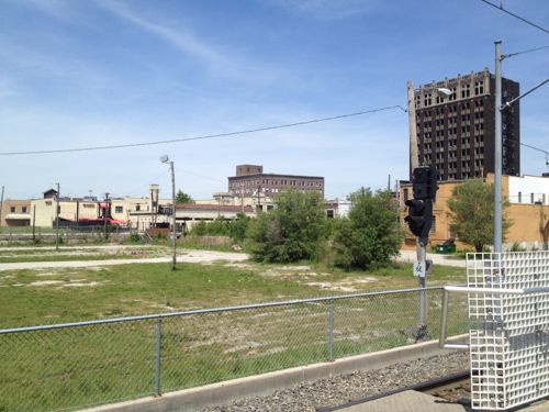
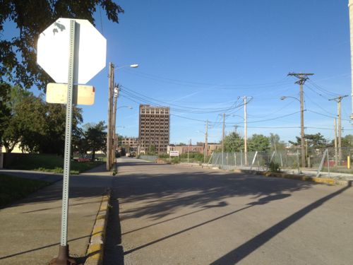
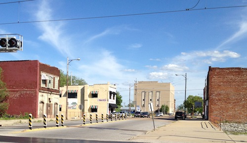
East St. Louis Mayor Alvin Parks and City Manager Deletra Hudson mentioned a downtown plan but I haven’t received a copy after making personal and email requests. Who knows if it’s any good or realistic? The problems are serious, some beyond their control.
In August 2007, the Federal Emergency Management Agency (FEMA) announced its conclusion that the levees protecting a large area in Southwestern Illinois from flooding no longer meet the agency’s requirements. The result of FEMA’s conclusion is to change Southwestern Illinois’ flood insurance designation as part of its national Flood Map modernization process. FEMA’s actions would classify much of St. Louis’ Metro East as subject to flooding as if the levee system did not exist at all. This conclusion was based on a finding by the U.S. Army Corps of Engineers (USACE) that the agency had “reduced confidence” that the 74-mile levee system could protect against a flood that has a 1% chance of being equaled or exceeded in any single year (commonly referred to as a 100-year flood or a base flood) without the need for flood fighting. As a result, the American Bottom, an area of 174 square miles in Southwestern Illinois that is home to 156,000 people, 4,000 businesses and 56,000 jobs in 25 communities in Madison, St. Clair and Monroe counties, would be declared a Special Flood Hazard Area (SFHA), with dire consequences for our region’s economy. While we continue to dispute FEMA’s conclusion, we must take immediate steps to demonstrate that we can meet FEMA’s standards for flood protection. (The Southwestern Illinois Flood Prevention District Council)
I’m rooting for a comeback in East St. Louis, but the odds are good. Tomorrow I’ll show you a reason to bet on East St. Louis’ success.
– Steve Patterson
Betting on East St. Louis’ success? I want some of that action.
Maybe Paul McKee and his group should roll ESL into the NSL package…..and really go for broke (which is what will happen)! In this economy, neither ESL nor NSL has even a slim chance of recovery, at least in the next 15 years, IMHO. Once an area is thoroughly squeezed, suctioned, then squeezed and suctioned again, as both ESL and NSL have been, very little can be done to revive it, unless there’re some experienced investors with big bucks patiently lingering on the sidelines, thinking outside the box, ready to re-entergize when the bottom has entirely dropped out. Building overpriced homes in an area ain’t gonna beckon potential residents to an area, unless the wrecking ball has been used to entirely clear out slums and decay within a radius of a two hour distance on foot…and only then if a 12′ reinforced concrete wall encloses the newly developed area.
What an innovative and original proposal!
That’s why I make the big bucks, Duckworth!
I agree Msrdls….I would think that North St Louis would be a great place to layout some institutional size farms and revert backwards.
Better in East St Louis – it’s already a dangerous flood zone, according to FEMA. Build houses in NSL for the ex-ESL residents, and sell off the land to farmers…
ESL has always been in a bad state, even in it’s supposed heyday. Corruption and industry have always had total control in ESL and still do today. Until that changes nothing else will change there.