Travel: Elevated Highway Removal In Oklahoma City Part 2
Yesterday I ended part 1 with the following photo showing Oklahoma City directing people from downtown, past where the old elevated I-40 was, through a desolate area toward the new I-40 and the Oklahoma River beyond.
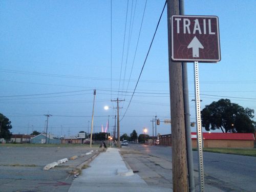
The new I-40 is a half mile south of the Myriad Botanical Gardens, a recently revamped space occupying a superblock made up of four city blocks. The Myriad Gardens now has many spaces along the lines of those at Citygarden, for example, interactive water features. The half mile space between the gardens and the new highway is pretty much a wasteland, long cut off from downtown by the old I-40. The river and waterside trail system is an another half mile south of the new highway, through a very low income neighborhood.
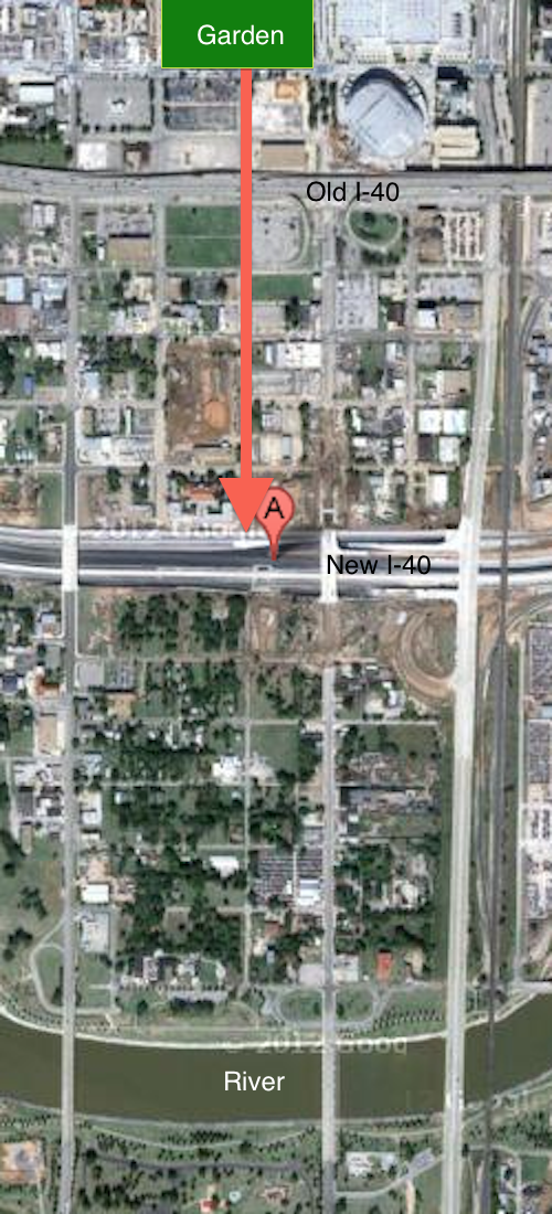
Does Oklahoma City really think people will walk through these areas? The two nights I did it I saw many people: individuals, couples & families. In time the half mile zone between the old highway and the new highway will be redeveloped and occupied. The removal of the old elevated highway is allowing development to spread whereas before it was contained. Why are people walking there now you ask? The major roads that cross over the new I-40 all have generous sidewalks but a pedestrian-only bridge was also constructed where Harvey Ave reaches the new highway.
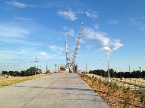
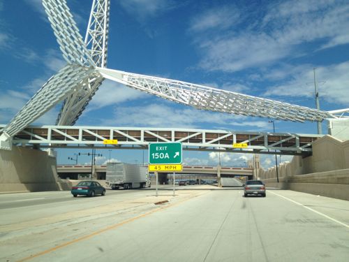
I saw the pedestrian bridge the first time as my train pulled in a night. At the time I wasn’t sure what it was but I asked my brother right away, it was just too intriguing not to be curious. The next day we drove under it as we returned downtown. The also allowed me to experience the new I-40 alignment.
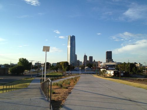
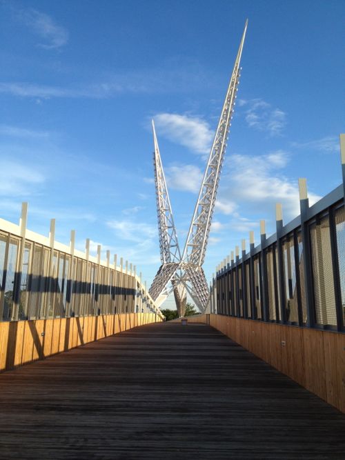
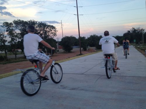
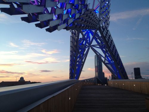
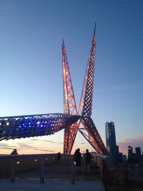
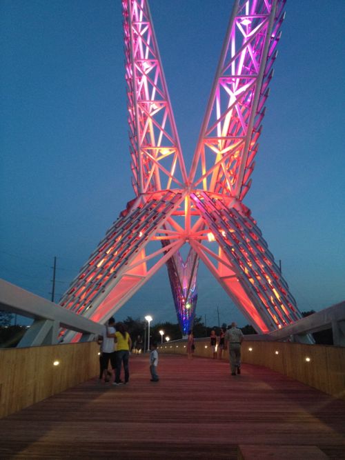
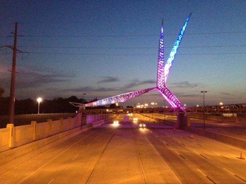
I visited two nights in a row and talked with numerous strangers both times. My entire life this area was a “bad” part of town and here I was talking with strangers at night. They’ve successfully begun to change perceptions of an area ignored for decades!
Take a look to see why.
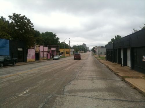
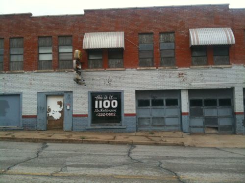
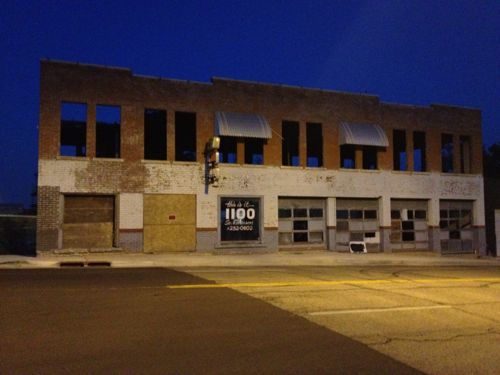
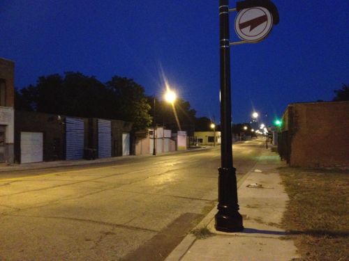
I’m still amazed I was exploring this area alone, at night, in a wheelchair! Their Core to Shore plan was big:
In 2006, the City of Oklahoma City undertook an ambitious planning process to redevelop 750 acres of underutilized land between the core of downtown to the shore of the Oklahoma River.
Envisioned as Core to Shore, efforts are now underway to build and connect a series of neighborhoods, parks, and economic opportunities that will reinvent downtown Oklahoma City, leading to new jobs and a higher quality of life for residents.
Major aspects of the Core to Shore plan include:
- Creation of a world-class, pedestrian-friendly boulevard
- Development of a 40-acre central park
- Development of business, retail and mixed use housing along the central park
- Building of a Convention Center and Convention Center hotel
- Relocation of some of the existing businesses and homes in the area
This is a vastly different thinking than the 1960s Pei Plan that led to the destruction of much of downtown and the creation of many superblocks. Financing for this work was part of the Metropolitan Area Projects Plan (MAPS) which began in the early 1990s. The highway move and other recent work was part of the third phase, MAPS3.
Many have been critical of the taxes paid and the cumulative costs of the numerous projects over the last 20 years. But schools have been updated, downtown energized, attracted a winning NBA franchise, saw massive private investment from major corporations (Chesapeake, Devon, SandRidge, etc.
In the country as a whole, single-family woes are fueling the multifamily surge. Stubbornly persistent foreclosure rates, mortgage bankers’ continued reluctance to lend to any but those with the very best credit and most stable employment history, as well as still-high unemployment in most places, have apartment investors investing in new product.
But here, a healthy local economy — enviable unemployment rates, population growth on the rise — has cautious and seasoned but willing single-family builders building again. (newsok.com)
Investing in your community pays dividends! It doesn’t happen overnight but financing the big ideas gets noticed eventually. Oklahoma City’s 2010 population was 579,999 and the metropolitan area was 1,322,459, half that of Greater St. Louis.
Back to St. Louis:
This is the type of planning St. Louis should’ve been doing to reclaim areas like Pruitt-Igoe and the 22nd Street Interchange, two areas where Paul McKee stepped in to fill the city’s planning absence.
It’s I-70 that currently uses the elevated and depressed highway dividing parts of downtown St. Louis. In 2014 I-70 will cross over into Illinois on the north edge of downtown rather than on the south edge at the Poplar Street Bridge.
— Steve Patterson
One, this seems like a positive project, albeit a complex one and one still very much a work in progress. Two, it’s great to see that the public was willing to fund it – I’m guessing that having one city and county made it an easier sell than trying to do something similar with our current fragmented local political structure. Three, OKC spent some serious $$$$, probably justifiably, to build that “scissor-tailed flycatcher [that] sits on top of the Skydance bridge”; we already have our iconic arch. And four, after all these major public investments, the real measure of success is in how the private sector follows.
I don’t know OKC, I do know Denver. This project seems similar to what Denver’s done successfully in an area known as the Lower Platte Valley, using many of he same types of investments – new public park, new skatepark, new pedestrian connections, new infill construction. And one thing that Denver has (and I’m clueless about this here) is something called 1% for the arts, a law that requires 1% of any construction budget on public projects be dedicated to public art. The result has been a wide range of installations, some as large as the scissor-tailed flycatcher, some as small as 2-D wall pieces in new police substations. Should we require something similar here? Or should we focus all our efforts on all our deferred maintenance?
I agree, we need to have a better vision on how St. Louis will evolve in the 21st Century. We also need the political will and the funding to make it a reality. These major investments take big dollars and looking beyond ward boundaries and city versus county, not just talk. The city is facing the hard reality of unfunded pension liabilities and static tax revenues – can (and should) we borrow our way way to success, assuming that more sales tax increases are going to be a tough sell here? Can we convince people in St. Peters and Maryland Heights to support public investments that will make McKee’s vision doable? Both Denver and OKC passed their bond issues and tax increases in better financial times – can we do something similar here?
One last thought, given OKC’s apparent success in relocating I-40 south, why shouldn’t we look at connecting 21st & Market and 9th & Howard with a depressed freeway? This would get through traffic away from our riverfront and open up underused parcels north and west of downtown to redevelopment. Or would have OKC actually been better off if they had just converted the elevated part of I-40 into an urban boulevard, without creating the new, parallel freeway?
1) That’s a lot of building in an expensive area for not much gain.
2) OKC would have been find with just a boulevard. Calgary and Edmonton, which are similar to OKC in many ways (particularly size), have no downtown freeways, and make up for it with extremely high (by North American standards) transit ridership.
This was in reply to JZ71