Little Change on Dr. Martin Luther King Drive

This is my ninth look at St. Louis’ Martin Luther King Jr. Drive on Martin Luther King Day.  As before, the street doesn’t do the man justice. For the previous eight years I started downtown, west to the city limits and returned. That was done by car or motor scooter, but I longer have a car.  Recently returning to St. Louis in a rented car I had the foresight to exit I-44 at Jamison, making my way over to McCausland and Skinker to the west end of MLK Dr.

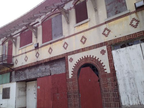
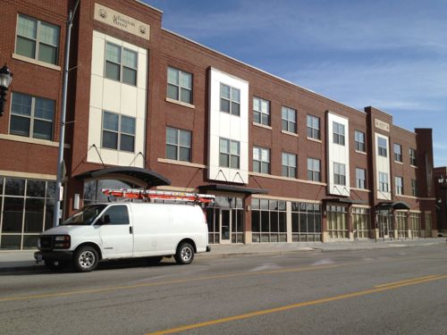
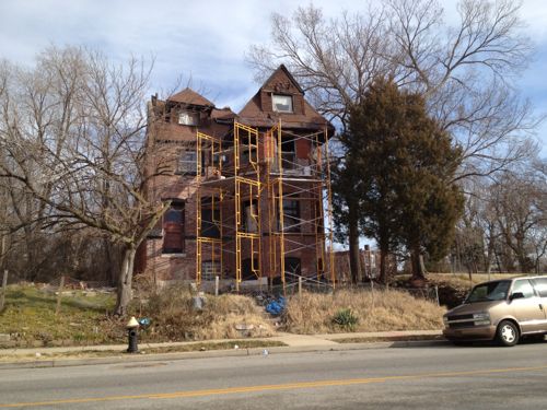
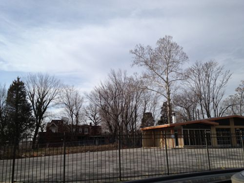
The following are sixteen images from my drive east to downtown.
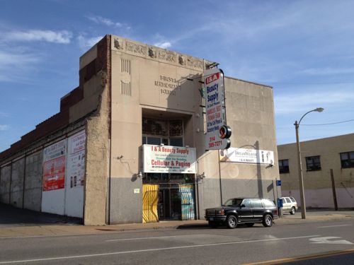
ABOVE: Commercial district continues west off the city limits
ABOVE: Commercial district continues west off the city limits line
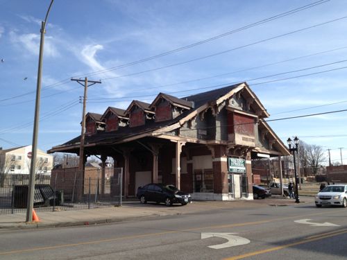
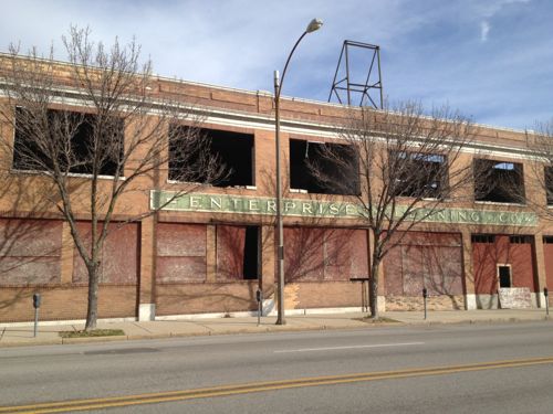
ABOVE: Just inside the city limits is the old Wellston Loop streetcar building
ABOVE: Across the street the once bustling district is largely vacsant
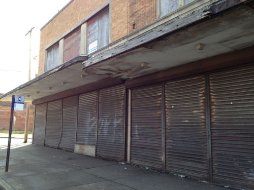
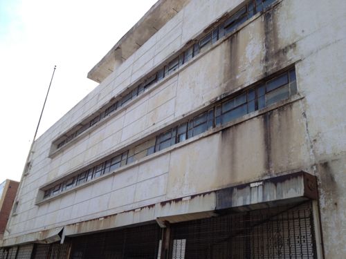
ABOVE: The former JC Penny store continues to deteriorate
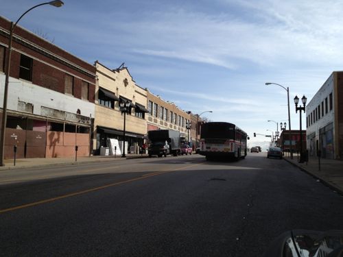
ABOVE: But businesses do exist today, still serving the needs of area residents
ABOVE: Just east of Goodfellow is one of my personal favorites
ABOVE: Housing development Arlington Grove is now open -- and fully occupied. More on this tomorrow.
ABOVE: Housing development Arlington Grove is now open — the residential units are fully occupied. More on this tomorrow.
ABOVE: Surprised to see this building still standing, even more surprised to see the front being tuck pointed.
ABOVE: Two of the four corners of Union & MLK have former gas stations, a third is currently a gas station.
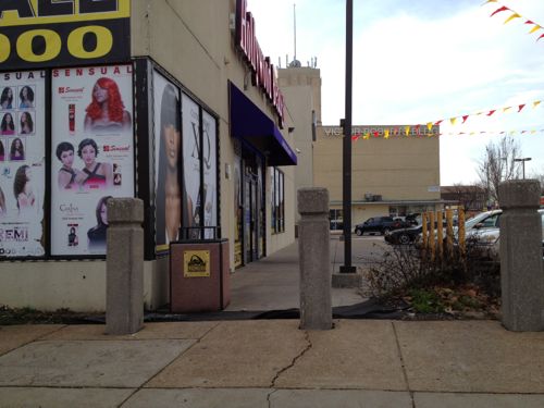
ABOVE: A new tenant is in the retail space at MLK & Kingshighway, but it wasn't even built with a connection to the public sidewalk just a few feet away
ABOVE: A new tenant is in the retail space at MLK & Kingshighway, but it wasn’t even built with a connection to the public sidewalk just a couple of feet away
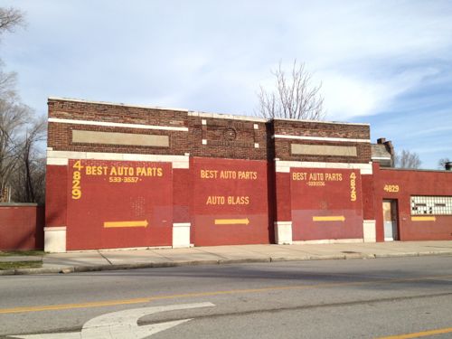
ABOVE: Boards over former windows is a too common sight
ABOVE: Boards over former windows is a too common sight, auto-related businesses dominate the area east of Kingshighway
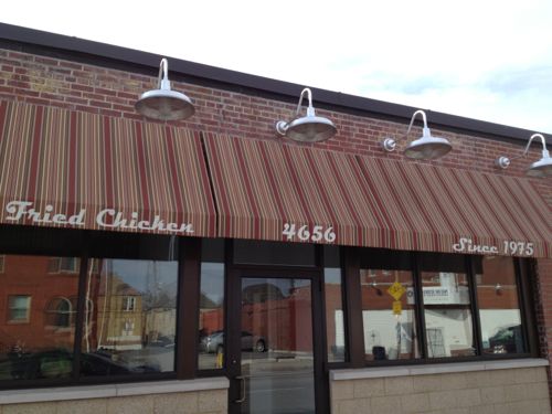
ABOVE: Across from the renovated buildings of Dick Gregory Place is a nice looking restaurant
ABOVE: Across from the renovated buildings of Dick Gregory Place is a nice looking restaurant, Arkansas Fried Chicken. Click image for Yelp listing
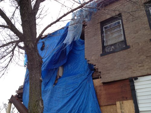
ABOVE: The corner of one building is collapsing
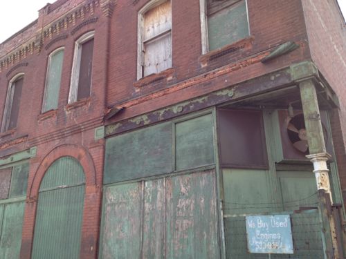
ABOVE: Another favorite building waiting for a new use.
ABOVE: Nearby is yet another favorite, in very original condition.
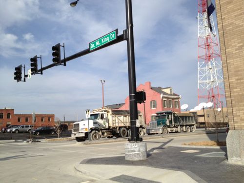
ABOVE: Skipping ahead from Vandeventer to Tucker we have the ongoing project to fill in the former railroad tunnel.

A few bright spots exist along this 5.7 mile stretch (map), but a more comprehensive approach is needed to address the myriad of problems that exist. The piecemeal approach isn’t going to do much beyond the immediate areas that have seen reinvestment.

We must find ways to get sources of good employment in the area again. It’s easy for you tell tell me the reasons why reality is that won’t happen, why jobs left and won’t return. I know why.  I want to know ideas for bringing new jobs in the future.

Tomorrow I’ll take a closer look at the Arlington Heights Apartments.

— Steve Patterson
 

Poll: How Often Do You Rent A Car?

Rental cars have been around for decades, especially serving business travelers. Enterprise began in St. Louis serving the needs of others needing a car temporarily. It is a huge industry:

In 2011, the U.S. car rental industry achieved record rental revenue of $22.4 billion, an 8.1% increase over 2010. (Auto Rental News)

I hadn’t rented a car in nearly a decade but last week I had to pick up my brother in Oklahoma City,OK and get to Amarillo, TX on short notice. The only mode possible was drive — but I sold my car last April.

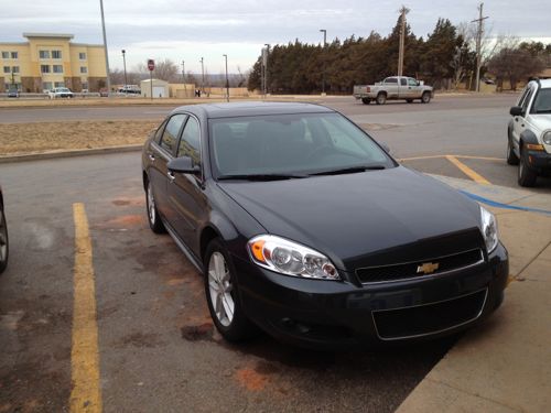
Chevy Impala rental in Elk City, OK
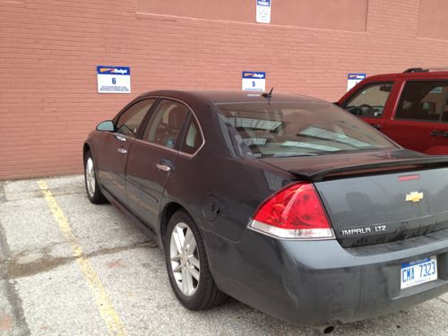
ABOVE: Returning Chevy Impala after a 1,500 mile trip

I requested an economy car but Budget’s disability person thought I needed hand controls instead of just a spinner knob, but I ended up with a full0-size Impala. I’d talked to the folks at the Enterprise location on Washington Ave near Jefferson a month ago but I had to go with Budget because Enterprise locations weren’t open on Tuesday. Seriously!?!

Turns out insurance at Budget is significantly than Enterprise.  Still, the cost was nearly $300. I don’t think I’ve spent that much on the total of all prior rentals I’ve had over the years. In the past I’ve rented cars when mine was in the shop as well as on trips.

The poll question this week asks how often you rent a car: never, rarely, occasionally or never. I’d say I’m in the rarely camp. Vote in the right sidebar and share your thoughts below.

— Steve Patterson


Never Know What You’ll See Out The Bus Window

One of the great things about riding the bus is being able to observe the city as you pass through it…

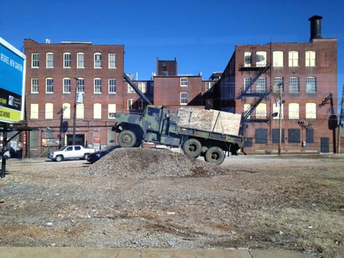
ABOVE: An odd scene at Cass & Jefferson
ABOVE: An odd scene at Cass & Jefferson, click image for map.

…and being able to photograph something that strike’s you as odd.  A military truck parked on a pill of dirt/rocks is such an example.

This site had a building on it as recently as 1971, verified via historicaerials.com. That spot where the truck is parked was vacant in 1909 but buildings existed to the left and right. The building in the background was already there, it was Brown Shoe’s “Blue Ribbon factory”, via Sanborn maps.

The NW corner of the vacant Pruitt-Igoe site is across the street.

— Steve Patterson


Fueling Assistance For The Disabled

January 18, 2013 Accessibility, Featured 2 Comments

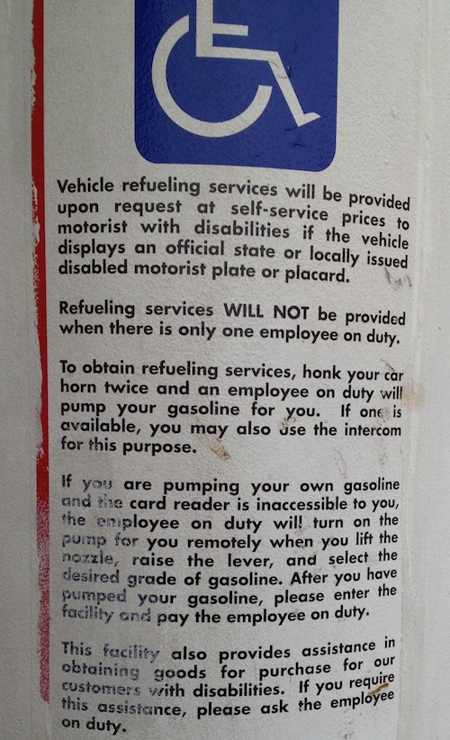
With hand controls many disabled people are able to drive, filling their tank is another story though. In the nearly four years I owned a car after my stroke I never needed assistance, thankfully.

ABOVE: Posted sign at the Shell station on Tucker & Delmar

This is another simple task so many people take for granted.  Some states don’t allow customers to pump their own fuel, everyone gets full service.

Have a good friday.

— Steve Patterson


Reading: Made for Walking by Julie Campoli

Every so often I get a book to review that I keep repeating “Yes!” as I go through it, Made for Walking is that sort of book:

Landscape architect and urban designer Julie Campoli challenges our current notions of space and distance and helps us learn to appreciate and cultivate proximity. In this book, developed as a follow-up to Visualizing Density (2007, co-authored with aerial photographer Alex S. MacLean), she illustrates urban neighborhoods throughout North America with hundreds of street-level photographs.

Researchers delving into the question of how urban form affects travel behavior identify specific characteristics of place that boost walking and transit use while reducing VMT. In the 1990s some pinpointed diversity (of land uses), density, and design as the key elements of the built environment that, in specific spatial patterns, enable alternative transportation. After a decade of successive studies on the topic, these “three Ds” were joined by two others deemed equally important—distance to transit and destination accessibility—and together they are now known as the “five Ds.” Added to the list is another key player: parking.

This book should be required reading for everyone involved in neighborhoods, development, transit in the St. Louis region – especially St. Louis aldermen. Camponi articulates why it is beneficial to change land use patterns, accompanied by hundreds of images to make her points.

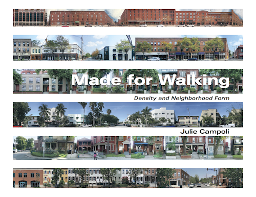
Cover of Made for Walking: Density and Neighborhood Form by Julie Camponi. Click image for the publisher's page
Cover of Made for Walking: Density and Neighborhood Form by Julie Camponi. Click image for the publisher’s page with free chapter download

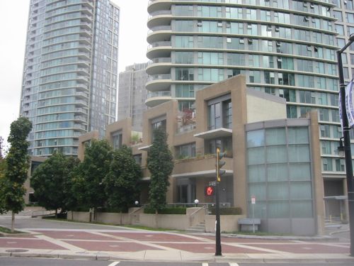
One example I recognized immediately, the Coal Harbour area of Vancouver BC. Here the sidewalks in an area of new high rise buildings are pleasant because smaller-scale buildings front onto them, defining them.

ABOVE: The Coal Harbor area of Vancouver in 2003
ABOVE: The Coal Harbour area of Vancouver in 2003. Click image to view neighborhood in Google Maps.

Here is the chapter list:

  • Everything is somewhere else
  • Five Ds and a P
  • Neighborhood Form
  • Twelve places made for walking
  • Low-carbon neighborhoods
  • The shape of things to come
  • Good bones

Highly recommended!

— Steve Patterson


Advertisement


[custom-facebook-feed]

Archives

Categories

Advertisement


Subscribe