Today is Martin Luther King Jr. Day, and for the 11th year in a row, I’m posting about St. Louis’ Dr. Martin Luther King Dr. (MLK herein). Unlike the past couple of years, this year offers no new projects completed or started. To check out changes I rode the #32 MetroBus on Thursday January 15th — the #32 runs on Cass until it merges with MLK West of Grand. Then on Saturday 1/17 I drove the length of the continuous portion of MLK — from East of Tucker to past the city limits.
This post covers the main changes I saw from last year:
Modifications to ADA ramps, new crosswalks
Buildings being torn down or that may be gone before next year
Signalized intersections now 4-way stops
In the car I started at Tucker, the farthest East MLK is continuous, and headed West past the city limits in the suburb of Wellston.
1) DA Ramps & New Points to Cross MLK
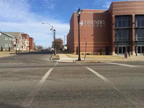
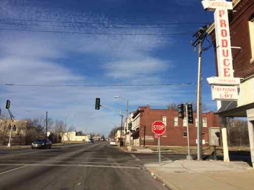
MLK goes through multiple wards, areas built at different period and very different grids. Within the last decade a major traffic calming project on MLK between Jefferson & Grand reduced travel lanes, protected parking lanes, installed new lighting, and replaced sidewalks. As I’ve written before, this multi-million dollar from-scratch project forgot to make any provisions to cross MLK for the mile-long project. Now, years later, this is finally getting corrected as best they can after the fact.
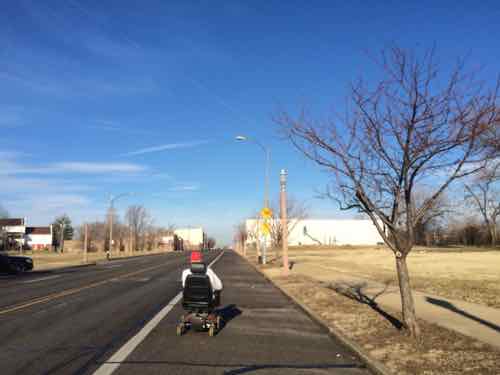
The Jefferson-Grand had the greatest need, but this new work took place from end to end, where needed. These examples from East to West. For those unfamiliar, I often use public transit with a power wheelchair.
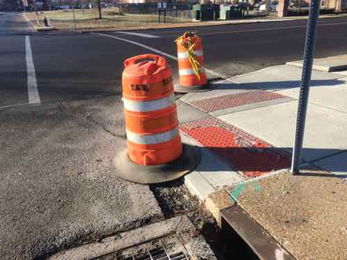
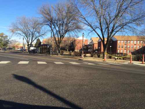
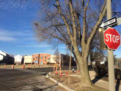
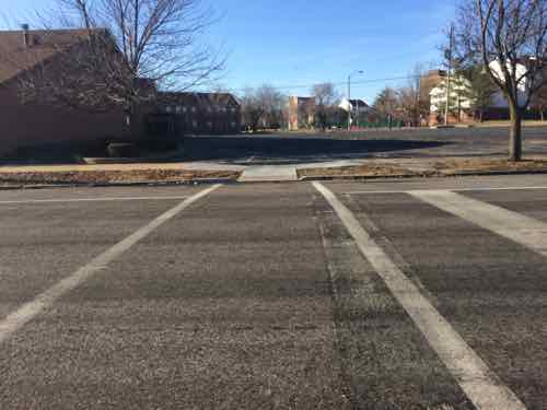
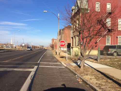
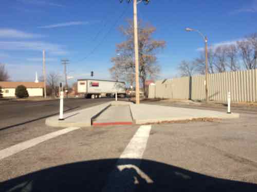
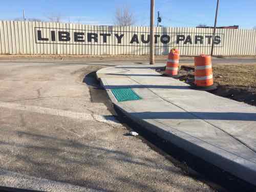
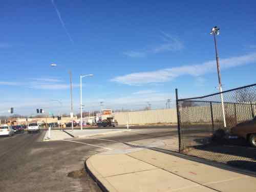
All along MLK Dr I saw evidence of new ramps and crosswalks. Hopefully the city will come back to fill in the asphalt gap — I often need to report these as I encounter them.This new crossing point is at N 22ndAnother view of the same. Lack of crosswalks is often an unintended consequence of street removal to create super blocks.I’ve personally had trouble getting to/from the bus stop on the North side of LeffingwellLooking South-ish at LeffingwellJust West of Glasgow Ave, looking NorthSame new crosswalk, looking SouthNew crosswalk at N Cardinal Ave, has been a 3-way stop for years, just no way to crossI was driving this day but I’m usually in a wheelchair, I first saw this man East of Jefferson and now he’s almost to Cardinal. He’s in the street because the new ramps have those huge gaps that can’t be crossed until filled with asphalt.Where MLK meets Cozens a new channel was created for wheelchair navigation, lacks a point to pass when two meet each other. Sorry for the blurry image.The crosswalk leads to where a new ramp was, based on Google’s aerial, but a newer ramp was build midway between Cozens & MLKSame type of channel to the West where Cass & MLK meet, again no place to meet anyoneMuch further West, at Burd Ave, a needed crosswalk is now completed.
If only the civil engineers had considered the basic idea that pedestrians need to places to cross the street.
2) Demolished or will be
I saw no evidence of buildings removed in the last year, but one was actively being razed and others will likely be razed rather than rehabbed/rebuilt.
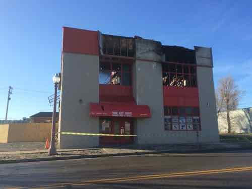
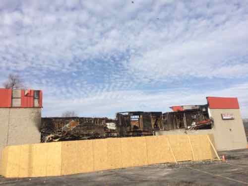
In November 2014 fire destroyed The Hit Zone at 2618 MLK, just West of Jefferson. According to city records he 2-story building was built in 1996. Click image for KSDK story on the fireEast side view of the destroyed bar at 2618 MLK
b
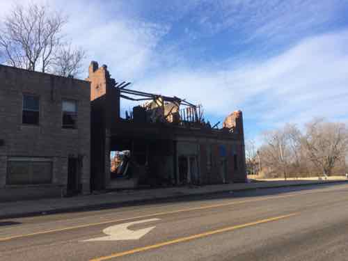
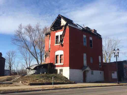
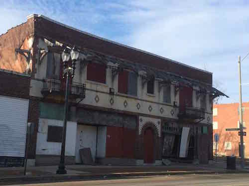
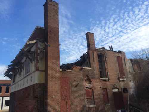
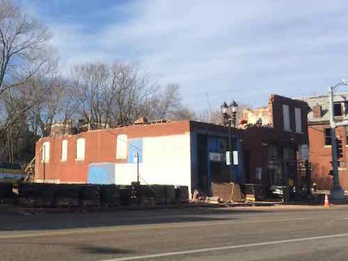
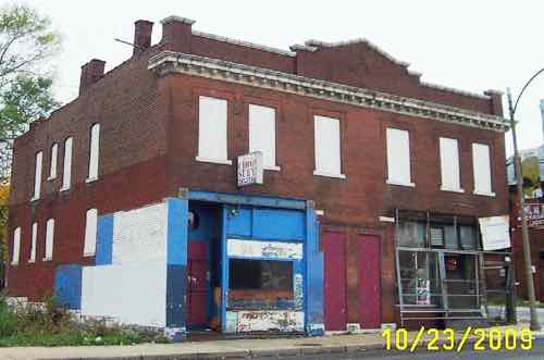
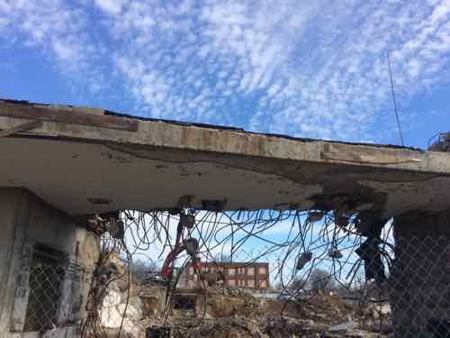
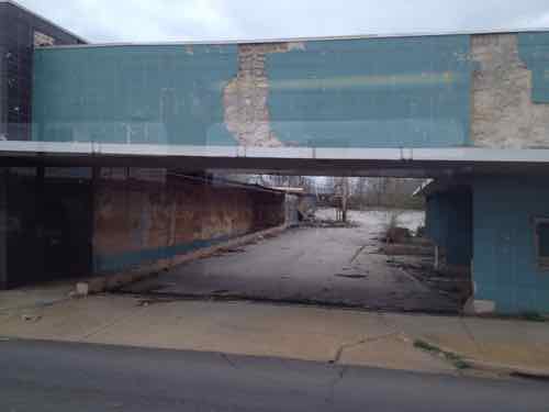
5088 MLK, just West of kingshighway, had a big fire in the fall It was inspected/condemned on 10/30/2-141495 Stewart Pl, built in 1890, was condemned on 12/24/2013 — over a year ago.I’ve been watching 5716 MLK for years, I love the design. After seeing daylight through a side window I drove down the side street (Shawmut) to see the back.Unfortunately the roof has collapsed over the Western half of the building.5746 MLK being razed brick by brick, built in 1907. A city (LRA) propertyOctober 2009, Source: GEO St. LouisLast remains of the State Bank of Wellston, in Wellston. Click image for more informationPassing by on MetroBus, April 2013
Many of these neighborhoods are depressing; lots of poverty, few jobs in the area. I’d imagine many residents would like a way out. Yet, efforts to bring investment and jobs would be labeled as gentrification. Not sure how to change the situation in these neighborhoods, but I don’t like watching them crumble.
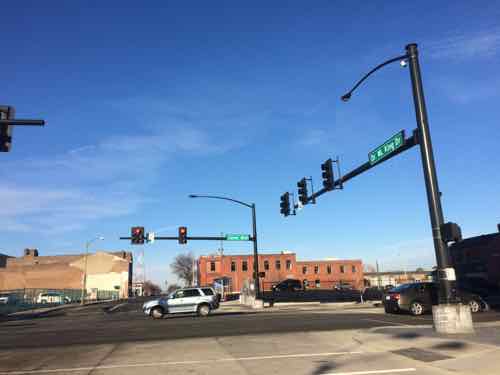
3) From Signalized to 4-Way Stop
Two intersections that have traffic signals, now shut off, are 4-way stops.
MLK & Euclid is now a 4-way stop, the signals are turned off.
You state that “Many of these neighborhoods are depressing; lots of poverty, few jobs in the area. I’d imagine many residents would like a way out. Yet, efforts to bring investment and jobs would be labeled as gentrification. Not sure how to change the situation in these neighborhoods, but I don’t like watching them crumble.” I agree with most everything except that efforts to improve the area “would be labeled as gentrification”. When an area is as derelict and depressed as this is, any efforts at redevelopment, at least initially, might be labeled as crazy, insane or Pollyannish, but I doubt that they would be viewed as gentrification. Residents, here, face little risk of being kicked out for tenants willing to pay higher rents; they’re more likely to be preyed on by predatory slumlords, and more retail would be the first step to bringing some stability to the area.
Your other two points raise some interesting issues with government spending, as well. Converting signalized intersection to four-way stops illustrates two things, decreased traffic and declining budgets. Signals cost more to run than stop signs, so if they’re no longer needed, as they are along Jamieson in south city (at Fyler and Pernod), they should be removed. Four-way stops, below a certain threshold, are just as safe as signals, and can actually move traffic more efficiently, if they’re not spaced too closely together.
On a micro scale, it’s good to see efforts to finally comply with ADA standards, citywide. On a macro level, it remains frustrating to see piecemeal, scattershot, investments being made that do little to either create a cohesive pedestrian network or to complement development efforts by the private sector. Would the city be better served if our dollars were spent to get things right (and complete) in the CWE, Cortex, TGW, TGS, TGE, Soulard, Benton Park and South City, instead of spending money in areas where no development is happening, missing sidewalks are forcing pedestrians into the street and there are far fewer residents, employees or customers? I know we want to be “fair”, but we also have limited resources (and limited will) to spend what needs to be spent to “get things right”, everywhere, citywide, anytime soon . . . .
Hopefully the MLK memorial project planned for Hamilton gets done and spurs some surrounding retail activity. It would be great to see more quality mixed-use projects like the North Sarah Apartments built in the Vandeventer neighborhood throughout the area.
AARP Livibility Index
The Livability Index scores neighborhoods and communities across the U.S. for the services and amenities that impact your life the most
Built St. Louis
historic architecture of St. Louis, Missouri – mourning the losses, celebrating the survivors.
Geo St. Louis
a guide to geospatial data about the City of St. Louis

You state that “Many of these neighborhoods are depressing; lots of poverty, few jobs in the area. I’d imagine many residents would like a way out. Yet, efforts to bring investment and jobs would be labeled as gentrification. Not sure how to change the situation in these neighborhoods, but I don’t like watching them crumble.” I agree with most everything except that efforts to improve the area “would be labeled as gentrification”. When an area is as derelict and depressed as this is, any efforts at redevelopment, at least initially, might be labeled as crazy, insane or Pollyannish, but I doubt that they would be viewed as gentrification. Residents, here, face little risk of being kicked out for tenants willing to pay higher rents; they’re more likely to be preyed on by predatory slumlords, and more retail would be the first step to bringing some stability to the area.
Your other two points raise some interesting issues with government spending, as well. Converting signalized intersection to four-way stops illustrates two things, decreased traffic and declining budgets. Signals cost more to run than stop signs, so if they’re no longer needed, as they are along Jamieson in south city (at Fyler and Pernod), they should be removed. Four-way stops, below a certain threshold, are just as safe as signals, and can actually move traffic more efficiently, if they’re not spaced too closely together.
On a micro scale, it’s good to see efforts to finally comply with ADA standards, citywide. On a macro level, it remains frustrating to see piecemeal, scattershot, investments being made that do little to either create a cohesive pedestrian network or to complement development efforts by the private sector. Would the city be better served if our dollars were spent to get things right (and complete) in the CWE, Cortex, TGW, TGS, TGE, Soulard, Benton Park and South City, instead of spending money in areas where no development is happening, missing sidewalks are forcing pedestrians into the street and there are far fewer residents, employees or customers? I know we want to be “fair”, but we also have limited resources (and limited will) to spend what needs to be spent to “get things right”, everywhere, citywide, anytime soon . . . .
Hopefully the MLK memorial project planned for Hamilton gets done and spurs some surrounding retail activity. It would be great to see more quality mixed-use projects like the North Sarah Apartments built in the Vandeventer neighborhood throughout the area.