Though not always easy, I like to end the week on a positive note. Today’s post is positive in that something bad hasn’t happened, hopefully won’t.
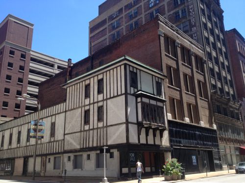
June 2013: The first two buildings remain threatened with demolition. I’m not attached to them, I just want buildings not a circle driveway.Still standing…but still threatened, Massing here is better than yet another void.
The corner building, 923 Locust, didn’t always have that fake half-timber look. The second, however, is mostly original. As I’m not a preservationist, I have no problem razing one or both of these. As an urbanist, the only acceptable solution would be new buildings of equal or greater massing.
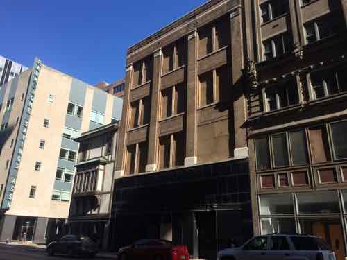
This is one reason why the Downtown Neighborhood Association is looking to add a form-based zoning overlay. I think Thursday October 8th is the date for the first public meeting on the subject. I’ll have details before then.
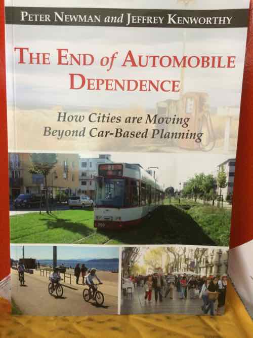
Cities will continue to accommodate the automobile, but when cities are built around them, the quality of human and natural life declines. Current trends show great promise for future urban mobility systems that enable freedom and connection, but not dependence. We are experiencing the phenomenon of peak car use in many global cities at the same time that urban rail is thriving, central cities are revitalizing, and suburban sprawl is reversing. Walking and cycling are growing in many cities, along with ubiquitous bike sharing schemes, which have contributed to new investment and vitality in central cities including Melbourne, Seattle, Chicago, and New York.
We are thus in a new era that has come much faster than global transportation experts Peter Newman and Jeffrey Kenworthy had predicted: the end of automobile dependence. In The End of Automobile Dependence, Newman and Kenworthy look at how we can accelerate a planning approach to designing urban environments that can function reliably and conveniently on alternative modes, with a refined and more civilized automobile playing a very much reduced and manageable role in urban transportation. The authors examine the rise and fall of automobile dependence using updated data on 44 global cities to better understand how to facilitate and guide cities to the most productive and sustainable outcomes.
This is the final volume in a trilogy by Newman and Kenworthy on automobile dependence (Cities and Automobile Dependence in 1989 and Sustainability and Cities: Overcoming Automobile Dependence in 1999). Like all good trilogies this one shows the rise of an empire, in this case that of the automobile, the peak of its power, and the decline of that empire.
I look forward to checking out the references to Bus Rapid Transit (BRT) and Light Rail Transit (LRT).
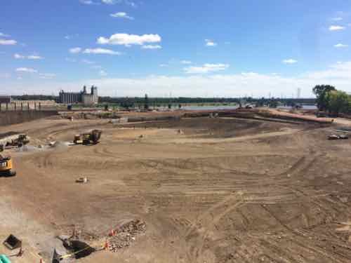
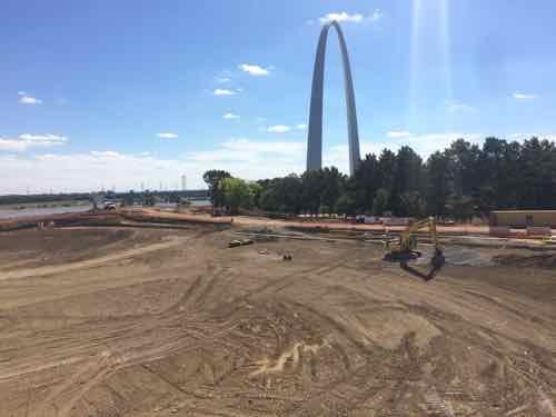
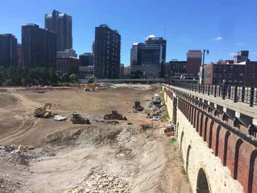
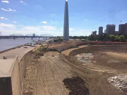
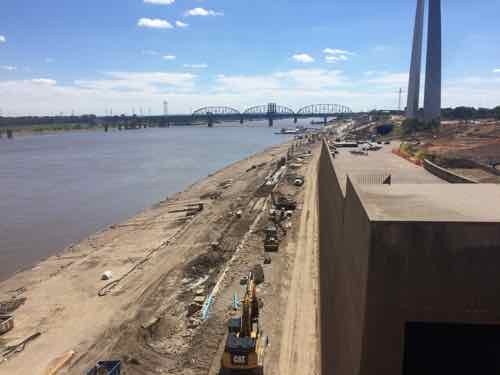
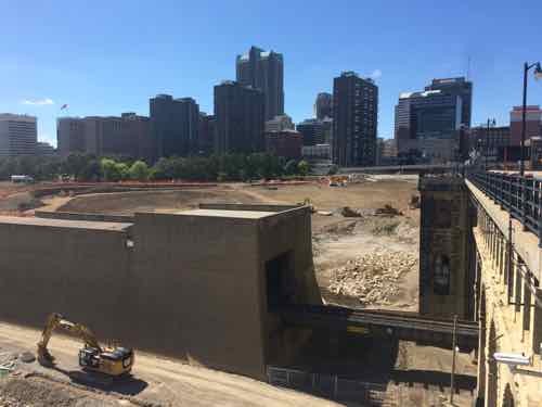
Over the weekend we walked down to see the progress at Luther Ely Smith Square, and the Arch. before heading back to our loft we went out on the pedestrian walkway of the Eads Bridge.
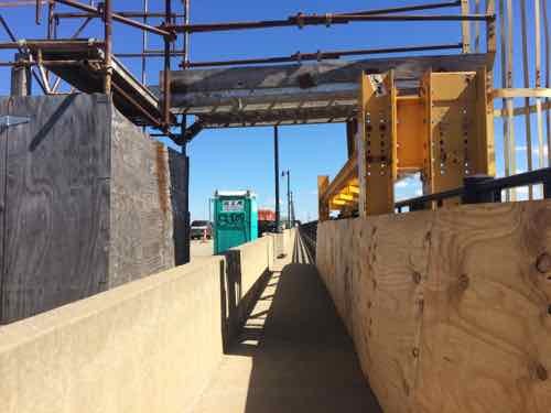
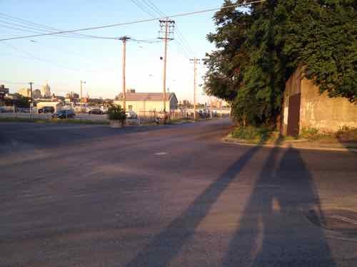
Laclede’s Landing building that lost pare of a wall last monthLooking out where the Arch garage used to beWith the Arch in the backgroundLooking back toward downtownThe wall/lookout (left) conceals the train tracks, part of the historic landscape design .Work continues on the North end of Lenore K. Sullivan — raising it was delayed by flooding.The South end has already been raised about 4 feet.Again, looking back toward downtownNote sure what this was about on the Eads, presumably something to do with the restoration work going on below the top deck
Next nice day we have I’d encourage you to go for a walk on the Eads. Over the next year the view below will change dramatically.
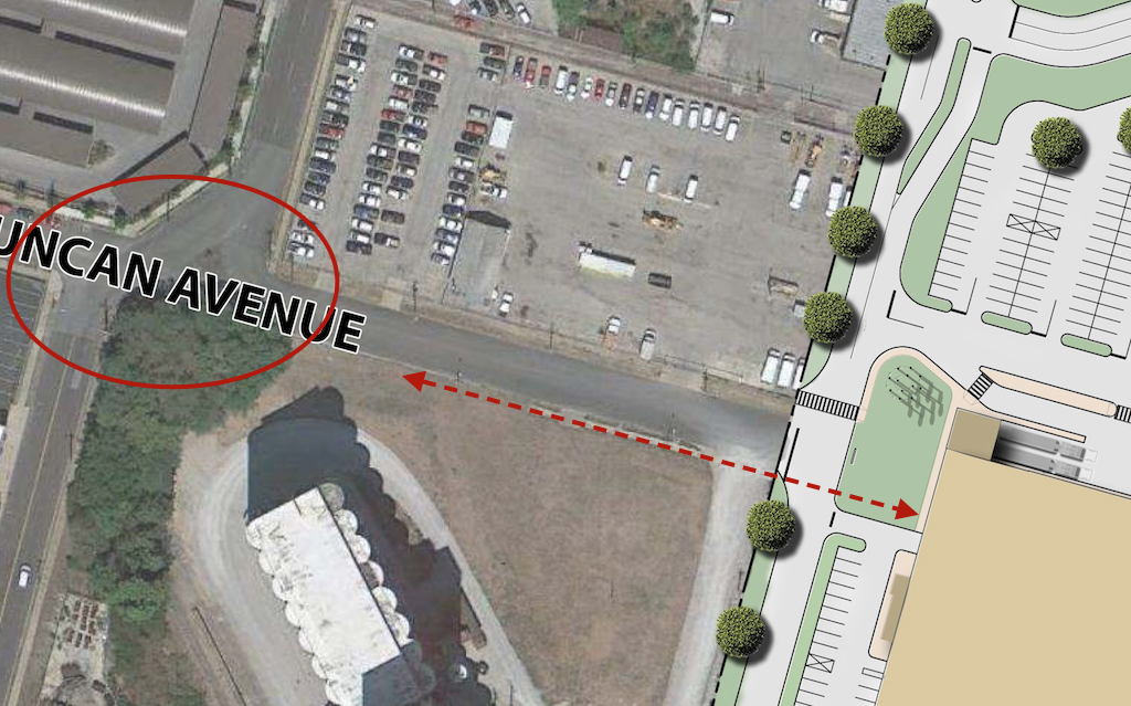
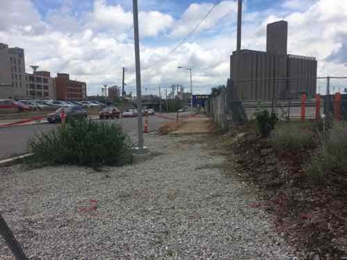
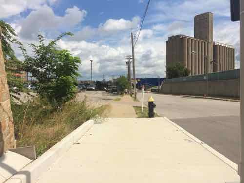
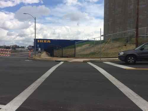
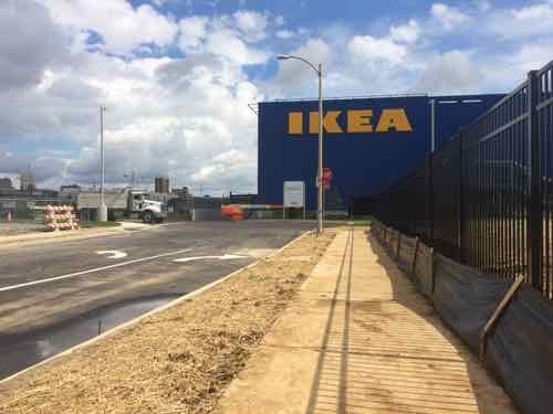
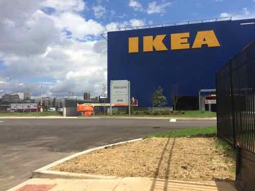
Current site plan doesn’t show pedestrian access from the south side of Duncan Ave., intersection at Sarah needs to be addressed to connect IKEA to MetroLink.Looking east from in front of the grain silo toward the future IKEA. A sidewalk exists currently.
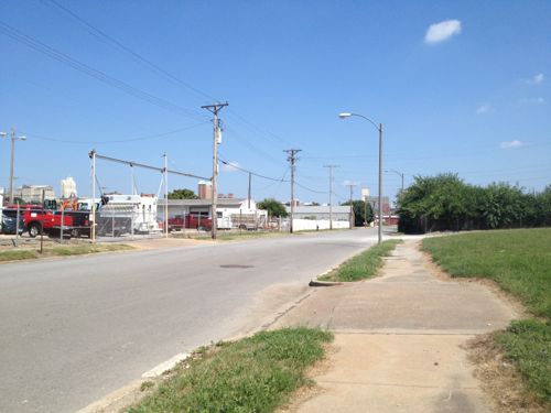
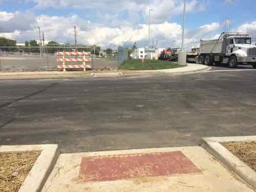
In 2013 I was focused on the horrible intersection of Duncan & Sarah and getting into the IKEA site. The odd configuration made it horrible for motorists, pedestrians, and cyclists.
May 2012 — looking East across Sarah from the South side of Duncan.
Thankfully, this has been addressed, as you’ll see later.
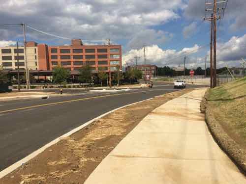
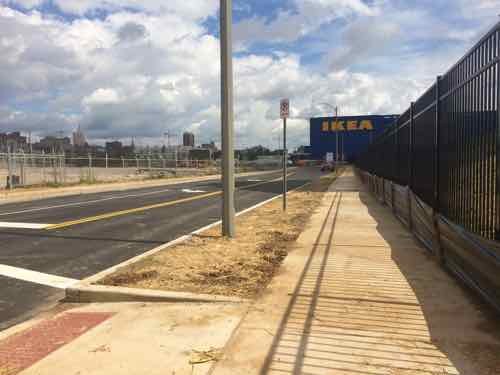
Today let’s start at Boyle and the CORTEX Commons — and head East to IKEA.
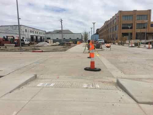
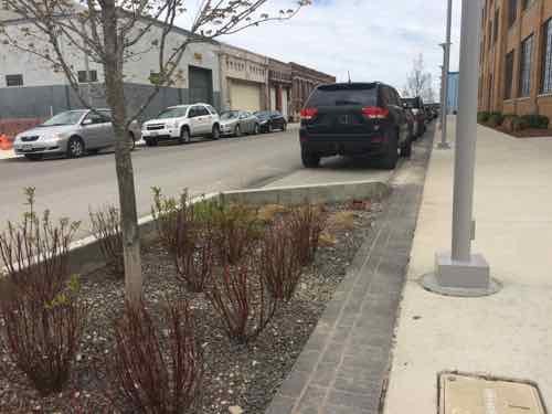
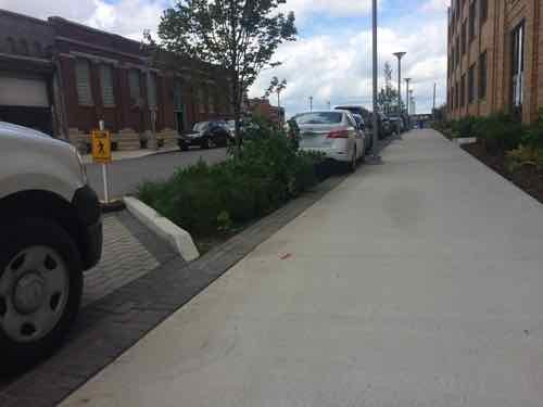
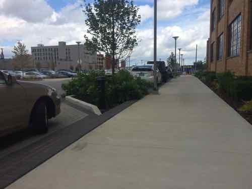
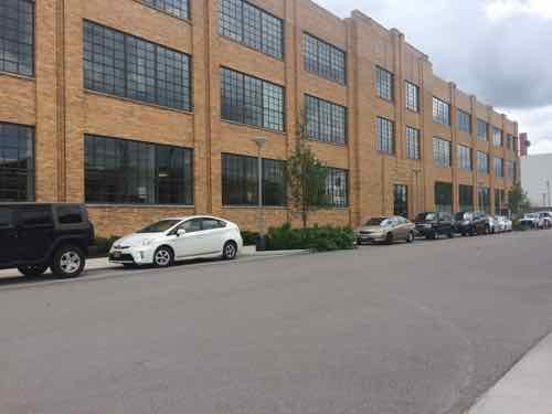
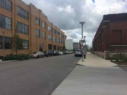
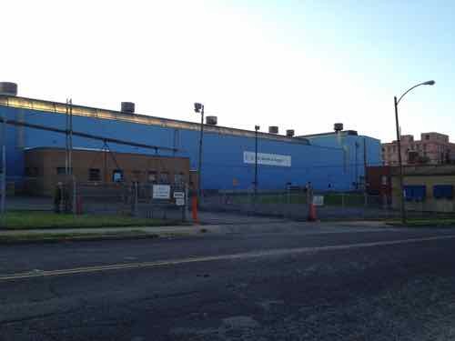
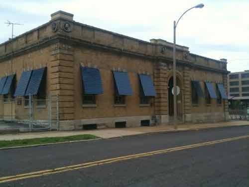
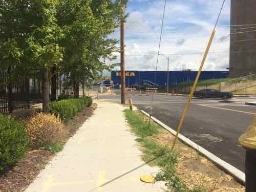
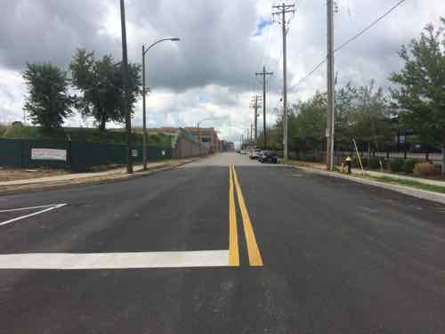
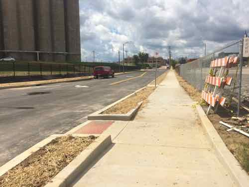
Looking East across Boyle on the North side of Duncan in April 2015Trees planted in the parking lane on the South side of Duncan in front of the @4240 building, also April 2015This similar view from Sept 11th shows the plants have matured, the parking paving is permeable. If you look closely you can see the side of IKEA’s big blue box at the end of the sidewalk.A little further East. In St. Louis this is a very generous sidewalk, in Chicago it would be on the smaller side. Still, I like that it is so open.Back on the North side we can see how the trees break up the line of parked cars.Looking back West toward Boyle, the North side didn’t get the same treatment with street trees.During my visit on the 11th work was still ongoing on the South side of Duncan just before SarahPart of the work is on the adjacent site where this massive US Metals building used to be. View from Sarah, May 2012The former office on Sarah was also razed, which is a shame. May 2012.Ok, so we’re back on Duncan facing East. Because the sidewalk was out on the South we’re on the North.As we approach Sarah we can see it looks different than beforeBefore we look at Sarah, a look back West on DuncanNow looking East across SarahHere’s the May 2012 photo from before so you can compare them, The tall wall is gone and the traffic flow shifted.Turning South we can now see how Sarah curvesThis view looking North from the East side of Sarah shows how Sarah now curves to the right for a conventional intersection at DuncanLooking East after crossing SarahGetting closerThe sidewalk on the South side of Duncan ends, but a crosswalk point to the North is providedLooking North, the crosswalk wasn’t marked on my visit but paint crews were working on site. This would’ve been an excellent spot for a raised crosswalk.Looking back West.
Monday next week I’ll take a closer look at the various pedestrian access points to IKEA St. Louis, as well as a peak inside!
Duncan Ave is bookended by BJC hospital just West of Taylor, and IKEA just East of Sarah — about a mile total in length — the pedestrian experience is highly inconsistent and doesn’t begin to approach friendly. Yet, this is the mile stretch the CORTEX Master Plan says should be pedestrian-friendly, the primary East-West means for pedestrian circulation. At best it’s less hostile in a few spots than it was a few years ago.
The controversial topic of right-t0-die was in the news again recently:
The “death with dignity” movement marked a victory in California Friday when the state Senate passed a bill allowing terminally ill patients to end their own lives with the help of a physician.
The End of Life Option Act, which passed in the state Assembly Wednesday, would allow patients to seek aid-in-dying options so long as they are given six months or less to live by two doctors, submit a written request and two oral requests at least 15 days apart and possess the mental capacity to make their own health care decisions.
Gov. Jerry Brown (D), who attended a Jesuit seminary prior to his political career, has yet to indicate whether he will sign the bill into law. (Huffington Post)
I thought this would be a great policy subject for a Sunday Poll.
Please vote below
The poll is open until 8pm, the choices are randomized.
AARP Livibility Index
The Livability Index scores neighborhoods and communities across the U.S. for the services and amenities that impact your life the most
Built St. Louis
historic architecture of St. Louis, Missouri – mourning the losses, celebrating the survivors.
Geo St. Louis
a guide to geospatial data about the City of St. Louis