A year ago the police were called to a parking dispute at our condo association. The issue was a fight between residents and the tenant of one commercial space, see Parking Battle Close To Home.
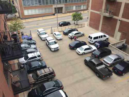
View from my balcony on Friday July 25th, 2014.
A couple of months ago everything was resolved — much better than anyone could’ve predicted. It did require legal action. The original developer, the now-defunct Loftworks, was seriously delinquent on condo dues for the two commercial spaces and a few residential units. After years of negotiations and missed payment plans, our board had enough and for a foreclosure sale. They were mortgaged for more than their value, but our board then began negotiating with the bank(s).
The best part is the commercial tenant in my building, Stealth Creative, was able to purchase their space. Every parking spot on the lot between the two buildings has been assigned to a commercial space. So just like our residential spaces, both commercial spaces now have assigned parking. While the other commercial space is vacant and for sale, those parking spaces are leased to residents seeking a 2nd parking space.
As I mentioned a year ago, I think my neighbors and the employees are too auto dependent. Hopefully having a fixed number of parking spaces will help change that attitude. I also want to make the case to Enterprise that their CarShare service needs vehicles West of 11th Street. They’re waiting for more members, we’re waiting for the service before joining.
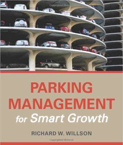
July 23, 2015Books, Featured, ParkingComments Off on Reading: Parking Management for Smart Growth by Richard W. Willson
Parking management is a popular topic, I have numerous books on the subject. Now I have one more: Parking Management for Smart Growth by Richard W. Willson:
The average parking space requires approximately 300 square feet of asphalt. That’s the size of a studio apartment in New York or enough room to hold 10 bicycles. Space devoted to parking in growing urban and suburban areas is highly contested—not only from other uses from housing to parklets, but between drivers who feel entitled to easy access. Without parking management, parking is a free-for-all—a competitive sport—with arbitrary winners and losers. Historically drivers have been the overall winners in having free or low-cost parking, while an oversupply of parking has created a hostile environment for pedestrians.
In the last 50 years, parking management has grown from a minor aspect of local policy and regulation to a central position in the provision of transportation access. The higher densities, tight land supplies, mixed land uses, environmental and social concerns, and alternative transportation modes of Smart Growth demand a different approach—actively managed parking.
This book offers a set of tools and a method for strategic parking management so that communities can better use parking resources and avoid overbuilding parking. It explores new opportunities for making the most from every parking space in a sharing economy and taking advantage of new digital parking tools to increase user interaction and satisfaction. Examples are provided of successful approaches for parking management—from Pasadena to London. At its essence, the book provides a path forward for strategic parking management in a new era of tighter parking supplies.
The book, published by Island Press, is available in softcover & hardcover
To see the topics covered, here’s the contents:
Introduction: What is a Parking Space Worth? Parking as a Contested Space
Problems of Unmanaged Parking
Understanding Parking Behavior
Strategic Parking Management
Key Terms
Map of the Book
Parking Management Techniques Origins of Parking Management
Understanding and Organizing Parking Management Methods
Basic, Intermediate, and Advanced Parking Management
Parking Management Gone Wrong
Conclusion
Creating a Parking Management Strategy Planning and Strategy in Parking Management
Parking Management Stakeholders
Process for Developing a Parking Management Strategy
Process Pays
Managing an Integrated Parking Supply (Rick Williams) Management Principles
Organizational Structure: Administration and Management
Defining the Role of On-Street Parking
Relationship of On- and Off-Street Parking Assets
Rate Setting Policy and Protocols
Measuring Performance
Identifying and Communicating the Integrated Parking System
New Technologies
Financial Analysis and Management
Conclusion
Best Practice Strategies Best Practice: Individual Measures
Best Practice: Integrated Strategies
Global Perspective
Case Study Conclusions
Implementing Strategic Parking Management Politics and Community Participation
Technical Challenges
Greening Parking Operations
Parking Enforcement
Conclusions on Implementation
Parking Management for Smart Growth A Paradigm Shift
Why Not Rely on Pricing Alone?
A Broader Vision for Strategic Parking Management
It’s Time
References
Index
I’m looking forward to diving into some of these topics. The book came out last month, you can read an excerpt or order from Left Bank Books.
For over a decade I’ve written about pedestrians, including pedestrian deaths. It’s difficult to visit the sites and write about how the area could be designed better, but nothing like the pain experienced by the families & friends who’ve lost a loved one. Most recent was Bapi Gupta:
Gupta’s mother, Genie Dee, and Georgie Busch, who lost her daughter, Amber Wood, in a hit-and-run accident in the same location in 2012, are hoping to bring change to the stretch of roadway.
The string of fatalities and near misses has many calling for slower traffic in the area.
“Why is it 35 miles an hour here? Why isn’t there a stop light up the street here, which they took down, by the way,” said Michael Chekoudjian, the driving force behind a change.org petition asking for changes to the area. (KMOV)
With 3 fast lanes of traffic heading south, trying to beat the lights cars are exceeding the speed limit by 20 to 50 MPH. This is very Dangerous in an “Entertainment District” with as many as a 1000 people in the streets at times and as we know by the hit and run death of “Amber Wood” at the 700 block of Broadway in April of 2012 this is a very dangerous stretch of roadway. We the signers of this petition want Mayor Slay to put a stop to this speeding on this dangerous stretch of road in the name of “Amber Wood” NOW!
First let’s look at a couple of recent suggestions offered by family & friends:
Lower the posted speed limit: Motorists currently exceed the 35MPH speed limit, they’ll drive the same speed regardless of the posted limit. This is because people drive at what they perceive to be a safe speed based on the design of the road. If you want to lower the speed — you must change the design! More on the design later.
Traffic signal at previous intersection: The previous light at Cerre St was removed when a new ramp onto Eastbound I-64 made it a dead-end street. Putting a signal back doesn’t make sense. However, a flashing yellow signal overhead would be a good idea, changing to red if activated by a pedestrian wanting to cross Broadway.
There are things that should change, let’s take a look:
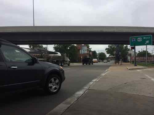
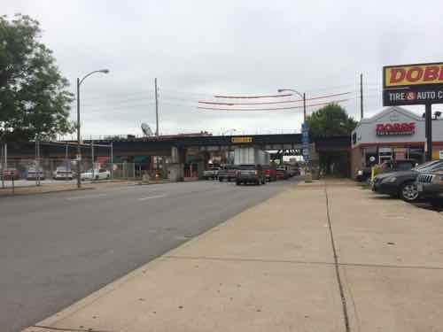
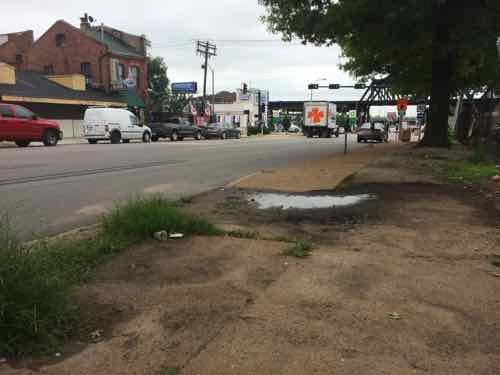
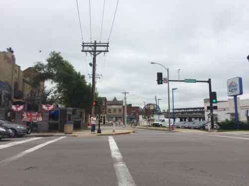
A lot of the traffic on Broadway gets on Westbound I-64 before getting to the commercial district where pedestrians have been struck & killed.Approaching Cerre St from the North.After many get on the highway the remaining traffic now has more room, so they can speed up. Looking South from from just South of Cerre St, three wide traffic lanes in one direction plus parking lanes on both sides. This is designed to move cars quickly, not a good design for the commercial district just beyond the elevated train tracks. The vehicles you see are a deep line stopped at Gratiot St.This is the pedestrian environment across the street from the Broadway Oyster Bar.Looking East at Gratiot St we see the traffic light is green but the pedestrian signal is “don’t walk” Broadway Oyster Bar is on the left. Also not the curb bulbs out into both Gratiot & Broadway.
I sat here for a few cycles to time the lights. For vehicles the light is green for about 38-40 seconds. However, the pedestrian signal is “walk” for just 4 seconds before it begins to flash! It flashes for 10-15 seconds before going to a solid don’t walk, but the traffic signal remains green. Having such a short walk time with a longer traffic time encourages pedestrians to go for it rather than wait on the longer Broadway signal. The pedestrian signal timing needs to change immediately! Ok, let’s cross.
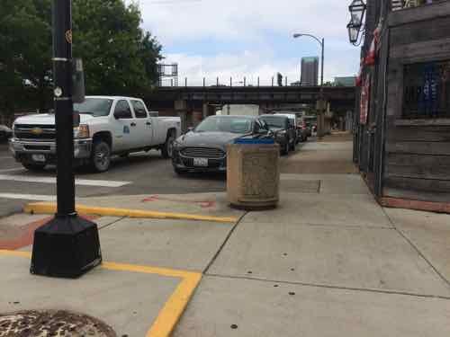
Looking North we see how the “curb bulb” encloses the end of the parking lane on the East side of Broadway, Why wasn’t the curb on the West side bulbed out as well?
Based on my visit, here are my suggestions:
Immediate solutions:
Change pedestrian signal timing at Gratiot.
Short-term solutions:
Reinstall traffic signal at Cerre St., on yellow flash, changing to red if activated by a pedestrian.
Restripe Broadway, narrowing the 3 drive lanes.
Add a solid white lane to separate the outside drive lanes from the adjacent parking lanes.
Change pedestrian signals to have a countdown timer.
Long-term solutions:
New streetscape, putting the road on a diet with curb bulbs at all corners. Include mid-block planters in the parking lanes.
Return 4th & Broadway to 2-way traffic.
More observation, at different times, is needed. But this area must change or we’ll see more pedestrians hit.
On October 28, 1965 the last piece of the Arch was lowered into place, so October 28, 2015 is the 50th anniversary of that event.
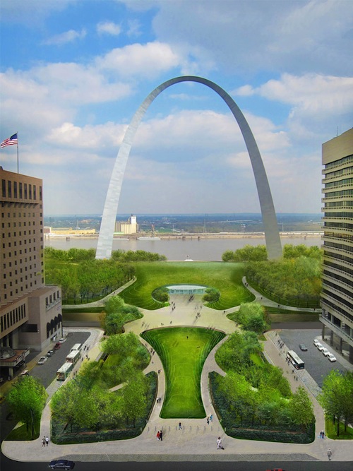
I’ve been posting the following image when discussing the CityArchRiver project for nearly 3 years now, the view is looking East from the Old Courthouse.
2012 rendering of Luther Ely Square extended over the highway, leading to the future Arch/museum entrance
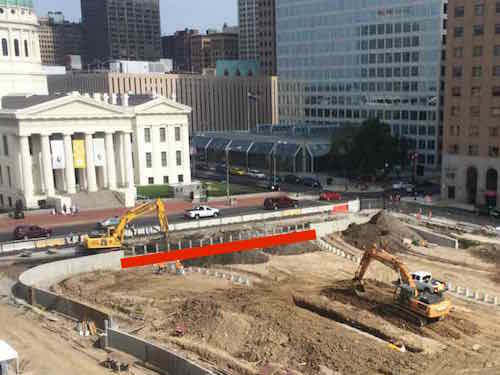
Two weeks ago, looking out from the 7th floor balcony of the CityArchRiver offices, I saw the work underway.
Construction on Luther Ely Square with the Old Courthouse in the background, the red line indicates the central sidewalk area
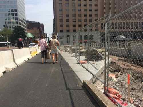
At first I thought we were going to have lots of people crossing 4th Street between Market & Chestnut — going to & from the Old Courthouse and Luther Ely Square & Arch. But as I put the rendering into this post I looked closely at the bottom and it looks like a wall is shown keeping pedestrians from crossing 4th Street mid-block. Or it’s a cut-out to pull over and drop people off — not sure.
Looking North along 4th, with Luther Ely Square on the right, temporary Jersey Barrier wall on left.
If there isn’t a wall people will cross mid-block. If there is a wall, pedestrians will be taken via a circuitous route.
Plans for the 50th anniversary will be announced shortly, but Luther Ely Square is supposed to be completed by then. The riverfront work maybe — the high river level has delayed the project. If they can clean the mud off the work area quickly then it to should be complete, in a few weeks we’ll know. Plans will include a festival the weekend before October 28th, and a ceremony that day.
Remember the original landscaping wasn’t finished until the early 80s, here’s a look from May 1982:
It has been almost five years since the CityArchRiver competition was reduced to five finalists.
On Tuesday I wrote about the condemned parking garage at Tucker & Locust, which led to discussion in the comments about what should/could happen. Perfect poll topic…
Please assume the list choices aren’t necessarily government imposed or funded, could be entirely private — you can wave a magic wand. You may pick two, one can be your own.
AARP Livibility Index
The Livability Index scores neighborhoods and communities across the U.S. for the services and amenities that impact your life the most
Built St. Louis
historic architecture of St. Louis, Missouri – mourning the losses, celebrating the survivors.
Geo St. Louis
a guide to geospatial data about the City of St. Louis