Home » Featured » Recent Articles:

June 12th: Loving Day
June 12, 2015 Events/Meetings, Featured, History/Preservation Comments Off on June 12th: Loving Day
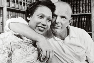
Mildred & Richard Loving, 1967

At the end of this month the U.S. Supreme Court will rule on two questions of marriage equality with respect to LGBT people. Forty-eight years ago they ruled on the divisive marriage question of the day: marriage between whites & non-whites, mostly blacks:

Few cases were more aptly named than Loving v. Virginia, which pitted an interracial couple – 17-year-old Mildred Jeter, who was black, and her childhood sweetheart, 23-year-old white construction worker, Richard Loving – against Virginia’s “miscegenation” laws banning marriage between blacks and whites. After marrying in Washington, D.C. and returning to their home state in 1958, the couple was charged with unlawful cohabitation and jailed. According to the judge in the case, Leon M. Bazile, “Almighty God created the races white, black, yellow, malay and red, and he placed them on separate continents…. The fact that he separated the races shows that he did not intend for the races to mix.” Judge Bazile sentenced the Lovings to a year in prison, to be suspended if the couple agreed to leave the state for the next 25 years.

The Lovings left Virginia and went to live with relatives in Washington, D.C. When they returned to visit family five years later, they were arrested for traveling together. Inspired by the civil rights movement, Mildred Loving wrote to Attorney General Robert F. Kennedy for help. The couple was referred to the ACLU, which represented them in the landmark Supreme Court case, Loving v. Virginia (1967). The Court ruled that state bans on interracial marriage were unconstitutional. (Loving v. Virginia: The Case Over Interracial Marriage)

The court ruling is celebrated annually:

Loving Day is an annual celebration held on June 12, the anniversary of the 1967 United States Supreme Court decision Loving v. Virginia which struck down all anti-miscegenation laws remaining in sixteen U.S. states citing “There can be no doubt that restricting the freedom to marry solely because of racial classifications violates the central meaning of the equal protection clause.” In the United States, anti-miscegenation laws were U.S. state laws banning interracial marriage, mainly forbidding marriage between non-whites and whites. Loving Day is not yet an official recognized holiday by the U.S. government, but there is a movement to persuade U.S. President Barack Obama to make it so. Loving Day is the biggest multiracial celebration in the United States. (Wikipedia)

Additional resources:

If not for Loving v. Virgina, conservative Justice Clarence Thomas couldn’t live in or visit 17 states with his 2nd wife, but I expect him to vote again marriage equality later this month…he got his!

— Steve Patterson


Rethinking Chariton Square

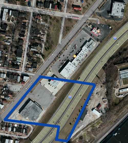
In May of last year I posted about a drive-in theater that replaced a quarry, itself soon replaced by I-55 (see May 26, 1954: South Broadway Drive-In Theater Opened).

The blue lines mark the approximate outline of the 1964 theater site.
The blue lines mark the approximate outline of the 1964 theater site. Click image for map to area.

In that post I indicated I would do a followup on ideas for the tired auto-centric Chariton Square strip shopping center:

In the coming weeks I’ll take a look at the commercial development along this stretch of Broadway and share my concept for an urban redevelopment.

But I got married a week later and never got to it. Recently a friend inquired about my ideas so here they are…finally. Before I get into my solution I want to show you some of the problems I hope to solve.

THE PROBLEM

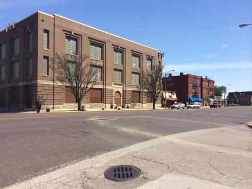
As you head sSouth on Broadway it is bounded by handsome 2-3 story brick urban buildings, but this changes after passing Gasconade St one block further South 
As you head sSouth on Broadway it is bounded by handsome 2-3 story brick urban buildings, but this changes after passing Gasconade St one block further South. The large 3-story building is owned by Ameren.
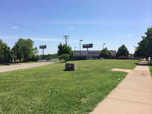
South of Gasconade the pattern changes from from the established urban pattern
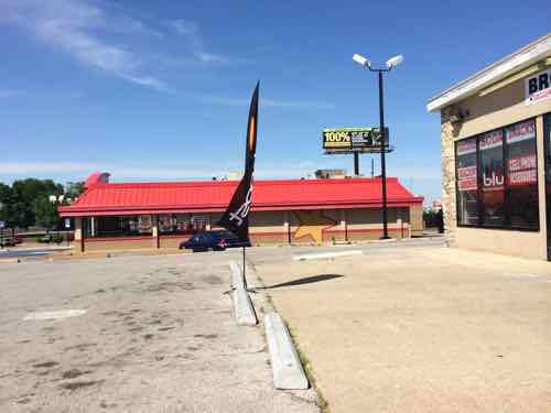
Chariton Square was built on the 1960s when walkability & accessibility weren't considered
Chariton Square was built on the 1960s when walkability & accessibility weren’t considered
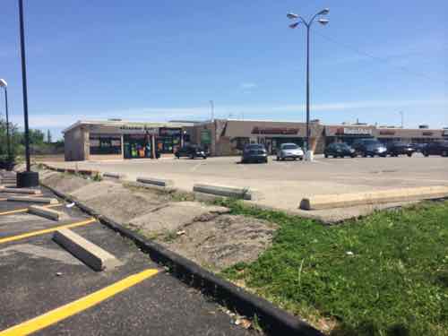
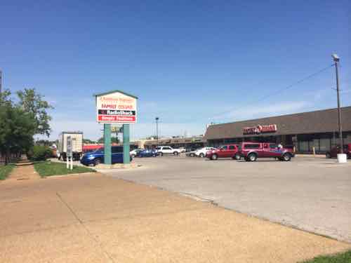
Even once inside the site getting from building to building is difficult.
More disconnect from one building to the next
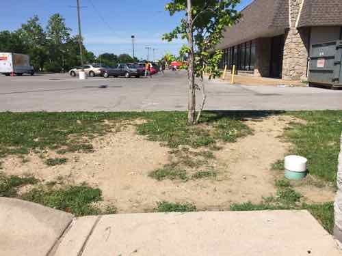
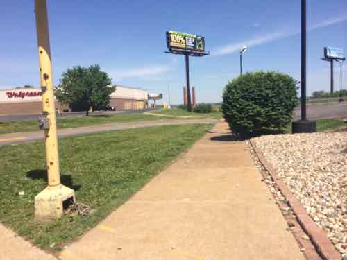
Lots of hardscape creates water runoff and separates pedestrians from storefronts
The old street grid was cut off.

ONE SOLUTION

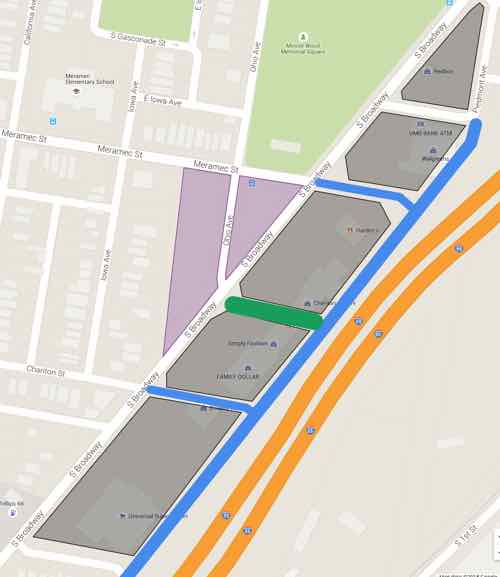
Let me preface this by saying this is a rough digital napkin sketch about what I think could physically be built to replace the existing strip shopping center. The intent is to trigger people’s imagination to see this as potentially being redeveloped in a different manner than it has been for the last half century. The only other vision I’ve seen put forward was as a park-n-ride lot for a light rail line, see Northside-Southside Light Rail Wouldn’t Be Good For St. Louis Neighborhoods.

KEY:  Lt Green: existing park space Gray: new buildings  Purple: existing green space to consider developing  BLUE LINE: New public  street, extensions of existing street grid  DK GREN LINE: New common plaza
KEY:
Lt Green: existing park space
Gray: new buildings
Purple: existing green space to consider developing
BLUE LINE: New public street, extensions of existing street grid
DK GREN LINE: New common plaza
Click image to view in Google Maps

NOTES:

  1. The best streets have a similar building type across the street, which is hard to accomplish in this narrow site. The extensions of Chariton & Meramec would help create quality urban faces on opposite sides of s street.
  2. Building on the open areas (purple) would help with changing the feel of Broadway.
  3. Broadway and all newly extended streets would have parking on both sides — angled on Broadway and Piedmont Ave parallel to I-55.
  4. Narrow drive lanes and curb bulbs would allow vehicular traffic to move but also be pedestrian-friendly. Protected bike lanes are possible on Broadway.
  5. The proposed buildings wouldn’t be monolithic masses, these might be several buildings within that newly created block.   They might be separated by  pedestrian-only street parallel to Broadway & I-55, depending upon the depth of the property. They might have structured parking in the middle surrounded by habitable building on all sides.
  6. The natural slope down to the highway would help facilitate a level of parking under some/most of the new buildings.
  7. A streetcar/BRT line could loop around this project. A light rail stop could be in the center of Broadway.
  8. The site has excellent highway visibility. Some taller buildings might have good views of the Mississippi River.
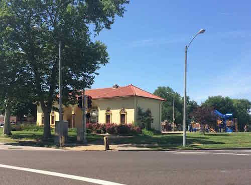
Minnie Wood Park at Meramec & Broadway is a great asset to the future development potential of the area
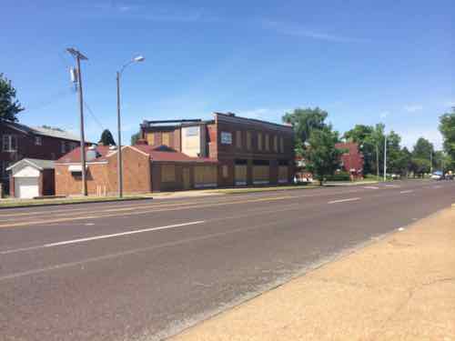
This 1920 property on Broadway & Chariton could be a part of the bigger project
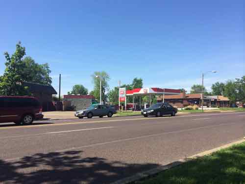
Two gas stations where Broadway & Osceola meet might become one urban station with building in front, pumps behind.

Again, this is a rough sketch of an idea that’s been bouncing around in my head. I wouldn’t expect anything to get built exactly as I’ve indicated. I would like to see residers of the 9th & 20th Wards to work on planning for the future of this area — coming up with a form-based overlay to guide what they’d like to see this become over the next 20-50 years.

— Steve Patterson


Readers Split On Bill To Gradually Increase The Minimum Wage In St. Louis

Demonstrators in front of Wendy's in Rock Hill,  August 26, 2013
Demonstrators in front of Wendy’s in Rock Hill, August 26, 2013

Readers split on the question of raising the minimum wage in St. Louis.  Here are the results of the Sunday Poll:

Q: A bill introduced Friday would raise the minimum wage in St. Louis to $10/hr, with annual increases of $1.25/hr until reaching $15/hr in 2020. I…

  1. Strongly support 12 [25.53%]
  2. Oppose 11 [23.4%]
  3. Support 10 [21.28%]
  4. Strongly oppose 9 [19.15%]
  5. Neutral 3 [6.38%]
  6. Unsure/no opinion 2 [4.26%]

Support narrowly edged opposition 22-20.  The common argument against raising the minimum wage is that doing so would lead to inflation. That’s interesting, because the minimum wage hasn’t kept up with inflation:

Myth: The federal minimum wage goes up automatically as prices increase.

Not true: While some states have enacted rules in recent years triggering automatic increases in their minimum wages to help them keep up with inflation, the federal minimum wage does not operate in the same manner. An increase in the federal minimum wage requires approval by Congress and the president. However, in his call to gradually increase the current federal minimum wage to $10.10 per hour, President Obama has also called for it to adjust automatically with inflation. Eliminating the requirement of formal congressional action would likely reduce the amount of time between increases, and better help low-income families keep up with rising prices.
Myth: The federal minimum wage is higher today than it was when President Reagan took office.

Not true: While the federal minimum wage was only $3.35 per hour in 1981 and is currently $7.25 per hour in real dollars, when adjusted for inflation, the current federal minimum wage would need to be more than $8 per hour to equal its buying power of the early 1980s and more nearly $11 per hour to equal its buying power of the late 1960s. That’s why President Obama is urging Congress to increase the federal minimum wage and give low-wage workers a much-needed boost. (Minimum Wage Mythbusters — U.S. Dept of Labor)

Not raising the minimum wage means these people find it harder and harder to survive each year as most everyone else gets raises, and groceries and other goods go up in cost. People are also focusing on $15/hr — that rate isn’t happening soon anywhere — increases will be gradual:

Among the cities that have enacted even higher local minimums are San Francisco ($15 by 2018), Seattle ($15 by 2021), Chicago ($13 by 2019) and Washington, D.C. ($11.50 by 2016), according to the National Employment Law Project. (5 facts about the minimum wage — Pew Reseach)

I hope this bill passes.

— Steve Patterson


Second Downtown Dog Park: Land Between Federal Courthouse & Stadium West Parking Garage

June 9, 2015 Downtown, Featured, Parks, Planning & Design Comments Off on Second Downtown Dog Park: Land Between Federal Courthouse & Stadium West Parking Garage

Today’s post continues a series on a 2nd dog park for downtown:

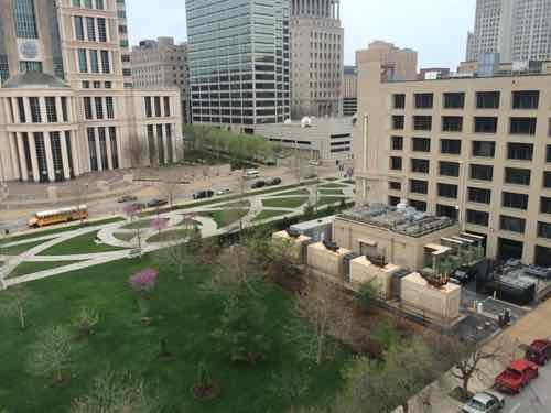
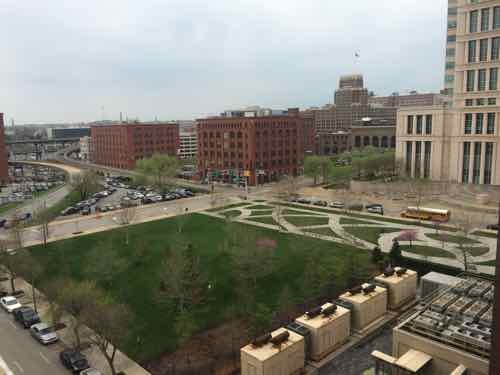
Today’s site is close to residents in the Cupples district and is also a good site for new construction. Unlike the others, this site is privately owned.

The NW corner of 9th & Clark is owned by Digital Realty as part of their 900 Walnut data center (right) The background park with patterned walkways is owned by the federal government, related to the federal courthouse across the street.
Another view showing the close proximity to the Cupples Station warehouses

Fencing this square would better define the federally-owned public park and provide much-needed activity.  The owner might get a tax credit if it leased the land to a non-profit dog park. As you can see there are numerous locations downtown for a 2nd dog park.

— Steve Patterson


Day Trip To Atlanta For First Anniversary

June 8, 2015 Featured, Metro East, Travel Comments Off on Day Trip To Atlanta For First Anniversary

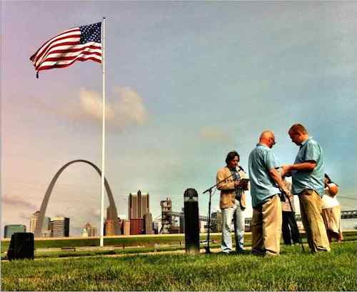
Today is my wedding anniversary — my first ever.  When I finally acknowledged to myself, at age 16, that I was gay, the idea of marrying a man 30+ years later never entered my mind.  Thankfully the political & social landscape has changed a lot since then!

David and I exchanging our vows on Sunday June 8 2014, officiated by our friend Chris Reimer. The location was the Malcolm Martin Memorial Park in East St. Louis, IL.
David and I exchanging our vows on Sunday June 8 2014, officiated by our friend Chris Reimer. The location was the Malcolm Martin Memorial Park in East St. Louis, IL  Click image for information on Reimer’s new book “Happy Work”

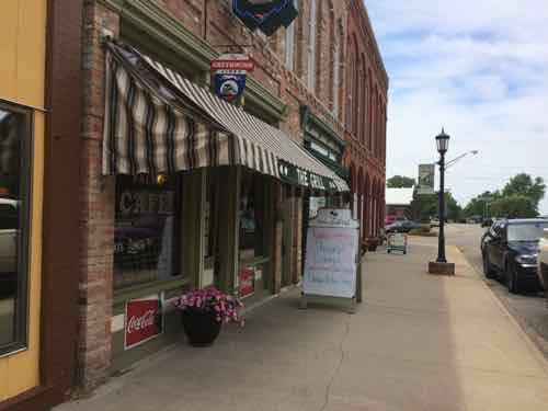
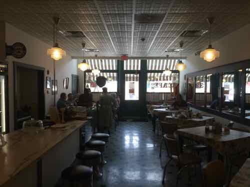
To celebrate we decided to visit Atlanta…Illinois, not Georgia. First we visited his family in Springfield IL, then we headed north to Atlanta. This small town on the old Route 66 was incorporated in 1853.

We had lunch at the Palm Grill Cafe, which  opened in 1934 to serve travelers on Route 66. In 1947 a bypass sent Route 66 traffic around the East edge of town. The Palm Grill closed in the late 60s.
We had lunch at the Palm Grill Cafe, which opened in 1934 to serve travelers on Route 66. In 1947 a bypass sent Route 66 traffic around the East edge of town. The Palm Grill closed in the late 60s.
It reopened in 2009, helping boost the town's sales tax revenue. People from 50+ countries have signed their guest book. Click image to see video from 4 years after reopening. 
It reopened in 2009, helping boost the town’s sales tax revenue. People from 50+ countries have signed their guest book! Click image to see video from 4 years after reopening.
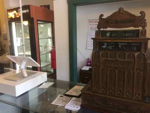
This symbolizes what they've done: the new iPad-based register sits next to a vintage register.
This symbolizes what they’ve done: the new iPad-based register sits next to a vintage register.
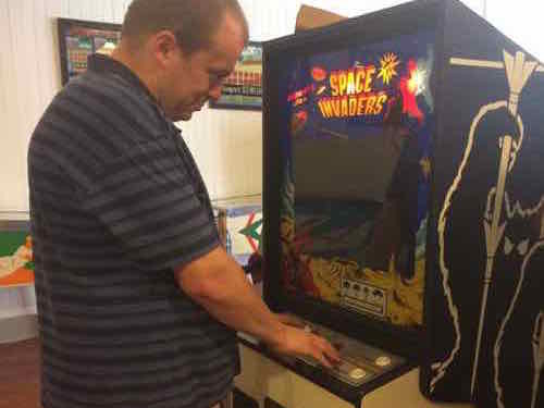
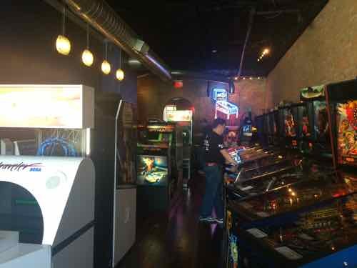
Next door we visited the Route 66 Arcade Museum, featuring arcade games from the 1930s-1980.
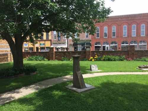
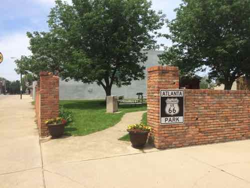
Across the street we checked out their Route 66 Park.
From inside the park. No building was razed for the park, the wood shed that has been on the site since the mid 19th century remains.

We decided to save the tour of the wood J. H. Hawes Grain Elevator Museum and other sites for our next visit.  After Atlanta we drove 5 minutes North on the old Route 66 to the smaller town of McLean IL, incorporated 13 years later. We’d actually been to McLean before — the truck stop right off I-55 is where Megabus stops to/from Chicago.

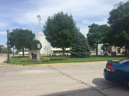
The toen square is technically s triangle because of the design of the street grid & railroad
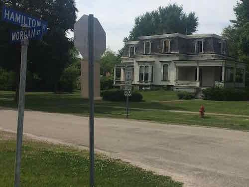
A magnificent Secind Empire house near the town square.
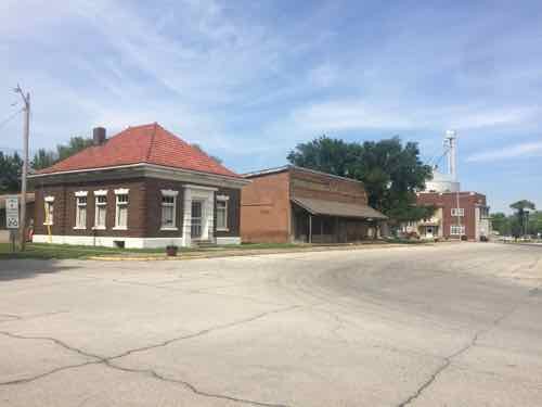
These buildings face the square 00 love the corner building with the peaked clay tile roof.
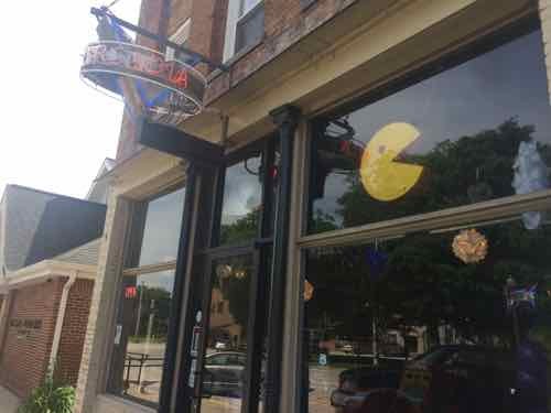
Our destination was Arcadia.
This arcade features games from 1980-2000, click image for website

These towns sprang up in the 19th century because of the railroad, which has me curious about how the railroads got their right-of-way. I also find the street patterns in these towns — in relation to the railroad — interesting.

The design of the original town of McLean remains almost unaltered to this day from the original plans. The design was similar to other places along the Alton and Springfield Railroad including Normal, Towanda, Odell, and Dwight. The original town was basically a square with streets aligned north-south and east-west, split diagonally by the railroad with a line of lots paralleling either side of the tracks.

As in other towns along the same railroad, there was a widened rectangular area paralleling the tracks labeled “Depot Grounds.” In the case of McLean, the Depot Grounds were laid out only on the southeast side of the railroad. The triangle of land on the northwest side, between the lots paralleling the railroad and remainder of the town, was designated as a public property and is still used as a park. The comparable triangle on the opposite side of the tracks was unlabeled and its intended use is unclear. This same arrangement of public land was followed at the town of Towanda.

Mclean was distinctive in that there were no streets between the diagonal line of lots along the tracks.Perhaps because of this, much of the business district developed along Morgan Street, which ran east-west just north of the park, or along Hamilton Street, which ran north-south, just west of the park. The line of lots paralleling the tracks and southeast of the railroad became the location of the hotel and the town jail. Later additions on the east side of the town featured additional lots which parallel the railroad as well as more conventional blocks (Wikipedia)

 Interstate 55 in this area opened in 1977, making the remaining Route 66 a by-road. We had a great day exploring Illinois, eating good food, and playing video games — a perfect way to celebrate our first anniversary!

— Steve Patterson


Advertisement


[custom-facebook-feed]

Archives

Categories

Advertisement


Subscribe