Home » Featured » Recent Articles:

Doering Mansion Sacrificed for Disappointing Mississippi Bluffs Developments

South Broadway once had some stately homes, with great views overlooking the Mississippi River. In early 2006 one was gone — razed for a multi-building condo project known as Mississippi Bluffs.
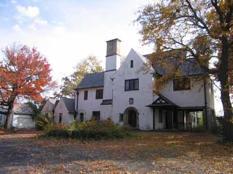
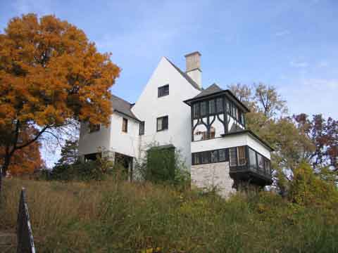
The former Doering Mansion
The River facade
The river facade

Most of the site for Mississippi Bluffs was to come from the former Good Samaritan Home, the Doering Mansion to the North, was included in the sale of the closed retirement home. The developer wanted just the retirement home site, but the seller wouldn’t split them up. Rather than market the Doering Mansion himself, the developer incorporated that land into his plans:

He’s building an oasis of 34 high-end condominiums on the Mississippi, each with its own garage and surrounded by 6.2 acres of park, sidewalks for dog walking and jogging, and a large pool. It sits on the city’s only mile of terrain above the flood plain, 80 feet above the Mississippi, perfectly positioned for views of the barge industry to the north, vast river to the south and Illinois forest to the east. 

Now, if only he could sell that idea to everyone else.

The land Curran is so fond of was once the site of a retirement home run by the Good Samaritans. The nonprofit organization also owned the adjacent Doering Mansion, which sat unused for 30 years. When the complex went up for sale in 2003, the owners’ only stipulation was that the mansion and the home could not be sold separately—no exceptions. Thus both buildings just sat. And sat. (St. Louis Magazine — September 2007)

I wrote about this project quite a bit at the time:

Many questioned the plan and the developer’s ability to perform. See map.
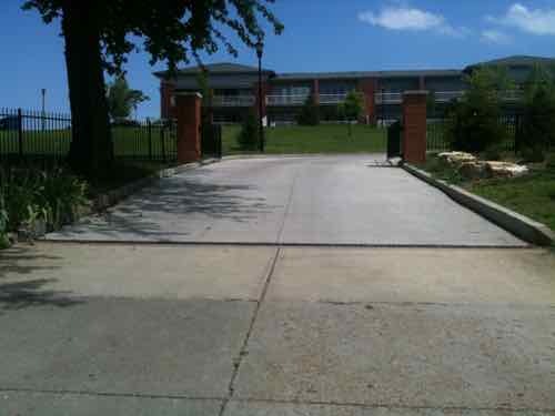
Only one of the planned buildings was built -- on the south end of the site. As promised, the garage doors weren't visible from Broadway
Only one of the planned buildings was built — on the south end of the site. As promised, the garage doors weren’t visible from Broadway

But the balance of the site remained vacant for years. Now the plan has changed — not for the better.
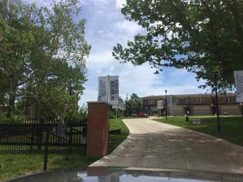
The view from the North entry, where the Doering once stood. Garage doors are highly visible from Broadway.  
The view from the North entry, where the Doering once stood. Garage doors are highly visible from Broadway.
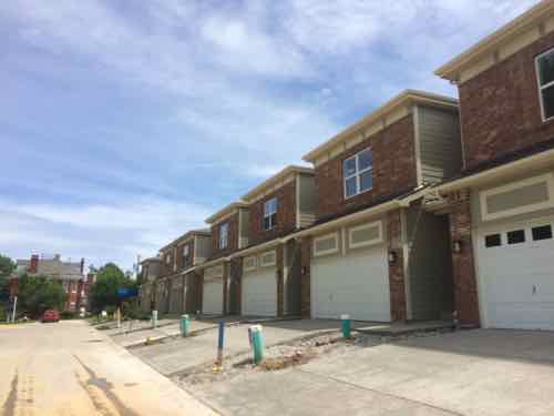
Up close the garages are very prominent. The original condo plan had the tuck-under garages.
Up close the garages are very prominent. The original condo plan had the tuck-under garages. Click image for the official website

Their views of the river are stunning.

It’s certainly possible had the Doering Mansion not been razed it would still be vacant and falling apart, but it’s also possible it would’ve been renovated and occupied years ago. A trusted politically-connected developer was allowed to raze one the few remaining mansions in a historic district because his project would fail without doing so. It failed anyway.

If only the Doering Mansion had been offered for sale on its own, only then would we have known if anyone would’ve been interested in renovating it. I’m just glad I don’t get down to this area very much anymore, I’d hate to see these garages on a regular basis.

— Steve Patterson


Sunday Poll: 12+ months prior to the convention, who do you THINK will be the five (5) final candidates for the 2016 GOP presidential nomination?

Please vote in the poll, located in the right sidebar

The 2016 election cycle is heating up, on the GOP side many have declared their candidacy and others are still considering running.  It’s too early to know who the GOP will nominate at their July 2016 convention in Cleveland — that’s the point — to later be able to compare 2015 perceptions with 2016 reality.

For today’s poll I combined declared & potential candidates from these two sites:

There was a lot of overlap, but each had some not listed on the other. Here is the combined list of 47, listed alphabetical:

  1. Skip Andrews
  2. Kelly Ayotte
  3. Haley Barbour
  4. John Bolton
  5. Kerry Bowers
  6. Jeb Bush
  7. Herman Cain
  8. Dr. Ben Carson
  9. Dale Christensen
  10. Chris Christie
  11. Ted Cruz
  12. Mitch Daniels
  13. John Dummett, Jr.
  14. Bob Ehrlich
  15. Mark Everson
  16. Carly Fiorina
  17. Newt Gingrich
  18. Lindsey Graham
  19. Nikki Haley
  20. Chris Hill
  21. Mike Huckabee
  22. Bobby Jindal
  23. John Kasich
  24. Peter King
  25. Michael Kinlaw
  26. Dennis Michael Lynch
  27. Susana Martinez
  28. Sarah Palin
  29. George Pataki
  30. Rand Paul
  31. Ron Paul
  32. Tim Pawlenty
  33. Mike Pence
  34. Rick Perry
  35. Michael Petyo
  36. Condoleezza Rice
  37. Mitt Romney
  38. Marco Rubio
  39. Brian Russell
  40. Mitch Sandoval
  41. Rick Santorum
  42. Tim Scott
  43. Rick Snyder
  44. John Thune
  45. Donald Trump
  46. Scott Walker
  47. Allen West

I usually randomize the answers in the poll (right sidebar), but because of the sheer number of names they’re displayed in alphabetical order. The poll question isn’t who you want to see make it to the final 5, but rather who you think will be the 5 who survive the next 9-12 months.

Please be sure to pick 5 answers, the poll closes at 8pm tonight. UPDATE: Because of a software problem this morning I’m going to leave this open until 10pm.

— Steve Patterson


Shriner’s Hospital Returns To St. Louis City After 52 Years In Suburban Frontenac

Sunday afternoon the new Shriner’s Hospital for Children will be dedicated.  The new facility will open for patients on June 1st, a return to the City of St. Louis after 52 years in the affluent suburb of Frontenac.

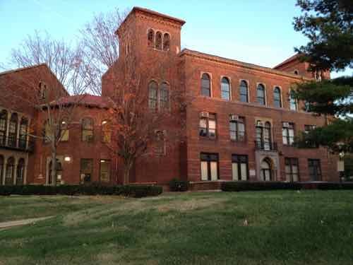
In 1924 the Shriner's Hospital for Crippled Children opened on the NE corner of Euclid & Clayton
In 1924 the Shriner’s Hospital for Crippled Children opened on the NE corner of Euclid & Clayton
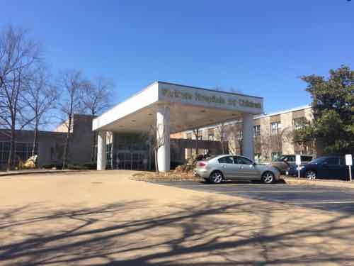
In 1962 the Shriner's built a larger hospital on many acres in Frontenac
In 1963 the Shriner’s built a larger hospital on many acres in Frontenac

Changes in care meant the 1960s facility was too large:

The hospital is leaving a 182,000-square-foot facility in Frontenac for a 90,000-square-foot facility in St. Louis. The new hospital, at 4400 Clayton Avenue, will continue to use 12 inpatient beds despite its license for 80. (Post-Dispatch)

Many of us have been watching the new building take shape for a while now, much more visible than the facility they’re leaving.

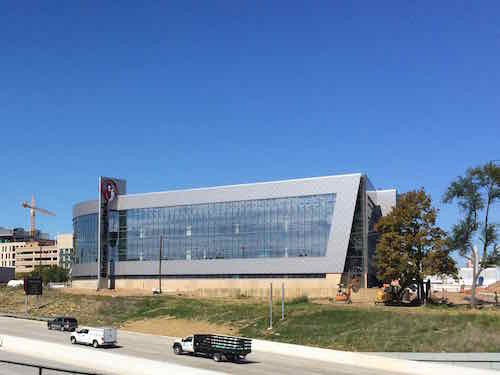
The new hospital as seen from across I-64 last October
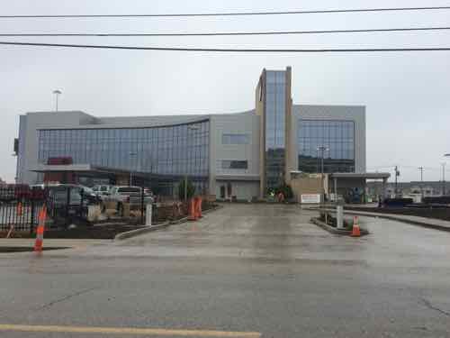
The Clayton Rd entry in December
The Clayton Rd entry in December, the ADA accessible route is on the right

About Sunday’s dedication:

New hospital dedication ceremony May 17
Dedication of the new replacement hospital for Shriners Hospitals for Children — St. Louis, will take place from 1 – 4 p.m., Sunday, May 17. 

Imperial Potentate Dale Stauss and Chairman of the Board of Trustees Doug Maxwell will officially open the building for visitors that day. Following a special ceremony featuring the local and national leadership of Shriners Hospitals for Children – as well as a few surprises from the patients – the hospital will be open for tours. Tours of the hospital will include a once-in-a-lifetime opportunity to see in some areas of the hospital that will be restricted to patients, families and employees only, such as the operating rooms, patient rooms and patient-family quarters.

Sunday’s dedication is open to the public. Yesterday I got a tour of the facility, here are most of the photos I took:

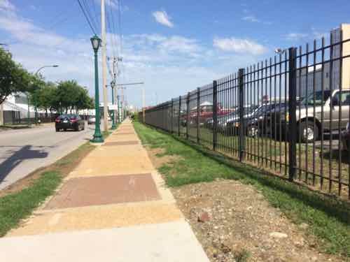
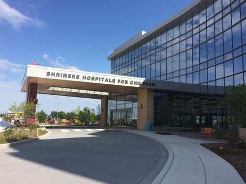
Approaching on Clayton Ave, from Euclid
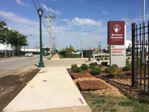
At the entrance
At the entrance
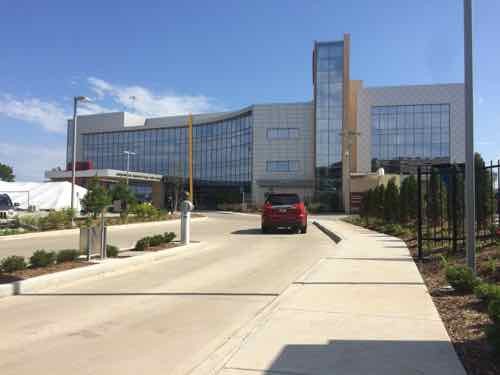
The required ADA accessible route
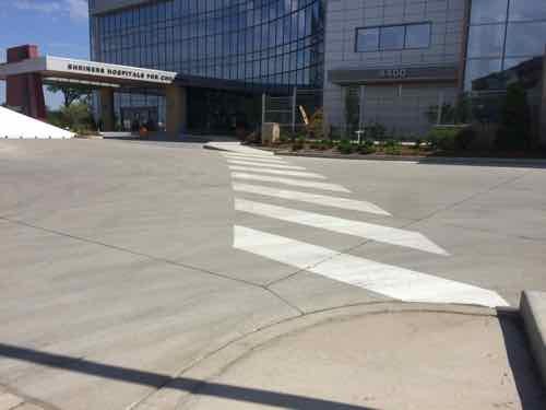
Crosswalk at drive
Crosswalk at drive
At the main entry
At the main entry
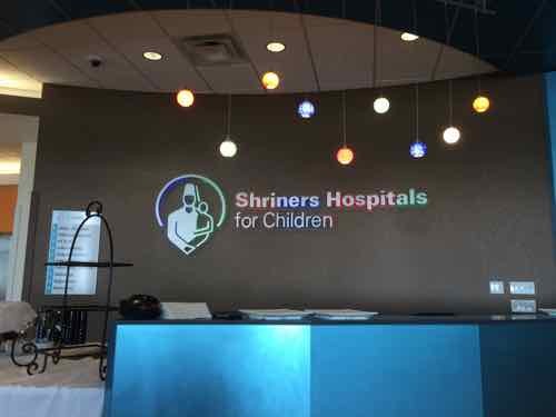
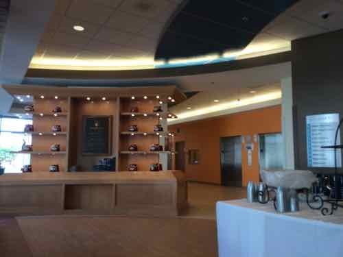
Just inside the front doors
Looking to the left of the reception desk
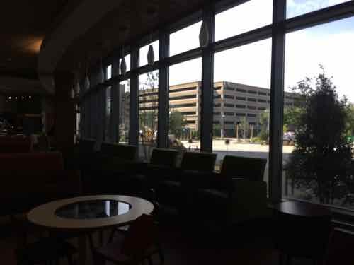
Looking out toward Clayton Ave from the lobby cafe
In the cafe area changing images are projected onto a wall
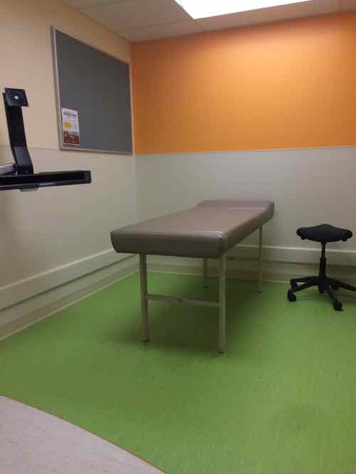
One of the exam rooms
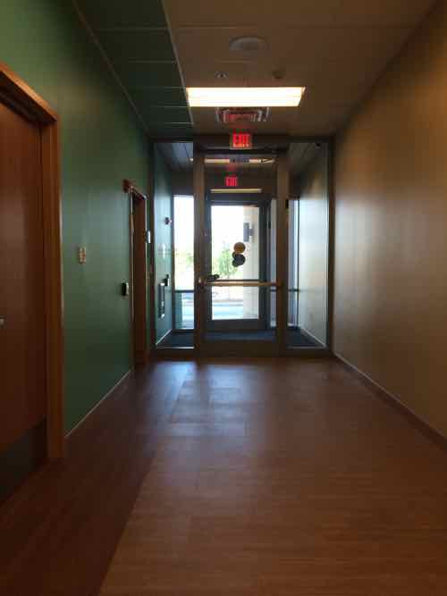
A side entry on the East side allows patients to arrive/leave in privacy
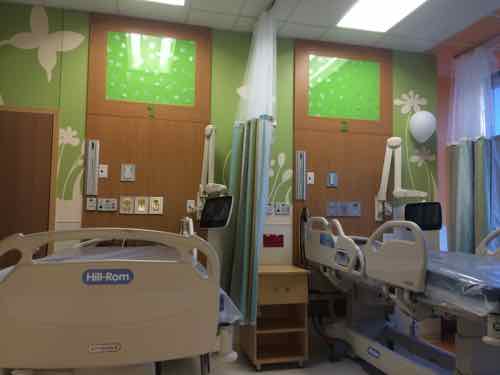
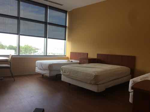
There are six double rooms . Each patient has a tablet for music, games, etc. Patients can also adjust a color-hanging LED light over their bed!
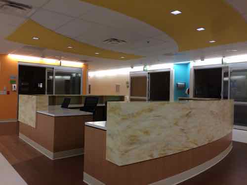
The nurses station in the recovery area
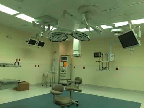
The main operating room
On the 2nd floor is the board room, which will also be used for staff meetings
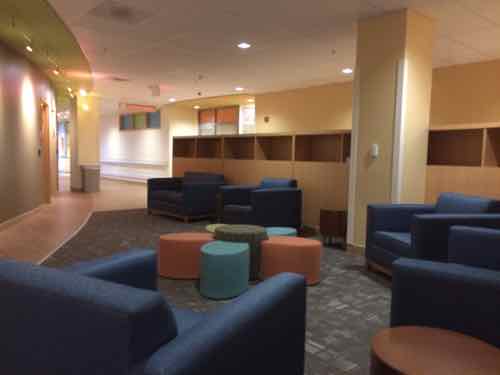
A 2nd floor lounge
A 2nd floor lounge
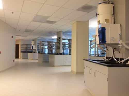
A large research lab
Recreational therapy
One of the hotel-like rooms for family staying overnight
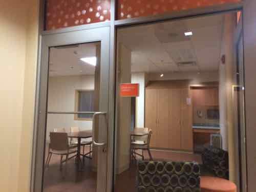
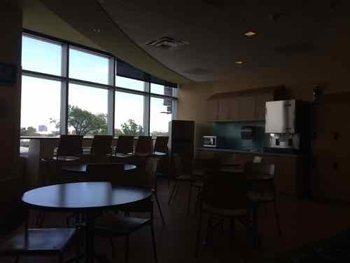
A family lounge on the 3rd floor with windows facing East toward downtown
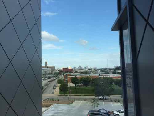
The view looking East

This new hospital is good news for the City of St. Louis, even better news for the young patients & their families who’ll receive care here in the decades to come. I know the hospital where I had surgery at age 4 looked nothing like this, it was a scary institutional place. Thankfully all new hospitals have gotten more welcoming.

The last all-new hospital in the 22-hospital Shriner system was in 1997 — so this is a big deal. Shriner’s St. Louis has always had a connection to Washington University, this new location will strengthen that relationship.  Again, Sunday’s dedication is open to the public.

Welcome back Shriners!

— Steve Patterson


What To Do With 1.2 Million Square Feet In The Railway Exchange Building (UPDATED)

Downtown’s Railway Exchange Building, completed in 1913, occupies an entire city block. From the 2009 National Register nomination:

The Railway Exchange Building was recognized as an architectural and engineering wonder even before it was constructed. But the building’s rich history was built more on the shoulders of the companies it was designed to house than the structural supports and ornamental flare it boasted in its design. The building has been a commercial asset to the St. Louis downtown since its construction, housing what became the city’s largest department store. In addition, many local businesses operated on the upper floors of the building, and the building’s official moniker derived from the abundance of railroad company tenants occupying the building when it opened.

The Railway Exchange Building was designed in 1912 by Mauran, Russell and Crowell as a home for the newly merged Famous-Barr Company. By the time Famous and Barr were merged, each had established themselves as a prominent department store in St. Louis. William Barr & Company opened as a drygoods store in 1850. Located on Fourth Street between St. Charles and Vine, the drygoods company grew rapidly, and by 1876 boasted over 300 employees and 32 departments with a separate manager for each division. In 1880 William Barr moved into the Julia Building, a four-story construction that occupied half the block at 6th an Olive Streets. As the city’s first department store, Barr’s took advantage of the mail-order trade as well as the in-house sales. The company remained in this building until it was replaced in 1913 by the Railway Exchange Building.

May Department Stores was bought out by Federated Department Stores in August 2005, a year later Famous-Barr became a Macy’s (Wikipedia). In 2011 Macy’s consolidated into the lower 3 floors, from 8, but still couldn’t make it. Macy’s closed in 2013 (Post-Dispatch).

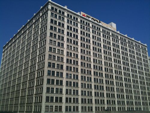
Railway Exchange building in 2011, before the consolidated Macy's closed.
Railway Exchange building in 2011, before the consolidated Macy’s closed.

Tuesday morning I attended the public presentation by ULI St. Louis’ Technical Assistance Panel (TAP) on their recommendations to the developer that owns the structure. Unfortunately, their presentation isn’t yet online. Here are some highlights from memory:

  • With 1,000 parking spaces in the block to the South they didn’t recommend including any parking within the building.
  • Reskin/update the parking garage, remove the ramp off 7th
  • Consider a plaza for the surface lot at 6th & Olive.
  • The building would get sectioned into various zones for development into many functions. Different developers could then work on their portion, without any single developer having to take on the entire project at once.
  • The total square footage would be reduced some by opening up floors at various spots — such as creating 2-story volumes in some residential units.
  • Remove the roof and create an outdoor walk around the perimeter of the 21st (top) floor.
  • Residential units on the floors just below. Various sizes could be offered.
  • Two hotels on floors below the residential, one a boutique hotel like 21C and one an extended stay.  With new startups downtown they indicate there is demand for such hotels. Each hotel could have large volume spaces.
  • Recreational space, like a gym or basketball court.
  • Street-level retail like Urban Target, CVS/Walgreens, a fresh produce market, etc.

The building would still likely be over a million square feet after the reductions in floor area. With four primary facades you could have separate entrances for each function.

I still don’t like the existing garage, it’s old & ugly. The flow inside is awful. The garage needs to be replaced with a new garage if parking is excluded from the building. I’d love an Urban Target, a 24/7 CVS or Walgreens, and a Trader Joe’s. The developer already has interest in a couple of the pieces, but not enough to move forward just yet. The TAP felt if broken up into pieces it could be marketed nationally to interest developers from outside our region.

UPDATE: 5/14/15 # 7:40PM — the ULI presentation wasn’t available online yesterday as I finished the post, but thanks to a reader this morning who posted the link.

— Steve Patterson


Northside-Southside Light Rail Wouldn’t Be Good For St. Louis Neighborhoods

Lately I’ve been hearing people wanting the build the long-planned Northside-Southside MetroLink lines. While I’m a huge advocate of public transit, rail transit in particular, this would ultimately be a costly disaster for St. Louis’ neighborhoods.

For the Northside corridor, the preferred transit alternative was a MetroLink line running from downtown St. Louis north by using rights-of-way along several streets including 14th Street, Natural Bridge Avenue, and West Florissant Avenue into North St. Louis County. Two potential preferred alternatives were selected for the Southside corridor. One was a MetroLink extension from downtown St. Louis running south using rights-of-way within 14th Street, Chouteau Avenue, the Union Pacific Railroad track and along I-55. The other possible design was a Bus Rapid Transit system from downtown south via Market Street, Grand Boulevard, to rights-of-way alongside the Union Pacific Railroad track and Loughborough Avenue, then via I-55 to South St. Louis County. (Northside-Southside Overview)

Here’s what I think these people don’t understand:

  • This would be a completely separate system from our existing light rail — Northside-Southside would use different vehicles & track. An existing line coming from the airport, for example, wouldn’t be able to run into south city. Passengers would need to exit the older high-floor light rail vehicles at the Civic Center MetroLink station and walk to 14th Street to board the new line. Fares could be integrated, but physically separate otherwise.
  • The vehicle type used would be the same as the proposed St. Louis Streetcar.  These are modern vehicles and are an excellent choice. When used as “light rail” they operate in dedicated right-of-way (ROW) with far fewer stops so as to achieve desired speeds end to end. As streetcars they stop much more frequently, putting more people closer to a stop. The tracks can be crossed easily by pedestrians & motorists. Connectivity, not speed, is the priority.
  • The goal for Northside-Southside was to end at large park-n-ride lots and get suburbanites through “scary” city neighborhoods and into downtown as quickly as possible. Stops would be over a mile apart.
  • To achieve necessary speeds the number of conflict points between rail & autos/pedestrians would need to be greatly reduced. This is accomplished by building a median down the center of the road (Natural Bridge, Jefferson) with very few points to cross. That left turn you used to make would become impossible, as would walking across the street at all but a few points.
  • Property along the routes would need to be taken, some buildings razed. This is because creating a dedicated ROW takes lots of room — more than even our generous ROWs have to offer.This light rail ROW would act similar to a highway — dividing the neighborhoods on either side in an effort to rush people through as quickly as possible.

These are not positives for the neighborhoods, unless you live near one of the few stops it won’t be useful to residents.

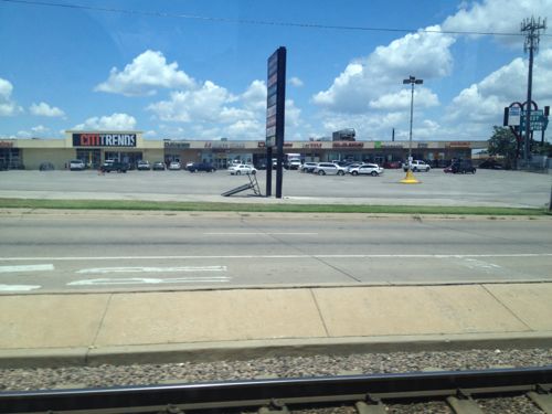
We don’t have any examples of light rail in the center of a road, so we need to look elsewhere. In 2012 I visited Dallas and rode their Blue Line south in the center of Lancaster Rd.

ABOVE: One of several auto-centric strip shopping centers along the Blue line
One of several auto-centric strip shopping centers along their South Blue line, the physical design of the light rail line discourages new development, walking, etc

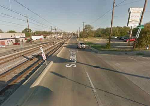
All of my photos are from inside the light rail car or at the stations. To understand you you need to view from outside. Short of a personal visit, you can look at Google’s Street View.

This view from Google Street View shows how traffic & pedestrians from a side street are forded to turn right. Click image to view the location on a map
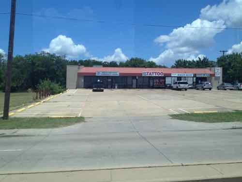
A 2012 photo I took of the shopping center on this corner

Light rail doesn’t appear to have spurred any development in the 18 years it has been open. The rail vehicles, however, do move at a high speed between stations. Success depends on your goals.

What the St. Louis neighborhoods North & South need is an investment in excellent localized rail transit — streetcars. Again, the vehicles are virtually identical — it is the design of the track and number of stops that make the difference. To me, the South/Jefferson County person driving downtown is likely to just stay on I-55 to reach their destination — we shouldn’t design this to persuade them to exit the highway and park in a big parking lot.

We should design & invest in infrastructure that brings the neighborhoods together, that helps local merchants.  Light rail is the wrong choice, streetcars is the best rail choice. If you’re opposed to MoDOT’s plans for Gravois you should be opposed to creating a light rail ROW in the middle of our major aerials.

— Steve Patterson


Advertisement


[custom-facebook-feed]

Archives

Categories

Advertisement


Subscribe