Home » Featured » Recent Articles:

Poll: Which TWO (2) Institutions In The Metropolitan Zoological Park and Museum District Are Your Favorites?

March 24, 2013 Featured, Sunday Poll 5 Comments

zmdlogoThe poll this week is pretty straightforward — pick your two (2) favorite institutions in the Metropolitan Zoological Park and Museum District. Here are the five institutions, as listed on the ZMD website:

Saint Louis Art Museum
The Saint Louis Art Museum is rated as one of the principal art museums in the United States and is visited by up to a half million persons every year.
Click here for website

Saint Louis Zoological Park
The Saint Louis Zoological Park is recognized as a leading zoo in animal management, research, conservation, and education. Admission is free, although there are fees for some activities.
Click here for website

Missouri Botanical Garden
The Missouri Botanical Garden is one of the oldest botanical institutions in the United States and a National Historic Landmark.
Click here for website

Saint Louis Science Center
The St. Louis Science Center is among the largest of its type and, like all science centers, is intended to be a place of informal science education for all ages.
Click here for website

Missouri History Museum
The Missouri Historical Society was established in 1866 to rescue “from oblivion the early history of the city and the state.” The Missouri History Museum houses a variety of exhibits and educational resources.
Click here for website

Please vote in the poll located in the right sidebar, picking two of the provided answers. New poll 8am Sunday March 31st, results presented on Wednesday, April 3rd.

— Steve Patterson


St. Louis Rapid Transit Connector Study: First Round of Open House Meetings Scheduled March 28, April 2, and April 5

The following is a press release:

—-

Bi-State Development Agency (Metro) announced the first round of public open houses focusing on a new St. Louis Rapid Transit Connector Study scheduled for March 28, April 2 and April 5. The study is another step toward fulfilling Metro’s long-term goal of offering efficient, competitive and attractive transit services to more residents and more places in the St. Louis region.

The study, led by the Bi-State Development Agency (Metro) and the Transportation Corridor Improvement Group, will identify two transit investment projects to move forward in pursuit of federal funding. It is anticipated at least one project will be implemented as a result of this effort.

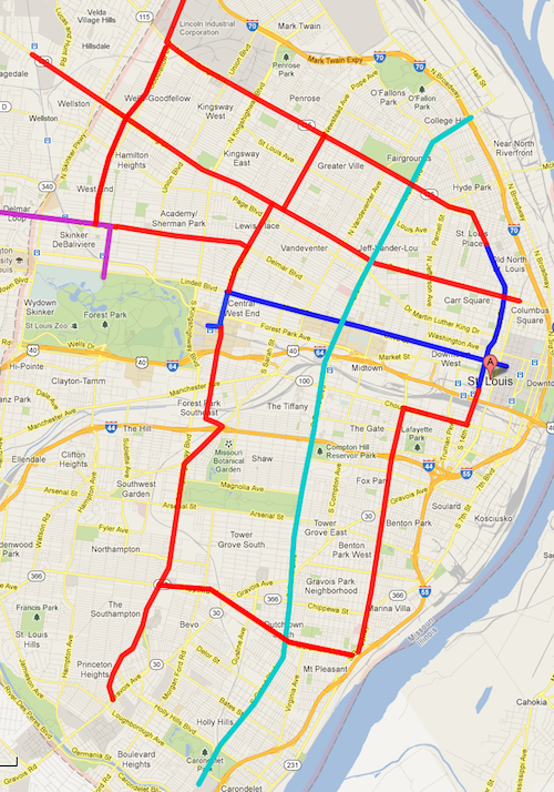
The St. Louis Rapid Transit Connector Study is a direct result of Moving Transit Forward, the long-range transit plan that highlighted the potential of using the region’s existing network of highways and major streets to provide higher-speed, limited-stop transit services. The general transportation corridors identified by the public as significant opportunities for high-performance transit are Interstates 70, 44, 64, and 55, major streets near those highways, and Grand Boulevard in St. Louis.

“By improving the connections between people and jobs, education, and other opportunities, we can maximize the potential not only of our transportation network, but of our residents and businesses as well,” said Jessica Mefford-Miller, Metro Chief of Planning and System Development.

The study takes a data-driven approach to identify and evaluate potential projects. Final recommendations will be shaped by several objectives, including improved access to transportation that supports economic growth; expansion of access to opportunities; enhanced employer access to a broader and more diverse labor pool; reduction of traffic congestion and air pollution; and financial feasibility.

The partners leading the St. Louis Rapid Transit Connector Study will answer questions and encourage discussion at the three upcoming public meetings. The meetings will be conducted in open-house style, with the attendees invited to participate in interactive activities designed to gather community input on project goals and transit performance criteria. Residents will also learn about the range of possible options for expanding cost-effective rapid transit service in St. Louis.

The same information will be presented at each of the public open houses.

· Thursday, March 28 from 4:30-7:30 p.m. A formal presentation will be made at 5:30 p.m. and again at 6:30 p.m. Located at the JC Penney Conference Center at the UMSL Campus. The meeting will be in the 1st Floor Lobby of the building located at 1 University Boulevard, St. Louis, MO 63121.

· Tuesday, April 2 from 4:30-7:30 p.m. A formal presentation will be made at 5:30 p.m. and again at 6:30 p.m. Located at the World Trade Center on the 10th Floor. The building is located at 121 S. Meramec Avenue, Clayton, MO 63105.

· Friday, April 5 from 11:30 a.m. to 1:30 p.m. A formal presentation will be made at noon. Located at St. Louis City Hall on the 2nd Floor Hall and in the Kennedy Room. City Hall is located at 1200 Market Street St. Louis, MO 63103.

More information and futures updates on the St. Louis Rapid Connector Study can be found at www.movingtransitforward.org/stlrapidtransit.

About the Transportation Corridor Improvement Group

The St. Louis Rapid Transit Connector Study is being conducted by the Bi-State Development Agency (Metro) in partnership with the Transportation Corridor Improvement Group, a partnership between East-West Gateway Council of Governments (EWGCOG), St. Louis County, the City of St. Louis, and the Missouri Department of Transportation (MoDOT).


Ballpark Village Work Actually Underway

The groundbreaking for phase one of the long-delayed Ballpark Village project was held six weeks ago today (see post). Suits grabbed shiny shoves and tossed dirt placed neatly in front of the stage.

Years after Busch Stadium II was razed, the ground was broken on 2/8/2013 for Ballpark Village
ABOVE: Site plan for BPV Phase 1 released 2/8/2013

And yes, workers have been busy the last six clearing the site and prepping for the infrastructure needed to support all phases of the project. Here are a couple of views from Three Sixty taken on March 15, 2013:

bpv
Initial buildings to be opposite Busch Stadium Gate 5, center above
bpv
Looking west toward the Stadium West garage
ABOVE: The curving 7th Street from Clark Ave to Walnut St will be eliminated
ABOVE: The former International Bowling Hall of Fame (background) and 7th Street from Clark Ave to Walnut St have been removed. Photo from October 2012.

Eighth St will become two-way up to Market Street, leaving just 5 blocks between Market & Washington as one-way southbound. Walnut St will also become two-way between 8th and Memorial Drive, leaving just four blocks from Tucker to 8th was one-way eastbound. Hopefully these scattered blocks won’t remain one-way.

— Steve Patterson


A Close Look at the Proposed St. Louis Streetcar in the CBD

Much of the talk about the proposed Downtown to CWE modern streetcar line has been focused on:

  1. The use of streetcar vs bus
  2. The east-west corridor vs investment in north & south St. Louis
  3. How the proposed route mirrors the 1993 MetroLink route
  4. How to end the line in the CWE, see post from yesterday here.

All valid topics, but today I want to zoom in to look at the route in the downtown central business district (CBD).

I added the existing #99 downtown trolley to the map of the proposed streetcar route
I added the existing #99 downtown trolley (blue) to the map of the proposed streetcar route

At this point in the streetcar process it isn’t known if the #99 Downtown Trolley bus route would remain, change or be eliminated completely. The draft report does note that operational savings could be realized through the elimination of a couple of bus routes. Eliminating the #99 would mean greater walking distances for service workers using transit since the proposed streetcar route has a more compact footprint, not a good thing for them.

East of 14th Street objectives that drove decisions regarding downtown alignments included:

  • Get as close as possible to the center of the employment concentration.
  • Minimize distance, physical and psychological, to major attractions, including the Arch Grounds.
  • Reduce capital and operating costs.
  • Minimize the number of curves to reduce noise and
  • increase speed.
  • Minimize the distance between tracks on one-way pairs. (The narrowness of the downtowtreets precludes double-track operation.)
  • Eliminate impacts to MetroLink from streetcar construction.
  • Lessen traffic impacts.

Application of those principles resulted, first, in the elimination of several options. Impacts to MetroLink during construction eliminated 8th Street and Washington Avenue. Traffic impacts, as cited by the City of St. Louis and the Missouri Department of Transportation, caused Broadway and 4th Street to be dropped, and the cost of extending the alignment from the downtown employment core to Memorial Drive eliminated that option.

This screening process resulted in a set of east-west streets that generally satisfied the evaluation criteria listed above. These included Chestnut, Pine, Olive and Locust Streets. North-south options were more limited and included 6th-7th Street and 9th-10th Street pairs. The former set was selected because it is closer to the heart of the downtown employment concentration and provides better proximity to major destinations. Olive Street is the logical eastbound half of an east-west one-way pair as it is a no-turn continuation of the alignment west of 14th Street. This results in a decision between Locust and Pine for the westbound segment. Locust was selected because of its centrality to the employment core, and because of its more pedestrian friendly first-floor uses, i.e., retail. Finally, the alignment south to Kiener Plaza addressed the strong desire from many stakeholders to provide direct and very visible pedestrian access to the Arch Grounds. (The plaza also provides a non-street layover point for streetcars.) In the next phase future coordination with the CityArchRiver 2015 project (draft study p14)

At Kiener Plaza a “layover point” is shown off street. This doesn’t fit with the latest concept for rebuilding Kiener Plaza. Such a change would need to be reviewed by the Gateway Mall Advisory Board, of which I’m a member.

Also not addressed is the use of 14th Street where it crosses the Gateway Mall (Market to Pine). Currently that is part of the “Civic Room” in the Master Plan. Currently 14th Street is frequently closed to traffic during major events like Taste of St. Louis and the Komen Race for the Cure. During these times the many bus routes that utilize 14th are rerouted on other streets but if 14th Street is used for the streetcar that means auto traffic may be rerouted but the streetcar needs to get through. This has major implications on the final design of the Civic Room and on event planning.

It was the relocation of the Saint Louis Law School that started all this, if Pine was used instead of Locust, that would be adjacent to the school. That said, I agree with the selection of Locust St. Yes, I live on Locust but at 16th so I won’t have a streetcar line directly in front of my building regardless.

It’s still early in the process but there’s lots to think about if this streetcar moves forward.

– Steve Patterson


Readers Split On Proposed Streetcar Route

Readers in the poll last week didn’t select any one option by a majority. The three routes presented as options, two being considered and another I’ve been advocating for years, each received a similar number of votes.

Q: My preferred route for a streetcar line is…

  1. Option 2: Olive/Lindell>Euclid>Forest Park Blvd>Taylor>Lindell 35 [29.66%]
  2. Option 1: Olive/Lindell>Taylor>Children’s Place/CWE MetroLink 31 [26.27%]
  3. New option: Olive/Lindell to Vandeventer to Delmar to Loop Trolley 29 [24.58%]
  4. None, don’t built a streetcar line 12 [10.17%]
  5. Other: 10 [8.47%
  6. Unsure/No Opinion 1 [0.85%]

The ten other answers were:

  1. Use the old Hodiamont Streetcar right of way
  2. grand blvd
  3. Olive/Lindell>Euclid>Forest Park Blvd>Vanderventerr>Lindell/Olive
  4. Street cars are a joke. They are a waste. Busses offer far more flexibility.
  5. Use the old Hodiamont street car right of way.
  6. Continue on Lindell to Debaliviere/Loop Trolley connection.
  7. Middle-upper income routes to replace cars.
  8. Link “downtown” only by s.cars: riverfrt. to Jeff Ave,, Delmar to Soulard.
  9. free, downtown loop, between Tucker & Broadway
  10. Option 1 but utilize Market and Forest park instead of Olive/Lindell

When streetcars were first installed it was a private effort by real estate developers to make it easier for buyers to reach new development:

The Gravois-Jefferson Streetcar Suburb Historic District is located within the boundaries of the City of St. Louis, Missouri. The -715-acre District is a triangular area generally bounded by the intersection of Gravois and South Jefferson Avenues at the north, South Jefferson Avenue and South Broadway Street (south of Chippewa Street) on the east, Meramec Street on the south, South Grand Boulevard on the west, and Gravois Avenue on the northwest.’ Gravois Avenue is a major arterial street and historically served as a wagon, streetcar, and vehicular transit corridor. South Jefferson Avenue also was and is a major transportation corridor. Meramec Street is a major collector street. Mixed commercial, institutional, and residential use along these major city thoroughfares visually and historically defines the survey area. (National Register nomination PDF)

Today funding streetcars in developed urban areas takes more than available right-of-way, it takes enough demand to justify the investment in infrastructure. Often this means connecting some big dots, the in between will fill in over time with proper land use controls. The problem in St. Louis is our big dots are generally east-west between downtown and Clayton.  What big dots exist north & south to guarantee ridership on a daily basis?

Grand has a few dots:

  • VA Hospital
  • Grand Center/SLU
  • Grand MetroLink
  • SLU Hospital

Okay, suppose you connect these via streetcar — that’s a mile and a half length. Not bad, but you’d still have to run the #70 (Grand) MetroBus to reach areas north and south — an additional 7.5 miles. Even my longtime preferred route of Olive/Lindell to Vandeventer to Delmar doesn’t have enough dots to get funding.

But between the Option 1 & 2 being considered I have a strong preference for #1 —  the double track on Taylor Ave option rather than the Euclid/Forest Park/Taylor loop.Establishing a double track on Taylor Ave sets up a perfect scenario for north-south expansion. Below is one concept:

Teal = Loop Trolley Blue = Proposed Streetcar Red = Possible Future Lines
Purple = Loop Trolley, Teal = #70 Grand BRT, Blue = Proposed Streetcar, Red = Possible Future Lines.  Click image to view map in Google Maps

The dots aren’t there for an initial north-south line but extending a couple of miles here and there every few years would eventually build a system. The current proposal calls for a north-south piece at 14th Street, going up to St. Louis Avenue. The double track on Taylor of Option 1 provides an ideal spot for a second north-south line further west. Expansion could happen to reach new development projects.

Yes, what I’ve shown above would take decades to construct. That’s how long-term planning works. For further reading on streetcars please see a 65-page literature review of Relationships Between Streetcars and the Built Environment.

— Steve Patterson


Advertisement


[custom-facebook-feed]

Archives

Categories

Advertisement


Subscribe