Home » Featured » Recent Articles:

Chippewa Sidewalk Still Not Passable Nearly Six Months Later

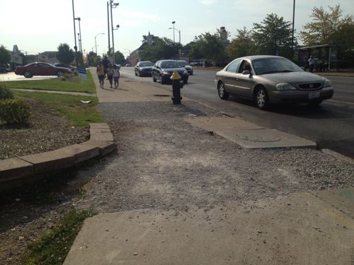
Since I sold my car in April I’ve made two shopping trips to Target on the #11 (Chippewa) MetroBus. In June I spotted sidewalk construction between the bus stop and Hampton, the driver let me off on the west side of Hampton so I wouldn’t be stuck.

In July it looked like the sidewalk was fixed, but it wasn’t.
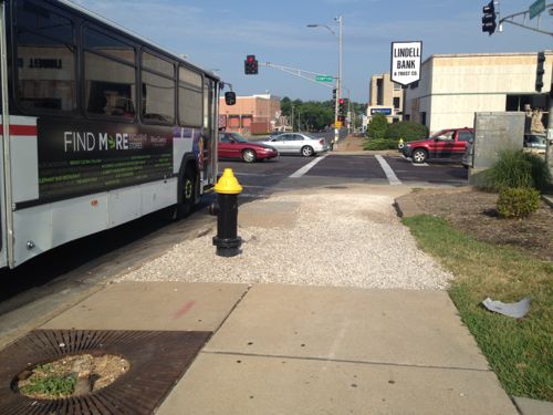
ABOVE: July 3 2012 the sidewalk remained not passable to my power chair.
ABOVE: View looking east from Hampton after I “drove” through the Walgreen’s parking lot

This was due to a water main break:

The break happened on Tuesday morning in the Northhampton neighborhood. A thin layer of water is covering roadways near the intersection and there is a fear that the water will freeze causing a slick and potentially dangerous situation. (KMOV)

Freeze? Yes, the water main break happened on January 24, 2012! Did someone forget about the sidewalk?

— Steve Patterson


Poll: Why Do You Think The Pruitt-Igoe Site Has Remained Vacant For 40 Years?

The first implosion of a high rise at Pruitt-Igoe took place on March 16, 1972. The final building was demolished on four months later on July 15, 1972 — forty years ago today.

After months of preparation, the first building was demolished with an implosion at 3 p.m., on March 16, 1972. The second one went down April 22, 1972. After more implosions on July 15, the first stage of demolition was over. As the government scrapped rehabilitation plans, the rest of the Pruitt–Igoe blocks were imploded during the following three years; and the site was finally cleared in 1976 with the demolition of the last block. (Wikipedia)

Four years to clear the site after the last building was demolished!

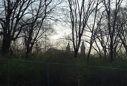
ABOVE: The steeples of St. Stanislaus Kostka are visible through the overgrowth on the former Pruitt-Igoe site.

Pruitt-Igoe’s 33 buildings were only occupied for 18 years (1954-1972)  with the last few of that in such poor condition a rent strike was held by residents in 1969. A school was built on part of the site in the early 1990s but otherwise the site remains vacant and overgrown.

The poll this week wants to know why you think the site has remained vacant for four decades. The poll is in  the upper right sidebar.

— Steve Patterson


MetroLink Moves Masses For Events

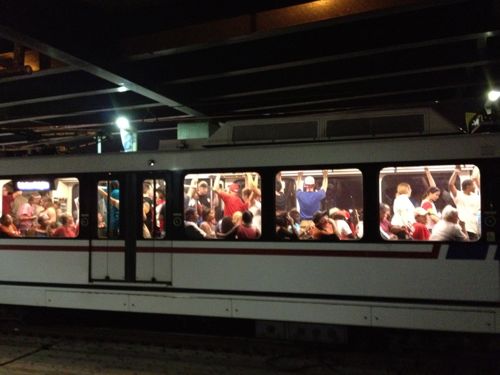
After the fireworks were over on the 4th many headed toward public transit, not a private vehicle. MetroLink light rail was packed with people going east & west from both sides of the river.

ABOVE: Crowds fill trains after fireworks on July 4th

Downtown couldn’t have handled all the cars if these people had driven, not enough parking and the streets would have been jammed for a long time. I can’t imagine not having our light rail lines to get people to & from major events.

— Steve Patterson


A Park With A View

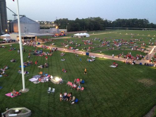
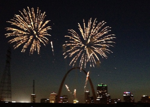
One of the best views of St. Louis fireworks isn’t in St. Louis at all, but in East St. Louis across the Mississippi River.

ABOVE: Hundreds watched gathered on the 4th in the Malcolm Martin Memorial Park in East St. Louis IL to watch the St. Louis fireworks.
ABOVE: Fireworks on the 4th with the Arch and St. Louis skyline in the background. Taken with an iPhone 4S.

For more information on Malcolm Martin Memorial Park click here.

— Steve Patterson


Lambert Field Dedicated 1930

ABOVE: East Terminal at Lambert

Lambert Field, now Lambert International Airport, was dedicated on this day in 1930. At the time it was way out in the countryside.

Nearly 20 years later the impact

Within a decade air transport has become a major consideration in the planning of the urban areas. The volume of traffic, passenger, freight and express, will increase manifold during the next twenty years.

It is reasonable to assume that the developments in air transportation during the next few decades will parallel that of automobile transportation, which really started about three decades ago. St. Louis must be prepared to accept and make the most of conditions that will arise. Provision of the several types of airfields required must be on a metropolitan basis. The recently prepared Metropolitan Airport Plan proposes thirty-five airfields. (1947 Comprehensive Plan)

Thirty-five?  Because the city is so small only three of the thirty-five would be located within the city limits: two minor fields “for non-scheduled traffic, commercial uses and for training” and one private airport for, logically, private aircraft. See a diagram of all 35 airports here.

A lot has changed since 1930 and 1947. I’m traveling now by not by air, by train.

— Steve Patterson


Advertisement


[custom-facebook-feed]

Archives

Categories

Advertisement


Subscribe