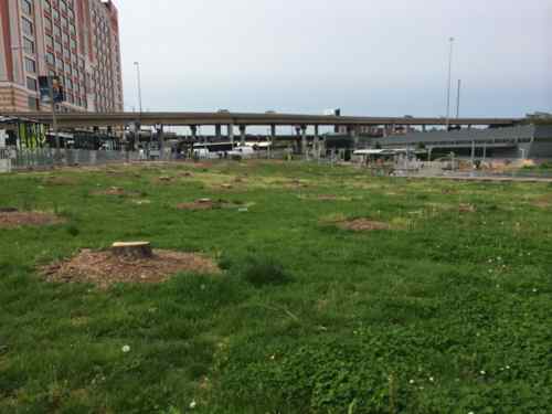
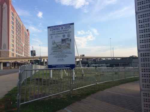
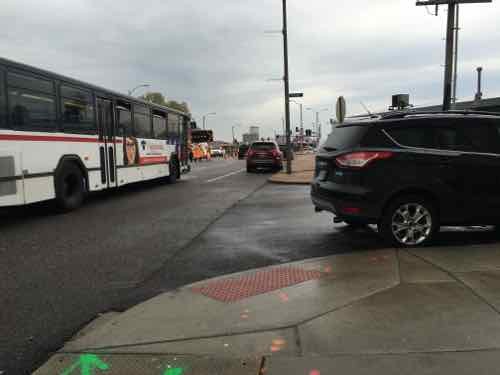
The Civic Center MetroBus Transit Center, at 14th & Clark, is now closed for the next 18 months. It will be redone to handle more buses — and longer buses.
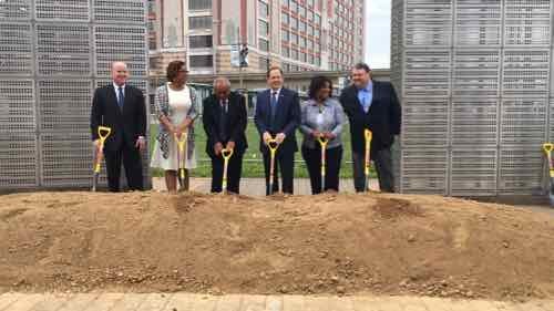
Tuesday 4/19 dignitaries each tossed a shovel of dirt to kick off the new project.
Construction will expand the Civic Center Transit Center and triple the current number of bus bays, which will allow MetroBus passengers to connect with all of their bus routes inside the transit center and out of vehicular traffic on 14th Street. A new building will also be constructed on the site that will feature new passenger amenities, including public restrooms, an indoor waiting area, digital boards with MetroBus arrival times, a concession area and a Metro Public Safety substation.
“It is our duty to ensure that residents, workers, tourists and visitors can travel safely and efficiently throughout the bi-state region,” said Ray Friem, Executive Director of Metro Transit, “and that they enjoy the best possible transit system and experience we can provide.”
Metro successfully secured federal funding to rebuild the Civic Center Transit Center, and those funds will support 80 percent of the total project cost of $10.5 million. “The competition for federal transit dollars is intense,” said Mokhtee Ahmad, Regional Administrator for the Federal Transit Administration, Region VII. “Bi-State Development and Metro are to be commended for being so diligent and fiscally conscientious in maximizing federal transit funds to get taxpayers the highest return on their investment.”
b
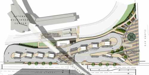
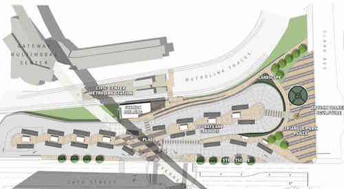
The design has changed.
Latest plan, click image to view larger PDF on Scribd
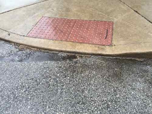
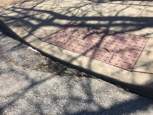
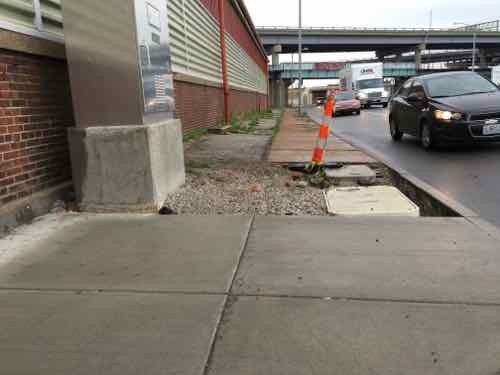
The ramp down to the MetroLink platforms is much more direct — but steeper than previously drawn. The other changes are at the North end. There’s now an accessible route from the center bays/canopies to Triangle Park. The “park” is also different — the metal panels (shown in first photo, above) will go away. A 2nd sculpture is shown right in front of the accessible route — a potential problem.
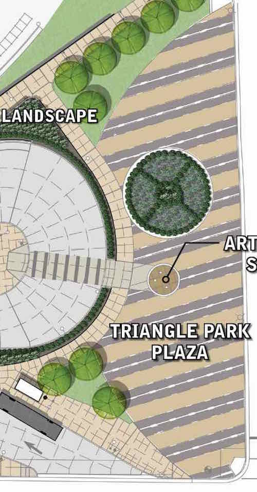
Close-up of Triangle Park
I also don’t get having a new sculpture next to the existing one.We’ll see how it turns out in 18 months.
Yesterday, in Part 1, I talked about the two different transit I’d taken (MetroLink, #90 & #32 MetroBus) and issues faced as a pedestrian trying to navigate in between. I’d made it to IKEA for shopping, followed by lunch.
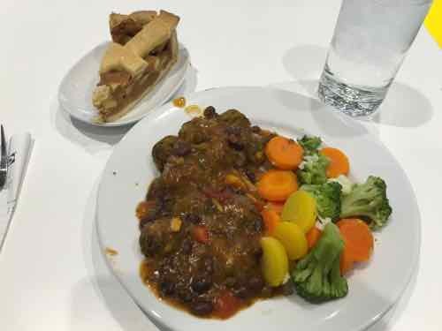
I’m obsessed with food so naturally I took a pic of my plate: Veggies balls with vegetarian black bean sauce,, steamed veggies, Swedish apple cake, and tap water.When I was done with lunch the rain had resumed.
I checked the transit options, it would be a while before a MetroBus stopped out front. Plus, that would only get me to Lindell where I’d have to wait in the rain for the #10. The Grand MetroLink is closer than the CWE MetroLink, but Forest Park is the most direct route and I recall some access issues the last time. Plus, my transfer from earlier was now long expired.
No matter what I’d be in the rain, so I decided to just roll home — 2.9 miles. I’ve done it a few times before, though not in the rain. I’m still wearing a poncho to keep me and the controller on my chair dry. My shoes, however, get soaked. North on Vandeventer to Lindell. I stayed on the West side of Vandeventer because I’m bot sure if the city ever got around to the huge gaps in front of the curb ramps on the NE corner of Vandeventer & Forest Park. At Lindell, I checked the schedule again — I can get home before the next bus would arrive.
Because of the rain I only took a few pictures. The following week I took the bus to Lindell & Spring to backtrack and take pictures of things I saw in the rain.
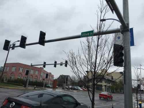
Lindell & Spring, the crowd passed the walk button. Not sure if required.New traffic signals being installed at the Lindell/Olive intersection. April 6thThis signal is long overdue! In the background the Hotel Ignacio is getting its EFIS facade repairedHow many years ago did I post about the need for painted crosswalk lines here? August 2011 — click image for post.Olive & Compton, no need to push the button tho cross Compton. If you want to cross Olive you must press the button.At Ewing is a ramp my powerful chair cannot get up — the vertical height is too much. April 6thThe same ramp again. Like hundreds/thousands of curb ramps it was built too high relative to the paving. Plus, like so many, the paving right in from is partially missing. I have to role in Ewing a little bit to get to a driveway to get onto the sidewalk.The West side at Ewing & Olive is another issue. The concrete at the top has caved in between the top of the ramp and the access panel.I’ve not tried to go up this ramp. it might also be impossibleAt Leffingwell you must press the button to get a walk signal to cross Olive — even when traffic has a green lightAt Olive & 20th I saw the buttons in the rain, they were far away. To cross 20th you needed to be over by Olive and vice versa.When I went back I confirmed no button is needed to cross 20th but you do need to press a button top cross Olive. The signs are wrong, the button next to each crosswalk is what is wired.
Used to be — but no curb ramp is missing for the nearly 3 mile trip. If I tried to use Locust there are many missing curb ramps.
I still fail to understand why all the cost of the buttons when they don’t need to be pushed in the East-West direction. And why have to press a button to get a walk signal when vehicles from side streets get a green light? This is how we’ve spent money — building infrastructure that frustrates this pedestrian!
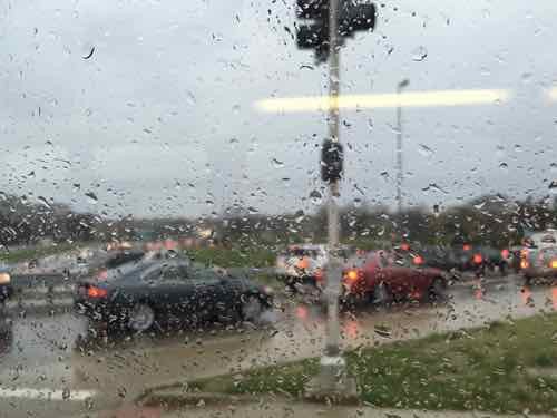
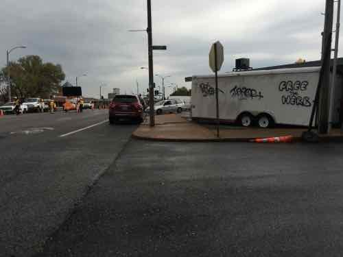
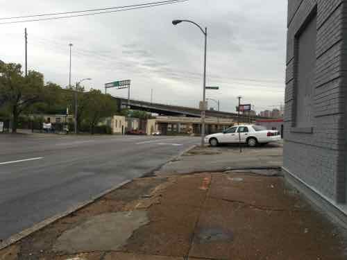
The morning of April 6th I had a 9am appointment on Hampton Ave, between Columbia & Elizabeth. It was raining off and on that day. Today’s post is about the journey there & back.
I had originally planned to take MetroBus there, but I didn’t have any two-hour passes so I’d get a transfer for the 2nd bus. So I went to the Union Station MetroLink station, purchased a few passes, validated one, boarded a Westbound train to the Forest Park MetroLink station. Just before a Southbound #90 (Hampton) MetroBus arrived it began to sprinkle. I left home in a poncho to keep and my wheelchair’s controller dry.
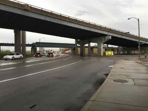
View out a Southbound #90 MetroBus on Hampton about to cross over I-64. Traffic was backed up on the highway and WB on ramp
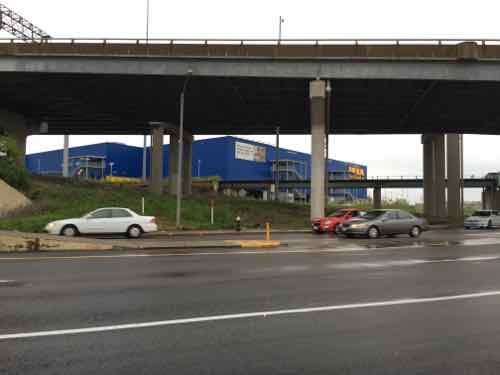
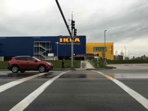
After taking care of business at two places on Hampton, I wanted to visit IKEA to shop and have lunch. The most direct route was a short ride on a Northbound #90 (Hampton) MetroBus, then take a #32 (Chouteau-Manchester) MetroBus to Vandeventer. But when I was ready to leave it was going to be a while before the next #90 arrived, I might as well just roll it.
I’ve gone up to Clayton Ave before, so I knew I could manage — it was about 3/4 of a mile from my starting point to Lloyd Ave. where I’d go right to make my way down to Manchester (map). As I turned off Hampton onto Lloyd I was pleasantly surprised a sidewalk existed — I wasn’t sure that would be the case. However, a the bottom of the hill there was no sidewalk along Sulphur. Well, there is along the East side, but because of curbs, I couldn’t get to it.
At this point I had two options:
Roll on the Sulphur Ave roadway, or
Go back up to Hampton, cross, reach Manchester on the other side.
Looking at the time I thought I’d miss the next #32 if I went with the safer #2 option. So, when there was no traffic I quickly rolled South to Manchester. Whew…
The ADA ramp to cross Manchester is covered in a fine gravel. I can power over it but others would have difficulty.Looking back where I’d beenThe EB MetroBus stop. I wish it had a curb at the far right edge to prevent backing up too far and rolling down the hill.Looking West to see the #32 coming. In September I posted about the danger of reaching one bus stop to the West — clock image to view that post
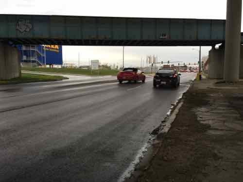
So the #32 MetroBus came right on time, my transfer was still valid, and it had stopped raining. I’d get off at Vandeventer Ave and roll North to IKEA — about a half a mile. So I got off at the last MetroBus stop before Vandeventer Ave., just had to cross one side street first.
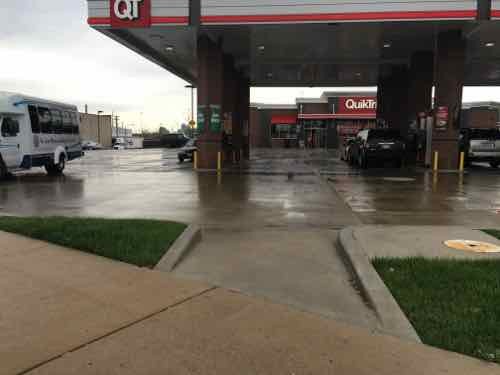
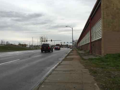
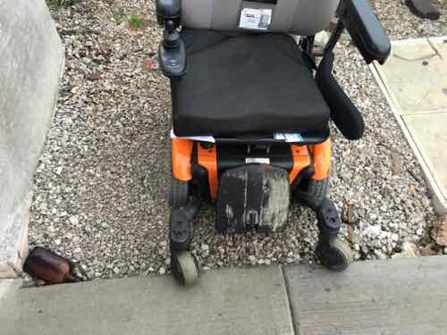
Hemp Ave is between the bus stop and Vandeventer, but no curb ramp is visible. But be just out of viewNope, just 100 feet from a bus stop there’s no curb cut! I found a driveway I was barely able to use to get onto the sidewalkLooking North I’d hoped to cross here to stay on the West side of Vandeventer — but pedestrians aren’t allowed ri cross at this pointSo I crossed Vandeventer, them crossed Manchester. The sidewalk design makes it clear to not go East on Chouteau.QuikTrip thinks this is a compliant pedestrian route. It’s not.Heading North, but I see a problem ahead. Initially I thought no sidewalk existed after the building on the rightBut the tiny sidewalk has been blocked by Laclede Cab. Looking at city records, the public right-of-way is as wide as it is ned to the building — the sidewalk should be wider!Continuing, I’m almost to Market St. JJs Clubhouse, a gay bar, is to the rightTurning left, I can see my destination–almost there!Rough surface that would be a challenge for manyWhen the side on the right is soon developed, this sidewalk will be redone. Still, this was great compared to what I had just experiencedBut when IKEA was built one time section was left as gravel and my chair couldn’t get up over the vertical edge — not with me in it. Unlike many, I’m fortunate enough to be able to stand on level ground. So I got up and the chair could then get up to the new sidewalk.Looking back we can see the tiny section left unfinished and inaccessible for more than half a year .Finally, I can now cross to IKEA.
Combined with public transit, I can cover miles as a pedestrian in my wheelchair — though our public rights-of-way are far from ideal. Looking at Google Maps it suggests using Sarah to reach IKEA instead of Vandeventer — no matter where you start from: Commerce, QuikTrip, Laclede Cab, even JJs Clubhouse! Yes, if you’re at Vandeventer & Market where you can see IKEA it suggests you cross Vandeventer and go West on Clayton Road to Sarah.
This isn’t a lack of money issue — it’s a lack of concern issue. Money is spent building infrastructure that doesn’t work for actual users. This mentality needs to change!
Tomorrow’s post will be about my trip back downtown from IKEA.
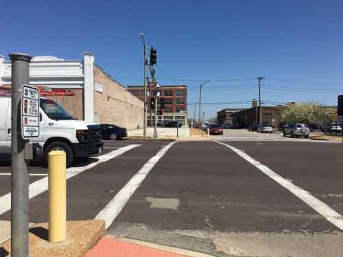
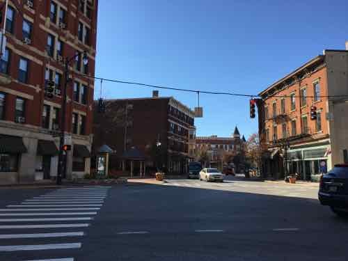
Monday was the Cardinals home opener, tens of thousands made their way into Busch Stadium III for the afternoon game. The current stadium opened a decade ago, the previous Busch Stadium opened to the North half a century ago, in 1966. So you’d think by now the pedestrian environment to/from the stadium has been refined by now? Sorry, no.
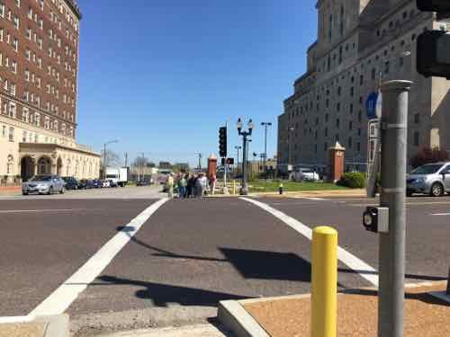
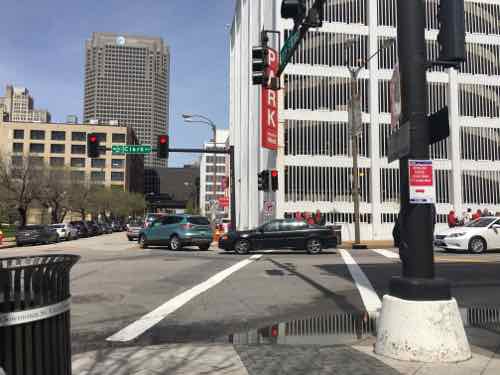
Looking North toward the stadium West garage, we can see the traffic light but no pedestrian signal. It rained earlier so the curb ramp is a pond.Looking South pedestrians have no signal or even a traffic light to determine when to cross Clark Street
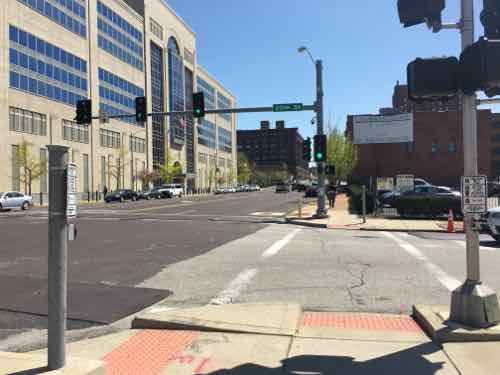
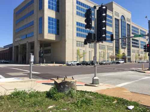
This is a common occurrence downtown, here’s why:
Lack of pedestrian signals at many signalized intersections throughout downtown
One-way streets mean pedestrians can see traffic light in one direction
But the opposite the direction they’re clueless, taking a risk when stepping off the curb
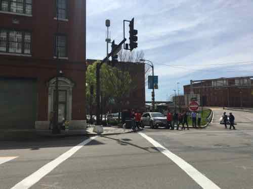
The intersection at 9th & Clark St isn’t typical — the interstate exit ramp complicates matters. It would be east for s person to attempt to cross here when vehicles have a green light — such as the highway exit.
Again, people have been walking to/from Cardinals games here for 50 years — the last 10 to the new stadium! The adjacent Westin Hotel in an old Cupples Station warehouse opened in 2001. I can see issues still existing a mile or more away — but this is just one block!
So now what? Someone needs to review every single intersection used by pedestrians on game days to see which are lacking. Then prioritize a list of updates to correct the shortcomings. Same goes for other attractions downtown and throughout the city, like:
Scottrade Center
Peabody Opera House
Kiener Plaza/Old Courthouse/Ely Smith Square/Arch
Soldiers’ Memorial (Reopening 2018)
Fox Theater/Powell Hall
Major transit stops (MetroBus & MetroLink)
This isn’t a lack of money — it’s a lack of priorities. Pedestrians aren’t valued in St. Louis so nobody bothers to think about how to attract/maintain them.
Thanks for your input on the crosswalks. I’m working on improving our pedestrian facilities and we will get better. Please feel free to send me other locations you’ve noticed besides those mentioned. I’d also value any pics you may have from other cities in your travels that have different approaches.
Since you asked, I put together information on problems I’ve seen here in St. Louis, along with solutions I’ve seen in other cities. I’m making this open to increase public awareness and discussion. It does cause me concern that a “traffic engineer” is in charge of pedestrian & bike issues — it is traffic engineering that has made it such a liability to be a pedestrian or cyclist in this city & region. This is reflected in pedestrian deaths.
That said, I do know engineers can do good work — when they think like pedestrians instead of drivers! The Portland Pedestrian Design Guide, dated June 1998, is a great place for you to start your re-education. Yes, a document nearly two decades old shows how far behind St. Louis is when it comes to addressing the needs pedestrians.
Here’s my initial list — in no particular order:
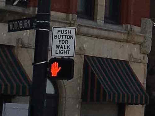
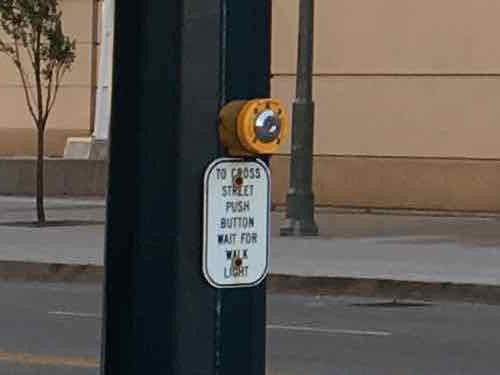
Do not require pedestrians to press a button to get a WALK signal — except in very limited circumstances.
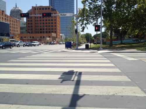
Make sure every leg of a signalized intersection includes a pedestrian signal — with countdown timer.
Allow pedestrians to cross at each leg of an intersection.
Give pedestrians a head start with a WALK signal a few seconds before the traffic light turns green.
Give pedestrians the walk before left-turning traffic, trailing left instead of leading left.
Time pedestrian signals consistently. Some say DON’T WALK while traffic still has 30-60 of a green light remaining.
Make sure sidewalks are level, not cracked. Sufficiently wide through path so pedestrians can meet/pass — not single file.
Ramps perpendicular to curb, not on the apex of the corner.
Use street trees and/or parked cars to separate pedestrians from vehicles
Mid-Block crossings should be marked in the middle — a center sign and/or overhead light/sign
I don’t have photos to illustrate all ten items, but here are some:
A crosswalk & pedestrian signal in Cincinnati OHThe sign above the pedestrian signal lets pedestrians know this signal requires activationThey al;so mark the buttons too let pedestrians know they need to activate the walk signal.
In their downtown the bulk of the crossings were automatic, no activation required. This is how it should be in places with higher pedestrian traffic. There were a couple of places where they need a button but that was only to activate audio signals for those visually-impaored — a sign was there to let the rest of us know it was an audio signal — we didn’t need to press it to get a WALK signal.
Cincinnati
As Oklahoma City rebuilds downtown the new crosswalks are very wide, curb ramps can accommodate many users. July 2012
Contrast this with the narrow crosswalks and curb ramp in/around Ballpark Village — which are undersized for game-day pedestrian volume. As I find more examples in my photo library I’ll do a new post(s). In the meantime, I’d like us to take a walk.Ideally, we’d arrange for a power wheelchair for you to use so we can cover more territory.
AARP Livibility Index
The Livability Index scores neighborhoods and communities across the U.S. for the services and amenities that impact your life the most
Built St. Louis
historic architecture of St. Louis, Missouri – mourning the losses, celebrating the survivors.
Geo St. Louis
a guide to geospatial data about the City of St. Louis