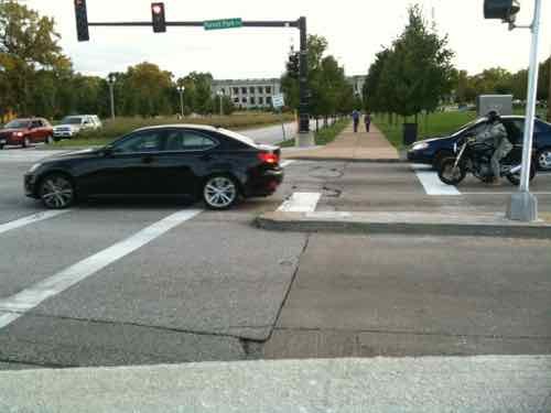
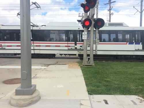
I often post about accessibility problems, but today’s post is about a problem that’s finally getting addressed. The reconstruction of the DeBaliviere viaduct/bridge over MetroLink tracks is making great improvements to crossing Forest Park Parkway (map). Tuesday I saw the improvement on the newly-opened West side.
Before: The ramps on each side heading South weren’t the best, the crosswalk was pushed out right next to traffic. September 2010Before: we had to use a narrow ramp reach the crosswalks. If you’re waiting to cross a street someone crossing the other would be blocked. These were also trip hazards to others. September 2010After: Now the ramp is wide and directional. The crosswalk won’t be up against Southbound traffic anymore.After: Looking back North you can see the West side isn’t totally finished.
After the East side and the crosswalks are complete I’ll do another post. I’m just so thrilled at the ramp improvement!
Hopefully the pedestrian signal buttons, once activated, will be solely for the visually impaired to get audio signals about when to cross. Other pedestrians shouldn’t need to press a button to get a walk signal.
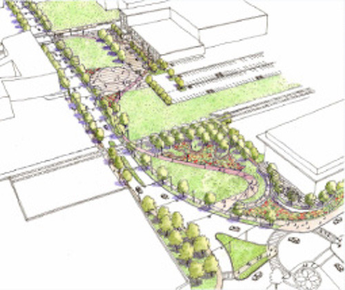
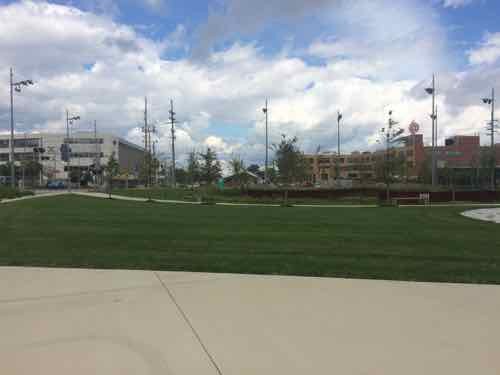
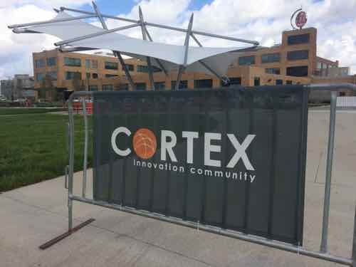
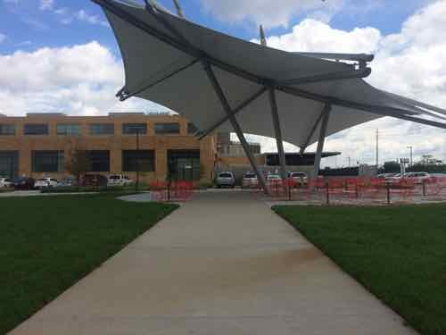
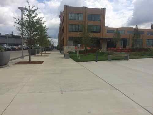
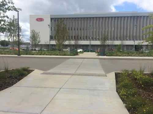
The masterplan for St. Louis’ technology district, called CORTEX, included a significant green space. Originally formed in 2002, the green space is just now being completed. Here is how they describe the CORTEX campus:
The intent of the CORTEX Master Plan is to create well-designed public open spaces that will contribute significantly to the quality of life within the district, community and city. The Master Plan calls for the creation of the CORTEX Commons, a public park that will be accessible to all who work and live in the district and surrounding neighborhoods.
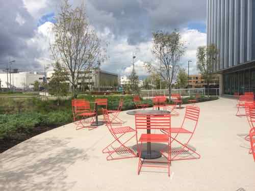
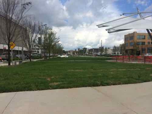
The Commons: right in front of the @4240 entrance you’ll find a beautiful green space with areas for relaxing, meeting, or just enjoying the fresh air.
Restaurants/Cafes: surrounding the @4240 building will be cafes, restaurants and other places to grab lunch, dinner, or have cocktails after work.
Living Space: within walking distance of @4240 are lofts, apartments and other living spaces that allow for a commute that is literally minutes away.
Shops: retail space will be part of the new Phase II expansion, providing convenient shopping and unique boutiques all within a short stroll of the office and laboratory space.
Transportation: getting to and from work will be simplified for those driving as well as those wishing to use public transportation. A new highway interchange at the major east-west Interstate 64 provides convenient access for drivers, plus a new MetroLink light rail station will be within a block of the @4240 building.
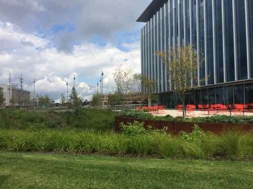
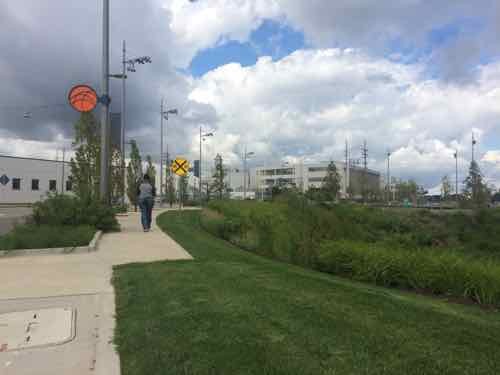
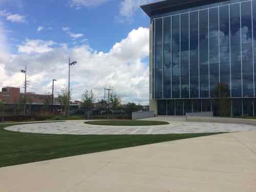
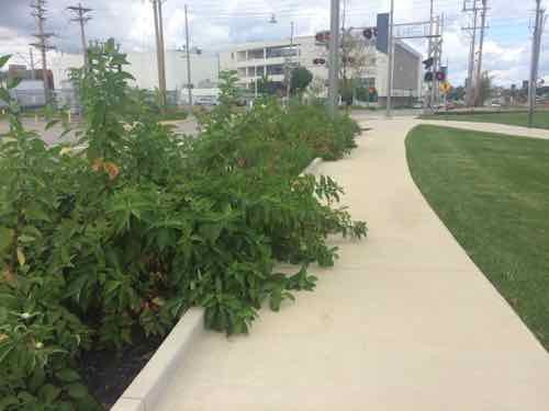
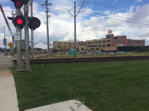
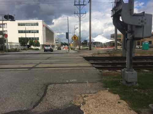
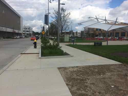
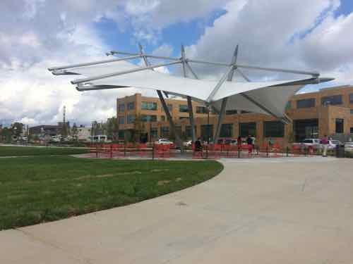
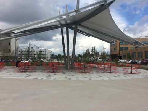
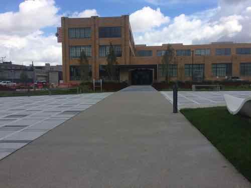
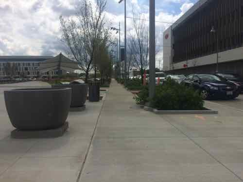
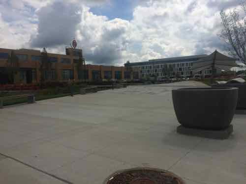
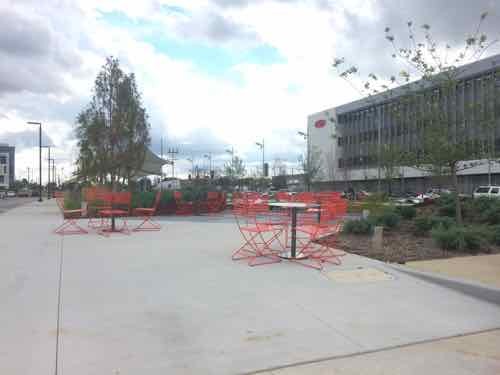
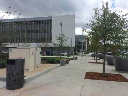
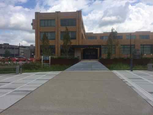
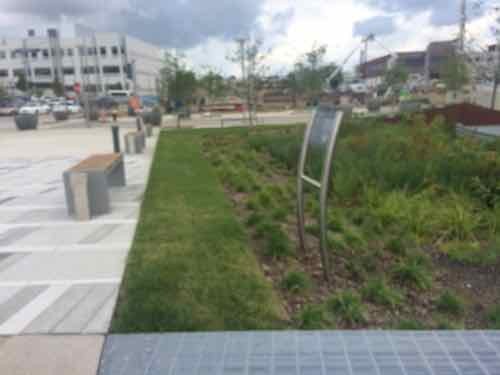
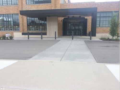
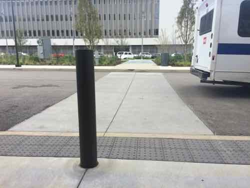
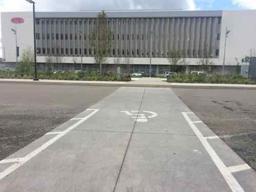
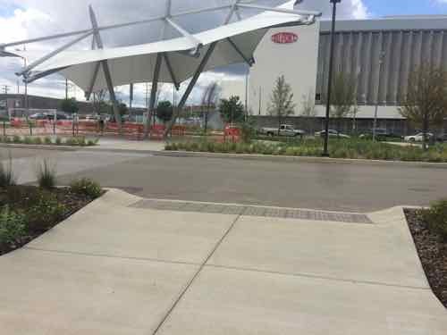
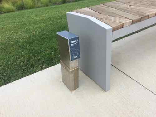
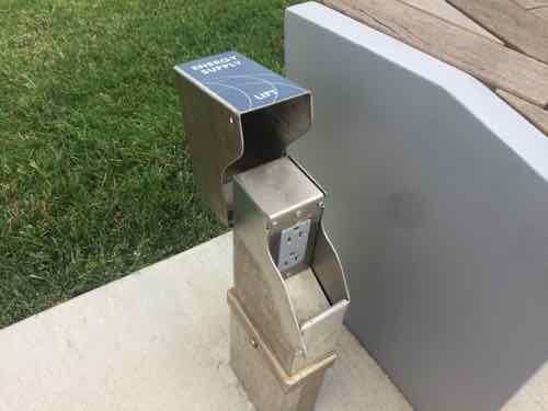
The visitor sees lush landscaping, at right is the new BJC @ The Commons buildingTurning to the left we see the sidewalk follows the curve of Boyle. The orange circle is the logo for the CORTEX Commons. In a couple of places the sidewalk make a sharp shift.An open area hardscape area to the West of the buildingLooking back toward Clayton we can see the sign marking the rain garden and the patio beyond. I couldn’t get close enough to the sigh to read the body text. Numerous such signs throughout are also too far away to be read.Looking North from the patio, the movable tables & chairs are better than fixed furnishings — allows people to rearrange.Back out by the hardscape circle, looking NorthHeading North on the Boyle sidewalk these plants in the rain garden are already reducing the sidewalk width. This is the only plant choice I didn’t like.We can now see the light rail line, known as MetroLink, divides the space. Will discuss the renovated building in the background later in this post.The sidewalk narrows at the track crossing, this is the low point in the experience.With the train gone we can cross.Looking back South after having crossed the two MetroLink tracks and a third extra track (nearest)Looking back North we are again faced with the sidewalk making a hard shift to the right. The parked cars on Boyle don’t have a bulb out to enclose the parking lane.Turning toward the Southeast we can see an unfinished spot, this is likely to connect to the new light rail station to be built. Hopefully the track crossing will be improved at that time.Approaching the @4240 buildingLooking North. DuPont, formerly Solae, is across Boyle on the left.Turning Eastward we see the centerpiece shade canopy.Looking North at the canopy, the same movable tables & chairs are used.Back at the sidewalk parallel with Boyle we see the first of numerous connections to draw you into the space from the edge.The Northernmost of the connections leads right to the @4240 building entrance, more on that in a bit.Looking back South along the Boyle sidewalkLooking diagonally into the CORTEX CommonsLooking East along Duncan Ave, the main East-West spine in the district.Looking South from a position closer to the @4240 building we see another patio with the same movable furnishings. Most of this area is a metal grate over a rain garden.Looking back West toward Boyle, with DuPont/Solae in the backgroundBack in the Commons we can approach the @4240 building after crossing the rain garden on the metal grate pedestrian bridge — love this!Another pf the informational signs that can’t be read from the paved areasLooking out to Boyle & Duncan we can see the South facade of the first CORTEX building. It was built without an ADA-complianfr accessible route and hasn’t yet been correctedThe paving clearly directs the user to the entry but the the curb on this side of the drive prevents me from continuingThe view out from the entry shows the accessible entry on the near side and the non-accessible curb on the far side. D’oh!The next area, connecting to accessible parking, has the same problemAnd the next one, a good place for a raised crosswalkAnd again. Clearly, someone goofed! The disabled shouldn’t have to go all the way to the Duncan public sidewalkTo finish on a positive, here’s a detail I liked. Next to fixed benches are power outlets.Just lift the cover and plug in your phone, tablet, laptop, or wheelchair.
I hope get CORTEX to correct the accessibility issues to the @4240 building. Read more about the building and how it is being used here.
On Tuesday SSM Health took over Saint Louis University Hospital from Saint Louis University, at the same time announcing plans to construct a new facility:
SSM Health plans to invest $500 million to build a new St. Louis University hospital and ambulatory care center.
The new facilities, which will be situated in the immediate vicinity of the current 365-bed hospital near the midtown campus of St. Louis University, will be completed within five years, SSM officials said. (Post-Dispatch)
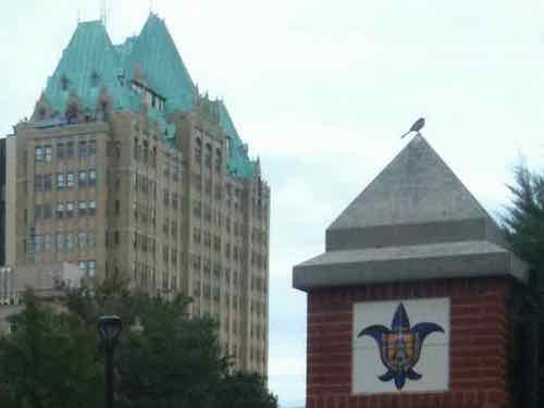
Uncertainty of the existing Desloge Tower left many wondering if it might be razed.
Desloge Tower in 2011
First, some background:
Going back in the history books, Firmin Desloge Hospital was officially dedicated on November 3, 1933, rising 250 feet and topped by a French Gothic roof of copper-covered lead. Over the next several weeks, it began admitting its first patients. It was unique for its time, offering patients private or semi-private rooms instead of the open ward model common in most hospitals. Desloge Tower served as the main hospital building of the Saint Louis University Medical Center until 1959 when Firmin Desloge Hospital, the Bordley Memorial Pavilion and the David P. Wohl Sr. Memorial Institute were collectively renamed Saint Louis University Hospital.
Desloge Tower is also home to the chapel of Christ the Crucified King, commonly known as Desloge Chapel, which was designed by Gothic revivalist architect, Ralph Adams Cram, who was a prolific and influential American architect of collegiate and ecclesiastical buildings. The chapel was designed to echo the contours of the St. Chapelle in Paris, which was Louis IX’s palace chapel, and in 1983, Desloge Chapel was declared a landmark by the Missouri Historical Society.
Desloge Tower continues to serve SLU Hospital with physician offices, gastroenterology, interventional radiology and the cardiac catheterization lab.
Its image is a well-recognized part of the St. Louis skyline, and is often the symbol of the hospital itself. (SLU Hospital)
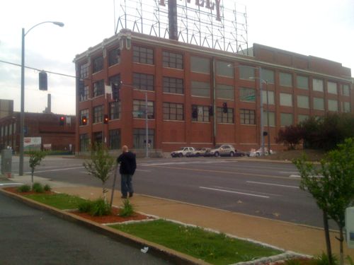
With a fresh start nearby, it does mean the future is uncertain. The future of the old Pevely Dairy just to the North is more certain — it’ll likely be gone.
The former Pevely Dairy at Grand & Chouteau, 2011
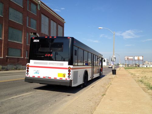
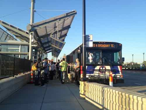
I’m fine with the Pevely coming down — as long as the new facilities are very urban in form. This is on the route of the busiest MetroBus route in the region — the #70 (Grand), and the #32 (ML King-Chouteau) runs in Chouteau. Just to the North is the Grand MetroLink (light rail) station.
Westbound #32 MetroBus on Chouteau just barely west of Grand. The Pevely bldg is to the left. 2012#70 MetroBus riders at the Grand MetroLink station, August 2012. Dislodge Tower can be seen in the distance
What many in St. Louis, especially at City Hall, fail to realize is facilities can be friendly to motorists and pedestrians — these are not mutually-exclusive. The street grid need-not be decimated to create a campus.
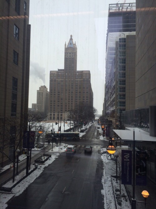
Looking east along Erie St at Fairbanks, Chicago IL
When we visit Chicago next month, our 4th time in 2015, we’ll be staying in a friend’s condo located within the Northwestern Medicine/Northwestern Memorial Hospital campus. The sidewalks are packed with people visiting street-level restaurants. The internal walkway system and lots of parking garages hasn’t made the sidewalks a ghost town.
SSM Health is going to build a new complex. Now’s the opportunity to look at how medical campuses in other cities can be vibrant active places that are also convenient to those using cars. Dislodge Tower could become a mixed-use building with retail, restaurants, offices, and residential.
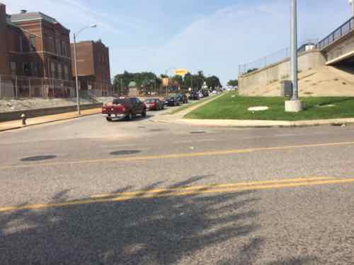
Last week I was near Manchester & Hampton doing research, I arrived & departed on the #32 (ML King-Chouteau) MetroBus. Arriving the bus was headed West on Manchester, so the stop was on the adjacent sidewalk. For the return trip I needed to catch the bus as it headed East on Manchester — no sidewalk on that side. But there is a just big enough concrete pad. I didn’t get a pic from across the street but you can see it on Google Street View here.
It took a while but I finally got a break in traffic where I could quickly cross Manchester to the stop I needed.
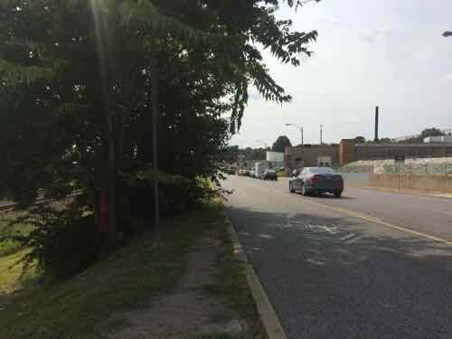
Looking North from Metro Stop ID: 13572Looking West I was concerned the bus driver wouldn’t be able to see me. A path was worn in the grass from others using this stop.The ground was also worn East of the stop.
I was right at the edge waving as the bus approached. Another passenger got off at my stop so she stood close to my wheelchair on the small pad while the driver extended the lift so I could board. Would the driver have seen me if a passenger wasn’t wanting to exit at my stop?
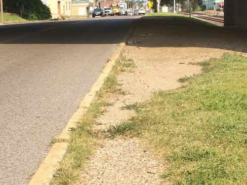
I had wanted to go to the next stop to the East where I could cross at a crosswalk, but vegetation (upper left of last photo) blocked the sidewalk.
So who’s responsible?
Metro
MoDOT
St. Louis
All three are involved, but fragmentation means the pedestrian experience here sucks. The quick solution is to trim the vegetation in both directions. A crosswalk with warning signs for motorists to stop for pedestrians would be relatively cheap. I’m going to email Ald. Vollmer (10th) & Ald. Ogilvie (24th) to let them know about the issues here.
The CSB responded: “What are you asking or saying about it?” At this point many others joined the conversation, not always including me in the loop. In short, others could see the problem from the pic but the CSB: 1) thought I or someone else was talking about the car making a left turn in the background, 2) was confused by the term “curb ramp” and told me it’s a “wheelchair ramp” — more on that later, 4) that the containers don’t belong to the city — they just empty them. The tweets went back and forth for nearly 4 hours! Finally I got a Service Request number, which I favorited for future reference.
A curb ramp is the term used by the American’s with Disabilities Act (ADA) and the Federal Highway Administration within the U.S. Department of Transportation. They’re not called “wheelchair ramps” because many pedestrians use them — such as those who walk with a cane or walker, for example. Plus it’s six fewer letters.
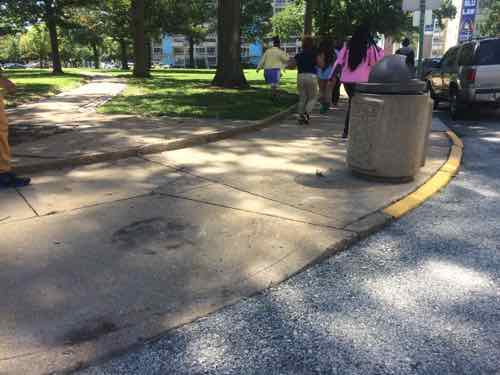
Nearly 3 weeks later, on August 5th, I passed by and noticed the trash can still hadn’t been moved. I realize not everything can be done immediately but often little things are addressed quickly. So I posted another image on Facebook & Twitter noting “Trash can blocking curb ramp SW crnr 14th & Pine, reported to @stlcsb (no 7560493) on 7/17 still in the way.”
The text read: “Trash can blocking curb ramp SW crnr 14th & Pine, reported to @stlcsb (no 7560493) on 7/17 still in the way.”
This is a good time to note that I had no problem getting around the trash can in my power chair. My concern wasn’t for me — it was for others who use a manual wheelchair, came, walker. Trying to navigate the flared side can present problems! I didn’t want someone else wheeling in the road or falling because of this ill-placed trash can. This is a curb ramp I use often — the trash can had’t been there before in the last 7 years.
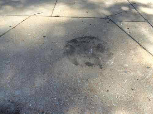
Two days later I heard from Dena Hibbard, a Neighborhood Stabilization Officer (NSO) asking if it had been moved. I replied it hadn’t, then she said my service request was closed — city staff indicated it was not blocking the ramp. WTF!?! We keep in touch and finally she got through to someone in Refuse. I got word on August 20th it was finally moved off the ramp. A few hours later I go by on the way from from the grocery store.
The trash can is now out of the ramp.The circle shows where it had been.
It shouldn’t have taken more than a month and lots of effort to get this moved! I’m grateful Dena Hibbard follows my blog/social media, without her help it wouldn’t have gotten moved. The best part is her area is the 9th Ward — but this ramp is in the 7th Ward.
AARP Livibility Index
The Livability Index scores neighborhoods and communities across the U.S. for the services and amenities that impact your life the most
Built St. Louis
historic architecture of St. Louis, Missouri – mourning the losses, celebrating the survivors.
Geo St. Louis
a guide to geospatial data about the City of St. Louis