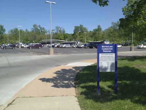
The Rock Road MetroLink station was designed in the early 1990s as a drive-to station with 183 parking spaces. For twenty years now pedestrians have endured horrible conditions to reach the train platforms and MetroBus lines.
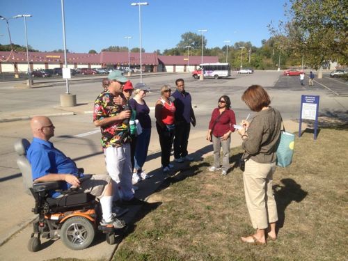
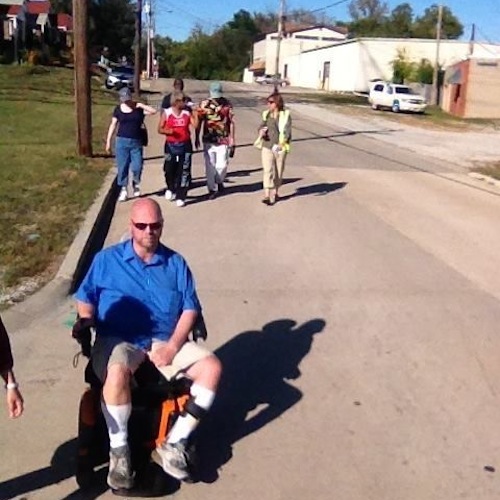
On Sunday I joined a Citizens for Modern Transit (CMT) Ten Toes walking group as it did a walk audit in the neighborhood to the south.
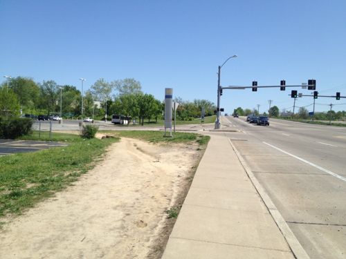
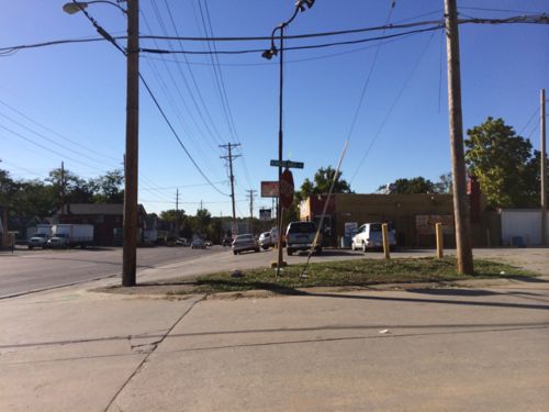
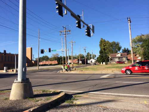
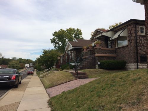
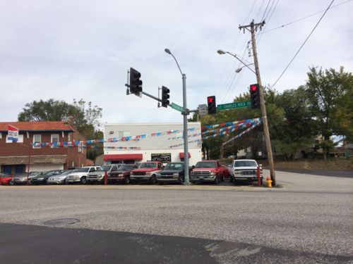
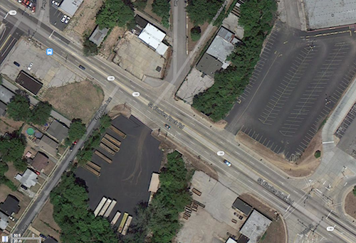
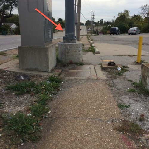
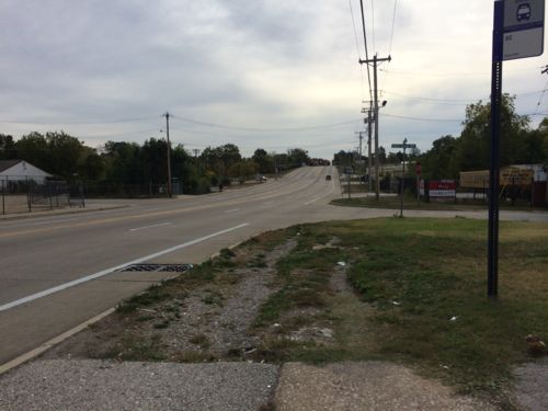
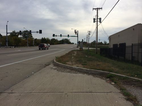
We started at the ticket machines, our first stop was the entry point. Half did a straight shot through the parking lot, the rest of us went the long way on the sidewalk. Photo: CMTIn April 2012 I noted: The parking was placed between the entry off St. Charles Rock Rd. and the station itself, pedestrians must either go out of their way to stay on the sidewalk or schlep through the parking lot. Click image to view April 2012 post on the Wellston & Rock Road stationsApproaching from the west pedestrians have worn a strong path to reach the station. April 2012We went south on Kingsland to Page, most of the way we had to use the road since no sidewalks exist. Photo CMTAt Page we headed west to Ferguson, click image for mapAt Ferguson I had to split off since I forgot to charge my chair the night before. I caught a #94 back downtown. Click image for map.Ferguson surprised me with cute houses and a decent, but narrow, sidewalk. The only issue is many people park on the curb. St. Charles Rock Road can be seen at the end of FergusonWhen you reach St. Charles Rock Road there’s no easy or safe way to cross to the north side. So I decided to stay on the south side and cross at the entry to the station. Click image for map.I was in the upper left and had to get to the lower right to cross the street and enter the station property.My destination is marked by the red arrow, but traveling the short distance looks problematic20 years of pedestrians have worn a pathI had to use the shoulder because my chair can’t jump curbs, a worn path is visible.
Again, it baffles me that we could spend hundreds of millions to build transit infrastructure and, after two decades, not do what it takes to make it accessible nearby to pedestrians. No wonder we’ve not seen any new development around this busy station.
What this illustrates has less to do with Metro and more to do with our many layers of government, how they’re funded and how they decide / choose to spend their finite tax dollars. Any network – highway, pedestrian, transit, computer – is only as good as its weakest / missing links. 125 years ago, St. Charles Rock Road, here, was a two-lane dirt road. There were no sidewalks and no traffic signals. Pedestrians only competed with horses. Since then, many things have been “improved”, multiple times, by the highway department, by the local governments, by Metro and by private property owners. There is no master plan, no ultimate goal. Each entity does what they think is “best”, at least within their current budget, in their own little part of the world. Could it be better? Absolutely! Is it better than what was there before? Most likely, it is. Can we identify multiple hurdles / missing links, especially to pedestrians with physical limitations? Certainly!
The real question is how do we catalog, prioritize and (most importantly) FUND the fixes that are needed. Your third photo shows a dirt path that’s apparently a shortcut from the original concrete sidewalk. To me, paving that is a much lower priority than installing curb ramps or installing sidewalks to replace the dirt paths in your last two photos, but the odds are Metro will find the funding for the former before the local city finds funding for the latter. I don’t see a real compelling need, based on capacity or major new developments, for any major infrastructure projects in the area, so any new work will be more like what MoDOT is doing now along Manchester and Chippewa. Can we count on MoDOT to do the same thing here? What about along streets that aren’t MoDOT’s responsibility? (St. Louis County seems much less willing to invest in ADA retrofits.) This all gets back to the reality that pedestrians are a minority in the transportation matrix, and pedestrians with disabilities are a minority within a minority, and our funding reflects that.
AARP Livibility Index
The Livability Index scores neighborhoods and communities across the U.S. for the services and amenities that impact your life the most
Built St. Louis
historic architecture of St. Louis, Missouri – mourning the losses, celebrating the survivors.
Geo St. Louis
a guide to geospatial data about the City of St. Louis
What this illustrates has less to do with Metro and more to do with our many layers of government, how they’re funded and how they decide / choose to spend their finite tax dollars. Any network – highway, pedestrian, transit, computer – is only as good as its weakest / missing links. 125 years ago, St. Charles Rock Road, here, was a two-lane dirt road. There were no sidewalks and no traffic signals. Pedestrians only competed with horses. Since then, many things have been “improved”, multiple times, by the highway department, by the local governments, by Metro and by private property owners. There is no master plan, no ultimate goal. Each entity does what they think is “best”, at least within their current budget, in their own little part of the world. Could it be better? Absolutely! Is it better than what was there before? Most likely, it is. Can we identify multiple hurdles / missing links, especially to pedestrians with physical limitations? Certainly!
The real question is how do we catalog, prioritize and (most importantly) FUND the fixes that are needed. Your third photo shows a dirt path that’s apparently a shortcut from the original concrete sidewalk. To me, paving that is a much lower priority than installing curb ramps or installing sidewalks to replace the dirt paths in your last two photos, but the odds are Metro will find the funding for the former before the local city finds funding for the latter. I don’t see a real compelling need, based on capacity or major new developments, for any major infrastructure projects in the area, so any new work will be more like what MoDOT is doing now along Manchester and Chippewa. Can we count on MoDOT to do the same thing here? What about along streets that aren’t MoDOT’s responsibility? (St. Louis County seems much less willing to invest in ADA retrofits.) This all gets back to the reality that pedestrians are a minority in the transportation matrix, and pedestrians with disabilities are a minority within a minority, and our funding reflects that.
CMT, have they ever gotten anything done or do they just complain and then Metro does nothing?
I didn’t assign any blame for this failure.