Please vote in the poll, located in the right sidebar
Starting October 1st St. Louis County will have another police force:
Flordell Hills has decided to form its own police department even though the city only has 822 residents. The city said the move has been in works for months. The department will feature six full time officers, and it will cost more than what the city paid to have County Club Hills patrol the municipality. The city will have one officer for every few square blocks. (KMOV)
There are different ways one might view this change, so I thought this would be a good poll topic this week. The exact poll question is “Starting Oct 1st the north county suburb of Flordell Hills, pop 822, will have its own police force again. Thoughts:” I’ve provided a few answers but you can also type in your own if you don’t like mine. The poll is in the right sidebar. Mobile users need to switch to the desktop layout.
Earlier this week one local company stepped up to invest in Ferguson:
Centene Corp. has selected Ferguson, the site of unrest for more than three weeks following the police shooting of Michael Brown, as the location for a new claims processing facility, with plans to bring up to 200 jobs to the city.The unrest following Brown’s death prompted Centene to select the city for the expansion. (stltoday)
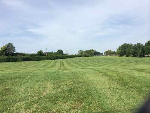
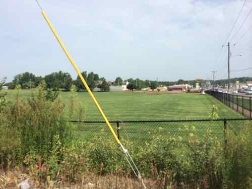
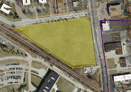
This is potentially great news! I say potentially because most major call centers fit perfectly in an exurban office park; generic building sounded by massive surface parking lots, all fenced in. Ferguson needs these jobs, but it needs them in an engaged environment. Where? What would it look like? The where is quite simple: Emerson owns the perfect site on the SW corner of W. Florissant & Ferguson Ave., 9001 W. Florissant Ave.
This corner is 7+ acresLooking north from an adjacent Ameren substation, the Ferguson Market is in the backgroundLooking north from in front of the Ameren substationLooking south from Ferguson AveMap of the site consisting of two parcels, both owned by Emerson, right of the purple line is Jennings
I’m not sure why Emerson bought this property, likely to raze the structure that was on the site as of 1971. Having a neighbor like Centene could be beneficial to Emerson, more workers means more lunch places. Hopefully Emerson would be willing to sell to Centene, or partner on a project to develop the site. And build what?
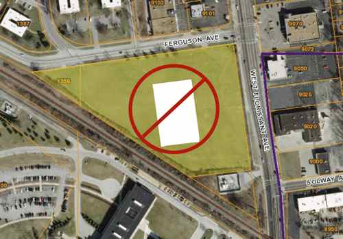
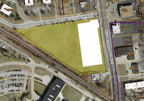
What they shouldn’t build is a building in the center surrounded by parkingInstead, the building should be pushed out to the corner so pedestrians can easily reach the entrance(s).
Ideally the building would be at least two floors, with the first floor for retail. I’d like to see a St. Louis Bread Co (aka Panera*) or Chronicle Coffee on the corner. This would provide additional jobs and more places for these 200 employees and those who work in the area to get breakfast, lunch & dinner. Nearby locally-owned places like Ferguson Burger Bar & More would also benefit. Parking can be located behind the building. If Centene doesn’t need this much space the site could be planned for more than one building facing W. Florissant. * Disclosure: I have a handful of Panera stock
If Ameren built a new substation at the back corner, an auto entrance could be created at the traffic signal at Solway Ave.
A project at this corner could be a great way to implement East West Gateway’s Great Street master plan for W. Florissant!
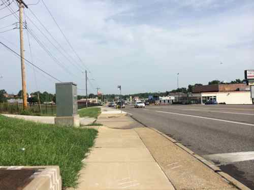
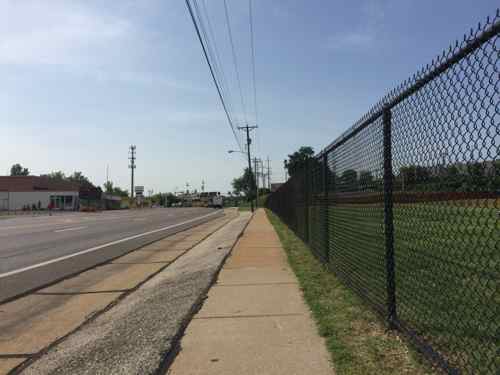
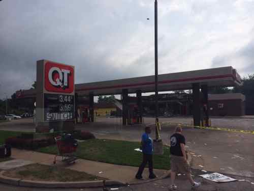
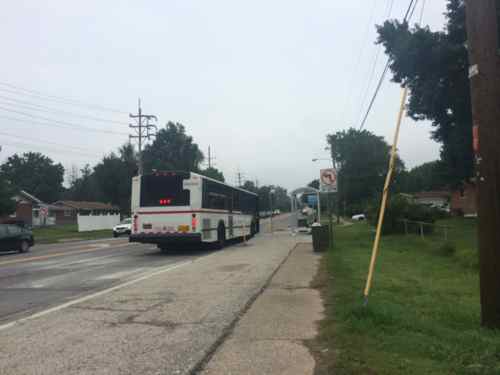
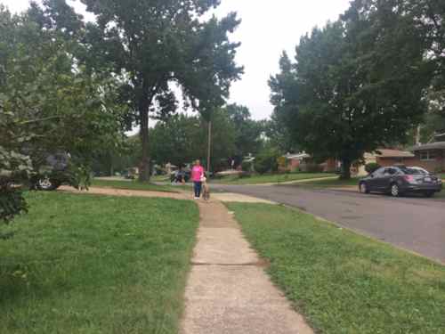
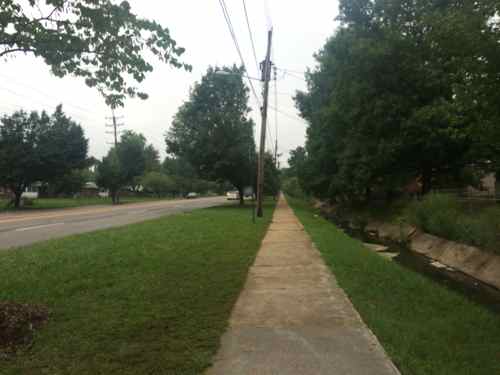
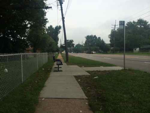
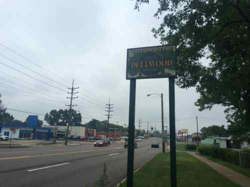
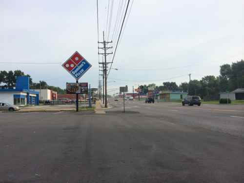
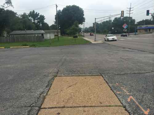
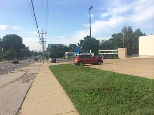
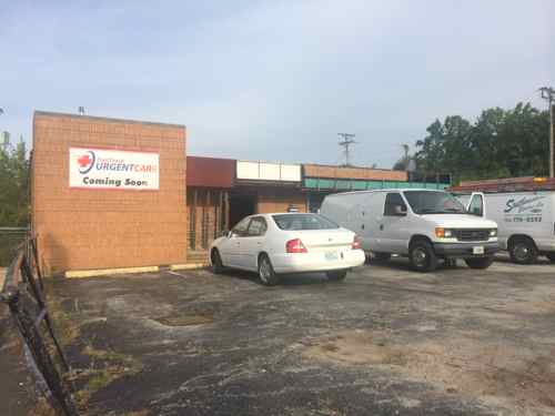
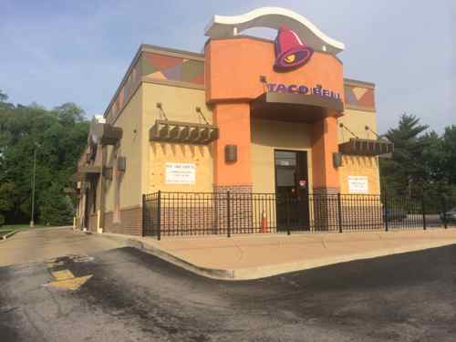
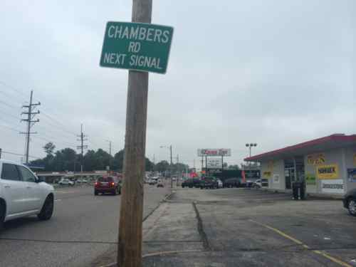
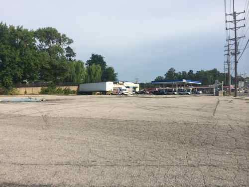
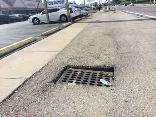
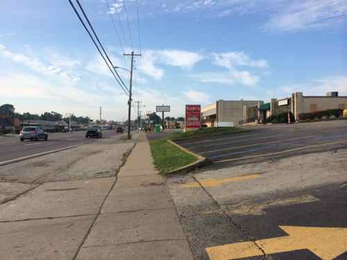
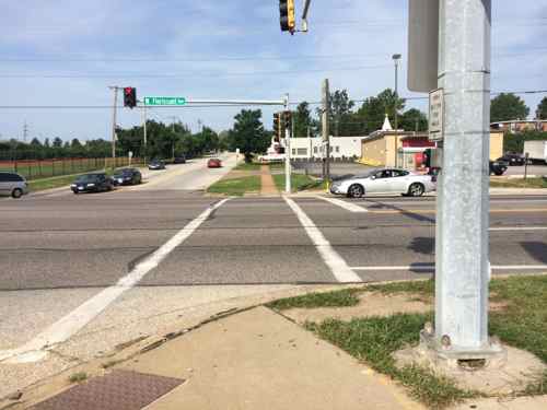
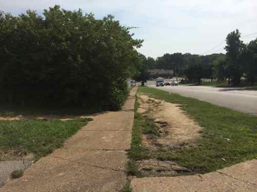
Burnt out QT at 9420 West Florissant on Monday Aug 11, 2014, 9:37am. What will replace the QT? A new QT? A used car lot? A new commercial development? A park?North of the QT the area changes from suburban commercial to suburban residential, W. Florissant is served by the 74 MetroBus routeA woman walking her dog on Nesbit Dr in the Northland Hills subdivision of late 1950s ranch homesOn the east side, between Nesbit Dr & Highmont Dr, you get a long stretch with no intersecting streets, a concrete creek separates W. Florissant from backyards. But look, street trees!The bus stops along W. Florissant were recently improved to be accessible, which benefits all users.Just past the bus stop is the Dellwood city limits, W. Florissant returns to being commercial.Commercial starts up sooner on the west side of W. FlorissantIn this area of W. Florissant the pedestrian experience is odd; different surfaces, different distances from the road. Very unplanned!The grass between the sidewalk and parking lot is a welcomed relief from all the pavingThe former Fox Trap nightclub is becoming an urgent care facility.Like the McDonald’s in Part 1, this Taco Bell fails to have the required ADA access route from the public sidewalk. This was built in 2007.Almost to Chambers Rd., here the pedestrian space blends with parking lotsBetween the Taco Bell and the corner gas station is a rare vacant parcel of land.This image sums up how pedestrians are treated. The bus in the background is the #61 heading WB on Chambers Rd.
For 3+ weeks now I’ve been thinking about the physical environment of West Florissant from the burnt out QuikTrip location south to the elevated train tracks, just under half a mile. Let’s take a look:
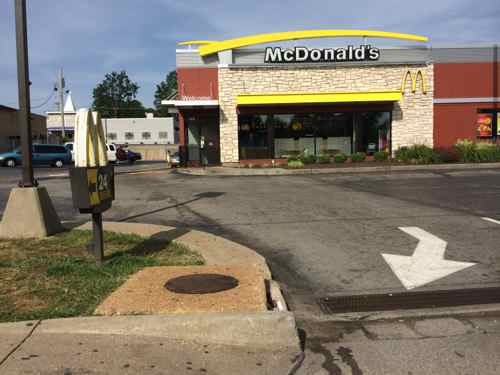
The former Ponderosa at 9200 W. Florissant was built in 1972, it closed sometime between September 2012 and August 2014. A Google Streetview camera from 9/2012 showed the business openJack in the Box built this in 1969, now it’s a locally owned businessThe streetscape design is pure 1960s, lacking anything that would appeal to a pedestrian. The absence of curbs & street trees make you feel vulnerable to traffic. What is this like during heavy rains?Drains for runoff waterThe West side of W. Florissant is very similar to the East. lots and lots of pavingVery few crosswalks exist, the ones that do are poorly designed. Here the crosswalk and ramp have no relationship to each other. One of the rare spots where curbs exist.Pedestrians are many but they’re subjected to narrow broken sidewalksNeither of these storefronts are accessible in a wheelchair. Why hasn’t the Chesterfield-bsaed company that owns numerous buildings on W. Florissant made required ADA improvements in the last 21+ years?The McDonald’s was built in 1989, but recently remodeled inside & out. An ADA accessible route was forgotten in the remodeling though.Pedestrians arriving in wheelchairs must roll into the site from the public sidewalk to nest the rear of the building before finding a ramp.
The area looks & feels tired. Ferguson, Jennings, Dellwood, St. Louis County, Emerson, etc. all need to look at updating the public streetscape along W. Florissant. The use of rain gardens on both sides would visually improve the look as well as absorbing considerable water runoff. Walk Score gives the area a low 36 (Car Dependent) rating, embarrassing for an area with so many pedestrians and frequent transit users.
In Part 2 I’ll look at similar issues a little further North, in Dellwood.
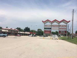
Belle Parke Plaza strip mall was built in 1963 to serve the new residents of the unincorporated area known as Spanish Lake
Up to seventy readers last week correctly guessed the fours areas in St. Louis County that are unincorporated, not a separate village, town, or city: St. George, Lemay, Affton, and Spanish Lake. With 90 incorporated it’s hard to keep track of all the areas of the county.
Here are the four that are not incorporated:
St. George:In November 2011 residents voted to disincorporate so they could return to being part of unincorporated, lack of money to repair roads was the stated reason. St. Louis County had 91 separate municipal governments prior to St. George’s disincorporation. See St. George may close up shop at year’s end
Lemay: An area in unincorporated south county, see the Wikipedia entry.
Affton: Another unincorporated area in south county, see the Wikipedia entry.
Spanish Lake: I’m surprised more people didn’t get this right, it is famously unincorporated.
Three of the four were never incorporated.
Here are the results from last week’s voting, the correct four were the top vote getters:
Q: TRIVIA: Which FOUR (4) of the following are part of unincorporated St. Louis County, NOT a separate village/town/city:
St. George 81 [16.4%]
Lemay 78 [15.79%]
Affton 72 [14.57%]
Spanish Lake 70 [1417%]
Tie 25 [5.06%]
Crystal Lake Park
Green Park
Country Life Acres 23 [4.66%]
Greendale 18 [3.64%]
Tie 17 [3.44%]
Oakland
Wilbur Park
Tie 15 [3.04%]
Bella Villa
Winchester
Kinloch 14 [2.83%]
Uplands Park 10 [2.02%]
Pasadena Park 9 [1.82%]
Pasadena Hills 5 [1.01%]
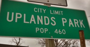
Sign on Natural Btidge marks the city limits of Uplands Park, population 460
Here is more about each of the areas some thought were unincorporated, in the same order as the poll results. All links are to Wikipedia entries:
Crystal Lake Park: Tiny class 4 city in west county with an area of 0.11 square miles, and 470 residents as of the 2010 census. Adjacent to Frontenac, off Bopp Rd.
Green Park: Small city in south county with area of 1.35 square miles, and 2,622 residents as of the 2010 census. Tesson Ferry Branch of the St. Louis County Library is within Green Park.
Country Life Acres: a village in west county with an area of 0.11 square miles, and 74 residents as of the 2010 census. Adjacent to the city of Town & Country.
Greendale: a city in north county with an area of 0.21 square miles, and 651 residents as of the 2010 census. Adjacent to Normandy.
Oakland: a city in west county with an area of 0.61 square miles, and 1,381 residents as of the 2010 census.
Wilbur Park: a village in south county with an area of .06 square miles, and 471 residents as of the 2010 census. Off Gravois Rd just outside St. Louis.
Bella Villa: a city in south county with an area of 0.13 square miles, and 729 residents as of the 2010 census. I-55 & Bayless.
Winchester: a city in west county with an area of 0.25 square miles, and 1,547 residents as of the 2010 census. Near Manchester & Woods Mill (141)
Kinloch: a city in north county with an area of 0.73 square miles, and 299 residents as of the 2010 census. Northeast of I-170 & I-70.
Uplands Park: a village in north county with an area of 0.07 square miles, and 445 residents as of the 2010 census. South of Natural Bridge west of Kienlen Ave.
Pasadena Park: a village in north county with an area of 0.1 square miles, and 470 residents as of the 2010 census. East of the UMSL campus.
Pasadena Hills: a city in north county with an area of 0.22 square miles, and 930 residents as of the 2010 census. Southwest from I-70 @ Lucas & Hunt.
The total area of these 12 is 3.95 square miles, less than 1% of the county. The total population in 2010 was 10,089, roughly 1% of the 2010 population of the county.
This is just twelve of the ninety municipalities in St. Louis County. Many contract with a neighboring municipality or St. Louis County to provide some services. Clear fragmentation when 1% of your land & population are divided into 12 separate governments.
AARP Livibility Index
The Livability Index scores neighborhoods and communities across the U.S. for the services and amenities that impact your life the most
Built St. Louis
historic architecture of St. Louis, Missouri – mourning the losses, celebrating the survivors.
Geo St. Louis
a guide to geospatial data about the City of St. Louis