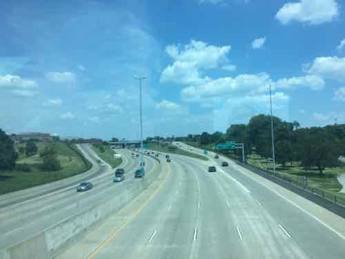
Last week I posted about Forest Park’s 140th anniversary. Earlier this month my husband and I visited the Science Center, looking out from the walkway over Interstate 64 I was reminded that land was originally part of the park.
6/11/16 2:14pm
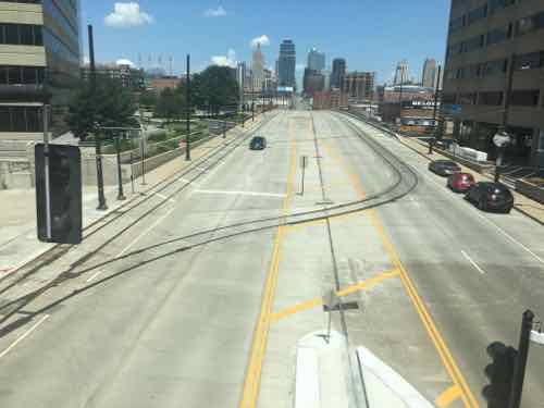
In 1958 Kingshighway hadn’t been straightened, but a small road cut through the Southern edge of Forest Park — see aerial. Highways were meant to connect cities to each other, but within cities they divided and consumed valuable land.
October 1909 Sanborn map shows 2 of 3 circles, click image to view full page
Twenty-Five years ago I’d just moved to the Murphy-Blair neighborhood, now known as Old North St. Louis. The tiny 3-room flat was significantly cheaper than the tiny efficiency I had on Lindell in the Central West End.
Prior to my arrival, neighbors had already been trying to get the neighborhood’s name officially changed. They thought playing off the history was better than being named after a public housing complex.
That history is the area was founded as a separate village — North St. Louis — on June 29, 1816. St. Louis was founded 50+ years earlier, in February 1764.
June 29, 1816:
A town was incorporated which rivaled its southern neighbor, St. Louis, for many years. The new town, founded by Maj. William Christy, was named simply “North St. Louis.” Its southern boundary line was Madison Street, then a considerable distance from the northern boundary of the city which Christy and his associates referred to as “St. Louis under the hill.”
Christy had come to St. Louis from Pennsylvania with advanced ideas about city planning. With two partners, he proposed a scheme for developing a city which would appeal to the settlers flocking in from the East. Street names reflected the founders’ interest in politics — Madison and Monroe; Benton for the young lawyer who would become one of Missouri’s first senators; and Warren, for a hero at Bunker Hill. A boatyard was established, and inducements offered steamboats to land at North St. Louis instead of farther downstream. A ferry made regular runs between North St. Louis and Alton. In 1841, just a quarter century after its founding, the city was absorbed into St. Louis. (Source: St. Louis Day by Day by Frances Hurd Stadler, page 122)
The first attempt to develop this area was made in 1816, when the Village of North St. Louis was incorporated by William Chambers, William C. Christy and Thomas Wright. It was bounded by the present Monroe, Hadley, Montgomery Streets and the Mississippi River. It continued as a village until 1841 when it was absorbed into the City of St. Louis.
A unique feature of the village layout was the provision for three circular public use areas. These were Clinton Place as a school site, Jackson Place for recreational and assembly purposes and Marion Place for a church and cemetery. A public wharf at the foot of North Market Street was called Exchange Square.
The Village was to provide sites for mills similar to those in the New England hometowns of the village’s first settlers.
The village was about a mile upstream above Roy’s Wind Mill, which marked the northern limit of the town of St. Louis at the foot of Ashley Street, and on the Great Trail which later became North Broadway. Other prominent roads of the north side were Natural Bridge Road, which was laid out in the 1840’s as a northwestward extension of Mound Street, and Florissant Road which was a northward continuation of 16th Street in a western addition to the village.
Today, North St. Louis generally refers to everything North of Delmar — the Delmar Divide. North St. Louis has more poverty, crime, abandoned buildings, & vacant land than the rest of St. Louis. Will this always be the case, or will it change over time?
Readers who voted in the recent non-scientific Sunday Poll were optimistic:
Q: In 25 years, will North St. Louis be better or worse than today?
Substantially better 13 [24.07%]
Better 13 [24.07%]
Slightly better 14 [25.93%]
About the same 6 [11.11%]
Slightly worse 2 [3.7%]
Worse 4 [7.41%]
Substantially worse 2 [3.7%]
Unsure/No Answer 0 [0%]
Nearly three-quarters feel North St. Louis will be better within a quarter century. I wish I could share their optimism, but the last 26 years have used up all the enthusiasm I had for the future of St. Louis. I do have fond memories of my 3+ years living in Murphy-Blair/Old North St. Louis.
One new Board Bill was introduced at the St. Louis Board of Aldermen on Friday 6/24/2016:
Board Bill No. 99 | Ordinance relating to Office of Recorder of Deeds
BOARD BILL NO. 99 INTRODUCED BY ALDERMAN LARRY ARNOWITZ An ordinance relating to the employees and salaries of the Office of the Recorder of Deeds; repealing Ordinances #69192 approved pertaining to the Office of the Recorder of Deeds and enacting in lieu thereof a new ordinance pertaining to the same subject matter and containing an emergency clause.
Last week leaders in the St. Louis region argued publicly over future pubic transit:
St. Louis Mayor Francis Slay has made clear his support for a north-south MetroLink expansion, saying it’s a top priority in his final year in office. But a recent push for money to plan such a route has met with strong resistance from St. Louis County Executive Steve Stenger.
Stenger, in a letter to the Federal Transit Administration, said he will not endorse the north-south route until other proposed routes are studied. (Post-Dispatch)
At the other end of the state, in Kansas City, there’s also a disagreement about the expansion of rail-based public transit. The local non-profit behind the new KC Streetcar wants to expand South on Main Street, while another is pushing a light rail plan.
[Clay] Chastain argues his plan gives Kansas City residents a real choice and a much more extensive rail transit system, from the airport to the Cerner Trails campus under construction in south Kansas City and from Union Station to the stadium complex.
He estimates it would cost $2 billion to build, or about $45 million per mile, although some light-rail systems have cost considerably more than that per mile. He assumes the federal government would provide $1 billion of that amount.
The local match would come from a 3/8-cent sales tax increase for 25 years, plus 3/8 cents that currently go for the bus system, once that tax expires in 2024. (Kansas City Star)
Anyone who has flown in/out of KC’s airport knows it is a long distance from downtown KC. It’s a 20-25 minute drive, but takes over an hour by bus. Frankly, they need to do both — expand the new streetcar and build light rail to far off destinations like their airport and stadiums.
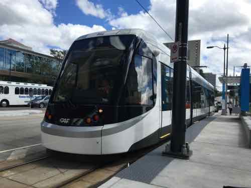
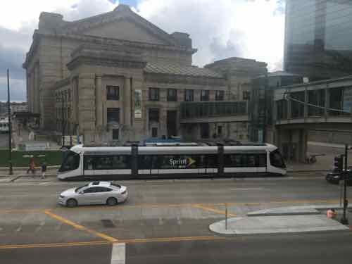
Kansas City was without rail-based public transit from 1957 until May 6, 2016 — the day the 2.2 mile starter streetcar opened.
THE FUNDING:
Cost to build: $100 million — $37 million from the federal government, $63 million from bonds.
Cost to operate: $4 million annually to be paid by a combination of sales & property taxes within the transportation district.
Fare: $0 — free
Local comparison: Our Loop Trolley vintage streetcar project. also 2.2 miles long, is costing $51 million to build. The 8-mile cross-county MetroLink extension that opened in 2006 cost $430 million.
THE VEHICLES:
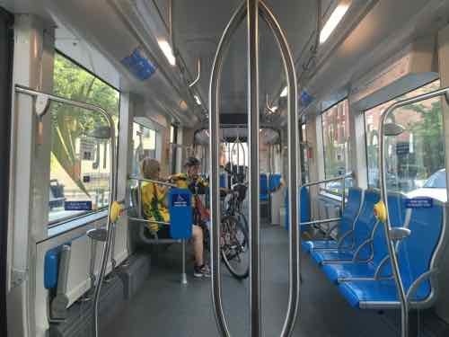
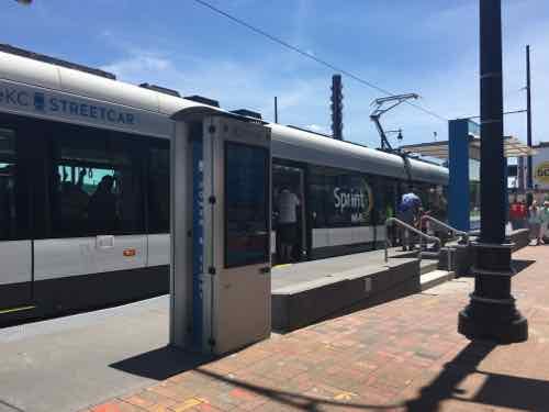
“Each vehicle is 77 feet and 8 inches long; 78,000 pounds; and 12 feet tall.”
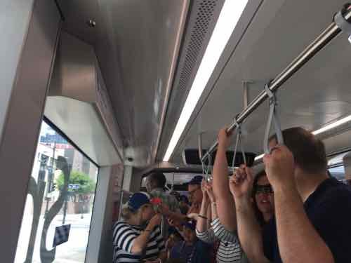
“Each vehicle capacity is approximately 150 riders and is bi-directional (can run both directions). There is a combination of sitting and standing within the streetcar.”
“There are three “cars” in each streetcar vehicle, with 4 sets of doors (one on each end and two in the middle car).”
Each of the four vehicles cost $4.39 million each (source).
Same as vehicles used in the Cincinnati Streetcar opening later this year.
Manufactured in Elmira NY by CAF USA, a subsidiary of a Spanish company.
To meet US crash-standards the body is made of steel
Comparison: our 4-car light rail vehicles are 90 feet long; capacity of 72 seated plus 106 standing
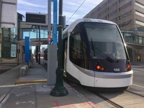
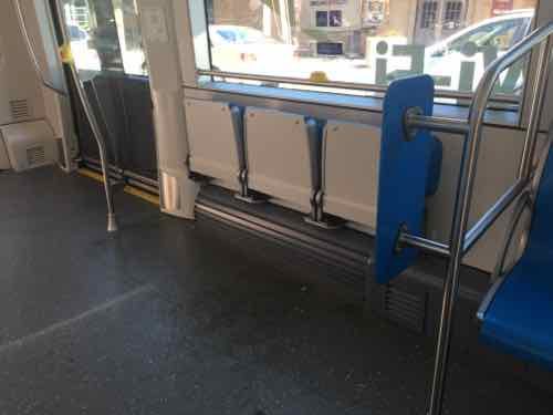
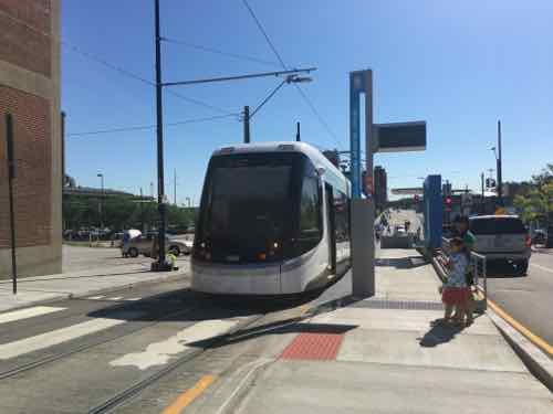
Each end is identicalThe lights change depending upon direction of travel. The step on this end of the Union Station platform is annoying.This view gives you an overview of the three cars in each vehicle — middle and two ends. Wheelchairs, strollers. bikes, the middle car, the door on each end has a stepThe center car is very open, the ends are filled with fixed seating. The floor is level throughout,The center car has two areas with theater seats. My wheelchair fit here and my husband could sit on one seat.It got packed to capacity a few times we were riding
THE ROUTE:
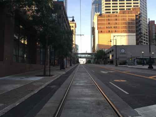
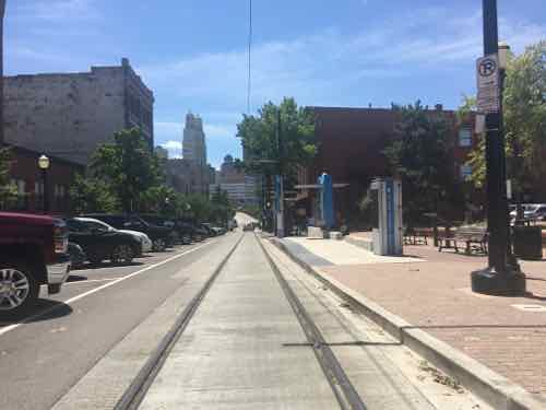
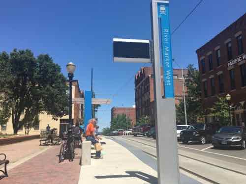
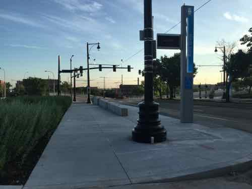
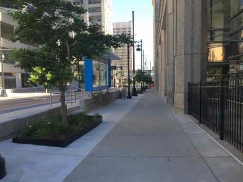
Kansas City is lucky to have Main Street as a central arterial. We have Olive/Lindell, but they’re very different. The 2.2 mile route does a loop on the North end around their River Market area. It goes down Main and ends at Union Station.
The route is 2.2 miles long and travels along Main Street in downtown Kansas City from the River Market to Union Station/Crown Center. The route also includes a loop around the City Market and runs on 3rd St on the north, Delaware on the west, 5th St on the south, and Grand on the east. (KC Streetcar FAQ)
An extension to continue South on Main Street is already being planned.
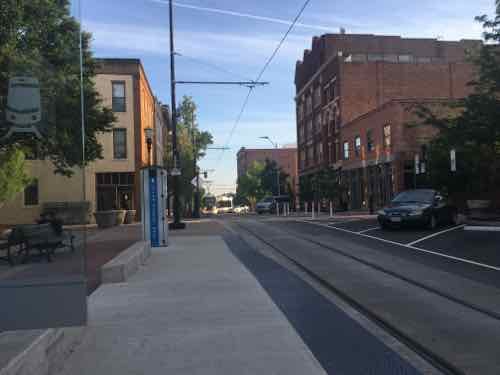
Looking North on Main St toward Downtown Kansas City.Looking South in the CBD
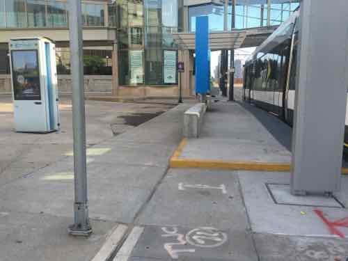
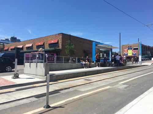
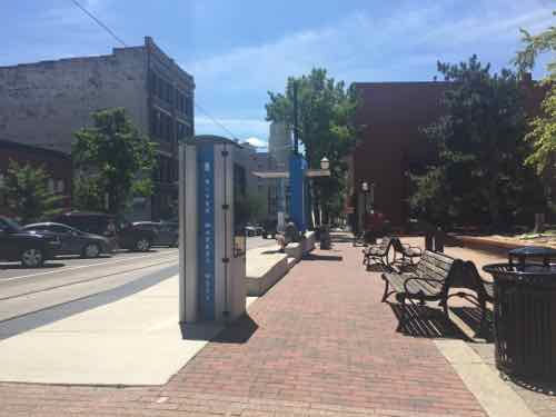
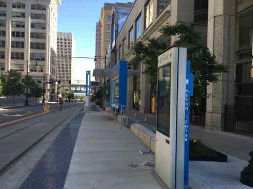
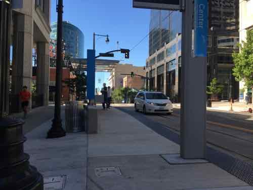
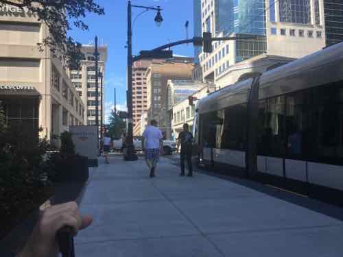
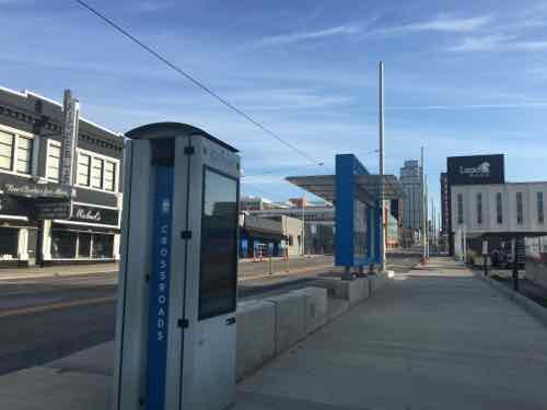
Stops are every few blocks, over the 3-day weekend I rode the streetcar a few times but also traveled the route on the sidewalk. For the most part. the stops are built out into the parking lane — leaving the sidewalk unblocked.
Another view of the Union Station stopThe River Market North stop is the only stop in the middle of trafficAnother view of the River Market North stopNext stop is River Market WestThe view from the sidewalkLooking North you can see the streetcar coming around the corner in the backgroundPeople gathering for the next streetcar, we tried to get on here a couple of times but it was too full from the two prior stopsNorth Loop is the most unusual stop, as it’s mostly parking lotsLooking West from the stopSidewalk next to Northbound Metro Center stopSame stop, same direction — just out near the curbOpposite viewSouthbound Metro Center stopStreetcar at SB Power & Light stopNB Crossroads stop
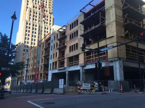
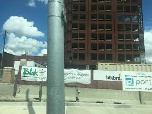
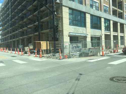
NEW CONSTRUCTION:
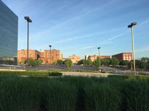
New construction is everywhere in Kansas City, especially near the streetcar route.
New construction at 13th & Baltimore, one block West of MainRehab on E 19th, just East of MainNew construction E 5th & GrandNew infill on Main Street between 19th-20th
VIDEO:
I put together a brief video of various clips I took:
FINAL THOUGHTS:
Their streetcar isn’t meant to be a regional system, at least not initially. CAF makes very similar vehicles for use in higher-speed light rail applications, so if they ever do a light rail line the vehicles could look just like their streetcar.
The main problem we experienced was crowds — but it was a nice holiday weekend in the first month of service. Would like to ride it on a regular weekday. We did speak to a retired couple that recently moved from the suburbs to new construction downtown — the streetcar was one reason,
Being right there it helped add life to the street. It’ll be interesting to see if they’ll be able to expand.
A quarter century ago I moved North of Delmar — from the Central West End. As I reflect back on the last 25 years, I think about what the next 25 might look like.
The National Geospatial Agency (NGA) will have been in it’s new headquarters for years. Will it help or hurt the surrounding area? Will Paul McKee’s plans get built? Will public transit be improved?
I have a lot of questions, but no crystal ball. There’s also a good chance I won’t be alive in 25 years to see the answers to my questions.
There’s no right or wrong answer to today’s poll — it’s a non-scientific measure of readers’ outlook. I’m not setting any criteria by which to compare now to 25 years from now, that’s up to you.
The poll is open until. 8pm.
Starting this week I’ll be cutting back from six posts to five — no more Monday posts, the next post will be Tuesday.
AARP Livibility Index
The Livability Index scores neighborhoods and communities across the U.S. for the services and amenities that impact your life the most
Built St. Louis
historic architecture of St. Louis, Missouri – mourning the losses, celebrating the survivors.
Geo St. Louis
a guide to geospatial data about the City of St. Louis