An Open Letter To St. Louis’ Bicycle/Pedestrian Coordinator, Jamie Wilson

Jamie,

This open letter is in response to your February email reply regarding my posts St. Louis Fails At Crosswalks, Part 1 and Part 2. You wrote:

Thanks for your input on the crosswalks. I’m working on improving our pedestrian facilities and we will get better. Please feel free to send me other locations you’ve noticed besides those mentioned. I’d also value any pics you may have from other cities in your travels that have different approaches.

Since you asked, I put together information on problems I’ve seen here in St. Louis, along with solutions I’ve seen in other cities. I’m making this open to increase public awareness and discussion. It does cause me concern that a “traffic engineer” is in charge of pedestrian & bike issues — it is traffic engineering that has made it such a liability to be a pedestrian or cyclist in this city & region. This is reflected in pedestrian deaths.

That said, I do know engineers can do good work — when they think like pedestrians instead of drivers! The Portland Pedestrian Design Guide, dated June 1998, is a great place for you to start your re-education. Yes, a document nearly two decades old shows how far behind St. Louis is when it comes to addressing the needs pedestrians.

Here’s my initial list — in no particular order:

  1. Do not require pedestrians to press a button to get a WALK signal — except in very limited circumstances.
  2. Make sure every leg of a signalized intersection includes a pedestrian signal — with countdown timer.
  3. Allow pedestrians to cross at each leg of an intersection.
  4. Give pedestrians a head start with a WALK signal a few seconds before the traffic light turns green.
  5. Give pedestrians the walk before left-turning traffic, trailing left instead of leading left.
  6. Time pedestrian signals consistently. Some say DON’T WALK while traffic still has 30-60 of a green light remaining.
  7. Make sure sidewalks are level, not cracked. Sufficiently wide through path so pedestrians can meet/pass — not single file.
  8. Ramps perpendicular to curb, not on the apex of the corner.
  9. Use street trees and/or parked cars to separate pedestrians from vehicles
  10. Mid-Block crossings should be marked in the middle — a center sign and/or overhead light/sign

I don’t have photos to illustrate all ten items, but here are some:
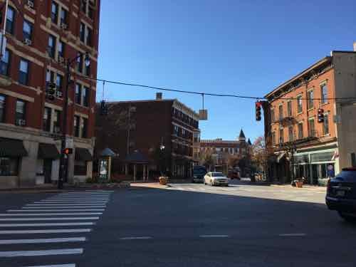
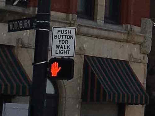
A crosswalk & pedestrian signal in Cincinnati OH
The sign above the pedestrian signal lets pedestrians know this signal requires activation
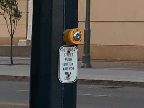
They al;so mark the buttons too let pedestrians know they need to activate the walk signal.

In their downtown the bulk of the crossings were automatic, no activation required. This is how it should be in places with higher pedestrian traffic. There were a couple of places where they need a button but that was only to activate audio signals for those visually-impaored — a sign was there to let the rest of us know it was an audio signal — we didn’t need to press it to get a WALK signal.

Cincinnati
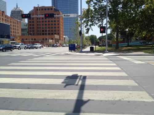
As Oklahoma City rebuilds downtown the new crosswalks are very wide, curb ramps can accommodate many users. July 2012

Contrast this with the narrow crosswalks and curb ramp in/around Ballpark Village — which are undersized for game-day pedestrian volume. As I find more examples in my photo library I’ll do a new post(s). In the meantime, I’d like us to take a walk.Ideally, we’d arrange for a power wheelchair for you to use so we can cover more territory.

Additional reading:

And please take 20 minutes to watch Dan Burden:

— Steve Patterson


Sunday Poll: What’s the right age for legal tobacco sales?

April 10, 2016 Featured, Sunday Poll 2 Comments
Please vote below
Please vote below

The age you need to be to do many things legally varies from state to state, activity to activity. Take getting a driver’s license — in some states you can get a learner’s permit as young as 14, in others you can’t get a full license until 18 (Source).   Today’s poll, however, is about the purchase of tobacco products.

The poll is open until 8pm.

— Steve Patterson


Reading: City on a Grid by Gerard Koeppel

April 8, 2016 Books, Featured Comments Off on Reading: City on a Grid by Gerard Koeppel

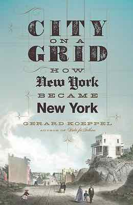
cityonagrid.koeppelRegular readers know I love St. Louis’ street grid — it’s one of the things that drew me here in August 1990. New York was already 150+ years old when St. Louis was founded. St, Louis’ first streets were in a grid pattern, but New York’s weren’t.  St. Louis had a population of 1,600 in 1810, but New York City was nearly 120,000 and growing fast.

In 1811 New York City adopted a new grid pattern for the largely rural island of Manhattan. It was unforgiving, no regard for geography. It would be decades before it was completed.

From author Gerard Koeppel:

Back in St. Louis, the original riverfront grid gave way to a less organized street pattern as you got away from downtown. The 1876 Great Divorce set the city limits far into rural land – those in the late 19th century didn’t foresee suburban sprawl that would take place in the mid to late 20th century.

You either love it or hate it, but nothing says New York like the street grid of Manhattan. Created in 1811 by a three-man commission featuring headstrong Founding Father Gouverneur Morris, the plan called for a dozen parallel avenues crossing at right angles with many dozens of parallel streets in an unbroken grid. Hills and valleys, streams and ponds, forests and swamps were invisible to the grid; so too were country villages, roads, farms, and estates and generations of property lines. All would disappear as the crosshatch fabric of the grid overspread the island: a heavy greatcoat on the land, the dense undergarment of the future city.

No other grid in Western civilization was so large and uniform as the one ordained in 1811. Not without reason. When the grid plan was announced, New York was just under two hundred years old, an overgrown town at the southern tip of Manhattan, a notorious jumble of streets laid at the whim of landowners. To bring order beyond the chaos—and good real estate to market—the street planning commission came up with a monolithic grid for the rest of the island. Mannahatta—the native “island of hills”—became a place of rectangles, in thousands of blocks on the flattened landscape, and many more thousands of right-angled buildings rising in vertical mimicry.

The Manhattan grid has been called “a disaster” of urban planning and “the most courageous act of prediction in Western civilization.” However one feels about it, the most famous urban design of a living city defines its daily life. This is its story.

What would Manhattan look like today if the 1811 grid hadn’t been adopted? What would St. Louis look like if it had suggested a similar rigid grid?


— Steve Patterson


Monogram Building, Formerly CPI Headquarters, To Become Loft Apartments

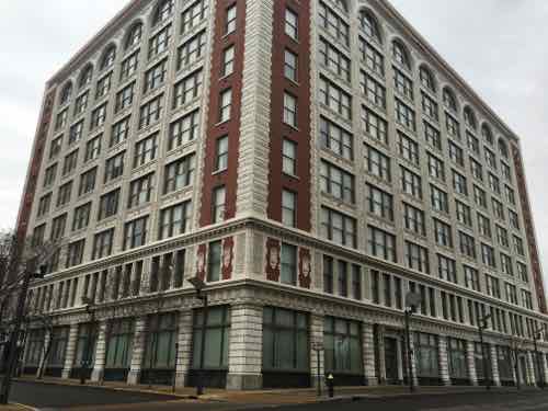
It’s time to stop calling the 9-story building at 1706 Washington Ave the “CPI” building. It has been a few years since the failed portrait studio operator occupied the building. For decades it was known as the Monogram Building, located within the Washington Avenue Historic District on the National Register, here are a couple of quotes from the listing:

The Monogram Building, rising nine stories, is a concrete-frame factory-warehouse extending eight bays on the east, elevation (facing 17th St. and 10 bays on the north (facing Washington). On both elevations, cream colored, glazed terra cotta, fashioned into shells, bound sheaves of wheat, caducei , and -foliated patterns, faces the narrow piers and spandrels which -frame triple windows . The end bays are sheathed in red brick and demarcated by terra cotta quoining. Above the two-story base, there is a foliated, bracketed cornice of terra cotta. The facade terminates with round arches formed bv the piers above the ninth story. A terra cotta cornice crowns the facade. 

and…

Rosenthal-Sloan, the “world’s largest millinery establishment,” occupied the Monogram Building at 1700 Washington constructed in 1910.” Numerous other millinery companies occupied quarters within the District and, according to one source, St. Louis was the largest millinery market in the country. ‘ Specialty items, junior dresses, for example, originated on Washington Avenue. Fashion shows were held first yearly and then twice yearly attracting thousands of buyers to the City. Large and small firms alike and the many out of town concerns that maintained offices and showrooms in the district flourished.

Before the Monogram was built in 1910, the site had already made history in St. Louis. Washington University in St. Louis, founded in 1853, opened its first building, Academic Hall, on the site on September 8, 1856. At the time, Lucas Place, now Locust St, was home to the city’s finest mansions.

Fol­low­ing the cholera epi­demic and fire in 1849, wealthy cit­i­zens became con­vinced that it was no longer desir­able to live in down­town St. Louis. James Lucas and his sis­ter Anne Lucas Hunt soon offered a solu­tion. They devel­oped the idea of the “Place,” a neigh­bor­hood with deed restric­tions that ensured it remained apart from the city and gen­eral pop­u­la­tion. The main thor­ough­fare was aptly called Lucas Place. Orig­i­nally Lucas Place (now Locust Street) extended between 13th and 16th streets when the city lim­its were just one block to the west between 17th and 18th streets. When estab­lished, Lucas Place was west of the devel­oped por­tion of the city, mak­ing it St. Louis’ first “sub­ur­ban” neighborhood. (Campbell House Museum)

The first mansion, built in 1851, was the Campbell House — the only mansion still standing.  The university occupied Academic Hall at 17th & Washington, and other buildings, until moving to its current campus in 1905. By the time the Sanborn Fire Insurance Map Co documented these blocks in February 1909, Academic Hall had already been razed.

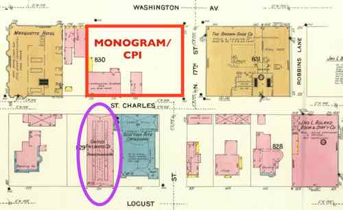
Every building shown in this four block map is gone -- except for the streetcar powerhouse circled in purple. The Monogram was built the next year on the site outlined in red. Click image to see larger version.
Every building shown in this four block map is gone — except for the streetcar powerhouse circled in purple. The Monogram was built the next year on the site outlined in red. Click image to see larger version.
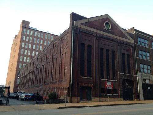
1711 Locust was a power station for the original streetcar system, the Monogram can be seen in the left background

The Monogram Building, built 1910-12, was designed by architect Albert B. Groves (1868-1925). Groves and his family lived at 5419 Maple Ave, built in 1906.  There are two entries for him in findagrave.com — here and here. Their son Theron A. Groves was also an architect.  Albert died weeks before his 57th birthday, Theron died at 65 — the wife & mother lived to 95!

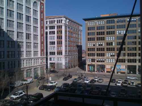
This building is important to me, for 8+ years it has been a significant part of the view from my loft & balcony.

The Monogram is the building on the left in this December 2008 image. In November I posted about how CPI had lights on 24/7, click image to see post. In 2010 I moved my bed to the other bedroom away from the windows and urban light pollution.
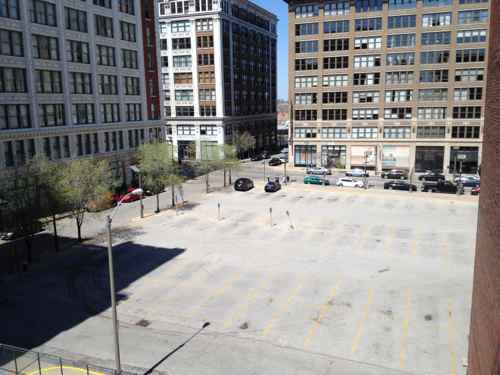
By May 2014 the frequently full parking lot was empty, but begging to be rented by the hour & month. Click image for post.

The Monogram Building has likely had many occupants over the last century, with a variety os uses. In January it was sold:

Revive Capital Development LLC, of Kansas City, bought the nine-story building from downtown St. Louis property owner David Jump. John Warren, a vice president of commercial real estate company JLL, represented Jump’s 1706 Washington LLC in the sale that closed Monday. No financial terms were revealed.

JLL said Thursday the new owner plans to put loft apartments in the former CPI headquarters at 1706 Washington Avenue. Efforts to reach a Revive representative were unsuccessful. (Post-Dispatch)

Hopefully this new Kansas City firm will be successful. The LLC’s sole listed organizer is real estate attorney Michael D. McKinley, a partner at the law firm Lathrop & Gage.

The two detailed facades are 17th (left) and Washington (right)
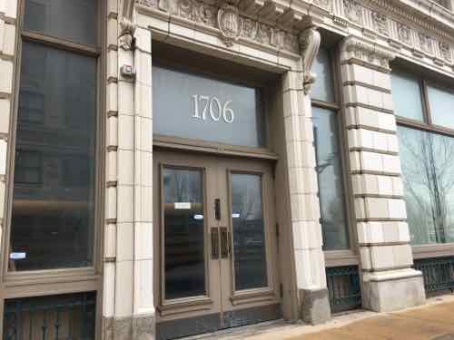
The first (East) entrance facing Washington Ave
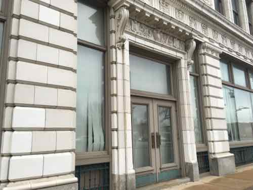
The next has a small step
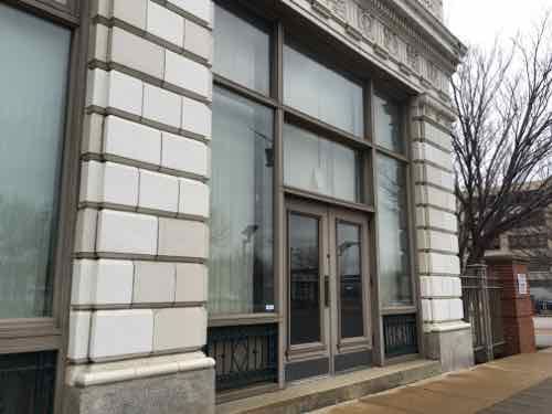
The third has a taller step

It’ll be interesting to see how Revive Capital Development configures the residential units, allocates parking, uses the ground floor. Hopefully one or two of the Washington Ave entrances will be for a restaurant or retail space, with the addition of an ADA-compliant ramp.

— Steve Patterson


Readers Opposed To Naming St. Louis Cardinals Official Baseball Team of Missouri

April 6, 2016 Missouri, Politics/Policy Comments Off on Readers Opposed To Naming St. Louis Cardinals Official Baseball Team of Missouri

The St. Louis Cardinals home opener is Monday, downtown will be packed with Cardinals fans. A mile away we can hear the fireworks when they get a home run.

In the non-scientific Sunday Poll more than three-quarters (78.43%) oppose a bill in the Missouri House that would name the St. Louis Cardinals the official MLB team of Missouri:

Q: If passed, a bill in Jefferson City would make the St. Louis Cardinals the official baseball team of Missouri. Support or oppose?

  • Strongly support 7 [13.73%]
  • Support 0 [0%]
  • Somewhat support 1 [1.96%]
  • Neither support or oppose 2 [3.92%]
  • Somewhat oppose 2 [3.92%]
  • Oppose 17 [33.33%]
  • Strongly oppose 21 [41.18%]
  • Unsure/No Answer 1 [1.96%]

Why would so many be opposed? Because Missouri has two MLB teams — the Cardinals and Kansas City Royals.  How would we feel if a legislator from the KC region wanted to name the Royals the official state team? Now if Rep Courtney Curtis wants to name the St. Louis Blues the official hockey team for Missouri or the Kansas City Chiefs the official NFL team for Missouri I don’t think anyone would object. Of course, when you only have one of something it’s sorta the state’s team by default.  There’s no incentive to when you have two of something to make one official.

I emailed Rep Curtis and suggested he withdraw HB2831 — and copied my state rep so he’d know my position.

— Steve Patterson


Advertisement


[custom-facebook-feed]

Archives

Categories

Advertisement


Subscribe