McKee’s Gas Station & Grocery Proposal Highly Suburban In Plan — Inappropriate Near Central Business District

In a December 2011 post, titled Downtown’s New Entrance, I said the following of developer Paul McKee’s plans along the new Tucker coming into downtown from the Stan Musial Veterans Memorial Bridge:

I’m still concerned the new buildings will lack connections to adjacent sidewalks. St. Louis now has a “Complete Streets” policy, but no requirement for adjacent properties to connect. The ADA requires minimal connection but a building can be built and occupied without it, leaving enforcement up to those who complain. If we take McKee, and his consultants, at their word the area will be pedestrian-friendly. My preference, of course, would be a requirement by ordinance. Former 5th Ward Alderman April Ford-Griffin never would initiate such a requirement and I don’t expect any of the three woman running to fill the vacant seat to do so either. The election is December 20th. Good or bad, McKee has the Tucker & Cass area under control. But what about south of Biddle St? The 1986 McDonald’s was just razed and replaced. The new one does have an ADA access route from one of the four streets bordering the property, but it’s still a prototype  best suited for a suburban/rural highway exit.

I used the following graphic/caption in that post:
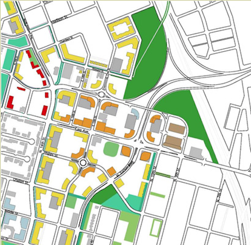
The following message popped up when I went to save this image from the source"Since we are still in the early design phases of the project, we ask that you please not copy our images yet since these designs are not final."
The following message popped up when I went to save this image from the source”Since we are still in the early design phases of the project, we ask that you please not copy our images yet since these designs are not final.”

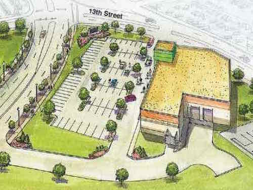
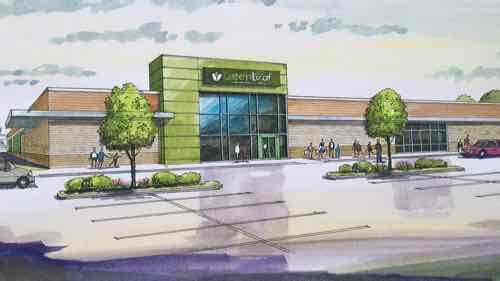
New buildings were shown up to the streets, with parking behind — the way we should be things in the center of the region. Someone may drive to work, but it makes walking to lunch, for example, feasible.   Constructing new buildings back behind surface parking is typical suburbia — it has no place in the urban core of the region — not minutes from the Central Business District.

Years ago Paul McKee said he wanted to build walkable urbanism — not the drivable suburbia he was known for. Last week he presented a plan for two new buildings, one on each side of Tucker, that are highly suburban in their site planning.

The GreenLeaf Market will be located at 1408 N. 13th St., not far from the Stan Musial Veterans Memorial Bridge. Right across the street, McKee said there will be the ZOOM Store — a gas station, store and car wash.

“We expect the ZOOM Store to open by Thanksgiving and the other market to open by March 1,” McKee said.  (St. Louis Public Radio)

The worst-case scenario has come true — McKee is planning to build suburbia within minutes of the central business district. Not the pedestrian & transit-friendly vision he initially communicated.
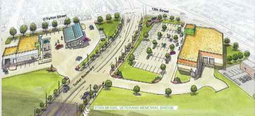
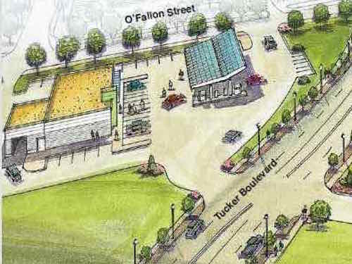
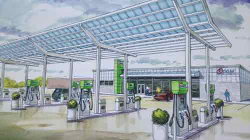
On the left/East is Zoom gas station, and on the right/West is Greenleaf grocery store
On the left/East is Zoom gas station, and on the right/West is GreenLeaf grocery store
Crop of ZOOM gas station: Pedestrians are shown on the sidewalks, but no route to enter the business
View as motorists drive up to the pumps.
Crop of GreenLeaf grocery store. Like the gas station, no route shown for the pedestrians on the Tucker sidewalk to reach the entrance
Typical auto-centeric viewpoint

Both would be easy to have a pedestrian access route to a side street — ZOOM to O’Fallon and GreenLeaf to 13th. Technically achieving the bare minimum required by the Americans with Disabilities Act (ADA) is still a long way from being pedestrian-friendly.

I’ve defended McKee’s efforts to build new urbanism in areas such as the 22nd St Parkway interchange, Pruitt-Igoe, and Tucker & Cass. That was based on him indicating his intention to do something positively urban, not ordinary suburban.  These first buildings will set the pattern for this area.

I’ve been visiting & photographing this area since work on the new Tucker began. Here are some images from 2012:
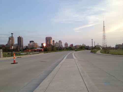
Looking South at the new Tucker from Cass Ave, both sides have large land areas ready for development. July 2012 image
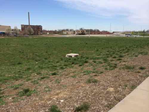
This land os all North of the proposed grocery store and Cass Ave. How will this be filled in? What route will people who live/work here take to walk to the grocery store? July 2012 image
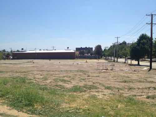
Site of the proposed gas station, July 2012 image

Last month I went back again:

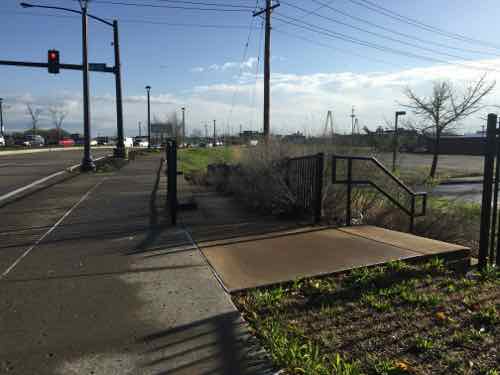
I knew from my earlier visits that O'Fallon St no longer connected to Tucker. Is this to change if the gas station gets built?
I knew from my earlier visits that O’Fallon St no longer connected to Tucker. Is this to change if the gas station gets built?
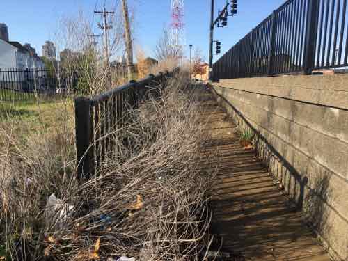
A ramp that's too narrow because of plants goes from Tucker down to O'Fallon
A ramp that’s too narrow because of plants goes from Tucker down to O’Fallon
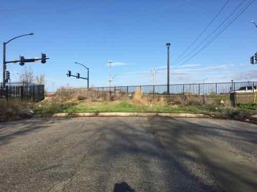
O'Fallon St just currently just ends. Reopening to Tucker would further complicate the traffic intersection
O’Fallon St just currently just ends. Reopening to Tucker would further complicate the traffic intersection
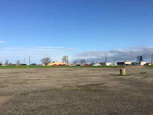
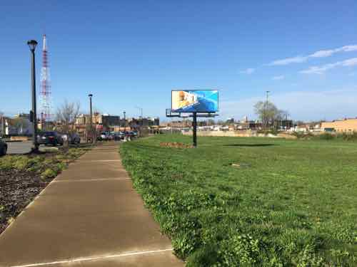
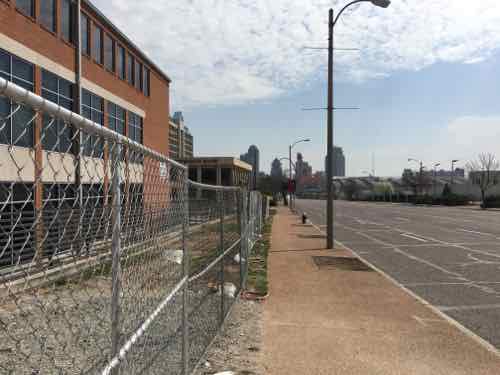
View looking toward Tucker from the site of the proposed gas station.
Southbound on Tucker, the grocery store would be built on the right past the billboard
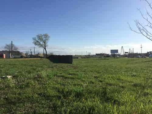
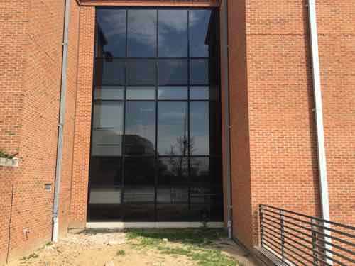
View from 13th looking at the proposed grocery store site. The wall is the last bit of the tunnel where the commuter train went under Tucker

How we begin building on these large swaths of land matter, we need to ensure people can walk from building to building in the most direct manner possible — not some circuitous route or through surface parking lots. I’ve already contacted Good Natured Family Farms to tell them I welcome a grocery store — but not in a suburban form.

— Steve Patterson
 

New NGA West Location Will Gut St. Louis Place Neighborhood, Not Revitalize What Remains

The National Geospatial Agency decided to keep its Western headquarters in the City of St. Louis. The narrative around this decision is summed up nicely here:

The decision means the city will keep 3,100 jobs, currently housed at the Old Arsenal complex south of Anheuser-Busch brewery, and move them to a $1.75 billion development just northwest of downtown. The move is expected to further the city’s pursuit of redeveloping the near North Side with a massive federal anchor — something that could lure more investment to the struggling area, but also give a major boost to nearby Washington Avenue. (Post-Dispatch)

I get the first part — keeping thousands of jobs within the city. I do hear that many of the 3,100 don’t live in the City of St. Louis — they aren’t thrilled about driving to North City. But, it’s the second part that I don’t get — how does putting many acres behind chainlink fencing help those outside the fence?

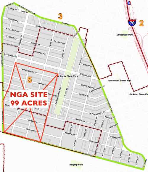
The NGA will take a big chunk of the St. Louis Place neighborhood.

The NGA’s high-security entrance will be facing Jefferson Ave — it’ll turn its back on the remaining neighborhood.  The NGA as an anchor institution? Hardly:

Anchor institutions are nonprofit institutions that once established tend not to move location. Emerging trends related to globalization—such as the decline of manufacturing, the rise of the service sector, and a mounting government fiscal crisis—suggest the growing importance of anchor institutions to local economies. Indeed, in many places, these anchor institutions have surpassed traditional manufacturing corporations to become their region’s leading employers. If the economic power of these anchor institutions were more effectively harnessed, they could contribute greatly to community wealth building. The largest and most numerous of such nonprofit anchors are universities and non-profit hospitals (often called “eds and meds”). Over the past two decades, useful lessons have been learned about how to leverage the economic power of universities in particular to produce targeted community benefits. (Source)

Once open, the NGA will be like the current site. Thousands will drive there, do their job, drive home. They won’t be running outside the barbwire fence to grab lunch. An employee living in, say Arnold, isn’t suddenly going to move to the neighborhood. A high-security government spy agency will never be a neighborhood anchor.

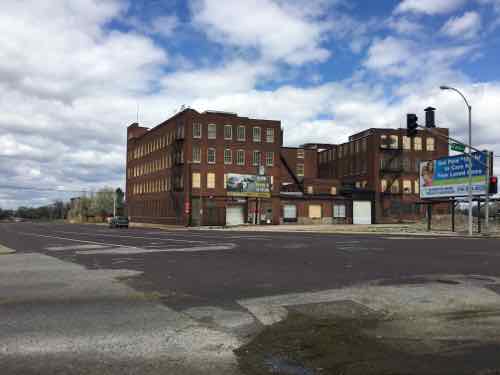
Corner pf Jefferson & Cass, April 1, 2016

For those employees driving to work from Arnold, they currently drive 15.8 miles, about 20 minutes or so each way. The new location will be 20 miles, roughly 30 minutes or more.  For others, the commute to work will be shorter.

The best we can hope for is its presecence convinces others to consider relocating to the former Pruitt-Igoe site, South across Cass Ave. MetroBus might improve frequency to the area…might.

Jefferson Ave & Cass Ave both need to be updated — fewer & narrower lanes, new sidewalks, crosswalks, etc.

Sadly, our leadership still thinks razing block after block — totally erasing the street grid — is a positive thing to do. Is is 2016 or 1946?

— Steve Patterson


Sunday Poll: Should The St. Louis Cardinals Become Missouri’s Official Baseball Team?

Each year legislators in Jefferson City introduce many bills. One recent bill recently received national attention:

A bill in the Missouri House of Representatives would make the St. Louis Cardinals the state’s official baseball team. (KMOV)

House Bill 2831 was introduced by State Rep Courtney Allen Curtis (D-73). This district is in North St. Louis County. Missouri has two Major League Baseball (MLB) team: the Kansas City Royals and St. Louis Cardinals.

Please vote below
Please vote below

Here’s today’s poll:

The poll will be open until 8pm.  Wednesday I’ll discuss the results and my thoughts.

— Steve Patterson


The Chemical Dihydrogen Monoxide (DHMO) Is Everywhere In St. Louis!

We’ve all heard about the horrible problem of lead poisoning in Flint, Michigan, but silence on the problem here in St. Louis: Dihydrogen Monoxide

Dihydrogen Monoxide (DHMO) is a colorless and odorless chemical compound, also referred to by some as Dihydrogen Oxide, Hydrogen Hydroxide, Hydronium Hydroxide, or simply Hydric acid. Its basis is the highly reactive hydroxyl radical, a species shown to mutate DNA, denature proteins, disrupt cell membranes, and chemically alter critical neurotransmitters. The atomic components of DHMO are found in a number of caustic, explosive and poisonous compounds such as Sulfuric Acid, Nitroglycerine and Ethyl Alcohol. (DHMO.org)

Despite the dangers, it is everywhere in our society. Where is the media on this? Silenced! At least with natural gas they add an odor so people can be aware of the danger it poses!

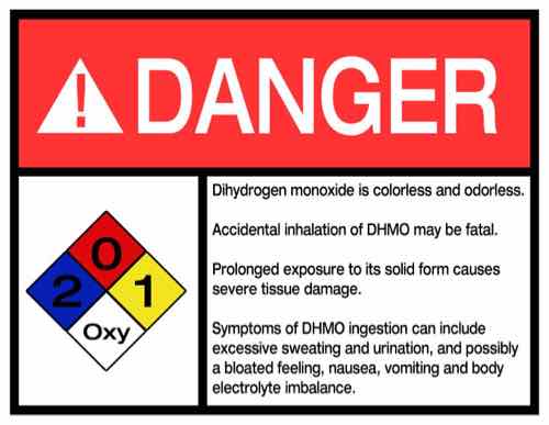
You've been warned!
You’ve been warned!

Turn on your tap and I guarantee you’re going to get DHMO — the same chemical Monsanto uses in many of its products. Independent test results have confirmed the presence of DHMO in taps in the St. Louis region.

Officials claim it is safe to drink — but they said that in Flint too!  Do you really want to take that chance?

Thankfully there are grassroots efforts to raise awareness and ban this harmful chemical:

The National Consumer Coalition Against DHMO (NCCADHMO), not affiliated with the Coalition to Ban Dihydrogen Monoxide, was founded in 1997 in an effort to raise public awareness about the dangers of Dihydrogen Monoxide (DHMO) in our daily lives. The secondary goal of NCCADHMO is to act in the public interest as a lobbying agent in Congress to affect public policy regarding the safety and uses of DHMO. Although we are not funded by the EPA, we are loosely affiliated with the US Environmental Assessment Center’s Dihydrogen Monoxide Research Division. This affiliation was created in an effort to make information available to the public in an expedient fashion, and to provide a public forum for the ongoing DHMO debate. 

But DHMO has found its way into everything: food, beverages — even our own bodies! Yes, the chemical sprays on commercial crops & golf courses is in the food we eat daily.

— Steve Patterson


Green Street Development Updating Building At Jefferson Ave & Market St

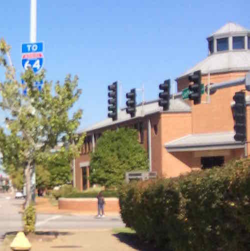
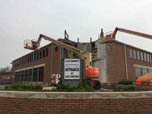
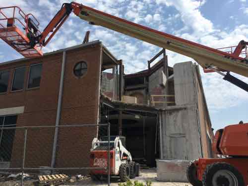
In 2014 Green Street Development bought a vacant building at Jefferson Ave & Market Street, originally built by AG Edwards, now Wells Fargo Financial. Last year they signed web developer Avatara as the main tenant, click here to see their webpage on the project. Construction on a new entry is now underway.

This is the best photo of the building I could find in my library. This shows the original corner, click image to view on Google's Street View
This is the best photo of the building I could find in my library. This shows the original corner, click image to view on Google’s Street View
The corner tower has been removed, will be replaced by a more modern entry
Another view of the corner entry with the old tower gone
Avatara has already moved in, they're using this entry on Chestnut for now.
Avatara has already moved in, they’re using this entry on Chestnut for now.
The building was built in two phases, the corner/West part in 1993. The East part, right, in 2001. Based on Green Street's rendering this connection between the two parts will also be updated.
The building was built in two phases, the corner/West part in 1993. The East part, right, in 2001. Based on Green Street’s rendering this connection between the two parts will also be updated.
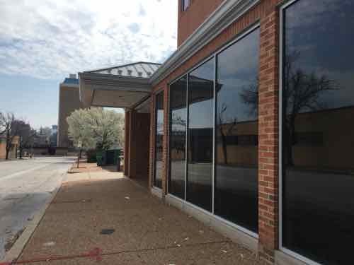
Looking East down Market St

I never liked the corner tower, so I’m glad it is gone. Looking forward to seeing the final results.

— Steve Patterson


Advertisement


[custom-facebook-feed]

Archives

Categories

Advertisement


Subscribe