Three Track Types For Street-Running Transit

Many of us agree we should invest in better North-South transit, most likely rail-based. But details such as route, track type, speed, spacing of stops, etc is where there’s disagreement. Today I want to review three track options for street-running rail transit:

  1. Ballasted track
  2. Embedded track, shared lane
  3. Embedded track, protected lane

I’m going to use photos from Dallas to demonstrate these.

Ballasted track

This is the traditional type of railroad track.

Track ballast forms the trackbed upon which railway sleepers (UK) or railroad ties (US) are laid. It is packed between, below, and around the ties. It is used to bear the load from the railroad ties, to facilitate drainage of water, and also to keep down vegetation that might interfere with the track structure. This also serves to hold the track in place as the trains roll by. It is typically made of crushed stone, although ballast has sometimes consisted of other, less suitable materials. The term “ballast” comes from a nautical term for the stones used to stabilize a ship. (Wikipedia)

Our light rail uses this type of track in its exclusive right-of-way, with wood ties in the original 1993 line and concrete ties in later extensions. Obviously, this is not used in places where cars drive in the same space. With railroads they are completely separate but when used in the public right-of-way (streets) it requires physical barriers to keep cars off the track.
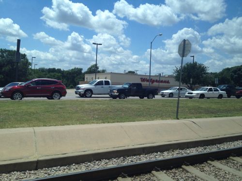
Dallas' South Blue Line light rail uses ballasted track in a wide median
Dallas’ South Blue Line light rail uses ballasted track in a wide median

This is the least costly and fasted type of track. To achieve the highest speeds it’s important to have few conflict points (crossings) and greater distances between stops.

Embedded track

Embedded track is more costly to install than ballasted track, and vehicles operate at slower speeds.

Where a rail is laid in a Road surface (pavement) or within grassed surfaces, there has to be accommodation for the flange. This is provided by a slot called the flangeway. The rail is then known as grooved rail, groove rail, or girder rail. The flangeway has the railhead on one side and the guard on the other. The guard carries no weight, but may act as a checkrail.

Grooved rail was invented in 1852 by Alphonse Loubat, a French inventor who developed improvements in tram and rail equipment, and helped develop tram lines in New York City and Paris. The invention of grooved rail enabled tramways to be laid without causing a nuisance to other road users, except unsuspecting cyclists, who could get their wheels caught in the groove. The grooves may become filled with gravel and dirt (particularly if infrequently used or after a period of idleness) and need clearing from time to time, this being done by a “scrubber” tram. Failure to clear the grooves can lead to a bumpy ride for the passengers, damage to either wheel or rail and possibly derailing. (Wikipedia)

This type of track is more common where vehicles & pedestrians are in the same space as the track.

Embedded track, shared lane

Dallas’ light rail doesn’t share lanes with vehicles, where it uses streets not in a median cars are banned.
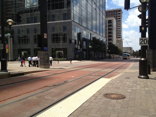
Light rail in downtown Dallas uses embedded track on Pacific Street where cars are banned. Emergency vehicles like fire, ambulance, police can use this street. In some cities cars are allowed to share these lanes.

This is common for light rail. However, Dallas does have embedded track with shared lanes — their new tramway (aka streetcar).
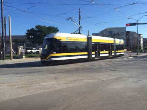
Trams worldwide share lanes with other users.

Embedded track, separate lane

With a separate lane the transit vehicle can move slightly faster than it can when sharing a lane.
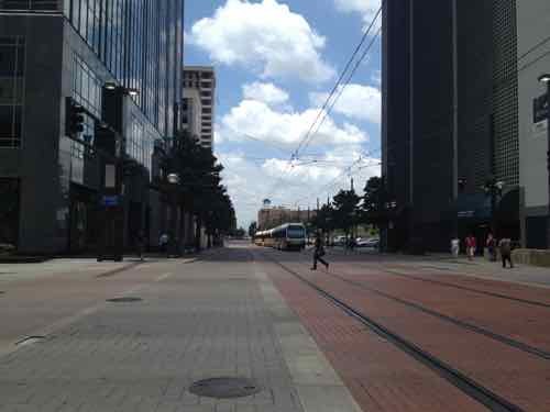
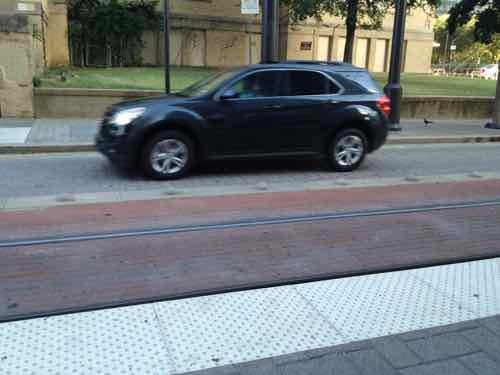
Dallas has a few spots where cars & transit use the same street. Transit here travels considerably slower than where it has an exclusive right-of-way.
Dallas has a few spots where cars & transit use the same street. Transit here travels considerably slower than where it has an exclusive right-of-way. Here cars can use the single grey lane, transit uses the red,
Here we see small bumps are used to let drivers know to stay in their lane (gray)

Each of these has their place, depending upon the situation and desired speed. I can see using ballasted track in auto-centric suburban medians, but not within the City of St. Louis or even inner-ring suburbs. The more separate ballasted track you have, combined with fewer stops, the faster the transit vehicle will get from A to B.

Those advocating more rail transit in St. Louis need to think about these track types and the implications of each.

— Steve Patterson


Sunday Poll: Approve or disapprove of financing plan for a new stadium up for final vote by the Board of Aldermen on Tuesday?

December 13, 2015 Board of Aldermen, Featured, Politics/Policy, Sunday Poll Comments Off on Sunday Poll: Approve or disapprove of financing plan for a new stadium up for final vote by the Board of Aldermen on Tuesday?

Last week a Board of Aldermen committee moved forward a plan for the financing of $150 million of a $1 billion dollar new stadium. Though our Edward Jones Dome is only 20 years old, St. Louis Rams owner Stan Kroenke wants to move the team back to Los Angeles.

On Thursday, an aldermanic committee voted 7-2 to push the bill forward to a vote of the full Board of Aldermen.

The board could debate the matter as early as Friday, but procedural rules will require the board to come back next week for at least one special session to take a final vote. In order to debate the matter at Friday’s planned second reading, the aldermen will need to suspend the rules, requiring support from two-thirds of those present, and fast-track the bill. (St. Louis Post-Dispatch)

On Friday the bill wasn’t fast tracked so a special session will be held on Tuesday to meet the NFL’s end of the year financing deadline.

Please vote below
Please vote below

The poll closes at 8pm tonight, the answers are randomized.

— Steve Patterson
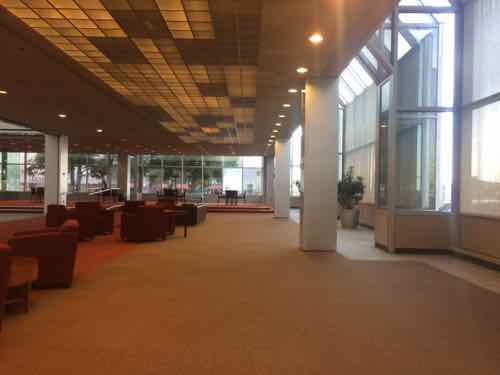
 

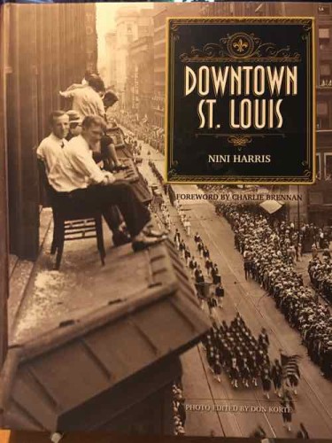
Reading: Downtown St. Louis by NiNi Harris with Forward by Charlie Brennan

December 11, 2015 Books, Downtown, Featured Comments Off on Reading: Downtown St. Louis by NiNi Harris with Forward by Charlie Brennan
The cover shows men on the roof of an Arcade building bay window watching a parade on Olive

St. Louis Author, historian, & tour guide NiNi Harris is out with another book — this time on Downtown St. Louis.

Here’s the official publisher description of Downtown St. Louis:

In this rich photographic history, author NiNi Harris follows the evolution of downtown St. Louis from colonial days when French traders and craftsmen planted maize on the prairies that stretched from Fourth Street west to Jefferson Avenue, to millennials and empty nesters living in castle-like warehouses converted into twentyfirst-century lofts. 

Downtown St. Louis recalls when Native Americans arrived by canoe to attend a grand council and when the sounds of Italian street vendors filled the air in the 1870s. It describes the street celebration that erupted at Eighth and Olive Streets at the news that the Japanese had surrendered, ending World War II. All the while, generations of St. Louisans were building and rebuilding a spectacular downtown with ornate Victorian architecture reflected in the sheer glass walls of International Style skyscrapers, lavish art deco civic buildings, and a train station modeled after a walled medieval city. Filled with myriad images—historical and contemporary—this book chronicles the building of the old riverfront, the Wainwright Building, Busch Stadium II, and the Gateway Arch, among other major moments.

The five chapters are organized as follows:

  1. 1764-1816
  2. 1817-1873
  3. 1874-1916
  4. 1917-1945
  5. 1945-present

Previous posts about some of Harris’ other books:

Eventually I’ll find time to go through the book to examine all the images & read all the information.

— Steve Patterson
 

Reimagining 100 North Broadway to Take Advantage of New Luther Ely Smith Square & Arch Entrance

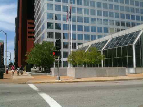
For over 5 years now I’ve been thinking about how to redesign the Bank of America Tower at 100 N. Broadway. My primary beef wasn’t with the 22-story tower, but with the 1-story section to the South of the tower.

Looking North from Broadway & Chestnut, June 2010

First, a little background:

Bank of America Tower is a 22-story, 500,000 square foot Class-A office tower located in the heart of the prominent Downtown St. Louis market – the regional center for Missouri’s largest law, accounting and financial service firms. Located at the intersection of two major downtown arteries, Broadway and Pine, the Bank of America Tower offers easy access to the region’s extensive highway system and Metrolink light rail system.

Bank of America Tower was built to exceptional standards in 1976 as the corporate headquarters facility for Boatman’s Bancshares. Designed by the world-renowned architectural firm Hellmuth, Obata & Kassabaum, the building features exquisite granite and marble finishes throughout and floor configurations which offer tenants breathtaking views.

Hertz Investment Group acquired this prestigious property in 2005. It is currently owned and managed by Hertz Investment Group. (Hertz Investment Group)

NationsBank bought Boatman’s Bancshares in 1996, and two years later it bought the larger BankAmerica Corporation — taking the name Bank of America. At some point the building was sold to investors. Through all the ownership changes the 1-story section remained a branch bank — until November 21, 2014.  See: Bank of America closing one of its downtown St. Louis branches.

My design idea is directed at the San Diego owners, I’m not proposing taxpayers do or fund any of what I’ll suggest below. Some of you may think if there was market demand for my idea it would already exist. This viewpoint ignores the fact that markets & buildings are constantly changing to reflect new market conditions. Because building changes don’t happen overnight, there’s a delay between a shifting market and physical changes.

Before I get into my idea I want to show you more of the photos I took in June 2010:

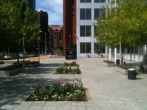
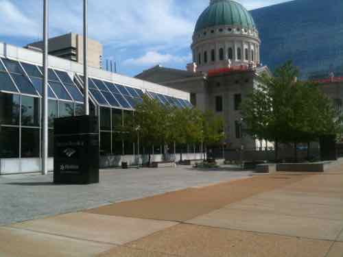
Looking North at the West side plaza, this is considered the front since it faces Broadway, June 2010
Though my main focus was the 1-story glass wing, I didn't like how the tower and the sidewalk/plaza met, June 2010
Though my main focus was the 1-story glass wing, I didn’t like how the tower and the sidewalk/plaza met, June 2010
From this view we can see it is across Chestnut from the Old Courthouse, June 2010
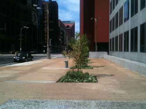
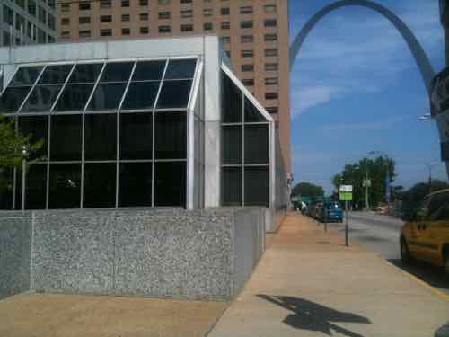
Looking East see can see the Arch. The building has zero relationship with the sidewalk, June 2010
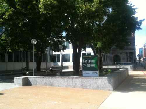
The East plashes a different feel because it is raised above the 4th St sidewalk, June 2010
A view of the East side plaza from 4th & Chestnut, June 2010
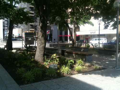
Both plazas and the building are built over underground parking. This fact places limits on what can be done to give the building a better relationship with sidewalks on Broadway, 4th, and Chestnut in particular, June 2010

I returned in September of 2010 to have another look. With an active bank branch in the 1-story part my focus was on the tower’s ground floor facing Broadway. This time I did do a brief post, sharing the next two images. The captions are new.

The SW corner the tower as it meets the plaza. The interior floor level is nearly level, making it easier open this space directly to the exterior. But what, if anything, is on the ground floor? Can't tell just passing by.
The SW corner the tower as it meets the plaza. The interior floor level is nearly level, making it easier open this space directly to the exterior. But what, if anything, is on the ground floor? Can’t tell just passing by. September 2010
From inside the lobby we see it's a restaurant, September 2010
From inside the lobby we see it’s a restaurant, September 2010
In my September 2010 post I didn't share this image, but it shows the restaurant space going back along the exterior wall.
In my September 2010 post I didn’t share this image, but it shows the restaurant space going back along the exterior wall.

The Atrium Cafe was very good, but it’s only open for lunch weekdays. Given that it’s hidden from anyone outside, that makes sense.

After the Bank of America branch closed I returned in July of this year to see the interior space and take another look at the exterior.

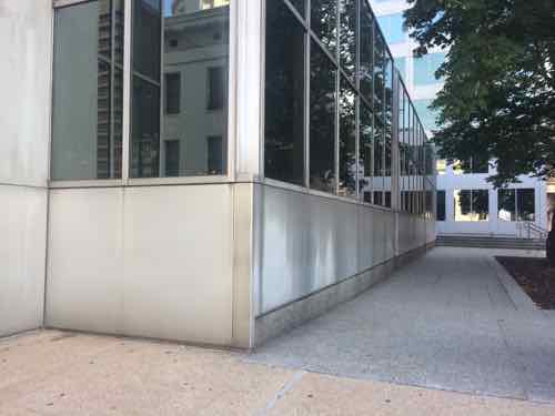
The SE corner of the vacant 1-story atrium bank branch from the Chestnut sidewalk
The SE corner of the vacant 1-story atrium bank branch from the Chestnut sidewalk, July 1015
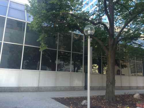
Looking at the East greenhouse
Looking at the East greenhouse, July 2015
Looking West along the narrow Chestnut sidewalk, the interior floor level is higher than the sidewalk, July 2015
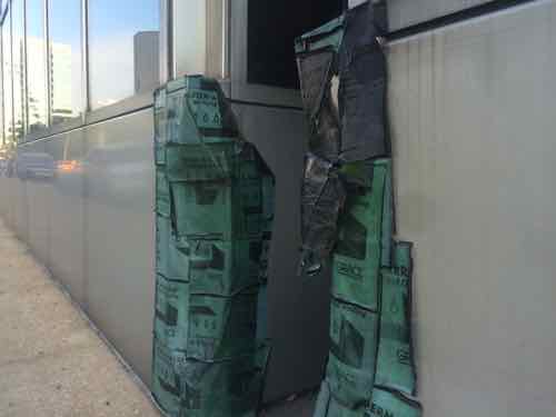
At one of the breaks between greenhouse glass we see the exterior is damaged and poorly patched, July 2015
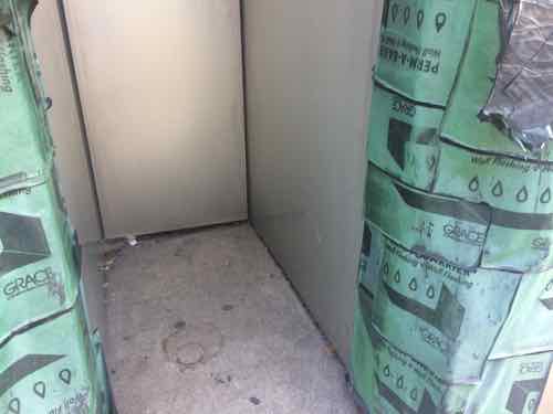
Looking closer we see a little dead space used to separate the greenhouses, July 2015
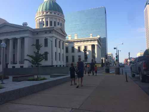
On Broadway we see more pedestrians with the Old Courthouse being the new main ticketing point for the Arch, July 2015
Turning toward the building we can see the top of the Arch peaking above the 1-story atrium space, July 2015
Inside looking East along the South atrium/greenhouse wall we can see the inward point we saw outside and the structure set back from the glass, July 2015
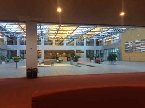
Looking toward the building lobby, July 2015
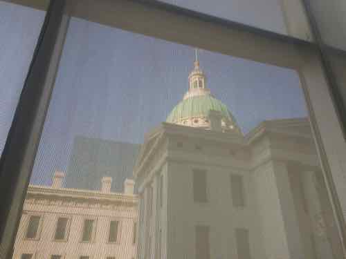
Looking at the Old Courthouse through the window screens
Looking at the Old Courthouse through the window screens, July 2015
Looking at the Arch through the window screens
Looking at the Arch through the window screens, July 2015

Even at this point it hadn’t hit me, though I knew the protruding greenhouse glass had to go. It was on my 2nd visit to the new Luther Ely Smith Square that I figured it out. Lets start with the last photo from that post.

Looking toward 4th & Chestnut

The owners consider Broadway & Pine the main corner, but the diagonally opposite corner is positioned to take advantage of the new Square and future Arch entrance.Many Arch visitors will park in the Kiener garages and walk right past 100 N. Broadway.

The solution is to remove all the glass & cladding from the 1-story section and rethink it. The space has been vacant for over a year, with bank branches continuing to close it’s unlikely a bank will lease it. It is time for s physical change to the space to respond to the changing market. It isn’t 1976 anymore!

Looking at the building from the NW corner of the Luther Ely Smith Square. Many Arch visitors will be parking un the garage seen in the background

So my thought is this should become a restaurant. Not a weekday lunch-only spot but a place open for breakfast, lunch, & dinner 7 days a week. With all the tourists it should be familiar — Panera — still called St. Louis Bread Co here. There’s one on the ground floor of the Kiener East garage a block West — this could be a larger more up-to-date location.

Here’s more detail:

  • Remove the greenhouse glass from all three sides, widen Chestnut sidewalk
  • Create new building lobby with door to new restaurant — not open like it has been for nearly 4 decades.
  • Place the kitchen & restrooms in the center.
  • Include an elevator and stairs to a new rooftop patio. Shade for rooftop patio could come from a pergola, stretched canvas, umbrellas, etc.
  • Nighttime lighting would be important to make this a great evening destination.

A St. Louis Bread Co here would be bad for the Atrium Cafe, perhaps they move to the old Bread Co space a block West. Their old space could be opened to the plaza like I suggested in September 2010 — occupied by a restaurant different enough from Panera/Bread Co. to survive.

The other side of the Old Courthouse has a similar low platform with tower arrangement. That low platform is occupied by the inwardly-focused Tony’s. I don’t see change coming to that building anytime soon. The owners of 100 N. Broadway have a great opportunity to rethink their building to take advantage of the new Arch entrance.

— Steve Patterson
b

b

ht


Readers Split on Forest Park Entry Markers

In the recent unscientific Sunday Poll the readers were almost evenly split on new entry markers for Forest Park.

Mock-up of an entry marker, northeast corner of Forsythe and Skinker. Photo by Mark Beirn

Here are the results:

Q: How do you feel about the proposed entry markers for Forest Park?

  1. TIE 10 [27.03%]
    1. Approve
    2. Disapprove
  2. TIE 6 [16.22%]
    1. Neither approve or disapprove
    2. Strongly disapprove
  3. Strongly approve 4 [10.81%]
  4. Unsure/no answer 1 [2.7%]

Count me among the 16.22% that neither approve or disapprove. I’m not opposed, I’m just not convinced. I don’t want to hear we can’t afford to design park bus stops so motorists won’t park in them if we’ve got millions for this!

— Steve Patterson
 

Advertisement


[custom-facebook-feed]

Archives

Categories

Advertisement


Subscribe