Cleveland’s Healthline Bus Rapid Transit (BRT), Part 2
Last week I introduced you to transit in Cleveland. including their Heathline Bus Rapid Transit (BRT), see Cleveland’s Healthline Bus Rapid Transit (BRT), Part 1. In summary, they had long planned street-running light rail (LRT) on their most important East-West corridor — Euclid Avenue.
RTA originally conceived the project in the 1980s as the “Dual Hub” light-rail line, but found in the 1990s that a rail line would have cost $700 million to $800 million. Inspired by the rapid bus system in Curitiba, Brazil, RTA redesigned the Euclid Avenue project to achieve the speed and high-class feel of light rail at the lower cost of a bus line. (Euclid Corridor Health Line is a strong RX for Cleveland’s once and future Main Street)
Curitiba, Brazil? In 1971 a young architect. Jaime Lerner, became mayor.
Realising the importance of mass transit, planners called for the creation of subway lines, as well as widened streets for cars – but construction would be costly and could take decades to complete.
Instead, Lerner saw an opportunity in the one form of transport that many considered a lost cause: the bus. His idea was to devise a system that gave buses as many of the functional advantages of urban train systems as possible. He proposed to integrate dedicated bus lanes along the city’s main arteries, with stations placed on medians along the routes. This would allow buses to run at speeds comparable to light rail, while dramatically reducing the cost.
A savvy deal-maker, Lerner made a bargain with private bus operators to pay for the creation of the new infrastructure, while they would provide the vehicles in exchange. With this trade-off in place, the first rapid bus lanes of Curitiba ended up costing 50 times less than rail.
Though the system wasn’t an instant success after the opening of the first line in 1974, it gradually worked its way into the livelihoods of residents. In 1979, Lerner created the Rede Integrada de Transporte (Integrated Transport Network) to better manage the system and, as new routes were added, it began to show its full potential. By 1993, it was carrying 1.5 million passengers a day.
But high ridership created a problem. Buses in the system still used conventional boarding systems, where passengers entered through the front of the bus and paid fares on board. Lerner, who was back in office for his third term as mayor, came up with an elegant solution.
He called for a revamped station design that enabled faster boarding through multiple doors, and fares would be exchanged before entering the station – similar to subway or light-rail systems. Offboard payment would also allow for the creation of transfer stations, meaning one fare would cover the entire system. To top it off, Lerner gave the stations a distinctive look by placing them in futuristic glass tubes. These new “tube stations” debuted in October 1991 as part of the first Ligeirinho express line. Today there are 357 tube stations throughout the city. (How Curitiba’s BRT stations sparked a transport revolution)
Curitiba’s Rede Integrada de Transporte has been so successful (overcrowded) they are now considering a costly subway system. This new mode, BRT, prompted Cleveland transportation planners to switch from LRT to BRT in planning for their Euclid Ave. corridor.
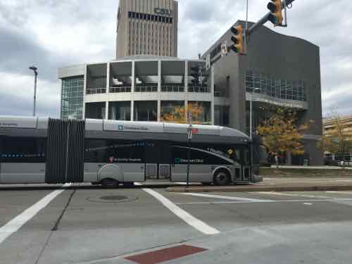
It has paid off handsomely — Cleveland’s Heathline is the highest ranked BRT in the U.S. However, it isn’t ranked high enough to achieve a gold-level rating. In 2014 it got a score of 76/100 — giving it a silver rating. No BRT system in the world has earned the full 100 points, Curitiba’s Green Line ranks second worldwide with a 92/100 score. The highest ranking BRT is in Guadalajara, Mexico with 93/100. Here are some videos on BRT in Guadalajara (Spanish but the visuals are great) & Curitiba.
Let’s take a closer look at the 14 areas where Cleveland’s Healthline missed 24 points:
Off-board fare collection 6/7
Off-board fare collection is one the most important factors in reducing travel time and improving the customer experience. There are presently two basic approaches to off-board fare collection: “Turnstile-controlled,” where passengers pass through a gate, turnstile, or checkpoint upon entering the station where their ticket is verified or fare is deducted, and “proof-of-payment,” where passengers pay at a kiosk and collect a paper ticket that is then checked on board the vehicle by an inspector. Both approaches can significantly reduce delay. Turnstile-controlled is slightly preferred, but proof-of-payment systems on bus routes that extend beyond BRT corridors extend the benefits of time savings to those sections of the bus routes that lie beyond the BRT corridor.
Each station along Cleveland’s Healthline has a fare machine where tickets can be purchased — we mostly opted for day passes because they’re priced at just $5, a roundtrip would be $4.50. Our Metro doesn’t offer day passes.
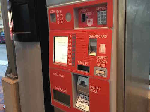
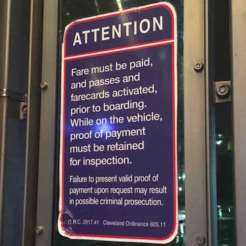
At times I rode the Healthline boarding passengers would enter through the numerous side doors and walk to the front to swipe their cards on the fare box by the driver. Other times my husband tried to swipe his card and the driver said they weren’t worrying about fare collection at that time. I still don’t when a person is expected to go all the way up to the front of the bus to swipe their payment — at least the bus was able to keep moving during the fare parade.
Intersection Treatments 3/6
There are several ways to increase bus speeds at intersections, all of which are aimed at increasing the green-signal time for the bus lane. Forbidding turns across the bus lane and minimizing the number of traffic-signal phases where possible are the most important. Traffic-signal priority, when activated by an approaching BRT vehicle, is useful in lower-frequency systems but less effective than turn prohibitions.
Cleveland allows left turns across the bus-only lane, on left arrow.
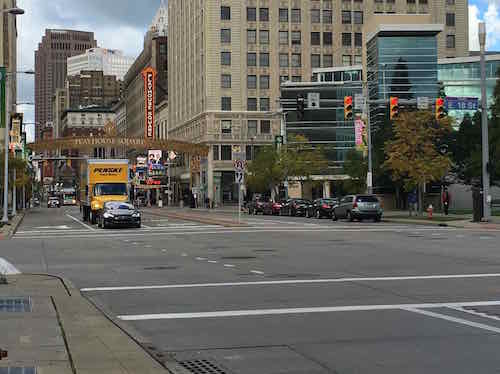
I’m curious how cities handle traffic where left turns aren’t allowed across the bus lane. A prohibition on left turns is very much like street-running light rail.
Peak frequency 1/3
How often the bus comes during peak travel times such as rush hour is a good proxy for quality of service. For BRT to be truly competitive with alternative modes, like the private automobile, passengers need to be confident that their wait times will be short and the next bus will arrive soon.
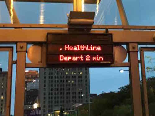
During peak times it is every 5 minutes, which means morning & afternoon weekday rush:
Arriving every 5 minutes during morning and afternoon weekday rush hours, and providing service in 10, 15, 20 and 30 minute increments during other hours, the HealthLine offers service 24 hours a day, 7 days a week.
Off-peak frequency 0/2
As with peak frequency, how often the bus comes during off-peak travel times is a good proxy for quality of service.
The RTA website says during off-peal it operates every 8-15 minutes, but as the quote above indicates, it is actually 10-30 minutes off-peak.
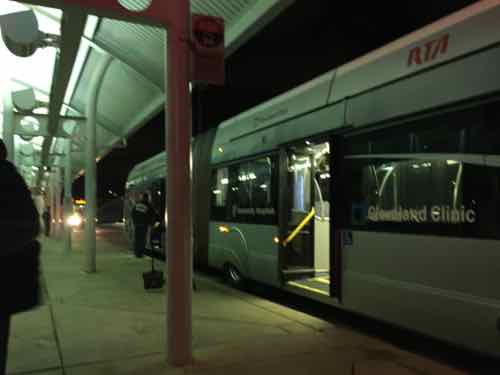
I was impressed the Healthline operates 24/7.
Express, Limited, and Local Services 0/3
One of the most important ways that mass-transit systems increase operating speeds and reduce passenger travel times is by providing limited and express services. While local services stop at every station, limited services skip lower-demand stations and stop only at major stations that have higher passenger demand. Express services often collect passengers at stops at one end of the corridor, travel along much of the corridor without stopping, and drop passengers off at the other end.
Infrastructure necessary for the inclusion of express, limited, and local BRT services is captured in other scoring metrics.
Cleveland didn’t design their system for Express or Limited service. Like regular bus routes, it doesn’t stop at a station unless someone wants to board or de-board. Still it can take a while to travel from end to end.
Multi-corridor network 1/2
Ideally, BRT should include multiple corridors that intersect and form a network, as this expands travel options for passengers and makes the system more viable as a whole. When designing a new system, some anticipation of future corridors is useful to ensure the designs will be compatible with later developments. For this reason, a long-term plan is recognized, with an emphasis on near-term connectivity through either BRT services or infrastructure.
Not sure why they received 1/2 points.
Passing lanes at stations 2/4
Passing lanes at station stops are critical to allow both express and local services. They also allow stations to accommodate a high volume of buses without getting congested with buses backed up waiting to enter. While more difficult to justify in low-demand systems, passing lanes are a good investment, yielding considerable passenger travel-time savings and allowing for flexibility as the system grows.
Again, they didn’t plan for Express & Limited — but they do have some points where one bus can pass by another,
Minimizing bus emissions 2/3
Bus tailpipe emissions are typically a large source of urban air pollution. Especially at risk are bus passengers and people living or working near roadsides. In general, the pollutant emissions of highest concern from urban buses are particulate matter (PM) and nitrogen oxides (NOx). Minimizing these emissions is critical to the health of both passengers and the general urban population.
The primary determinant of tailpipe emission levels is the stringency of governments’ emissions standards. While some fuels, like natural gas, tend to produce lower emissions, new emission controls have enabled even diesel buses to meet extremely clean standards. However, “clean” fuels do not guarantee low emissions of all pollutants. As a result, our scoring is based on certified emissions standards rather than fuel type.
Over the last two decades, the European Union and the United States have adopted a series of progressively tighter emissions standards that are being used for this scoring system. Buses must be in compliance with Euro VI and U.S. 2010 emission standards to receive 3 points. These standards result in extremely low emissions of both PM and NOx. For diesel vehicles, these standards require the use of PM traps, ultra-low-sulfur diesel fuel, and selective catalytic reduction. To receive two points, buses need to be certified to Euro IV or V with PM traps (note: 50 ppm sulfur diesel fuel or lower is required for PM traps to function effectively).
Vehicles certified to the Euro IV and V standards that do not require traps emit twice as much PM as vehicles meeting more recent standards. Therefore, these vehicles are awarded one point. Ideally, buses will include contractually stipulated requirements in the purchase order to control real-world NOx emissions from buses in use, because the actual NOx emissions from urban buses certified to Euro IV and V have been tested at levels substantially higher than certified levels. Because that is hard to verify, it is included as a recommendation, but not as a requirement, for receiving the one point. Zero points are awarded for U.S. 2004 and Euro III standards and less stringent standards, because these standards allow ten times as much PM emissions as the U.S. 2010 and Euro VI standards.
Buses also generate greenhouse gas emissions. Since no clear regulatory framework exists that requires bus manufacturers to meet specific greenhouse-gas emission targets or fuel-efficiency standards, there is no obvious way to identify a fuel-efficient bus by vehicle type. For CO2 impacts, we recommend the use of the TEEMP model, which incorporates the BRT Standard into a broader assessment of project-specific CO2 impacts.
Emissions is one area where rail (streetcars, light rail) is superior to diesel busses.
Stations set back from intersections 1/3
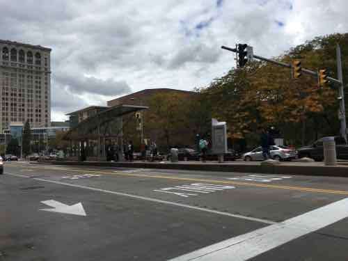
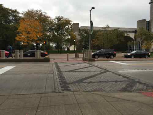
Stations should be located at minimum 26 meters (85 feet), but ideally 40 meters (130 feet), from intersections to avoid delays. When stations are located just beyond the intersection, delays can be caused when passengers take a long time to board or alight and the docked bus blocks others from pulling through the intersection. If stations are located just before an intersection, the traffic signal can delay buses from moving from the station and thus not allow other buses to pull in. The risk of conflict remains acute, particularly as frequency increases. Separating the stations from the intersections is critical to mitigating these problems.
Cleveland’s Healthline has a variety of station types, but most are near intersections.
Center stations 1/2
Having a single station serving both directions of the BRT system makes transfers between the two directions easier and more convenient—something that becomes more important as the BRT network expands. It also tends to reduce construction costs and minimize the necessary right-of-way. In some cases, stations may be centrally aligned but split into two—called split stations, with each station housing a particular direction of the BRT system. If a physical connection between the two directions is not provided, fewer points are awarded. Bi-lateral stations (those that, while in the central verge, are curb-aligned) get no points.
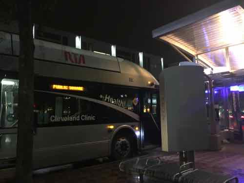
The stations on the East end aren’t in the center.
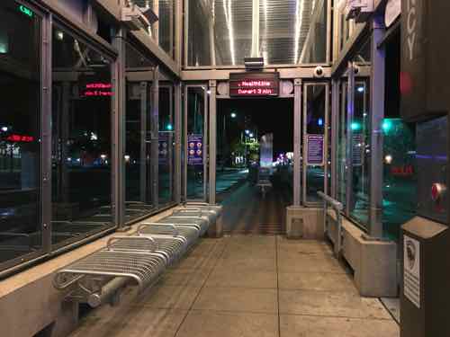
Sliding doors in BRT stations 0/1
Sliding doors where passengers get on and off the buses inside the stations improve the quality of the station environment, reduce the risk of accidents, protect passengers from the weather, and prevent pedestrians from entering the station in unauthorized locations.
Integration with other public transport 1/3
When a BRT system is built in a city, a functioning public transport network often already exists, be it rail, bus, or minibus. The BRT system should integrate into the rest of the public transport network. There are two components to BRT integration:
- Physical transfer points: Physical transfer points should minimize walking between modes, be well-sized, and not require passengers to exit one system and enter another;
- Fare payment: The fare system should be integrated so that one fare card may be used for all modes.
Very little observed integration.
Secure bicycle parking 1/2
The provision of bicycle parking at stations is necessary for passengers who wish to use bicycles as feeders to the BRT system. Formal bicycle parking facilities that are secure (either monitored by an attendant or observed by security camera) and weather-protected are more likely to be used by passengers.
Didn’t see any bike parking.
Bicycle lanes 1/2
Bicycle-lane networks integrated with the BRT corridor improve customer access, provide a full set of sustainable travel options, and enhance road safety.
Bicycle lanes should ideally connect major residential areas, commercial centers, schools, and business centers to nearby BRT stations to provide the widest access. All such major destinations within at least two kilometers of a corridor should be connected by a formal cycleway.
Moreover, in most cities, the best BRT corridors are also the most desirable bicycle routes, as they are often the routes with the greatest travel demand. Yet there is a shortage of safe cycling infrastructure on those same corridors. If some accommodation for cyclists is not made, it is possible that cyclists may use the busway. If the busway has not been designed for dual bike and bus use, it is a safety risk for cyclists. Bicycle lanes should be built either within the same corridor or on a nearby parallel street and should be at least 2 meters, for each direction, of unimpeded width.
Didn’t see any bike lanes.
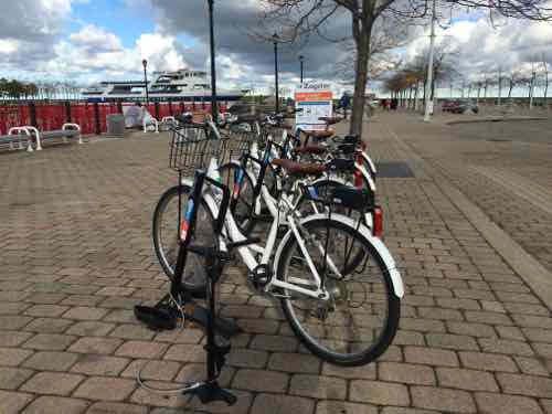
Bicycle-sharing integration 0/1
Having the option to make short trips from the BRT corridor by a shared bicycle is important to providing connectivity to some destinations. Operating costs of providing bus service to the last mile (i.e., feeder buses) are often the highest cost of maintaining a BRT network; thus, providing a low-cost bicycle-sharing alternative to feeders is generally seen as best practice.
Still seeking donations toward the cost of the trip — have raised $200 of the $375 total so far — click here to donate $5, $10, $15 or more.
Next week Part 3 will look at areas of the Healthline’s design & operation I didn’t like.
— Steve Patterson

