Note that two years ago polls were open for 7 days, now the polls are only open for 12 hours — that’s what the vote count is lower now. Of course, these polls aren’t scientific.
I actually think things are improving now — because of the events in 2014. Let me explain, I think many more white folks, like myself, now have a much greater awareness of the problems faced by blacks, browns, & tans. There’s more dialog now about problems and solutions. Awareness…
The percentage of Americans naming “race relations” or “racism” as the most important problem in the U.S. has climbed dramatically to 13%, the highest figure Gallup has recorded since a finding of 15% in 1992, in the midst of the Rodney King verdict. In November, race relations/racism was cited by 1% of the public as the most important problem. (Gallup)
Hopefully today’s youth/Millennials will continue to keep these problems in the spotlight so they’ll get addressed rather than swept under the rug.
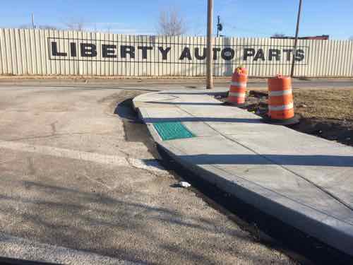
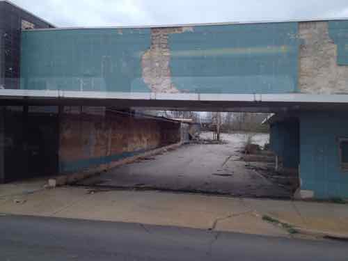
It was recently suggested by former St. Louis Mayor Vince Schoemehl that a new NFL/MLS stadium be built across the river in Illinois. Over the last few years I’ve thought this as well, regular reader & prolific commenter “JZ71” has mentioned several times building a stadium specifically between the approaches to the MLK & Eads bridges. It would be visible from downtown St. Louis and be located adjacent to an existing MetroLink light rail station. I’ve thought that was too tight but knew there’s lots of vacant land there awaiting new use.
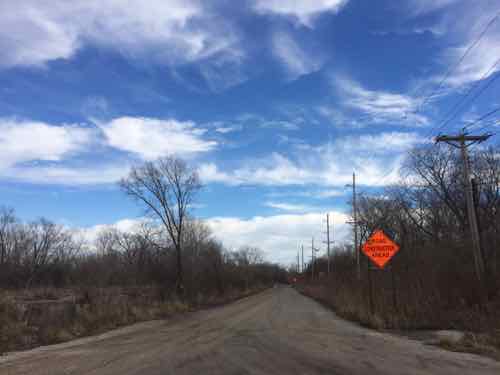
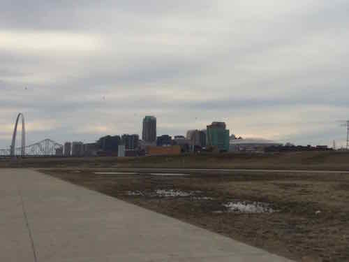
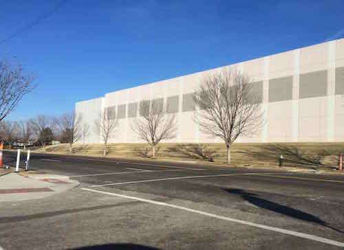
In June I got married at the beautiful Malcolm W. Martin Memorial Park — directly across from the Arch — maybe South of there? Or to the North of the MLK bridge approach? Looking at maps and serial images only gets you so far, so Saturday afternoon I drove around checking out the Metro East riverfront/bottoms.
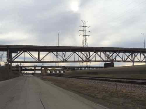
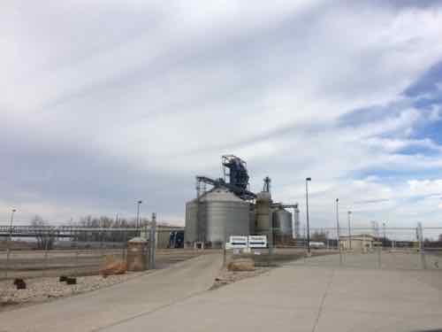
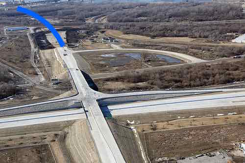
I crossed the river on the Eads Bridge since it was direct, I quickly ruled out the land to the South of the Martin Memorial/geyser because of access issues and future CityArchRiver plans, wildlife, etc. So then I looked at the space between the Eads & MLK approaches — as I suspected it appears way too tight for a stadium with enough buffer to keep the bridges open game days.
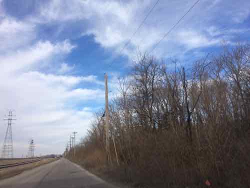
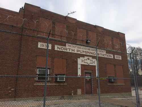
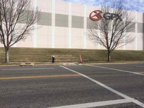
Looking South on Front St with the MLK in the foreground, the Eads in the background, and the Arch to the rightLooking East from Front St, the MLK approach is to the left just out of view, the Eads approach on the right. Great location for a hotel(s) if a stadium were built to the North of the MLKJust North of the MLK bridge approach, the land on the right is mostly vacant of structuresLooking East at a gravel road. More on this later in this post.East St. Louis Police shooting range headPresumably this 80 year old pumping station is still operationalVery quickly the new SMVMB is in view past the leveeIndustry at the end of the road, no access to I-70 or the new bridge — yet.Looking back at St. Louis across the Mississippi River
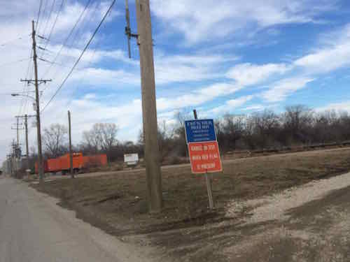
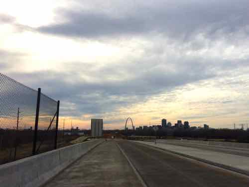
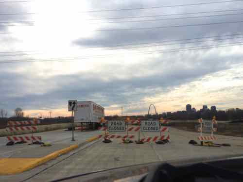
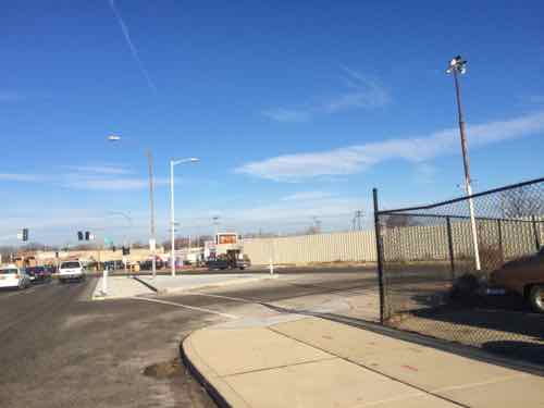
So access here kinda sucks too — but not for long. Since it opened in February 2014 I’ve driven across the new Stan Musial Veterans Memorial Bridge (I-70) many times, but this weekend was my first seeing how it connected to IL Route 3. Later this year will mark 25 years I’ve lived in St. Louis, I know the region pretty well, including the Metro East — but the new I-70 approach to the new bridge is very different than it has been. Connectivity is greatly improved and will get better.
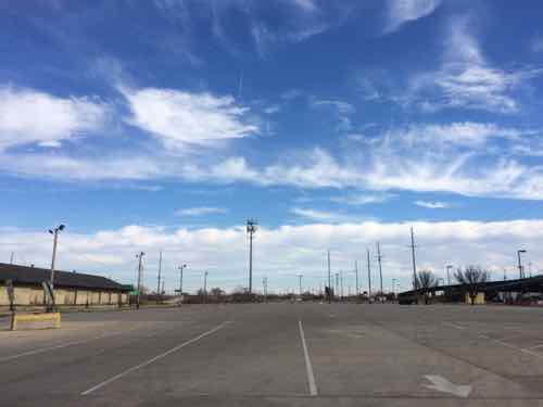
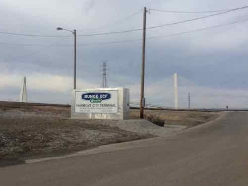
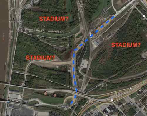
The new I-70/Route 3 interchange has the start of a road heading toward the East St. Louis riverfrontIt’s unfinished but will soon provide easy access to the Casino Queen, Malcolm Martin Memorial, and anything else built here.The blue line marks where the road will continue. Image from the New Bridge gallery, click to view.Aerial shows how the new I-70/iL Route 3 interchange will connect to Riverpark Dr leading Front St. Three potential sites here, the bottom left has good visibility from downtown St. Louis and the other two from the new I-70.
This is within St. Clair County, an analysis of future MetroLink light rail expansion into neighboring Madison County four of seven possible alignments would pass by to the East along the Route 3 corridor. Additionally transportation officials are working to improve Amtrak speeds between Alton & St. Louis while also considering a new stop in St. Clair County. No historic buildings/districts razed, fewer/no businesses/residents displaced.
A new NFL/MLS stadium, light rail expansion into Madison County, and an Amtrak stop could transform this area and further connect the St. Louis region. Sorry Gov Nixon, Illinois make much more sense!
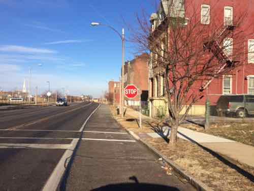
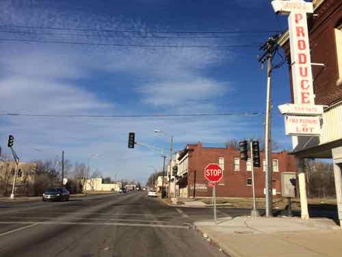
Today is Martin Luther King Jr. Day, and for the 11th year in a row, I’m posting about St. Louis’ Dr. Martin Luther King Dr. (MLK herein). Unlike the past couple of years, this year offers no new projects completed or started. To check out changes I rode the #32 MetroBus on Thursday January 15th — the #32 runs on Cass until it merges with MLK West of Grand. Then on Saturday 1/17 I drove the length of the continuous portion of MLK — from East of Tucker to past the city limits.
This post covers the main changes I saw from last year:
Modifications to ADA ramps, new crosswalks
Buildings being torn down or that may be gone before next year
Signalized intersections now 4-way stops
In the car I started at Tucker, the farthest East MLK is continuous, and headed West past the city limits in the suburb of Wellston.
1) DA Ramps & New Points to Cross MLK
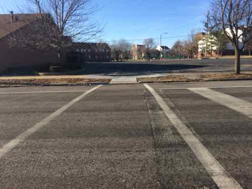
MLK goes through multiple wards, areas built at different period and very different grids. Within the last decade a major traffic calming project on MLK between Jefferson & Grand reduced travel lanes, protected parking lanes, installed new lighting, and replaced sidewalks. As I’ve written before, this multi-million dollar from-scratch project forgot to make any provisions to cross MLK for the mile-long project. Now, years later, this is finally getting corrected as best they can after the fact.
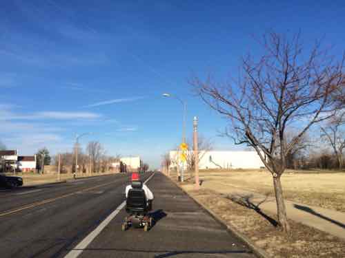
The Jefferson-Grand had the greatest need, but this new work took place from end to end, where needed. These examples from East to West. For those unfamiliar, I often use public transit with a power wheelchair.
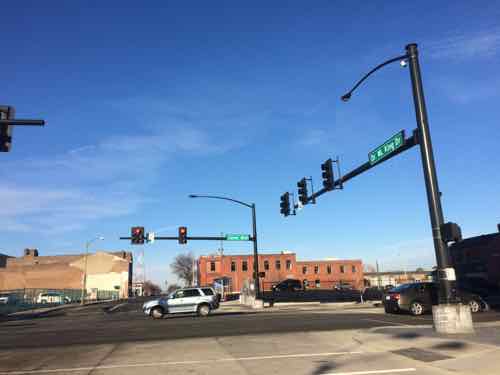
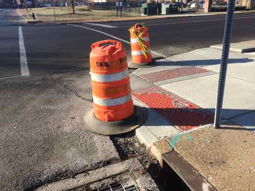
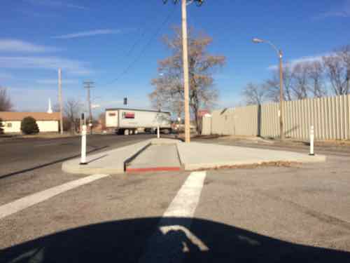
All along MLK Dr I saw evidence of new ramps and crosswalks. Hopefully the city will come back to fill in the asphalt gap — I often need to report these as I encounter them.This new crossing point is at N 22ndAnother view of the same. Lack of crosswalks is often an unintended consequence of street removal to create super blocks.I’ve personally had trouble getting to/from the bus stop on the North side of LeffingwellLooking South-ish at LeffingwellJust West of Glasgow Ave, looking NorthSame new crosswalk, looking SouthNew crosswalk at N Cardinal Ave, has been a 3-way stop for years, just no way to crossI was driving this day but I’m usually in a wheelchair, I first saw this man East of Jefferson and now he’s almost to Cardinal. He’s in the street because the new ramps have those huge gaps that can’t be crossed until filled with asphalt.Where MLK meets Cozens a new channel was created for wheelchair navigation, lacks a point to pass when two meet each other. Sorry for the blurry image.The crosswalk leads to where a new ramp was, based on Google’s aerial, but a newer ramp was build midway between Cozens & MLKSame type of channel to the West where Cass & MLK meet, again no place to meet anyoneMuch further West, at Burd Ave, a needed crosswalk is now completed.
If only the civil engineers had considered the basic idea that pedestrians need to places to cross the street.
2) Demolished or will be
I saw no evidence of buildings removed in the last year, but one was actively being razed and others will likely be razed rather than rehabbed/rebuilt.
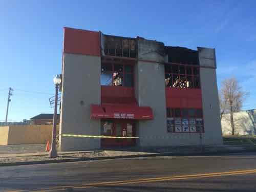
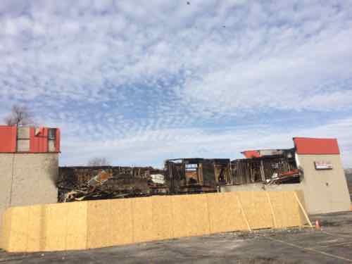
In November 2014 fire destroyed The Hit Zone at 2618 MLK, just West of Jefferson. According to city records he 2-story building was built in 1996. Click image for KSDK story on the fireEast side view of the destroyed bar at 2618 MLK
b
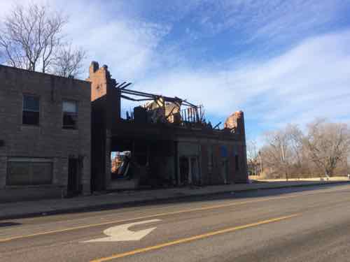
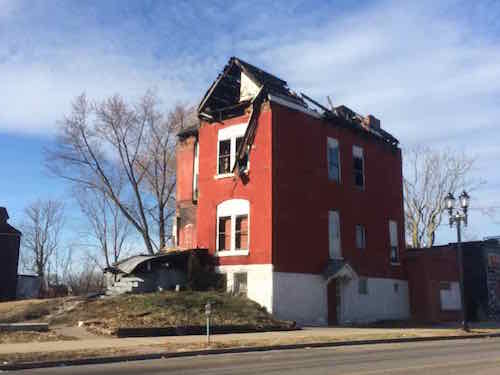
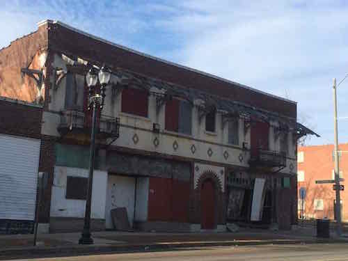
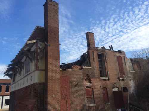
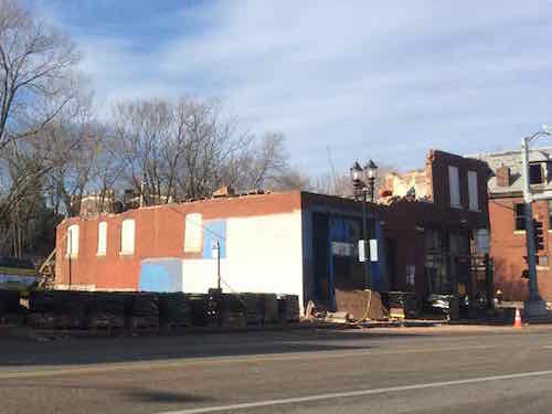
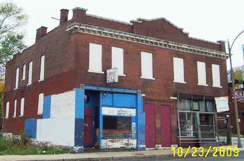
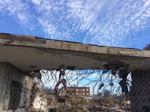
5088 MLK, just West of kingshighway, had a big fire in the fall It was inspected/condemned on 10/30/2-141495 Stewart Pl, built in 1890, was condemned on 12/24/2013 — over a year ago.I’ve been watching 5716 MLK for years, I love the design. After seeing daylight through a side window I drove down the side street (Shawmut) to see the back.Unfortunately the roof has collapsed over the Western half of the building.5746 MLK being razed brick by brick, built in 1907. A city (LRA) propertyOctober 2009, Source: GEO St. LouisLast remains of the State Bank of Wellston, in Wellston. Click image for more informationPassing by on MetroBus, April 2013
Many of these neighborhoods are depressing; lots of poverty, few jobs in the area. I’d imagine many residents would like a way out. Yet, efforts to bring investment and jobs would be labeled as gentrification. Not sure how to change the situation in these neighborhoods, but I don’t like watching them crumble.
3) From Signalized to 4-Way Stop
Two intersections that have traffic signals, now shut off, are 4-way stops.
MLK & Euclid is now a 4-way stop, the signals are turned off.
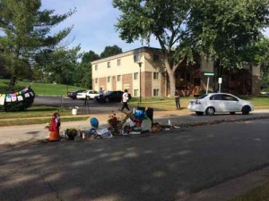
January 18, 2015Featured, Sunday PollComments Off on Sunday Poll: The State Of Race Relations In The St. Louis Region Are…
Please vote in the poll, located in the right sidebar
Tomorrow is Martin Luther King Jr. Day — much has happened in St. Louis since this time last year. The poll today is simple: rate the state of race relations in our region: improving, declining, steady?
The poll is, as always, at the top of the right sidebar. Mobile viewers will need to switch to the desktop layout at the bottom to vote in the poll.
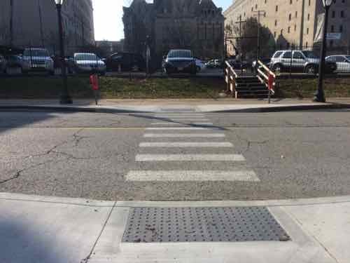
It’s Friday so that means a post with good news. Today’s good news is that the area of Midtown known as Grand Center is beginning to implement some of the improvements from their master plan. The blocks between Grand & Spring are very long — too long. They’d painted crosswalks at midpoints years ago, but these crossing points didn’t work for those of us in wheelchairs. Even the able-bodied could face difficulties with parked cars, motorists not stopping, etc.
So last month I was happy to see a new crossing on Olive between the Nine Network (KETC) and St. Louis Public Radio (KWMU)
The curb gently bows out to narrow the crossing with of Olive. Looking North, the Nine Network on the left, St. Louis Public Radio on the right, the new Media Commons plaza center.Looking the other direction you can see both new ramps built within the parking lane.
In April 2010, while visiting the Pulitzer, I photographed the problem in Grand Center: paint but no ADA ramps, cars able to block the crosswalk. The following was very common in Grand Center so I’m very glad to see it getting addressed!
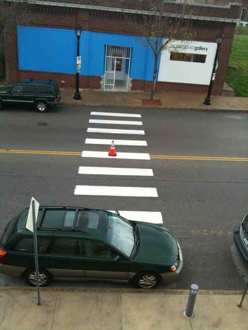
The Subaru wagon is parked in line with other cars. but blocking the crosswalk. No ramp on either end of the crosswalk. April 2010
Pushing the ramps out into the parking lane puts pedestrians where they can look both directions and where motorists can see pedestrians entering the crosswalk so they can stop to let them cross. Tomorrow will be a nice day so get out and take a walk. See you Sunday with a new poll.
AARP Livibility Index
The Livability Index scores neighborhoods and communities across the U.S. for the services and amenities that impact your life the most
Built St. Louis
historic architecture of St. Louis, Missouri – mourning the losses, celebrating the survivors.
Geo St. Louis
a guide to geospatial data about the City of St. Louis