The age you need to be to do many things legally varies from state to state, activity to activity. Take getting a driver’s license — in some states you can get a learner’s permit as young as 14, in others you can’t get a full license until 18 (Source). Today’s poll, however, is about the purchase of tobacco products.
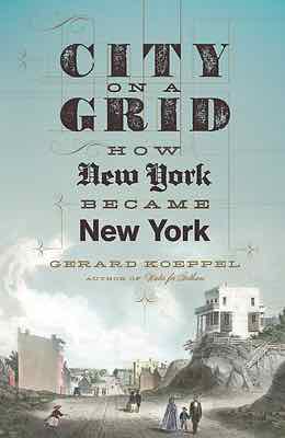
April 8, 2016Books, FeaturedComments Off on Reading: City on a Grid by Gerard Koeppel
Regular readers know I love St. Louis’ street grid — it’s one of the things that drew me here in August 1990. New York was already 150+ years old when St. Louis was founded. St, Louis’ first streets were in a grid pattern, but New York’s weren’t. St. Louis had a population of 1,600 in 1810, but New York City was nearly 120,000 and growing fast.
In 1811 New York City adopted a new grid pattern for the largely rural island of Manhattan. It was unforgiving, no regard for geography. It would be decades before it was completed.
Back in St. Louis, the original riverfront grid gave way to a less organized street pattern as you got away from downtown. The 1876 Great Divorce set the city limits far into rural land – those in the late 19th century didn’t foresee suburban sprawl that would take place in the mid to late 20th century.
You either love it or hate it, but nothing says New York like the street grid of Manhattan. Created in 1811 by a three-man commission featuring headstrong Founding Father Gouverneur Morris, the plan called for a dozen parallel avenues crossing at right angles with many dozens of parallel streets in an unbroken grid. Hills and valleys, streams and ponds, forests and swamps were invisible to the grid; so too were country villages, roads, farms, and estates and generations of property lines. All would disappear as the crosshatch fabric of the grid overspread the island: a heavy greatcoat on the land, the dense undergarment of the future city.
No other grid in Western civilization was so large and uniform as the one ordained in 1811. Not without reason. When the grid plan was announced, New York was just under two hundred years old, an overgrown town at the southern tip of Manhattan, a notorious jumble of streets laid at the whim of landowners. To bring order beyond the chaos—and good real estate to market—the street planning commission came up with a monolithic grid for the rest of the island. Mannahatta—the native “island of hills”—became a place of rectangles, in thousands of blocks on the flattened landscape, and many more thousands of right-angled buildings rising in vertical mimicry.
The Manhattan grid has been called “a disaster” of urban planning and “the most courageous act of prediction in Western civilization.” However one feels about it, the most famous urban design of a living city defines its daily life. This is its story.
What would Manhattan look like today if the 1811 grid hadn’t been adopted? What would St. Louis look like if it had suggested a similar rigid grid?
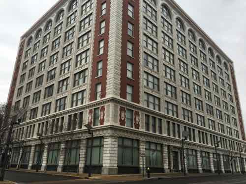
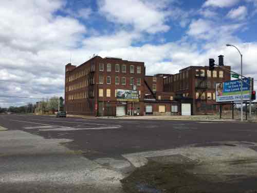
It’s time to stop calling the 9-story building at 1706 Washington Ave the “CPI” building. It has been a few years since the failed portrait studio operator occupied the building. For decades it was known as the Monogram Building, located within the Washington Avenue Historic District on the National Register, here are a couple of quotes from the listing:
The Monogram Building, rising nine stories, is a concrete-frame factory-warehouse extending eight bays on the east, elevation (facing 17th St. and 10 bays on the north (facing Washington). On both elevations, cream colored, glazed terra cotta, fashioned into shells, bound sheaves of wheat, caducei , and -foliated patterns, faces the narrow piers and spandrels which -frame triple windows . The end bays are sheathed in red brick and demarcated by terra cotta quoining. Above the two-story base, there is a foliated, bracketed cornice of terra cotta. The facade terminates with round arches formed bv the piers above the ninth story. A terra cotta cornice crowns the facade.
and…
Rosenthal-Sloan, the “world’s largest millinery establishment,” occupied the Monogram Building at 1700 Washington constructed in 1910.” Numerous other millinery companies occupied quarters within the District and, according to one source, St. Louis was the largest millinery market in the country. ‘ Specialty items, junior dresses, for example, originated on Washington Avenue. Fashion shows were held first yearly and then twice yearly attracting thousands of buyers to the City. Large and small firms alike and the many out of town concerns that maintained offices and showrooms in the district flourished.
Before the Monogram was built in 1910, the site had already made history in St. Louis. Washington University in St. Louis, founded in 1853, opened its first building, Academic Hall, on the site on September 8, 1856. At the time, Lucas Place, now Locust St, was home to the city’s finest mansions.
Following the cholera epidemic and fire in 1849, wealthy citizens became convinced that it was no longer desirable to live in downtown St. Louis. James Lucas and his sister Anne Lucas Hunt soon offered a solution. They developed the idea of the “Place,” a neighborhood with deed restrictions that ensured it remained apart from the city and general population. The main thoroughfare was aptly called Lucas Place. Originally Lucas Place (now Locust Street) extended between 13th and 16th streets when the city limits were just one block to the west between 17th and 18th streets. When established, Lucas Place was west of the developed portion of the city, making it St. Louis’ first “suburban” neighborhood. (Campbell House Museum)
The first mansion, built in 1851, was the Campbell House — the only mansion still standing. The university occupied Academic Hall at 17th & Washington, and other buildings, until moving to its current campus in 1905. By the time the Sanborn Fire Insurance Map Co documented these blocks in February 1909, Academic Hall had already been razed.
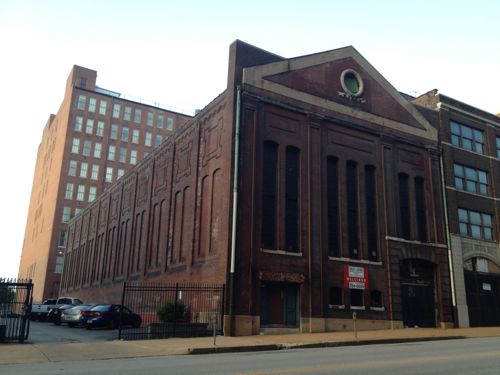
Every building shown in this four block map is gone — except for the streetcar powerhouse circled in purple. The Monogram was built the next year on the site outlined in red. Click image to see larger version.1711 Locust was a power station for the original streetcar system, the Monogram can be seen in the left background
The Monogram Building, built 1910-12, was designed by architect Albert B. Groves (1868-1925). Groves and his family lived at 5419 Maple Ave, built in 1906. There are two entries for him in findagrave.com — here and here. Their son Theron A. Groves was also an architect. Albert died weeks before his 57th birthday, Theron died at 65 — the wife & mother lived to 95!
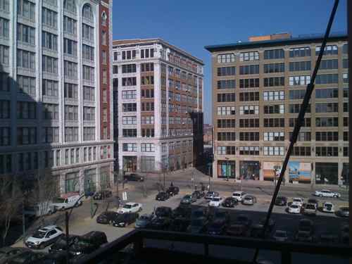
This building is important to me, for 8+ years it has been a significant part of the view from my loft & balcony.
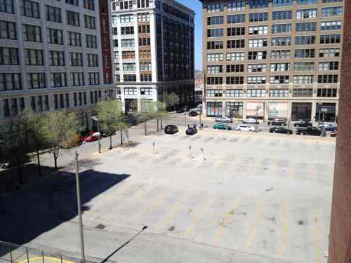
The Monogram is the building on the left in this December 2008 image. In November I posted about how CPI had lights on 24/7, click image to see post. In 2010 I moved my bed to the other bedroom away from the windows and urban light pollution.By May 2014 the frequently full parking lot was empty, but begging to be rented by the hour & month. Click image for post.
The Monogram Building has likely had many occupants over the last century, with a variety os uses. In January it was sold:
Revive Capital Development LLC, of Kansas City, bought the nine-story building from downtown St. Louis property owner David Jump. John Warren, a vice president of commercial real estate company JLL, represented Jump’s 1706 Washington LLC in the sale that closed Monday. No financial terms were revealed.
JLL said Thursday the new owner plans to put loft apartments in the former CPI headquarters at 1706 Washington Avenue. Efforts to reach a Revive representative were unsuccessful. (Post-Dispatch)
Hopefully this new Kansas City firm will be successful. The LLC’s sole listed organizer is real estate attorney Michael D. McKinley, a partner at the law firm Lathrop & Gage.
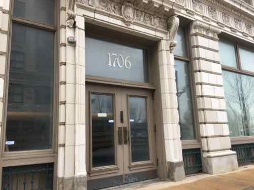
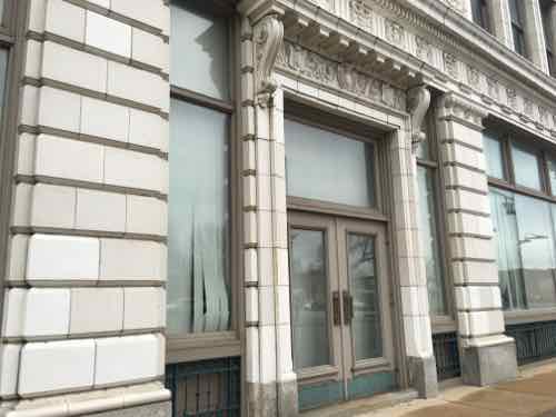
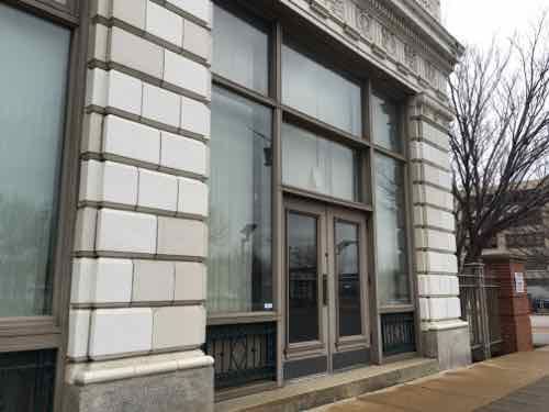
The two detailed facades are 17th (left) and Washington (right)The first (East) entrance facing Washington AveThe next has a small stepThe third has a taller step
It’ll be interesting to see how Revive Capital Development configures the residential units, allocates parking, uses the ground floor. Hopefully one or two of the Washington Ave entrances will be for a restaurant or retail space, with the addition of an ADA-compliant ramp.
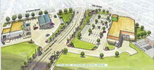
In a December 2011 post, titled Downtown’s New Entrance, I said the following of developer Paul McKee’s plans along the new Tucker coming into downtown from the Stan Musial Veterans Memorial Bridge:
I’m still concerned the new buildings will lack connections to adjacent sidewalks. St. Louis now has a “Complete Streets” policy, but no requirement for adjacent properties to connect. The ADA requires minimal connection but a building can be built and occupied without it, leaving enforcement up to those who complain. If we take McKee, and his consultants, at their word the area will be pedestrian-friendly. My preference, of course, would be a requirement by ordinance. Former 5th Ward Alderman April Ford-Griffin never would initiate such a requirement and I don’t expect any of the three woman running to fill the vacant seat to do so either. The election is December 20th. Good or bad, McKee has the Tucker & Cass area under control. But what about south of Biddle St? The 1986 McDonald’s was just razed and replaced. The new one does have an ADA access route from one of the four streets bordering the property, but it’s still a prototype  best suited for a suburban/rural highway exit.
I used the following graphic/caption in that post:
The following message popped up when I went to save this image from the source”Since we are still in the early design phases of the project, we ask that you please not copy our images yet since these designs are not final.”
New buildings were shown up to the streets, with parking behind — the way we should be things in the center of the region. Someone may drive to work, but it makes walking to lunch, for example, feasible. Constructing new buildings back behind surface parking is typical suburbia — it has no place in the urban core of the region — not minutes from the Central Business District.
Years ago Paul McKee said he wanted to build walkable urbanism — not the drivable suburbia he was known for. Last week he presented a plan for two new buildings, one on each side of Tucker, that are highly suburban in their site planning.
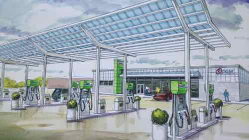
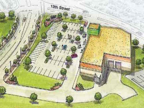
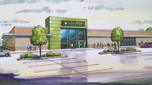
The GreenLeaf Market will be located at 1408 N. 13th St., not far from the Stan Musial Veterans Memorial Bridge. Right across the street, McKee said there will be the ZOOM Store — a gas station, store and car wash.
“We expect the ZOOM Store to open by Thanksgiving and the other market to open by March 1,” McKee said. (St. Louis Public Radio)
The worst-case scenario has come true — McKee is planning to build suburbia within minutes of the central business district. Not the pedestrian & transit-friendly vision he initially communicated.
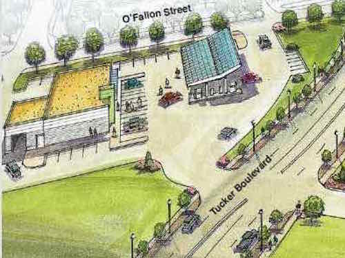
On the left/East is Zoom gas station, and on the right/West is GreenLeaf grocery storeCrop of ZOOM gas station: Pedestrians are shown on the sidewalks, but no route to enter the businessView as motorists drive up to the pumps.Crop of GreenLeaf grocery store. Like the gas station, no route shown for the pedestrians on the Tucker sidewalk to reach the entranceTypical auto-centeric viewpoint
Both would be easy to have a pedestrian access route to a side street — ZOOM to O’Fallon and GreenLeaf to 13th. Technically achieving the bare minimum required by the Americans with Disabilities Act (ADA) is still a long way from being pedestrian-friendly.
I’ve defended McKee’s efforts to build new urbanism in areas such as the 22nd St Parkway interchange, Pruitt-Igoe, and Tucker & Cass. That was based on him indicating his intention to do something positively urban, not ordinary suburban. These first buildings will set the pattern for this area.
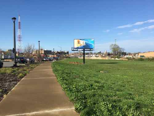
I’ve been visiting & photographing this area since work on the new Tucker began. Here are some images from 2012:
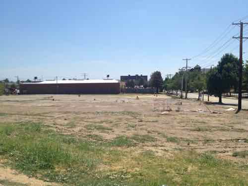
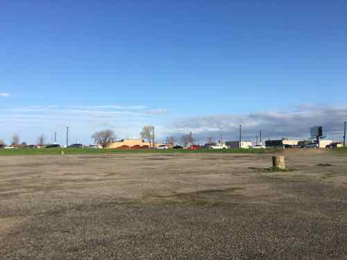
Looking South at the new Tucker from Cass Ave, both sides have large land areas ready for development. July 2012 imageThis land os all North of the proposed grocery store and Cass Ave. How will this be filled in? What route will people who live/work here take to walk to the grocery store? July 2012 imageSite of the proposed gas station, July 2012 image
Last month I went back again:
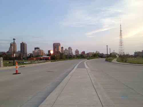
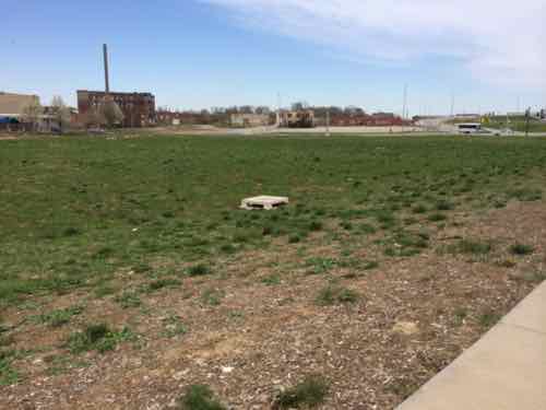
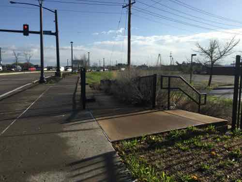
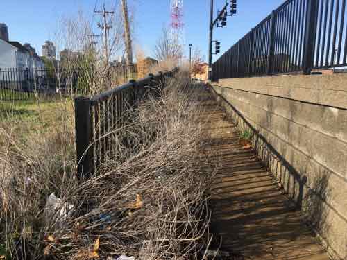
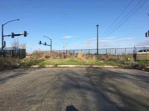
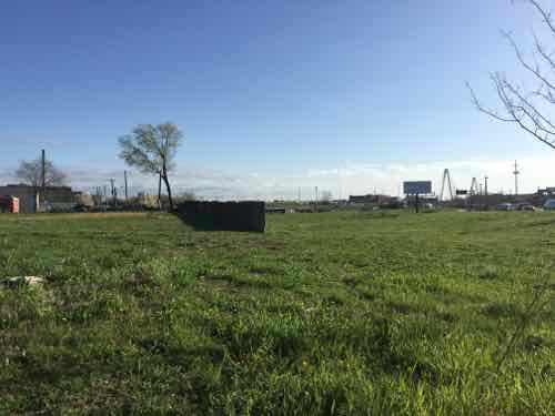
I knew from my earlier visits that O’Fallon St no longer connected to Tucker. Is this to change if the gas station gets built?A ramp that’s too narrow because of plants goes from Tucker down to O’FallonO’Fallon St just currently just ends. Reopening to Tucker would further complicate the traffic intersectionView looking toward Tucker from the site of the proposed gas station.Southbound on Tucker, the grocery store would be built on the right past the billboardView from 13th looking at the proposed grocery store site. The wall is the last bit of the tunnel where the commuter train went under Tucker
How we begin building on these large swaths of land matter, we need to ensure people can walk from building to building in the most direct manner possible — not some circuitous route or through surface parking lots. I’ve already contacted Good Natured Family Farms to tell them I welcome a grocery store — but not in a suburban form.
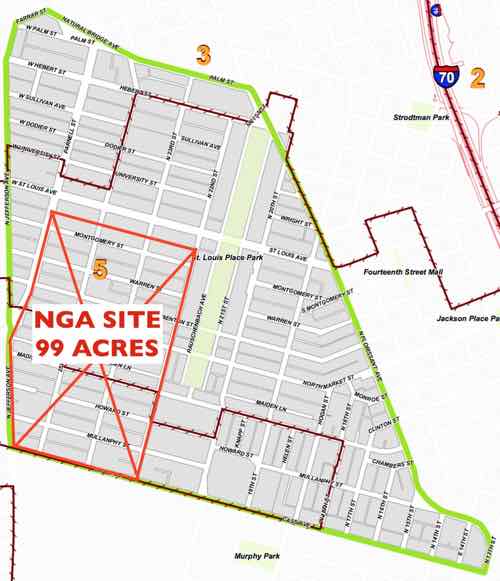
The National Geospatial Agency decided to keep its Western headquarters in the City of St. Louis. The narrative around this decision is summed up nicely here:
The decision means the city will keep 3,100 jobs, currently housed at the Old Arsenal complex south of Anheuser-Busch brewery, and move them to a $1.75 billion development just northwest of downtown. The move is expected to further the city’s pursuit of redeveloping the near North Side with a massive federal anchor — something that could lure more investment to the struggling area, but also give a major boost to nearby Washington Avenue. (Post-Dispatch)
I get the first part — keeping thousands of jobs within the city. I do hear that many of the 3,100 don’t live in the City of St. Louis — they aren’t thrilled about driving to North City. But, it’s the second part that I don’t get — how does putting many acres behind chainlink fencing help those outside the fence?
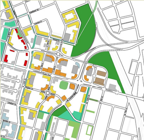
The NGA will take a big chunk of the St. Louis Place neighborhood.
The NGA’s high-security entrance will be facing Jefferson Ave — it’ll turn its back on the remaining neighborhood. The NGA as an anchor institution? Hardly:
Anchor institutions are nonprofit institutions that once established tend not to move location. Emerging trends related to globalization—such as the decline of manufacturing, the rise of the service sector, and a mounting government fiscal crisis—suggest the growing importance of anchor institutions to local economies. Indeed, in many places, these anchor institutions have surpassed traditional manufacturing corporations to become their region’s leading employers. If the economic power of these anchor institutions were more effectively harnessed, they could contribute greatly to community wealth building. The largest and most numerous of such nonprofit anchors are universities and non-profit hospitals (often called “eds and meds”). Over the past two decades, useful lessons have been learned about how to leverage the economic power of universities in particular to produce targeted community benefits. (Source)
Once open, the NGA will be like the current site. Thousands will drive there, do their job, drive home. They won’t be running outside the barbwire fence to grab lunch. An employee living in, say Arnold, isn’t suddenly going to move to the neighborhood. A high-security government spy agency will never be a neighborhood anchor.
Corner pf Jefferson & Cass, April 1, 2016
For those employees driving to work from Arnold, they currently drive 15.8 miles, about 20 minutes or so each way. The new location will be 20 miles, roughly 30 minutes or more. For others, the commute to work will be shorter.
The best we can hope for is its presecence convinces others to consider relocating to the former Pruitt-Igoe site, South across Cass Ave. MetroBus might improve frequency to the area…might.
Jefferson Ave & Cass Ave both need to be updated — fewer & narrower lanes, new sidewalks, crosswalks, etc.
Sadly, our leadership still thinks razing block after block — totally erasing the street grid — is a positive thing to do. Is is 2016 or 1946?
AARP Livibility Index
The Livability Index scores neighborhoods and communities across the U.S. for the services and amenities that impact your life the most
Built St. Louis
historic architecture of St. Louis, Missouri – mourning the losses, celebrating the survivors.
Geo St. Louis
a guide to geospatial data about the City of St. Louis