Regular readers know I have a strong dislike of the interstate highways that were forced through existing dense urban neighborhoods, destroying social networks and dividing neighborhoods. So it’s no surprise I’ve thought about I-64 in Midtown St. Louis for decades.
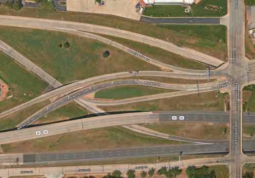
Aerial of the vast area immediately west of Compton. Source: Apple Maps. Click image to view area in Google Maps.
It was August 2021 when I learned MoDOT would be undertaking the huge task of rethinking the stretch of I-64 between Jefferson and Kingshighway. Nine months later, in May 2022, the Future 64 planning project finally went public:
The I-64 Corridor between Kingshighway and Jefferson is an essential route for homes, schools, and businesses. The Missouri Department of Transportation (MoDOT) is working with the community to determine the future of the corridor in terms of needs and desired outcomes. Before MoDOT makes any improvements to the corridor corridor, it will evaluate the existing conditions of roadways, interchanges, surface streets, and bicycle/pedestrian access.
The method the department is using is formally known as a Planning and Environmental Linkages study or PEL. This PEL study will look at the potential impact future projects will have on the environment, the community, and connectivity in the area. MoDOT is conducting the PEL now so when funding is identified for corridor projects, construction can begin sooner.
The PEL study for the I-64 central corridor is called: Future64: Community. Transportation. Together. The title reflects the importance of public engagement and community involvement in this process. As a result, this study will incorporate ongoing engagement that is equitable and inclusive to help ensure that a wide range and extensive number of voices are heard, and that equity is the focus of proposed solutions. (MoDOT/Future64)
So this planning effort is an important milestone.
After the project went public some immediately began posting their ideas, but I’m a little slower in both my analysis and presentation. Now, a year after I began thinking about specifics, I’m ready to share what I’ve come up with — and why.
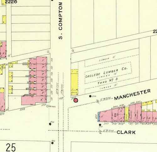
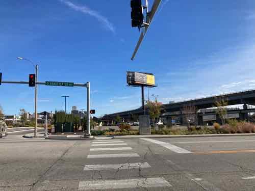
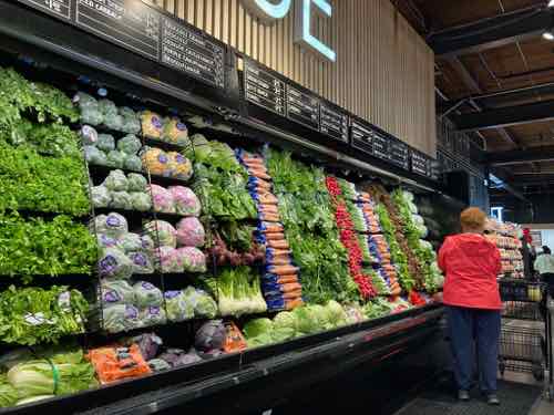
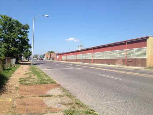
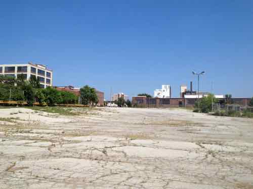
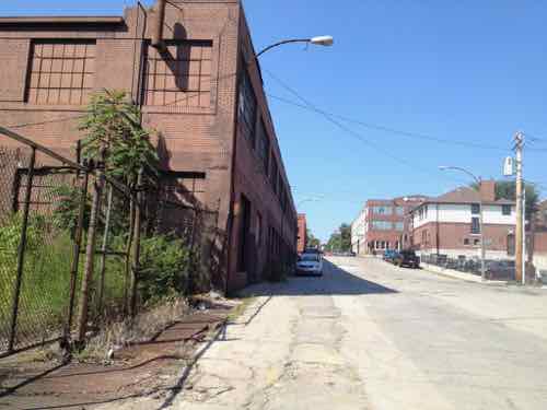
First we need to look back at what the area looked like pre-interstate. In February 1909 if you were heading west on Market and reached Jefferson the main road bent to the left but became Laclede. Market west of Jefferson was a minor residential street. Between Beaumont & Leffingwell the road split again, with Laclede continuing ahead and Manchester off to the left. To repeat: Market briefly became Laclede, which split off to Manchester at a diagonal. Yes, Manchester used to run at a diagonal heading through what later became known as Mill Creek Valley toward downtown.
From the February 1909 Sanborn map we see Manchester, not Market, intersecting with Compton. Click image to see the full page view on the University of Missouri digital library website.
Go ahead, look at a map and visually draw a line between Manchester & Vandeventer and Compton & Market. Because of the many rail lines Manchester wouldn’t have been a straight line, it would have bent to the north of them. My point is a century ago streets continued uninterrupted, but highways/interstates (and industrialization) radically altered the landscape to make life easier for those behind the wheel of those noisy new horseless carriages (shaking cane). It’s possible the Manchester connection was severed prior to the highway but I didn’t want to further delay this post while searching the Post-Dispatch archives for the answer.
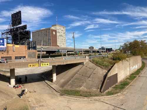
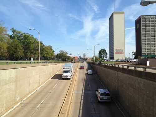
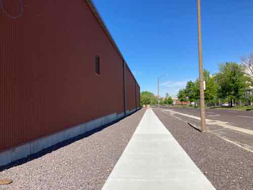
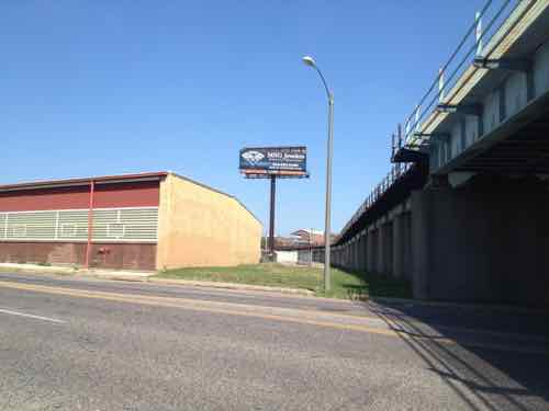
It’s a given that I-64/U.S. 40 will not be removed, or buried in a big dig. What is happening now will determine how it looks and functions for the next 50-70 years. Next we need to list and look at what I see as the problems to solve by changing how the highway and interchanges are currently configured.
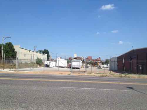
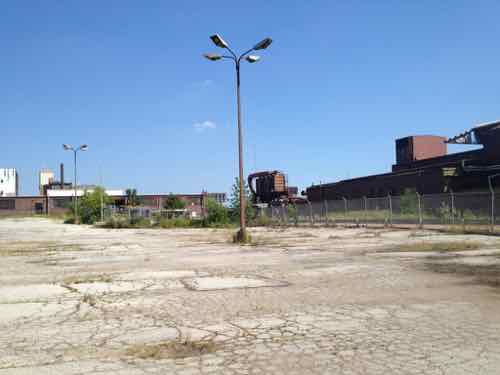
Large amount of land used, wasted
Pedestrian & bicycle navigation of area is challenging, nearly impossible, the local street network decimated
Driving the area is also challenging, with awkward & confusing on/off ramps
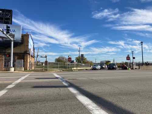
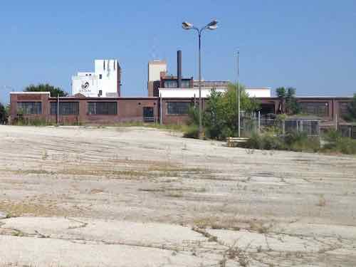
Looking west northwest from Compton & Spruce…if only I had a drone to get video/aerial photosThe Grand exit from eastbound I-64 may have made since in the 1950s/60s but not todayAfter a right right turn back drivers that exited eastbound I-64 are facing west at Grand
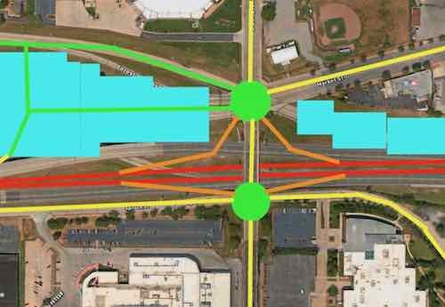
Okay, here’s my proposed solution.
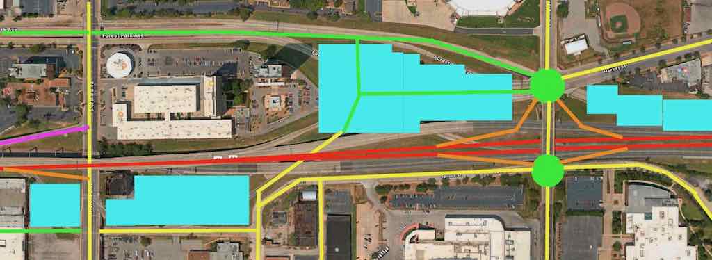
Below I’ll look at this in two sections. Click image to view larger version.
Key:
Yellow: existing streets
Green: new or revised streets
Red: interstate
Purple: existing ramp
Orange: new on/off ramps
Light blue:
Let’s start on the left/west side.
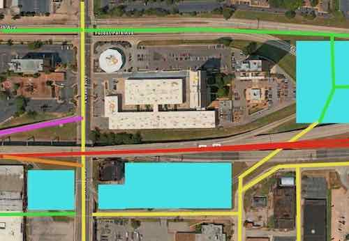
The biggest change from the left is the awkward existing Grand exit from eastbound I-64 has been replaced by a more conventional ramp. Drivers would be going up as they exited, but that would help them slow down. With the current ramp gone the building right at Grand & I-64 could be incorporated into a new development on reclaimed land. I’d also bring Forest Park Ave up to grade at Grand for a more conventional intersection.The new exit would come up to Grand, the light could be moved. If the elevated section is completely replaced it would make this easier. The new eastbound exit would be similar to the one at 14th — just up instead of down.Removing the current exit would free up a lot of land that can be used for new construction near the Grand MetroLink station and the heavily used #70 Grand MetroBus.With Forest Park ducking under Grand the intersection on top is awkward for drivers, bicyclists, and pedestrians. As with Forest Park & Kingshighway, this intersection needs to be at grade and conventional.
Ok, lets move down to the big area to the east.
It makes sense to continue to allow interstate drivers in both directions an exit in this area. but it can be accomplished in a far more compact manner. Specifics below.
The two green circles are roundabouts. Market Street could continue into the center of the newly developed area. Ideally 5+ story building would be built as a terminus to the view when heading west on Market. A new north-south connection through the new development would allow access to Spruce Street and the other parts south of I-64. The eastbound lanes of I-64 would need to be shifted north to give room for the on/off ramps at roundabout at Compton & Spruce. The westbound lanes of I-64 can shift south to free up land for development.
I’m not a traffic/civil engineer so I might not have sufficient room for say acceleration/deceleration on on/off ramps or some other detail, but I think this accomplishes the job of fixing the current problems. It gives more room for development, and increases connections for all modes of travel.
I’d love to see the new development include a variety of residential price points from low income to top market rates, parking available at a rate of less than one space per dwelling unit. It shouldn’t all be expensive housing geared toward college students. Other uses include office, retail, small manufacturing, perhaps business incubator space, etc.
I don’t know that I’ll live long enough to see any changes, but hopefully these ideas will be helpful to the process.
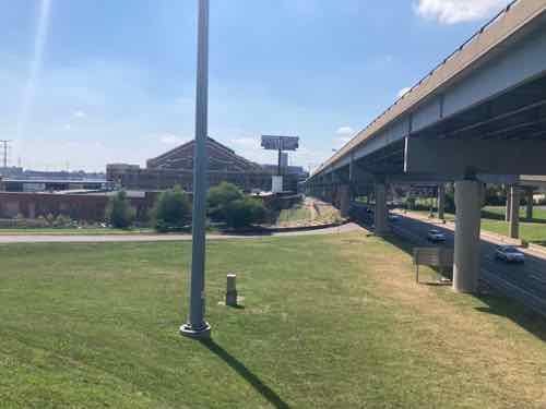
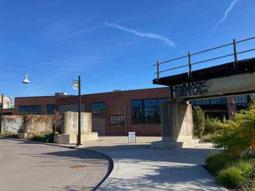
One of my favorite views is seeing the remains of the elevated railroad line.
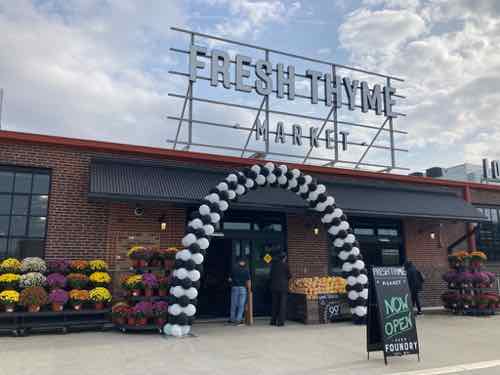
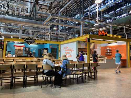
Today’s post is a look at City Foundry St. Louis, a new retail & office development in an old foundry along Forest Park Ave., between Spring and Vandeveter.
Almost 100 years ago, the Century Electric company purchased the Midtown St. Louis property now known as City Foundry STL. At the time, Midtown was a manufacturing hub for the city, thanks to its proximity to the Wabash Railroad line, which cuts across the City Foundry STL Property.
Century Electric was one of the top 3 manufacturers in the city, manufacturing motors and generators that were sold internationally. In fact, Century’s motors helped spark the development of small household appliances.
While the foundry changed owners over the years, and the products produced there changed, one thing did not: nearly 24-hour-a-day work continued on the site until 2007.
Today, this 15-acre site is being reimagined as City Foundry STL, with first-to-the-area makers and merchants moving to the complex. We can’t wait to for you to be a part of the next chapter of this storied creative complex. (City Foundry St. Louis)
First, a definition:
A foundry is a factory that produces metal castings. Metals are cast into shapes by melting them into a liquid, pouring the metal into a mold, and removing the mold material after the metal has solidified as it cools. The most common metals processed are aluminum and cast iron. However, other metals, such as bronze, brass, steel, magnesium, and zinc, are also used to produce castings in foundries. In this process, parts of desired shapes and sizes can be formed. (Wikipedia) [An aside: a segment from a 1997 Simpsons episode comes to mind]
I’ve lived in St. Louis for over 31 years now, but don’t recall the name Century Electric. My memory of the foundry was the smell making automotive brake parts for Federal-Mogul. My post from last month: A Look at City Foundry St. Louis…in August 2013.
The 1909 Sanborn Fire Insurance maps show a few scattered wood frame buildings in this area, not a foundry. City records list four buildings on the site:
Manufacturing 1932: 146,015 square feet
Warehouse 1937: 66,197sf
Warehouse 1953: 38,640sf
Manufacturing 1982: 5,760
Let’s take a look, getting into some history along the way.
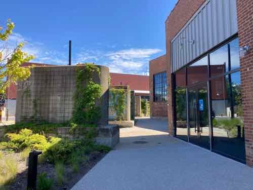
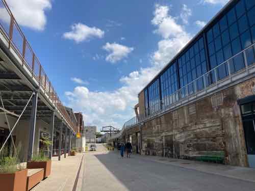
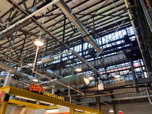
This 2015 photo looking east shows a new intersection on Vandeveter with a driveway for the then-new IKEA.Leaving IKEA we see the low building along Vandeventer no longer exists. My assumption is this was the 1982 building.Looking left we see the intersection of Vandeveter & IKEA Way now includes Foundry Way to the east.Foundry Way would be named Clark Ave if they continued the name from east of Spring Ave. The open land on either side here is for future phases. Sidewalk only on the south side, for now.One of my favorite views is seeing the remains of the elevated railroad line.My 2nd favorite view is toward the left, looking NE. The repetition of old piers the held the railroad tracks is just lovely to my eyes. The bright red wall on the left, not so much.
I wanted to know more about Century Electric so I began scouring the Post-Dispatch archives online via the St. Louis Public Library. Here’s a bit of what I found in a Post-Dispatch article from December 25, 1949, P61:
Century Electric organized 1900, incorporated 1901
first workshop an old church at 1011 Locust
first working motor tested on thanksgiving day 1903 — sold to Rosenthal-Sloan Millinary Co.
products shipped to 90 foreign countries
first to offer repulsion type motor in small sizes
a century motor was in the first successful home refrigerator
manufactures everything except the wire
foundry address is/was 3711 Market Street — before I-64/Hwy 40 went though.
Let’s resume the tour.
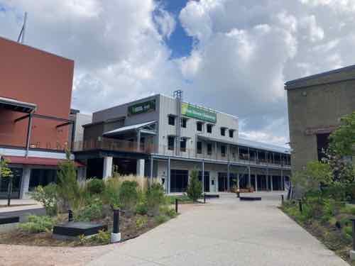
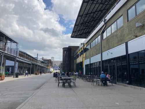
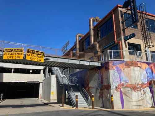
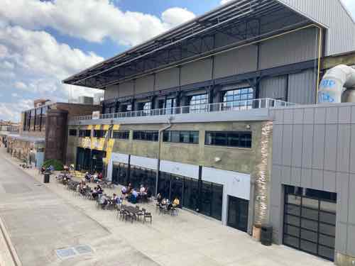
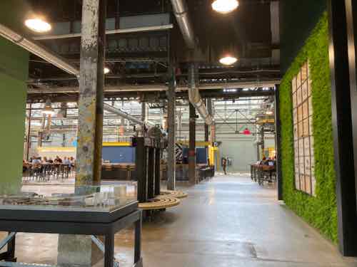
Again, I love the concrete railroad piers. Using them as an element is better & cheaper than removal and dumping in a landfill.Here it begins to open up. The silver metal building is one of two new buildings designed to hide the new multi-level parking garage that was cut into the land between Forest Park Ave and the historic foundry. These new buildings are considered “liner buildings”, shallow structures designed to screen and offer a nicer street view. We’ll visit that upper area later.Now we’re facing east, with the old foundry on the right, new liner buildings hiding the parking on the left.The food hall is the main public attraction in the old foundry building. More on this food destination below.Continuing further east, toward Spring Ave. Old foundry still on the right, liner still on the left.Almost to Spring Ave we get to the 1937 building that houses Fresh Thyme grocery store. You can see the east end of the parking garage.Looking north/uphill along Spring Ave from near I-64 we can see foundry offices that used to front onto Market Street, the foundry, and the SE corner of the building that’s now Fresh Thyme.
Let’s go out to Forest Park Ave and approach from the west.
This approach is the worst, blank wall, no street trees, gravel instead of landscaping.Looking back west, toward Vandeventer Ave.This is the primary pedestrian access from Forest Park Ave., the new garage on the left. Dreary, but at least it’s wide. This brings you in at the upper level, mentioned previously.Looking west, toward IKEA. Again, the vacant land will be for a future phase.Looking southeast we get a good look at the old foundry.
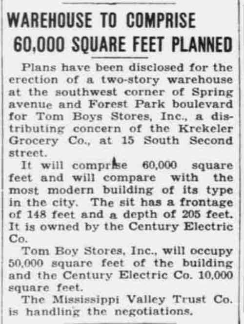
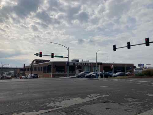
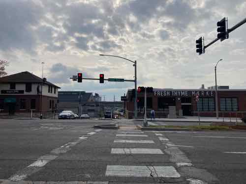
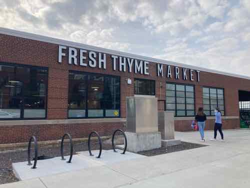
One last exterior area to show you, the building on the SW corner of Forest Park & Spring avenues. It began as the new offices of a local grocery chain, so using it for a new grocery store is very fitting. From the Post-Dispatch July 18, 1937:
This 1937 article announces the construction of a new building to be built for the Tom Boy Stores grocery chain. A few years later I saw it written Tom-Boy and then Tomboy before disappearing in the archives.Looking SW from the opposite corner at Spring & Forest Park avenues. Spring continues down the hill, where we were earlier.Looking south across Forest Park AveIn front, the door isn’t the main entry. I love that a building built for the offices of a grocery chain with late 19th century roots is now used as a grocery store.The main entry is in the west facade, facing the top level of the parking garage. This photo was taken on opening day, 11/10/2021.Looking back north toward Forest Park we see a protected pedestrian route to the right of the yellow bollards. Unfortunately they’ve been filing it with extra shopping carts lately, defeating the purpose.Looking back out toward the parking. New hotel with rooftop bar across the street, in the background.
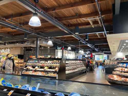
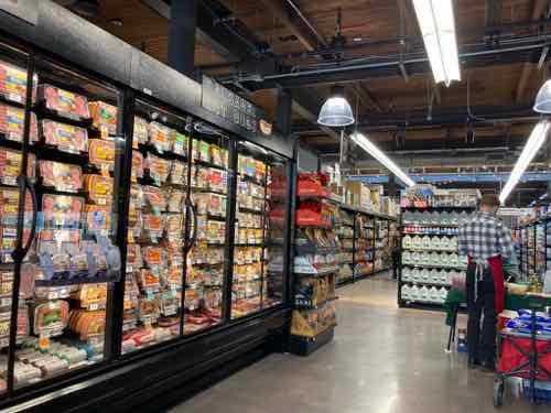
Let’s go inside Fresh Thyme, later we’ll go into the Food Hall.
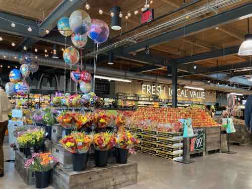
When you enter the main doors, you head to the left.They’re known for having nice produce that’s nicely displayed.I love the old industrial skylight.Inside looking north toward the meat & deli areas.In the NE corner is a seating area, I can imagine Saint Louis University students/staff/faculty walking over here, meeting friends.The compact store is well-stocked, though they don’t yet have sweetened condensed milk.Even checkout is self serve, though there are a lot of employees to help you. Some are for smaller purchases while others are for larger with more area for scanned items.
Fresh Thyme Market has other locations in the region, on both sides of the river. The grocery chain in based in suburban Chicago (Downers Grove, IL). The large chain Meijer is an investor, their nearest location is Springfield IL. So you’ll see some Meijer products on shelves.
On opening day I planned to get a package of Meijer frozen tuna steaks that I priced on the Fresh Thyme’s website (Kirkwood location). At this new location the very same item was 50% more than in Kirkwood. WTF!?! I ask the manager why the price is so much more. The answer was unexpected. The Fresh Thyme Market at City Foundry STL isn’t part of Fresh Thyme’s system, including pricing. Fresh Thyme investor Meijer is a partner on this location, so the pricing is based on that. The manager told me they’d match the significantly better price at checkout. To this day if you do a search on the actual Fresh Thyme website for the nearest location it won’t find the City Foundry location. It’s not on the Meijer website either. Very weird.
Other than the frozen tuna steaks the prices I’ve checked have all been reasonable, their milk price is the best I’ve seen anywhere in the region. We’ve been back numerous times, a welcome new addition. Now if they’ll just stop filling the ADSA-compliant accessible route with extra shopping carts.
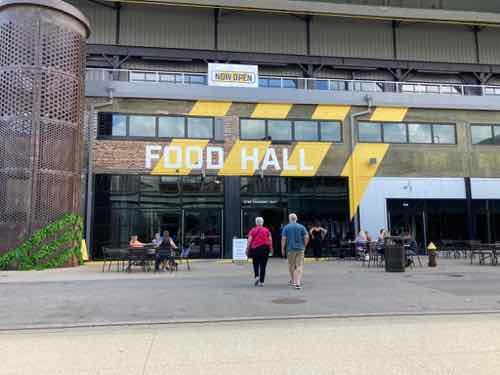
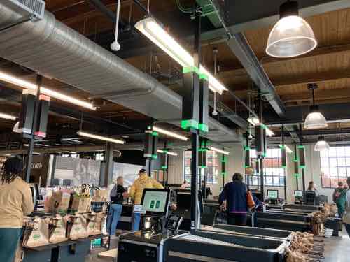
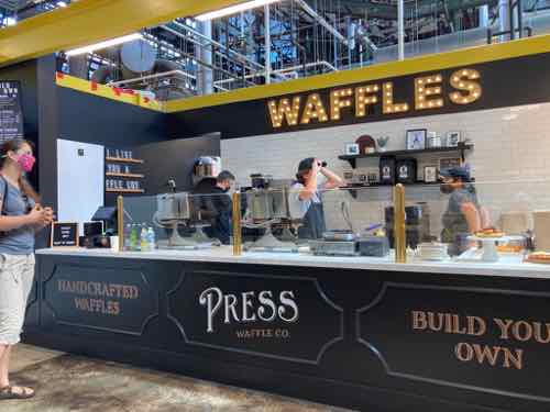
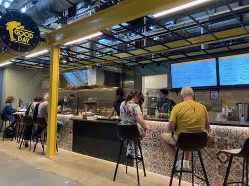
Moving on, let’s visit the Food Hall. First, a food hall is not the same as a food court:
Food halls are usually a collection of small, locally-developed restaurant concepts or outright new creations that come from the minds of local chefs or start-up entrepreneurs and restauranteurs. They offer an assortment of unique food and beverage items that are usually cooked from scratch (prepared from raw ingredients vs. shipped in partially or wholly made) or nearby in a commissary (but still from scratch). On the other hand, food courts are usually filled with national chain restaurants that offer little scratch cooking and little-to-no brand cache.
Food courts will typically feature a cast of usual players like one or two Asian concepts (with one or both of them serving a version of Bourbon chicken), an ice cream place, a pizza place, a burger chain or two, a Latin concept, a hot dog concept, a cheesesteak concept, and maybe a cookie place. The dining options in a food hall are more in line with a collection of food trucksat a food truck park than the food found in a food court, with ethnic favorites like Vietnamese bao buns, Cuban street sandwiches, wine and cheese, Italian sandwich or pasta shop, local ice cream or gelato, chocolatiers, or Napolitano style pizza (vs. Sbarro’s par-cook-n-reheat slices), southern fried chicken sandwiches, and just about anything you can imagine.
Food halls are aesthetically pleasing, often in turn-of-the-century warehouses, train stations, or old mills with high ceilings where the building’s history is partially or mostly preserved. Ponce City Market was originally a Sears & Roebuck distribution warehouse. Chelsea Market in New York was a Nabisco factory where the Oreo was invented. Quincy Market in Boston is one of the oldest food halls in America (it was a food hall before folks started calling them food halls) and sits next to historic Faneuil Hall…it was designed from the beginning (1824-1826) to be a marketplace. In a food hall, the charm of historic significance combines with the unique food offerings and the novelty of reclaimed industrial space to form a city’s social nucleus, while food courts are really little more than uninspired feeding pit stops for mall shoppers.
Food halls are destinations. Retail stores are few and are injected to add interest and shopping-as-entertainment to the food experience, but they must convey a consistent lifestyle “voice” to their visitors. Anthropologie, Lululemon, or Madewell are common national retail supplements. Food courts are designed to keep shoppers shopping so they don’t leave the mall when they get hungry… the food supports the shopping, not the other way around like in a food hall.
Ready?
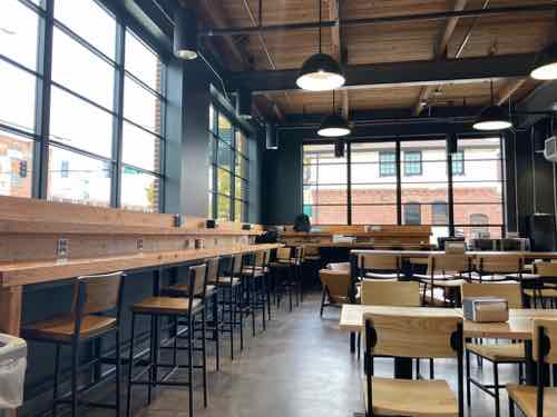
Entry before you get into the main space.The main space is in the heart of the old foundry, very industrial.Tables & chairs are throughout the large space. Vendors have small storefronts.Most vendors are walk up.But a few also offer bar seating. This might not be ADA-compliant because a person in a wheelchair couldn’t eat here, will need to see if they have a provision for that.
Concluding thoughts on City Foundry St. Louis
I was very happy & curious when I first heard the developers planned to keep the old industrial buildings rather than scrape the site clean. Overall I’m pleasantly surprised by how they’ve turned an old dirty industrial site into a retail & office destination. If you haven’t been I recommend visiting.
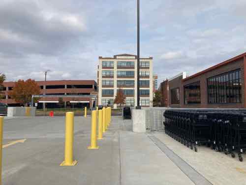
Transit users can take MetroLink to either Grand or Cortex, the nearest bus lines are the 42 & 70.
In August 2013 the vacant brake foundry in Midtown St. Louis, Vandeventer Ave. & Forest Park Ave., was an “eye sore” just south the main campus of Saint Louis University. IKEA’s announcement to build on the opposite side of Vandeventer was still a few months away. I visited the foundry site as best I could in my power wheelchair, taking 9 photos in a 20 minute period.
Before posting about the new City Foundry STL (with food hall, offices, retail space, and recently opened grocery store) I want to take you back to the afternoon of Saturday August 24, 2013:
Looking NE from the west side of Vandeventer, under I-64.A little further north, looking toward Forest Park Ave.Turning east, the rail spur (right) hadn’t been used in decades.Further north, looking east.Now east of Vandevener, looking east along the north side of the foundry site, Forest Park AveFrom the gently-sloping parking lot within the site, looking east.This is a cropped view from the previous image.Into the site a little more, looking SELooking south along Spring Ave, the east boundary of the foundry site.Down the hill, looking back north along Spring Ave. The eastern most foundry building is now on the left.Looking east from IKEA’s 3rd floor restaurant on September 23, 2015 — the day the media was allowed to preview the new store. IKEA’s Opening Day was a week later, September 30, 2015. The foundry site to the east was unchanged more than 2 years after my visit above.
Soon I’ll use these images to compare the foundry to the completely reimagined present. The single-story building along Vandeventer was razed, all other buildings remain today. See amazing before interior photos here.
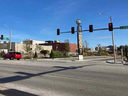
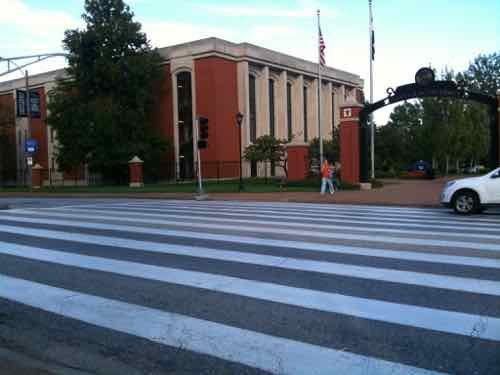
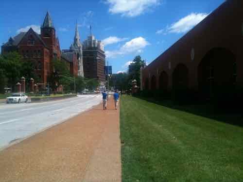
Grand Avenue runs through Saint Louis University’s main campus. It’s very busy because other North-South options like Spring & Theresa were vacated years ago. This means North-South that had 5 options now have 3: Vandeventer, Grand, and Compton. To handled the increased volume, on-street parking was removed. Without having to slow for cars parking, speeds increased. For pedestrians this is dangerous.
Since the city has given away public right-of-way (aka streets) to private property owners for years this problem exists throughout the city. The proposed solution is the same superficial one — decorative crosswalks. The warm & fuzzy element of urban planning.
SLU’s rendering of proposed changes to Grand where West Pine used to be
Here again is what SLU is planning at Lindell, where West Pine used to be, and Laclede:
The project calls for the elimination of one of the three northbound lanes on Grand, which will allow the remaining lanes and the median to be widened. Bollards will also be installed to protect pedestrians who are about to cross the street as well as those who might be standing in the median. The roadway where the crosswalk is, will be changed to a brick-like surface to enhance the look and remind drivers to slow down. (KMOV)
Let’s take a closer look at each element.
Removal of one Northbound travel lane: Reducing the number of travel lanes is good.
Widen the remaining travel lanes & median: While widening the median is ok. increasing the width of travel lanes is the wrong thing to do! Wider lanes means driver’s feel safe at higher speeds. The remaining lanes should either be kept at their current width or reduced if you want to slow vehicles to increase pedestrian safety.
Bollards installed: In this context bollards gov an impression of safety, though they might help since cars will be going even faster on wider lanes.
b
I’ve long been interested in the Grand & formerly West Pine crosswalk. I visited and observed at 4:45pm on Tuesday September 21, 2010 — nearly 8 years ago.
The crosswalk was highly visible to pedestrians & motorists, September 2010
After I observed the crosswalk and took the photo (above) I decided to record what I was witnessing,
Here are the problems I listed at the end of the video:
Signal timing is too long for pedestrians, they get tired of waiting and cross when they can. The timing needs to change so pedestrians can safely cross more frequently.
The pedestrian button, like most in St. Louis, doesn’t do anything. Even the one person who pressed the button crossed before getting the “walk” signal. Eliminate the button or make the signal change quickly once pressed.
The fixes, save for shortening the crossing distance & giving students more space to stand between traffic, won’t make this crossing any safer. It’s possible the dark bricks will be less noticeable to motorists than the white paint. I know from a wheelchair perspective brick crosswalks are highly annoying. Motorists need to slow down before they reach the crosswalk.
Looking North on the East side of Grand, June 2011
One of the big problems is the lack of anything to get motorists to slow down: parked cars, narrow lanes, or — my favorite — street trees. It feels too wide open so motorists feel ok going faster than they should. Other things to do would be rumble strips in the pavement prior to reaching the crosswalk. make traffic stop more frequently during busy times, embed flashing LED lights in the lane markers ,a lighted sign overhead, etc.
Sadly too many are fooled by this region’s superficial efforts to appear to make pedestrian-friendly environments. Here’s the results of the recent non-scioentiofic Sunday Poll:
Q: Agree or disagree: Proposed changes to the crosswalk on Grand South of Lindell will greatly improve safety for pedestrians.
Strongly agree 3 [13.64%]
Agree 3 [13.64%]
Somewhat agree 7 [31.82%]
Neither agree or disagree 2 [9.09%]
Somewhat disagree 2 [9.09%]
Disagree 4 [18.18%]
Strongly disagree 1 [4.55%]
Unsure/No Answer 0 [0%]
This crosswalk will, to most eyes, look better. Aesthetics aside, it won’t perform any better — it might be worse. This is a way for SLU to mitigate damages from a future lawsuit by claiming they made an effort to improve safety. Actual safety is perceived as too inconvenient to motorists.
The NFL has left, but major league soccer (MLS) is interested in St. Louis.
There are at least two potential MLS ownership groups in St. Louis.
They include Foundry St. Louis, which has already identified property at the northwest corner of Chouteau Avenue and Grand Boulevard for stadium development, and MLS2STL, whose representatives are adamant the stadium site should be downtown. (Post-Dispatch)
The downtown site would technically be in Downtown West — just West of Union Station.
So today’s non-scientific poll seeks to figure out where the readership thinks a dedicated soccer stadium is best placed, if at all. There are many pros & cons to both possible locations.
AARP Livibility Index
The Livability Index scores neighborhoods and communities across the U.S. for the services and amenities that impact your life the most
Built St. Louis
historic architecture of St. Louis, Missouri – mourning the losses, celebrating the survivors.
Geo St. Louis
a guide to geospatial data about the City of St. Louis