Home » Planning & Design » Recent Articles:

Metro’s Disconnect With Riders, Pedestrians

On Monday August 20, 2012 the Grand MetroBus stop and Grand MetroLink stations reopened. On the overhead speakers in all stations Metro, speaking in transit jargon, announced the Grand station was open for “revenue service.” Really Metro, revenue service?

From dictionary.com:

jar·gon [jahr-guhn, -gon] noun

1. the language, especially the vocabulary, peculiar to a particular trade, profession, or group: medical jargon.

2. unintelligible or meaningless talk or writing; gibberish.

3. any talk or writing that one does not understand.

4. pidgin.

5. language that is characterized by uncommon or pretentious vocabulary and convoluted syntax and is often vague in meaning.

What’s the big deal, so they used transit agency speak? The use of technical jargon by any business shows it doesn’t know how to communicate with its customers. If they announcement had been that Grand was “open for service” nobody would’ve  thought they didn’t have to pay since they didn’t say “revenue” before service. Metro has problems relating to those of us that use transit, largely because Metro employes drive instead of use transit.

From the joint City/Metro press release:

On Saturday the ribbon cutting was held for the Grand viaduct (bridge). 

WHERE: South end (Chouteau side) of Grand Bridge.

(VIP and media parking will be available off Papin Street.)

The public is encouraged to take the #70 Grand MetroBus or MetroLink to the Grand Station. Parking at the new Grand MetroLink Station Park-Ride lot is also an option. The lot is located at Scott Avenue and Theresa Avenue at the northeast end of the bridge.

At least they mentioned transit after parking. I took transit to the event, but not the #70 MetroBus or MetroLink. I caught the #32 just two blocks east of my loft downtown and it dropped my off right at Grand & Chouteau, much closer than the MetroLink or rerouted #70.
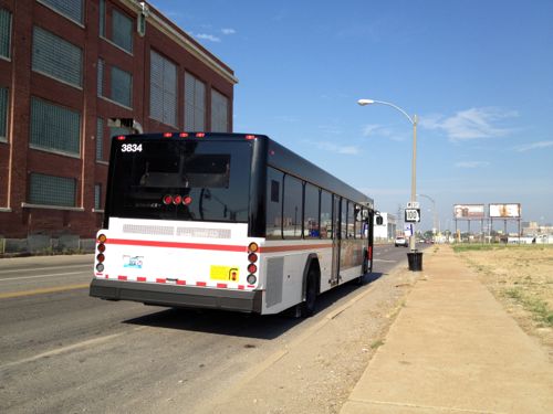
ABOVE: The westbound #32 MetroBus on Chouteau just barely west of Grand. The Pevely bldg is to the left, for now.

But the real problem is how Metro didn’t connect their new work to the city. I’ve already shared this concern with folks from Metro, some who were in agreement with me and others with the attitude that created the disconnect. Let me show you what I’m talking about.
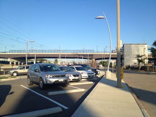
ABOVE: Metro built a small parking lot for the Grand station which included a new sidewalk for the south side of Scott Ave. The other side of Scott Ave doesn’t have a sidewalk at all.
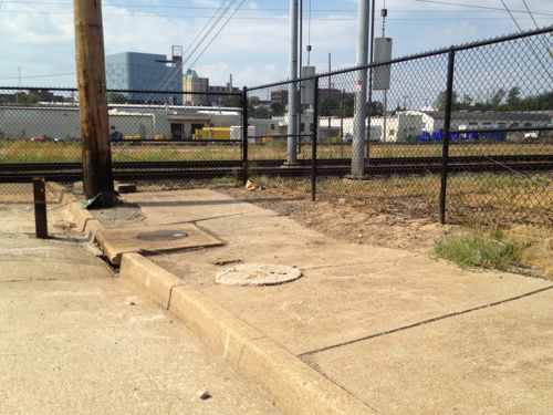
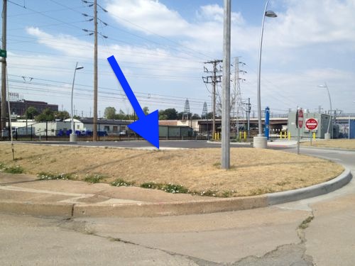
ABOVE: But Metro assumed the only folks that would walk on this sidewalk are going to their car in their parking lot. They changed the grade and didn’t bother to connect the sidewalk so that people, like myself, can cross Scott or Theresa Avenues. One Metro employee said it’s just an employee entrance at the business across the street. WTF!?! If they use transit they’ll be a pedestrian!
ABOVE: The little bit of sidewalk along Theresa next to Metro’s new parking lot is useless anyway. Why wasn’t it removed?

What is there to connect to east of here? Lots actually, including a Metro facility. I doubt those who designed the station, parking lot and sidewalk ever bothered to walk around the area before starting the design. Designers must literally put themselves in the shoes of those that’ll use what they design.
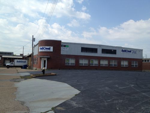
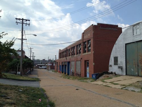
ABOVE: Businesses exist directly east of the station, Metro could’ve helped provide a place for pedestrians rather than force them into the street or walk on grass.
ABOVE: Some buildings are vacant but being so close to a major transit hub should be helpful in getting them occupied.
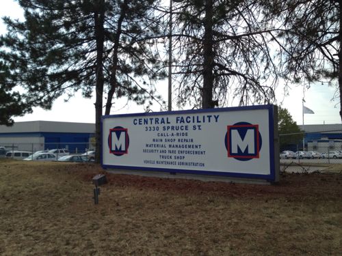
ABOVE: And 4/10th of a mile east is a Metro facility.

I continued on Spruce to Compton. This would be a good route for people going to the Chaifetz Arena, Harris-Stowe and Sigma-Aldrich.

I took lots of pictures and some video at the Grand viaduct/bridge ribbon cutting but I’m not going to show you those. The speakers  all talked about how great it’ll be for pedestrians. True, it’s a massive improvement as I acknowledged here. I’m just furious the most basic/obvious pedestrian connection wasn’t planned for yet again.

To Metro engineers/planners/designers: Transit users are pedestrians when arriving & leaving transit stations. We come from and go in all directions. Able bodied pedestrians take the shortest route — a straight line. This isn’t complicated stuff.

— Steve Patterson
 

A Look At South Broadway Through The Marine Villa Neighborhood

Every city probably has a Broadway; I grew up on Broadway Ave in Oklahoma City, I’ve been to Broadway in NYC and I’ve seen traveled all of Broadway in St. Louis. Correct me if I’m wrong, but Broadway is the only road in the City of St. Louis that crosses the city limits in opposite ends, north and south.

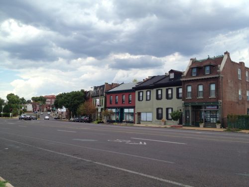
Broadway in St. Louis varies in feel as it curves along following bends in the Mississippi River. To my eye one the mile stretch through the Marine Villa neighborhood is the most interesting. I’d driven, scootered and bicycled this mile stretch of Broadway from Keokuk St. on the south to Cherokee St on the north numerous times in my 22 years in St. Louis but recently I “walked” both sides using my power wheelchair.

Naturally my mind started thinking of ways to revitalize this corridor so this post is a look at the good, the bad, and some of what’s needed. I’ll share some of the 250+ pictures I took on Sunday August 19, 2012.

ABOVE: Broadway heads off to the right just past Keokuk. The intersection of Broadway, Jefferson & Chippewa has been a commercial center since the 19th century.
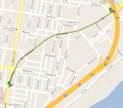
ABOVE: Map of the mile stretch of Broadway through the Marine Villa neighborhood. Click image to view in Google Maps.
ABOVE: Detail of 3812 S. Broadway, built in 1896!
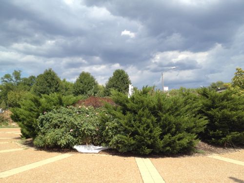
ABOVE: In the wedge where Broadway meets Jefferson at Chippewa is a fountain surrounded by overgrown shrubs. Really? Is this supposed to be positive public space? It looks like it was designed to repel, not attract, people.
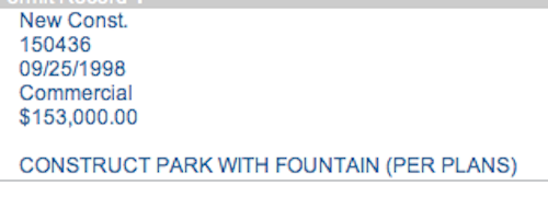
ABOVE: City records show this “park” was built in 1998, after Ald. Craig Schmid had the city buy and raze the existing building.
ABOVE: On weekends many cyclists use S. Broadway
ABOVE: Also in the space between Broadway & Jefferson is a former Hollywood Video store. The suburban parking lot, just behind Schmid Park, was never appropriate at this location.
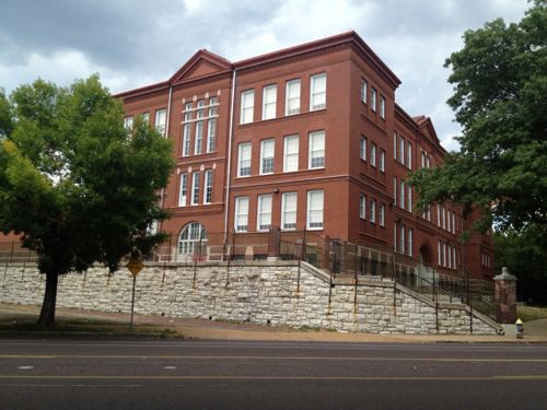
ABOVE: Monroe Elementary School has a prominent position on Broadway at Missouri Ave
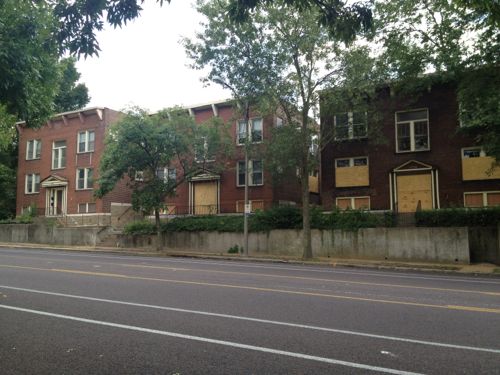
ABOVE: The next stretch of Broadway is mostly residential
ABOVE: But not all are occupied
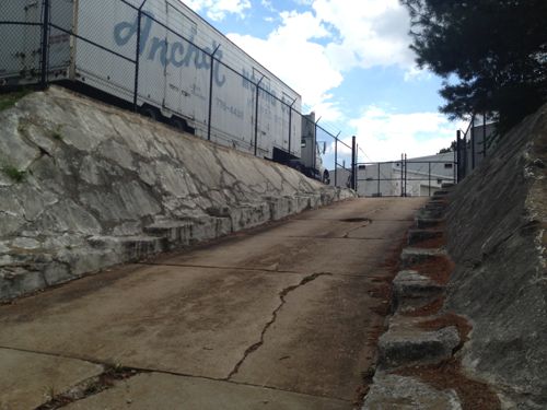
ABOVE: Residential quickly changes to commercial/industrial, entrance to Anchor Moving & Storage,
ABOVE: Parking lot for the school creates a long dead zone, needs buildings again.
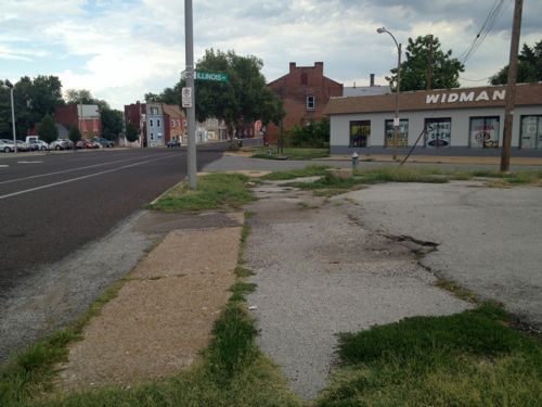
ABOVE: Widman Motorcycles has been a fixture on South Broadway for decades
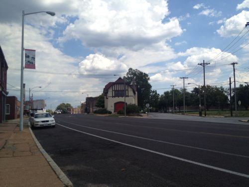
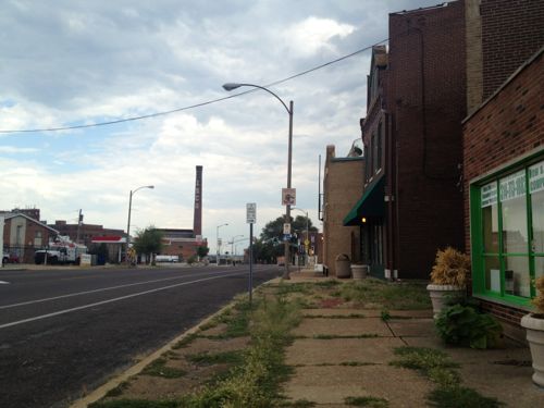
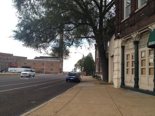
ABOVE: The gentle curve of Broadway creates interesting views
ABOVE: The way the orthogonal street grid intersects with the meandering Broadway creates interesting but awkward intersections.
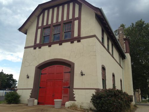
ABOVE: Former fire engine house #3 bounded by Broadway, Miami St & Salina Salena St., owned by the city but leased out to an individual for storage.
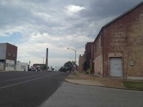
ABOVE: View across Salina Salena St from the old firehouse. City records say this first building was built in 1941 but it must be from the 19th century
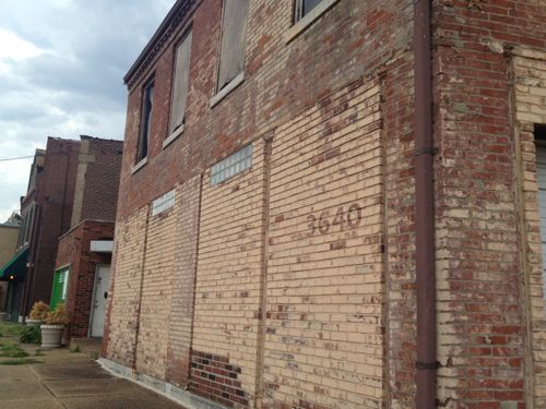
ABOVE: 3640 S. Broadway has seen better days but the barely visible old cast iron storefront is an obvious clue it was built long before 1941.
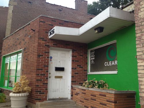
ABOVE: City records are likely right on the building next door, says it was built in 1955
We’re in the other mostly commercial section of S. Broadway in Marine Villa
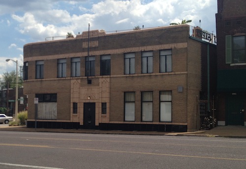
This 6,000+ sq ft doctor’s office & residence was built in 1941. I had the pleasure to tour the building a number of years ago. One of my favorite buildings in St. Louis!
Across Broadway is this 12-unit apartment building built in 1964
Just 5-6 years ago an interesting grouping of a few 4-family buildings existed here, I was talked casually with an investor about buying and rehabbing them. This is where Lemp Ave intersects with Broadway.
ABOVE: The bar/grill in the ground floor of this 1887 building at President St has closed. We have a President St?
ABOVE: The bar may be closed but the residential is occupied. Across the street is the massive former Lemp Brewery complex
ABOVE: A long stretch of the Lemp Brewery property along Broadway is vacant and fenced, perfect for new construction
ABOVE: The Lemp Brewery complex was built over a period of years and thus includes numerous buildings. Click the image for the Lemp Brewery Wikipedia entry
ABOVE: The design of the buildings presents many challenges, including accessibility for the disabled. It’s being marketed as the Lemp Brewery Business Park, click image for website.
ABOVE: Heading south on Broadway the Lemp Brewery complex is the first thing you see as you go under I-55 at Cherokee St.

So what’s my take away? Lots of potential, lots of obstacles. Here are my recommendations, in no particular order:

  1. Undertake a corridor study to take an in-depth look to inform future policy decisions (aka zoning, infill, etc).
  2. Issue an RFP to replace the Schmid fountain and vacant Blockbuster Hollywood Video with a 2-3 story mixed-use structure with urban form, unless #1 above says a park at the intersection of three major streets is a good idea. I can’t imagine that being the case.
  3. In the meantime remove overgrown plantings around the fountain and islands in the area. Replant with low maintenance plants that don’t get so massive.
  4. Create a marketing campaign (brand identity)  for the commercial area where Broadway, Jefferson & Chippewa meet.   Get the name for this area circulated so it becomes recognizable.
  5. Look at curb bulb outs or other treatments to visually narrow the roadway. Alternatively, this might be a good area to place the bike lane between the on-street parking and curb. Perhaps literally narrowing the road is a good idea, it was likely widened in the early 20th century.
  6. Develop a form-based code to guide infill in vacant areas, in particular Lemp & Broadway. A free-standing McDonald’s with double drive-thru wouldn’t be desirable at that corner. But a CVS in a new multi-strory mixed-use urban building would be a nice addition in my view.
  7. Look at the sidewalks, fix areas where broken or missing. Clean off other areas where grass has grown over the sidewalk in other areas. Organize monthly walks up and down the street.
  8. Find a more positive use for the firehouse. Work with the Brewers & Maltster’s Union hall to the south on developing their vacant land between their hall and the firehouse.

I’m sure I’ll have many more thoughts the more I think about it. What are your thoughts? Generally negative (“location, location, location”) don’t offer any value to the dialog, constructive ways to improve the location do.

— Steve Patterson


Five Guys Adds ADA Accessible Route To Reach Former Blockbuster

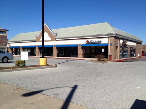
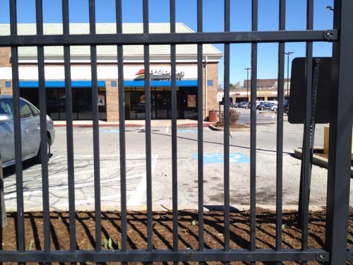
Back in March I photographed the lack of an ADA accessible route from the public sidewalk to the Lindell Marketplace building that once contained a Blockbuster video rental store. For years pedestrians have had to walk in the auto driveway, risking getting hit.

ABOVE: In March 2012 the only access to the building was through the automobile driveway.
ABOVE: The metal fence prevented pedestrians from accessing the building at other points that would be safer than the auto driveway.

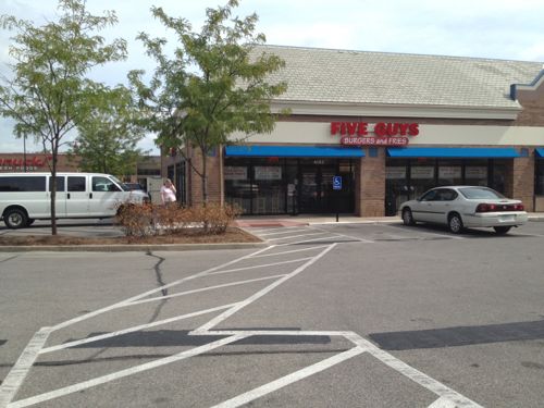
I was pleasantly surprised months later when Five Guys Burgers and Fries opened in the west end of the former Blockbuster — they’d added an ADA accessible route before opening!

ABOVE: New ADA accessible route to Five Guys Burgers and Fries in part of the former Blockbuster space
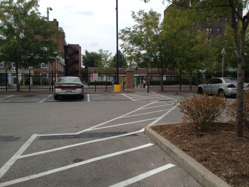
ABOVE: Opposite view looking out toward Lindell.

They had to modify the fence, pour concrete in two places and stripe the route. It was the right thing to do, it’s just refreshing to see it done without having to ask.

And yes, I stopped and had lunch there recently.

— Steve Patterson
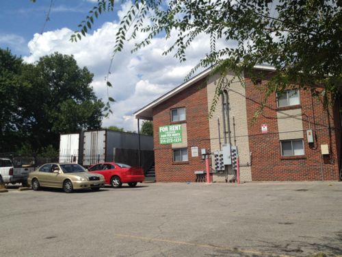
 

Filling In Three Blocks Along North Tucker Boulevard

North Tucker Boulevard has been more urban than it is today. Over the years buildings came down left and right to provide surface parking, mostly for workers at the St. Louis Post-Dispatch. Much of the surface parking is owned by the paper but with hundreds fewer employees the same level of parking is no longer needed. It’s time to rethink north Tucker Blvd!

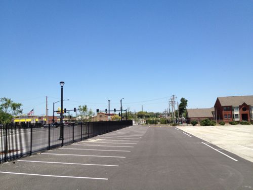
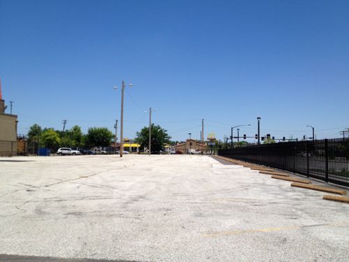
ABOVE: Privately owned parking lot vacant on a Tuesday afternoon (June 5, 2012). NE corner of Tucker Blvd@ Cole St., click image for Google Maps.
ABOVE: Unused parking lot owned by the Post-Dispatch.
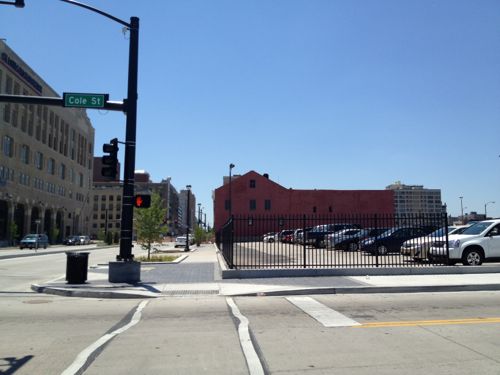
ABOVE: Across Cole St to the south the parking area is partially full on the same day.
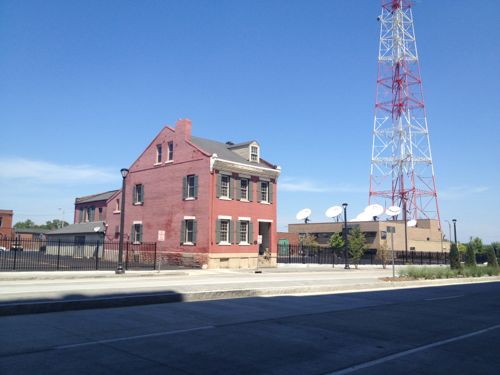
ABOVE: The building at 911 N. Tucker was built in 1890.

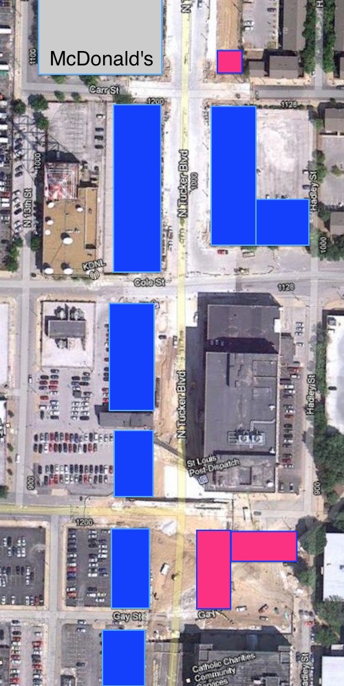
Below I’ve placed blue rectangles on the spots where new buildings could be constructed. The red are harder spots due to small size (Carr St) or a new useless plaza (south end).

ABOVE: Aerial of a few blocks of north Tucker showing locations where infill buildings can easily be constructed (blue) and additional spots where they should be considered (red)

The Carr St on the north to Convention Plaza (Delmar) on the south there are many opportunities to construct infill buildings. At the center is the St. Louis Post-Dispatch.

I can hear the naysayers now, “there’s no demand for new construction here” or “location, location, location.” The new Mississippi River Bridge opens in 2014 and then suddenly this will become a major entry into downtown St. Louis. Now’s the time to start planning so at least one building can be open by 2014. It may very well take 10-20 years to fill in as I’ve shown but this is the first step to getting to that goal.

Remember, 15 years ago naysayers said there was no demand for housing downtown — and they were right — sorta. Those who wanted a hip loft in a walkable downtown had no way as individuals to get what they wanted. A few were marketed but not enough were willing to take the risk — and it was a risk. Then Washington Ave went on a road diet going from 4 travel lanes to two, widening the sidewalks in the process. Through these efforts the area was reinvented and things began to take off.

Storefronts are still vacant but housing occupancy is on par with other areas.  The area of North Tucker Blvd I’m talking about is just a few blocks north of Washington Ave. The new Tucker streetscape is being finished now. It includes provisions for on-street parking in this area so ground-level retail is an option.

Lee Enterprises, owner of the Post-Dispatch, should be talking with developers now. They might get a new parking garage behind new buildings facing Tucker — I’d want the city to prohibit/strongly discourage a parking garage facing Tucker but facing 13th would be ok.

In the block opposite the Post-Dispatch new buildings on each side of 911 N. Tucker should be respectful without copying. Modern would be fine with me, just not a six-story mirrored box.

The opportunity for a “signature” building is on the NW corner of Tucker Blvd. & Cole St.

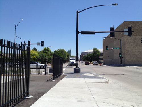
ABOVE: Looking east on Cole St from Tucker Blvd.
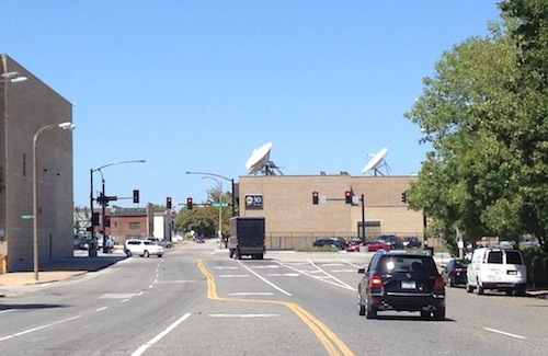
ABOVE: Looking west on Cole St from 11th. A new building on the vacant lot would hide KDNL’s building.

Cole Street has a very wide right-of-way east of Tucker, giving the opportunity for high visibility for pedestrians and motorists heading west on Cole. This is also an opportunity to look at Cole and how to encourage more pedestrians to use Cole to connect parts of downtown and the housing to the north.

Perhaps a CVS or Walgreen’s would locate in the ground floor of one of these buildings on Tucker?  New construction in this area could be exciting, much more so than Ballpark Village.

— Steve Patterson
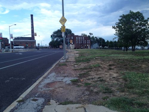
 

On-Street Parking On Washington Ave

Regular readers know I’m a fan of on-street parking. It forms a nice barrier between moving traffic and pedestrians. It also helps up road width. Linear parking is so much better than surface or structured sparking.  A few years back there were efforts by officials to keep the full curb-to-curb width of Washington Ave for moving vehicles. After some battles, parking is permitted on both sides between 10th-11th and the south side from 11th-Tucker (12th). In true St. Louis fashion, this is being addressed block by block rather than a well-planned coordinated effort.

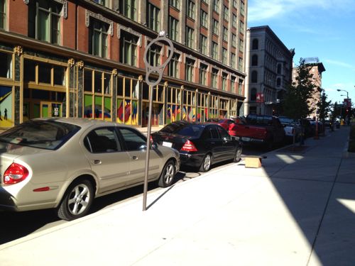
ABOVE: Cars parked on Washington Ave east of 7th Street

The other evening I was pleased to see cars parked on Washington Ave. east of 7th. There are no signs prohibiting parking so it seemed to just happen organically. There’s also no parking meters.

ABOVE: Cars still parked on Washington Ave a couple of hours later.

If retail is going to open and survive on-street parking is a must-have.

— Steve Patterson


Advertisement


[custom-facebook-feed]

Archives

Categories

Advertisement


Subscribe