Home » Planning & Design » Recent Articles:

5th & Missouri MetroLink Station East St. Louis, Illinois

I like East Louis, Illinois. Yes, it has been hit hard by abandonment but, oddly enough, that’s part of it’s appeal. There’s so much to be done!

East St. Louis is a city in St. Clair County, Illinois, United States, directly across the Mississippi River from St. Louis, Missouri in the Metro-East region of Southern Illinois. As of the 2010 census, the city had a total population of 27,006, less than one-third of its peak of 82,366 in 1950. Like many larger industrial cities, it has been severely affected by loss of jobs in the restructuring of the railroad industry and de-industrialization of the Rust Belt in the second half of the 20th century. In 1950 East St. Louis was the 4th largest city in Illinois. (Wikipedia)

Last week I visited the 5th & Missouri MetroLink Station twice (Monday & Thursday). Thursday was for the grand opening of Legends Restaurant & Sports Bar just a half block from the station. I’d met Mayor Alvin Parks before but I was a bit starstruck by Jackie Joyner-Kersee.

So now they’ve got a nice restaurant in downtown East st. Louis, there might be others but not that I’ve seen. Still, the most common elements around the light rail station are parking, vacant buildings and vacant land. Tomorrow I’ll post about the amazing development that’s taken place around the next station east, Emerson Park, but today is about the 5th &  Missouri Station area.
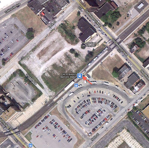
ABOVE:Aerial view of station, the arrow marks the entrance. Click to view in Google Maps

The station opened as part of the original MetroLink line on July 31, 1993, it was the east end of the line. “The station features 322 Park-Ride spaces, including 25 long term spaces.” (Wikipedia). Numerous bus routes serving St. Clair & Madison counties stop at the station.

Access to the platform is via a single point. 5th & Missouri is the intersection at the top of the above map so I’m not exactly sure how that intersection was picked as the name for the station. The railroad right-of-way that was used is equal distance between 5th & 6th, with the entry point facing 6th. The entry to the station is also halfway between Route 15 (Broadway) on the bottom left and Missouri Ave, upper right.
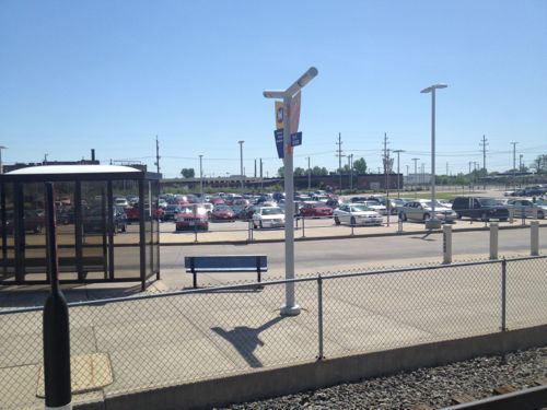
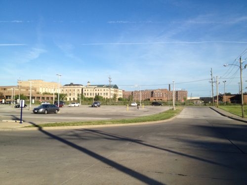
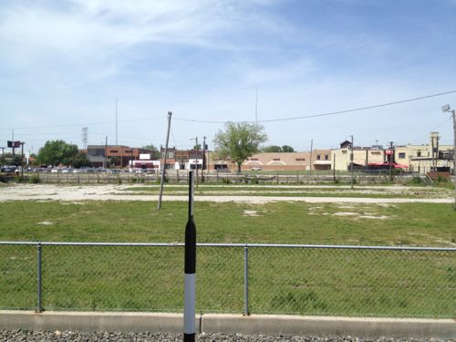
ABOVE: Looking east from the platform
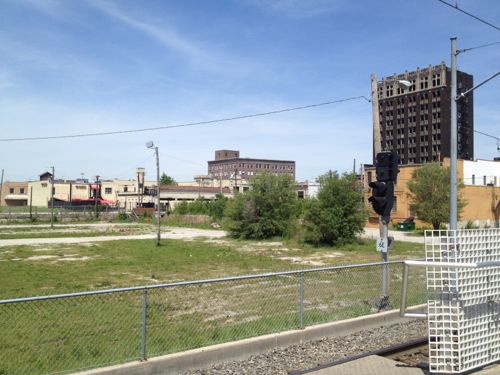
ABOVE: Looking west from the station across the park-and-ride lot
ABOVE: Looking west from the MetroLink platform past N 5th St. to buildings along Collinsville Ave.
ABOVE: Rotating at bit to the right the tall building you see is the Spivey Building at the literal 5th & Missouri.
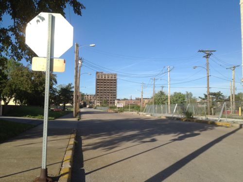
ABOVE: Looking north on N 5th St toward Missouri Ave
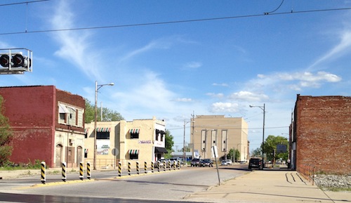
ABOVE: Looking east on Missouri Ave just north of the station. Legends restaurant has the striped awnings on the left

East St. Louis Mayor Alvin Parks and City Manager Deletra Hudson mentioned a downtown plan but I haven’t received a copy after making personal and email requests. Who knows if it’s any good or realistic?  The problems are serious, some beyond their control.

In August 2007, the Federal Emergency Management Agency (FEMA) announced its conclusion that the levees protecting a large area in Southwestern Illinois from flooding no longer meet the agency’s requirements. The result of FEMA’s conclusion is to change Southwestern Illinois’ flood insurance designation as part of its national Flood Map modernization process. FEMA’s actions would classify much of St. Louis’ Metro East as subject to flooding as if the levee system did not exist at all. This conclusion was based on a finding by the U.S. Army Corps of Engineers (USACE) that the agency had “reduced confidence” that the 74-mile levee system could protect against a flood that has a 1% chance of being equaled or exceeded in any single year (commonly referred to as a 100-year flood or a base flood) without the need for flood fighting. As a result, the American Bottom, an area of 174 square miles in Southwestern Illinois that is home to 156,000 people, 4,000 businesses and 56,000 jobs in 25 communities in Madison, St. Clair and Monroe counties, would be declared a Special Flood Hazard Area (SFHA), with dire consequences for our region’s economy. While we continue to dispute FEMA’s conclusion, we must take immediate steps to demonstrate that we can meet FEMA’s standards for flood protection. (The Southwestern Illinois Flood Prevention District Council)

I’m rooting for a comeback in East St. Louis, but the odds are good. Tomorrow I’ll show you a reason to bet on East St. Louis’ success.

– Steve Patterson


Let’s Build Around Light Rail

The title of this post is from the title for an upcoming luncheon:  CMT’s Let’s Build Around Light Rail Luncheon to be held May 8th (ticket deadline April 26th). Guest speaker Katherine Perez is billed as a “national Transit Oriented Development Expert.” Awesome!

When I saw the invitation it got me thinking; “How are we doing at building around light rail?” The original line of our St. Louis MetroLink opened on July 31, 1994 1993, almost 18 19 years ago. I decided to visit two of those original stations that had the most opportunity for new development: Wellston & Rock Road.

Wellston Station

The Wellston Station is located in the very poor St. Louis County municipality of Wellston:

Wellston was incorporated as a city in 1909; due to “government difficulties” the city was dissolved three years later, only to be reestablished in 1949. The city was named for Erastus Wells.

During the early 1900s, the Wagner Electric Company, a manufacturer of small motors for appliances and transformers, began development along Plymouth Avenue in Wellston, growing to occupy the entire block and providing 4,500 jobs during World War I. North of the Wagner site, ABEX Corporation built a steel foundry that began operation in 1923.

In 1982 ABEX moved out of its Wellston location; the next year, the Wagner Electric Company closed its doors. After closure, it took 22 years, and millions of dollars in tax credits and development grants, for the St. Louis County Economic Council to demolish five buildings and clean up 15 acres (6.1 ha) of the Wagner brownfield land along the MetroLink so that it could be made marketable as the Plymouth Industrial Park. (Wikipedia)

An industrial park isn’t the most vibrant idea around transit but when you try to develop formerly toxic industrial land your options are limited, housing isn’t possible. So how’s that going around the Wellston Station? (Aerial)

The station itself isn’t much, two platforms and “243 park and ride spaces” (Source). That’s a lot of parking!

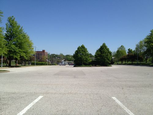
ABOVE: Park and ride lot on Monday April 9, 2012 at 1:39pm
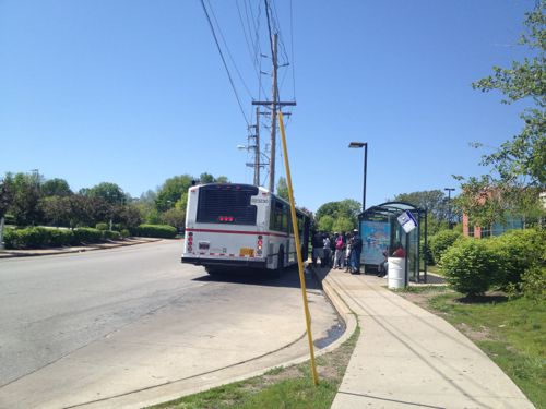
ABOVE: I arrived at the station via the #94 (Page) MetroBus, I got on the bus a block from my downtown loft. At Wellston Station a huge crowd waited to board the westbound bus
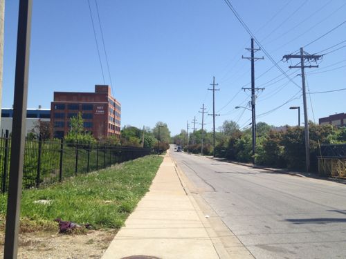
ABOVE: Looking east on Plymouth Ave after crossing the tracks, on the left is the MET Center

In 1994 the Metropolitan Education and Training Center opened in an existing building east of the MetroLink line at 6347 Plymouth Ave:

The MET Center is a strategic partnership created to stimulate the economic self-sufficiency of individuals living in low-income communities of the St. Louis region. The Center seeks to accomplish this mission by delivering focused, comprehensive, and accessible job training, placement, assessment, career development services and transportation services. We serve the underemployed, unemployed, and displaced workers, leading to sustainable work and a competitive regional economy. (MET Center)

Great, how do I get there? Their website says it’s “Centrally Located Near the Metro Link” but under location they offer a link to Metro’s Trip Finder but mostly they give driving directions. Wow, major TOD fail. But the low-income customers they serve know how to find MET.

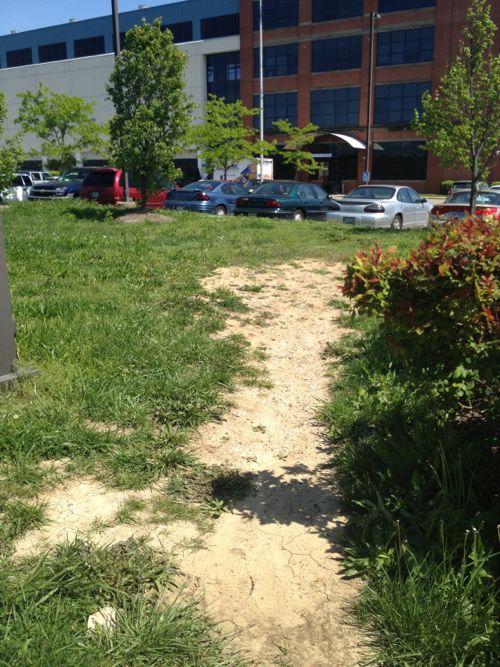
ABOVE: The MET Center doesn't have any route for pedestrians arriving on foot, the facility was designed to be driven to.

So the MET Center failed to grasp the idea of orienting to transit, how about the industrial park?

In order to obtain the state’s oversight and participate in the Missouri Department of Economic Development’s Brownfield Tax Credit program, the St. Louis County Economic Council enrolled the site in Missouri’s Voluntary Cleanup Program in 1997. The tax credits were sold to Ameren Corp. and Allegiant Bank, which earned the project $3.5 million. The site was also funded in part with $1.9 million by an Economic Development Administration grant for remediation and infrastructure and a County Industrial Development Authority loan. (2005 St. Louis Business Journal story)

Big bucks, must be great

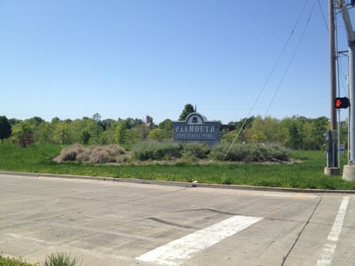
ABOVE: The entrance to the Plymouth Industrial Park along Page
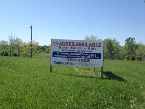
ABOVE: Sign marketing the Plymouth Industrial Park along Page, click image for Clark Properties website
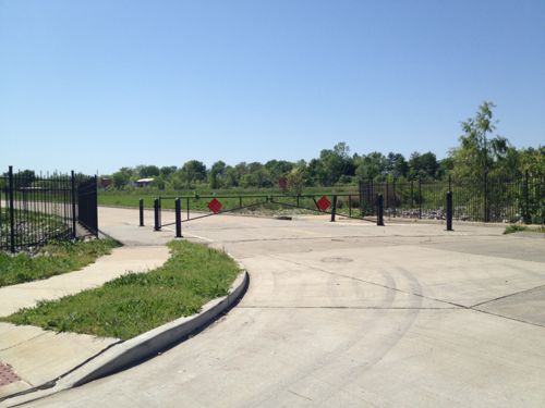
ABOVE: The road is gated off but the sidewalk on the east side of the road is open
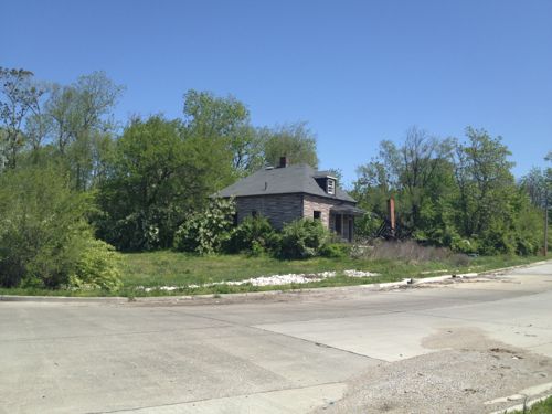
ABOVE: Housing adjacent to the entrance road for Plymouth Industrial
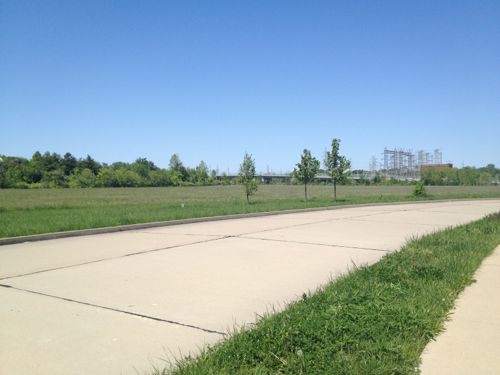
ABOVE: Nothing has been built yet, other than the closed road
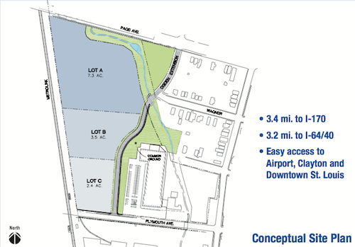
ABOVE: The site plan shows three parcels. Lot C is the nearest the station but a fence prevents true TOD.
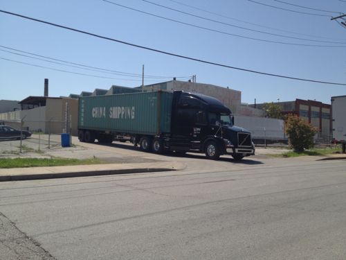
ABOVE: Existing industry across Plymouth from the MET Center does provide some employment but it's not TOD

So not much east of the Wellston MetroLink Station, let’s go west and see if that nearly vacant park and ride lot has spurred development.

… Continue Reading


Peabody Opera House Valets Caught Driving On 14th Street Sidewalk

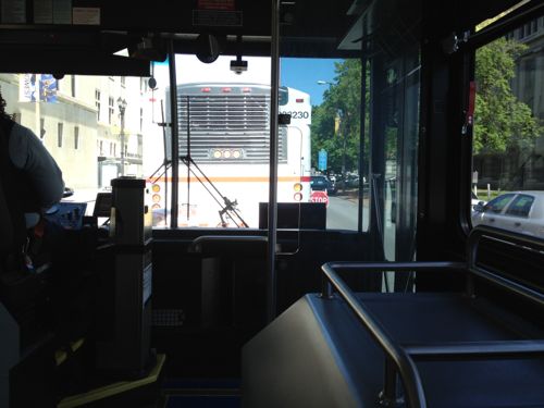
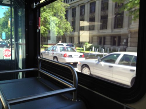
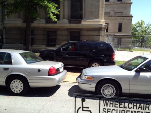
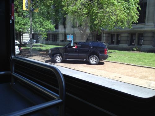
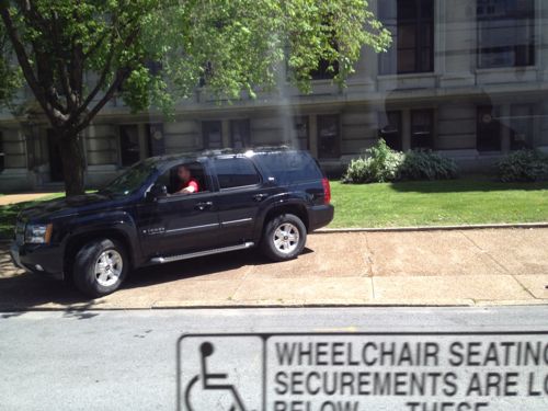
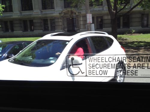
Last Sunday I was heading home on the bus just before 1:30pm in the afternoon. Something big was going on at the Peabody Opera House because traffic was backed up. At first I was happy to see cars weren’t being parked on the east sidewalk along 14th like the previous time I came through the area during an event. But, I was soon shocked — the valets were driving on the sidewalk to park customer’s vehicles diagonally on 14th.  Here are the pictures I got from the bus:

ABOVE: Stopped traffic on 14th, beyond the temporary stop sign you can see cars parked on the road diagonally
ABOVE: Two cars are parked on the road but in the background you can see a vehicle on the sidewalk, it was being driven
ABOVE: I spotted a 2nd vehicle passing the bus on the sidewalk!
ABOVE: Valet about to drive off the sidewalk onto the road
ABOVE: The bus was moving now and we caught up with the sidewalk-driving valets
ABOVE: The 1st vehicle I spotted driving on the sidewalk just after the valet parked it on the road

I posted one of the images to Twitter and Facebook then once home emailed a few to various city officials. I’ll email this post to people at the Peabody. Sidewalks are for pedestrians! They are not overflow parking or private driveways. If I have to sit in my power chair in the middle of that sidewalk  to get this to stop, I will.

– Steve Patterson


Chouteau Needs To Go On A Diet

Chouteau is too fat! Not the late Auguste Chouteau — I’m talking about the avenue named after St. Louis’ founder. Chouteau Ave has four travel lanes plus generous parking lanes, it’s too wide. I couldn’t find the curb-to-curb width but the public right-of-way (PROW) is a massive 80 feet, encompassing the road and adjacent sidewalks.

Recent road diet projects on Grand and Manchester had the number of travel lanes reduced from four to two. I don’t think that’s necessary or even a good idea on Chouteau. It’s not lined with shops, although some do still exist in places. No need to make Chouteau into a low volume shopping street but there is no reason it’s can’t accommodate the current volume of vehicular traffic AND be less hostile to pedestrians.  This takes a corridor study.

Chouteau Ave extends east to the river and west until it becomes Manchester as it crosses Vandeventer, 3.4 miles long.  The far east end isn’t as wide and is located in what will become Chouteau’s Landing. A corridor study should focus on the 3 mile stretch from S. 4th on the east to Vandeventer Ave on the west. The issues are similar end to end but I’ll use examples for the 6/10th of a mile section between Truman Parkway/18th and Jefferson Ave.

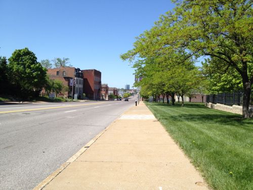
ABOVE: Pedestrians do exist along Chouteau

Chouteau is marked as 35mph, but given the generous widths traffic goes considerably faster.

ABOVE: Looking east on Chouteau Ave

Unlike Gravois and other roads, the right side of the outside lane isn’t marked to separate it from the parking lane. Visually this tells drivers the right lane is more than 20 feet wide compared to the 8-10 feet sufficient for a 35mph road.

ABOVE: Ameren’s green lawn doesn’t make the pedestrian feel less vulnerable

Only in a few areas does anyone park in the parking lane. , most of the time it’s vacant.  Key to calming the traffic speeds is to visually reduce the perceived width of the road. This is accomplished by striping the outside lane and blub outs from the curb so the parking lane isn’t viewed as another travel lane.

ABOVE: At the end of Mississippi Ave bulbs helped provide room for the monument markers

The bulb outs at Mississippi Ave had nothing to do with calming the speeding traffic but providing room for pedestrians to get around the decorative markers. Still, the push out into Chouteau is helpful but one little spot on one side only isn’t enough. Traffic has a clear shot between Truman Parkway and Jefferson, more than a half mile without a signal, stop sign or even a crosswalk. That’s right, if you live on Mississippi Ave in Lafayette Square the only two safe places to cross Chouteau Ave is Jefferson Ave or Truman Parkway.

If I wanted to have lunch at Eleven-Eleven Mississippi I’d get off the bus at the stop were I took the above picture, cross and head up the street right? Wrong. Even the able-bodied risk getting hit by a car trying to cross such a wide street with fast traffic. For me, using a power chair, I’d have to go 2/10th of mile back to Truman Parkway to cross then 2/10th of a mile back to Mississippi Ave. Realistically I’d get off the bus closer to Truman but you get the point — I wouldn’t cross here because it’s too risky. In fact — I couldn’t cross the street because there aren’t any curb cuts to make it possible.

ABOVE: Vin de Set, PW Pizza, etc are popular destinations, causing people to cross Chouteau often

The bulb outs at Mississippi Ave have curb ramps to make it possible to continue parallel with Chouteau Ave. A corridor study of the 3 mile length of Chouteau Ave would identify key points where crosswalks are needed. Those not at intersections, like Mississippi Ave, would have a yellow caution light flashing overhead. In the 6/10th of mile between Truman Parkway and Jefferson Ave I’d suggest two pedestrian crossing points: Mississippi Ave and 22nd Street, this would equally space them 2/10th of a mile apart. Too far apart for a commercial district but adequate for this area.

This came to me recently when I attended an event at the new Sheet Metal Workers hall at Jefferson. Despite all the money spent the sidewalk wasn’t replaced.

ABOVE: Old sidewalk in front of new union hall

I asked Ald Kacie Starr Triplet about this at the event and she said the city will replace the sidewalk when funds are available. The sidewalk does need replacing but we should do so much more. I wouldn’t eliminate the parking lane but use bulbs to create end caps for parking and bus stop areas.

– Steve Patterson
 

Washington University Replacing Occupied Buildings, Leaving Vacant Buildings/Land Vacant

ABOVE: Drawing from a February 2010 Student Life article, click image to view

In February Washington University made a big announcement regarding development in the Delmar Loop:

Washington University plans to remake a central part of the Delmar Loop with an $80 million project consisting of stores and apartments for about 550 students.

The project comprises a four- to six-story building of retail space and apartments on Delmar Boulevard at Eastgate Avenue and three new mid-rise apartment buildings on Enright Avenue nearby. Design work will begin soon, and construction could begin in January 2013 with occupancy in August 2014, university officials said. (STLtoday.com)

Numerous existing buildings will be razed to make room for the new buildings. My first reaction was disapproval, razing occupied structures when vacant land and buildings exist just a short distance to the east. But I wanted to wait to blog about the project until I had a chance to see all the buildings that would be razed and to get a feel for the area. First though I want to talk vacant land and buildings.

East of Skinker

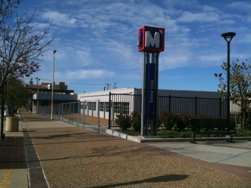
The long closed auto service place located at 6045 Delmar is owned by Quadrangle Management, part of Washington University. The building is the only structure on the block surrounded by Delmar Blvd, Des Peres Ave and Rosedale Ave. This MetroLink station has been open nearly 20 years, I’d hoped this site would be redeveloped years ago.

ABOVE: The closed auto service center was built in 1964. It's adjacent to MetroBus & MetroLink stops. Click image to view in Google Maps.

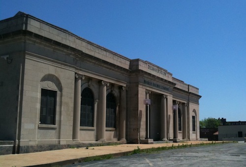
Redevelopment of this site right next to the light rail line and the meeting point for numerous bus lines would be great for the area. The vacant 1928 Wasbash Wabash Station across Des Peres Ave might be renovated and occupied.

ABOVE: Historic Wasbash Wabash Station is owned by Joe Edwards through an LLC. Click image for more information on this station.

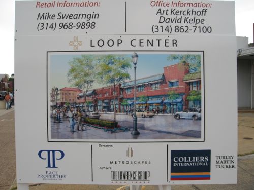
Just to the west of the vacant auto service building is a large parcel of land (6105-23 Delmar) that had been proposed for development in 2006.

ABOVE: Sign for unbuilt "Loop Center" project, April 2006.

The unremarkable structures that existed were razed in 2006 2007 — the land has been vacant since. Neither Washington University or Joe Edwards control this land. Still it just strokes me as wasteful for Washington University to razed occupied buildings when they own an vacant and out of character building right next to a major transit hub. But let’s cross over Skinker and check out what they do plan to replace.

West of Skinker

Let’s take a tour of the site starting with two structures facing Delmar that would be razed then working our way counter-clockwise.

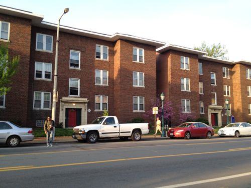
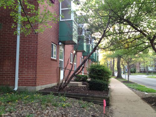
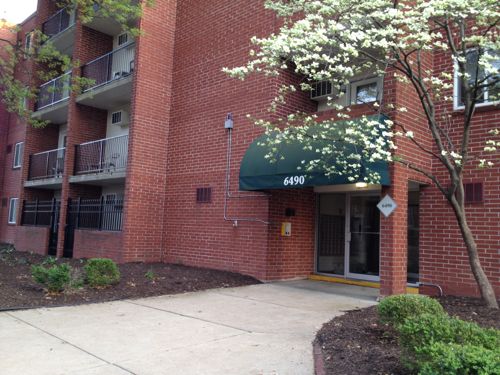
ABOVE: These two apartment buildings from 1928 would be replaced
ABOVE: The vacant lot at Delmar & Eastgate would be developed once again. The building across the street isn't part of the development site
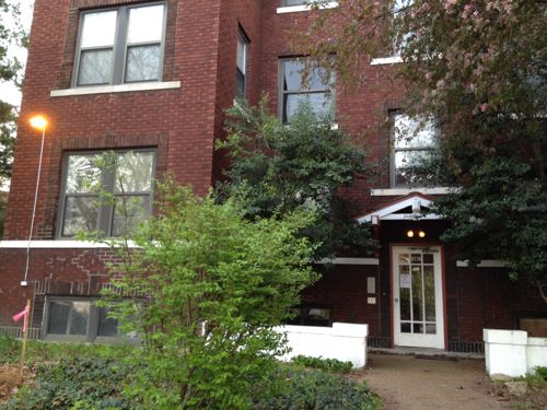
ABOVE: This nice occupied building from 1923 would be razed, 609-611 Eastgate Ave
ABOVE: 6236 Enright Ave was built in 1923 and contains 6 apartments
ABOVE: The remainder of the south side Enright is occupied by University Terrace, apartment/townhouse buildings from 1970
ABOVE: University Terrace building at Enright & Westgate Ave

According to this video the University Terrace apartments on Enright were renovated in 2009. Look like nice housing to me.

Not Part of Project

Continuing our walk around the block we’re at Westgate and Delmar, these buildings are not part of the Washington University project.

ABOVE: The out of place building at Delmar & Westgate was built in 1969, the year before the University Terrace buildings behind it.
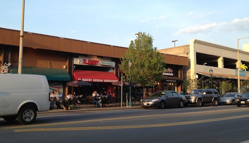
ABOVE: This building and parking garage across from the Tivoli will remain. The garage was built in 1998.
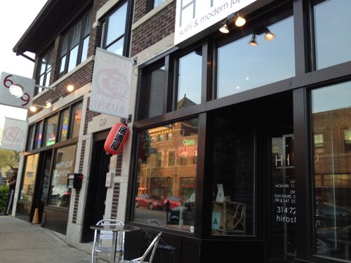
ABOVE: East of the garage is a 2-story building from 1920 and the first of a series of 3-story apartment buildings with retail on the first floor, also built in 1920.
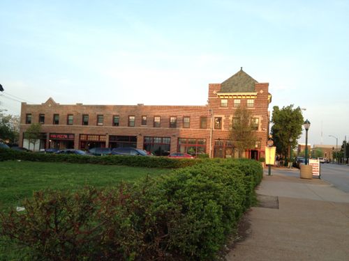
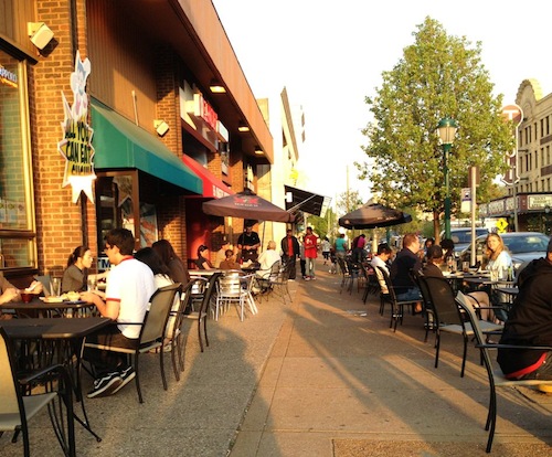
ABOVE: More 3-story apartment buildings, with the first floor as storefronts. Built in 1920.
ABOVE: The last 1920 apartment building with retail, the Washington University project will raze the building barely visible on the right.

b

Disclosure: I have NO relationship with Washington University.


http://www.studlife.com/news/facilities-and-construction/2012/03/08/washington-university-investing-80-million-to-develop-apartment-complex-on-the-loop/

http://www.parkviewgardensvision.org/


Advertisement


[custom-facebook-feed]

Archives

Categories

Advertisement


Subscribe