Home » Planning & Design » Recent Articles:

The Density Needed For Walkability Myth

Continuing the walkability theme from yesterday, I thought it would be interesting to explore the assertion that walkability requires density. So I decided to look at 1st tier suburb Kirkwood MO and 2nd tier suburb Ballwin MO to see if this is the case.   If you buy into the theory that walkability requires density then you probably think  Kirkwood is more walkable because it has greater density than Ballwin.

As you will see, walkability has less to do with density and everything to do with how the land is used, a reflection of the era in which they were created.

Kirkwood, MO:

Ballwin, MO:

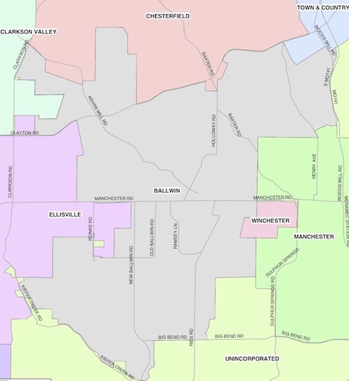
ABOVE: Map of Ballwin, click to view larger version

For the Walk Score of both suburbs I just put in the city name, it determined the address it must consider the center point.

So the older, less dense, suburb is more walkable than the newer, more dense, suburb.  How can this be?  Ballwin was planned at a time when people thought nothing of getting in the car for every trip.  The lady of the house had her own car now so she could drive the kids to school, do some shopping and get groceries on the way home. Kirkwood, on the other hand, was laid out long before the car.  Being near the train station was important for reaching St. Louis.

Residential lots in Kirkwood are about the same size as those in Ballwin, the big difference is the Kirkwood lots are narrow & deep whereas the Ballwin lots are wide & shallow.  Commercial districts are vastly different between the two.  Kirkwood has too much newer auto-dependent retail but it also has a nice 19th century downtown.

Fortunately, Ballwin is not a lost cause.  It, and many other 2nd tier suburbs of the same era can be retrofitted to be more walkable.    The existing residential neighborhoods of single-family detached homes can remain unchanged, except for the addition of sidewalks internally and leading out to the commercial areas. Manchester Rd in Ballwin running through Kirkwood and into the City of St. Louis is an ideal corridor to be retrofitted. New structures can be built to infill the massive parking lots.  I can picture enhanced bus service or even a streetcar line the entire distance.

– Steve Patterson


Much Of The Region Should Be Walkable, Not Just The City

Late last week I posted about the lack of walkability at a subdivision in the western suburb of Chesterfield, These McMansions Will Be Hard To Give Away A Decade From Now.  As I expected I got this viewpoint in the comments: “I get it – you love urban living, but not everyone else does.  One size does not fit all, and commuting is highly personal, and for an increasing number of people, no longer includes the CBD.”

For the last 3 years I’ve lived downtown, just west of the central business district. The prior 17 years I lived in the CWE, Old North & Dutchtown/Mt. Pleasant neighborhoods.  I commuted by car to jobs in Rock Hill,  North St. Louis and Kirkwood.

The St. Louis MSA (Metropolitan Statistical Area) is 16 counties — 8 in Missouri and 8 in Illinois.

ABOVE: STL MSA. Not shown: Bond, Calhoun, & Macoupin counties in Illinois & Washington in Missouri. Click image to view the WikiPedia entry on the region

So? Our region is quite large geographically.  In 2000 we had 2.8 million living in 8,846 square miles.  The City of St. Louis represents only 66.2 square miles of the total area – less than one percent.  Even looking at St. Louis County & City only, the city represents only 11% of the total area.

We can’t all live in the city so I expect much of the region to be walkable.  That is, a person living in a developed area should be able to walk to a store.  Their kids should be able to walk to school.  The fact is this is already a reality for many throughout our region.  The concept of walkability shouldn’t be limited to within the city limits.

Yes, most will drive to reach their places of employment.  But for those living in walkable areas like downtown St. Louis, New Town at St. Charles, Ferguson, etc.  the many non-work trips can be done on foot. Many of the people I know who live downtown don’t work downtown.  They live here, in part, because it provides a walkable lifestyle for everything other than getting to/from their jobs.

Back to that McMansion subdivision in Chesterfield, those residents must drive everywhere.  They have no choice. Every no-work trip will be an auto trip.

There is nearly 20 miles from the street I mentioned before reaching the western edge of the City of St. Louis.

I don’t have figures on how much of the 8,846 square mile region is urbanized (developed) vs rural.  Parts of the city are, unfortunately, auto-dependent.  Some of the region outside the city is at least somewhat walkable.  But how much of the total area isn’t auto-dependent? Maybe 1-2%? I’d like to see that be 10% or more.

But please, don’t assume that I’m speaking of the city vs the remainder of the region when I write about walkability.  Walking knows no political boundary.

– Steve Patterson


These McMansions Will Be Hard To Give Away A Decade From Now

About 8 years ago I had a client on a quiet & respectable street in the suburb of Chesterfield. What struck me at the time was the number of houses all with a single road to get out of the subdivision. One visit I stopped to reset my trip odometer just to see how long it was from the main road to their house, it was over a mile and a half!

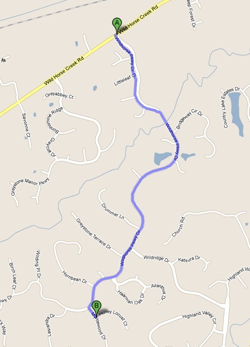
ABOVE: 1.7 miles between the subdivision entrance & the street with the client's house
ABOVE: 1.7 miles between the subdivision entrance & the street with the client’s house. Click image to view in Google Maps.

I remembered this area as I read an article about a recent study:

People who live in walkable communities are more socially engaged and trusting than those who live in less walkable areas, says a new study from the University of New Hampshire.

The study buttresses other research that has linked a neighborhood’s walkability to its residents’ quality of life, notably improved physical and mental health.

The McMansion on the large lot & 3-car garage was once desirable by many, but those days are fading. This subdivision has sidewalks, but no direct connection to each front door!

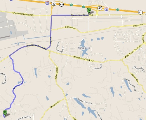
ABOVE: 4.1 mile route to "nearby" shopping
ABOVE: 4.1 mile route to “nearby” shopping. Click image to view in Google Maps

Out of curiosity I decided to run the Walk Score for this street. No surprise it got a 2 out of 100 and the label “auto-dependant”

ABOVE:
ABOVE: A score of 2 compared to an average of 41 for Chesterfield

Half a century ago you couldn’t give away mansions in the city. They were big, drafty, and “functionally obsolete.” They lacked modern plumbing, wiring and air conditioning. A decade from now these McMansions will be obsolete. The cost to heat & cool these houses alone is enough to make them undesirable but it will be the lack of walkability that will do them in.

In contrast, my downtown address got a score of 95 – walker’s paradise. My first apartment in St. Louis (CWE) has a score of 91. My first apartment in Old North St. Louis has a “very walkable” 77. The two properties I owned in Dutchtown have a “somewhat walkable: score of 52. Must someone live in a downtown loft to have a high Walk Score? Hardly. My former office was in Kirkwood where the residential units where the former Target store was located get a 91 “walker’s paradise” score. Inner-ring suburbs often score high because they originate in days of streetcars. Ferguson MO gets an 80 and Maplewood 75, both “very walkable.” On the Illinois side of the region you have places like Belleville (80) and Edwardsville (86).

Here is how they define the levels.

walkscorelevelsAs gas prices & public transit ridership go up homes in car-deopendent areas will have little appeal. Areas that are somewhat & very walkable will be retrofitted to become more walkable. I’ve set up a calendar reminder for December 23, 2020 to revisit this issue, and this street in Chesterfield.

– Steve Patterson


Salazar & LaHood Show Support For City+Arch+River Project

December 18, 2010 Downtown, Metro East, Parks, Planning & Design Comments Off on Salazar & LaHood Show Support For City+Arch+River Project
img_2112
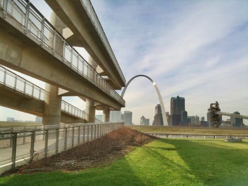
ABOVE: View of the St. Louis skyline as seen from the Malcolm W. Martin Memorial Park in East St. Louis IL., with the lookout tower in the foreground.

Last week I attended a press event held at the Malcolm W. Martin Memorial Park in East St. Louis IL.

The event featured some big names showing support for the City+Arch+River project.  Representing the Obama administration was Ken Salazar, Secretary of the Interior; and Ray LaHood, Secretary of Transportation.  Missouri’s Senator Claire McCaskill was also there , the one that got two cabinet members here at the same time. Additional speakers included East St. Louis Mayor Alvin Parks and St. Louis Mayor Francis Slay.

This video is long — 24 minutes.

httpv://www.youtube.com/watch?v=j0ZJ48du9jQ

I look forward to being able to reach this park without being a pedestrian in the road.

– Steve Patterson


Travel By Train Good For Urban Centers

img_1778
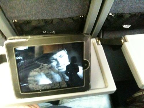
ABOVE: Watching Toni Braxton on my iPad in coach

Recently I took a weekend trip to Kansas City.  I’d driven there many times and I’ve flown there once.  But have you been to the Kansas City airport? It is located more than 20 miles north of downtown Kansas City and the bus ride takes more than an hour!  For this trip I took Amtrak.

The train trip was longer than if I had driven my car (6 hours vs 4 hours 15 min), but the convenience was worth it.  First, I could read, stay current on email, watch music videos, take pictures and arrive at my destination refreshed.  Apparently, I’m not alone:

In the fiscal year ending Sept. 30, Amtrak served more than 28.7 million riders, an increase of 5.7% from 2009, according to a company statement. Ticket revenue grew 9%, to $1.7 billion. Ridership on the Acela, Amtrak’s higher-speed train, was up 6.6%. Manieri says the ability to stay connected by phone and Internet while traveling is just one reason she prefers the train over flying or driving.

“You can make phone calls, and you don’t have to turn your laptop on and off,” says Manieri, adding she also avoids the airport’s long security lines and the highway’s congestion.

Amtrak has benefited from the “remarkable lifestyle shift” caused by smartphones, laptops and iPads that let travelers work and communicate almost everywhere, says Joseph Schwieterman, a transportation professor at DePaul University in Chicago. “It’s kind of a have-iPhone-will-travel kind of thing.”

Young adults especially view trains and intercity buses as extensions of the public transportation system, he says. They can hop on without ever disconnecting from the rest of the world, he says. (Amtrak chugs along nicely to record ridership)

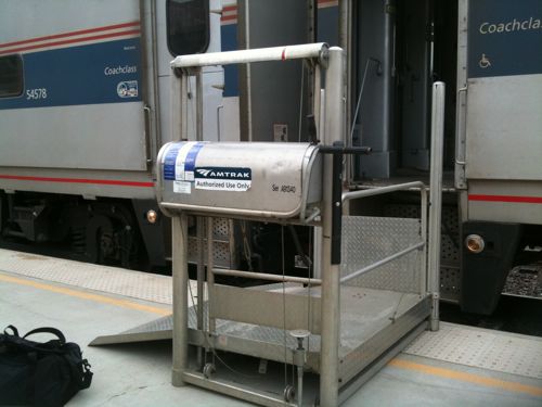
My last train trip was to Chicago, nearly a decade earlier.  That trip was a disaster, arriving about 6-7 hours late. But this trip was punctual to the minute.  By taking my train I was able to have my power wheelchair with me, saving the hassle of parking and of my limited walking distance.

img_1754
ABOVE: Manual lifts are placed where needed to get wheelchairs into a train car

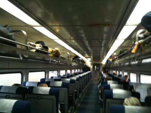
ABOVE: The coach car to Kansas City was clean & comfortable

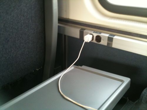
ABOVE: One outlet per seat for coach & business class

ABOVE: Business class on the return trip had much more room, leather seats and softer lighting

Future trips will be by planes, trains & automobiles. Once Amtrak service in Missouri & Illinois gets wi-fi like trains on the east coast I think we will see more and more opting for train travel.  More people traveling from urban center to urban center will only help those  cities, without hurting the suburban edge.  Next week I will look at Kansas City’s BRT (Bus Rapid Transit) line.

– Steve Patterson


Advertisement


[custom-facebook-feed]

Archives

Categories

Advertisement


Subscribe