Home » Planning & Design » Recent Articles:

Autonomous Cars, Urban Planning, Public Transit

February 25, 2016 Featured, Planning & Design, Politics/Policy, Transportation Comments Off on Autonomous Cars, Urban Planning, Public Transit

Two weeks ago today I attended a Economic Club of Chicago luncheon — the guest speaker was Lex Kerssemakers, President & CEO of Volvo Car USA. His words got me thinking about driverless cars and the implications for cities in the future.
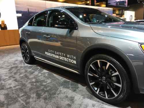
Volvo S60 with pedestrian detection at the 2016 Chicago Auto Show, click image to see Volvo's vision for autonomous cars
Volvo S60 with pedestrian detection at the 2016 Chicago Auto Show, click image to see Volvo’s vision for autonomous cars

In December Elon Musk said in two years a new Tesla will be able to drive itself.

As I began to research the topic I found varying thoughts on the future:

Whether self-driving cars reduce harmful emissions or the amount of land, energy, money, and other resources consumed by the transportation system depends largely on whether they reduce car ownership and driving. Optimists envision a future where driverless cars lead to a revolution in shared urban mobility. Why own a car when you can summon one to pick you up while avoiding the worries of parking, insurance, or maintenance?

In this scenario, the shift in ownership will also encourage payment based on miles driven and time of day rather than lumpy vehicle purchases, insurance fees, and parking. Instead of thinking about how much gas is in the tank, travelers will now consider the full marginal cost of a car trip when deciding whether to walk, bike, drive, or take transit. Transit service may also improve as a result of shared cars and minivans operating on fixed and flexible routes.

The biggest opportunity for improvement is in cities and neighborhoods where densities are currently too low to justify frequent bus or rail service. If shared or public, self-driving cars will dramatically reduce the demand for parking. Even privately owned vehicles will drop off passengers at front doors before driving off-site or behind a building to park, thus decoupling parking from other urban land uses. This would allow cities to dedicate more space to housing, shops, and offices, as well as stormwater management, street trees, and other sustainable features.

Pessimists, by contrast, see vehicle automation as one more technology that makes driving more comfortable and convenient and thus increases the amount that people drive. In this scenario, most households will own one or more self-driving cars, send their vehicles to run errands, circle to avoid paying for parking, and treat travel as if it had zero or very low time costs.

Many cars may become full-time mobile offices, whisking people between meetings, and the number of workers commuting between metropolitan regions will almost certainly increase. Making long commutes more productive will support the growing trend in long-duration commutes. Between 1990 and 2010, the proportion of commuters traveling more than 60 minutes and more than 90 minutes to work increased from six to eight percent and 1.6 to 2.5 percent, respectively.

Self-driving cars will also expand personal mobility for the third of the population without drivers’ licenses and the tenth of households without cars due to age, disability, low income, or preference. A demonstration video of one of Google’s prototype self-driving cars features a legally blind man riding to a Taco Bell in a self-driving vehicle.

Expanded access to cars may be particularly important for the nation’s elderly, many of whom live in and would like to remain in car-dependent communities. In this scenario, even if self-driving cars double existing capacity, this capacity will fill quickly — encouraging dispersed development and greater land consumption, which would further erode any sustainability benefits from increased efficiency. (When Autonomous Cars Take to the Road — American Planning Association)

No doubt there will be unintended consequences — both good & bad. Even as the technologies get closer to reality few cars on the road will be so equipped. It’ll be interesting to watch changes as more and more cars can drive themselves.

Further reading:

You can watch Lex Kerssemakers talk to the Economic Club of Chicago luncheon here — was on 2/11/16.

— Steve Patterson
 

Zoning Should Not Be Used To Force Washington Ave To Become A Retail Street

There are some who envision one mile of our Washington Ave (from 4th to 18th) as being a retail street like the Delmar Loop or Chicago’s Magnificent Mile along Michigan Ave. One person even wants to use a proposed form-based code overlay to mandate a retail use on the ground floor. Yes, the idea of using a form-based code to regulate uses is illogical. The whole point of moving from use-based zoning to form-based zoning is to get the form correct.

Recognizing uses change more often than the physical form of buildings.

It was a December announcement that prompted this push for a retail street:

LockerDome, which currently has 45 employees, moved to a 6,800-square-foot storefront on Washington Avenue in 2012 but has outgrown that space, said its chief executive and co-founder Gabe Lozano.

After a 120-day build-out set to begin in the second half of 2016, LockerDome’s employees will move to occupy an 18,000-square-foot building a block away at 1314 Washington. (Post-Dispatch)

LockerDome is a St. Louis-based tech company.

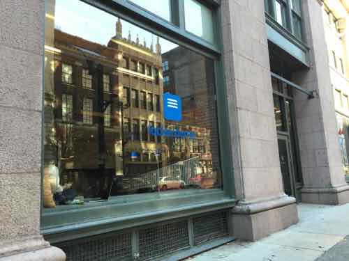
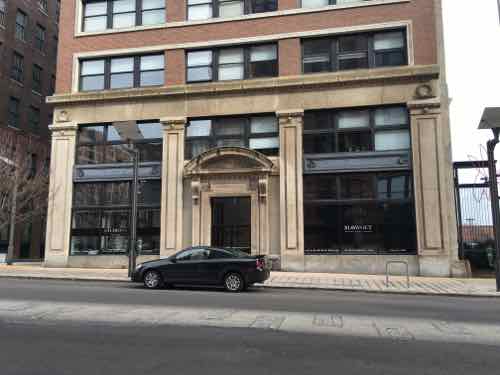
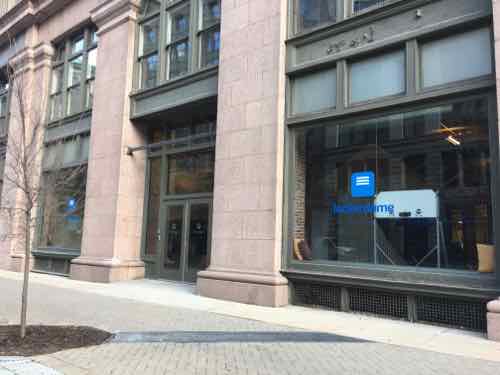
LockerDome has been at 1221 Washington Ave since 2012, the space was previously occupied by an architectural firm. Their windows are never covered,
In January I saw a woman, presumably an employee, working and eating lunch in one of the windows.
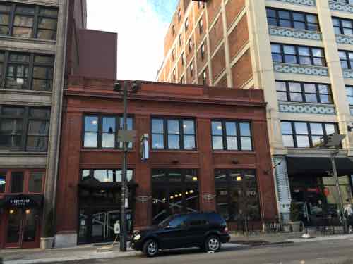
Lockerdome will be moving to 1314 Washington Ave, currently occupied by the gym Fitness Factory. Their windows are never covered.

Both have the form right, both have windows we can see into day & night. Some think a gym is an acceptable use on a retail street — but a high-tech firm is not. I personally don’t care what’s going on behind the facade. I can see into the windows when I pass by.

But one person would prevent LockreDome from occupying the ground floor of this building — he doesn’t want offices on ground floors. Yet, firms want to be located on Washington Ave. because it is the most vibrant part of Downtown/Downtown West. With the upper floors converted into residential there are too few options for large offices. For that matter, there are too few spaces for a larger retailer like a CVS/Walgreen’s.

What makes a credit union/bank lobby ok, but not a creative office?

It’s the non-creative offices that are the buzz kill…

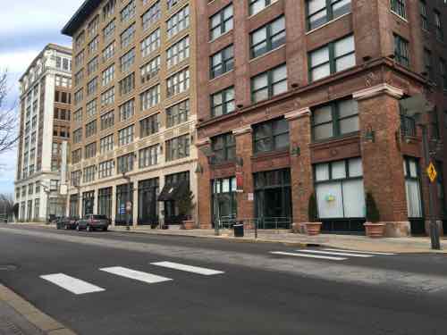
The blinds at Rise Community Development have been closed since they moved intro 1627 Washington Ave, (right). The same space has been used for a clothing reseller and a restaurant,
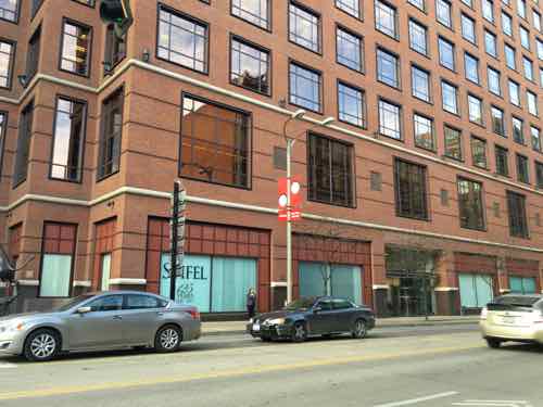
Between Broadway (5th) and 6th the Stifel financial headquarters keeps their ground floor blinds shut.

Regulating uses is arbitrary — which is why I want the city of St. Louis to abandon old-fashioned Euclidean use-based zoning and adopt form-based zoning. Form-based zoning, however, can be used to regulate the form – largely windows & doors at the ground level where pedestrian activity it to be encouraged.

Many ground floor offices downtown keep their blinds closed 24/7 — that’s something a form-based code could/should address. We need uncovered windows where we can see activity going on inside. But could Washington Ave become a retail street like the Delmar Loop or Magnificent Mile?

No — both of those were built for retail purposes.

This mile of Washington Ave has had many uses over the decades — the middle part included sweatshops where immigrants manufactured clothing, shoes, hats, etc. Items sold in stores all over the country, possibly in the Sears catalog. It wasn’t a retail street then.

Today Washington Ave is largely a restaurant street, with the occasional niche retail merchant. Besides bars/restaurants the other common “retail” use is hair salons.

Both storefronts at 1619 Washington Ave are salons.

Another problem are the many gaps in continuity.

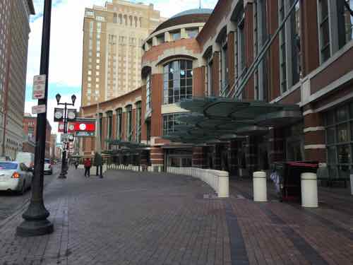
Our convention center occupies two blocks of Washington Ave -- from 7th to 9th
Our convention center occupies two blocks of Washington Ave — from 7th to 9th
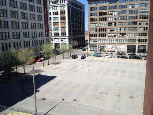
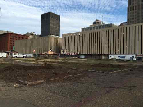
Former CPI parking lot between 16th-17th

Get the form right — including being able to look into ground floor spaces. Don’t fret about the users.

— Steve Patterson
 

Kiener Parking Garages Need A Major Facelift

Work has started on the $19 million revamp of Kiener Plaza”, which will help guide visitors to the upcoming city-facing entrance to the museum under the Arch. With the 1980s Arch parking garage razed visitors will be directed to existing parking garages in the central business district (CBD) — largely the two Kiener garages — across Chestnut Street from Kiener Plaza.

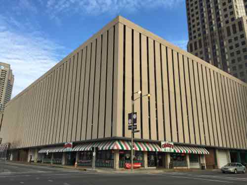
The East & West Kiener garages are highly visible
From Market & Broadway

After investing a billion in changes to improve the Arch experience and connectivity to downtown, the first & last thing many will see are the Kiener garages. Today I want to discuss the problems and how we might solve them.

The Problems

  • They’re privately owned
  • Owner has little financial incentive to make them more attractive
  • They’re in too good of condition to buy & replace
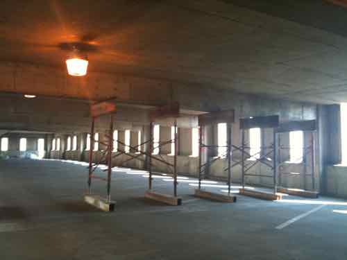
All four sides of two city blocks are covered in the most awful concrete panels
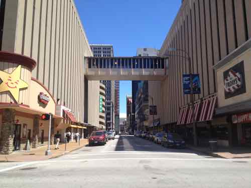
6th Street is awful with a garage on each side
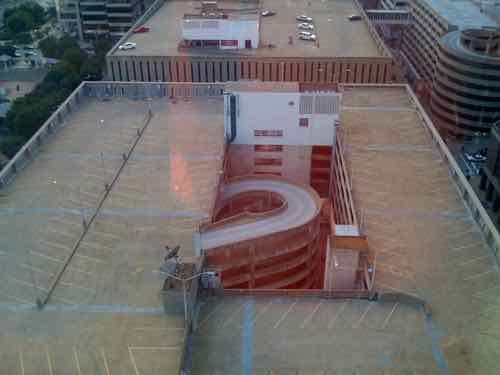
The layout is dated
The layout is dated
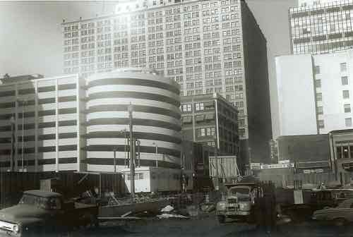
They were built in 1964 (East) and 1966 (West). The garage in the background was used for Famous-Barr for decades -- built in 1962. Photo is approximately 1963-64, from my personal collection
They were built in 1964 (East) and 1966 (West). The garage in the background was used for Famous-Barr for decades — built in 1962. Photo is approximately 1963-64, from my personal collection
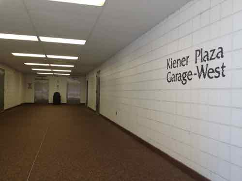
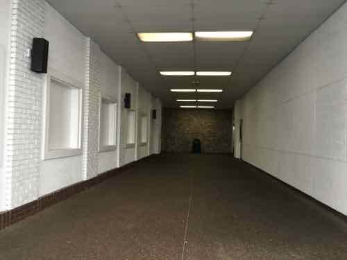
The pedestrian entry/exit points require walking into deep walkways, the materials, lighting, elevator, etc don't add up to a positive impression
The pedestrian entry/exit points require walking into deep walkways, the materials, lighting, elevator, etc don’t add up to a positive impression
The East garage pedestrian entry


There is some good news…

Built with ground floor retail on all four sides of each -- very rare in the mid-60s.
Built with ground floor retail on all four sides of each — very rare in the mid-60s.
The structures have been maintained. This is structural repairs being made in 2010
The concrete exterior panels are attached to the structure, not part of it.

The Solutions

With the ugly concrete panels being attacked to the structure one solution is to remove them and reskin it. Easier said than done, but worthy of discussion. Before I go any further let me say I don’t know how this would be paid for. The city has offered facade grants to building owners before, but otherwise using public money on a private building has issues. Perhaps tax abatement if the owner does it? I think this can be figured out — let’s discuss the design.

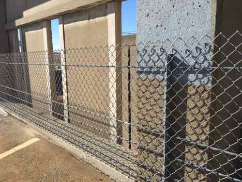
The old anchors into the structure might not support a new skin after the concrete skin is cut off. Despite being open in the center the exterior walls should continue to allow for airflow — natural ventilation eliminates the need for costly mechanical systems.

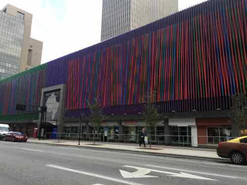
I think creative types could come up with some interesting ideas on how to reskin these. I want to share one such parking garage I saw in Cincinnati in November.

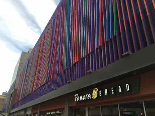
This colorful screen appears to be rather simple in construction, click image to view in Google Street View
From the sidewalk
From the sidewalk
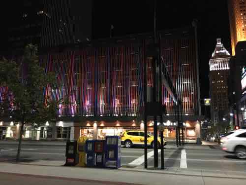
At night
At night

This screen on an old garage was the work of artist Julian Stanczak, it is titled “Additional”. I like that the Cincinnati garage only had this colorful side facing 6th St.

In St. Louis each of the two Kiener garages could have something unique for each, for each side, or both. I think everyone would agree the South facades facing Kiener Plaza are the most visually important.  All facades should look good day & night — same for the pedestrian entrances for each.

In the past people have mentioned giant video screens but those are costly, cut off airflow, and contribute to light pollution. Steel mesh, colored aluminum, LED lights, etc. are just some of the materials that come to mind. I’d like to see solar panels on the South facade and a new roof canopy to generate power for new LED lighting.

Thanks to reader “Mark-AL” for technical advice.

— Steve Patterson
 

A Look at AARP Public Policy Institute’s Livability Index

February 19, 2016 Featured, Planning & Design, Politics/Policy Comments Off on A Look at AARP Public Policy Institute’s Livability Index

At the beginning of the month I attended Livability Matters: Transportation Choice and Connections — sponsored by Citizens for Modern Transit and others.  The day before I was able to interview the event’s primary speaker: Jana Lynott, Senior Strategic Policy Advisor from American Association of Retired Person (AARP)’s Public Policy Institute in Washington D. C.. We talked for an hour in the lobby of her hotel.

First, some background:

AARP’s Public Policy Institute:

The Public Policy Institute informs and stimulates public debate on the issues we face as we age. The Institute promotes development of sound, creative policies to address our common need for economic security, health care, and quality of life.

Jana Lynott, AICP, MA, Senior Strategic Policy Advisor:

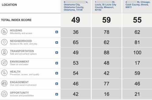
Jana Lynott manages AARP’s transportation research agenda and is responsible for the development of policy related to transportation and other Livable Communities issues adopted by the AARP Policy Council and Board and presented in the AARP Policy Book. Her research focuses on human services transportation coordination, accessible street design, the travel patterns of older adults, transit service needs, and older driver safety. She was responsible for the development of AARP’s Livability Index, released in April 2015. This first of its kind on-line tool is designed to help communities better serve an aging population. The Index blends mapping technology, preference survey results, quantitative measures, and public policies to measure how well a location—down to the neighborhood level—is meeting residents’ current and future needs. It uses a scoring system of 60 indicators spread across seven categories of livability: housing, neighborhood, transportation, environment, health, engagement and opportunity.

Prior to her employment with AARP, she was director of transportation planning for the Northern Virginia Transportation Commission, where she designed and managed a groundbreaking study on the link between land use and the mobility of older adults. She also initiated and managed a travel instruction program to teach seniors how to use transit services.

As a land use and transportation planner, she brings practical expertise to the research field. She serves on her county Transportation Commission and on the Transportation Research Board’s Committee for Safe Mobility of Older Persons. She holds a Master of Urban and Environmental Planning from the University of Virginia and a Bachelor of Arts in global studies from the University of Iowa.

What is the Livability Index?

The AARP Public Policy Institute developed the Livability Index as a web-based tool to measure community livability. Users can search the Index by address, ZIP Code, or community to find an overall livability score, as well as a score for each of seven major livability categories: housing, neighborhood, transportation, environment, health, engagement, and opportunity. Users also can customize the Index to place higher or lower emphasis on the livability features of most importance to them. The Livability Index website provides resources to help consumers and policymakers use livability scores to effect change in their communities. It is the first tool of its kind to measure livability broadly at the neighborhood level for the entire country, and it is intended to inform and encourage people to take action to make their communities more livable.

During our hour conversation we looked at the Livability Index on her tablet, the categories are:

  • Housing
  • Neighborhood
  • Transportation
  • Environment
  • Health
  • Engagement
  • Opportunity

The index is location based:

Part of understanding the livability of your location, or prospective location, is understanding how that location compares with other livable communities across the nation. Use our Location Comparison tool to examine the difference between up to three (3) different locations, comparing Livability Categories and the metrics and policies that go into defining them.

This video explains:

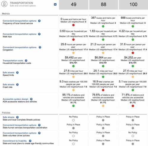
I compared three locations I know well: In the first column is the address where I grew up in Oklahoma City, next is my loft in downtown St. Louis, and last is the condo where we stay in Chicago.

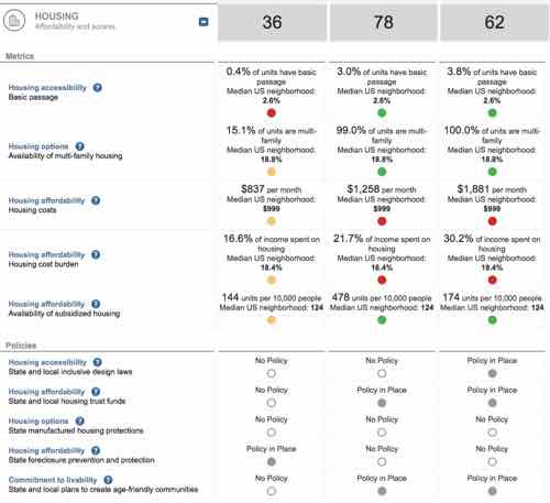
The numbers all have a lot of data behind them. If you click on a category you can see more detail.


Housing expanded.
Housing expanded.


Transportation expanded

Clicking on the question marks throughout will give you a pop-up with an explanation, for example:

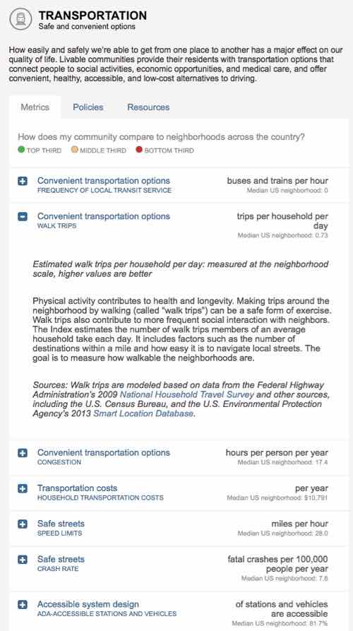
TRANSPORTATION: Safe and convenient options 
How easily and safely we’re able to get from one place to another has a major effect on our quality of life. Livable communities provide their residents with transportation options that connect people to social activities, economic opportunities, and medical care, and offer convenient, healthy, accessible, and low-cost alternatives to driving. 

From there you can click for more detail:

Detail on transportation, with Walk Trips expanded

So check it out here — the link has also been added to the right sidebar.

— Steve Patterson


A Decade Since Locust Street Returned To Two-Way Traffic

February 16, 2016 Downtown, Featured, History/Preservation, Planning & Design, Transportation, Walkability Comments Off on A Decade Since Locust Street Returned To Two-Way Traffic

A decade ago I was still living in South St. Louis, but I posted about a street I would move to within 2 years:

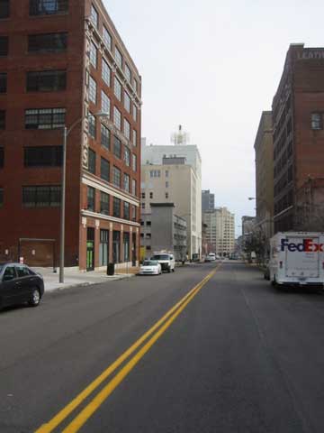
What a difference! Today I drove the full length of Locust Street from 14th west to Teresa (just shy of Grand). For the first time since I’ve lived in St. Louis, I was able to drive eastbound on Locust. It was like a totally different street!

Heading westbound from downtown you see new markings on the street when you are approaching 14th Street behind the library. The right lane becomes a right-turn only lane while the left lane is forward or a left turn. Ahead you can see temporary two-way signs that will likely stay around until people have adjusted to the change.

Driving down the street I noticed myself not wanting to drive as fast. With only a single lane in my direction and cars coming the other way in their lane it just didn’t seem like a high-speed escape route anymore. I knew if would feel different but it was more profound than I had anticipated. Locust St. Now Two-Way West of 14th!

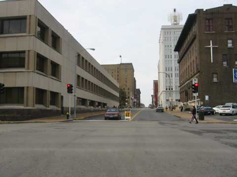
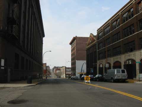
That was ten years ago today — here are a few of images from that post:

In November 2007 I bought a loft in the building on the left.
Looking West from 14th & Locust. This signalized intersection still doesn't have crosswalk markings. Click image to see recent post on crosswalks.
Looking West from 14th & Locust. This signalized intersection still doesn’t have crosswalk markings. Click image to see recent post on crosswalks.
Looking West from 17th

I can imagine  how awful these last eight years would’ve been if Locust St had remained one-way Westbound. Hopefully we’ll get around to changing Pine & Chestnut back to two-way traffic West of Tucker (12th) – 14th.

— Steve Patterson


Advertisement


[custom-facebook-feed]

Archives

Categories

Advertisement


Subscribe