Home » Planning & Design » Recent Articles:

‘Indulge In Urban Living’ At Streets of St. Charles

I had 20 years to eat at Noah’s Ark restaurant in St. Charles before it closed in 2000, but I never did.  With a lot of land and a highly visible location developers were interested. New Urbanist developer Greg Whittaker, of New Town at St. Charles, bought the site. He hired Duany Platter-Zyberk (DPZ) to plan a New Urbanist project to be called Plaza at Noah’s Ark.

December 2006:

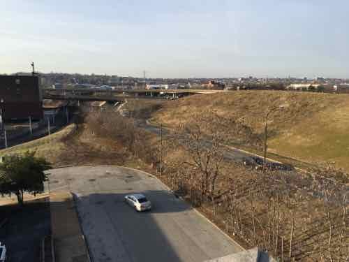
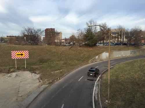
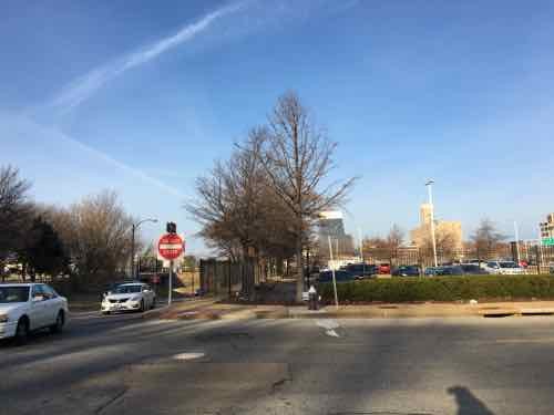
The multi-use development is planned on 26.8 acres occupied by the former Noah’s Ark restaurant and motel and a small subdivision. The area was developed in the 1960s, but the restaurant closed in 2000 and the hotel two years later.

Plans include an 18-story high-rise residential complex, an outdoor ice rink, a movie theater, a 150-room upscale hotel, restaurants and a parking garage that could include 1,827 spaces. (Post-Dispatch)

March 2007:

The 26.8-acre high-density development is planned for the site of the former Noah’s Ark restaurant and motel at the southeast corner of the Interstate 70 and South Fifth Street interchange. Plans call for an 18-story residential building with a minimum of 518 units costing about $250,000 each, retail shops, a movie theater, a 10- to 14-story hotel, an outdoor ice rink and a multilevel, vertical parking garage. (Post-Dispatch)

November 2011:

The site plan allows for 17 buildings, as many as 12 of which would be one or two stories tall. None would be taller than six stories.

An earlier plan called for 27 buildings ranging from one to 18 stories and set aside 374,200 square feet for commercial space and 759,600 for residential units.

Under the current plan, commercial square footage will range from 561,575 to 1,147,275. Residential square footage can be from 505,000 to 602,000, with an average unit size of 971 square feet.

Construction of the second building is expected to begin sometime in 2012, Buralli said. The 300,000-square-foot building would include the site’s 196 residential units. Cullinan doesn’t plan to sell any of the residential units for now. (Post-Dispatch)

April 2013:

Peoria, Ill.-based Cullinan bought the property in January 2007 from Whittaker Homes, which had acquired the site for a project then called the Plaza at Noah’s Ark. Cullinan renamed it and reached a new development agreement with the city, but the recession delayed construction. The City Council in January 2010 approved $40 million in bonds to help get it going, and in July 2011 approved a revised plan calling for more commercial square footage, less residential space and fewer buildings than Whittaker proposed. (Post-Dispatch)

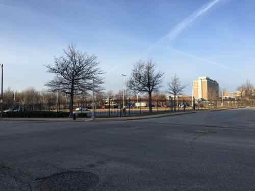
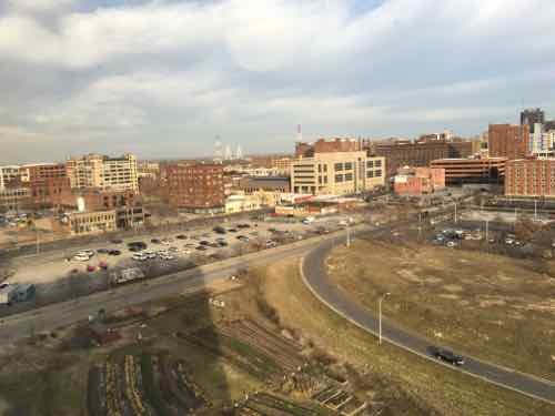
A few years ago I saw it after the first building was completed, earlier this month I returned when we were in the area.  My reaction is best described as mixed.

Looking North from 5th & Main. Note the banner on the tall retaining wall "Indulge in Urban Living"Looking North from 5th & Main. Note the banner on the tall retaining wall "Indulge in Urban Living". Click image for official website
Looking North from 5th & Main. Note the banner on the tall retaining wall “Indulge in Urban Living”. Click image for official website
From 5th Street
From 5th Street
Up the hill from the QT, still room for future buildings .
Beale Street has multi-story buildings on both sides with street-level retail storefronts
Another view of Beale Street. The first building is on the left, has offices over retail
The AMC theater is strikingly modern compared to the other buildings
A new 1-story PF Change is under construction to the North of the original building
Further North is another 1-story building with Missouri's first Pieology pizza chain. Click image for Sept 2015 article
Further North is another 1-story building with Missouri’s first Pieology pizza chain. Click image for Sept 2015 article
Despite what appears to be decent pedestrian circulation, there are several areas that aren't accessible to everyone
Despite what appears to be decent pedestrian circulation, there are several areas that aren’t accessible to everyone

Drury plans a 180-room hotel.

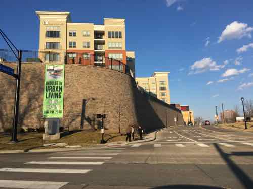
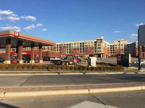
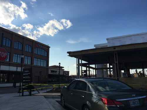
As I said, I have mixed feelings on this project. As a 25+ year resident of the City of St. Louis, their slogan “Indulge in Urban Living” is laughable to me. But I know I’m not their target market. To most residents of St. Charles County this is more urbanity than they ever thought they’d see on their side of the Missouri River.

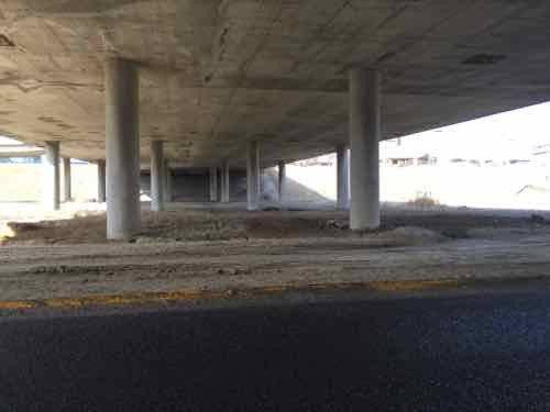
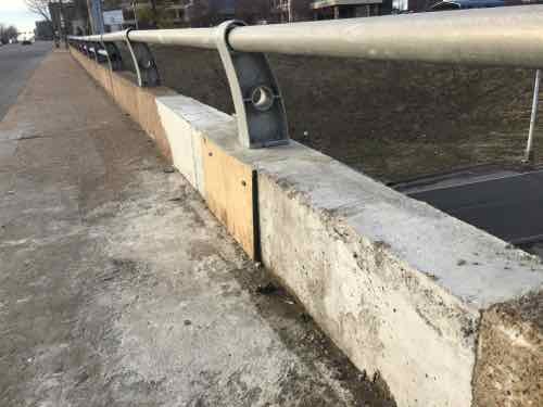
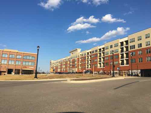
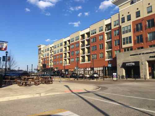
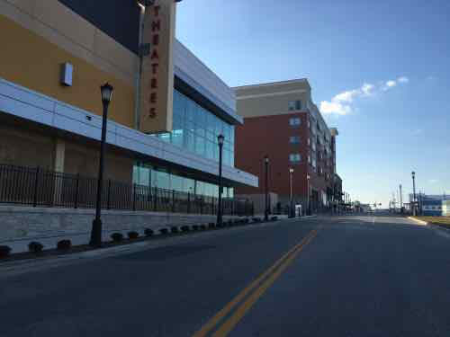
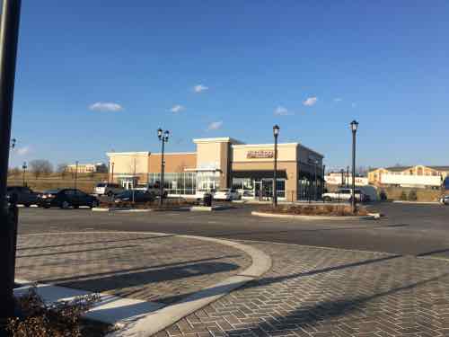
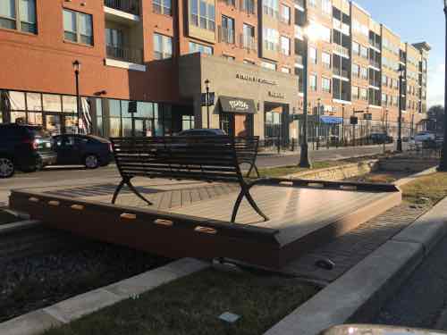
A decade or more ago this site would’ve been developed as a big box with an even bigger parking lot. Smaller buildings would’ve dotted the perimeter. Visitors would’ve been expected to arrive via car and to drive to reach other buildings on the site.  From my brief observations, it appears the planners have made sure pedestrians can reach every building via a sidewalk.

While I’m not going to give up my downtown loft to live here, it’s an improvement over old-school development patterns.

I’d love to visit in my wheelchair so I could experience it as a pedestrian. It appears I can catch the St. Charles Area Transit’s I-70 Commuter bus at North Hanley, which I’ll do in the coming month or two. A few hours exploring the site, touring a model apartment, having lunch will give me a better feel of the project.

— Steve Patterson

b

b

b


Local Example of Light Rail in Center of Street

For a while now I’ve been trying to convey how disastrous light rail in the center of Natural Bridge & Jefferson would be. I kept trying to think of a local example, but then the 2006 light rail extension in the center of Forest Park Parkway in Clayton came to mind.

Southbound traffic on S. Meramec in Clayton see a wall and right turn only signs at Forest Park Parkway
Southbound traffic on S. Meramec in Clayton see a wall and right turn only signs at Forest Park Parkway. Click to view in Google Street View
To achieve higher speeds,places to cross would be reduced through the use of concrete walls.

Such walls preventing pedestrians, bicyclists, and motorists and crossing the street except at a few points would be horrible for the surrounding neighborhoods. Do as I did — go to the interception of Meramec & Forest Park Parkway and see if you think that would be good for Natural Bridge or Jefferson.

— Steve Patterson


More On Soccer Stadiums

Yesterday’s post was my site idea for locating a Major League Soccer (MLS) downtown — Downtown West, to be precise. In trying to figure out if a soccer-specific stadium would fit I looked at other recently built stadiums. Today I thought I’d share some of the research.  I like to start with a big picture historical view — knowing where we’ve been helps to know where we may go.

The St. Louis Cardinals baseball team originated in St. Louis in 1875, as the Brown Stockings. The team started here, has stayed here. The Chicago Cardinals football team moved to St. Louis for the 1960 season — staying through the 1987 season. St. Louis was just a pit stop. In 1967 the St. Louis Blues hockey team was created during the NHL’s first expansion — doubling in size to twelve teams. Founded here, stayed here.

And of course, the always moving Rams:

  • Cleveland 1936-1945
  • Los Angeles 1946-1994
  • St. Louis 1995-2015
  • Los Angeles 2016-

Teams that were founded here, have stayed here. Teams founded elsewhere —  that moved here — moved again.

What about soccer?

The earliest record of organized soccer in St. Louis date to 1881. In 1891, the St. Louis Soccer League was organized, and before long, amateur soccer was flourishing in the city. Unlike other cities where clubs were often associated with immigrant working communities and sponsored by ethnic social clubs, many of the major clubs in St. Louis were associated with churches and parishes, and later with manufacturing & retail companies. The catholic parishes in St. Louis, through the CYC chapters, adopted soccer as an inexpensive mass participation sport for their recreational programs, and it wasn’t long before the top teams were winning national honors. One result of this is the long history in St. Louis of developing home grown talent rather than attracting foreign players to the top level professional leagues. 

The Kensingtons won the first two league championships, followed by Blue Bells and St. Teresa’s. Later, the first dynasty was established by St. Leo’s who won nine consecutive championships between 1905/06 and 1913/14. St. Leo’s was originally composed entirely of members of the St. Leo’s Sodality, a church men’s organization. After the team opened its memberships to outsiders, it began its championship run. They were also the first team to tour the East, as they played a series of New Jersey teams in tours during this time. St. Louis soccer grew very early on, and the leagues have been strong from the beginning, but the city also had a very independent tradition, and even after the local association joined the United States Soccer Federation, it remained somewhat aloof, not fully integrating itself into the national body until 1918.
(History of Soccer in St. Louis — recommenced)

So soccer has a very long history in St. Louis.

To see if a soccer stadium would fit in Downtown West I needed to look at dimensions.

A soccer-specific stadium typically has amenities, dimensions and scale suitable for soccer in North America, including a scoreboard, video screen, luxury suites and possibly a roof. The field dimensions are within the range found optimal by FIFA: 110–120 yards (100–110 m) long by 70–80 yards (64–73 m) wide, These soccer field dimensions are wider than the regulation American football field width of 53 1?3 yards (48.8 m), or the 65-yard (59 m) width of a Canadian football field. The playing surface should also consist of grass as opposed to artificial turf, since the latter makes players more susceptible to injuries.

Lastly, the seating capacity is generally small enough to provide an intimate setting, between 18,000 and 30,000 for a Major League Soccer franchise, or smaller for minor league soccer teams. This is in comparison to the much larger American football stadiums that mostly range between 60,000 – 80,000 in which the original North American Soccer League teams played at and most MLS teams participated in during the league’s inception. (Wikipedia: Soccer-specific stadium)

I also looked at some recent stadiums and how those would overlay in the area bounded by Pine, 20th, Market, and 22nd (new). The distance between Market and Pine is tight, between 20th and 22nd generous — assuming the pitch was oriented East-West. Placing the pitch North-South might be better — would give lots of room to the East & West sides for amenities. Ideally restaurants, team store, etc would face 20th Street. I love the idea of the main stadium entry being located at 20th & Market. A tower at that corner could have a rooftop restaurant open year round with Eastern views of Aloe Plaza/Gateway Mall, Union Station, Civil Courts,  and the Arch.

Approximate view looking East from new tower at 20th & Market/Chestnut

There is a preference for urban stadiums:

Going urban also helps activate the building on non-gamedays with everything from company picnics on the pitch to conferences in suites and club spaces that offer more than the mundane four walls of a downtown hotel.

“It is an amazing thing to have (the stadium) in the heart of downtown,” Portland Timbers president of operations Mike Golub, tells SI.com. “The energy, intimacy and passion comes through.” (Sports Illustrated)

Providence Park in Portland OR is an urban neighborhood (aerial). I’m still reviewing Wikipedia’s List of Major League Soccer stadiums. More will open in 2017 & 2018.

As I stated yesterday, I think any new soccer stadium should[n’t] be owned by the public. I think government’s role would be to rework the public streets and highway on/off ramps to free up land for private development.  The city/state were responsible for the existing hole in the urban fabric — they’re responsible to piece it back together. Part of this investment into getting currently wasted land ready for development would be a form-based zoning code to achieve a walkable urban neighborhood once fully built out.

— Steve Patterson


A Great Site For A Major League Soccer (MLS) Stadium In Downtown St. Louis

Last week Major League Soccer (MLS) officials indicated they’re interested in expanding — adding a team in St. Louis:

Major League Soccer will begin searching for a stadium site in St. Louis and planning for its financing and operations immediately, the league’s commissioner told the Post-Dispatch Thursday. (Post-Dispatch)

The site they shouldn’t consider is the North riverfront one previously targeted for a significantly larger NFL stadium — we shouldn’t tear down buildings when we have vacant land available. We have land, mostly state owned, without any buildings and a target for redevelopment for years already. I’m talking about the 22nd Street Interchange area — an area on the West side of downtown I’ve written about numerous times over the 11+ years.

Large area of mostly unused land on the West edge of downtown, the views East are spectacular -- would look great during televised broadcasts
Large area of mostly unused land on the West edge of downtown, the views East are spectacular — would look great during televised broadcasts
Same image without the text & lines

Why this location?

  1. Brings needed activity/development to Downtown West
  2. Right size for stadium
  3. Paul McKee was going to redevelop the area, but nothing has happened yet
  4. Most of the land is owned by Missouri or St. Louis
  5. Would not involve relocating any residents or businesses
  6. Doesn’t require the demolition of any buildings
  7. Numerous hotels already serve this area
  8. New stadium could anchor West end of the Gateway Mall, events could take place in Aloe Plaza
  9. Market St viaduct/bridge is in poor condition
  10. Great views to the East.
  11. Would give a reason for the #99 Downtown Trolley (Bus) to make a complete circle and serving Downtown West, operating in both directions

What physically needs to happen for this to work?

  1. Gateway Greening’s urban farm project would need to be relocated
  2. Street grid restored, Pine/Chestnut 1-way couplet returned to 2-way traffic
  3. Highway on/off ramps need to be reworked:
    1. Entrance onto I-64 in both directions from 22nd & Clark
    2. EB off ramp connects to grid at 21st & Clark instead of 20th & Chestnut
    3. WB off ramp connects to grid at Clark between 21st-22nd
    4. Roundabouts may help along Clark at on/off ramps

What politically needs to happen for this to work?

  1. Elected officials need to abandon the idea of razing the North Riverfront
  2. City/region/state pays for these new roads/sidewalks, on/off ramps
  3. New ownership group pays for the actual stadium
  4. Form-based code to ensure development creates an urban pedestrian-friendly neighborhood over the next 15-20 years

Below is a rough mock-up:

The blue box near the center is the stadium site, red are new streets/ramps, Purple are development sites, yellow is a revised trolley route. Click image to view map in Google Maps

Here are some additional images to show current conditions:

The EB highway off ramp could end at 21st & Clark
Looking North from 21st & Eugenia
The area between 21st & 22nd could be infilled with new development
From the existing EB I-64 off ramp
Under the Market St bridge/viaduct. This would be filled in so Market would be at grade
Repair on the Market St bridge/viaduct
Exposed rebar on Market
Looking down from Market to where the 22nd Parkway was to continue North, and tight ramp leading to 20th at Chestnut.
Looking West from 20th & Chestnut
20th & Pine, privately owned parking lot would become part of stadium site
Area North of Pine could see infill development
Pine could become 2-way again -- another route East from Jefferson
Pine could become 2-way again — another route East from Jefferson
Gateway Greening's Urban Farm
Gateway Greening’s Urban Farm
Gateway Greening's Urban Farm has used some of this excess land, would need to relocate to other vacant land
Gateway Greening’s Urban Farm has used some of this excess land, would need to relocate to other vacant land
West of 20th is Aloe Plaza West Extension -- really just leftover from the off ramp. This should be the prime corner of a new MLS stadium
West of 20th is Aloe Plaza West Extension — really just leftover from the off ramp. This should be the prime corner of a new MLS stadium

I think this location offers the chance to create a new neighborhood and provide the environment/experience desired by the MLS.

— Steve Patterson


St. Louis Fails At Crosswalks, Part 2

Monday, in Part 1, I explained why St. Louis officials shouldn’t be shocked their colorful art crosswalks don’t meet federal guidelines. They’re less visible than the classic bright white “continental” crosswalk.

Decorative crosswalk crossing Manchester at Sarah was installed in 2015
From 2011: A freshly painted "continental" crosswalk at 17th & Olive
From 2011: A freshly painted “continental” crosswalk at 17th & Olive

From the Federal Highway Administration (FHA):

8.5 Crosswalks
Crosswalks are a critical part of the pedestrian network. A crosswalk is defined as “the portion of a roadway designated for pedestrians to use in crossing the street” (Institute of Transportation Engineers, 1998). Crosswalks are implied at all intersections whether or not they are marked. Midblock crossings include all marked crosswalks that do not occur at intersections. Midblock crossings are only created if a marked crosswalk is provided. The agency responsible for the roadway must ensure that all marked and unmarked crosswalks and midblock crossings are optimized for the safety and accessibility of all pedestrians.

8.5.1 Crosswalk markings
Crosswalk markings, if provided, are used to define the pedestrian path of travel across the roadway and alert drivers to the crosswalk location. Marked crosswalks should be designed in accordance with the Manual of Uniform Traffic Control Devices (MUTCD). Although the MUTCD provides options for crosswalk markings, the continental design is recommended because research indicates that it is the most visible to drivers (Knoblauch et al., 1988). The ladder design is created with white longitudinal lines at a 90 degree angle to the line of the crosswalk. The lines should be approximately 305 mm to 610 mm (12 in to 24 in) wide and spaced 305 mm to 610 mm (12 in to 24 in) apart (USDOT, 1988). The continental design can also be installed so that the primary paths for vehicular tires are between the crosswalk markings, which helps to reduce wear and maintenance. Use of the continental design for crosswalk markings also improves crosswalk detection for people with low vision and cognitive impairments. It is recommended that the continental design be used consistently to mark all crosswalks; otherwise the impact of less visible markings may be weakened by comparison.

They make it very clear that “continental” crosswalk markings are preferred. The design is such that, if properly done, allows vehicle tires to roll over the non-painted areas — thus reducing wear on the paint.  The last sentence above is worth repeating:

“It is recommended that the continental design be used consistently to mark all crosswalks;
otherwise the impact of less visible markings may be weakened by comparison.”

Crosswalk markings downtown are anything but consistent, the continental marking is rare.

From the National Association of City Transportation Officials:

While pedestrians generally have the right to cross at any intersection regardless of crosswalks, designers should be sensitive to the misperception that a crosswalk is the only legal place to cross the street. Use crosswalks as both a guide for pedestrians and a way to communicate crossings to motorists.

The practice of discouraging pedestrian crossings by leaving uncontrolled crossings unmarked is not a valid safety measure. Instead, it encourages unsafe, risk-taking behavior and discourages walking citywide. Efforts should be made to enhance or highlight desired crossings wherever practicable. Hybrid beacons, rapid flash beacons, raised crossings, medians, and other safety counter-measures may be suitable and less expensive than full signalization. These should all be considered before leaving an uncontrolled crossing unmarked.

But we can’t afford to mark every possible crossing point — how do we determine when to mark and when to leave unmarked?

All legs of signalized intersections must have marked crosswalks unless pedestrians are prohibited from the roadway or section thereof, or if there is physically no pedestrian access on either corner and no likelihood that access can be provided. Pedestrians are unlikely to comply with a 3-stage crossing and may place themselves in a dangerous situation as a result.

Let’s look at 14th Street from Washington Ave to Olive Street to see how inconsistent St. Louis is with crosswalks:

Crossing 14th at Washington Ave the decorative brick crosswalk isn't as visible as the bright white continental design
Crossing 14th at Washington Ave the decorative brick crosswalk isn’t as visible as the bright white continental design
At St. Charles Street (glorified alley) there's no signal, no stop sign. There are two continental crosswalks
At St. Charles Street (glorified alley) there’s no signal, no stop sign. There are two continental crosswalks
The North side of Locust at 14th, a signalized intersection, has no crosswalk marking
The South side of Locust at 14th is the same -- n o crosswalk marking. Behind ,me is a school, the main library across 14th.
The South side of Locust at 14th is the same — n o crosswalk marking. Behind ,me is a school, the main library across 14th.
An aside -- the unmarked crosswalk leads to a non-compliant curb ramp that I pointed out prior to completion of the library.
An aside — the unmarked crosswalk leads to a non-compliant curb ramp that I pointed out prior to completion of the library.
Olive at 14th is the basic parallel white lines. Still more visible than the expensive decorative brick crosswalk at Washington Ave

I’d like to think St. Louis’ new bike/ped coordinator will be able to make a difference — but for so long pedestrians got half-ass infrastructure. Not sure one bureaucrat can change the culture.

— Steve Pattersin


Advertisement


[custom-facebook-feed]

Archives

Categories

Advertisement


Subscribe