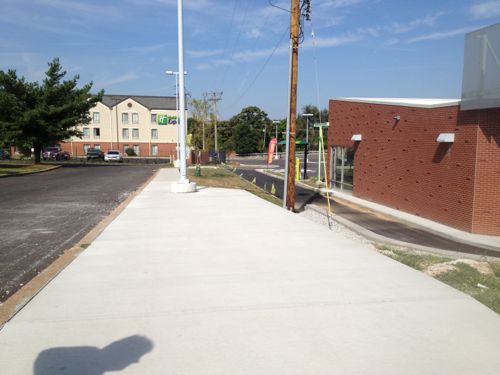
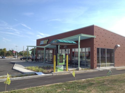
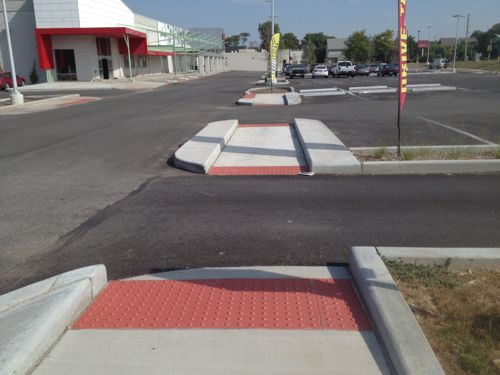
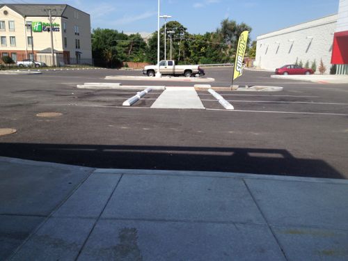
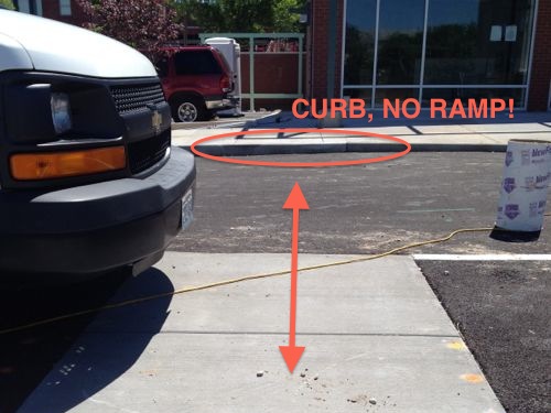
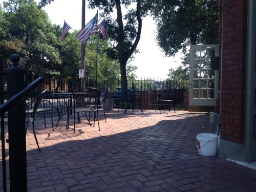
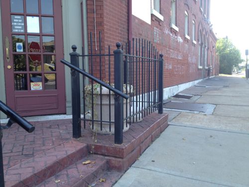
One of two newly created ADA access routes into Jefferson Commons, this is the south one.From this access route you can see the front of the newly constructed outlot building with two tenant spaces.Turning to the north at the bottom of the route you can see pedestrian access was given considerable thought.View from the new outlot building toward the ADA access routeBut approaching the building it was clear to me during construction in May one detail was overlooked, but I wanted to wait to see just in case something was planned. Last month the problem remained.
UIC/Greenstreet Properties did a great job and, as required by the ADA, provided a non-drivewalk access route from each public transit stop. Shopping centers must do so, whereas stand-alone properties can provide access through a driveway. Yet an important detail for compliance was overlooked. It may have been shown on the drawings but overlooked during construction, or left off the drawings by mistake.
I’ve not seen any crossing paint here, drawing that in on construction plans can greatly reduce a design or construction error. I’ll be sending this to my contacts at the companies responsible and to city officials.
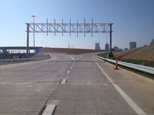
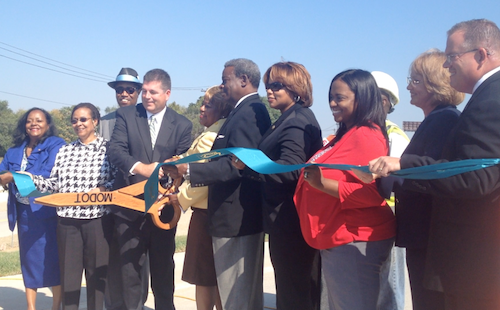
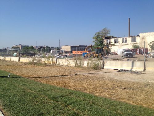
Yesterday MoDOT and city officials cut a ribbon to open traffic from I-70 onto the new Tucker.
An hour before the off ramp from I-70 to Tucker signs still weren’t placed. Only the right was opened, the left will be for I-70 traffic when the new bridge opens next yearThe view of downtown motorists will now seeOfficials cut the ribbon opening the off ramp from I-70 onto the new Tucker on September 26, 2013.The land surrounding thus on/off ramp is now more valuable.
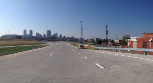
With the new offramp, and the opening of the Stan Musial Veterans Memorial Bridge in 2014, the adjacent land is suddenly prime real estate. Will it be developed like most highway offramp areas or will it be more urban/dense/walkable? I don’t have any illusions the city will make any such demands so my only hope is Paul McKee comes through with a plan the surprises his many critics.
Jefferson Avenue is a 5+ mile north-south arterial road in south, central, and north St. Louis (map). Along this stretch the road has 4-6 travel lanes, a center turn lane, and sometimes 2 parking lanes. What’s pretty consistent is the public right-of-way and curb to curb widths are excessively wide.
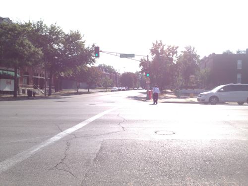
A female pedestrian makes her way across Jefferson at Russell
Here are some examples of the right-of-way width in locations you might be familiar:
Jefferson @ Russell: 120 feet
Lindell @ Euclid: 100 feet
Kingshighway @ Delmar: 100 feet
Grand @ Hardford: 80 feet
Chouteau @ Mississippi: 80 feet
Manchester @ Taylor: 70 feet
The above figures are from Sanborn Maps, mostly from 1909. Again, these are the public right-of-way (PROW), which includes the road and sidewalks. In an urban context this is measured from the face of a building to the face of the building on the opposite side. The road & sidewalk widths can vary within the PROW.
At Russell, Jefferson has a wider PROW than streets like Grand, Lindell, and yes — Kingshighway! This partly explains why Jefferson doesn’t have the same “feel” as South Grand. The wider the curb to curb, the faster traffic travels. The faster the traffic, the fewer the pedestrians. Fewer pedestrians & faster traffic means businesses will focus on customers in cars, not pedestrians. This reality conflicts with adjacent neighborhoods that seek a more urban environment, like McKinley Heights whose code required Family Dollar to build more urban than usual.
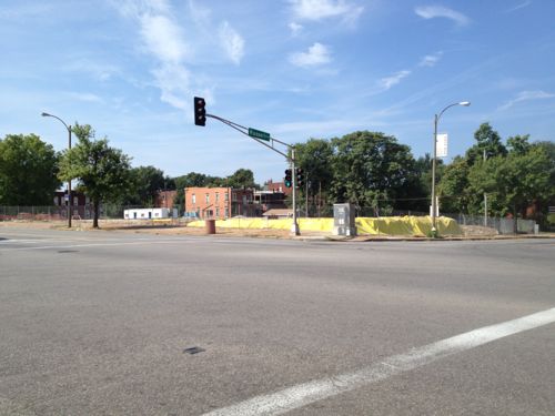
Construction of the new SouthSide Early Childhood Center is underway on the SE corner
Jefferson passes by many neighborhoods and political wards, with different ones on the east & west sides. With schools & residents on both sides crossing the street is important. Some intersections have pedestrian signals, others, like Russell, do not. The east side is the McKinley Heights neighborhood & 7th Ward while the west side is the Fox Park neighborhood and the 6th ward, such fragmentation makes it challenging to get projects done.
Hopefully enough residents from both neighborhoods can convince Phyllis Young (7) and Christine Ingrassia (6) to take a closer look at Jefferson Ave.
I’d like to see the following in the short-term:
Stripe Jefferson to just 4 travel lanes end to end
Include a solid white outside line separating the right travel lane from the parking lane as MoDOT did on Gravois
Add pedestrian signals with countdown timers at existing signalized intersections currently lacking pedestrian signals
Stripe crosswalks in the more visible “Continental” pattern
In the longer term I’d like to see:
A detailed corridor study looking at all transportation modes (car, bike, transit, pedestrian), development patterns & potential, etc
A charrette to look at designing a new streetscape.
In the coming weeks & months I’ll post more about problems & solutions for Jefferson Ave.
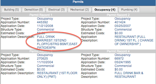
Being an old city we have many old buildings that aren’t yet wheelchair accessible. When a business opens up they need to be aware of the ADA, especially when spending money remodeling.
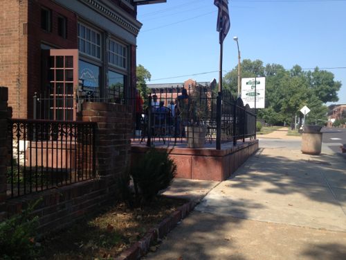
The building on the SW corner of Jefferson Ave & Winnebago St has had many establishments over the years, including quite a few since the 1990 passage of the ADA. Most changes over the years have been relatively minor. According to city records the previous owner owned the property from December 1977 to July 2007. In 2008 the current owner added a new patio out front, mostly in the public right-of-way. This was the perfect opportunity to make the first floor of this 1890 building wheelchair accessible.
The 2008 patio at Jefferson Ave BistroLooks very nice!But it has steps up from the sidewalk, maybe the door on the side is the accessible entrance?This door is unlocked and also used as an entrance, the step makes it impossible to enterMy footrest ran right into the step upI didn’t find a building permit for the patio online, perhaps it was built without prior approval. This occupancy permit mentions patio expansion
When the patio was built the owner could’ve easily modified the sidewalk to provide access to the side door. It would’ve been a relatively minor add on to the patio project. To do it now will be far more costly.
As a disabled person, my independence is very important. I assume no matter the disability. independence is important. Thus it isn’t a surprise to me to see it mentioned in mission a statement:
Yet their website illustrates auto-centric thinking, not independence:
The Society is located at the southeast corner of Brentwood Blvd. and Manchester Road. The corner of Brentwood and Manchester is approximately 2 miles south of the Galleria shopping mall. The Society’s facility is approximately 12 miles west of downtown St. Louis.
There are signs visible from all four directions at that corner indicating the “Society For The Blind Building”, with all addresses (8764 – 8798) of occupants of the building below the name. The Society’s entry is clearly marked above the main entrance.
There are reserved parking places in front of the main entrance, as well as handicapped parking next to the building.
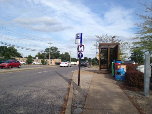
Where’s the information from public transit? I often encounter blind & visually impaired riders on transit.
The eastbound #57 MetroBus stops directly in front of their building on the SE corner of Manchester & Brentwood
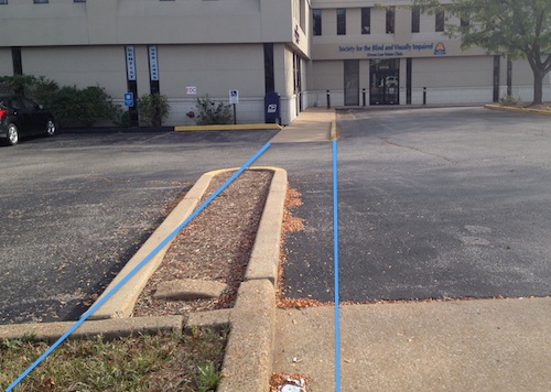
It would help their independence if the Society made a slight modification to provide an pedestrian access route separate from the auto driveway. It would be fairly straightforward:
Blue lines mark the ideal path an ADA access route would take
As you can see from the image above, building a pedestrian route would be a fairly simple proposition for them. I sent them a message a couple of days ago suggesting this. I’ll keep you posted if anything happens.
AARP Livibility Index
The Livability Index scores neighborhoods and communities across the U.S. for the services and amenities that impact your life the most
Built St. Louis
historic architecture of St. Louis, Missouri – mourning the losses, celebrating the survivors.
Geo St. Louis
a guide to geospatial data about the City of St. Louis