Thinking about the former Ackerman Toyota site on South Kingshighway
For decades Ackerman Toyota was located on South Kingshighway Blvd, between Tholozan Ave on the North, and Beck Ave on the South. In 2015 they announced they’d build a new dealership on the NE corner of Hampton & I-44, the site of the former MSD headquarters.
Ackerman Toyota, the southern outpost of the decades-old string of St. Louis car dealerships on South Kingshighway, is hitting the road.
After nearly 27 years at 3636 South Kingshighway, the dealership plans to move to 2000 Hampton Avenue. The three-acre site owned by the city’s Land Clearance for Redevelopment Authority is the former headquarters of the Metropolitan St. Louis Sewer District at Hampton and Interstate 44.
Jerry Ackerman, the dealership’s owner, said Thursday he hopes to begin construction by December and open his new location as early as June. (Post Dispatch, August 2015)
Today’s post isn’t about their new location, this is about the location they recently vacated.
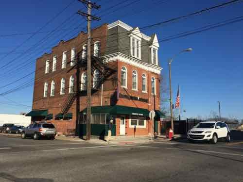
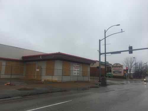
Their old address was listed as 3636 S. Kingshighway — the address for the building on the South, at Beck Ave. It dates to 1940, per city records online. The other building on Kingshighway, at Tholozan Ave. is from 1929. Both have been remodeled so many times neither has any historic value. A 3rd building, an anonymous service structure, facing Tholozan, was built in 1948.
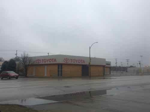
The former car dealership contains over 145k square feet, roughly 3.3 acres. It is made up of 6 different parcels. These could be combined, or developed separately. The most likely scenario is one developer will buy all six parcels and, after consolidating them into one, develop the total site.
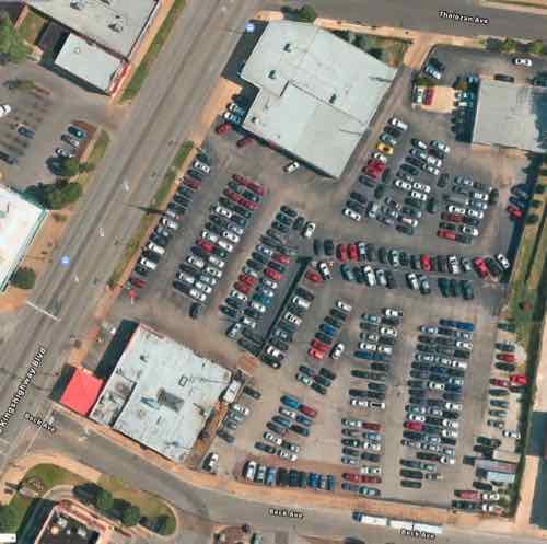
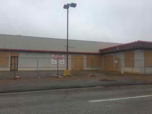
The bottom right section is 2 of the 6 parcels, it was still a field as late as 1971. It got paved for parking sometime between 1971 and 1991, based on historic aerials of the site. In the 2015 article, linked above, Jerry Ackerman is quoted as indicating they were seeing a franchise from another manufacturer for a dealership at this location. Given that they’ve boarded the buildings my assumption is that didn’t pan out.
Good.
This site needs to cease being about the sales & service of cars. It needs to be a mix of uses, including some residential. Two and three story buildings are very common on this stretch of Kingshighway, so a dense/urban site plan would be appropriate.
It’ll be interesting to watch to see what, if anything, becomes of this site.
— Steve Patterson