Home » St. Louis County » Recent Articles:

Shrewsbury: MetroLink to City Hall

I love rail transit, but a problem with our MetroLink light rail system is getting from the stations to your destination. Last week I attended a meeting hosted by Trailnet at Shrewsbury City Hall, a mile from the station. I could’ve caught a bus that would’ve dropped me off at Murdoch & Shrewsbury Ave but I still would’ve had 4/10ths of a mile to reach city hall. It was decent out and my power chair had a full charge so I decided to “walk” the mile.

But first a little background information.
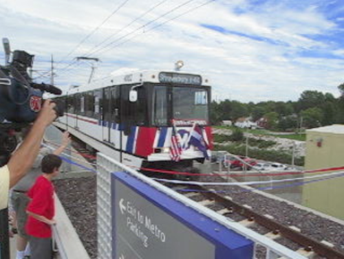
The Shrewsbury MetroLink station opened with the blue line extension on August 26, 2006.
Click image to view video of the arrival of the first train pictured above.

The Shrewsbury MetroLink station is located in the City of St. Louis, but the Shrewsbury city limits is the western edge of the commuter parking lot. The station has been open neatly 7 years now so there’s been time to better connect the surrounding neighborhoods to transit.

Okay, let’s head to Shrewsbury City Hall located one mile away at 5200 Shrewsbury Ave.
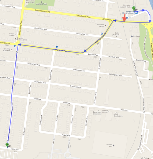
My planned route Lansdowne, Murdoch Cut-Off, Murdoch, Shrewsbury Ave, click map to view in Google Maps
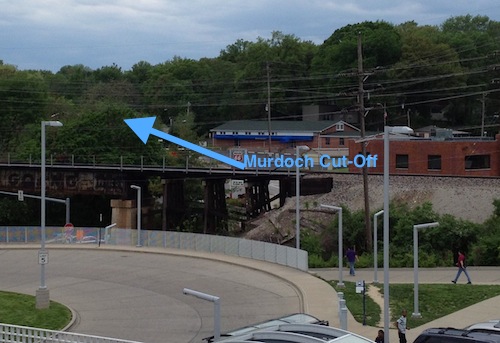
From the station platform I could see the direction I needed to go to reach the Shrewsbury City Hall.
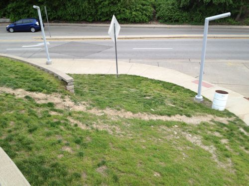
Looks like many walk up/down this hill
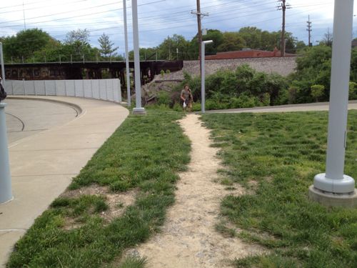
Others walk here.
Others walk here, but I’d better find a sidewalk I can use.
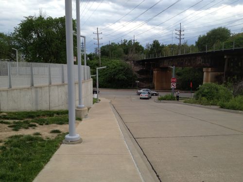
Now I'm headed down toward Lansdowne Ave, sandwiched between the retaining wall on the left and the auto driveway on the right.
Now I’m headed down toward Lansdowne Ave, sandwiched between the retaining wall on the left and the auto driveway on the right. Not a friendly environment!
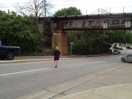
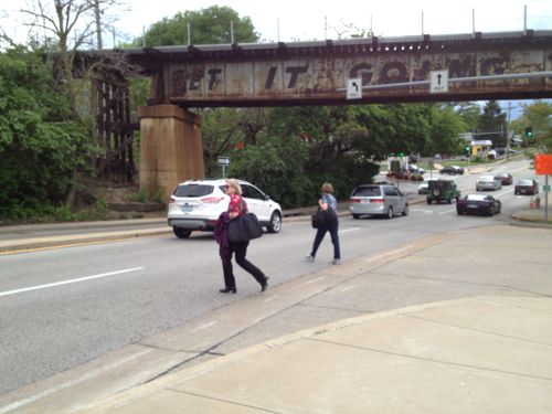
At Lansdowne Ave I see pedestrians crossing the street without a crosswalk.
At Lansdowne Ave I see pedestrians crossing the street without a crosswalk. I couldn’t cross here even if I wanted to because of the numerous curbs.
More pedestrians risking getting hit by cars
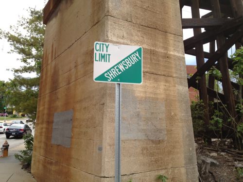
I stick to the north side of Lansdowne Ave and head west under the railroad tracks, the Shrewsbury city limit.
I want to cross Lansdowne Ave here but there is no curb cut or crosswalk to allow me to do so.
I'm able to use this crosswalk to reach the other side of Murdoch Cut-Off
I’m able to use this crosswalk to reach the other side of Murdoch Cut-Off
But there's no sidewalk on this side of Murdoch Cut-Off
But there’s no sidewalk on this side of Murdoch Cut-Off
So I returned to the intersection to cross Murdoch Cut-Off to reach the point I originally wanted to reach but couldn't
So I returned to the intersection to cross Murdoch Cut-Off to reach the point I originally wanted to reach but couldn’t
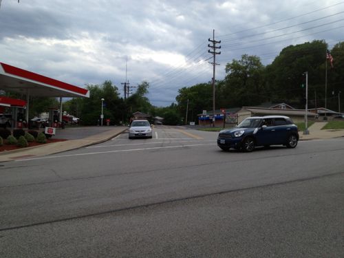
After passing the gas station I discover there's no sidewalk on this side of Murdoch Cut-Off either.
After passing the gas station I discover there’s no sidewalk on this side of Murdoch Cut-Off either. It looks like many pedestrians walk in the narrow dirt path, I had to use the narrow shoulder. This point is about 400 feet from where I left the station property.
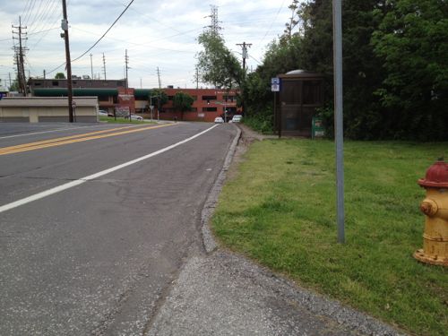
Looking back from where I'd just traveled you can see a bus stop encouraging pedestrian use of this area.
Looking back from where I’d just traveled you can see a bus stop encouraging pedestrian use of this area.
As Murdoch Cut-Off approaches Murdoch a sidewalk does exist.
But the sidewalk doesn't continue, it turns and heads back east.
But the sidewalk doesn’t continue, it turns and heads back east. This is about 1/8th of a mile from the station.
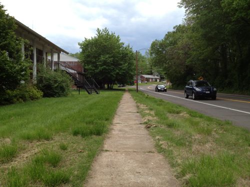
I head south on St. Vincent Ave, this view is looking back north from Notttingham.
I head south on St. Vincent Ave, this view is looking back north from Notttingham. Only the west side of St. Vincent Ave has a narrow sidewalk.
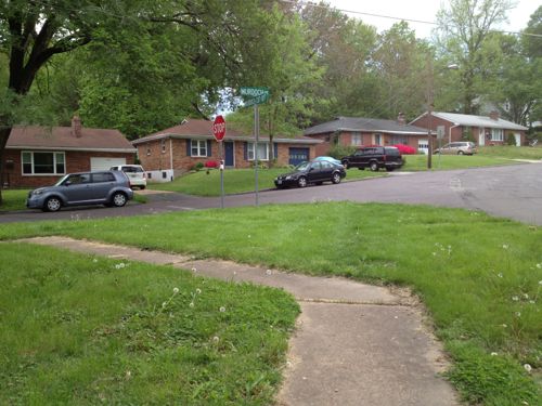
The streets intersecting with St. Vincent don't have sidewalks for the first block to Danbury Ave.
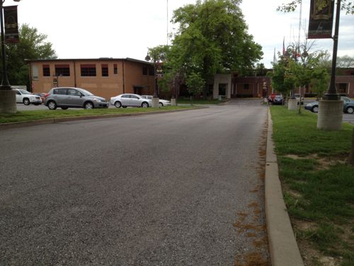
The streets intersecting with St. Vincent don’t have sidewalks for the first block to Danbury Ave., I cautiously proceed in the street.
Once past Danbury Ave sidewalks are available
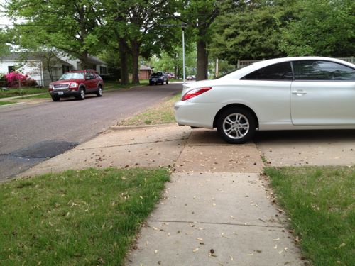
That doesn't mean the sidewalks weren't blocked  at times. This owner had more room on their driveway before their garage door, more than enough to keep the sidewalk clear.
That doesn’t mean the sidewalks weren’t blocked at times. This owner had more room on their driveway before their garage door, more than enough to keep the sidewalk clear.
After I reached Shrewsbury Ave I went north to Murdoch to see where sou;d've been dropped off had I taken a bus.
After I reached Shrewsbury Ave I went north to Murdoch to see where sou;d’ve been dropped off had I taken a bus. This point is about a third of a mile from the corner of the transit station property.
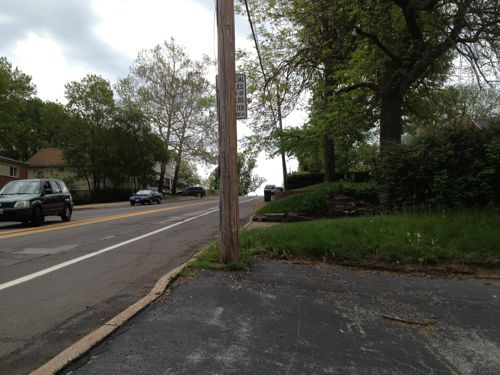
Looking east on Murdoch, the direction I originally thought I'd take.
Looking east on Murdoch, the direction I originally thought I’d take. No sidewalk, only shoulder.
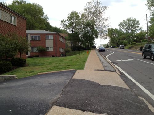
The north side of Murdoch has a sidewalk next to the apartment buildings only.
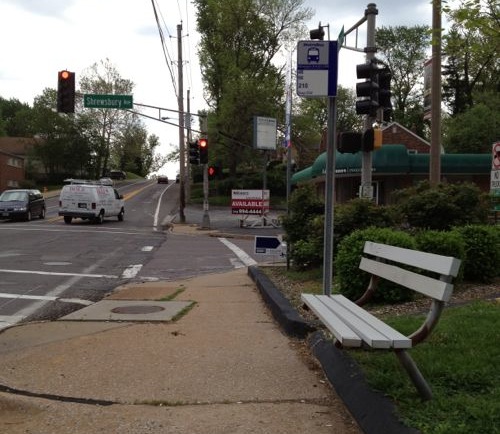
This is the bus stop heading back toward the MetroLink station, I caught a bus here a couples of hours later to return downtown.
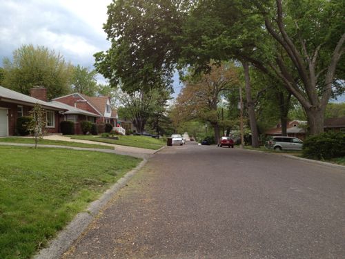
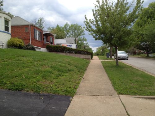
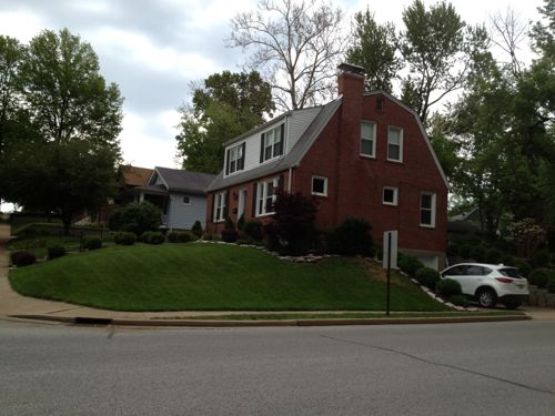
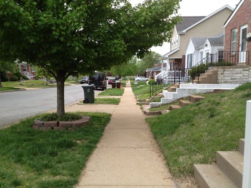
Heading back south toward city hall I passed charming houses and the route was paved and easy to navigate.
Heading back south toward city hall I passed charming houses and the route was paved and easy to navigate. The distance was over a half mile but it was fine, the worst part of the journey was closest to the transit station.
Getting closer to city hall and the neighboring park
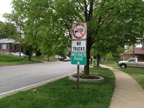
Getting closer to city hall and the adjacent Wehner Park
Newer houses mix well with older houses.
Almost there
Almost there!
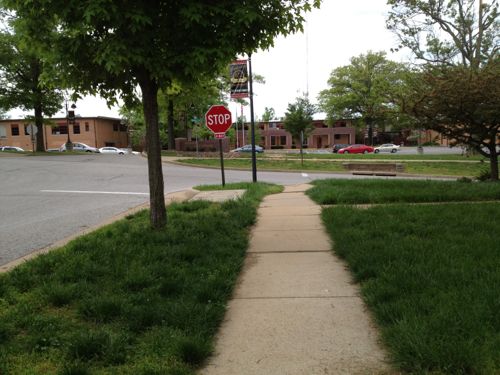
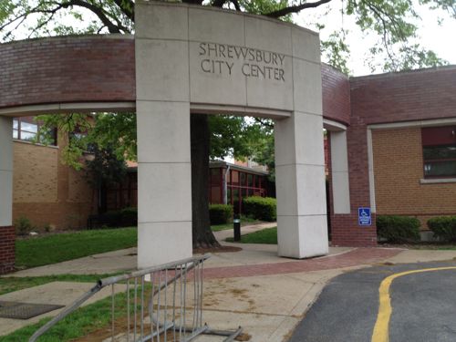
The sidewalk just ends, dumping me into the street. No crosswalk or visible sidewalk into the Shrewsbury City Center complex grounds.
The sidewalk just ends, dumping me into the street. No crosswalk or visible sidewalk into the Shrewsbury City Center complex grounds, just a sidewalk going east & west.
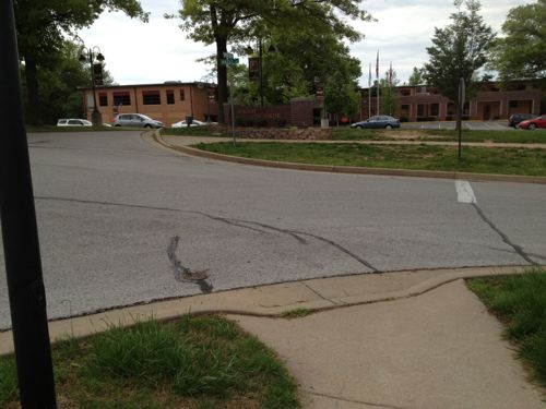
No way in on the east side of the auto drive.
No way in on the west side either, so I had no choice but to use the auto driveway
No pedestrian route on the west side either, so I had no choice but to use the auto driveway
shrewsbury052013-31
A pedestrian route along the east side of the auto driveway would be a direct path to the main entrance of the Shrewsbury City Center complex. Voters approved a bond in 1991 to pay for the renovations to city hall, the work was completed in 1993 — both after The Americans with Disabilities Act of 1990.
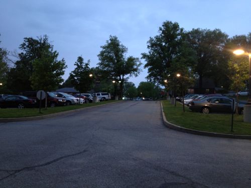
Leaving at night via the auto driveway. I'd imagine many neighbors drive here from just blocks  away because that's the message the design suggests.
Leaving at night via the auto driveway. I’d imagine many neighbors drive here from just blocks away because that’s the message the design suggests.
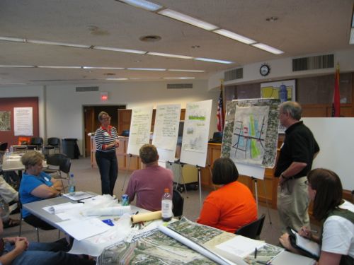
My only other time here was Saturday June 17,2006 for a charrette on connecting St. Louis & Shrewsbury to the open MetroLink line, attended by residents, businesses and elected officials.  I drove on that visit.
My only other time here was Saturday June 17,2006 for a charrette on connecting St. Louis & Shrewsbury to the open MetroLink line, attended by residents, businesses and elected officials. I drove on that visit.

Given the substantial capital investment made in the MetroLink expansion and the commitment of sales taxes to help fund Metro I find it unacceptable that nothing has been done in nearly 7 years. Well, the sidewalk along one side of St. Vincent looks like it was done in that time frame, but nothing else looks different. Employees & customers should be able to walk from the MetroLink station to the businesses along Murdoch & Murdock Cut-Off. Shrewsbury residents living within a 1/4 mile of the station should have a easy walk, but they don’t.

I suggest the following action steps:

  1. Metro, St. Louis, Shrewsbury, Trailnet, etc. begin to examine ways to improve the pedestrian experience to/from the Shrewsbury MetroLink/MetroBus station.
  2. Shrewsbury begin to evaluate multiple routes from the station to destinations with Shrewsbury, starting with a walking audit. I’d be happy to participate. Dan Burden from the Walkable & Livable Communities Institute would be an outstanding facilitator.
  3. Shrewsbury work to add an ADA-compliant accessible route to the main accessible entrance of the Shrewsbury City Center complex.

I’m emailing various officials at Shrewsbury & St. Louis this morning to try to raise awareness and get some action.

— Steve Patterson
 

Poll: How Should St. Louis County Reduce Traffic Congestion Between Mid & South County?

St. Louis County is still trying to make it easier to get from Hanley to Watson Rd., now through what’s being called the South County Connector. Various schemes have been around for decades:

A plan for an improved connection from south St. Louis County to central St. Louis County has existed since the late 1950s. The original concept was for a freeway “inner belt expressway” to provide better north-south access through the St. Louis suburbs. This freeway concept became Interstate 170 north of Interstate 64/U.S. Route 40. Originally, Interstate 170 was supposed to continue south into the southern part of St. Louis County to provide improved access between Interstates 44, 64 and 55. After much deliberation, area leaders decided in the 1990s not to pursue a southward extension of Interstate 170 due to public concerns. Although this option was abandoned, St. Louis County, the Missouri Department of Transportation (MoDOT), and other local agencies continued planning efforts to identify potential options for north-south access improvements in south St. Louis County. (source)

Here’s a summary of the current proposal:

John Hicks, the county’s Transportation Development Analyst, says the county is now presenting two alternatives to the public, but both roughly follow a route from River Des Peres Boulevard at Watson Road, through a portion of the Shrewsbury MetroLink parking lot, across I-44, into Big Bend Industrial Court, crossing Deer Creek Center and ending at Hanley Road near Flora Avenue. (KMOV)

A good portion would be elevated roadway.

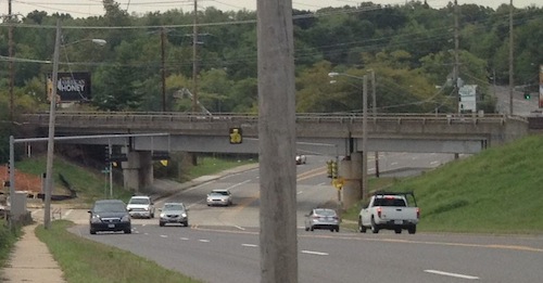
South Hanley ducks under railroad tracks.
South Hanley would be widened where it ducks under railroad tracks near Deer Creek Center.

Proponents say the project is needed to address projected increases in traffic, critics say the focus should be on transit, biking, and walking solutions.  They also say the widened/high-speed intersections would be dangerous to bikers and pedestrians.

I want to know what you think about it, the weekly poll is in the right sidebar. Cast your vote and share your thoughts below.

— Steve Patterson


Former River Roads Mall Site Vacant, the Few New Buildings Aren’t Pedestrian Friendly

River_Roads_LogoRiver Roads Mall was located in the north St. Louis County municipality of Jennings, MO:
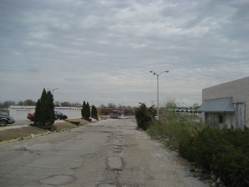
Opened in 1962, the mall originally featured St. Louis-based Stix, Baer & Fuller as its main anchor store, as well as a Kroger supermarket and a Woolworth dime store. Walgreens operated a store in the mall as well. A 1970s expansion brought JCPenney as a second anchor store. Dillard’s bought the Stix, Baer & Fuller chain in 1984, converting all Stix, Baer & Fuller stores to the Dillard’s name. However, the River Roads Mall store was closed not long afterward in 1986 at the end of the lease. JCPenney converted its store to a JCPenney outlet in 1984. Woolworth closed the River Roads location (along with locations at West County Mall and in South St. Louis City) in early 1991 during one of the chain’s earliest rounds of store closures. By the early 1990s, the mall was briefly renamed St. Louis Consumer Center. (Wikipedia)

Two decades after opening it was already in decline. The surrounding residential neighborhoods remain a decent place to grow up.

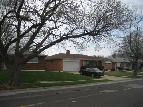
Homes facing the former mall remained tidy in 2007

I love that sidewalks were provided, those didn’t exist in the 1960s subdivision where I grew up, but they’re meaningless because the sidewalks didn’t lead anyone to nearby retail. You see in the 1960s America thought driving everywhere was the future. Cart the kids around until they get a license then they can drive themselves.

A March 2007 view looking south to Jennings Station Rd from River Roads Mall showed no consideration for pedestrians.
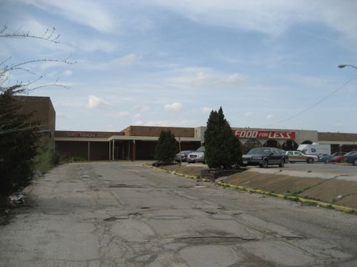
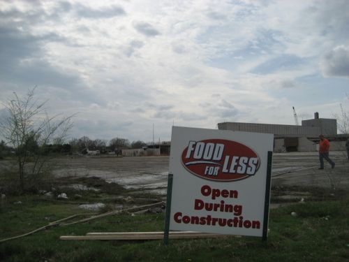
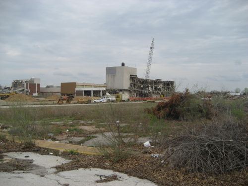
When I visited the site in March 2007 the mall had been closed for over a decade but the attached grocery store remained open during the demolition process.
They had to place signs to make it clear they were open
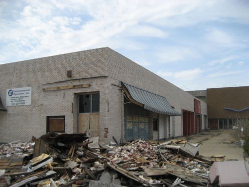
A corner of the former mall
The mall was located far from Jennings Station & Halls Ferry, not designed to welcome pedestrian shoppers

But we know better now, right? We need to design places to accommodate multiple modes of mobility: car, bike and foot. So you’d think the few new buildings that have been constructed in the last 5-6 years on the edge of the site have improved things for area residents. Well, you may not think so but I expected to see an improvement.

Boy was I disappointed on my first visit in 6+ years.

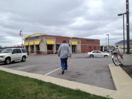
Pedestrians heading to McDonald's (customers & employees) but go over curbs, through grass and navigate cars. Wheelchair users must use the auto entrances/exits.
Pedestrians heading to McDonald’s (customers & employees) must go over curbs, through grass and navigate cars. Wheelchair users must use the auto entrances/exits, bicyclists must improvise to secure their bikes.
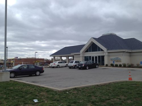
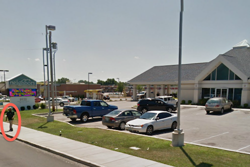
Neighbors wanting to visit Neighbors Credit Union should drive to do so, they've made no provisions to arrive on foot.
Neighbors wanting to visit Neighbors Credit Union shouldn’t walk since they’ve made no provisions for customers to arrive on foot.
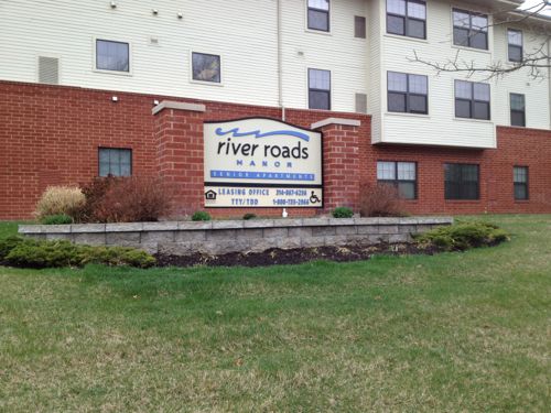
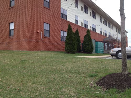
Surely senior apartments with accessible units will have a good connection to the sidewalk
The River Roads Manor website brags about being near public transit, too bad residents can't get to it.
The River Roads Manor website lists being near public transit as an amenity, too bad residents can’t get to it without walking in/out auto driveways.

River Roads Manor was a Pyramid Properties project, completed prior to the collapse of the company on April 18, 2008 (see Five Years Since Pyramid Properties Ceased Operations). The McDonald’s & Neighbors Credit Union were started.  So John Steffen’s Pyramid Properties is to blame for not raising the bar in this area.

I just hope  Stacy Hastie of Environmental Operations, the entity that now owns the mall site, will take pedestrian access into consideration in the future. I also hope Jennings will realize their residents do walk places and that new construction should include provisions for them as well as for motorists.

Some of you will say nobody walks, everyone drives. Why then is the area serviced by MetroBus is everyone drives?  All we have to do is take a look at Google Street View to spot pedestrians.

Pedestrian in front of Neighbors Credit Union
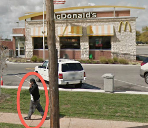
Pedestrian in front of McDonald's
Pedestrian in front of McDonald’s
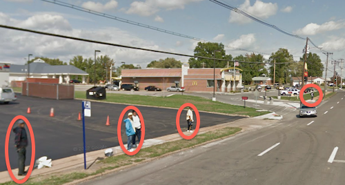
Many pedestrians waiting to catch the #16 MetroBus

Massive efforts go into accommodating motorists, from municipal codes to vast amounts of paving and land. I just want a pedestrian connection to adjacent streets, I think that’s fair.

— Steve Patterson


County Voters Approved Proposition A For Transit Three Years Ago

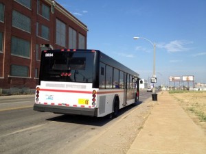
ABOVE: The westbound #32 MetroBus on Chouteau just barely west of Grand. The Pevely bldg is to the left, for now.
The westbound #32 MetroBus on Chouteau just barely west of Grand.

It was three years ago today that St. Louis County voters approved Proposition A, activating a sales tax previously approved by voters in St. Louis City.

Proposition A, a ½-cent sales tax in St. Louis County, passed on April 6! It will provide revenue needed for continued operation and expansion of the transit system including MetroLink, Metrobus and Call-A-Ride services for the disabled. The County tax will raise approximately $75 million annually – and now triggers a matching quarter cent sales tax that was passed in the City of St. Louis in 1997 which will add an additional $8 million a year to the program. (source)

In the last three years Metro has been able to restore MetroBus service to areas where it had been cut due to lack of funding. St. Louis County is holding back some of the tax revenue generated  each year, to use for local match for an expansion of MetroLink light rail.

But where?

  • South from the Shrewsbury end?
  • North along I-170?
  • Out to Westport Plaza?

I haven’t kept up with the long range planning so perhaps the next route has been selected already, anyone know?

— Steve Patterson


Lack Of Crosswalks May Have Contributed To Death Of Boy

On the evening of Friday October 5th a tragedy happened:

A boy has died and another is in critical condition after a pickup truck hit them and left the scene in Pagedale Friday evening.

The incident happened at about 7:30 p.m. in the 7300 block of St. Charles Rock Road in Pagedale at Salerno Drive, just east of Pennsylvania Avenue. (stltoday.com)

His 10 year-old brother survived, with serious injuries. Earlier this month I visited the accident site, well I got as close as I could.

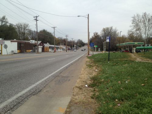
ABOVE: The boys crossed St. Charles Rock Road to reach the gas station/convenience store on the right.
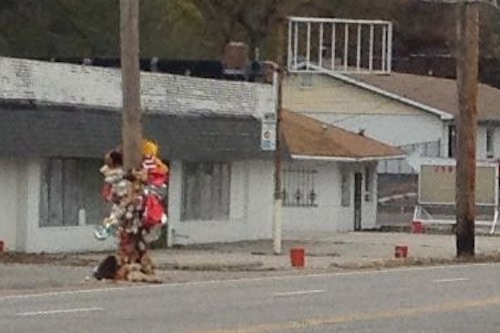
ABOVE: A power pole pays tribute to 4 year-old Traye-shon Williams killed at the scene.

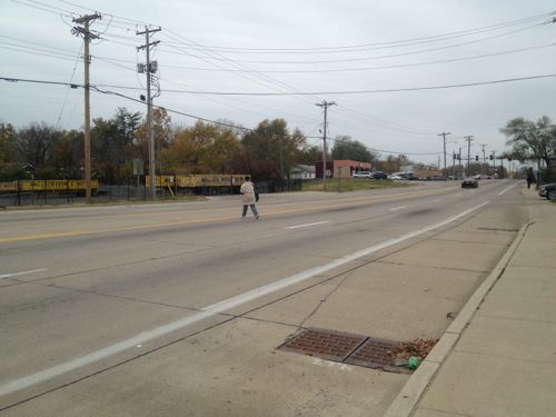
I couldn’t reach the convenience store or cross the street in my wheelchair due to a lack of sidewalks and crosswalks.  The distance between signalized crossings is more than a quarter mile, as a result pedestrians regularly cross the street where it is convenient to do so.

ABOVE: A woman crossing St. Charles Rock Road just east of the accident location.

Media reports focussed solely on the driver’s record:

In the last 30 years, he has been arrested about 150 times, almost always while driving in north St. Louis County. Six of his 11 DWI arrests resulted in convictions: four times on misdemeanors and two on felonies. He has served fewer than two years total in prison on the DWI charges. (He also has served time in prison on gun charges.) (stltoday.com)

Yes, those who drink & drive are a problem, but only part of it. The other part of the problem is this area, just a short distance from the Rock Road MetroBus/MetroLink center isn’t designed for use by pedestrians.

My sympathies to the families of all involved.

— Steve Patterson


Advertisement


[custom-facebook-feed]

Archives

Categories

Advertisement


Subscribe