Please vote in the poll, located in the right sidebar
In April 2010 voters in St. Louis County approved a transit sales tax, Prop A:
The sales tax is expected to generate about $75 million a year in St. Louis County, which will be used to restore lost service and expand MetroLink and bus rapid transit. Metro officials said passage of the measure also would trigger collection of a transit sales tax that voters in the city of St. Louis approved in 1997. (stltoday.com)
I’m not sure how much St. Louis County is putting toward operations versus holding back for future transit infrastructure. Regardless of the exact amount, having a discussion about where & how to expand transit is beneficial.
Light rail? Bus Rapid Transit? More regular bus routes?
The project to redo Tucker Blvd from Cass Ave to Washington Ave is nearly complete. The Stan Musial Veterans Memorial Bridge will be open in early 2014, bringing many into downtown along the rebuilt Tucker Blvd, but the rebuild stops at Washington Ave, because that’s where the old passenger rail tunnel stopped.
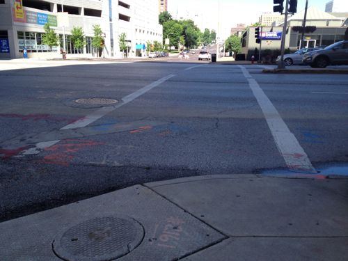
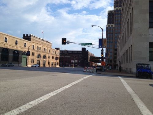
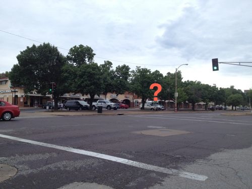
Looking west across Tucker from the NE corner at Olive. Too wide, no directional ramp.
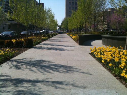
The public right-of-way (PROW) north of Washington Ave is a generous 80 feet wide, the new streetscape is fresh looking, with 2 lanes in each direction plus parking protected by curb bulbs. The half mile from Washington Ave south to Spruce St the width nearly doubles to a massive 150 feet. It has too many lanes — seven total travel lanes, a center turn lane, plus two parking lanes. See map.
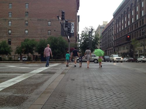
Pedestrians crossing Tucker on the south side of Washington Ave, the wide side
This half mile stretch of Tucker Blvd looks dated and functionally it’s awful as a motorist and as a pedestrian.
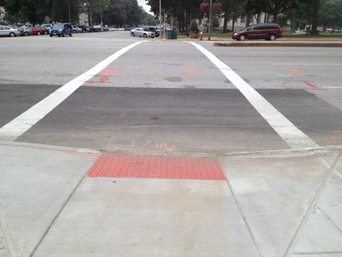
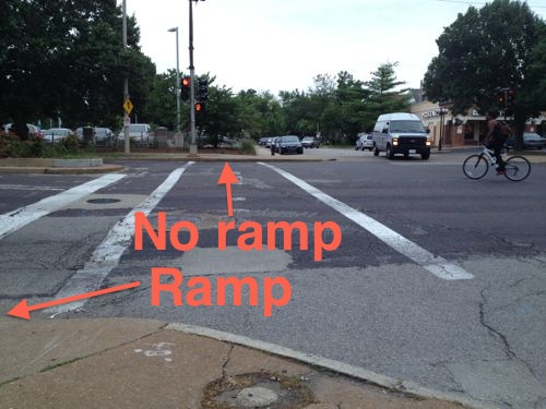
SLU at least did directional ramps in front of their new law school building, but the crossing distances are excessive. Bulbs at the ends of the parking lanes would reduce crossing widths.Example of curb bulb behind a parking lane, Tucker & MLK in front of the Post-Dispatch
Plus in a busy central business district the minimum width ADA ramp is way too narrow for all the pedestrians, strollers, wheelchairs, & [mobility] scooters. Just north of Market St the future Gateway Mall “hallway”, the wide sidewalk planned to connect the mall from Broadway to 20th can be planned for.
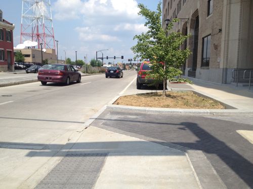
The Gateway Mall master plan calls for this “hallway” to run from Broadway to 20th, only two blocks exist currently, in Citygarden shown hereLooking south across Clark St toward the soon to be former police headquarters on the west side of Tucker.
Of course, many other streets throughout the city also need a road diet. I know, there’s no money for any of them. We need to figure out which ones need a diet and what we’d like to do. Then work to fund them.
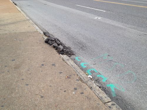
City buses are great ways to transport many people, but their weight can take a toll on roads. Bus stops, in particular, take a lot of punishment. This #11 stop on Chippewa at Hampton is a good example:
Repeated weight of buses stopping on Chippewa just east of Hampton has messed up the paving.
Asphalt tends to move when it is hot and pressure is applied over and over. To avoid such a maintenance headache some cities & transit agencies are paving bus stops in concrete.
Example of concrete paving at a bus stop. Source: Washington Metropolitan Area Transit Authority Guidelines for the Design and Placement of Transit Stops, click image for PDF
These concrete bus stops aren’t cheap though, and with hundreds of heavily used bus stops the cost to upgrade all would be astronomical.
I’ve observed damage like this at numerous other bus stops. I’m not sure how much this costs the city to repair, or if remains until the road is resurfaced. Thoughts?
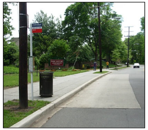
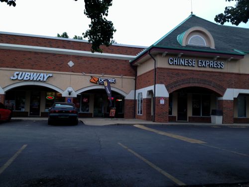
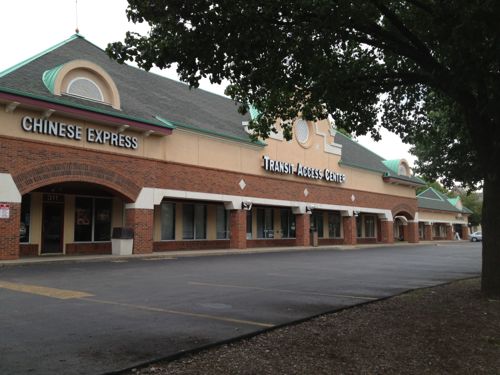
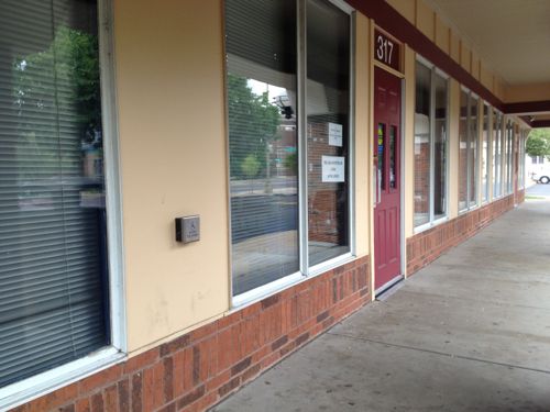
Seniors (65+) and the disabled can ride Metro for half price, but a reduced fare permit is required. Seniors have several options on obtaining such a permit, the MetroRide store downtown, for example. The disabled, like myself, must visit Metro’s Transit Access Center at 317 DeBaliviere. Let’s pretend we’re newly disabled and need to get a reduced-fare permit, for the first time. We arrive on the #90 (Hampton) MetroBus or via MetroLink at the Forest Park station. Remember this station opened twenty years ago, and was altered significantly in 2006 when the extension to Shrewsbury was built.
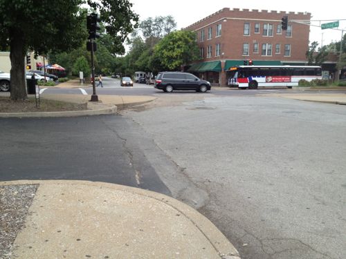
We get off the bus or come up from the platform on the east side of DeBaliviere and head north to find our destination.
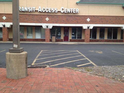
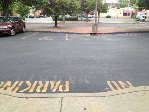
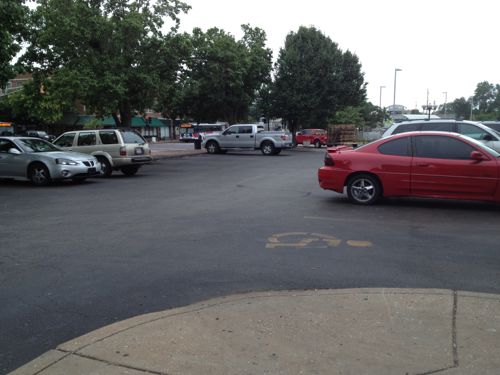
Based on the map online the Transit Access Center must be located in the strip mall over there.This curb ramp has nothing to do with the crosswalk, no curb ramp exists on the other end of the crosswalk. When the light turns green we’ll have to head over to the auto drive where cars will be leaving.Made it across safely, there’s our destinationDrat, no ramps on either side of the driveway! We could enter the auto driveway and hope we find a ramp before a vehicle backs over us, but none are visible from this point. Let’s continue along the public sidewalk to see if we can find another way in or our destination.There’s a ramp to the right of that car, we can’t reach it from here due to planter/curb/parking, We could go back and risk getting backed over or continue until we see our destination. I say we keep looking for a safe route.Oh, there’s the Transit Access Center, there must be a pedestrian route down further.See, I knew we’d find a direct way! Oh wait…Naturally a curb is in our wayAll the way on the far end is a route to reach the storefronts from the public sidewalk.We get to the door and we’re glad it has an automatic opener, but it doesn’t work when pressed. “It’s never worked”, says the person inside when we mention it.Leaving we see the problems from the other sideStill too risky to go behind parked cars, why must it be such a challenge?The fix here in this privstely-owned development is pretty simple actually, just replace a couple of curbs with ramps.
I’m not sure how long the Transit Access Center has been a tenant in this building, at least 4 years. The building was built in 1988, two years before the ADA and five years before the MetroLink opened. But for the last twenty years this development adjacent to a light rail station hasn’t been very accessible.
Again, this is the location every disabled person that seeks a reduced-fare permit must go. Granted, access from disabled parking is easy enough but many who need the permits can’t drive. For the disabled, independence is very important.
Regular readers know I’m a supporter of public transit, and an advocate for modern streetcars, in particular. When I received an email from a planning student asking about publishing her paper on her evaluation, I was curious. Here’s how Jill Mead described herself to me in that email:
I’m a Masters in Public Health and Masters of City Planning student at the University of North Carolina in Chapel Hill. I also work for the Pedestrian & Bike Info Center at UNC’s Highway Safety Research Center. If that weren’t enough, I’m very much a St. Louisan. I grew up in Forest Park Southeast (in the 80s!) and am a K-12 graduate of the SLPS. I went to UMSL for one year and Wash U for the rest of my college degree.
Though I don’t agree with her analysis and conclusions in the paper, I thought it would spur some good discussion. Here is a brief summary of her paper:
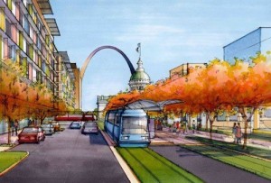
Artist rendering of proposed streetcar in downtown St. Louis.
Spurred by the availability of federal funds and inspired by the success of streetcar projects in other cities, the non-profit Partnership for Downtown St. Louis released a feasibility study for a downtown St. Louis streetcar project in March 2013. The feasibility study recommended the project based on its likelihood of achieving its two main objectives: (1) enhancing the region’s transit system and (2) catalyzing economic growth throughout the streetcar corridor. While the St. Louis Streetcar Feasibility Study is optimistic about the achievement of these two objectives, reviewing the study calls some of their claims into question. Ridership estimates seem inflated given the slow travel speeds of the streetcar and methodology used. The choice of alignment fails to prioritize the city’s densest areas and is out of sync with plans being made at the regional level. In terms of the streetcar’s ability to catalyze economic development in St. Louis, the study inadequately addresses the wide variety of contextual factors, such as land use policy and the existence of strong public-private partnerships and market demand that were characteristic of other cities’ success in attracting development to streetcar corridors. The paper concludes that strategies to improve economic growth and public transportation are necessary in St. Louis, but it is not clear that the proposed St. Louis Streetcar project is the best use of public resources to achieve these goals.
When St. Louis University announced plans to move their law school from midtown St. Louis to downtown, the Partnership for Downtown St. Louis once again began the discussion of a streetcar for downtown. This move presented an opportunity to link the two campuses with a streetcar and fulfill the goals of the Downtown Next Plan.
The idea of SLU running shuttle buses every day between midtown and downtown meant only a small segment of the population would be served, pollution would increase, roads would be see additional traffic from the continuous loop of shuttles. Us regular transit riders along Olive/Lindell would still have 30-40 minute headways on the existing #10 MetroBus. Why not improve the public transit system for all?
Connecting to south St. Louis wouldn’t help SLU with transporting students, faculty, and staff between the main campus in midtown and the new law school building downtown. By including a north-south segment on 14th the proposal recognizes future expansion into south & north city.
The existing MetroBus isn’t slow, it doesn’t take me long to get to the Central West End from my downtown loft, but the streetcar will come every 10-15 minutes instead of every 30-40 minutes — that’s far more important than whether it takes 8 minutes versus say 12-15 minutes to reach my stop! The streetcar will be faster than the bus, the center dedicated right-of-way, off-board fare payment, etc. will make the trip no longer than bus, very likely shorter. Buses are sometimes late; they get stuck in traffic, wheelchair lifts malfunction, rerouted around events, etc. When the bus takes 10 minutes to get to my stop but arrives 10 minutes late that puts me way behind. If I take the 30 minute earlier bus I arrive way too early and it uses more of my day.
Also from page 2 of the final study:
The purpose of the study was to:
support the goals established in The Downtown Next 2020 Vision to improve Downtown’s accessibility;
create a catalyst for continued economic development;
provide additional opportunities for alternative transportation;
support the region’s and City’s sustainability initiatives;
and promote an environment that will retain and attract new jobs and residents to the City.
I’ve invited Mead to come downtown and ride the #10 MetroBus with me, to midtown and back, to better understand the existing conditions, then I think she’ll see how the streetcar will be a potentially massive improvement. She’s in town visiting family, we’re talking about doing this later in the week.
Mead is correct when she said, “the study inadequately addresses the wide variety of contextual factors, such as land use policy.” The word “zoning” appears just four times in the final study report. “Proper zoning” is mentioned, but not defined. My fear is we won’t set up the necessary land-use controls to guide new development over the 10-20 years following the completion of the streetcar. If the prevailing Laissez faire attitude in St. Louis is allowed to squash good form-based zoning then the streetcar investment will be at least partially wasted.
But if we can get the formula right, it will be a boon and expansions can follow every few years, as we’ve seen in other cities. But I’ve been here long enough to know the old guard isn’t going to change so easily. Will this time be different?
Please share your thoughts on Mead’s paper, or my response, below.
AARP Livibility Index
The Livability Index scores neighborhoods and communities across the U.S. for the services and amenities that impact your life the most
Built St. Louis
historic architecture of St. Louis, Missouri – mourning the losses, celebrating the survivors.
Geo St. Louis
a guide to geospatial data about the City of St. Louis