Home » Transportation » Recent Articles:

Travel: Elevated Highway Removal In Oklahoma City Part 1

Count me among those who think St. Louis needs to remove the elevated section of I-70 north of Washington Ave that cuts off Laclede’s Landing from the rest of downtown. These types of elevated lanes were built during a period where little, if any, consideration was given to pedestrians. The negative consequences weren’t considered at the time but they became apparent later.

As a kid growing up in Oklahoma City we’d have to drive under an elevated highway to get to downtown. I rarely drove on I-40 since it was an east-west route and we lived a few miles directly south of downtown. The few times I did drive across the elevated highway I was nervous doing so, the lanes were narrow and the condition was poor. I never once walked under it.

The Oklahoma City Crosstown is an elevated four mile (6 km) stretch of Interstate 40 that dissects downtown Oklahoma City from Agnew Avenue to Byers Avenue. It is owned and maintained by the Oklahoma Department of Transportation (ODOT). It is the primary east–west artery through Oklahoma City, and serves an unofficial dividing line between north and south Oklahoma City (the official dividing line for address purposes is [Reno Avenue]). While the Crosstown designed to withstand about 76,000 vehicles a day, it is currently used by nearly 120,000 vehicles a day. The Crosstown was completed in the 1960s using an engineering process commonly termed as “fracture critical”, a process that has not been used since the 1970s because it does not provide redundancies. According to Brian Windsor, an ODOT structural engineer, without redundant support, the failure of a single beam creates the risk of total collapse of that section of bridge. The entire stretch of the Crosstown is elevated, and at some points, the elevation is as much as 50 feet (15.2 m). Other safety problems of the existing Crosstown include falling chunks of concrete and a lack of shoulders or breakdown lanes. In an August 2007 poll sponsored by The Oklahoman, nearly ? of respondents indicated that they were “afraid to drive across the Crosstown bridge in Oklahoma City”. (Wikipedia)

It wasn’t a good roadway, nor could it be retrofitted. It had to come down.
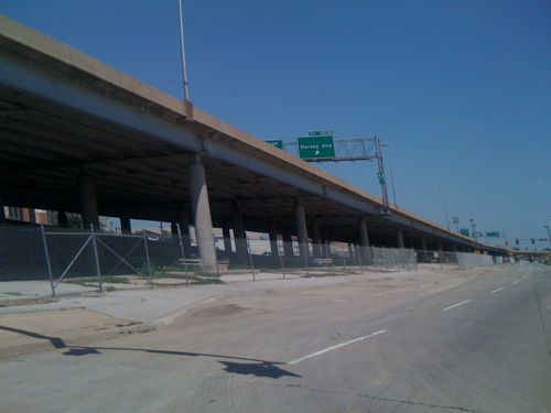
ABOVE: I-40 in Oklahoma City in August 2009

Well, the four mile elevated stretch of I-40 is now closed and is being dismantled. This was years in the planning and before you ask, yes they built a replacement highway in a wide trench a half mile to the south. Part 2 tomorrow will look at the new highway.

As I indicated earlier, I-40 is a major east-west highway:

Interstate 40 (I-40) is the third-longest major east–west Interstate Highway in the United States, after I-90 and I-80. Its western end is at Interstate 15 in Barstow, California; its eastern end is at a concurrency of U.S. Route 117 and North Carolina Highway 132 in Wilmington, North Carolina. Much of the western part of I-40, from Oklahoma City to Barstow, parallels or overlays the historic U.S. Route 66. I-40 intersects with eight of the 10 primary north–south interstates (all except I-5 and I-45) and also with I-24, I-30, I-44, I-77, and I-81. (Wikipedia)

Locals use I-40 but so do many more just passing through Oklahoma.
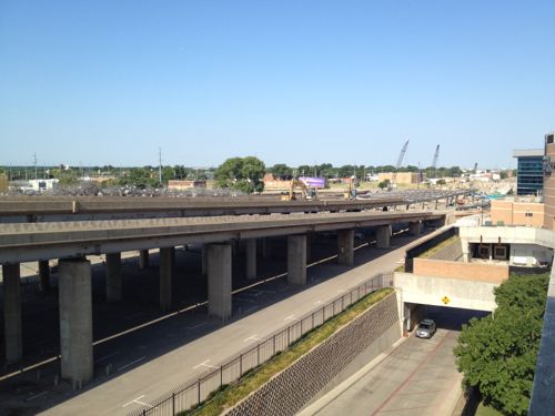
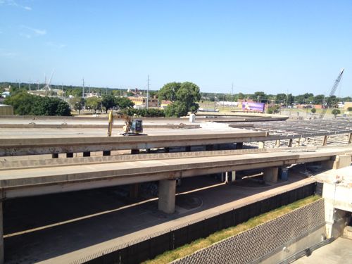
ABOVE: The old I-40 elevated lanes in Oklahoma City being demolished.
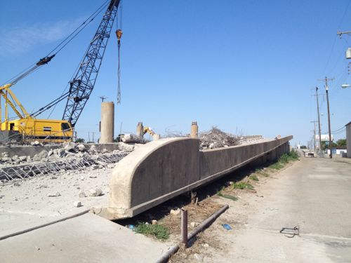
ABOVE: Close-up of old on-ramp to westbound I-40 cutting through the south edge of downtown Oklahoma City as the highway is being removed.
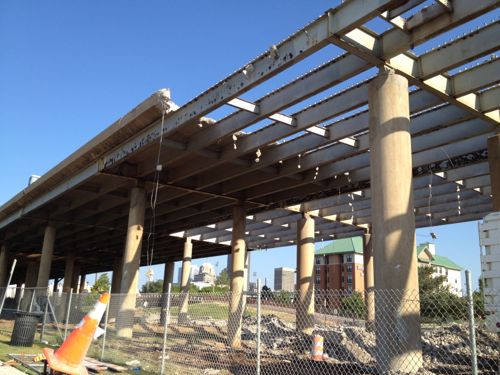
ABOVE: Crews slowly dismantle the old I-40 elevated lanes.
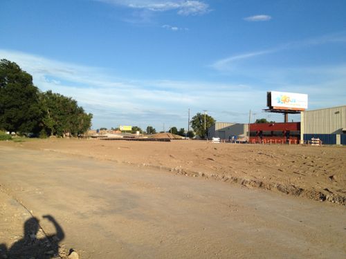
ABOVE: New development (background) can continue to the south once the elevated highway is removed.
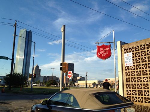
ABOVE: Just to the north is the Myriad Botanical Gardens and the new 844ft high Devon Tower, click image for more information. The Gateway Arch is only 630ft tall.
ABOVE: South of the highway was cut off from downtown and investment, places like the Salvation Army were the only ones that would locate there.
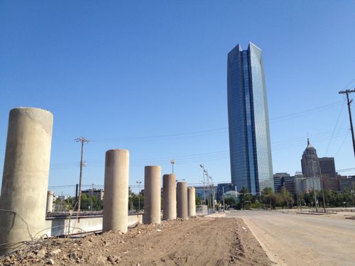
ABOVE: Vacant land where part of the elevated highway has been completely removed.
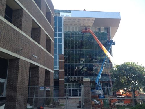
ABOVE: A new entrance to the Chesapeake Arena, home of the OKC Thunder NBA franchise, is being constructed now that the adjacent highway is being removed.
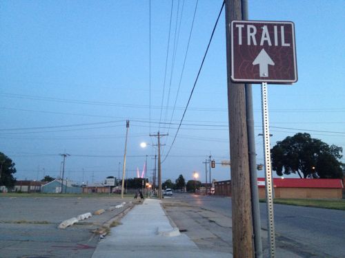
ABOVE: A sign indicates a trail, directing people southward through no-man’s land toward the new highway and the Oklahoma River beyond.

Tomorrow I’ll continue the story with a look at the new I-40 and how to cross it as a pedestrian. I’m excited about visiting Oklahoma City during the coming years as they fill in where the highway was removed.

— Steve Patterson
 

World Naked Bike Ride Tonight

July 28, 2012 Bicycling, Events/Meetings, Featured Comments Off on World Naked Bike Ride Tonight

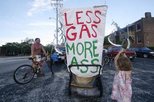
Tonight is the 5th World Naked Bike Ride in St. Louis:

This year’s event starts at 6 p.m. at the South Grand Boulevard parking lot and includes body-painting, live music and “costume” contests. The ride, typically 10 miles, starts at 8 p.m. (stltoday.com)

The St. Louis Facebook page is here.

Source: World Naked Bike Ride in St. Louis

What’s this all about?

World Naked Bike Ride (WNBR) is an international clothing-optional bike ride in which participants plan, meet and ride together en masse on human-powered transport (the vast majority on bicycles, but some on skateboards and inline skates), to “deliver a vision of a cleaner, safer, body-positive world.”

The dress code motto is “bare as you dare”. Full and partial nudity is encouraged, but not mandatory, on all rides. There is no mandate to cover intimate parts; this is a distinguishing feature of WNBR against other cycling events.

Creative expression is also encouraged to generate a fun and immersive atmosphere during the ride, capture the attention and imagination of the public and media, and make the experience more personalized and fulfilling for the riders. Body art, such as body painting, are common forms of creative expression, as well as costumes, art bikes, portable sound reinforcement systems (such as public address systems, bullhorns and boomboxes) and musical instruments or other types of noisemaker. (Wikipedia)

Of course local laws require participants “cover intimate parts.”

— Steve Patterson


New Grand Viaduct Huge Improvement, Development Opportunities Remain

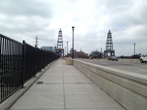
Several years ago I suggested an urban bridge over the train tracks at Grand, storefronts lining each side of the bridge. These would be built on the ground below and designed to have a floor level even with the bridge. With the old bridge out of the way we can see this was entirely possible — only 3-4 train tracks have to be crossed and combined with Scott Ave the bridge span would’ve been 250 feet for so.

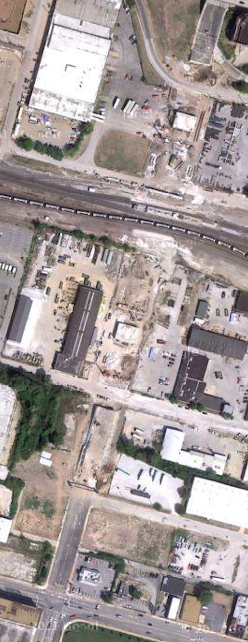
ABOVE: Aerial of Grand after the old viaduct was removed and before the new bridge was built. Click image to view in Google Maps.

But the new bridge wasn’t designed with that in mind. However, the spans aren’t as long as the prior structure because previously open areas were built filled-in.

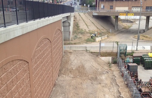
ABOVE: Solid fill under much of the roadway, a short span is seen over Bernard St.

As you can see from the above image it’s just ground next to the viaduct, it’s not spanning the Mississippi River! Hold that thought though while we take a look at what was replaced and what was built.

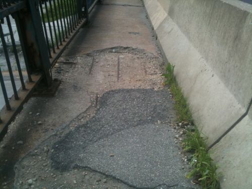
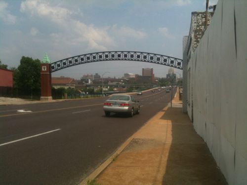
ABOVE: The old bridge had narrow & patched sidewalks on each side with a rusty railing.

Crossing the old bridge/viaduct as a pedestrian was a miserable experience. It was narrow and at the center it got crowded with transit riders for the #70 (Grand) MetroBus and MetroLink.

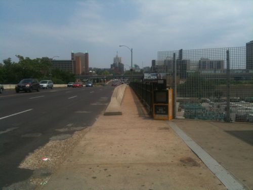
ABOVE: Looking north from the old transit stop in June 2010

Now it’s a much better pedestrian experience!

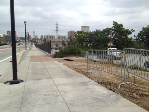
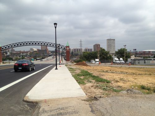
ABOVE: More generous width will allow wheelchairs & strollers to meet and pass. Planters take away some width but they’ll add some softening materials.
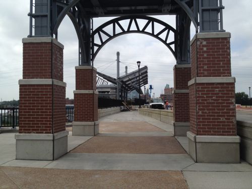
ABOVE: Towers are meant to recall an earlier viaduct that was replaced in the 1960s.
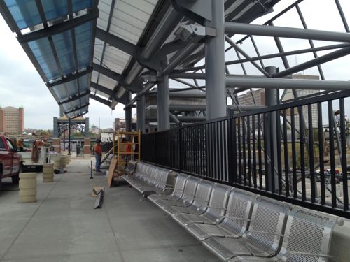
ABOVE: Workers are still putting the MetroBus stop together but this will be great for those who ride the city’s busiest bus line.
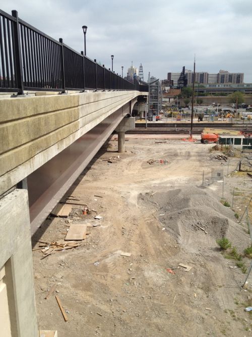
The area between roughly Gratiot St and Scott Ave is open span, not fill.

Ok, I like the new viaduct but it’s still a long distance from end to end — I’d still like to see structures built up next to the bridge over time. Next to the open section shown above might be problematic, but the earlier area near Scott Ave shouldn’t be difficult.  However, a building foundation next to the foundation for the fill wall might be challenging, I’m not an engineer.

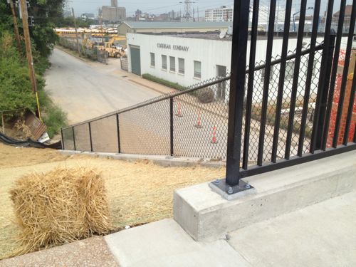
ABOVE: At the south end just before Papin St the grade comes up to the sidewalk. I see no reason a building couldn’t be built close to the sidewalk.
ABOVE: A nondescript building remained up to the sidewalk in June 2010 in the space between Papin St and the Captain D’s.
ABOVE: That building was razed, clearing the land for something new

The old sidewalk was narrow and the new sidewalk isn’t much wider, it also lacks street trees.  I’d like to see new buildings north and south of Papin St but I don’t think they should abut the sidewalk. Keep them back 10-15 feet, not 75+ feet the way Saint Louis University tends to do. Since the above is at grade and it won’t have on-street parking to separate pedestrians from traffic it really needs to have street trees and more width.

Remember that SLU wants more students walking from the main campus north of the viaduct to the medical campus to the south. The plants on the viaduct will help but we need street trees between cars and pedestrians where possible and buildings to give a sense of enclosure. This will be easier to accomplish on the west side so let’s cross Grand and have a look.

ABOVE: The bridge/viaduct ends on the south side of Gratiot St. so there is more opportunity to connect from this point to Chouteau.
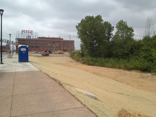
ABOVE: Huge opportunity to create a more urban context and give the sidewalk some protective enclosure.

Unfortunately with SLU involved and their plan to raze the Pevely building in the background I’m not optimistic about the future of this area. It’ll likely be much like walking next to SLU. Perfect manicured green grass and buildings set back 100 feet or more from the sidewalk, totally anti-urban rather than appropriate transit adjacent development.

Hopefully I’m wrong and good urbanism will get built on either side of Grand.

— Steve Patterson


Metro’s Multi-Use Transfer

For many transit riders the bus transfer is an important piece of paper.  Until this year I didn’t know the why or how to use a transfer but I learned quickly.

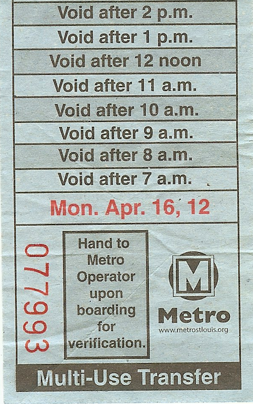
ABOVE: A transfer from April 16, 2012

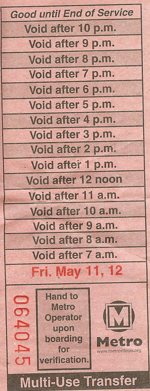
The current MetroBus adult fare is $2 and a “multi-use transfer” costs $1 more. Depending upon your trip it’s worth the extra buck. When you board a bus and pay $3 you get a transfer good for at least two hours. The driver tears off the transfer at the appropriate spot depending upon the current time.

ABOVE: Ride late enough and you’ll get a transfer good until service ends.

Here are some examples where the transfer comes in handy:

  1. Transferring to another bus to reach your destination.
  2. Transferring from bus to light rail to reach your destination.
  3. Return bus trip for a quick visit somewhere.
I’m back to buying a monthly pass now but I did all of the above over the winter months when I  was a cash rider. If you’re taking one bus to a place where you’ll be for three hours before leaving then a transfer doesn’t make sense. But if you’re going to the library to pick up a reserved item and you’ll be in/out within 30 minutes then the transfer will get you back home for $1 rather than $2.
There were times that I had bought a transfer and couldn’t use it, the next bus coming 10 minutes after my transfer expired.With experience I got better at figuring out when to buy a transfer and when no too.
If you start at MetroLink your time-stamped ticket also works like a transfer. When I was a cash rider I’d buy a stack of 2-hour tickets in advance from the MetroRide store at 7th & Washington Ave since I rarely carry cash, especially $1 bills. These don’t expire for months and are good for use on MetroLink and cover your fare & transfer on MetroBus. When I was going somewhere on MetroLink I’d often start my trip on the (#99 Downtown Trolley) because I’d get more time than I would just by stamping the 2-hour pass upon entering my starting station.

— Steve Patterson


MetroLink Moves Masses For Events

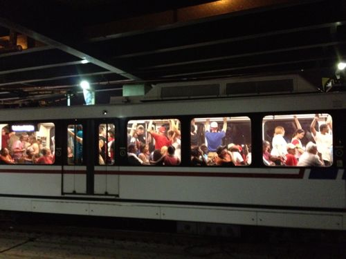
After the fireworks were over on the 4th many headed toward public transit, not a private vehicle. MetroLink light rail was packed with people going east & west from both sides of the river.

ABOVE: Crowds fill trains after fireworks on July 4th

Downtown couldn’t have handled all the cars if these people had driven, not enough parking and the streets would have been jammed for a long time. I can’t imagine not having our light rail lines to get people to & from major events.

— Steve Patterson


Advertisement


[custom-facebook-feed]

Archives

Categories

Advertisement


Subscribe