Home » Transportation » Recent Articles:

Reading: Human Transit by Jarrett Walker & Straphanger by Taras Grescoe

Two books arrived recently, both on transit, specifically now how transit can improve our lives: Human Transit: How Clearer Thinking about Public Transit Can Enrich Our Communities and Our Lives by Jarrett Walker and Straphanger: Saving Our Cities and Ourselves from the Automobile by Taras Grescoe. Given that I’d sold my car over a month ago both books piqued peaked my interest.
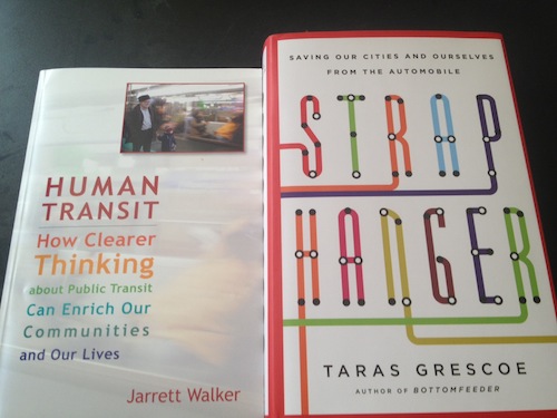
Human Transit: How Clearer Thinking about Public Transit Can Enrich Our Communities and Our Lives:

Walker takes complicated and often technical subjects and presents them to the reader in layman’s terms.

The table of contents shows the topics covered:

  1. What Transit is, and Does
  2. What Makes Transit Useful? Seven Demands and How Transit Serves Them
  3. Five Paths to Confusion
  4. Lines, Loops, and Longing
  5. Touching the City: Stops and Stations
  6. Peak or All Day?
  7. Frequency is Freedom
  8. The Obstacle Course: Speed, Delay, and Reliability
  9. Density Distractions
  10. Ridership or Coverage: The Challenge of Service Allocation
  11. Can Fares be Fair?
  12. Connections or Complexity?
  13. From Connections to Networks, to Places
  14. Be on the Way! Transit Implications of Location Choice
  15. On the Boulevard
  16. Take the Long View

Walker doesn’t offer the solutions, he asks the questions to get us to determine what  we need from our transit system:

This book aims to give you a grasp of how transit works as an urban mobility tool and how it fits into the larger challenge of urban transportation. This is not a course designed to make you a qualified transit planner, though some professionals will benefit from it. My goal is simply to give you the confidence to form and advocate clear opinions about what kind of transit you want and how that can help create the kind of city you want.

I can tell this book will be a valuable resource for me. Read the blog here and purchase here ($35 softcover)

Straphanger: Saving Our Cities and Ourselves from the Automobile

Grescoe takes a different, but valuable, approach to transit. Examples from numerous cities in North America and the entire world are examined.

Taras Grescoe rides the rails all over the world and makes an elegant and impassioned case for the imminent end of car culture and the coming transportation revolution

“I am proud to call myself a straphanger,” writes Taras Grescoe. The perception of public transportation in America is often unflattering—a squalid last resort for those with one too many drunk-driving charges, too poor to afford insurance, or too decrepit to get behind the wheel of a car. Indeed, a century of auto-centric culture and city planning has left most of the country with public transportation that is underfunded, ill maintained, and ill conceived. But as the demand for petroleum is fast outpacing the world’s supply, a revolution in transportation is under way.

Grescoe explores the ascendance of the straphangers—the growing number of people who rely on public transportation to go about the business of their daily lives. On a journey that takes him around the world—from New York to Moscow, Paris, Copenhagen, Tokyo, Bogotá, Phoenix, Portland, Vancouver, and Philadelphia—Grescoe profiles public transportation here and abroad, highlighting the people and ideas that may help undo the damage that car-centric planning has done to our cities and create convenient, affordable, and sustainable urban transportation—and better city living—for all. (MacMillan)

Not sure yet how lessons learned in other cities will apply to St. Louis but such knowledge is important to quality solutions.

Final thoughts

Both books reference a quote commonly attributed to Margaret Thatcher: “A man who, beyond the age of 26, finds himself on a bus can count himself as a failure.” 

It appears that the quote was misattributed to Thatcher:

Attributed to her in Commons debates, 2003-07-02, column 407 and Commons debates, 2004-06-15 column 697. According to a letter to the Daily Telegraph by Alistair Cooke on 2 November 2006, this sentiment originated with Loelia Ponsonby, one of the wives of 2nd Duke of Westminster who said “Anybody seen in a bus over the age of 30 has been a failure in life”. In a letter published the next day, also in the Daily Telegraph, Hugo Vickers claims Loelia Ponsonby admitted to him that she had borrowed it from Brian Howard. There is no solid evidence that Margaret Thatcher ever quoted this statement with approval, or indeed shared the sentiment. (Wikiquote)

Who spoke the words isn’t as important as the general agreement of much of the world with this view.

I’m glad to have these two books in my library.

– Steve Patterson
 

Tucker Tunnel Not Quite Gone

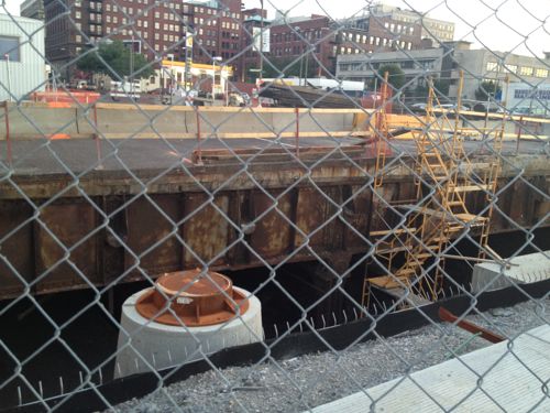
The former commuter railroad tunnel under Tucker (12th) isn’t fully gone, but it’s a lot shorter now.

ABOVE: The new Tucker meets the old Tucker at Gay St. on May 18, 2012. Click image to view in Google Maps

This project fascinates me, I wished at some point I’d seen the tunnel.  I’m looking forward to being able to use Tucker to get further north as a pedestrian. I still question the quality of any new development we’ll see along this corridor given the city’s lack of leadership on good urban planning.

– Steve Patterson
 

Redeveloping Natural Bridge & The UMSL South MetroLink Station

Considerable attention is being given to redeveloping Natural Bridge and the UMSL South MetroLink Station.

On Friday, [UMSL Chancellor] George announced that Normandy collaborators hit their $14 million goal last week to transform a portion of Natural Bridge Road between Lucas and Hunt Road and the inner belt of I-170 into a more pedestrian-friendly street.

The plan is part of the St. Louis Great Streets Initiative, a program through the East-West Gateway Council of Governments, designed to encourage community leaders to use their streets to enhance economic development and social activities in their communities. (St. Louis American)

The initial phase would be between Florissant and Hanley.  In the middle is the UMSL campus and the UMSL South MetroLink station just to the south of Natural Bridge.

CMT in partnership with Metro charged a group of local experts from the ULI St. Louis Chapter called a Technical Assistance Panel (TAP) to look at the possibilities for development at the UMSL South Station. This is the second TAP that CMT and Metro have commissioned – the first at the Belleville MetroLink Station. Thanks to the AGC St. Louis for underwriting this event.

One idea presented was the possibility of rebranding the area around the station as a retail/commercial/event space as Plank Street Station. There would be a new access road that would run from Natural Bridge to the Station. The City of Normandy is willing to move their City Hall location to another area within this possible development or a different area all together. The panel suggested that Metro’s role could include building a pedestrian bridge as well as additional parking structure on the west side of the station to feed both the system and the development. (CMT-STL)

With all this interest I needed to see the area again to be able evaluate the proposals. The easiest way would’ve been to drive down Natural Bridge, but I no longer have a car. Besides, evaluating an area for a walkable district by driving is like evaluating a restaurant’s food based on internet pictures.

So on May 10th I caught the #4 (Natural Bridge) MetroBus on 18th at Clark and got off at Lucas and Hunt (aerial). I then “walked” in my power chair west along the north side of Natural Bridge to Hanley, crossed to the south side and returned. It was a 3.4 mile “walk” per Google Maps. I added a bit more distance by dropping down to the south UMSL MetroLink Station along the way.

During my four hour trip  (end to end, with lunch) I took 382 photos, I’ll share just some here.

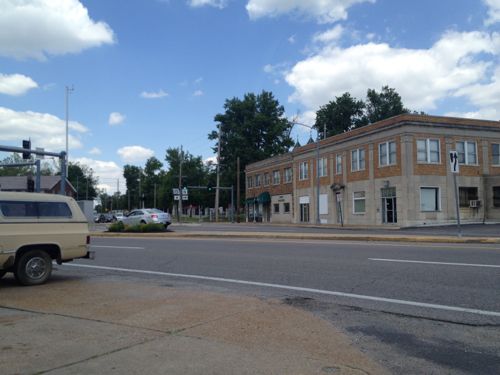
ABOVE: Intersection of Natural Bridge and Florissant has potential with mostly-urban buildings
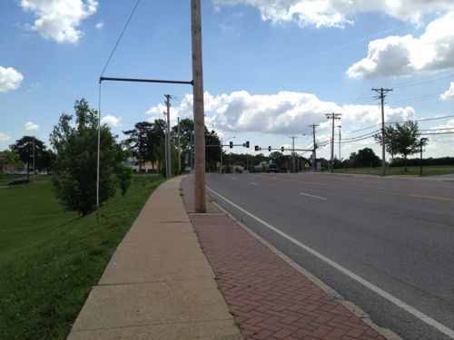
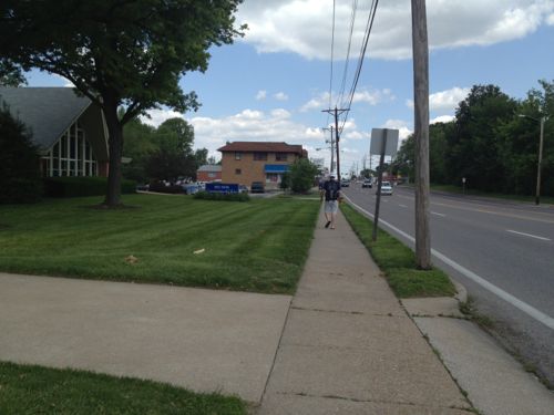
ABOVE: Sidewalks are narrow and many are adjacent to residential neighborhoods.
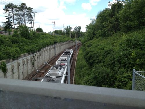
ABOVE: On the north side of Natural Bridge Rd the only sense light rail exists is if you see the power lines and/or train below
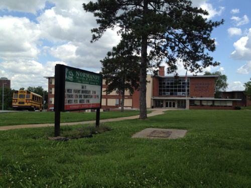
ABOVE: Two Normandy schools sit side by side west of the MetroLink right-of-way but there's no connection to it or the street
ABOVE: Far from a walker's paradise
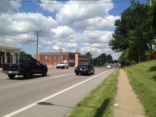
ABOVE: Numerous lanes for autos reduces the pedestrian experience
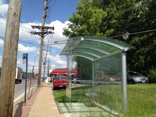
ABOVE: Very attractive glass bus shelter just east of Hanley, would make a nice greenhouse
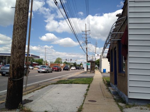
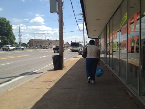
ABOVE: Commerce takes place but this isn't a pedestrian-friendly commercial district
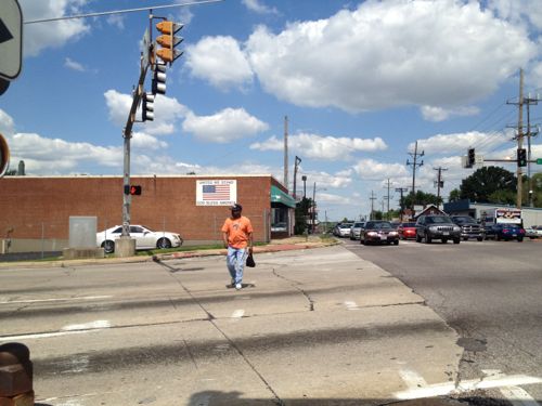
ABOVE: A man crosses Hanley heading east along Natural Bridge
ABOVE: Same man waiting for the bus a block east of Hanley
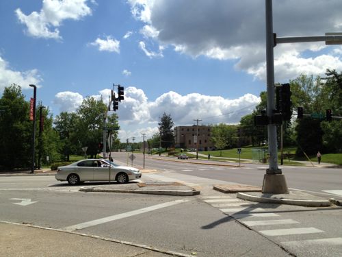
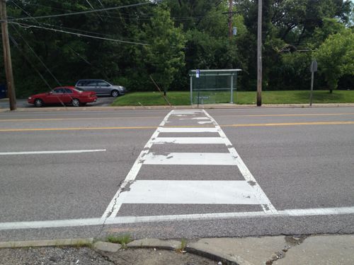
ABOVE: Pedestrian crossing at the bus stops, lack curb ramps and getting traffic to stop is nearly impossible
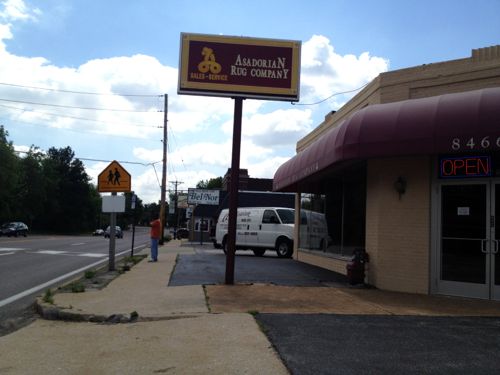
ABOVE: One of the worst areas I encountered was in front of the place I'd hoped to have lunch, but it doesn't have an accessible entrance...22 years after Pres. Bush signed the ADA
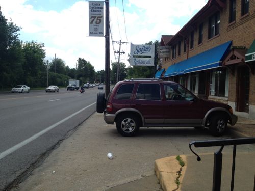
ABOVE: Pedestrian walks westbound toward Spiro's
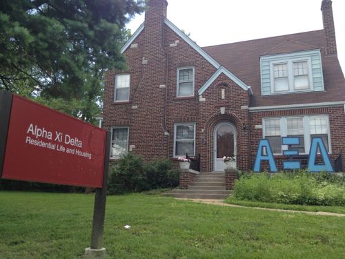
ABOVE: Some of the houses facing Natural Bridge are used for UMSL students
ABOVE: The north end of the St. Vincent Greenway, click image for more information
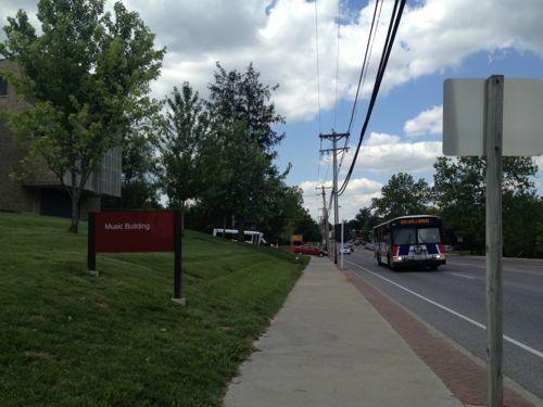
ABOVE: Like most areas, MetroBus is the primary mode of public transit
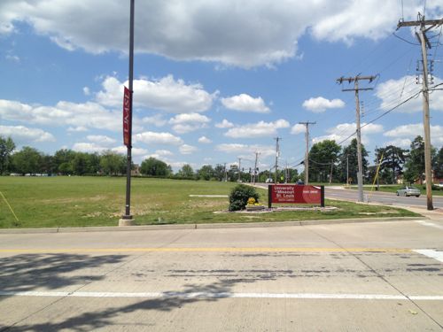
ABOVE: A huge area of undeveloped land along the south side of Natural Bridge is part of UMSL's campus and is very close to the UMSL South MetroLink station
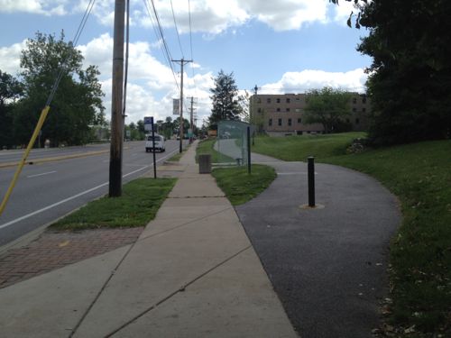
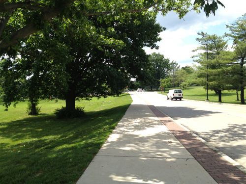
ABOVE: The sidewalk on the east side of UMSL's South Drive will lead you to the light rail station, eventually. Click image for aerial
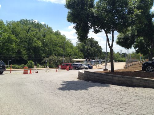
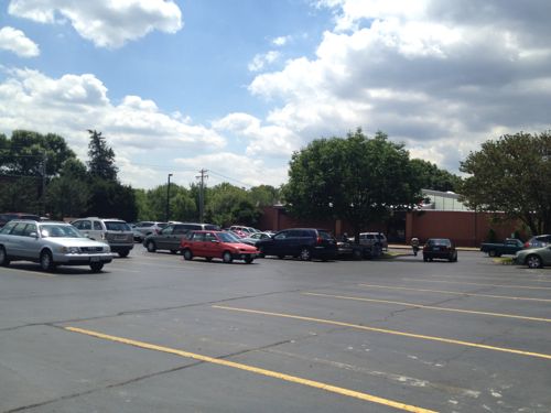
ABOVE: Once visible the most direct path is through an unfriendly park-n-ride lot
ABOVE: The pedestrian route takes an unpleasant circuitous path
ABOVE: Back on Natural Bridge we can see the station if we squint
ABOVE: Normandy City Hall is on the east side of the tracks, it has agreed to relocate to allow development
ABOVE: A convent is pretty but unwelcoming
ABOVE: A St. Louis Library branch is set back behind a parking lot, an access route is provided for pedestrians
ABOVE: Almost to Florissant now we see buildings up to the sidewalk

Amazingly I was able to travel more than 3 miles with only a few barriers along the way. A lack of barriers for the disabled is a good start but this is a long way from being “pedestrian-friendly” corridor. One article I read said the goal was to be more like the Delmar Loop. My guess that was more about the writer’s ignorance on the subject than a stated goal. You can make a suburban corridor attractive to pedestrians but that’s not the same as a dense commercial district.

A detailed look at Natural Bridge was done as part of the East-West Gateway’s Great Streets Initiative, see the report here. It prescribes different treatments for different areas of the corridor. The Urban Land Institute, working with Citizens for Modern Transit, took a detailed look at the existing UMSL South MetroLink station and immediate surroundings, see that report here.

I’m not yet sure the proposed ideas are the best solutions but I do know the pedestrian experience can, and should, be improved.

– Steve Patterson
 

The End Of The Hodiamont Streetcar Right-of-Way

Forty-six years ago today the last streetcar in St. Louis stopped rolling down the streets. The Hodiamont was St. Louis’ last streetcar line. The Hodiamont ran in city streets from downtown to just west of Vandeventer Ave where it went into its own private right-of-way.

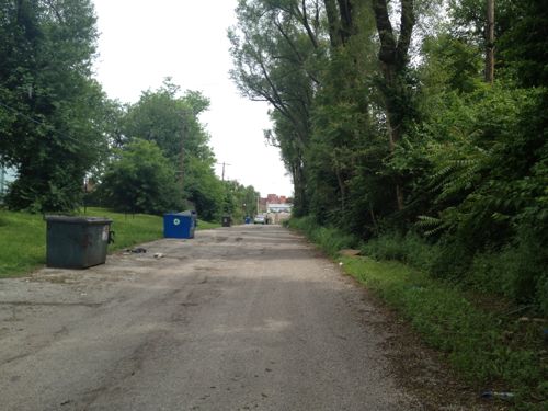
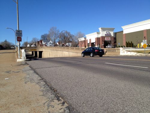
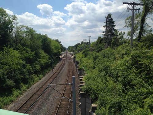
ABOVE: Looking east on the last eastern section of the Hodiamont Right-of-Way
ABOVE: Hodiamont ROW ends
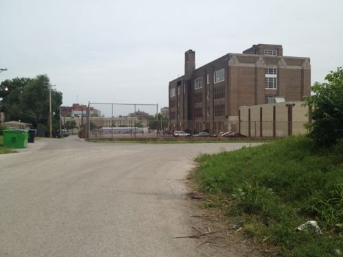
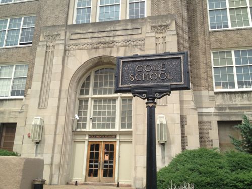
ABOVE: Cole School was built in 1936
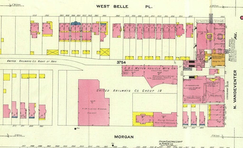
ABOVE: In 1909 the site was home to United Railways that owned the Hodiamont line. Click imaged to view larger version. Source: UM Digital Library Sanborn Maps Collection
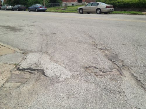
ABOVE: The streetcar tracks come out of the private right-of-way and head east on Enright Ave

ABOVE: The streetcar tracks come out of the private right-of-way and head east on Enright Ave

Eventually new rubber-tire buses with air-conditioning  replaced  the older streetcars:

Only three lines were left in April 1964, when the new Bi-State agency winnowed the system to the Hodiamont line, which ran from downtown to the Wellston Loop. Along the way through north St. Louis, the Hodiamont had its own right-of-way, like a railroad. (STLtoday.com article from 2010 — recommended)

I can’t help but wonder if running a new modern streetcar through this right of way today would make sense. Or even a bus line?

— Steve Patterson


Beautiful Detailing On Older Infrastructure

Many of you have probably driven under the railroad tracks while traveling on Chippewa St between Gravois Ave and Meramec.

ABOVE: Chippewa going under the railroad tracks

If you’re like me you never paid much attention to the design of the underpass. But earlier this month I was on a MetroBus heading westbound on Chippewa and it had to stop at the light at Meremac (aerial) and there was the railing right next to the bus window.

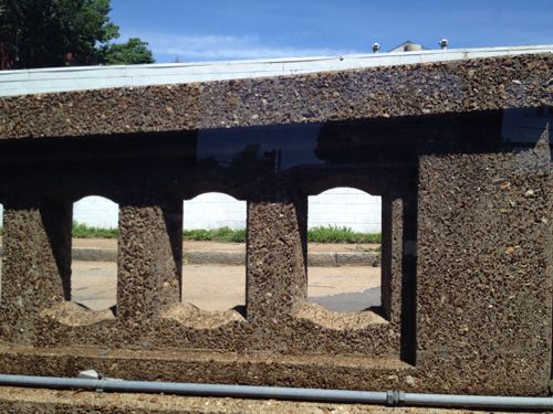
ABOVE: Close up of railing on Chippewa at Meramec

I love the detail, so much more interesting than today’s infrastructure. Seems we either get boring stuff with zero detail or over the top designs. I’d much rather see a nice balance.

– Steve Patterson
 

Advertisement


[custom-facebook-feed]

Archives

Categories

Advertisement


Subscribe