Home » Transportation » Recent Articles:

Happy 137th Birthday to the Eads Bridge
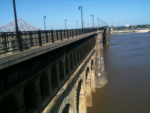
ABOVE: Eads Bridge May 2010

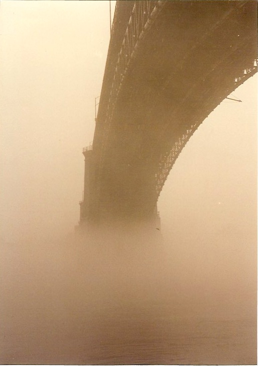
When I moved to St. Louis, almost 21 years ago, I immediately fell in love with Eads Bridge. The rail lines on the lower level of the bridge hadn’t been used in 15 or so years. The road deck was in place but it was removed during construction of the  MetroLink light rail that opened in 1993. The bridge was so beautiful to my young eyes.
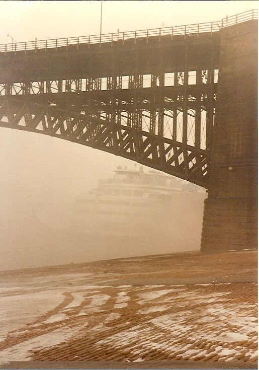
ABOVE: Eads Bridge with the Admiral in early 1991
ABOVE: Eads Bridge in early 1991

The history of the bridge is fascinating.  It opened 137 years ago today on June 4, 1874 with the official dedication was a month later on July 4, 1874:

The bridge is named for its designer and builder, James B. Eads. When completed in 1874, the Eads Bridge was the longest arch bridge in the world, with an overall length of 6,442 feet (1,964 m). The ribbed steel arch spans were considered daring, as was the use of steel as a primary structural material: it was the first such use of true steel in a major bridge project.

The Eads Bridge was also the first bridge to be built using cantilever support methods exclusively, and one of the first to make use of pneumatic caissons. The Eads Bridge caissons, still among the deepest ever sunk, were responsible for one of the first major outbreaks of “caisson disease” (also known as “the bends” or decompression sickness). Fifteen workers died, two other workers were permanently disabled, and 77 were severely afflicted.

On 14 June 1874, John Robinson led a “test elephant” on a stroll across the new Eads Bridge to prove it was safe. A big crowd cheered as the elephant from a traveling circus lumbered towards Illinois. It was believed that elephants had instincts that would keep them from setting foot on unsafe structures. Two weeks later, Eads sent 14 locomotives back and forth across the bridge at one time.

The Eads Bridge, which became an iconic image of the city of St. Louis, from the time of its erection until 1965 when the Gateway Arch was constructed, is still in use. The bridge crosses the St. Louis riverfront between Laclede’s Landing, to the north, and the grounds of the Gateway Arch, to the south. Today the road deck has been restored, allowing vehicular and pedestrian traffic to cross the river. The St. Louis MetroLink light rail line has used the rail deck since 1993. (Wikipedia)

This bridge, and the railroad tunnels under downtown, allowed the first Union Station to open a year later on June 1, 1875.  This Union Station was located at 12th (now Tucker) & Poplar. The Union Station we know opened 6 blocks to the west just 19 years later on September 1, 1894.

In 2024 we need to have a big party to celebrate the 150th anniversary of Eads Bridge.  Hopefully by then the raised section of I-70 at the west end of the bridge will be gone, opening sight lines.

– Steve Patterson


Tornado Brings Opportunity To Make Joplin More Pedestrian-Friendly


ABOVE: Joplin Area Chamber of Commerce passing out treats in the rotunda at the Missouri Capital on April 13th

As we all know, the City of Joplin was hit hard by an EF-5 tornado on May 22, 2011, making this the deadliest year on record. I know the historic & walkable downtown barely escaped the destruction. Much of Joplin, like most US cities, was a big ugly mess of auto-centric sprawl before the tornado.

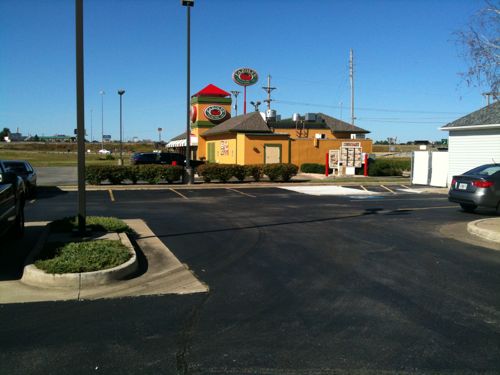
ABOVE: View of Fazoli's from my car in the hotel parking lot. September 2010

I stayed a night in Joplin in September last year and posted about having to drive to the restaurant next door to the hotel to have dinner. This area wasn’t damaged so making it walkable will have to wait but the areas where every building was leveled is a perfect opportunity to make slight improvements as they rebuild.

Wikipedia has the most detailed account of the path of destruction I’ve found:

The tornado initially touched down just east of the Kansas state boundary near the end of 32nd Street (37.056958°N 94.588423°W) between 5:35 and 5:41 p.m. CDT (2235 and 2241 UTC) and tracked just north of due east. Surveys remain incomplete there so it is possible it may have started in Kansas and crossed the state line into Missouri.

Damage became very widespread and catastrophic as it entered residential subdivisions in southwest Joplin. In addition, St. John’s Regional Medical Center (37.060554°N 94.530938°W) in the same area was heavily damaged with many windows and the exterior walls damaged and the upper floors destroyed. Several fatalities were reported there. Virtually every house in that area near McClelland Boulevard and 26th Street was flattened, and some were blown away in the area as well. Trees sustained severe debarking, a nursing home and a church school in southwest Joplin were also flattened and several other schools were heavily damaged. Damage in this area was rated as a low-end EF4.

As the tornado tracked eastward, it intensified even more as it crossed Main Street between 20th and 26th Streets. Virtually every business along that stretch was heavily damaged or destroyed and several institutional buildings were destroyed. It tracked just south of downtown, narrowly missing it. More houses were flattened or blown away and trees continued to be debarked. Two large apartment buildings were destroyed, as well as Franklin Technology Center and Joplin High School. Fortunately, no one was in the high school at the time. It approached Range Line Road, the main commercial strip in the eastern part of Joplin, near 20th Street. Damage in this area was rated as a high-end EF4.

The tornado peaked in intensity as it crossed Range Line Road. In that corridor between about 13th and 32nd Streets (37.05528°N 94.478452°W), the damage continued to be very intense and the tornado was at its widest at this point, being nearly 1 mile (1.6 km) wide. Some of the many destroyed buildings include a Cummins warehouse, Walmart Supercenter #59, a Home Depot store, and numerous restaurants, all of which were flattened. Heavy objects, including concrete bumpers and large trucks, were tossed a significant distance, as far as 1/8 mile (200 m) away from the parking lots along Range Line. Numerous other commercial and industrial buildings, as well as more houses, were destroyed with some flattened or blown away as the tornado tracked through southeast Joplin. Many fatalities occurred in this area. Damage in this area was rated as an EF5.

The Red Lobster I’ve been to at 32nd & Range Line is still there, although much of that area was heavily hit.  It has been estimated that anywhere from 10-25% of Joplin’s structures were leveled or damaged.  Joplin now has an opportunity to rebuild in a more connected manner, to take walkability as seriously drivability.

Here are my suggestions for Joplin as they begin:

  1. Speed up implementation of ideas from your Long Range Transportation Plan, with particular attention to bicycle & pedestrian & public transit planning.
  2. Make sure every public street has a sidewalk on both sides. Do quick corridor plans for the commercial streets where damaged occurred, look for simple changes to rebuild the buildings
  3. Require a private sidewalk from the front door of each business to each public sidewalk, this will help create a connected sidewalk network just as roads connect places for cars. Roads provide door to door connectivity, so should the sidewalk network.
  4. Eliminate minimum parking requirements for businesses. This will allow businesses to spend less money on parking lots and to possibly locate their buildings closer to the public sidewalk.
  5. Build to the sidewalk.  Many destroyed buildings were built up to the sidewalk and should be rebuilt that way. Neighboring buildings that had been allowed to push back from the sidewalk should be rebuilt up to the sidewalk.

My heart goes out to everyone in Joplin.

– Steve Patterson


New Boutique Hotel in Midtown Has Bicycles for Guest Use

May 28, 2011 Bicycling, Midtown Comments Off on New Boutique Hotel in Midtown Has Bicycles for Guest Use

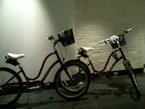
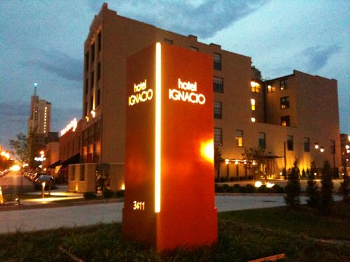
I was excited to see the two Electra Townie bikes on a recent visit to check out the new 49-room Hotel Ignacio in midtown St. Louis. Registered guests can check out the bikes at no additional charge.

I will take a look at the pedestrian connections around the hotel next week but I couldn’t hold my excitement about the guest bikes.

– Steve Patterson


Bike To Work Day Friday May 20th

As part of National Bike Month this week is Bike to Work Week and tomorrow is Bike to Work Day. Consider getting out that bike and riding to work tomorrow:

To celebrate National Bike to Work Day on Friday, May 20, join Trailnet for a free continental breakfast for bike commuters at various Refueling Stations around St. Louis. Breakfast will be served 6:30 – 9:00 a.m.

TRAILNET REFUELING STATION LOCATIONS INCLUDE:

Missouri History Museum: 5700 Lindell Boulevard

Creve Coeur: 12166 Conway Road

Missouri Botanical Gardens: 4344 Shaw Boulevard

Downtown St. Louis:1011 Locust

Delmar Loop: 6133 Delmar Boulevard

Central West End Station: West Pine at Euclid

Downtown Clayton: 7711 Bonhomme Avenue

Children’s Hospital: 1 Children’s Place

DeMun: 700 DeMun Avenue

Presented by: Great Rivers Greenway

In Partnership With: Bike St. Louis, Big Shark Bicycle Co., City of Creve Coeur, CIty of St. Louis, Companion Baking, Downtown Bicycle Station, Missouri Botanical Garden, Missouri History Museum, Moonrise Hotel, Pedal the Cause, and Urban Shark.

Being the critic I can’t help but notice the western bias of the fueling stations. The persons living in the Baden (north) or Carondelet (south) areas and heading to say midtown or downtown are basically out of luck.  When I lived in Dutchtown (south) I commuted by bike three days a week to I-70 & Union (north) in 1999. Come on, Children’s Hospital and Pine @ Euclid just blocks apart but nothing north and only the Botanical Gardens south.  Hopefully 2012 will see better coverage for these refueling stations.

– Steve Patterson


National Train Day Saturday May 7th, 40 Years of Amtrak

Saturday May 7th is National Train Day:

This year, Amtrak celebrates four decades of providing the nation with vital intercity and high-speed passenger rail service. After 40 years dedicated to serving communities across the country, Amtrak is proud of its role in America’s history, but even more excited about what’s to come. Here, you can learn what’s coming down the tracks, from the future of high-speed rail service to Amtrak’s energy-saving initiatives. And, of course, you can also take a look back at train travel through the years.

I love rail travel, it gets you into city centers. Sometimes it gets you back home.

ABOVE: view of our train from the bus in Hermann MO

Last month I took the train to Jefferson City to visit legislators at the Missouri capital. It was a good day until the train broke down in Hermann MO. After a couple of hours two motor coaches showed up to drive us into Kirkwood & St. Louis.  We arrived about 4 hours after we were supposed to arrive.

ABOVE: driver Hank after he dropped me off on Locust, my building is in the background

I sent an email to Mid-American Coaches praising their driver Hank for taking me to my street after dropping off the others.We arrived after local bus & MetroLink service ended and didn’t want to “walk” home alone in my power chair.

Despite the delay returning from Jefferson City last month I’m taking the train to Kansas City today. Hopefully the trip today and the return Sunday will be problem free.

– Steve Patterson


Advertisement


[custom-facebook-feed]

Archives

Categories

Advertisement


Subscribe