Celebrating Blog’s 19th Anniversary


  Nineteen year ago I started this blog as a distraction from my father’s heart attack and slow recovery. It was late 2004 and social media & video streaming apps didn’t exist yet — or at least not widely available to the general public. Blogs were the newest means of …

Thoughts on NGA West’s Upcoming $10 Million Dollar Landscaping Project


  The new NGA West campus , Jefferson & Cass, has been under construction for a few years now. Next NGA West is a large-scale construction project that will build a new facility for the National Geospatial-Intelligence Agency in St. Louis, Missouri.This $1.7B project is managed by the U.S. Army …

Four Recent Books From Island Press


  Book publisher Island Press always impresses me with thoughtful new books written by people working to solve current problems — the subjects are important ones for urbanists and policy makers to be familiar and actively discussing. These four books are presented in the order I received them. ‘Justice and …

New Siteman Cancer Center, Update on my Cancer


  This post is about two indirectly related topics: the new Siteman Cancer Center building under construction on the Washington University School of Medicine/BJC campus and an update on my stage 4 kidney cancer. Let’s deal with the latter first. You may have noticed I’ve not posted in three months, …

Recent Articles:

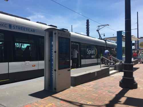
A Look At Kansas City’s New Modern Streetcar


Last week leaders in the St. Louis region argued publicly over future pubic transit:

St. Louis Mayor Francis Slay has made clear his support for a north-south MetroLink expansion, saying it’s a top priority in his final year in office. But a recent push for money to plan such a route has met with strong resistance from St. Louis County Executive Steve Stenger.

Stenger, in a letter to the Federal Transit Administration, said he will not endorse the north-south route until other proposed routes are studied. (Post-Dispatch)

At the other end of the state, in Kansas City, there’s also a disagreement about the expansion of rail-based public transit. The local non-profit behind the new KC Streetcar wants to expand South on Main Street, while another is pushing a light rail plan.

[Clay] Chastain argues his plan gives Kansas City residents a real choice and a much more extensive rail transit system, from the airport to the Cerner Trails campus under construction in south Kansas City and from Union Station to the stadium complex. 

He estimates it would cost $2 billion to build, or about $45 million per mile, although some light-rail systems have cost considerably more than that per mile. He assumes the federal government would provide $1 billion of that amount.

The local match would come from a 3/8-cent sales tax increase for 25 years, plus 3/8 cents that currently go for the bus system, once that tax expires in 2024. (Kansas City Star)

Anyone who has flown in/out of KC’s airport knows it is a long distance from downtown KC. It’s a 20-25 minute drive, but takes over an hour by bus. Frankly, they need to do both — expand the new streetcar and build light rail to far off destinations like their airport and stadiums.

Kansas City was without rail-based public transit from 1957 until May 6, 2016 — the day the 2.2 mile starter streetcar opened.

THE FUNDING:

  • Cost to build: $100 million — $37 million from the federal government, $63 million from bonds.
  • Cost to operate: $4 million annually to be paid by a combination of sales & property taxes within the transportation district.
  • Fare:  $0 — free
  • Local comparison: Our Loop Trolley vintage streetcar project. also 2.2 miles long, is costing $51 million to build. The 8-mile cross-county MetroLink extension that opened in 2006 cost $430 million.

THE VEHICLES:

  • “Each vehicle is 77 feet and 8 inches long; 78,000 pounds; and 12 feet tall.”
  • “Each vehicle capacity is approximately 150 riders and is bi-directional (can run both directions). There is a combination of sitting and standing within the streetcar.”
  • “There are three “cars” in each streetcar vehicle, with 4 sets of doors (one on each end and two in the middle car).”
  • Each of the four vehicles cost $4.39 million each (source).
  • Same as vehicles used in the Cincinnati Streetcar opening later this year.
  • Model: CAF Urbos 3 100% low-floor
  • Manufactured in Elmira NY by CAF USA, a subsidiary of a Spanish company.
  • To meet US crash-standards the body is made of steel
  • Comparison: our 4-car light rail vehicles are 90 feet long; capacity of 72 seated plus 106 standing
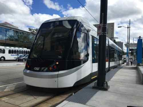
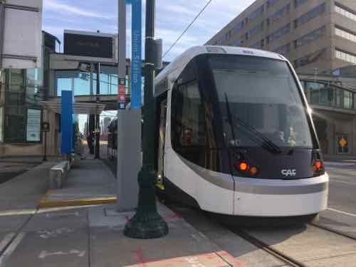
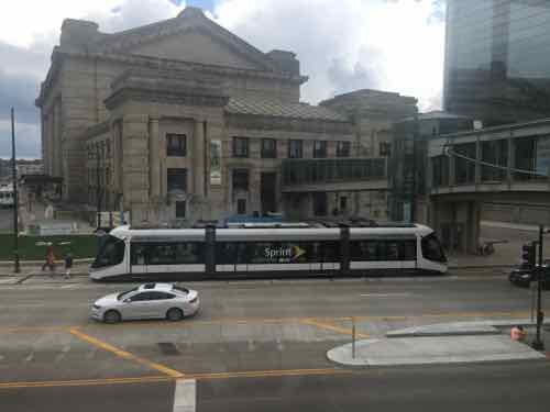
Each end is identical

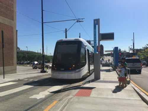
The lights change depending upon direction of travel. The step on this end of the Union Station platform is annoying.

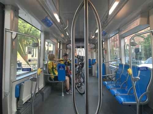
This view gives you an overview of the three cars in each vehicle -- middle and two ends. Wheelchairs, strollers. bikes, the middle car, the door on each end has a step
This view gives you an overview of the three cars in each vehicle — middle and two ends. Wheelchairs, strollers. bikes, the middle car, the door on each end has a step

The center car is very open, the ends are filled with fixed seating. The floor is level throughout,

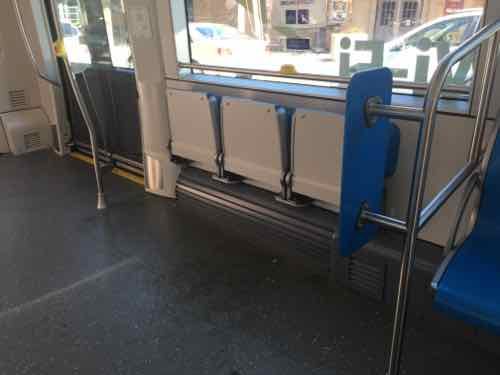
The center car has two areas with theater seats. My wheelchair fit here and my husband could sit on one seat.

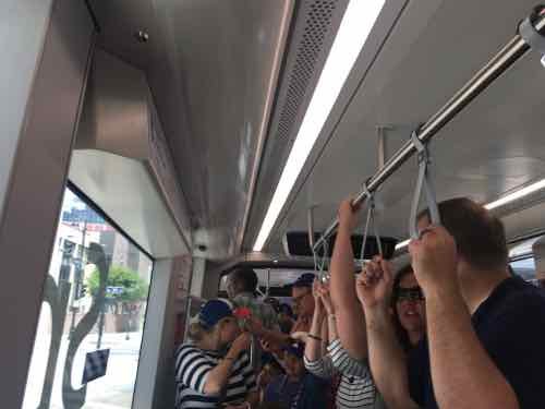
It got packed to capacity a few times we were riding

THE ROUTE:

Kansas City is lucky to have Main Street as a central arterial. We have Olive/Lindell, but they’re very different. The 2.2 mile route does a loop on the North end around their River Market area. It goes down Main and ends at Union Station.

The route is 2.2 miles long and travels along Main Street in downtown Kansas City from the River Market to Union Station/Crown Center. The route also includes a loop around the City Market and runs on 3rd St on the north, Delaware on the west, 5th St on the south, and Grand on the east. (KC Streetcar FAQ)

An extension to continue South on Main Street is already being planned.
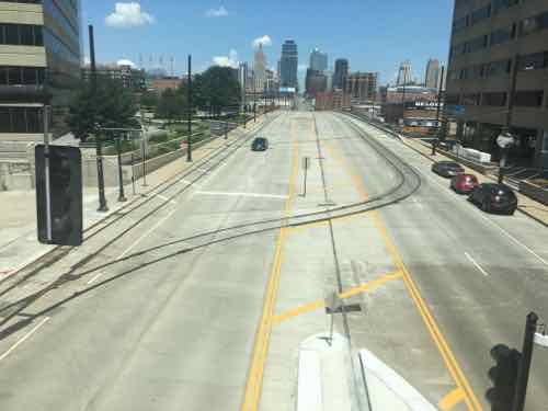
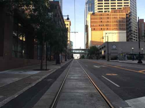
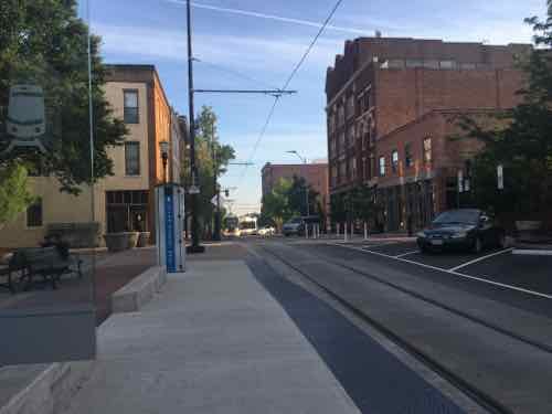
Looking North on Main St toward Downtown Kansas City
Looking North on Main St toward Downtown Kansas City.

Looking South in the CBD

See a route map here.

THE STOPS:

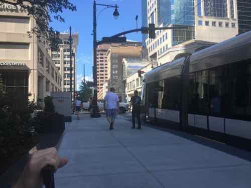
Stops are every few blocks, over the 3-day weekend I rode the streetcar a few times but also traveled the route on the sidewalk. For the most part. the stops are built out into the parking lane — leaving the sidewalk unblocked.
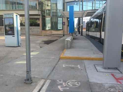
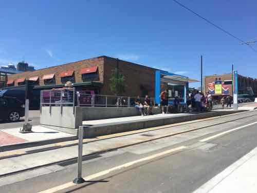
Another view of the Union Station stop

The River Market North stop is the only stop in the middle of traffic

Another view of the River Market North stop

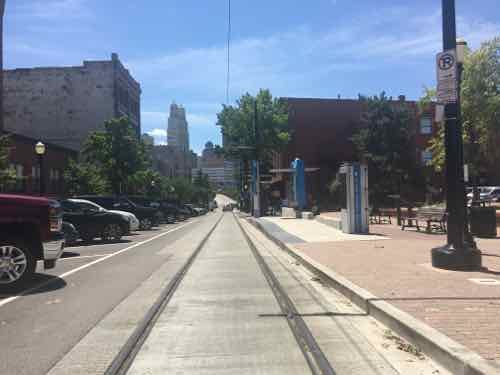
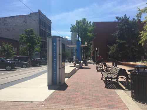
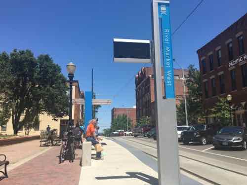
Next stop is River Market West

The view from the sidewalk

Looking North you can see the streetcar coming around the corner in the background

People gathering for the next streetcar, we tried to get on here a couple of times but it was too full from the two prior stops

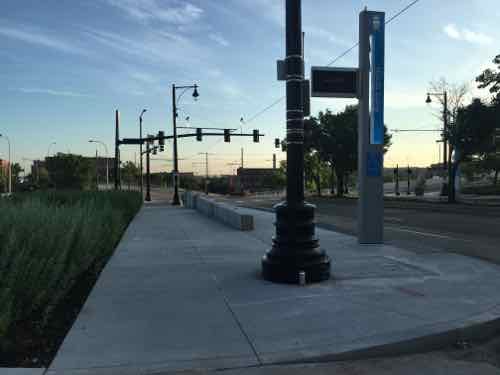
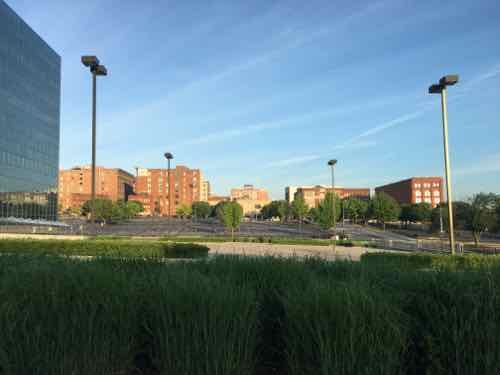
North Loop is the most unusual stop, as it's mostly parking lots
North Loop is the most unusual stop, as it’s mostly parking lots

Looking West from the stop

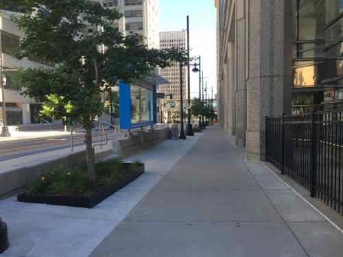
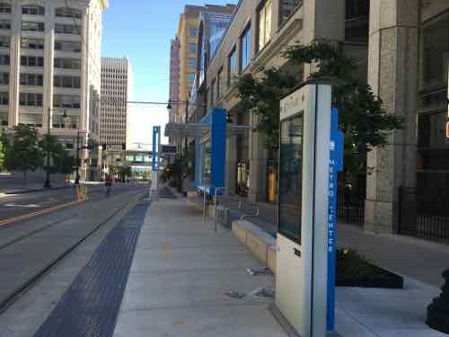
Sidewalk next to Northbound Metro Center stop

Same stop, same direction -- just out near the curb
Same stop, same direction — just out near the curb

Opposite view
Opposite view

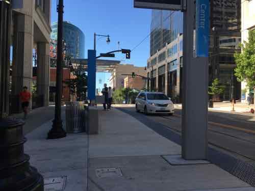
Southbound Metro Center stop

Streetcar at SB Power & Light stop

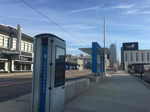
NB Crossroads stop
NB Crossroads stop

NEW CONSTRUCTION:

New construction is everywhere in Kansas City, especially near the streetcar route.
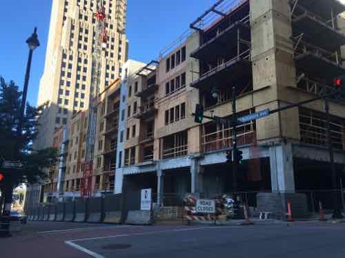
New construction at 13th & Baltimore, one block West of Main

Rehab on E 19th, just East of Main

New construction E 5th & Grand

New infill on Main Street between 19th-20th

VIDEO:

I put together a brief video of various clips I took:

FINAL THOUGHTS:

Their streetcar isn’t meant to be a regional system, at least not initially. CAF makes very similar vehicles for use in higher-speed light rail applications, so if they ever do a light rail line the vehicles could look just like their streetcar.

The main problem we experienced was crowds — but it was a nice holiday weekend in the first month of service.  Would like to ride it on a regular weekday. We did speak to a retired couple that recently moved from the suburbs to new construction downtown — the streetcar was one reason,

Being right there it helped add life to the street. It’ll be interesting to see if they’ll be able to expand.

— Steve Patterson

Sunday Poll: Will North St. Louis Be Better Or Worse 25 Years From Now?


Please vote below
Please vote below

A quarter century ago I moved North of Delmar — from the Central West End. As I reflect back on the last 25 years, I think about what the next 25 might look like.

The National Geospatial Agency (NGA) will have been in it’s new headquarters for years. Will it help or hurt the surrounding area? Will Paul McKee’s plans get built? Will public transit be improved?

I have a lot of questions, but no crystal ball. There’s also a good chance I won’t be alive in 25 years to see the answers to my questions.

There’s no right or wrong answer to today’s poll — it’s a non-scientific measure of readers’ outlook. I’m not setting any criteria by which to compare now to 25 years from now, that’s up to you.

The poll is open until. 8pm.

Starting this week I’ll be cutting back from six posts to five — no more Monday posts, the next post will be Tuesday.

— Steve Patterson


Forest Park Dedicated June 24, 1876, 140 Years Ago Today (6 Historic Photos)


Forest Park opened 140 years ago today — nearly three decades before the 1904 World’s Fair:

Forest Park, officially opened to the public on June 24, 1876, is one of the largest urban parks in the United States. At 1,293 acres, it is approximately 500 acres larger than Central Park in New York.

In 1904, the Louisiana Purchase Exposition, The St. Louis World’s Fair, drew more than 20 million visitors from around the world to Forest Park. (St. Louis)

When Forest Park was created by the Board of Aldermen residents to the North & South also wanted large parks in their part of the city, so O’Fallon & Carondelet parks were created before Forest Park opened. At that time the parks were largely rural, a way to preserve land in a rapidly growing city.

When Forest Park officially opened to the public on Saturday afternoon, June 24, 1876, it was located in St. Louis County, almost two miles west of the St. Louis City limits and a 40 minute carriage ride from downtown. 

The Globe-Democrat reported that the opening day ceremony attracted 50,000 people — at a time when the population of the city was only 350,000.

It was on a railroad line, which had opened only a week before the park was dedicated. The train ride from downtown took 20 minutes. 

At the same time as the dedication, the Democratic Party was holding its national convention in Downtown St. Louis. (The 1870 census called St. Louis the fourth largest city in the country behind New York, Philadelphia and Brooklyn.) (St. Louis)

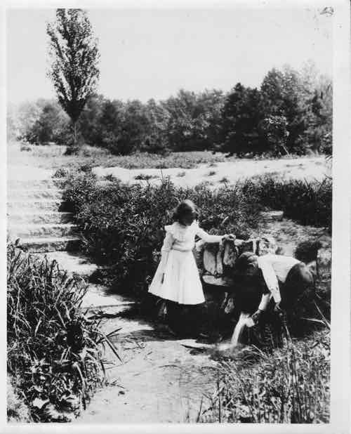
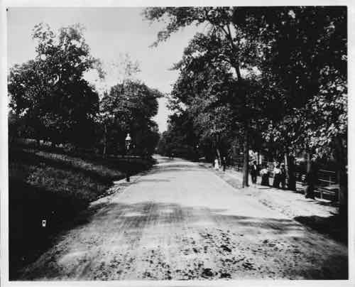
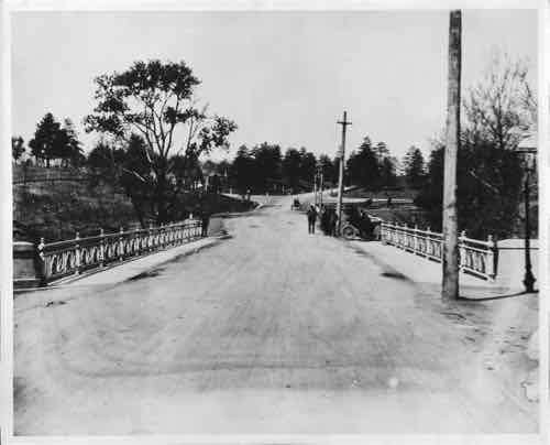
Yes, Forest Park was in unincorporated St. Louis County when initially dedicated. This was a good excuse for me to scan & post vintage/undated images from the archives of Louis (1907-1999) & Georgia (1918-2009) Buckowitz:

Cabanne Spring, Buckowitz Archives

Hooved Animal Enclosure, Buckowitz Archives

Old Bridge, Buckowitz Archives

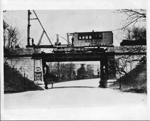
Old Wabash Bridge, Buckowitz Archives

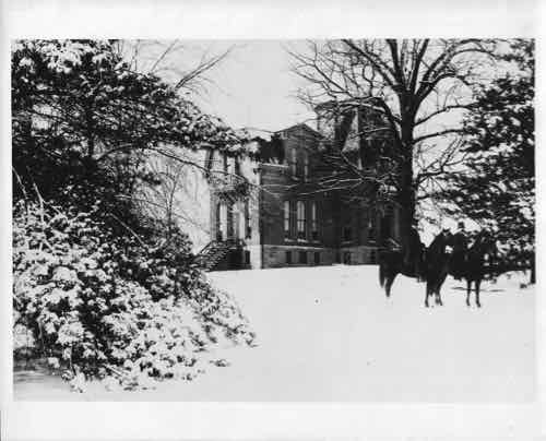
Superintendents House, Buckowitz Archives. "Constructed in 1875 from plans drawn by St. Louis architect James H. McNamara, the Second Empire style house was conceived as part of the original Master Plan for Forest Park. The Cabanne House was completed in June 1876, in time for the formal dedication of Forest Park/" Click image for quote source
Superintendents House, Buckowitz Archives. “Constructed in 1875 from plans drawn by St. Louis architect James H. McNamara, the Second Empire style house was conceived as part of the original Master Plan for Forest Park. The Cabanne House was completed in June 1876, in time for the formal dedication of Forest Park/” Click image for quote source

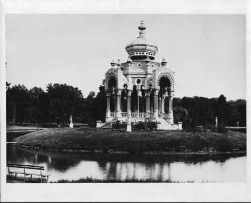
Pagoda Bandstand, Buckowitz Archives

Information on the pagoda bandstand is too much for the caption:

The original Forest Park bandstand, or music pagoda, was a wooden structure that stood on an island in Pagoda Lake. It was built about the time the park was dedicated in 1876. Mary J. Rankin donated statues representing the four seasons in 1886.

The bandstand was renovated and was landscaped for the 1904 World’s Fair. It was the site of concerts before and after the fair.

However, the bandstand fell into disrepair and was declared unsafe in 1911. 

Before it could be renovated, it blew down in a storm and was damaged beyond repair. 

In July 1924, St. Louis lawyer Nathan Frank donated funds to build a new bandstand. It was designed by Heffensteller, Hirsh and Watson.

The new bandstand cost about $50,000 and is of classic Renaissance design. It is made of white marble with bronze railings and ornaments.

It was renovated in 1981 with $13,000 from the Central West End Charitable Trust, raised by the Central West End Association. 

It was renovated and landscaped by the Flora Conservancy of Forest Park under the Forest Park Master Plan. (St. Louis)

Now you know why “Pagoda Drive” is named as such. A decade until the 150th. For information on events celebrating the 140th click here.

— Steve Patterson


St. Louis Board of Aldermen: New Board Bills 6/17/16


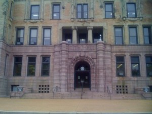
St. Louis City Hall
St. Louis City Hall

The following new Board Bills were introduced Friday June 17, 2016:

Board Bill No. 86 | Redevelopment plan for 721 Victor

BOARD BILL NO. 86 INTRODUCED BY ALD. JOHN COATAR An ordinance approving a Redevelopment Plan for the 721 Victor St./2403-15 S. 7th St. (“Area”) after finding that the Area is blighted as defined in Section 99.320 and Chapter 353 of the Revised Statutes of Missouri, 2000, as amended, (the “Statutes” being Sections 99.300 to 99.715 inclusive and Chapter 353), containing a description of the boundaries of said Area in the City of St. Louis (“City”), attached hereto and incorporated herein as Exhibit “A”, finding that redevelopment and rehabilitation of the Area is in the interest of the public health, safety, morals and general welfare of the people of the City; approving the Plan dated May 24, 2016 for the Area (“Plan”), incorporated herein by attached Exhibit “B”, pursuant to Sections 99.430 and 353.020 (4); finding that there is a feasible financial plan for the development of the Area which affords maximum opportunity for development of the Area by private enterprise; finding that no property in the Area may be acquired by the Land Clearance for Redevelopment Authority of the City of St. Louis (“LCRA”) through the exercise of eminent domain; finding that the property within the Area is unoccupied, but if it should become occupied the Redeveloper shall be responsible for relocating any eligible occupants displaced as a result of implementation of the Plan; finding that financial aid may be necessary to enable the Area to be redeveloped in accordance with the Plan; finding that there shall be available ten (10) year real estate tax abatement; and pledging cooperation of the Board of Aldermen and requesting various officials, departments, boards and agencies of the City to cooperate and to exercise their respective powers in a manner consistent with the Plan.

Board Bill No. 87 | Redevelopment plan for Kosciusko Site

BOARD BILL NO. 87 INTRODUCED BY ALDERMAN JOHN COATAR An ordinance approving a Redevelopment Plan for the Kosciusko Industrial Site I (“Area”) after finding that the Area is blighted as defined in Section 99.320 and Chapter 353 of the Revised Statutes of Missouri, 2000, as amended, (the “Statutes” being Sections 99.300 to 99.715 inclusive and Chapter 353), containing a description of the boundaries of said Area in the City of St. Louis (“City”), attached hereto and incorporated herein as Exhibit “A”, finding that redevelopment and rehabilitation of the Area is in the interest of the public health, safety, morals and general welfare of the people of the City; approving the Plan dated May 24, 2016 for the Area (“Plan”), incorporated herein by attached Exhibit “B”, pursuant to Sections 99.430 and 353.020 (4); finding that there is a feasible financial plan for the development of the Area which affords maximum opportunity for development of the Area by private enterprise; finding that no property in the Area may be acquired by the Land Clearance for Redevelopment Authority of the City of St. Louis (“LCRA”) through the exercise of eminent domain; finding that the property within the Area is unoccupied, but if it should become occupied the Redeveloper shall be responsible for relocating any eligible occupants displaced as a result of implementation of the Plan; finding that financial aid may be necessary to enable the Area to be redeveloped in accordance with the Plan; finding that there shall be available up to a twenty-five (25) year real estate tax abatement; and pledging cooperation of the Board of Aldermen and requesting various officials, departments, boards and agencies of the City to cooperate and to exercise their respective powers in a manner consistent with the Plan.

Board Bill No. 88 | Ordinance regarding Traffic Calming

BOARD BILL NO. 88 INTRODUCED BY: ALDERMAN CHRIS CARTER An ordinance requiring that requests for Traffic Calming, as defined herein, and related traffic complaints, received by the City of St. Louis be managed in accordance with a centralized process to be called the City of St. Louis Traffic Calming Policy; granting the Director of Streets authority to develop and promulgate the City of St. Louis Traffic Calming Policy, subject to the Board of Public Service approval; containing an emergency clause.

Board Bill No. 89 | Amending Civil Service Ordinance

BOARD BILL NO. 89 INTRODUCED BY: ALDERMAN FRANK WILLIAMSON An ordinance to amend Ordinance 70285 by removing Section 29 of Ordinance 70285, providing an effective date and including an emergency clause.

Board Bill No. 90 | Ordinance establishing 3-way stop at Marquette & Prather

BOARD BILL NO. 90 INTRODUCED BY ALDERMAN JOSEPH VACCARO An Ordinance establishing a three-way stop site at the intersection of Marquette Avenue and Prather Avenue by regulating all eastbound and westbound traffic traveling on Marquette Avenue at Prather Avenue and regulating all northbound traffic traveling on Prather Avenue at Marquette Avenue, and containing an emergency clause.

Board Bill No. 91 | Vacation of Barton & 7th Street

BOARD BILL #91 INTRODUCED BY: ALDERMAN JACK COATAR An ordinance recommended by the Board of Public Service to conditionally vacate above surface, surface and sub-surface rights for vehicle, equestrian and pedestrian travel in 17 foot wide north/south alley in City Block 840 as bounded by Barton St., 7th St., Victor St. and 9th St. in the City of St. Louis, Missouri, as hereinafter described, in accordance with Charter authority, and in conformity with Section l4 of Article XXI of the Charter and imposing certain conditions on such vacation.

Board Bill No. 92 | Vacation of N/S alley at Terrance/Christy

BOARD BILL #92 INTRODUCED BY: ALDERWOMAN BETH MURPHY An ordinance recommended by the Board of Public Service to conditionally vacate above surface, surface and sub-surface rights for vehicle, equestrian and pedestrian travel in 17.5 foot wide north/south alley in City Block 5334 from Terrace Ave. south 150.07 feet to the 15 foot wide east/west alley in City Block 5334 as bounded by Terrace Ave., Christy Blvd.. Gravois Ave. and Dahlia Ave. in the City of St. Louis, Missouri, as hereinafter described, in accordance with Charter authority, and in conformity with Section l4 of Article XXI of the Charter and imposing certain conditions on such vacation.

Board Bill No. 93 | Ordinance authorizing Parcel Development Agreement

BOARD BILL # 93 INTRODUCED BY ALDERWOMAN TAMMIKA HUBBARD An Ordinance recommended by the Board of Estimate and Apportionment authorizing the execution of a Parcel Development Agreement by and among The City of St. Louis, Missouri, Northside Regeneration, LLC, and St. Louis Grocery Real Estate, LLC; prescribing the form and details of said Parcel Development Agreement; authorizing certain actions by City officials; and containing a severability clause.

Board Bill No. 94 | 4-way stop at Walsh & Clifton

BOARD BILL NO. 94 INTRODUCED BY ALDERWOMAN DONNA BARINGER An Ordinance establishing a four-way stop site at the intersection of Walsh Street and Clifton Avenue by regulating all eastbound and westbound traffic traveling on Walsh Street at Clifton Avenue and regulating all northbound and southbound traffic traveling on Clifton Avenue at Walsh Street, and containing an emergency clause.

Board Bill No. 95 |Ordinance prohibiting the installation of any new pole signs

BOARD BILL NO. 95 INTRODUCED BY: ALDERWOMAN SHARON TYUS An ordinance prohibiting the installation of any new pole signs, any sandwich signs, limiting signage to one sign attached to the building and establishing a closing time of 7:00 p.m., for all businesses located on Kingshighway Memorial Boulevard, containing an exception, and containing an emergency clause.

Board Bill No. 96 | Ordinance to close traffic at Wabada west of Union

BOARD BILL NO. 96 INTRODUCED BY ALDERWOMAN SHARON TYUS An Ordinance amending Ordinance 70238 directing the Director of Streets to permanently close barricade or otherwise impede the flow of Traffic at Wabada 75 feet east the west curb line of Union Boulevard and containing an emergency clause.

Board Bill No. 97 | Ordinance to close traffic at Terry & Kingshighway

BOARD BILL NO. 97 INTRODUCED BY ALDERWOMAN SHARON TYUS An Ordinance amending Ordinance 70224 directing the Director of Streets to permanently close barricade or otherwise impede the flow of Traffic at Terry Avenue at the west curb line of Kingshighway Memorial Boulevard and containing an emergency clause.

Board Bill No. 98 | Ordinance pertaining to court fees

BOARD BILL NO. 98 INTRODUCED BY ALDERMAN JEFFREY BOYD An Ordinance pertaining to miscellaneous fees or surcharges imposed by the City Courts; amending Section Two of Ordinance 56787, codified as Section 3.08.240 of the Revised Code of the City of St. Louis, by providing for the assessment of a four dollar ($4.00) fee imposed by the City Courts for payment of court costs by means other than cash or negotiable instrument in order to cover the transaction costs imposed by credit card companies or other payment providers and containing an emergency clause.

Video of the meeting, which includes “perfection” of BB64 (starts at 1:03:50) :

— Steve Patterson


Opioids/Heroin Substantially More Dangerous Than Marijuana

June 22, 2016 Popular Culture Comments Off on Opioids/Heroin Substantially More Dangerous Than Marijuana
 

The federal government considers marijuana a Schedule 1 drug, along with heroin.

Schedule I drugs, substances, or chemicals are defined as drugs with no currently accepted medical use and a high potential for abuse. Schedule I drugs are the most dangerous drugs of all the drug schedules with potentially severe psychological or physical dependence. (DEA)

I’d agree that heroin is among the “most dangerous drugs”, the reality is harsh:

Amid a national spike in heroin deaths, the St. Louis metro area saw heroin and prescription painkiller fatalities more than triple over a seven-year span, climbing to 445 in 2014. Preliminary numbers for 2015 show a decrease, but probably no lower than in 2013, when 342 people died.

The recent decline in overdoses probably has less to do with lower drug use than it does with an increased use by doctors and emergency responders of a drug that can stop an overdose. (Post-Dispatch: Heroin’s youngest addicts are dying in high school)

Prescription opioids are considered less-dangerous, so they’re in Schedule 2. Still, overdose deaths are also an epidemic:

More people died from drug overdoses in 2014 than in any year on record. The majority of drug overdose deaths (more than six out of ten) involve an opioid. And since 1999, the rate of overdose deaths involving opioids (including prescription opioid pain relievers and heroin) nearly quadrupled. From 2000 to 2014 nearly half a million people died from drug overdoses. 78 Americans die every day from an opioid overdose.

We now know that overdoses from prescription opioid pain relievers are a driving factor in the 15-year increase in opioid overdose deaths. Since 1999, the amount of prescription opioids sold in the U.S. nearly quadrupled, yet there has not been an overall change in the amount of pain that Americans report. Deaths from prescription opioids—drugs like oxycodone, hydrocodone, and methadone—have also quadrupled since 1999.  (CDC: Drug overdose deaths in the United States hit record numbers in 2014)

What do opioids have to do with heroin?

Opiates are alkaloids derived from the opium poppy. Opium is a strong pain relieving medication, and a number of drugs are also made from this source.

Types Of Opiates

  • Morphine
  • Codeine
  • Heroin
  • Opium

Opioids are synthetic or partly-synthetic drugs that are manufactured to work in a similar way to opiates. Their active ingredients are made via chemical synthesis. Opioids may act like opiates when taken for pain because they have similar molecules.

Types Of Opioids

  • Methadone
  • Percocet, Percodan, OxyContin (oxycodone)
  • Vicodin, Lorcet, Lortab (hydrocodone)
  • Demerol (pethidine)
  • Dilaudid (hydromorphone)
  • Duragesic (fentanyl)
    (Difference Between Opiates And Opioids)

More…

Today’s typical heroin addict starts using at 23, is more likely to live in the affluent suburbs and was likely unwittingly led to heroin through painkillers prescribed by his or her doctor.
While heroin is illicit and opioid pills such as oxycontin are FDA-approved, each is derived from the poppy plant. Their chemical structures are highly similar and they bind to the same group of receptors in the brain. (A few opioids, like fentanyl, are totally synthetic but designed to bind with those same receptors).

In any case, the various drugs produce the same result: an increase in pain tolerance and a sense of euphoria, along with drowsiness, occasional nausea and, at higher doses, a slowing of the user’s breathing.
(CNN: Unintended consequences: Why painkiller addicts turn to heroin)

Yes, those addicted to prescription painkillers often turn to the similar-acting heroin — for a fraction of the cost. What alternative is there to manage pain? Medical marijuana:

America has a major problem with prescription pain medications like Vicodin and OxyContin. Overdose deaths from these pharmaceutical opioids have approximately tripled since 1991, and every day 46 people die of such overdoses in the United States.

However, in the 13 states that passed laws allowing for the use of medical marijuana between 1999 and 2010, 25 percent fewer people die from opioid overdoses annually. 

“The difference is quite striking,” said study co-author Colleen Barry, a health policy researcher at Johns Hopkins Bloomberg School of Public Health in Baltimore. The shift showed up quite quickly and become visible the year after medical marijuana was accepted in each state, she told Newsweek(IN STATES WITH MEDICAL MARIJUANA, PAINKILLER DEATHS DROP BY 25 PERCENT)

What? There’s a link between reduction in painkiller deaths and medical marijuana:

States that have legalized marijuana for managing chronic pain have significantly fewer deaths from prescription painkiller overdoses each year, according to a new study published Monday in JAMA Internal Medicine.

Researchers looked at medical marijuana laws and death certificate data in all 50 states between 1999 and 2010. During that time, just 13 states had medical marijuana laws in place.
“We found there was about a 25% lower rate of prescription painkiller overdose deaths on average after implementation of a medical marijuana law,” lead study author Dr. Marcus Bachhuber said. (CNN: Medical marijuana laws may reduce painkiller overdoses)

You might think this is just replacing one overdose for another. Not really:

If you mean can they overdose and die from marijuana—the answer is no, its not very likely. But they can experience extreme anxiety (panic attacks) or psychotic reactions (where they lose touch with reality and may become paranoid). And people can and do injure themselves because of marijuana’s effects on judgment, perception, and coordination. For example, marijuana affect the skills you need to drive (e.g., concentration, reaction time) so people can injure themselves and others if they drive while under the influence.  (NIDA for Teens: Can someone overdose on marijuana?)

Marijuana isn’t safe — but it’s not opioids or heroin either. In my view, alcohol & tobacco are also more dangerous than marijuana.

Here are the results from the recent Sunday Poll:

Q: Opioids/herion vs marijuana — are they equally dangerous drugs?

  • Marijuana is substantially more dangerous than opioids/heroin 1 [0.73%]
  • Marijuana is more dangerous than opioids/heroin 1 [0.73%]
  • Marijuana is slightly more dangerous than opioids/heroin 0 [0%]
  • Opioids/heroin & marijuana are equally dangerous 0 [0%]
  • Opioids/heroin are slightly more dangerous than marijuana 2 [1.46%]
  • Opioids/heroin are more dangerous than marijuana 11 [8.03%]
  • Opioids/heroin are substantially more dangerous than marijuana 120 [87.59%]
  • Unsure/No Answer 2 [1.46%]

Huge response, but the percentages are roughly the same as they were after just two hours into the poll. Very few people think marijuana is equal or more dangerous than opioids/heroin.To reduce addiction & overdoses, we need to approve medical marijuana in Missouri in November.

Locally, a new overdose prevention bill will be signed into law Friday morning (event link).

— Steve Patterson

Advertisement


[custom-facebook-feed]

Archives

Categories

Advertisement


Subscribe