Nineteen year ago I started this blog as a distraction from my father’s heart attack and slow recovery. It was late 2004 and social media & video streaming apps didn’t exist yet — or at least not widely available to the general public. Blogs were the newest means of …
The new NGA West campus , Jefferson & Cass, has been under construction for a few years now. Next NGA West is a large-scale construction project that will build a new facility for the National Geospatial-Intelligence Agency in St. Louis, Missouri.This $1.7B project is managed by the U.S. Army …
Book publisher Island Press always impresses me with thoughtful new books written by people working to solve current problems — the subjects are important ones for urbanists and policy makers to be familiar and actively discussing. These four books are presented in the order I received them. ‘Justice and …
This post is about two indirectly related topics: the new Siteman Cancer Center building under construction on the Washington University School of Medicine/BJC campus and an update on my stage 4 kidney cancer. Let’s deal with the latter first. You may have noticed I’ve not posted in three months, …
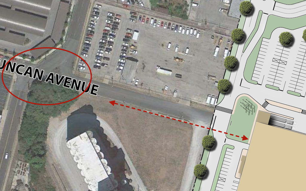
Current site plan doesn’t show pedestrian access from the south side of Duncan Ave., intersection at Sarah needs to be addressed to connect IKEA to MetroLink.
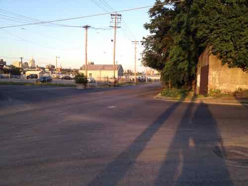
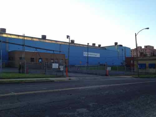
Looking east from in front of the grain silo toward the future IKEA. A sidewalk exists currently.
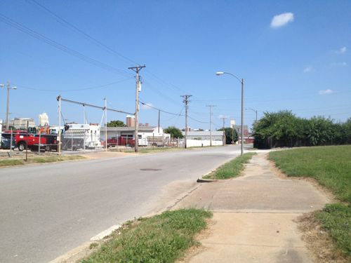
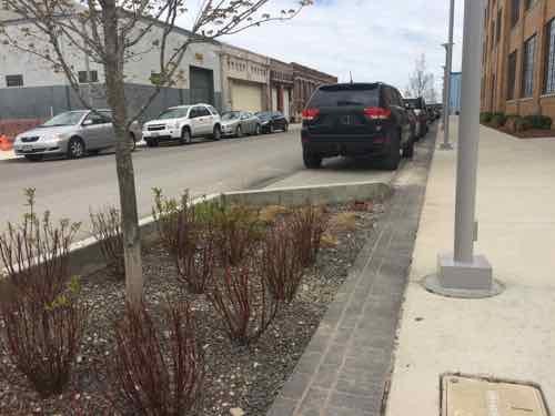
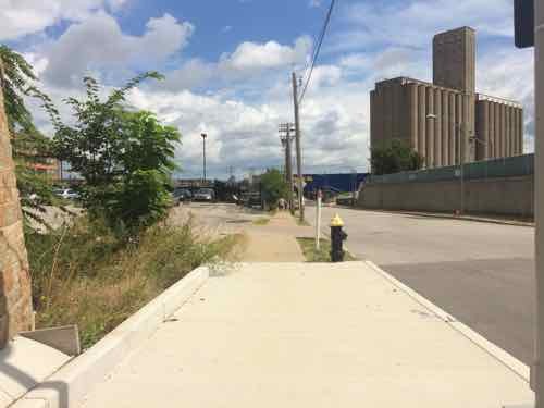
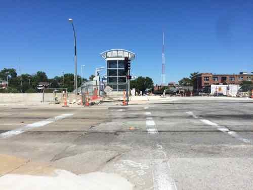
In 2013 I was focused on the horrible intersection of Duncan & Sarah and getting into the IKEA site. The odd configuration made it horrible for motorists, pedestrians, and cyclists.
May 2012 — looking East across Sarah from the South side of Duncan.
Thankfully, this has been addressed, as you’ll see later.
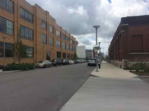
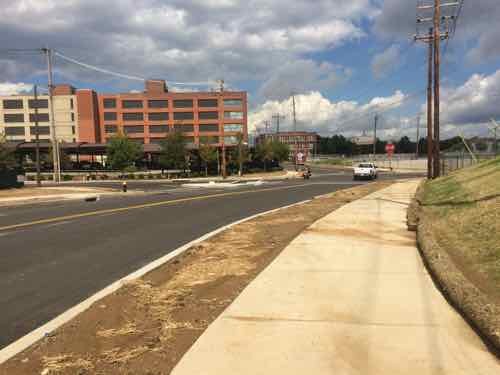
Today let’s start at Boyle and the CORTEX Commons — and head East to IKEA.
Looking East across Boyle on the North side of Duncan in April 2015
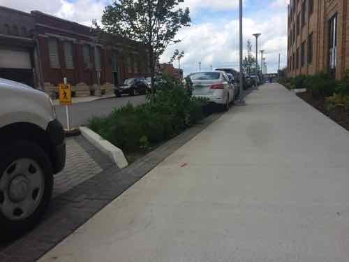
Trees planted in the parking lane on the South side of Duncan in front of the @4240 building, also April 2015
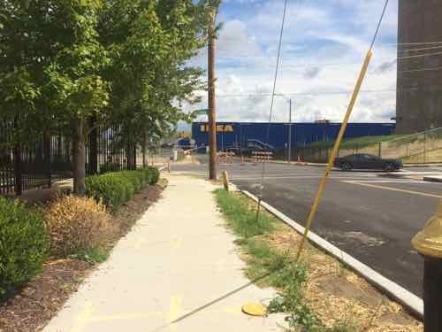
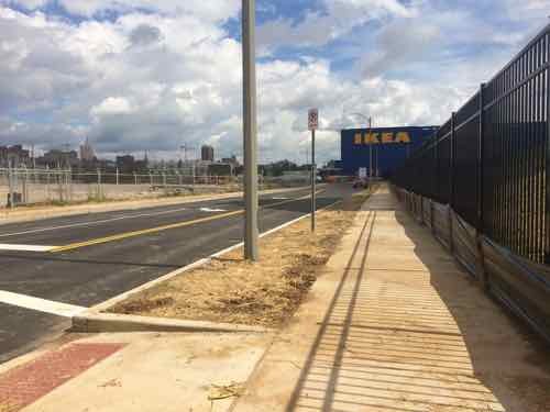
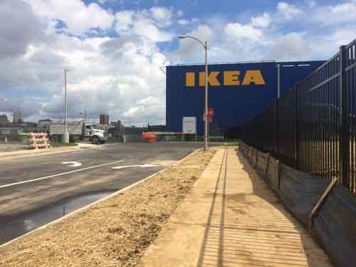
This similar view from Sept 11th shows the plants have matured, the parking paving is permeable. If you look closely you can see the side of IKEA’s big blue box at the end of the sidewalk.
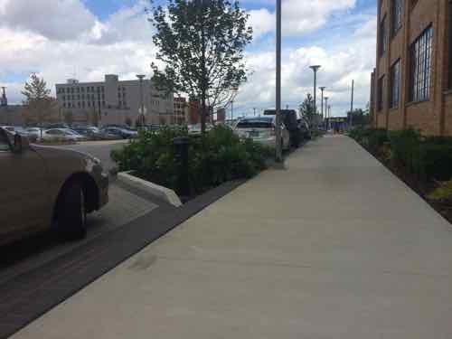
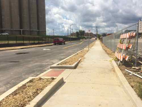
A little further East. In St. Louis this is a very generous sidewalk, in Chicago it would be on the smaller side. Still, I like that it is so open.
Back on the North side we can see how the trees break up the line of parked cars.
Looking back West toward Boyle, the North side didn’t get the same treatment with street trees.
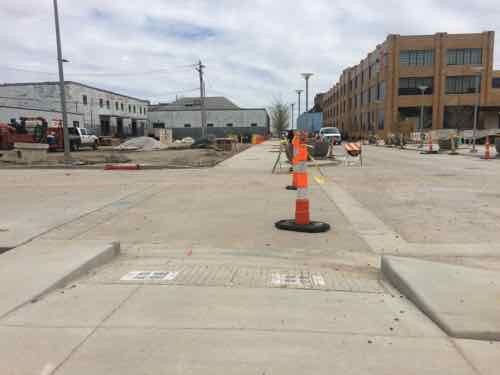
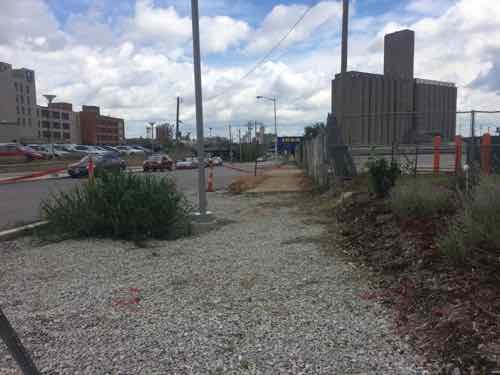
During my visit on the 11th work was still ongoing on the South side of Duncan just before Sarah
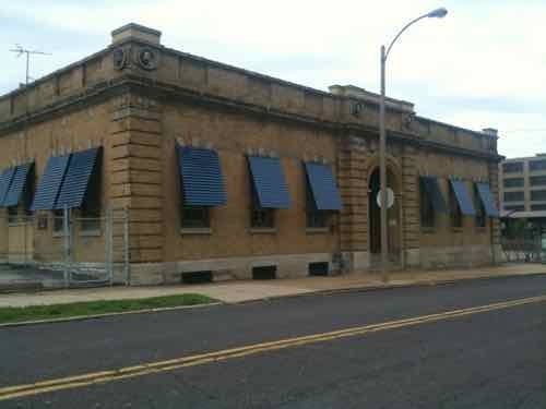
Part of the work is on the adjacent site where this massive US Metals building used to be. View from Sarah, May 2012
The former office on Sarah was also razed, which is a shame. May 2012.
Ok, so we’re back on Duncan facing East. Because the sidewalk was out on the South we’re on the North.
As we approach Sarah we can see it looks different than before
Before we look at Sarah, a look back West on Duncan
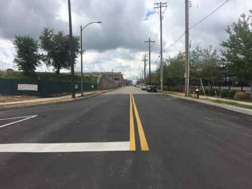
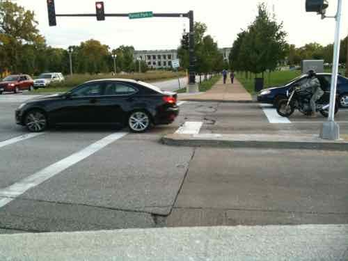
Now looking East across Sarah
Here’s the May 2012 photo from before so you can compare them, The tall wall is gone and the traffic flow shifted.
Turning South we can now see how Sarah curves
This view looking North from the East side of Sarah shows how Sarah now curves to the right for a conventional intersection at Duncan
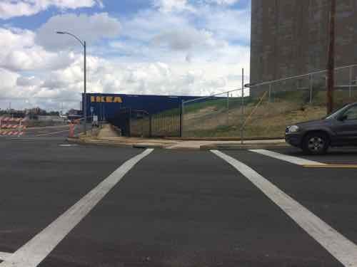
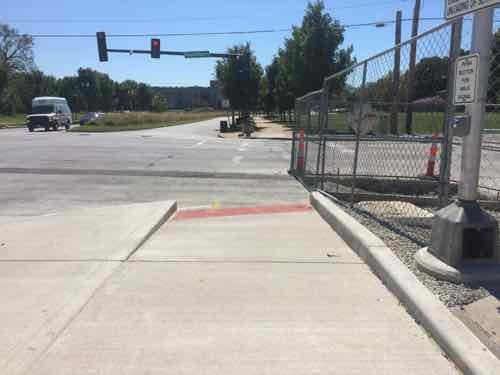
Looking East after crossing Sarah
Getting closer
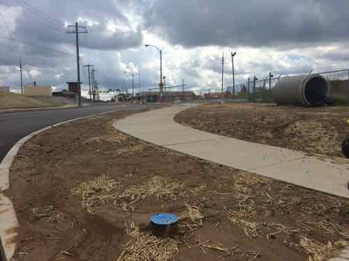
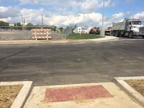
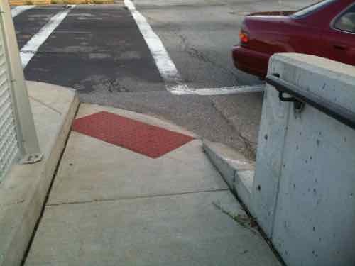
The sidewalk on the South side of Duncan ends, but a crosswalk point to the North is provided
Looking North, the crosswalk wasn’t marked on my visit but paint crews were working on site. This would’ve been an excellent spot for a raised crosswalk.
Looking back West.
Monday next week I’ll take a closer look at the various pedestrian access points to IKEA St. Louis, as well as a peak inside!
Duncan Ave is bookended by BJC hospital just West of Taylor, and IKEA just East of Sarah — about a mile total in length — the pedestrian experience is highly inconsistent and doesn’t begin to approach friendly. Yet, this is the mile stretch the CORTEX Master Plan says should be pedestrian-friendly, the primary East-West means for pedestrian circulation. At best it’s less hostile in a few spots than it was a few years ago.
The controversial topic of right-t0-die was in the news again recently:
The “death with dignity” movement marked a victory in California Friday when the state Senate passed a bill allowing terminally ill patients to end their own lives with the help of a physician.
The End of Life Option Act, which passed in the state Assembly Wednesday, would allow patients to seek aid-in-dying options so long as they are given six months or less to live by two doctors, submit a written request and two oral requests at least 15 days apart and possess the mental capacity to make their own health care decisions.
Gov. Jerry Brown (D), who attended a Jesuit seminary prior to his political career, has yet to indicate whether he will sign the bill into law. (Huffington Post)
I thought this would be a great policy subject for a Sunday Poll.
Please vote below
The poll is open until 8pm, the choices are randomized.
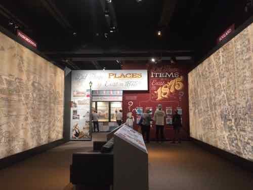
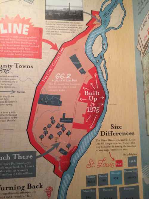
I’ve been wanting to see Missouri History Museum’s ‘A Walk In 1875 St. Louis’ exhibit since it opened in May. On Tuesday, my husband and I finally got there to see it.
One of the most amazing maps of a city ever created was Compton & Dry’s “Pictorial St. Louis,” drawn in 1875 and published in 1876. Using this incredibly detailed cartographic masterpiece as its backdrop, the Missouri History Museum developed A Walk in 1875 St. Louis, a 6,000 square-foot exhibition that explores the collective life of 1875 St. Louis through photographs, artifacts, news, writings and first hand accounts of the day.
The Museum’s exhibit staff wanted to create an exhibition that looks so closely at one single year in St. Louis’ history that people could imagine they were actually there. Compton & Dry’s ‘Pictorial St. Louis’ provides the perfect visual stage to create this immersive experience for visitors.
My expectations were high, and the exhibit greatly exceeded them. I hope too see the free exhibit a few more times before it closes in February 2016.
I took a lot of photos, here’s four:
Several large spaces feature two different areas on opposite wall, this example is Fairgrounds & Soulard. In front of you is information to highlight areas on the huge panels
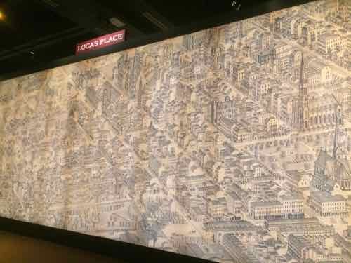
Since our loft is in the former mansion row of Lucas Place we liked seeing this panel. Lucas St is now Locust St.
Besides the maps, the exhibit explains what life was like in 1875 Sr. Louis
The great divorce, finalized the following year, is addressed. As you can see, the new city limits were placed far out from the developed city.
One wall had every page from Compton & Dry’s ‘A Pictorial St. Louis’ book assembled, reprints are sold in the gift shop. Please take time to see exhibit before it closes on February 14, 2016.
I often post about accessibility problems, but today’s post is about a problem that’s finally getting addressed. The reconstruction of the DeBaliviere viaduct/bridge over MetroLink tracks is making great improvements to crossing Forest Park Parkway (map). Tuesday I saw the improvement on the newly-opened West side.
Before: The ramps on each side heading South weren’t the best, the crosswalk was pushed out right next to traffic. September 2010
Before: we had to use a narrow ramp reach the crosswalks. If you’re waiting to cross a street someone crossing the other would be blocked. These were also trip hazards to others. September 2010
After: Now the ramp is wide and directional. The crosswalk won’t be up against Southbound traffic anymore.
After: Looking back North you can see the West side isn’t totally finished.
After the East side and the crosswalks are complete I’ll do another post. I’m just so thrilled at the ramp improvement!
Hopefully the pedestrian signal buttons, once activated, will be solely for the visually impaired to get audio signals about when to cross. Other pedestrians shouldn’t need to press a button to get a walk signal.
The results of the nonscientific Sunday Poll show support for short-term room rentals:
Q: Many St. Louis area municipalities frown on residents renting a room(s) for a few days at a time to strangers, similar to a hotel. Thoughts?
Room rental should not be regulated, should be allowed 16 [51.61%]
Boarding houses were outlawed for good reason 10 [32.26%]
Unsure/No Opinion 4 [12.9%]
Other: Compromise option: Have some regulation & education but otherwise leave open. 1 [3.23%]
This issue is being debated in one of 90 municipalities in St. Louis County:
Airbnb could be coming here after all.
The Maplewood City Council on Tuesday gave tentative approval to a measure to allow “short-term vacation rentals” in the residential district and to another that would establish regulations on them.
Last month when a motion to delay a bill to allow short-term rentals failed, City Manager Martin J. Corcoran said it couldn’t be reconsidered for six months. However, on Tuesday he said he misspoke in August and the delay wasn’t necessary. Therefore, the council considered the measure again. (Post-Dispatch)
AARP Livibility Index
The Livability Index scores neighborhoods and communities across the U.S. for the services and amenities that impact your life the most
Built St. Louis
historic architecture of St. Louis, Missouri – mourning the losses, celebrating the survivors.
Geo St. Louis
a guide to geospatial data about the City of St. Louis