Nineteen year ago I started this blog as a distraction from my father’s heart attack and slow recovery. It was late 2004 and social media & video streaming apps didn’t exist yet — or at least not widely available to the general public. Blogs were the newest means of …
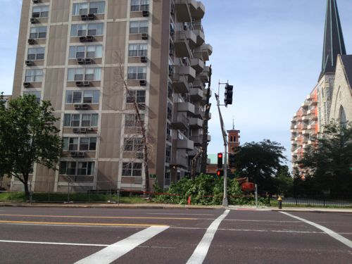
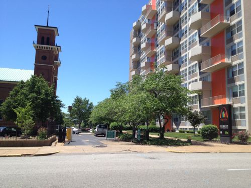
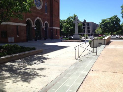
The new NGA West campus , Jefferson & Cass, has been under construction for a few years now. Next NGA West is a large-scale construction project that will build a new facility for the National Geospatial-Intelligence Agency in St. Louis, Missouri.This $1.7B project is managed by the U.S. Army …
Book publisher Island Press always impresses me with thoughtful new books written by people working to solve current problems — the subjects are important ones for urbanists and policy makers to be familiar and actively discussing. These four books are presented in the order I received them. ‘Justice and …
This post is about two indirectly related topics: the new Siteman Cancer Center building under construction on the Washington University School of Medicine/BJC campus and an update on my stage 4 kidney cancer. Let’s deal with the latter first. You may have noticed I’ve not posted in three months, …
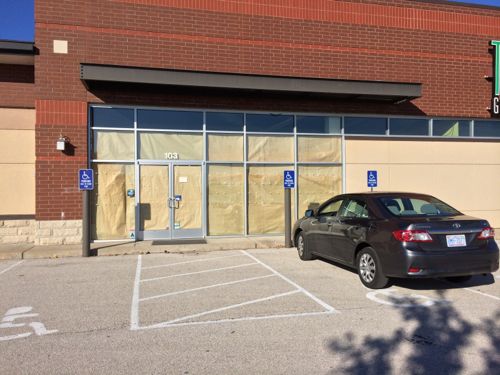
I’d never heard of Tee’s Golf Grill until Monday when I was driving around the Chesterfield Valley, it closed in July 2012:
The 10,400-square-foot golf center opened in early 2011 at 103 Chesterfield Valley Drive. “We’re doing a full-service sports bar and grill,” Ben Rassieur IV, Tee’s owner with Phil Harris, told Sauce magazine at the time. In addition to the bar and grill, Tee’s had 330-square-foot golf simulators that visitors used to practice their swings. (St. Louis Business Journal)
I’m not sure if the building was constructed new for this tenant, or a previous tenant. I also don’t know why this business closed so soon, but I found a number of issues that should be addressed by the owner before the next tenant leases the space.
Paper over the windows, only car is my rental. But look, no ramp to access the front door! Click image to view on Google Maps.
The ramp is off to the side, requiring the disabled to go into the driveway to access it. I prefer ramps when walking with my cane, so do folks who use walkers.
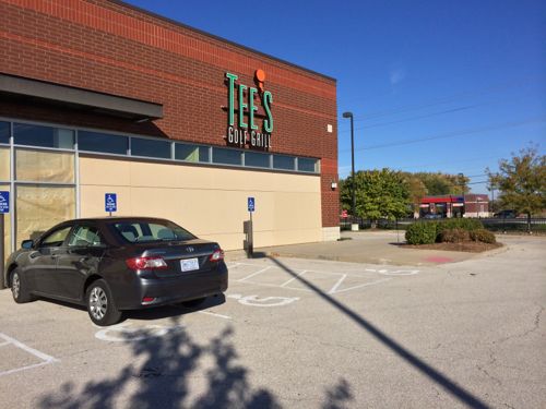
There’s a ramp & crosswalk out to the sidewalk that connects to other development, but no ramp to access it.
We can see the walk to the entry is minimal width.
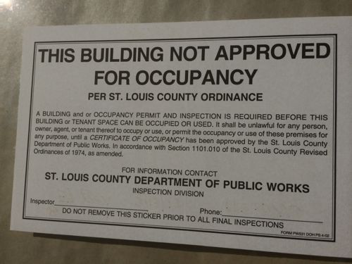
This sticker was affixed to both entrances to this building. I wonder if the City of St. Louis uses something like this to improve compliance?
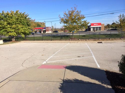
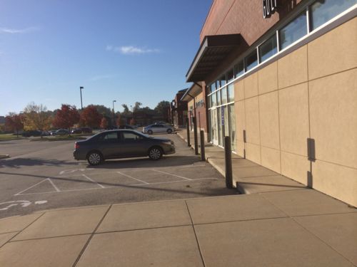
This building shares the same site with a multi-tenant building to the south, yet there isn’t an ADA-compliant accessible route connecting them, as required.
I will attempt to share the above issues with the owner and St. Louis County.
Me pre-stroke in the December issue of St. Louis Magazine. Photo by Dillip Vishwanat
Today marks the ninth anniversary of this blog. I began writing to focus on something other than my dad recovering from a heart attack. During the last nine years over 3,500 posts generated nearly 42,000 comments.
I write because I enjoy sharing my thoughts, many often disagree with me. I like to describe my vision for areas, how they might change in the future. Frequently comments suggest I’m just dreaming, the city’s broke, etc. Well, change starts when someone dreams up an idea that’s different than the current reality.
Money is tight, but here are some public projects completed during the nine years I’ve been blogging.
Washington Ave streetscape east of Tucker
Shrewsbury MetroLink extension
Rebuild of I-64/Highway 40
Jefferson Viaduct
Grand Viaduct
Jefferson over I-64
Grand streetscape
Grove streetscape
Tucker rebuild
No money, huh? These and other projects weren’t free. Ideas must be generated first, then you seek out funding. No government says they have extra money for the taking, the ideas are put into proper form to see about getting funded. Yesterday I saw a 2002 newsletter which had information on the idea for a new Mississippi River bridge. This idea has been hashed around for years, the scope revised numerous times as two states tried to figure out how to fund the project. It’ll open in 2014.
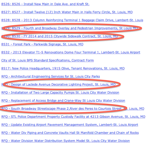
List of Board of Public Service plans for bidders, as of yesterday. The four circled are items I might review in the future.
According to Board of Public Service President Richard Bradley, they annually oversee projects totaling “$30-40 million which includes BPS projects at Lambert Airport.”
So I’m going to continue to share my ideas even though I don’t have a funding plan at that moment. I know that public infrastructure change often takes 5-20 years from idea to ribbon cutting, with only a small percentage making it to the end.
Those who voted in the poll last week don’t think St. Louis should enter into a contract with Veolia. Here’s the final tally:
Q: Should St. Louis Sign The Water Consulting Contract With Veoila?
No 46 [68.66%]
Yes 11 [16.42%]
Unsure/no opinion 10 [14.93%]
I agree we shouldn’t sign this contract. I do think we need a transparent process to take a critical look at the operations of our water utility. We own it and continuing to own it means decisions are based on what’s best for the citizens, not stockholders of a private corporation. Others shouldn’t profit on our water.
You can politely give comptroller Darlene Green support for refusing to sign the contract so far by using the email form here.
Yesterday morning an alderman posted to Facebook that a “representative from the Mayor’s office read a statement this morning informing the Ways and Means committee that Veolia has withdrawn its proposal to do business with St. Louis’ Water Division.”
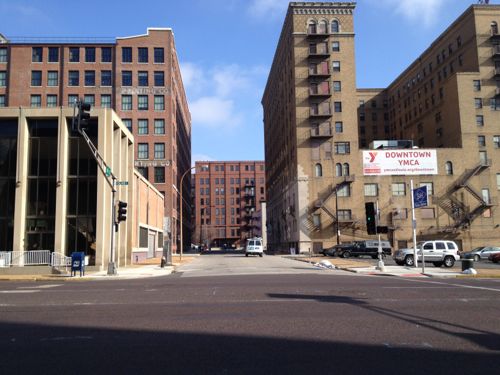
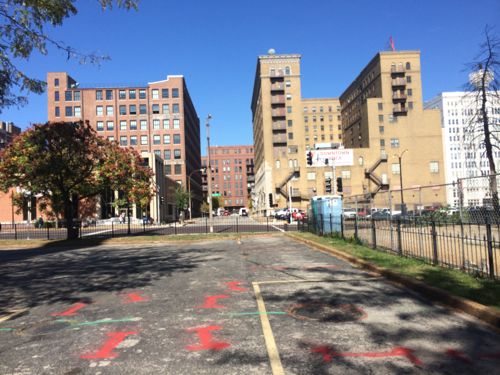
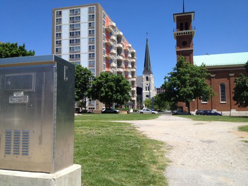
In 1951 the Plaza Square urban renewal area was defined. More than a decade later, in 1962, six new apartment buildings finally opened on four city blocks that were completely razed, except for two churches, which remained. In addition to removing hundreds of existing buildings, 16th Street was also removed. Both churches and two of the six buildings fronted a new pedestrian-only walkway where 16th Street had been. For over 50 years this has remained mostly unchanged, and, I’ll argue, has been part of the reason behind the decline in the area.
First, some background provided by city staff highlighted in a 1970 report:
In 1951, shortly after the establishment of the Land Clearance for Redevelopment Authority, Plaza Square became a federally-assisted Title I Urban Renewal Project. A bond issue for the project was submitted to voters in 1953 and failed, but was approved later in that year. Execution began in 1954 and rebuilding was done by the Urban Redevelopment Corporation. The Federal Government defrayed two-thirds of the $2,618,000 loss incurred in the write-down and the City bore the remaining third. By developing a park and making street and utility improvements in the area, the City exceeded its required contribution by $114,500. This was applied as credit to the cost of another project at a later date.
The present 16-acre, $20 million Plaza Square Apartment project completed in 1962, contains 1,090 apartments in six multi-story buildings. In addition, it includes two rehabilitated churches with expanded sites, a small park, shopping facilities, and a $2 million office building for the Blue Cross Group Hospital Service. The Plaza Project also has been a significant link in the concept for an East-West Axial Mall extending from Aloe Plaza eastward to the riverfront arch.
In the mid-1960’s, occupancy lagged in the project. In 1966, in an attempt to alleviate this problem, the Bethesda Foundation took title to one of the buildings. The Bethesda Townhouse is now a non-profit residence for senior citizens who lease the dwelling units for life. By 1970, the occupancy rate had reached 88% in the Plaza Square Project.
The success of Plaza Square has had far reaching consequences since it was the first of its kind in the City. One of the most important aspects was the fact that Federally assisted renewal program encouraged private investment in the reconstruction of the City. Its success provided the stimulus for later revitalization projects such as the Civic Center redevelopment.(History of Renewal)
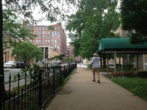
The non-profit building for seniors later became the Blu condos, many of which became rentals or were sold at auction. This post is a look at the pedestrian-only path left after 16th Street was removed. This matters to me personally because I live at 16th & Locust and need to reach the bus stop & city offices at 16th & Market (map).
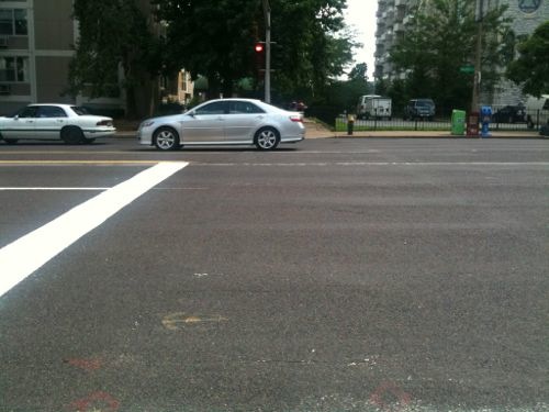
For years there was no pedestrian signal or crosswalk to cross Olive at 16th. The walkway can be seen beyond the car
In 2012 pedestrian signals were installed and a single crosswalk was painted on the east side of 16th. In this 2013 picture the new owner of the building on the left was cutting down old trees, blocking the narrow walkway.
Looking north at 16th from the south side of Olive. Pedestrians wanting to cross from the west side of 16th must cross 16th first, or jaywalk.
Same view but further south on the former 16th, now church parking.
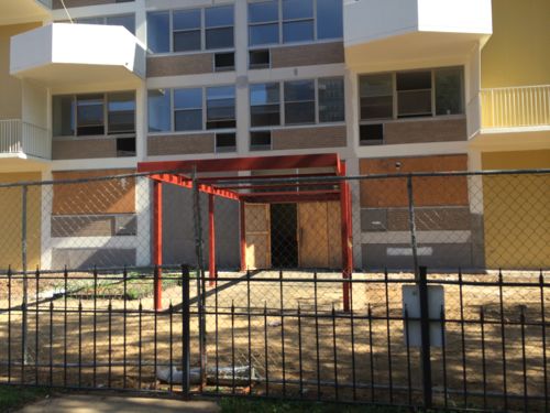
Looking north on the walkway before renovation of the adjacent building began. This area became a haven for trouble once that building became vacant, Centenary Church had the fence installed then.
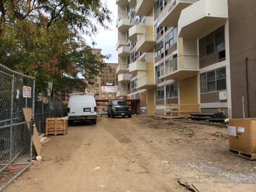
The apartment building entry is getting rebuilt, it faces the Centenary parking lot
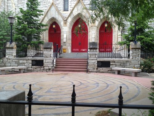
The fence keeps you from reaching the labyrinth and church entry. They’re considering a gate once the apartment building is occupied again
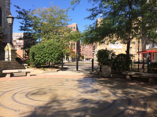
Looking north from the labyrinth, with parking beyond. The labyrinth was built in the 80s or 90s as a meditative space before or after services.
During the renovations of this building the walkway is closed to the public. This building will be for “active adults”, 55+
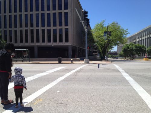
When you reach Pine there is no curb ramp to cross, plus you face the private auto driveway for St. John’s. To cross Pine mid-block I must go to a driveway off to my right and go to the church driveway, then to west to continue.
From here there’s no wheelchair access to the plaza in front of St. John. The bus stop and city office building is in the background
Looking the opposite direction we see the apartment entrance on the left
From the park looking across Chestnut there’s no place to cross, not even a driveway.
From 16th & Market you can see where you want to go. The able-bodied can do it, but few do because it isn’t a friendly walk.
Once at Market you can see the bus stop and city offices.
Few people use the former 16th Street walkway, it’s dark, narrow, uneven, and uninviting. I’m forced to take 17th, 15th or 14th instead. Like I said at the opening, I think this dead walkway has been a contributor to problems in the Plaza Square area.When the general public avoids an area and when a church erects a fence to keep out unsavory activity then you know a problem exists — a problem created by the poor design. It performs the opposite of how it was intended, a safe & pleasant car-free zone.
Cars are activity generators. The drivers are eyes on the street, police can drive down streets.
I’d like to see the community look at all options for 16th, including:
Revising the walkway so it is ADA-compliant.
Remaking the walkway so it is wider, more inviting and ADA-compliant.
Reopening 16th Street to traffic, on the same scale as north 14th in Old North. Both were a 60 foot public right-of-way.
Making Chestnut and Pine two-way streets again
I met with clergy from both churches, neither likes the idea of losing parking or the space in front of each respective entrance. Meanwhile, the owner of four of the six Plaza Square buildings wants to build a parking garage between two of the buildings, without losing the historic designation needed for tax credits (via NextSTL).
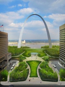
Two years from today marks the 50th anniversary of the topping of the Gateway Arch. October 28th wasn’t the original date, but delays happen:
President Lyndon B. Johnson and Mayor Alfonso J. Cervantes decided on a date for the topping out ceremony, but the arch had not been completed by then. The ceremony date was reset to October 17, 1965, and workers strained to meet the deadline, taking double shifts, but by October 17, the arch was still not complete. The chairman of the ceremony anticipated the ceremony to be held on October 30, a Saturday, to allow 1,500 schoolchildren, whose signatures were to be placed in a time capsule, to attend. Ultimately, the Pittsburgh-Des Moines Steel(Warren, Pa) set the ceremony date to October 28.
The time capsule, containing the signatures of 762,000 students and others, was welded into the keystone before the final piece was set in place. On October 28, the arch was topped out as then Vice President Hubert Humphrey observed from a helicopter. A Catholic priest and a rabbi prayed over the keystone, a 10 short tons (9.1 t), 8 feet (2.4 m)-long triangular section. It was slated to be inserted at 10:00 a.m. local time but was done 30 minutes early because thermal expansion had constricted the 8.5-foot gap at the top by 5 inches (13 cm). To mitigate this, workers used fire hoses to spray water on the surface of the south leg to cool it down and make it contract. The keystone was inserted in 13 minutes,[30] only 6 inches (15 cm) remained. For the next section, a hydraulic jack had to pry apart the legs six feet. The last section was left only 2.5 feet (0.76 m). By 12:00 p.m., the keystone was secured. Some filmmakers, in hope that the two legs would not meet, had chronicled every phase of construction. (Wikipedia)
So 48 years ago delays were common. In fact, it was years later before the Arch opened to visitors. Landscaping came later as well.
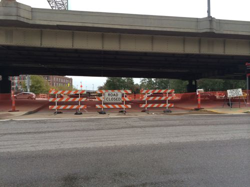
MoDOT recently closed Washington @ I-70 to rework the intersection before Memorial Drive is closed for construction of the lid/park
What will be completed in two years, what won’t be? Word is still that Kiener Plaza will be done as this is key to directing visitors to the newly planned museum entrance from various downtown parking garages. That must happen so the existing garage on the north end can be razed.
AARP Livibility Index
The Livability Index scores neighborhoods and communities across the U.S. for the services and amenities that impact your life the most
Built St. Louis
historic architecture of St. Louis, Missouri – mourning the losses, celebrating the survivors.
Geo St. Louis
a guide to geospatial data about the City of St. Louis