Home » Arch » Recent Articles:

New Park/Garden Under Construction Next To Eads Bridge

July 9, 2020 Downtown, Featured, Parks, Planning & Design Comments Off on New Park/Garden Under Construction Next To Eads Bridge

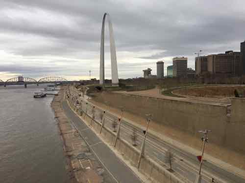
When Great Rivers Greenway announced six years ago they were going to build a park on the north side of the Eads Bridge many of us scratched our heads — there’s already huge park (90+ acres) on the south side of Eads Bridge — the Gateway Arch National Park. Why build a small park next to a big park?

It was announced a park was planned for the north side of the Eads Bridge, on the other side of the trucks parked in the alley. March 2014
Another March 2014 view, taken from Lucas Ave & Commercial alley.

Here is their initial press release:

Feb. 27, 2014 (St. Louis) – With the transformation of the Riverfront and Gateway Arch grounds underway, the Great Rivers Greenway District is pleased to announce the purchase of a historic property that will provide a safer and more accessible connection between Laclede’s Landing and the revitalized Riverfront.

The lot is situated directly north of the Eads Bridge between First and Second streets on Laclede’s Landing. It is the site of the former Switzer Licorice Building, which was demolished in 2007.

“We are very pleased to have acquired this property,” says Susan Trautman, Executive Director of Great Rivers Greenway District. “Not only will it provide a universally accessible connection to the Arch grounds, it has the potential to create larger connections across the region and spur future development.”

The District aims to transform the property into a park or other compatible development offering food, restrooms, or other services to enhance the visitor experience while providing a seamless transition between the revitalized Gateway Arch grounds and Laclede’s Landing.

“The site offers endless possibilities for connection,” says Trautman. “It is steps away from the Eads Bridge Metrolink station, four blocks south of the North Riverfront Trail, and around the corner from the new trails being built on the Arch Grounds and along the Riverfront. It is fitting that the ‘front door’ of this property is a soaring arch beneath the historic Eads Bridge.”

The District purchased the property from St. John’s Bank for $350,000. The property’s appraised value was $390,000. 

I didn’t catch this six years ago, but the site isn’t actually “between First and Second streets” — it’s between First and Lenore K. Sullivan Blvd (originally Warf).

What we often get in press releases about planned projects is statements meant to reduce possible objections to a decision. Who’d have a problem with safer and more accessible, right? Keep reading.

The 1st Street opening in the approach, the park site id on the other side of both the approach and 1st St.
The Commercial Alley opening, currently closed while workers on the park use the covered/shaded space.

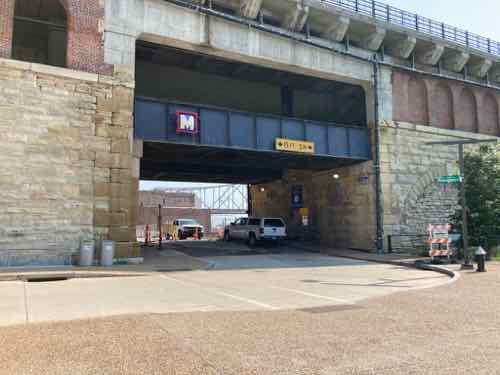
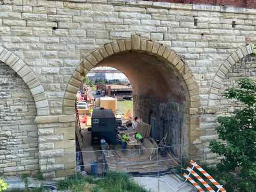
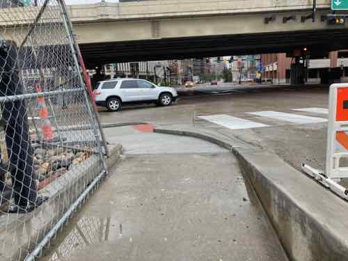
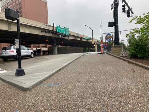
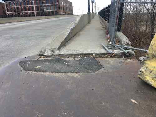
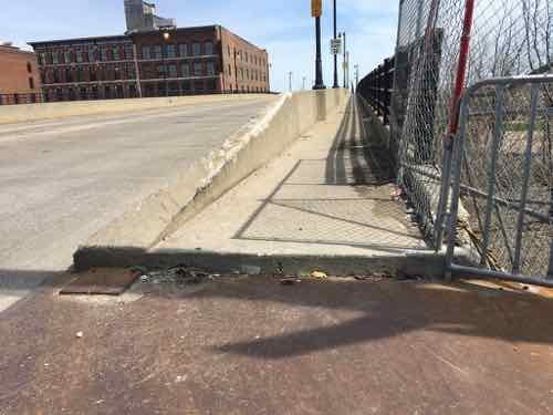
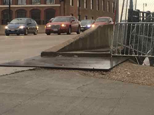
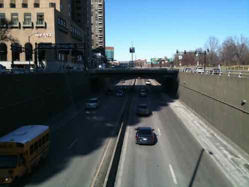
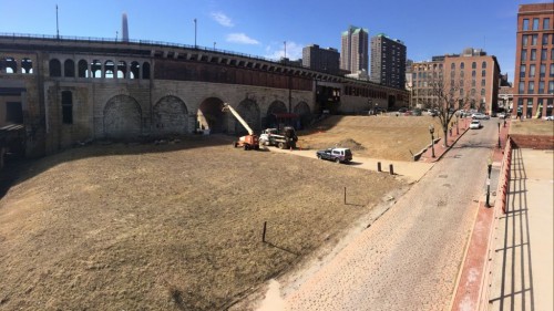
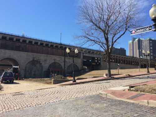
The Missouri approach to the 1874 Eads Bridge is brick & stone, but has five openings to allow people and vehicles to easily reach the other side:  Warf, First, Second, at two alleys in between the streets. They knew in the 19th century that closing off parts of the street grid wouldn’t be a good idea so they make sure every street & alley could continue unimpeded.

Stairs from 1st Street up to the MetroLink platform
From 2nd Street you can use the elector or stairs.

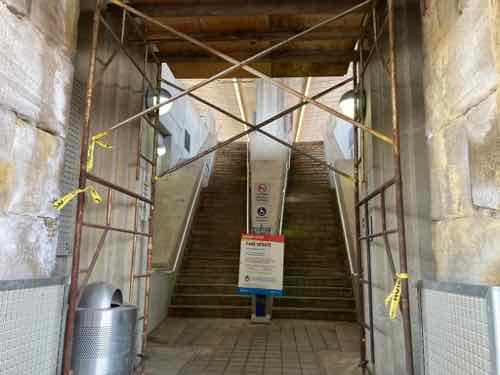
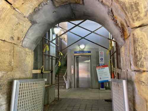
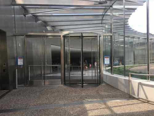
For anyone arriving at Laclede’s Landing via MetroLink light rail can exit to either First or Second streets — assuming they’re physically able to do so as only the Second Street exit has an elevator. Due to elevation changes, the Second Street exit also has significantly fewer steps than the First Street exit.

Surface parking across 1st Street from new park. The buildings in the background face 2nd Street.

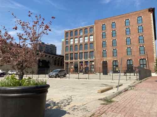
Second Street is the primary street in Laclede’s Landing, it has the most restaurants and such. First Street is ok a block further North, but right at the bridge it’s desolate — mostly surface parking and a old flood-prone parking structure down the hill.

View of new park site from 1st Street MetroLink station opening

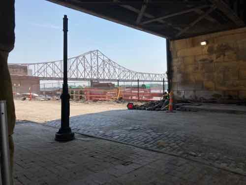
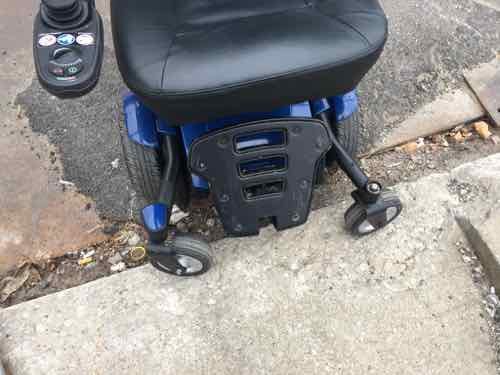
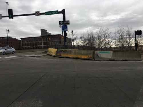
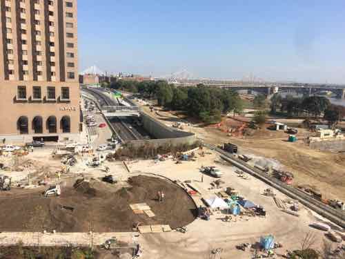
The west side of this new park is bounded by First Street, therefore adjacent to the First Street entry/exit for MetroLink. As a wheelchair user I can’t use the First Street exit. This park may prove popular, perhaps especially with cyclists and those looking for restrooms.

The land between Commercial alley and Lenore K. Sullivan Blvd is still privately owned, but Gateway Greening hopes this is a phase 2.

I personally would’ve liked to have seen new buildings, rather than more open space. That’s a big part of the problem with Laclede’s Landing — too few buildings, far too much open space. Sure, this will be green open space instead of asphalt open space. Hopefully the parking to the North & West can get replaced with new buildings — this would give this park nice walls.

The Katherine Ward Burg Garden is currently under construction

The new park is not named after the building that occupied the site for decades, Switzer licorice.  No, follow the money out to Ladue.

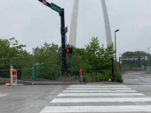
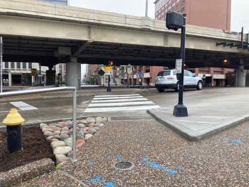
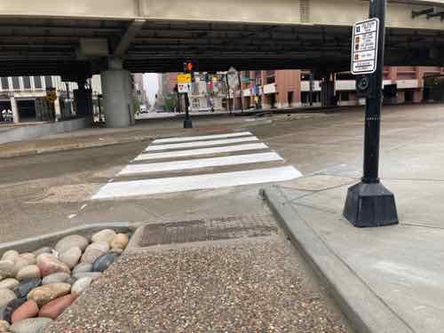
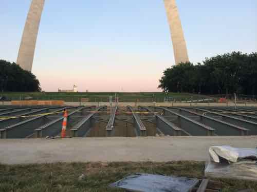
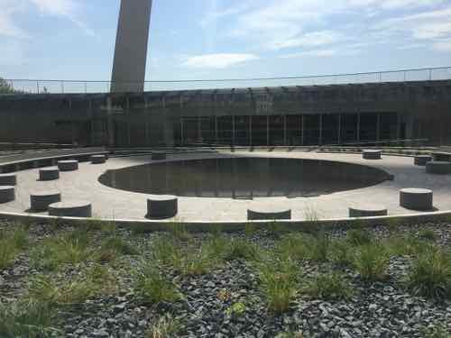
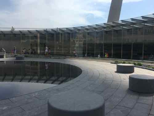
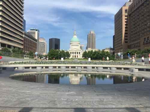
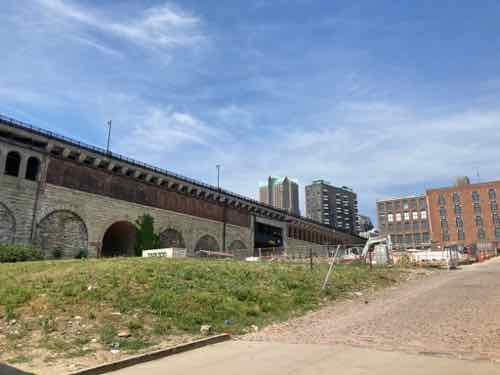
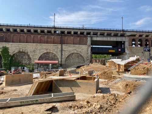
The Katherine Ward Burg Garden is the first step in this long-term plan to redevelop the St. Louis Riverfront north of the Eads Bridge and Gateway Arch. Situated adjacent to the Eads Bridge, the half-acre plaza will be a welcoming spot once people exit the MetroLink at the Laclede’s Landing stop.  It is bordered by North 1st street on the east, Lucas Avenue on the northern edge, the Mississippi Greenway (Commercial Alley) on the east and the Eads Bridge to the south.

Thanks to a generous bequest from the estate of  Katherine Ward Burg, the garden has been designed to create a flexible and welcoming open space which attracts visitors north from the Arch grounds to explore Laclede’s Landing or to the Arch grounds from the Landing. It incorporates an iconic trellis, stepped terraces and curving seatwalls offering a comfortable spot for respite, a meeting place to start an adventure and a site that can be adapted for special events and programs. The gently sloped landscape allows for accessible ramp access from First Street down to Commercial Street, a way for all people to move down toward the river, eventually connecting to the Mississippi Greenway.

Construction is underway and expected to be complete in Spring 2021. (Great Rivers Greenway)

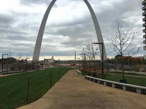
If you were looking for a post with uncritical approval with artists renderings you’ve come to the wrong blog. Hopefully my skepticism will prove unfounded, the garden will become a huge success.

We’ll find out how it looks and functions next year and if it’s a success after a few more years.

— Steve Patterson


Eads Bridge Pedestrian Path Finally Accessible Again After 4+ Years Inaccessible

May 14, 2020 Accessibility, Featured, Planning & Design, Walkability Comments Off on Eads Bridge Pedestrian Path Finally Accessible Again After 4+ Years Inaccessible

The renovation of the Arch grounds a few years back greatly improved accessibility for the public. Going from the top of the steps down to the riverfront used to be a major challenge if you were pushing a stroller, or using a wheelchair. New ramps now make it very easy.

But the project accidentally cut off access to the pedestrian walkway on the Eads Bridge, as early as May 2015. This month it was finally rectified, though the solution created another problem.

Looking west heading into St. Louis from the Eads Bridge. May 13, 2020

Let’s do a quick recap of the problem caused when a contractor busted through into the light rail tunnel below.

The earliest I can find the issue on Google Street View is from May 2015, how much earlier it began is uncertain.

May 7, 2017 is my oldest photo of the problem. This is when I began conversations with various officials about being able to access the pedestrian walkway in my wheelchair.
By March 16, 2019 the broken concrete had been removed but the height from steel plate to bridge sidewalk was too much for 99.9% of wheelchairs.

In January of this year I posted about the problem, see Eads Bridge Remains Inaccessible Years After Arch Project “Completed”. I was told a fix was in the works, but I’d been hearing excuses since 2017.

A week ago a friend sent a pic to me showing work happening. Yay, finally! Yesterday I went by to see the result, approaching from the North.

Approaching from Laclede’s Landing. I’m happy to see a smooth transition to the bridge, but the width of the crosswalk markings have no relationship to the width of the ramps on either end. 

I’m happy to report the accessibility is better than it ever was. The slopes, cross-slopes, ramps, etc. are all improved. I was very relived to be able to access the bridge. I then went to head West toward downtown.

Approaching the corner from the Arch grounds. At left is the point to cross the street to head into downtown proper.
Here’s a more direct view. Like before, the crosswalk is much wider than the ramp, but that’s not the main problem.
The stupid “beg button” for a walk signal is set back too far from the curb — only by leaning and stretching could I reach it.

Walkable areas shouldn’t have buttons to get a walk signal — they should always come up in the cycle. But if you’re going to make us press these damn buttons at least place them where they can be reached! I can see bottlenecks here post-covid with lots of tourists coming and going.

— Steve Patterson


Eads Bridge Remains Inaccessible Years After Arch Project “Completed”

January 13, 2020 Accessibility, Featured, Walkability Comments Off on Eads Bridge Remains Inaccessible Years After Arch Project “Completed”

Thursday last week I decided to go see the level of the Mississippi River before we began getting rains and localized flooding. The best view is from the pedestrian walkway on the south side of the Eads Bridge top deck. I knew there had been accessibility issues at the west end of the sidewalk, but the I’d seen some asphalt had been put down to lessen the problem.

The loaner wheelchair I’m using couldn’t get over the huge gap.

So I had to stand up and, while not falling, drag the chair up onto the sidewalk by pulling on each front caster, alternating from left to right. Someone saw me and came to help when I was nearly finished.

This is the view as I approached. The steel plate and asphalt are more recent, but now ineffective.
If we step back across Memorial Drive we see barricades have been placed to physically prevent anyone from going from the Eads to Arch grounds, or vice versa.

It seems a contractor on the Arch project accidentally busted into the MetroLink light rail tunnel beneath the Eads Bridge/Washington Ave. Since Metro owns the bridge & tunnel it’s up to them to get it fixed.

Let’s take a look at my older photos, in reverse order.

May 31, 2019. A steel plate covered the gravel but no asphalt yet to get up
May 2, 2019
April 1, 2019
March 16, 2019
May 7, 2017 is my oldest photo of the problem. This is when I began conversations with various officials about being able to access the pedestrian walkway in my wheelchair.

So this problem is about three years old at this point. Three years!

I did get to see the river level last week, but it took far more effort than it should have.

As Spring flooding season begins I’d like to get regular photos to show how water is approaching and eventually covering Lenore K. Sullivan Blvd.   I live close by so this shouldn’t be the issue it is.

— Steve Patterson


Sunday Poll: Border Wall Worth a Partial Government Shutdown?

December 23, 2018 Featured, Sunday Poll Comments Off on Sunday Poll: Border Wall Worth a Partial Government Shutdown?
Please vote below

As you likely know, the federal government has partially shut down because of a disagreement over $5 billion in funding to build a border wall.

The partial shutdown of the federal government that began just after midnight Saturday won’t be ending anytime soon. The Senate has adjourned with no business in the chamber anticipated before Thursday afternoon and, maybe not even then, if congressional leaders and President Trump can’t reach an agreement over the president’s demand for $5 billion in funding for his border wall.

The House and Senate convened at noon Saturday, but no votes were scheduled and many lawmakers have already left town. House GOP leaders have advised lawmakers that they will be given 24 hours’ notice of any planned vote. (NPR)

With the long holiday weekend most of us haven’t noticed…unless we tried to visit the Arch or Old Courthouse:

The Arch, museum and Old Courthouse are all closed indefinitely during the shutdown as part of the National Park Service. The partial shutdown affects nine of the 15 Cabinet-level departments, including Interior, which runs national parks, and Agriculture, which runs national forests. About 16,000 National Park Service employees — 80 percent of the agency’s workforce — are being furloughed.

Congress held a Saturday session in a failed attempt to find a compromise in the battle over President Donald Trump’s request for $5 billion to build a wall along the U.S.-Mexico border. The government agencies will remain closed until at least Thursday, officials said. (Post-Dispatch)

The partial shutdown is the subject of today’s non-scientific poll:

Today’s poll, like usual, will close automatically at 8pm tonight. Any effort to flood the site with voters will only result in increased revenue from ads displayed.

I’ll share my thoughts on Wednesday.

— Steve Patterson


Entrance To Gateway Arch Should Have Faced Downtown From The Start

July 2, 2018 Downtown, Featured, Parks Comments Off on Entrance To Gateway Arch Should Have Faced Downtown From The Start

On Thursday morning last week I made my first visit to the Arch since the new downtown-facing entrance opened recently. Before we get into the nw entry I need to take you back to how it was for decades.

At the base pf each leg of the Arch the walkway would slope down to the entrance was an entry/exit to the underground visitor’s center. These remain.
When security was added it was just inside the door — so the line was outside in the cold, rain, or heat.
Looking out fro the old entry/exit points. These will now be exit-only. But first you had to get here.
For many visitors that meant driving to the 1980s parking garage that was located on the North end of the grounds, then walking to the North Arch entry.
Others coming from Laclede’s Landing North of Eads Bridge or MetroLink got to walk through the 80s garage.
For those already downtown this 2010 photo showsthe highway separating downtown (left) from the Arch grounds (right). When the Arch was first planned this was the at-grade 3rd St Parkway, but it became a high speed interstate “depressed” below grade. Depressing indeed.
Construction on the “lid” over the highway, July 2014
By October 8, 2015 the entire area was closed for major construction.
Same day, same camera location, looking more tossed the Arch/river
A year later Luther Ely Smith Square was finished but work on the new Arch entry continued.
The accessible platform allows to peak over the concrete barrier & chain link fence

For so long it was just a big dirty hole, but slowly it began to take shape. Recently the entry was opened for visitors, but last week was my first visit to this entrance.

The approach to the new Arch entry feels so natural, it’s a shame it wasn’t like this 50 years ago.
Approaching from the North or South the new dug into the hill entry gradually appears.
A small plaza with water feature is in the center, forcing you to either side
Going around the center plaza will take you down to its level or go further to the outside of the circle fore the wide ramps leading to the entrance.
The center plaza
Looking back West from the center plaza
Both outside ramps lead down to the entrance — with revolving door. power operated doors tex to it for strollers, wheelchairs, etc.
From the center just inside.
Looking West from inside, very inviting! You can see ramps going off to each entry.
To the left (North) is restrooms & tickets for the trams, movies, etc. Admission to the museum is free.
To the right (south) is the entrance to take you down to the museum. This is like airport security. Unlike the old entry, this line is indoors!

The lower level was open, though the museum wasn’t — it opens tomorrow. The lower level also has the gift shop, a new restaurant, a movie theater, etc. I decided to wait so my husband could help me get through security, help with bags, wallet, etc. I’m excited by the new entrance, it’s clear to me downtown has not capitalized on the millions who’ve visited over the last half century.

Local journalist/author Jm Merkel is out with a 2nd edition of his book The Making of an Icon: The Dreamers, the Schemers, and the Hard Hats Who Built the Gateway Arch.

With his fourth book from Reedy Press, The Making of an Icon, Jim Merkel captured the spirit behind the conception and construction of one of America’s most distinctive and beloved national monuments. More than two million visitors stand in awe at the Gateway Arch each year, and the stories behind it were unearthed in breathless detail in the first edition. Back with even more lore and the addition of beautiful color images, Merkel brings new information on the Arch grounds and museum to this updated and revised second edition. Now expanded, his book includes more stories compiled from interviews with the visionaries, finaglers, protesters, and intrepid workers who built the arch while one misstep away from a fatal fall. Merkel’s book will help us appreciate the relentless pursuit, innovation, and toil that raised the Arch to the sky. (Reedy Press)

As beautiful as the Arch is, I still think razing 40 city blocks was a huge blunder that we’re still suffering from today.

— Steve PattersonT


Advertisement


[custom-facebook-feed]

Archives

Categories

Advertisement


Subscribe