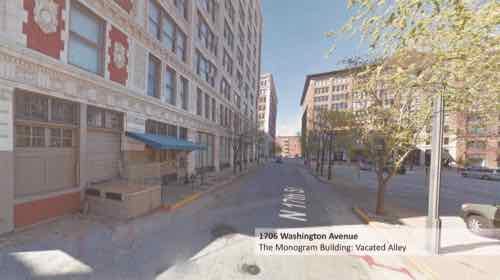
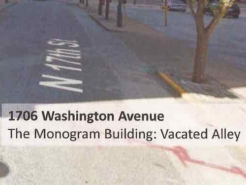
I looked through the materials — many of which are Google Street View screen captures. They couldn’t even come take photographs? One page explained a lot about the view of the developer & architects:
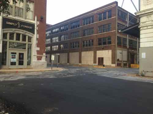
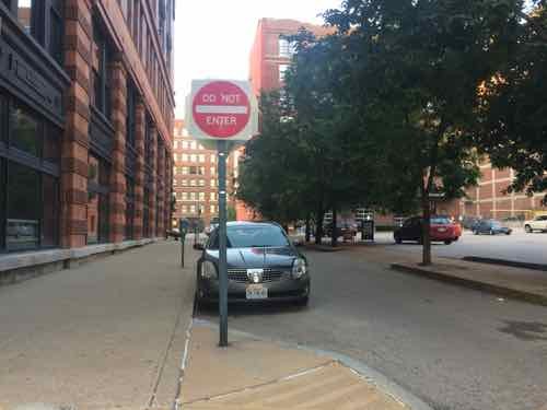
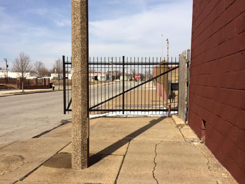
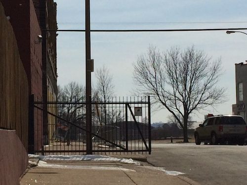
Google Street View looking North on 17th Street toward Washington Ave — but how it’s labeled that shows their lack of understandingA close up shows they view 17th Steet as an alley
The final vote on BB64 will likely take place tomorrow, hopefully the full board will reject it outright. Many signatures have been collected on petitions opposing the vacation of 17th St, from numerous adjacent condo projects. The Downtown Neighborhood Association has also gone on record in opposition. We want to see the Monogram/CPI building occupied, but not at our expense. The public uses 17th Street daily.
BB64 passed unanimously in committee, though Downtown Neighborhood Association Executive Director Jared Opsal spoke against it. Had we all known about it we would’ve packed the hearing room. Which is why the developer & Ald Davis didn’t tell us. However, my post today isn’t about BB64, it’s about the broader issue of notification about street vacations.
The fact that a bill giving away a public right-of-way (PROW) so many of us use daily could move so quickly before being noticed is shocking. I don’t want this to happen to others in the city. Your alderman might tell you of such things, but not all of us are that lucky.
What we need is a process for public notice, not unlike the one used for liquor licenses, zoning changes, etc. I think it need several components:
Posted notice at the location for at least 15-30 days in advance of first hearing
Mailed notice to property owners within 500′-1,000′ of location
The same should apply to blocking an end of a street, severing the street grid. It was the street grid that first attracted me to St. Louis 25+ years ago, it has been painful watching as we repeatedly make short-sided decisions here and there. Death by a thousand cuts.
I urge the Board of Aldermen to establish a process of notification regarding proposed street closures & vacations.
Over the last 8+ years I’ve written about the view from my balcony many times, including last Friday. Today’s post is about three locations I’ve covered separately: former CPI building, 17th St, and the former CPI parking lot:
Turns out the Kansas City developer isn’t keen on making 17th Street two-way as I suggested last year — he wants the city to abandon it for his private project. Board Bill 64 cites “Monogram Building LLC will use vacated area to improve safety and security.” What about the safety of everyone else who lives adjacent? Not having access to 17th Street will reduce our safety & security!
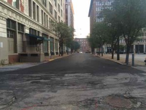
Looking South on 17th St from Washington Ave, this bit is one-way in the direction we are lookingThis view looks at the intersection of St. Charles (1-way WB) and 17th toward Locust (2-way)
I get it — they want residents in the Monogram to be able to park in the new building and walk to their building safely, but their safety shouldn’t come at our expense. We all use 17th Street to access Washington Ave via foot & vehicle. We have a vacant commercial space that’s visible from Washington Ave. Also cut off from access to Washington Ave would be the former Dragon Trading building, Blu, Leather Trades. etc.
This block of public property measures 50′ x 150′, or 7,500 square feet. Ideally 17th Street would remain public. But if the city will cave and butcher our street grid again. we get something in return. In exchange, the developer should give 16.5′ of the East end of the lot so the 16th St right-of-way would be 50′, instead of 33.5′. This is 2,475 square feet. This would permit two-way traffic (18′), parking (14′) and generous sidewalks (18′) on both sides. They’d pay to reconstruct the West side of the widened 16th Street.
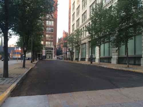
The significantly narrower 16th St is one-way northbound — the opposite of 17th
Additionally, St. Charles St (which is a glorified alley) should be widened from 38 feet to 50 feet so there’s room for 2-way traffic. trash & recycling dumpsters, moving vans, etc. A would require another 2,184 sq ft (12′ x 182′).
So we give up 7,500 sq ft in public property, but gain back 4,659 sq ft — a net loss of 2,841 sq ft. I’d prefer a zero loss of public right-of-way, but if they rebuilt the West side of 16th I could see it as a fair reallocation that could benefit everyone.
I ask that everyone reading this post to contact their Alderman before Friday and ask them to vote against the bill as written or amend it as I suggest above.
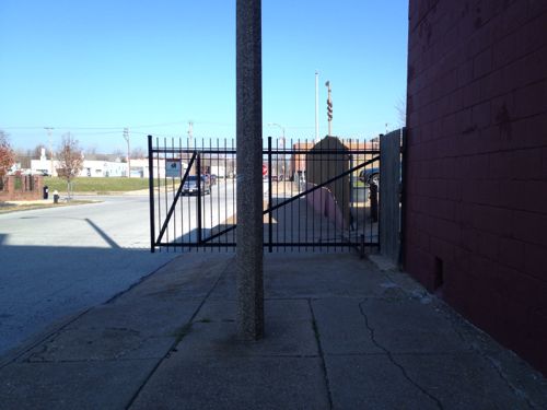
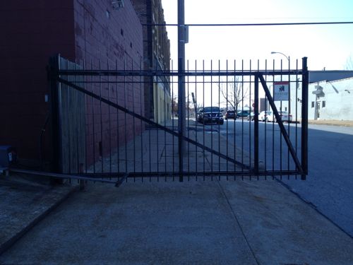
Often I encounter annoying things as I make my way around the city, dismissing many as flukes. I took photos of a gate blocking the public sidewalk on November 28, 2012 and again on March 7, 2014.
Looking north, November 28, 2012 @11:10amLooking south, November 28, 1012Looking north, March 7, 2014 @ 1:50pmLooking south, March 7, 2014
This is the side gate for 2840 Locust St., owned by Barry Adelstein & Scott Gundolf. Years ago the renter of the property was Michael McMillan, former alderman, license collector, and cureently head of the Urban League of St. Louis. To my knowledge he still lives here. This property is directly north of the neglected Castle Ballroom.
Just what is the relationship between Michael McMillan, Barry Adelstein, and Scott Gundolf? McMillan’s close associate, Marlene Davis, became the 19th ward alderman when he was elected to the office of license collector. Adelstein was a partner with Marlene Davis in a failed midtown bar, Gene Lynn’s, which closed in 2008. Davis was forced to file for bankruptcy in 2010.
Did these associations help get officials to look the other way regarding maintenance of the Castle Ballroom building? And to a lessor degree, feel like it’s ok to block the public sidewalk with a private gate? But wait, there’s more!
The real estate deal in question involves the old Castle Ballroom at 2839 Olive, which Rainford says Reed bought and sold for a large profit, before helping the developer who bought it get a taxbreak. Reed’s campaign says sale was profitable, because it happened during the 2004 market peak; and the tax break was sought by the alderman in that ward, passed unanimously by the board, then signed by Mayor Slay. (KMOX)
A tax break? There’s much more to this, I suspect! Plus I don’t want the gate left open blocking the public sidewalk.
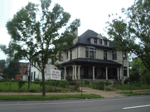
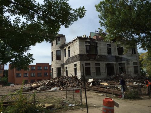
The once-stately residence at 3630 Page Boulevard was used as an assisted living facility for years. Now the 1888 structure is being razed.
2009 photo of ‘Page Manor’ from GEO St. LouisEarlier this week from the #94 MetroBus
The sad part is this property is in the 19th ward, so Cultural Resources wasn’t even given a chance to review the request for the demolition permit. Most of the city is in a “preservation review” area where trained staff look at requests for demolition, referring some to the Preservation Board for a decision on the fate.
Note: city records list the property address as 3630 Page Blvd, but Page Manor used the address 3636 Page Blvd.
AARP Livibility Index
The Livability Index scores neighborhoods and communities across the U.S. for the services and amenities that impact your life the most
Built St. Louis
historic architecture of St. Louis, Missouri – mourning the losses, celebrating the survivors.
Geo St. Louis
a guide to geospatial data about the City of St. Louis