Home » Oklahoma City » Recent Articles:

Reviving A Dead Mall By Rebranding With An Ethnic Focus

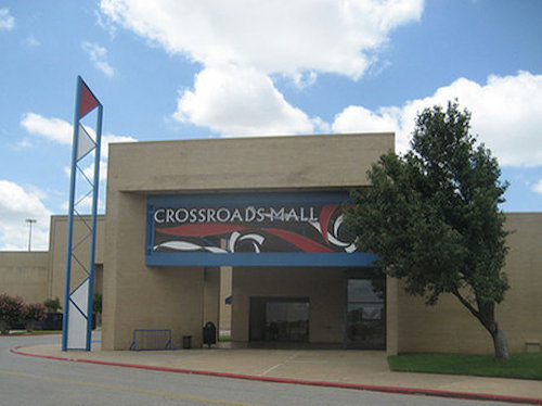
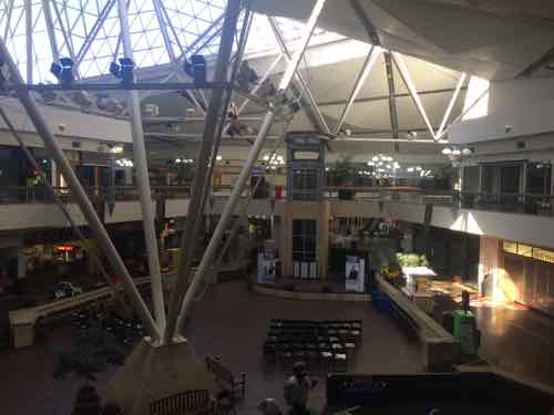
In 2009 I paid a visit to my childhood mall that opened in 1974 — eight days before my seventh birthday. By 2009 it was dead — all four anchors were closed as were most of the smaller stores. The next year National Public Radio did a story on how the Federal Reserve of New York came to own one of Oklahoma’s largest indoor malls:

It also owned a loan to Crossroads Mall in Oklahoma City. Then, when the owners of the mall couldn’t make the payments, the Fed foreclosed. So now it owns the mall, which includes a Chick-fil-A and an AMC theater. (NPR)

The AMC Theater is in a separate building on an outlet — built years later.

A Crossroads Mall  entrance, August 2009
Crossroads Mall entrance, August 2009 was used (by permission) in the 2010 NPR story.

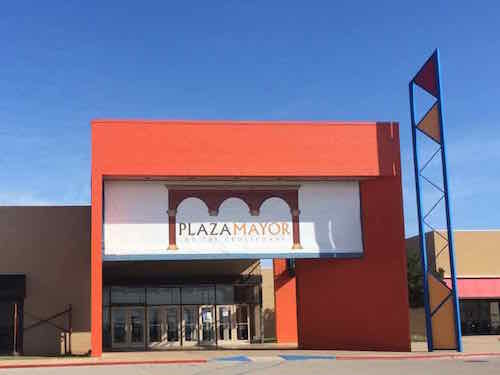
In March I returned with my husband. Why visit a dead mall again? New owners have rebranded the mall, attracting new customers and stores.  From two years ago:

The south Oklahoma City mall fell into the hands of the federal government in 2008, limped through the recession years with a handful of tenants while somehow managing to keep its doors open.

But Legaspi, who owns The Legaspi Co., a California firm known for turning ailing shopping malls into thriving, Hispanic centers, has a plan.

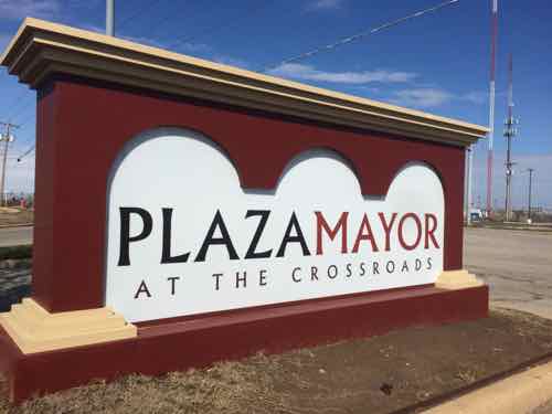
On Wednesday afternoon, he announced details of the project, including the mall’s new name: Plaza Mayor at the Crossroads, a name that translates to “the main square” at the crossroads. It includes space for a grocery store, nightclub and a rodeo arena seating 3,500 spectators.

Already, Legaspi has worked on a dozen ailing malls across the country. (NewsOK)

From the new owner’s About Me page:

The Legaspi Company is a full-service development/brokerage company for commercial/ investment real estate, particularly for retail projects.  We are recognized as an aggressive commercial real estate company, noted particularly for our ability to successfully identify and capitalize on untapped opportunities created by demographic changes and trends in the marketplace.  This reputation has led many investors, developers and retailers (please see accompanying client list) to seek our assistance in their expansion/development planning, site selection, and leasing/sales negotiation activities.  Municipalities and government entities have also recognized our ability to position, in many cases re-position, shopping districts in order to increase services to the community.

The foundation of our strength in various market areas is our niche marketing orientation: our recognition of the unique needs and marketing characteristics of each site on its own merits, and our willingness, as a matter of choice, to educate and work aggressively with investors, developers, retailers, and tenants in these areas, which in many cases were, till quite recently, considered marginal at best. (Legaspi Co)

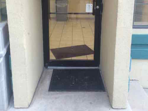
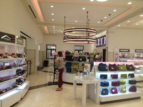
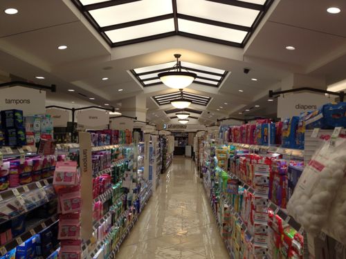
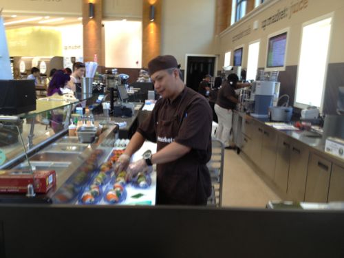
We visited early on a Sunday morning, just as stores were starting to open.

Color was added to the entrances
Color was added to the entrances, a vinyl banner covers the outdated metal graphics
The former Dillard's, where I worked briefly in college, now has some color
The former Dillard’s at right, where I worked briefly in college, now has some color. Click image to see this lot filled with people during a 2014 festival.
The former Dillard's store was being
The former Dillard’s store would soon be ‘El Parian’

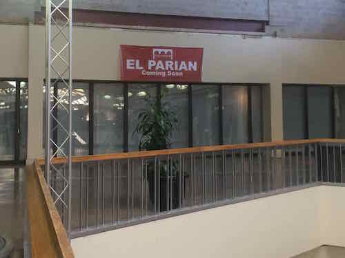
During our visit we didn’t know what El Parian would be, I’ve since learned:

El Parian will feature about 60, 12-foot by 12-foot incubator booths that will be ringed around an atrium.

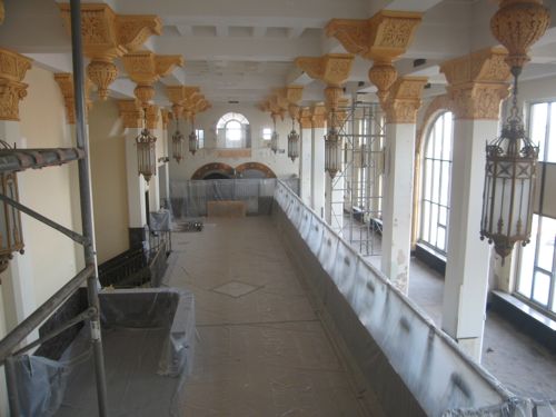
Additional phases of construction will include salon and restaurant space, with the hope of eventually having booth space for as many as 300 small start-up businesses, he said. The second and third floors of the Dillard’s wing will be converted to office space, Ruiz said.

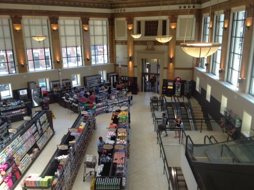
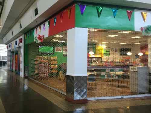
Tenants at the mall said they were hopeful that El Parian would draw more shoppers to Plaza Mayor and give existing businesses a boost. A trickle of new shops has continued to reopen in the mall since redevelopment plans with Hispanic mall developer The Legaspi Co. were unveiled in spring 2013. (NewsOK)

The El Parian is now open, so I have a reason to return. Another would be to visit later when places are open — especially restaurants.

One of several restaurants in the mall, this one was just about to open. Soccer was playing on the TV.
One of several restaurants in the mall, this one was just about to open for the day. Soccer was playing on the TV.
The center court once again hosts packed events
The center court once again hosts packed events, click the image above to see a photo from a 2014 event on their Facebook page

This video aired not long after the change to Plaza Mayor — it is wrong about the mall’s opening though — it opened in 1974 — not 1979.

Such a focus makes sense in Oklahoma City, in 2010 the population of Oklahoma City was 579,999 — with 17.2% being Hispanic or Latino (of any race) — up from 5% in 1990 (Wikipedia). By contrast, the City of St. Louis was only 3.5% Hispanic/Latino in 2010 (Wikipedia). The St. Louis region likely has a much lower percentage than the city.

Though this focus wouldn’t work for our dead/dying malls I bring this up because it shows how one developer has found a way to match vacant real estate with an often marginalized market. National brands are beginning to recognize the Hispanic/Latino market:

The 50 largest spending companies put $3.4 billion into Latino advertising in 2013, according to the most recent figures available from industry publication Advertising Age, which measured spending on Spanish-language ads on broadcast and cable networks and in Spanish language publications. Procter & Gamble Co. was the top spender with $334.8 million, followed by AT&T with $124.7 million. Target came in 28th, with $51.5 million. (LA Times)

Most real estate brokers & developers, blinded by their conventional wisdom, couldn’t see any use for this mall.

One of the new monument signs around the exterior

This is a good lesson on how the status quo establishment may not offer creative solutions — such reminders are a very good thing. I look forward to returning over the coming years to see Plaza Mayor continue to evolve.

— Steve Patterson


Many Disabled Couldn’t Enter Hotel Building Containing Disabled Rooms

I considered using today’s topic for a Sunday Poll but decided it was too technical to get a good response. My original plan was to ask for the ideal clear width next to the pull side of a door.

jjj
ADA diagram

Here’s the text description of the above diagram:

Plan view drawing showing the clear floor space adjacent to a hinged door. Door swings out into the clear floor space. An arrow indicates a forward approach to the door on the pull side.

Clear floor space is shown with a dotted line. The clear floor space extends 60 inches minimum from the door (closed position). The clear floor space width is the door width plus 18 inches minimum (24 preferred). A minimum of 18 inches clear space (24 inches preferred) is provided adjacent to the edge of the door (latch side) on the pull side.

My thought is many, likely the architects, would’ve selected 18″ instead of options like 0″, 6″ 12″, or 24″. This is because the bare minimum number (18″) has become so well known, the preferred/ideal of 24″ gets lost. The 18″ minimum is just that — a minimum — not ideal. Less than 18″ and many wheelchair users are unable to open the door. With the m,minimum of 18″ I find myself having to rub against the baseboard/wall to get into position to open the door.

Why bring this up? The architect/designer of the hotel we stayed at in Oklahoma City was confused. The Days Inn at 122nd & I-35 is an older hotel that later added another 2-story building in what was originally an oversized parking lot.

Both entrances to the newer building containing their rooms for the disabled had zero to the side of the pull side of the door.
Both entrances to the newer building containing their rooms for the disabled had zero to the side of the pull side of the door. Really?

Our room also wasn’t as ADA-compliant as you might expect for a disabled room: the bathroom door handle was a knob rather than a lever. The shower wasn’t roll-in as listed — it was a standard shower base. I was able to use it ok but others I know wouldn’t be able to shower.  I’ve submitted a complaint to Days Inn about the design.

— Steve Patterson


Three-Day Weekend: Fuel Taxes and Tolls

We did a 3-day weekend trip to Oklahoma City last weekend so my husband could meet more of my family — including two in from Northern California. For cost reasons we decided to drive rather than fly. We kept detailed records on costs — fuel and tolls. We drove I-44 the entire way — in Oklahoma it is a toll road.  I think the results will make for an interesting conversation about fuel taxes and tolls.

Those of us not using a prepaid PIKEPASS had to stop at toll plazas to pay in cash. Those using PIKEPASS save time and 5%. 
Those of us not using a prepaid PIKEPASS had to stop at toll plazas to pay in cash. Those using PIKEPASS save time and 5%. Those with a PIKEPASS can also use it in Northern Texas (Dallas-Ft. Worth) and Kansas.

Our roundtrip was 1,129 miles (585 were in Missouri, 544 in Oklahoma) — 51.8% vs 48.2%. We used 31.861 gallons of gasoline — 69.54% of which was purchased in Missouri.  Our 2007 Honda Civic, with over 100k miles, averaged over 35mpg on mostly highway miles, the government rating on our vehicle is 36mpg highway. We stayed a traveled a few MPH over the posted speed limit of 70 un Missouri and 75 in Oklahoma.

Our total cost for fuel & tolls was $21.48, but even though only 48.2% of our miles were in Oklahoma that state received 82.17% of our money, Missouri the remaining 17.83%.   In total state fuel taxes & fees we paid $3.83 to Missouri, $1.65 to Oklahoma. We paid Oklahoma a total of $16 in tolls  — $4 per toll plaza stop. Missouri collects 17.3¢/gal in fuel taxes & fees, Oklahoma a little less at 17¢/gal.  Oklahoma has ten toll highways thoughout the state!

If Missouri is unwilling to increase our fuel taxes to fund our infrastructure needs then we should consider tolls. This has allowed Oklahoma to fund roads & bridges while keeping fuel taxes among the lowest in the country. Oklahoma gets visitors passing through their state to pay for the privilege. Of course, if you ask Oklahomans about tolls they’ll say they don’t like them.

Critics of fuel taxes say increasing efficiency of vehicles causes shortfalls in state revenues, electric vehicles like a Tesla don’t pay any fuel taxes. Tolls are the great equalizer though — a Tesla would’ve paid $16 in tolls just like we did.

— Steve Patterson


New Walgreens Opens Inside a Historic Bank, Rather Than Raze It

August 12, 2013 Featured, Retail, Travel 23 Comments

Competition is heating up as retailers try to add locations in an effort to avoid stagnant sales growth. Having saturated suburban markets with their standard formula, they’ve been trying to do the same as they move into the urban core. Cities, more dense and often filled with vacant historic buildings, present new challenges to big retailers with one-size-fits-all formulas.

More than a dozen years ago a small group of citizens, myself among them, helped block Walgreens from razing the South Side National Bank (SSNB) at Grand & Gravois. “Put a Walgreens in the old bank”, we said to Walgreens officials. Unwilling to listen, they built a typical store across Gravois, but not on the corner.

Lobby of the South Side National Bank on  2/28/2006
Lobby of the South Side National Bank on 2/28/2006

The Lawrence Group bought the SSNB, putting residential condos in the tower. Much of the retail space, including the magnificent lobby, remains vacant today.

A few years after attempting to raze the SSNB, Walgreens tried to raze the Gold Dome in Oklahoma City, located at NW 23rd & Classen.

The 1958 Citizens State Bank in Oklahoma City is commonly known as the Gold Dome, click image for Wikipedia article.
The 1958 Citizens State Bank in Oklahoma City is commonly known as the Gold Dome

Walgreens was again met with citizen opposition:

Efforts to save the Gold Dome included picketing and marches, but in September 2001, a couple extended the efforts by writing a song. Also, an Oklahoma based company, Sonic Drive-In restaurants, offered up a billboard, located across the street from the Gold Dome, to the Citizens for the Golden Dome group. On the billboard was written “Stop the demolition of our historic landmark,” as well as the phone numbers for Bank One and Walgreens. (Wikipedia)

Today the Gold Dome is a central part of the neighborhood, now heavily inhabited by Chinese and other Asian nationalities, housing numerous businesses. Across one street is a typical CVS and across the other is a typical Walgreens, on the site of a former Beverly’s “Chicken in the Rough” restaurant.

In both cases a historic structure was saved, but the neighborhood was degraded by a standard suburban box(s). Both St. Louis & Oklahoma City didn’t care about anything besides the historic structure, or they were afraid to require something other than the standard prototype.

Fast forward a decade and we can look to a new Walgreens in Chicago that shows the retailer is willing to rethink their store design rather than forcing their standard box into a neighborhood. On a recent trip to Chicago this Walgreens was our first stop.

The former Noel State Bank is now a flagship Walgreens in the Wicker Park/Bucktown area of Chicago

In the 45 minutes we were on site I took 70 pictures, my boyfriend quickly understood why a Walgreens was the first place I wanted to visit on our first trip to Chicago together:

The uber-fancy flagship is part of a plan by Walgreens–now the nation’s largest drugstore–to cater to a higher tax bracket while giving its more than 100-year-old brand a dose of modern edge.

Walgreens has recently launched several “upscale” stores, including a multi-level flagship in downtown Chicago and a massive concept store on L.A.’s Sunset Blvd.

According to Crain’s Chicago Business, the opening of the latest flagship, nestled between the Windy City’s trendy Wicker Park/Bucktown neighborhoods, will be followed by roughly 10 more upscale stores stores in locations ranging from Hawaii to the Empire State Building in New York. (Huffington Post)

The upstairs mezzanine level is like a high-end department store cosmetics area
The basement level contains the pharmacy, over the counter medicines, and...
The basement level contains the pharmacy, over the counter medicines, toiletries, and…
...vitamins! Walgreens cleverly reused the old vault for additional retail space
…vitamins! Walgreens cleverly reused the old vault for additional retail space
The chef prepares sushi while others get a beverage from the juice bar, frozen yogurt is in the background left

Now you might be thinking sure, in Chicago…developers are so much more enlightened in Chicago. Not so:

Many many years ago what is the Nobel Bank Building located at 1601 N. Milwaukee Avenue was, in fact, a bank. And more recently the building was the home of Midwest Bank; a full-service library quiet bank filled with friendly staff.

Several years ago, the building was bought by an investor with plans to add retail to that corner. His plans, however, were also contingent upon adding a massive parking garage right at the corner of North/Damen/Milwaukee. You can only imagine what that would have done to the traffic and congestion already filling the area. The end result would have been gridlock. Alderman Waguespak, thankfully, would not approve of the garage. So the investor abandoned the project.

The building sat vacant bordering on foreclosure. (source)

Developers, even those in Chicago, think massive parking garages are necessary in dense urban neighborhoods served by transit. True, even this Walgreens has an off-street parking lot.

The lot has six regular spaces plus one disabled space, out of view to the left. That's it!
The lot has six regular spaces plus one disabled space, out of view to the left. That’s it! No drive through pharmacy either.
The busy corner has pedestrians, cyclists, and lots of auto traffic. The Walgreens is on the left.

Chicago knows to not let auto-centric developers gut their neighborhoods, thereby achieving a balance among users. We’ve had decades of gutting our neighborhoods for parking, we must now reverse course.

Kudos to Walgreens on this store!

— Steve Patterson


Travel: Elevated Highway Removal In Oklahoma City Part 2

Yesterday I ended part 1 with the following photo showing Oklahoma City directing people from downtown, past where the old elevated I-40 was, through a desolate area toward the new I-40 and the Oklahoma River beyond.

ABOVE: A sign indicates a trail, directing people southward through no-man’s land toward the new highway and the Oklahoma River beyond.

The new I-40 is a half mile south of the Myriad Botanical Gardens, a recently revamped space occupying a superblock made up of four city blocks. The Myriad Gardens now has many spaces along the lines of those at Citygarden, for example, interactive water features. The half mile space between the gardens and the new highway is pretty much a wasteland, long cut off from downtown by the old I-40. The river and waterside trail system is an another half mile south of the new highway, through a very low income neighborhood.

ABOVE: Aerial image showing the location of the Myriad Botanical Gardens at the top center and the suggested route south to reach the river trail, following Harvey Ave. Click image to view in Google Maps.

Does Oklahoma City really think people will walk through these areas? The two nights I did it I saw many people: individuals, couples & families.  In time the half mile zone between the old highway and the new highway will be redeveloped and occupied. The removal of the old elevated highway is allowing development to spread whereas before it was contained. Why are people walking there now you ask? The major roads that cross over the new I-40 all have generous sidewalks but a pedestrian-only bridge was also constructed where Harvey Ave reaches the new highway.

ABOVE: A larger-than-life 105 ton scissor-tailed flycatcher sits on top of the Skydance bridge rising 192 feet above the highway, attracting many pedestrians. Oklahoma City built it interesting and people come.

I saw the pedestrian bridge the first time as my train pulled in a night. At the time I wasn’t sure what it was but I asked my brother right away, it was just too intriguing not to be curious. The next day we drove under it as we returned downtown. The also allowed me to experience the new I-40 alignment.

ABOVE: You can’t help but notice the Skydance pedestrian bridge
ABOVE: Looking back north toward the downtown Oklahoma City skyline dominated by the Devon Tower.
ABOVE: The bridge features a wood floor and sides
ABOVE: On my first visit a group of four on rental bikes from downtown passed me heading to the river trail.
ABOVE: But as the sun goes down the lights come on and the people really start to come out in droves.
ABOVE: Instantly a part of town long written off is THE place to be, to get photographs together with the bridge in the background.
ABOVE: The powerful LED lights change colors so it’s not static
ABOVE: Looking west at the Skydance bridge from the Robinson Ave bridge nearby

I visited two nights in a row and talked with numerous strangers both times. My entire life this area was a “bad” part of town and here I was talking with strangers at night. They’ve successfully begun to change perceptions of an area ignored for decades!

Take a look to see why.

ABOVE: In August 2010 I drove south of the new I-40 construction on Robinson Ave, this was always auto junkyard row.
ABOVE: This building at 1100 South Robinson Ave caught my eye in August 2010. This was just south of the construction for the new I-40.
ABOVE: In July 2012 the building has been prepared for rehab. This is a block east of the south end of the pedestrian bridge, a visible location.
ABOVE: South Robinson still has junk yards but it’s a route to the river, the popular skate park and neighborhoods further south so as part of their “core-to-shore” plan it’s getting improved.

I’m still amazed I was exploring this area alone, at night, in a wheelchair!   Their Core to Shore plan was big:

In 2006, the City of Oklahoma City undertook an ambitious planning process to redevelop 750 acres of underutilized land between the core of downtown to the shore of the Oklahoma River.

Envisioned as Core to Shore, efforts are now underway to build and connect a series of neighborhoods, parks, and economic opportunities that will reinvent downtown Oklahoma City, leading to new jobs and a higher quality of life for residents.

Major aspects of the Core to Shore plan include:

  • Creation of a world-class, pedestrian-friendly boulevard
  • Development of a 40-acre central park
  • Development of business, retail and mixed use housing along the central park
  • Building of a Convention Center and Convention Center hotel
  • Relocation of some of the existing businesses and homes in the area

This is a vastly different thinking than the 1960s Pei Plan that led to the destruction of much of downtown and the creation of many superblocks. Financing for this work was part of the Metropolitan Area Projects Plan (MAPS) which began in the early 1990s. The highway move and other recent work was part of the third phase, MAPS3.

Many have been critical of the taxes paid and the cumulative costs of the numerous projects over the last 20 years. But schools have been updated, downtown energized, attracted a winning NBA franchise, saw massive private  investment from major corporations (Chesapeake, Devon, SandRidge, etc.

In the country as a whole, single-family woes are fueling the multifamily surge. Stubbornly persistent foreclosure rates, mortgage bankers’ continued reluctance to lend to any but those with the very best credit and most stable employment history, as well as still-high unemployment in most places, have apartment investors investing in new product.

But here, a healthy local economy — enviable unemployment rates, population growth on the rise — has cautious and seasoned but willing single-family builders building again. (newsok.com)

Investing in your community pays dividends! It doesn’t happen overnight but financing the big ideas gets noticed eventually. Oklahoma City’s 2010 population was 579,999 and the metropolitan area was 1,322,459, half that of Greater St. Louis.

Back to St. Louis:

This is the type of planning St. Louis should’ve been doing to reclaim areas like Pruitt-Igoe and the 22nd Street Interchange, two areas where Paul McKee stepped in to fill the city’s planning absence.

It’s I-70 that currently uses the elevated and depressed highway dividing parts of downtown St. Louis. In 2014 I-70 will cross over into Illinois on the north edge of downtown rather than on the south edge at the Poplar Street Bridge.

— Steve Patterson


Advertisement


[custom-facebook-feed]

Archives

Categories

Advertisement


Subscribe