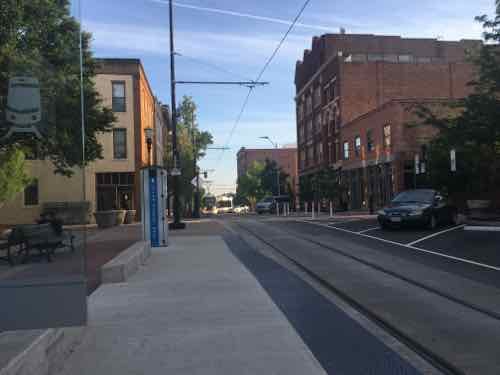
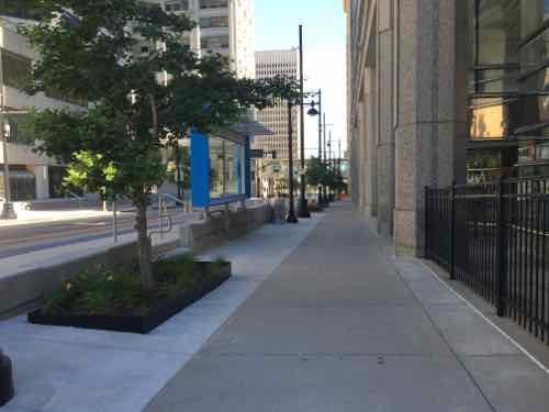
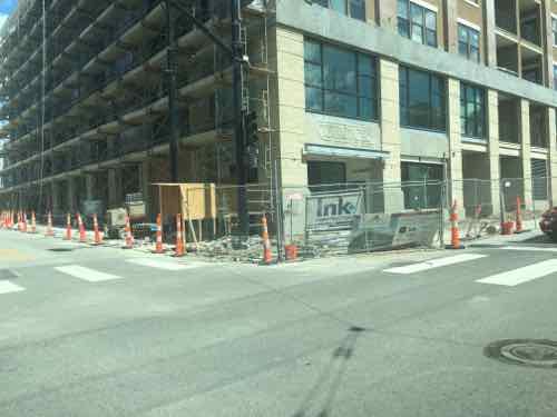
St. Louis tried redeveloping the North Riverfront, the largely vacant area just North of Laclede’s Landing, by razing it and building an NFL stadium. That failed…thankfully. Next up, the area was included in our bid to win Amazon’s HQ2. Last week Amazon announced their list of 20 cities being considered — St. Louis’ bid didn’t make the cut.
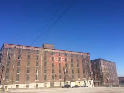
Warehouses along Ashley between 2nd and Lewis.
So now what to do with the North Riverfront? I say stop dreaming about a magic pill that’ll do it in one shot. The street grid still exists, sidewalks need to be built. There’s lots of room foe new buildings and existing buildings awaiting new uses. St. Louis could invest in the area and enact a form-based code to guide future development. The investment would take the form of infrastructure — utilities, sidewalks, and transportation.
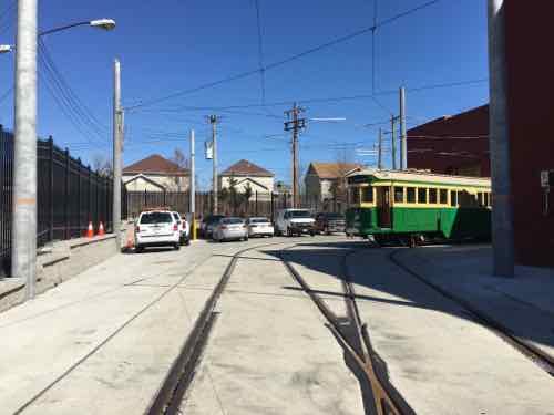
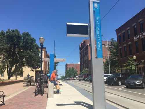
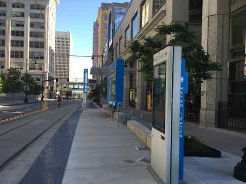
St. Louis is working on a North-South light rail plan to the West. This new line will use low-floor vehicles, not the high-floor vehicles used on our current MetroLink light rail lines. Modern streetcar & light rail lines use the same vehicles, the light rail usually just being longer and on a track where higher speeds are available. What does this have to do with the North Riverfront area?
We can use the same vehicles, maintenance facility, etc to operate lower-speed circulation streetcar route that’s connected to the proposed North-South line,
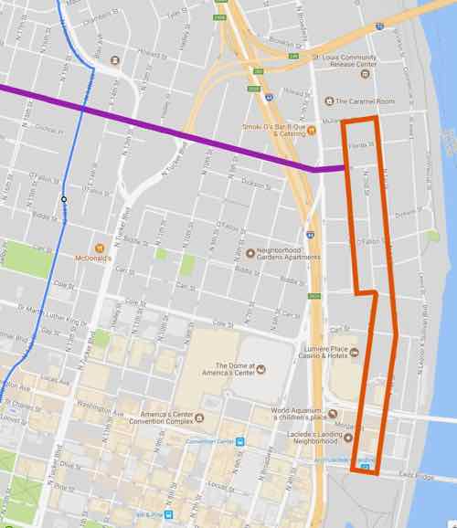
The blue line rep[resents the proposed North-South LR, the orange is a circulator route going from the Eads Bridge MetroLink station up to Mullanphy St. The purple is a connecting route along Cass — which could extend to the new NGA HQ and perhaps beyond in future expansions. After uploading the graphic I realized it would be good to have a connection in the center of the orange circulator route — at Biddle.The orange line is just under 2 miles long. Yes, I know, a bus is a far cheaper way to move people. I also know a bus route doesn’t spur private development. This have the potential to connect The Arch, Laclede’s Landing, the upcoming North-South line, and the NGA HQ.
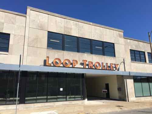
March 22, 2017Featured, TransportationComments Off on Opinion: Loop Trolley Will Surprise Naysayers
I’m not a huge fan of vintage/heritage streetcar/trolley lines — I much prefer modern streetcar lines
using 21st century low-floor vehicles (see Kansas City’s streetcar). I have ridden vintage/heritage lines in San Francisco, Little Rock, New Orleans, and Memphis. I wanted to ride the one in Dallas after becoming disabled, but it isn’t wheelchair accessible. The Loop Trolley, in testing now, will be accessible. Lifts will be on all vehicles to help with wheelchairs, strollers, etc. I’d still much rather see a modern streetcar line to reduce car use and increase transit ridership.
So I must agree with just over half the readers in thinking the Loop Trolly will be an expensive flop? Not at all.
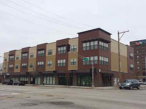
December 2014 photo of new housing at Delmar & Hamilton, and renovated building to the North — both just West of the Loop Trolley headquarters
It is true the Loop Trolley won’t make a significant impact on transportation use in the region or even within the Loop. Public investment in new infrastructure can result in very positive outcomes. The huge investment in the Washington Ave streetscape some 15 years ago is still paying dividends. Many long-vacant warehouses have been occupied for years. The Loop Trolley investment will have a profound impact along the route over the next 15-25 years.
Some say the Loop is already served by MetroLink. Yes, one station is on Delmar. Suppose visitors downtown decide they want to have dinner in the Loop — at The Melting Pot — are they going to walk nearby a mile (8/10ths) from the <MetroLink station to the restaurant and back? Highly unlikely. The Loop Trolly will step in to address the Loop’s last mile problem:
What is public transit’s first-mile/last-mile (FM/LM) problem? It begins with a ¼ mile. Most people in the United States are “comfortable” walking less than a ¼ mile to or from public transit stops. The problem arises when a potential rider is further than a “comfortable distance” to the necessary fixed-route stop. Of course, what you define as a “comfortable distance” may be very different than what I consider to be a “comfortable distance,” and this distance may vary based on uncontrollable variables such as weather and time of day. (Source)
Conversely, the new Loop Trolley will allow people to live car-free in new apartments/condos and get to MetroLink to take them to work West in Clayton or East at BJC, Cortex, SLU, or downtown.
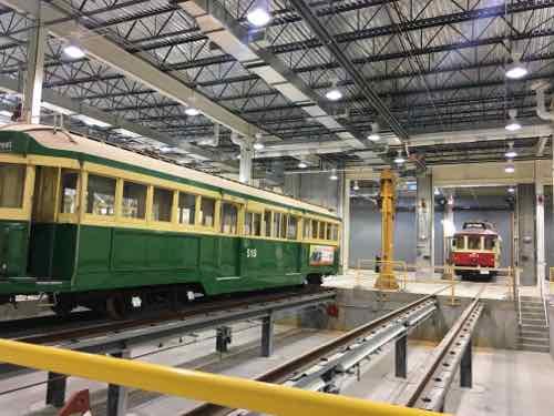
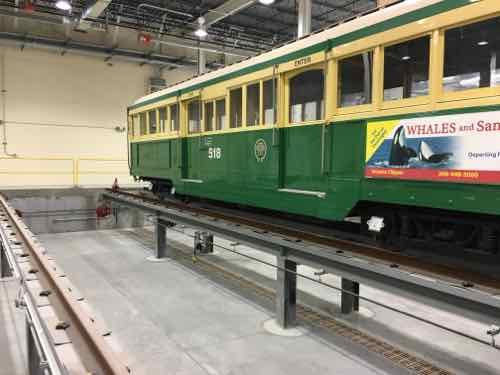
A long-vacant school building is now the headquarters and maintenance facility.Tracks leading to the storage & maintenance areaThe green car over the service pit is a Melbourne car from Seattle, the red car is 001Another view of the service pit
increase mobility within the Loop, especially to the newer area East of Skinker will increase foot traffic and hopefully reduce vehicular traffic and the associated parking issues.
Q: Agree or disagree: the Loop Trolley will be a costly flop
Strongly agree 10 [18.87%]
Agree 9 [16.98%]
Somewhat agree 8 [15.09%]
Neither agree or disagree 1 [1.89%]
Somewhat disagree 8 [15.09%]
Disagree 8 [15.09%]
Strongly disagree 5 [9.43%]
Unsure/No Answer 4 [7.55%]
Based on new construction that has already happened I’d say the Loop Trolley is already off to a good start.
Last week leaders in the St. Louis region argued publicly over future pubic transit:
St. Louis Mayor Francis Slay has made clear his support for a north-south MetroLink expansion, saying it’s a top priority in his final year in office. But a recent push for money to plan such a route has met with strong resistance from St. Louis County Executive Steve Stenger.
Stenger, in a letter to the Federal Transit Administration, said he will not endorse the north-south route until other proposed routes are studied. (Post-Dispatch)
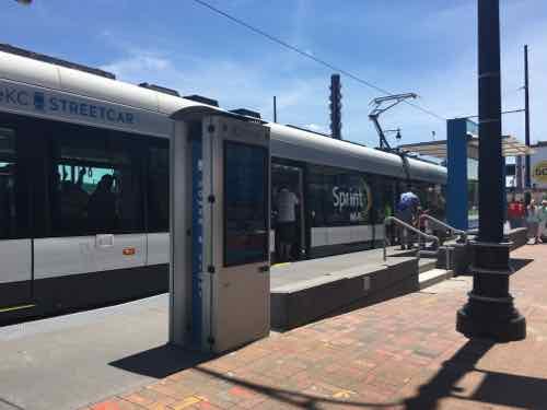
At the other end of the state, in Kansas City, there’s also a disagreement about the expansion of rail-based public transit. The local non-profit behind the new KC Streetcar wants to expand South on Main Street, while another is pushing a light rail plan.
[Clay] Chastain argues his plan gives Kansas City residents a real choice and a much more extensive rail transit system, from the airport to the Cerner Trails campus under construction in south Kansas City and from Union Station to the stadium complex.
He estimates it would cost $2 billion to build, or about $45 million per mile, although some light-rail systems have cost considerably more than that per mile. He assumes the federal government would provide $1 billion of that amount.
The local match would come from a 3/8-cent sales tax increase for 25 years, plus 3/8 cents that currently go for the bus system, once that tax expires in 2024. (Kansas City Star)
Anyone who has flown in/out of KC’s airport knows it is a long distance from downtown KC. It’s a 20-25 minute drive, but takes over an hour by bus. Frankly, they need to do both — expand the new streetcar and build light rail to far off destinations like their airport and stadiums.
Kansas City was without rail-based public transit from 1957 until May 6, 2016 — the day the 2.2 mile starter streetcar opened.
THE FUNDING:
Cost to build: $100 million — $37 million from the federal government, $63 million from bonds.
Cost to operate: $4 million annually to be paid by a combination of sales & property taxes within the transportation district.
Fare: $0 — free
Local comparison: Our Loop Trolley vintage streetcar project. also 2.2 miles long, is costing $51 million to build. The 8-mile cross-county MetroLink extension that opened in 2006 cost $430 million.
THE VEHICLES:
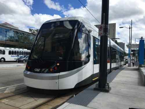
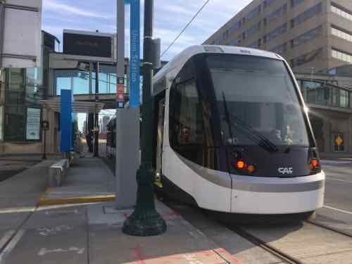
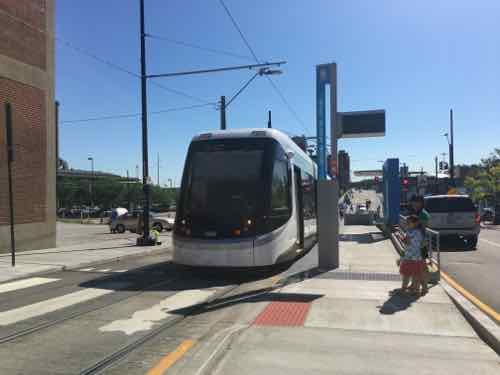
“Each vehicle is 77 feet and 8 inches long; 78,000 pounds; and 12 feet tall.”
“Each vehicle capacity is approximately 150 riders and is bi-directional (can run both directions). There is a combination of sitting and standing within the streetcar.”
“There are three “cars” in each streetcar vehicle, with 4 sets of doors (one on each end and two in the middle car).”
Each of the four vehicles cost $4.39 million each (source).
Same as vehicles used in the Cincinnati Streetcar opening later this year.
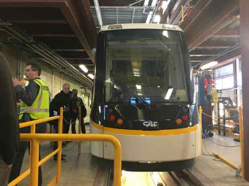
Manufactured in Elmira NY by CAF USA, a subsidiary of a Spanish company.
To meet US crash-standards the body is made of steel
Comparison: our 4-car light rail vehicles are 90 feet long; capacity of 72 seated plus 106 standing
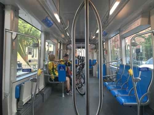
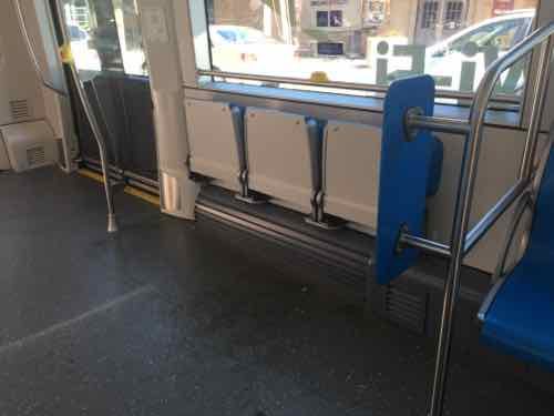
Each end is identicalThe lights change depending upon direction of travel. The step on this end of the Union Station platform is annoying.This view gives you an overview of the three cars in each vehicle — middle and two ends. Wheelchairs, strollers. bikes, the middle car, the door on each end has a stepThe center car is very open, the ends are filled with fixed seating. The floor is level throughout,The center car has two areas with theater seats. My wheelchair fit here and my husband could sit on one seat.It got packed to capacity a few times we were riding
THE ROUTE:
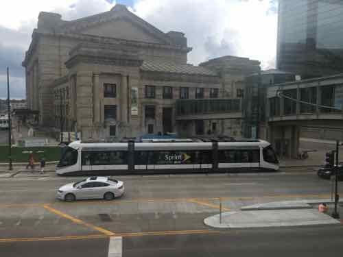
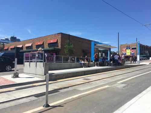
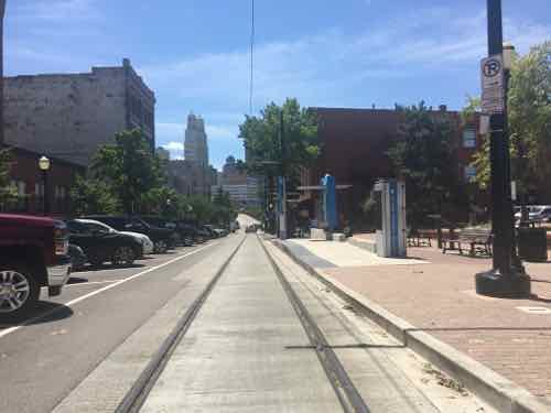
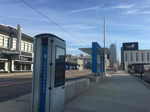
Kansas City is lucky to have Main Street as a central arterial. We have Olive/Lindell, but they’re very different. The 2.2 mile route does a loop on the North end around their River Market area. It goes down Main and ends at Union Station.
The route is 2.2 miles long and travels along Main Street in downtown Kansas City from the River Market to Union Station/Crown Center. The route also includes a loop around the City Market and runs on 3rd St on the north, Delaware on the west, 5th St on the south, and Grand on the east. (KC Streetcar FAQ)
An extension to continue South on Main Street is already being planned.
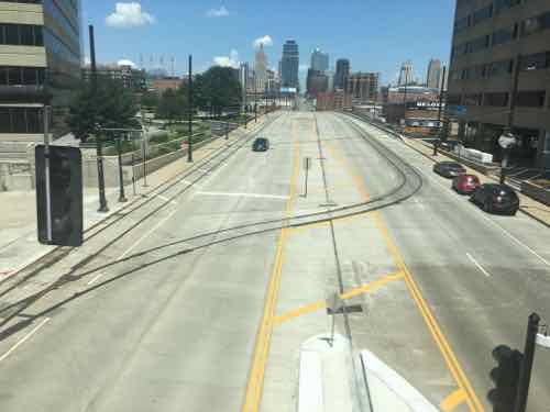
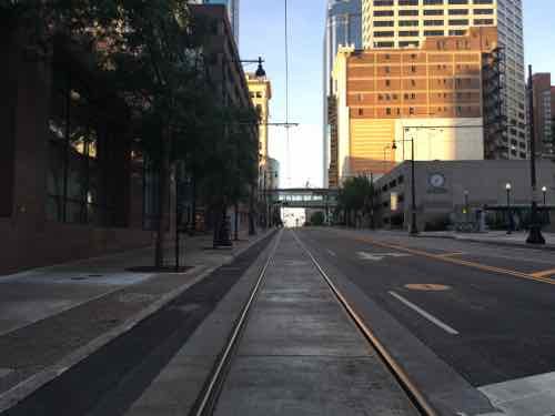
Looking North on Main St toward Downtown Kansas City.Looking South in the CBD
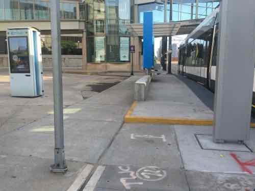
Stops are every few blocks, over the 3-day weekend I rode the streetcar a few times but also traveled the route on the sidewalk. For the most part. the stops are built out into the parking lane — leaving the sidewalk unblocked.
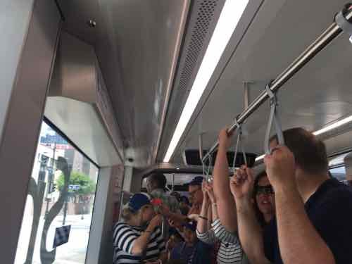
Another view of the Union Station stopThe River Market North stop is the only stop in the middle of trafficAnother view of the River Market North stopNext stop is River Market WestThe view from the sidewalkLooking North you can see the streetcar coming around the corner in the backgroundPeople gathering for the next streetcar, we tried to get on here a couple of times but it was too full from the two prior stopsNorth Loop is the most unusual stop, as it’s mostly parking lotsLooking West from the stopSidewalk next to Northbound Metro Center stopSame stop, same direction — just out near the curbOpposite viewSouthbound Metro Center stopStreetcar at SB Power & Light stopNB Crossroads stop
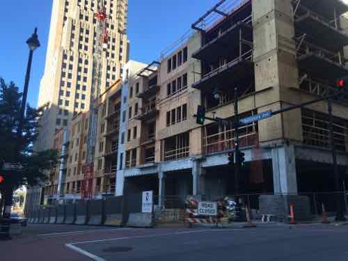
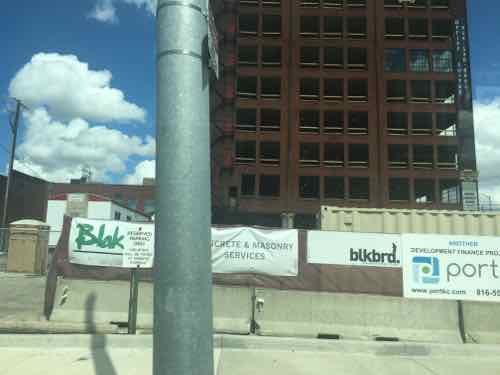
NEW CONSTRUCTION:
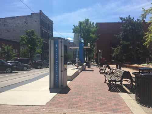
New construction is everywhere in Kansas City, especially near the streetcar route.
New construction at 13th & Baltimore, one block West of MainRehab on E 19th, just East of MainNew construction E 5th & GrandNew infill on Main Street between 19th-20th
VIDEO:
I put together a brief video of various clips I took:
FINAL THOUGHTS:
Their streetcar isn’t meant to be a regional system, at least not initially. CAF makes very similar vehicles for use in higher-speed light rail applications, so if they ever do a light rail line the vehicles could look just like their streetcar.
The main problem we experienced was crowds — but it was a nice holiday weekend in the first month of service. Would like to ride it on a regular weekday. We did speak to a retired couple that recently moved from the suburbs to new construction downtown — the streetcar was one reason,
Being right there it helped add life to the street. It’ll be interesting to see if they’ll be able to expand.
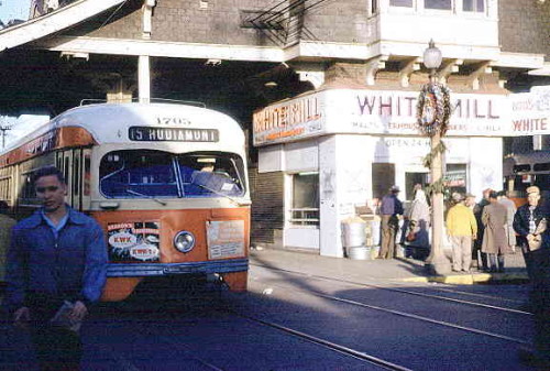
The last streetcar in St. Louis made its final run fifty years ago tomorrow.
Mr. and Mrs. Leslie Heinz stepped aboard clad in the same tuxedo and beaded dress they had worn to a New Year’s Eve party 36 years before. Railroad enthusiasts took pictures at every stop. A young man brought a case of beer.
Such was the clientele on Car No. 1628 on May 21, 1966, the last day of streetcar service in St. Louis. It ended an unbroken run of 107 years of public transportation on rails, sundered by family sedans and cul-de-sacs.
In the 1920s, about 1,650 streetcars rumbled along 485 miles of tracks in and near the city. Other lines ran to Florissant, Creve Coeur, Alton and Belleville. They ran across the Eads and McKinley bridges and down most every major street. Whole neighborhoods were built to be near them, and large apartment buildings sprouted at junctions and loops (turnarounds).
Then came buses and, fatally, automobiles. St. Louis Public Service Co., forerunner of the Bi-State Transit Authority (now Metro), bought a last fleet of streamlined streetcars shortly after World War II. But ridership continued to plunge while complaints rose from motorists about streetcars. Only three lines were left in April 1964, when the new Bi-State agency winnowed the system to the Hodiamont line, which ran from downtown to the Wellston Loop. Along the way through north St. Louis, the Hodiamont had its own right-of-way, like a railroad. (Post-Dispatch — with great images)
The Hodiamont line ran in exclusive right-of-way between Vandeventer to near the Western city limits, otherwise it ran on rail imbedded in the streets.
Looking East on the last eastern section of the Hodiamont Right-of-Way, 20121966 photo of the Hodiamont streetcar at the Wellston Loop. Source: Ancestry.com — click image to view
Other cities ended their streetcar lines prior to St. Louis. For example, Kansas City replaced their last streetcar lime(s) with buses in 1957 (Source). Two week ago today a new modern streetcar line opened in Kansas City — an absence of 59 years. We’ll be in Kansas City for Memorial weekend to ride their new line.
Many incorrectly think streetcars are just about nostalgia. Not true.
Streetcars bring people right to their destination, in a way out light rail in old freight right-of-way can’t. A half century ago the bus was quieter & smoother to the dated streetcar. Today, however, the modern 100% low-floor streetcar is the quieter & smoother choice. Streets with streetcars, trams across the pond, look & function differently. For me it is about how well the public right-of-way functions for all users.
In 2006/07 I attended many public meetings on a proposed Northside-Southside light rail line, it was finalized in 2008. In writing about these plans in the last year, people have asked if I’d seen the new study that was done, it’s not the same as it was in 2008. The study they’re referring to, Transit Oriented Development Study for the PROPOSED NORTHSIDE-SOUTHSIDE ALIGNMENT, isn’t anything new on the actual transportation side. It was completed in July 2013. At first, it wasn’t online. I pushed to get it online…downloading it on April 18 2014.
Today’s post is about this study — dispelling myths about what it is — and isn’t. My criticism of running high-speed light rail down streets like Natural Bridge & Cherokee is the street grid will be severed to achieve desired speeds. I’m an advocate of rail transit, and the preferred route. If it were up to me, I’d build it immediately — as modern streetcar/tram instead of light rail. This greatly simplifies construction by eliminating the need to reduce conflicts with a train speeding down the center of the street.
STUDY OBJECTIVE: To assist the City of St. Louis, its neighborhoods, and developers with preparing for and taking advantage of transit investment along the proposed Northside-Southside Alignment.
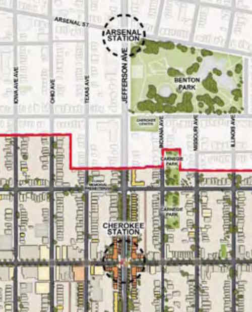
As the study title & objective indicate — it is about development related to proposed stations. The study is a detailed look at two stations on the proposed alignment: Kingshighway & Cherokee.
This study builds upon the goals set forth in previous plans, while giving a strong framework for decision-making regarding Transit Oriented Development, which ,as defined by HUD, is compact, mixed-use development in close proximity to transit facilities. Transit Oriented Development promotes sustainable communities by providing people of all ages and incomes with improved access to transportation and housing choices and reduced transportation costs that reduce the negative impacts of automobile travel on the environment and the economy. This report aspires to meet these goals and study the Alignment at this higher level of detail, with a comprehensive analysis of each of the proposed stations, a set of Station Area Plans that describe detailed development programs, building form and distribution, street improvements, and environmental analysis for the proposed Cherokee and Kingshighway Stations. These two stations were selected because they embody a similar range of challenges and opportunities to the other station areas along the Alignment. In future studies of the other station areas, lessons from Kingshighway and Cherokee can be readily applied.
The study makes no mention of what happens between stations.
Two East-West streets are between Cherokee & Arsenal– Utah & Wyoming
Depending upon how the Arsenal & Cherokee stations would be designed — both Wyoming & Utah could be cut off — no more crossing at either. Most likely the Northbound platforms would be located north of Arsenal & Cherokee, respectively. The Southbound platforms would be located South of each. This, rather than a shared platform, requires the least amount of width.
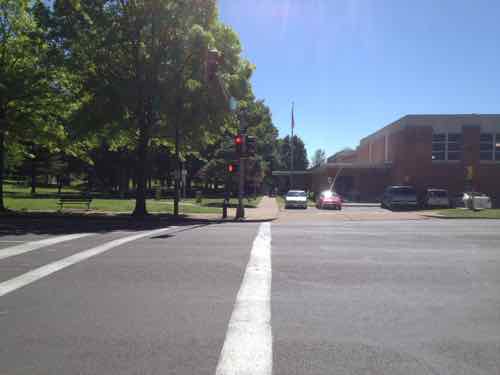
Looking East across Jefferson at Wyoming, May 2013. Benton Park on left, Cherokee Recreation Center on right
The distance between the two proposed stations is 4/10ths of a mile. Another 4/10ths North would be a Gravois station. The streets of Crittenden, Pestalozi, & Lynch would become no-crossing points. Another 4/10ths of a mile North to a station/crossing at Russell, with no-crossing allowed in between.
We should build North-South rail connection, but not at the expense of the street grid and the access it currently affords. Build modern streetcar on the Northside-Southside route. Keep the grid fully intact.
The study showed the current Siemens high-floor light rail vehicles in the new proposed street-runing lines. Not going to happen. In-street platforms and high-floor vehicles don’t work together.
The Siemens SD-400 & SD-460 vehicles are a 1980s design, used in only three regions worldwide: Pittsburgh, St. Louis, and Valencia, Venezuela. Shown: Shrewsbury opening August 2006Upcoming modern streetcar lines in Cincinatti & Kansas City use the same 100% low-floor vehicles. (CAF’s Urbos 3/100)
The best solution to simplify platforms and make ADA-compliance easier is 21st Century 100% low-floor vehicles.
From Wikipedia — a list of cities with Urbos 70 and Urbos 100 vehicles:
Cuiabá, Brazil (40 ordered)
Salvador, Brazil
Belgrade, Serbia (30)
Seville, Spain
Granada, Spain
Cádiz, Spain
Debrecen, Hungary (18)
Edinburgh, Scotland (27)
Málaga, Spain
Besançon, France (19)
Nantes, France (8)
Zaragoza, Spain (21)
West Midlands, England (£40 million order for 20, with options for five)
Kaohsiung, Taiwan (9 ordered; ACR system built in; no need for catenary)
Cincinnati, Ohio, USA ($25 million for 5 trams)
Sydney, Australia. ($20m order for 6 trams; order subsequently expanded to 12 trams)
Freiburg im Breisgau, Germany (12 ordered)
Kansas City, Missouri, USA
Budapest, Hungary (47; €90m order for the 47 trams)
Utrecht, Netherlands (27 ordered; to be operational in 2018)
The beauty of modern streetcar vehicles is they can be used for light rail as well. So if the lines were to continue into North & South St. Louis County the same vehicles could travel at higher speeds on closed right-of-way.
When it comes to the actual transit design of Northside-Southside, the final 2008 study still remains. The 2013 was a look at development options — a good thing considering how we’ve failed to capitalize on existing light rail stations since the first line opened in 1993.
AARP Livibility Index
The Livability Index scores neighborhoods and communities across the U.S. for the services and amenities that impact your life the most
Built St. Louis
historic architecture of St. Louis, Missouri – mourning the losses, celebrating the survivors.
Geo St. Louis
a guide to geospatial data about the City of St. Louis