Developing The North Hanley MetroLink Station
The North Hanley MetroLink station (map) was one of the original stations when our light rail system opened on July 31, 1993. Unfortunately, after 19+ years, it has yet to see any Transit Oriented Development (TOD). But finally it is getting some attention:
CMT received a grant from the Missouri Foundation for Health to look at areas surrounding MetroLink stations in our communities. We are asking for your help to create a healthier place to live through better use of our transit system.
Our goal is to get the community’s opinions about development near MetroLink and walkable neighborhoods. What do you like about the station? What would you like to see near your station? How is access to your station?
The North Hanley Station is located in unincorporated St. Louis County. How does this effect the zoning around the station?
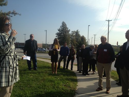
We will a facilitator on-site to lead us on our walkabout and to help facilitate conversations about the possibilities for the community. (CMT)
I attended this walkabout as I’d never explored the area before, though I had switched from light rail to MetroBus here a few times.
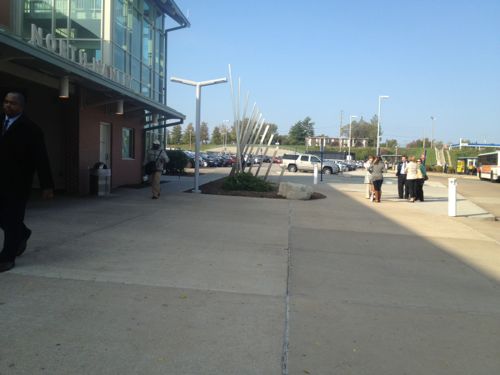
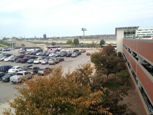
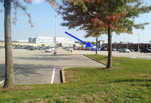
What about the headquarters of Express Scripts you might ask. Yes it is located next to the light rail line and is visible from the station platform, but at best it is transit-adjacent development. Although just a short distance, employees use a bus shuttle rather than walk because of the poor physical design of the station. Again, the surface and structured parking are a huge barrier.
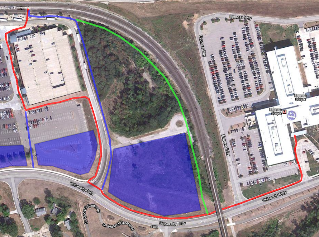
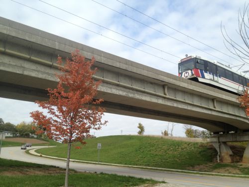
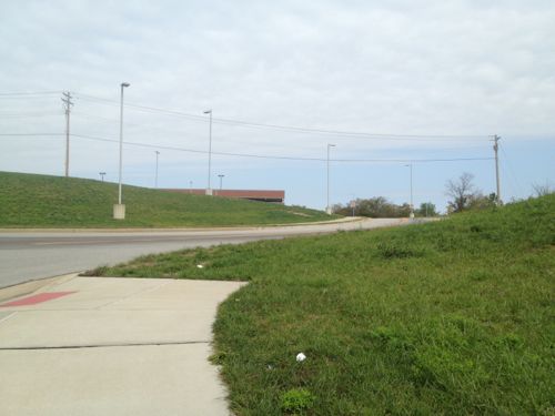
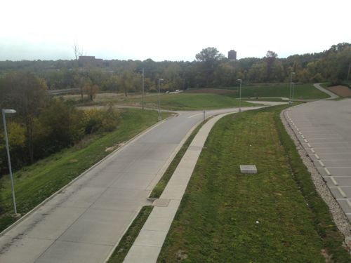
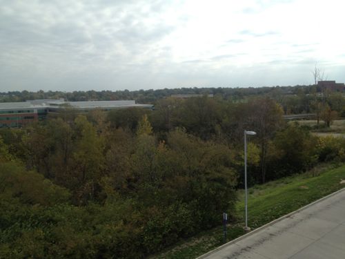
I say build a hotel on the dry hilly part, excavating most of the earth for a lower level to have a restaurant or two serving hotel guests and Express Scripts employees. The forest/drainage area can become a green entry to the hotel. By doing this you’ll make it possible to simplify the walk from the station to Express Scripts.
Scroll back up and look at the map again, the existing route, shown in red, requires pedestrians to cross the same access drive twice. Trying to get pedestrians to take extra steps, cross in front of buses twice and going around a huge parking garage it is no wonder nobody walks to work. But, it can be fixed!
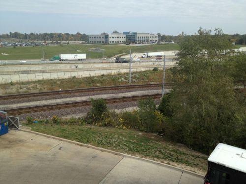
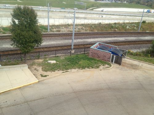
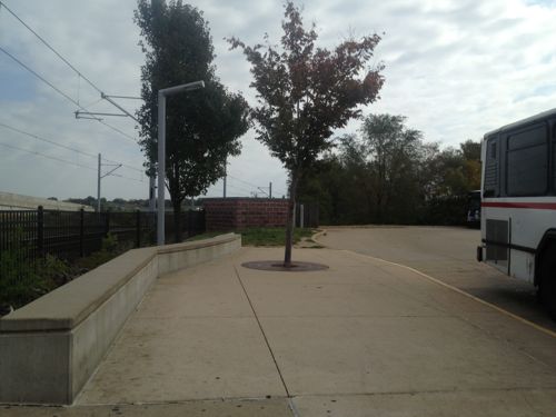
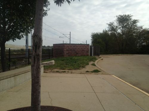
Maybe a hotel isn’t the best option for that site, although officials said a hotel has been desired for years. If built, it would be the first hotel a traveler could reach from the airport via MetroLink. Also, a hotel adjacent to one of the region’s largest employers would benefit both. The topography would allow for two different levels at grade (north vs south) and the height could be as needed.
I look forward to seeing what CMT’s team comes up with for North Hanley.
— Steve Patterson
Actually, the shortest, most direct route between the Metrolink platform and Express Scripts would be along I-70, heading north from the platform (instead of south), then east to the northwest corner of the parking lot / Express Way. Maybe not as “interesting”, but definitely shorter and quicker.
Ok, shortest without having to modify the platform area by adding another point where passengers cross the tracks. But that would be as unappealing, maybe more, than walking around the garage. My proposed route(s) would actually be used.
Actually, the best solution would be to move the whole platform to the north end of the bridge over University Place Drive, at the end of the cul de sac (at the top right of your blue rectangle) with pedestrian access to both the east (Express Scripts) and the west (Bi-State’s property). Where it is now is physically blocked on the north by I-70 and inaccessible from Hanley on the west, limiting potential development on 3 out of 4 quadrants. Move the bus bays from the north side of the garage to the east side, and you have way more real development potential. (When I served on the RTD Board, we did this on two occasions, to better serve development as the world evolved around the station areas – it’s not that hard to do, and should be done here.)
As for Express Scripts busing their employees – they may actually prefer to do that for safety / liability reasons. If an employee should be assaulted walking between the station and their offices, especially along a path / sidewalk on their property, lawyers could have a field day. Plus many employees would rather be bused than have to walk on days that aren’t as pleasant as it is today.
Horrible solution because that would cost a fortune to accomplish and would pull riders away from Hanley Rd.
Why is it “horrible” to pull riders “away from Hanley Rd.”?! Nothing has changed in 20 years, and there’s nothing magical or pedestrian friendly about the intersection of I-70 and N. Hanley – there are freeway ramps, 5+ lanes of surface traffic, a gas station, an aging apartment complex and Metro’s surface parking lot. Moving the platform and the bus bays would cost less than a million dollars, and would create a dynamic much more like the CWE/BJC station and much less like th Brentwood station. The whole key to successful TOD (which I presume is the whole intent of this exercise) is making the platform area the “center of attraction” and walkable within a 1/4 mile, on every side.
Sure, we could build a pedestrian tunnel under Hanley, parallel to the light rail tunnel, and we could build a pedestrian overpass over I-70 near that dumpster enclosure to access to the north side of I-70, and we could even fill in / cover the “overgrown area” / detention area, but any of these would cost at least as much, if not a lot more, than just moving the platform to a more central (for pedestrians) location.
A thing called NorthPark has happened in the last 5 years, work is going on now to improve crossing and I-70 and Metro will soon improve pedestrian access to Hanley Rd from the existing station. A well worn path in the grass shows how many access Hanley.
Interesting idea, Jim. I also think it would be nice to develop the parking lot of the station and push parking back behind it (or into more structure), but who knows how cost-effective that would be?
Metro is already planning to add more bus bays to the west side of the garage because they need more room for all the buses at this location.
I have an idea…Take #45 it goes right by express scripts.
There’s already a Garden Inn on the north side of 70 that I’m sure doesn’t get as much business as they hoped. I don’t know if this is surprising to you or not, but lots of people make the trek from the station, across 70, and around the Express Scripts building on the north side to get to Express Scripts or the Vatterot Campus. I understand the tour was focused on the HQ adjacent to the station, but the most pedestrian un-friendly behavior I see around there is the fence Express Scripts put around its parking lots in the north buildings, forcing an extra 1/2 walk around to the gate.
Yes, I’ve seen that hotel. Google Maps indicates that is a 0.9 mile walk — nearly four times as far as most are willing to walk.
I think relocation of the station to where JZ71 suggests would actually make a lot of sense and probably should be where the station was initially located. The only issue i see is that it is fairly close to the umsl north station location. I understand it is further from hanley and the development to the north of 70, but I think it would be better to sight the station in the center of the developable space rather that the edge. I also find it disturbing that the moderator chooses to classify someone’s input on the subject as ‘horrible’, especially with a suggestion that has at least some merit to it. Anyways, the adjustments to potential pedestrian paths make a lot of sense and would serve the station and it users well…thanks for supporting this dialog Steve…
Thanks for the support. While Steve and I have similar goals, we often disagree on the details. I didn’t take much offense about his categorizing my idea as “horrible”. I’ve had plenty of ideas that have been called a lot worse, and I chalked this one up to a “not invented here” response. The reality is that the level of sniping on this blog is incredibly low, and I credit Steve with both keeping it interesting and keeping a lid on the more outrageous “flaming”. If anything, I find the disagreements and discussions to be both informative and interesting, more so than everyone “holding hands and singing Kumbya” . . . .
As a regular user I can tell you that a rail station at grade is superior to one up in the air where you have to go down a flight of stairs twist through a ramp or use an elevator to reach your connecting bus before it departs.
Surface park-n-ride lots are ideal locations for future development but moving the platform would make sure it wouldn’t get developed and make the parking far less convenient for motorists.
Interesting perspective, stating that moving the platform would “make the parking far less convenient for motorists”. I agree, but that’s part of making TOD successful! Current thinking is that people, not cars, should be the priority nearest to the station, and that locating commuter parking 1/8-1/4 mile away is tolerated/accepted by commuters AND creates twice-daily traffic past whatever immediately surrounds the station, especially retail. The priorities that are usually identified are 1) pedestrian and bike access to the platform, 2) bus transfers, 3) taxis and private shuttles, 4) “kiss-and-ride” drop-off and pickup, 5) short-term parking and 6) long-term parking.
What you’re proposing is a relatively-inexpensive “fix”, one that will make it possible for pedestrians to have a complete path between Express Scripts and Metrolink (with no missing links). Unfortunately, it does not address the reality that it’s still a good hike (much like how you noted that the walk to the Hilton Garden Inn “is a 0.9 mile walk — nearly four times as far as most are willing to walk.”) My proposal would significantly shorten that distance to a major employment center, albeit at a higher cost. It boils down to both priorities and resources, and the following are some good ones:
http://www.tctod.org/pdf/TOD_Checklist.pdf
http://www.reconnectingamerica.org/assets/Uploads/TODFinal-Report-041309.pdf
http://www.tctod.org/pdf/TOD101.pdf
http://www.reconnectingamerica.org/assets/Uploads/20120327tcrprpt153.pdft
On what planet do you think people will drive to a transit station then walk an 1/8th of a mile from where they park to where they board the train? My solution addresses the need to connect Express Scripts with the station with little expense, uses vacant land and doesn’t create new problems.
Umm . . . on this planet. 1/8 mile = 660′ = approximately one city block. RTD (in Denver) has multiple stations where this is happening every day, on pedestrian bridges crossing major highways*. Yes, your solution addresses your perceived need for a sidewalk for those few Express Scripts employees who apparently would rather walk than ride the free shuttle bus their employer provides for them. (Have you actually asked if any of them even want a sidewalk? Or, do you just think / know that one will be used / appreciated if one is installed?) Yes, it would use vacant land, then, again, doing anything would use vacant land. And yes, any change creates “new problems” for some existing users (while improving things for others). The question is there a net increase in “problems” or a net decrease?! I get it, you want more people to walk. I do too, but just building “complete” sidewalks, especially in the middle of nowhere isn’t the answer. The answer is density, give people a reason to walk, not just the means!
Eyeballing your proposed walkways, it looks like they’re showing a travel distance of about 2,500′, from the platform to ES’s front door – that’s about 1/2 mile (and double what’s presumed to be acceptable / comfortable for TOD). Moving the platform would cut that down by 2/3, to something like 800′ (a block and a half), plus provide better access to your blue boxes / development parcels. Reading between the lines, I think that you think that having better, direct access between the existing platform and the Hanley bridge over I-70 is critical to making North Park “walkable”. I disagree, completely. The best solution for North Park will be a circulator bus. This is a suburban office/industrial park, with widely-spaced, low-rise buildings surrounded by parking lots, no different than Earth City or West Port. I-70 is a huge barrier to walking, unless you absolutely have to, better to focus on the immediate station area: http://www.northparkstl.com/
* http://goo.gl/maps/ZDFJq
* http://goo.gl/maps/V0Duu
* http://goo.gl/maps/UwGUH
But that’s exactly the beauty of JZ71’s suggestion. Since MetroLink transfers there from a hill to a bridge, you can have an at-grade station that still allows most passengers to get to their preferred platform without having to cross the tracks.
The bigger problem as I see it is the closeness to UMSL-North. However UMSL-North is already close to both UMSL-South and North Hanley, and has the lowest ridership (as of 2007) of any station on the airport branch. If there were an initiative for development on University Drive, it might then be worthwhile to 1) move North Hanley as JZ71 suggests 2) close UMSL-North 3) move UMSL-South a little north or at least improve its connections to Natural Bridge.
[…] Patterson of Urban Review STL gives his thoughts on the North Hanley MetroLink station, surroundings, and development potential after attending Citizens for Modern Transit’s […]
I have a question? If you move the station, What about all those transit users who walk to the station that live on the other side of Hanley Rd? Have anyone considered them? Do they matter? Or how about all the people who walk to jobs and their homes on Evans Ave? the otherside of I-70. Now people want to make them walk furthur by moving the Hanley Station?? I’m all for making better access to Express Scripts..But not at the expense of others. Build a better walkway to access Express Scripts.
Any time you change or remove a stop, be it for bus or for rail, odds are a few people will be negatively impacted. When Metro took away “my” bus stops a few months back, I was/am forced to walk another block or two. It’s not fair, but it’s life. Public transit is not a taxi – it doesn’t offer door-to-door service. In this situation, you have multiple competing agendas – dozens of residents versus hundreds of employees / potential commuters, better and worse development opportunities, density versus sprawl, pedestrians versus drivers. The purpose of both the walkabout and this post is to explore options. While I like “mine” and Steve likes his, odds are good that neither one will ever be adopted in its entirety. This isn’t about absolutes, it’s about identifying and exploring options, in hopes of reaching consensus. The area around the station has changed quite a bit over two decades. Sure, we can do it the St. Louis way – if it ain’t broke, don’t fix it – or we can see if there are any better ideas, weighing each one’s positive and negative impacts. None will be perfect, just like how the current facility isn’t perfect. But to say that any idea that impacts any rider or resident should be discarded is ludicrous. It’s all about balance and maximizing return on investment, of both the transit components and the real estate holdings.
Interesting article. Worth exploring.