Home » St. Louis County » Recent Articles:

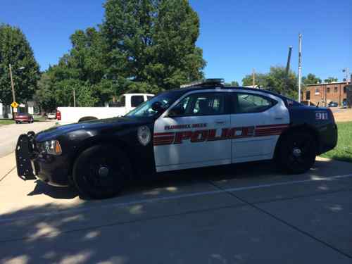
More Flordell Hills Police Means More Municipal Revenue

September 17, 2014 Featured, St. Louis County 2 Comments

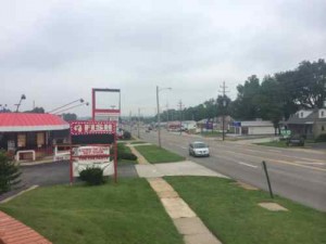
Flordel Hills is one of the many tiny municipalities in St. Louis County, it originated as a residential subdivision:

Before Flordell Hills was built in 1939, the area consisted of St. Ann Dairy Farms with corn fields, orchards, chicken houses, barns and buildings for cattle scattered throughout. A creek running under our area going out over Jennings Station Road, ran parallel to West Florissant and College where there was a foot bridge.

Norm Schuermann and Co. initiated construction of our homes in 1939, starting at Greenhaven. They came in three sizes selling for approximately $3,000 to $3,350. Some say the basements were dug out by mule teams and others remember tractors with metal wheels being used. We now have 360 homes and a population of approximately 950. Mr. Schuermann also agreed to enclose the ditch at Greendale Park (now Greenhaven) if we secured enough insurance policies from our residents for his insurance business. We got the policies and park too. The Improvement Association used the rocks from the ditch construction and formed the entrance columns on Greendale Drive.  (Flordell Hills history)

It was incorporated in 1945, prompting the incorporation of Jennings the following year:

By 1946, north St. Louis City and County were booming with plenty of blue-collar jobs and convenient bus transportation. The decision to incorporate the communities of Jennings, Jenwood, and Woodland occurred after the nearby smaller communities of Country Club Hills and Flordell Hills incorporated in 1943 and 1945, respectively. Both cities snapped up portions of commercial property on West Florissant Avenue. (Jennings history)

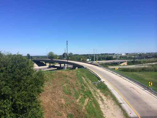
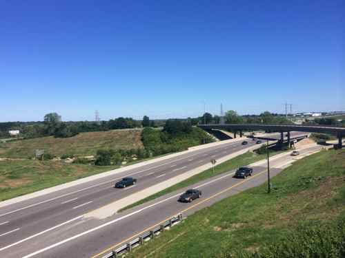
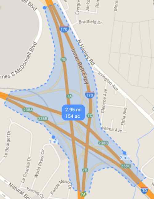
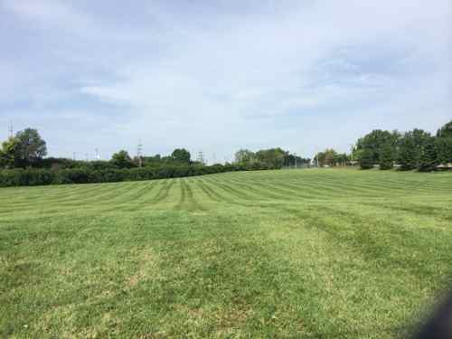
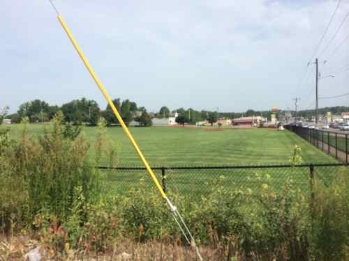
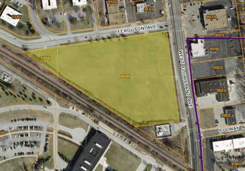
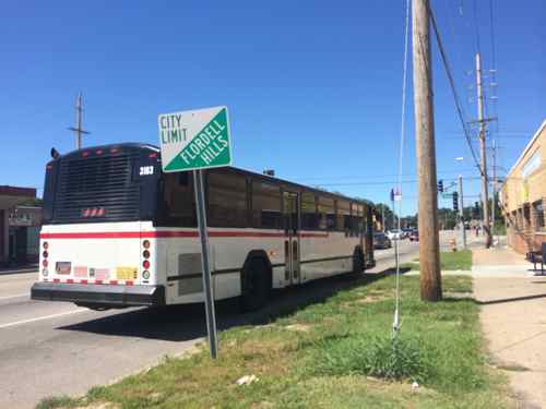
How tiny is Flordell Hills? Less than half the size of the I-70/I-170 interchange I posted about last week!

Two weeks from today Flordel Hills will have its own police force.

Flordell Hills police car

I wanted to know more about Flordell Hills so I started at the municipal website, flordell.com

Nowhere does the website list the names of the mayor or other elected officials. The municipal court tab, however, is very detailed. Click image to view live website.


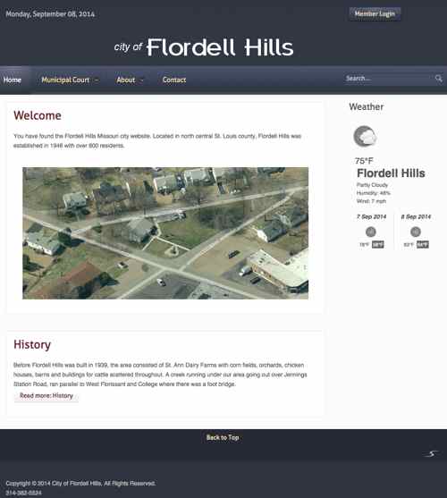
Here’s the text under the Municipal Court about:

About the Program
On March xx, 2011, the Board of Alderman of the City of Flordell Hills, Missouri passed Ordinance No. xx-xxxx amending the Flordell Municipal Code of Ordinance by adding a new section establishing the infraction of “violation of traffic safety on roadways” and the automatic traffic enforcement regulations in the City of Flordell Hills.

The Ordinance authorizes the use of automated speed enforcement to improve public safety by controlling speeds in enforced zones, improving traffic flows and reducing speed-related accidents.

The Ordinance can be reviewed by clicking on this link (click here) to the City of Flordell Hills Code.

Automated speed enforcement automatically detects, photographs, and identifies vehicles exceeding the speed limit and then issues violation notices to the registered owners of those vehicles via mail.

Speeding is a major cause of all vehicle crashes and speed enforcement is a constant priority for ensuring the public safety. Fewer vehicle crashes reduce the need for other public resources such as first responders and hospital emergency room resources. Automated traffic enforcement systems are being used in safety-minded communities across the globe. Automated enforcement systems are recommended by The National Highway Traffic Safety Administration, The International Association of Chiefs of Police, The Insurance Institute for Highway Safety, The Federal Highway Administration and The American Automobile Association.

City of Flordell Hills police officers already use electronic speed-enforcement methods, such as radar, to monitor drivers and issue tickets to speeders. This has proven to be effective in reducing vehicle accidents and improving public safety and public officer safety.

Better safety is our primary traffic-control goal. Our objective is to improve the long-term behavior of drivers in the Flordell Hills community, which in turn improves the safety of our citizens and visitors to our community.

Please obey speed limits and drive safely.

Really? The “click here” link isn’t a link at all. March xx, 2011? Ordinance No. xx-xxxx? At least I know they have a Board of Aldermen rather than a city council. I bet it has x number of members representing x wards…

I took the #74 MetroBus to visit Flordell Hills, the main intersection is W. Florissant & Jennings Station Rd, click image for map
The Flordell Hills city hall is the building on the left. The cannon isn't militarization, it's a WWII memorial.
The Flordell Hills city hall is the building on the left. The cannon isn’t militarization, it’s a WWII memorial.

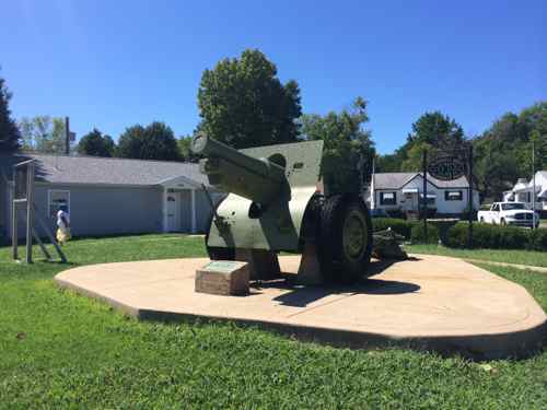
More on the memorial:

The cannon at Memorial Park is a WWI Howitzer than came from France with the approval of President Roosevelt. The cannon was dedicated on Memorial Day, 1946, to the men of Flordell Hills who lost their lives in WW2. Sixteen to twenty men volunteered to move the cannon from the boxcar on the tracks to Memorial Park. In the process it got away from them and nearly hit a building, but they managed to get the cannon in its present locations without further mishap. A band and parade were on hand for the dedication. In 1949 the cannon was supported by jacks encased in cement to keep the weight off the tires. (Flordell Hills parks

Here are the results from last week’s poll:

Q: Starting Oct 1st the north county suburb of Flordell Hills, pop 822, will have its own police force again. Thoughts:

  1. More officers means more revenue 32 [50.79%]
  2. Other: 12 [19.05%]
    1. Another example of why consolidation is needed
    2. Dissolve the counties’ police forces and local gov’ts and create one unity gov
    3. There should be only two police departments STL city & STL county
    4. stupid, disband town and police force, become county
    5. Another example of bureaucratic overload — mismanagement to the max
    6. Terrible
    7. Asinine ploy to get revenue
    8. They’ll lose money, get worse protection
    9. More opportunities for patronage placements!
    10. Sounds unnecessary
    11. Money grab
    12. contract with the county police!
  3. Won’t be substantially different than current protection from neighboring Country Club Hills 11 [17.46%]
  4. Unsure/No Opinion 5 [7.94%]
  5. They’ve decided to provide better police coverage for the community 3 [4.76%]

The Flordell Hills Police Department does have a Facebook page.

St. Louis County needs less police departments, municipalities, etc. Tomorrow I’ll expand on this subject.

— Steve Patterson


Land Hogs: Urban Highways

Urban interstate highways, especially their interchanges, a major land hogs. The other day on MetroLink heading to Lambert Airport the extent became very visible.

The EB I-70 ramp onto NB I-170
Traffic from I-170 merging with WB I-70
Using Google Maps I calculate this interchange consumes 154 acres, about 1/4 of a square mile

One quarter of a square mile isn’t much, is it?  At current density levels this would be enough to house:

  • 475 people (St. Louis County)
  • 1,200 (St. Louis City)
  • 2,845 (Chicago)
  • 17,000 (Manhattan, NYC)

Urban highways reduce overall density, place barriers that further separate us. I’m not saying we change this particular interchange, just recognize what highways do to urbanized areas (vs rural).

— Steve Patterson


East-West Gateway’s ‘Great Streets’ Examined W. Florissant In Jennings, Ferguson, & Dellwood

Looking South on W. Florissant in Dellwood, MO

A reader comment on West Florissant Ave Part 2: QuikTrip to Chambers Rd alerted me to the fact the Great Streets Initiative, through the East-West Gateway Council of Governments, had recently looked at West Florissant:

Vision Statement:
The Vision for West Florissant Avenue comes from community and stakeholder input received through multi-faceted outreach efforts. These have included public workshops and virtual walking tours, interviews with community leaders, input from the Community Committee and Technical Advisory Committee, an Agency workshop, and an online survey and mapping tool. The Vision Statement has distilled this community and stakeholder input, with the most significant community values expressed as how the corridor should look, feel, and contribute to the community’s future. 

Project Area:
The West Florissant Avenue Great Streets Project area is located in North St. Louis County, within the cities of Ferguson and Dellwood (Map 1.1). The Project area extends for approximately 2.6 miles, beginning at I-270 in the north and continuing to the East-West rail line at Emerson Electric headquarters and Buzz Westfall Plaza in the south (Maps 1.2 and 1.3; note change in map orientation). Th e Project area includes parcels that front the corridor, plus additional parcels along the key intersecting streets of Pershall Road and Chambers Road. Th e street corridor itself is owned and maintained by St. Louis County. Th e Project area parcels are about evenly divided between the cities of Ferguson and Dellwood; a few parcels also fall within Jennings city limits at the southeast end of the corridor. Several key landmarks and retail centers are located within or near the Project area. Dellwood City Hall is near the intersection of West Florissant Avenue and Chambers Road. The Project area also includes Dellwood Park and Dellwood Recreation Center. St. Louis Community College Florissant Valley Campus is just outside the northwest end. In addition to these landmarks, there are 160 acres of open space or park within one mile of the Project area, including open space associated with Maline Creek. A major shopping center is at the northern end of the corridor, with access to I-270. Just outside the southern end of the Project area, Buzz Westfall Plaza is another major retail center. The West Florissant Avenue corridor has been designed primarily to serve motorized vehicles, which is reinforced by the direct access to and from I-270 the road provides. The corridor is served by Metro Transit bus route #74, one of the most heavily-used lines in the system, and a future transit center is planned for Pershall Road in the northeast part of the Project area; its estimated completion date is in 2015. While sidewalks are present, many other pedestrian amenities are not, and the corridor is not pedestrian-friendly. The corridor currently does not have designated bicycle facilities, and is little used by bicyclists. As communities take an increasingly holistic view of streets and incorporate more of these Great Streets principles, our streets will serve multiple functions and become better places.

The supporting documents are on their West Florissant page, I’ve uploaded each to Scribd for quick reference:

The collection of the above can be viewed here.

I hope to dig into these documents soon, but I’m happy to know so much effort has already gone into planning for a better W. Florissant!

— Steve Patterson


Poll: Thoughts On Flordell Hills Police, Pop 822, Starting Its Own Police Force On Oct 1st

Please vote in the poll, located in the right sidebar

Starting October 1st St. Louis County will have another police force:

Flordell Hills has decided to form its own police department even though the city only has 822 residents.
The city said the move has been in works for months. The department will feature six full time officers, and it will cost more than what the city paid to have County Club Hills patrol the municipality. The city will have one officer for every few square blocks. (KMOV)

There are different ways one might view this change, so I thought this would be a good poll topic this week. The exact poll question is “Starting Oct 1st the north county suburb of Flordell Hills, pop 822, will have its own police force again. Thoughts:” I’ve provided a few answers but you can also type in your own if you don’t like mine. The poll is in the right sidebar. Mobile users need to switch to the desktop layout.

— Steve Patterson


Perfect Location For Centene’s New Ferguson Claims Center

Earlier this week one local company stepped up to invest in Ferguson:

Centene Corp. has selected Ferguson, the site of unrest for more than three weeks following the police shooting of Michael Brown, as the location for a new claims processing facility, with plans to bring up to 200 jobs to the city. The unrest following Brown’s death prompted Centene to select the city for the expansion. (stltoday)

This is potentially great news! I say potentially because most major call centers fit perfectly in an exurban office park; generic building sounded by massive surface parking lots, all fenced in. Ferguson needs these jobs, but it needs them in an engaged environment. Where? What would it look like? The where is quite simple: Emerson owns the perfect site on the SW corner of W. Florissant & Ferguson Ave., 9001 W. Florissant Ave.

This corner is 7+ acres
Looking north from an adjacent Ameren substation
Looking north from an adjacent Ameren substation, the Ferguson Market is in the background
Looking north from in front of the Ameren substation
Looking south from Ferguson Ave
Map of the site consisting of two parcels, both owned by Emerson
Map of the site consisting of two parcels, both owned by Emerson, right of the purple line is Jennings

I’m not sure why Emerson bought this property, likely to raze the structure that was on the site as of 1971. Having a neighbor like Centene could be beneficial to Emerson, more workers means more lunch places. Hopefully Emerson would be willing to sell to Centene, or partner on a project to develop the site. And build what?

What they shouldn't build is a building surrounded by parking
What they shouldn’t build is a building in the center surrounded by parking
Instead, the building should be pushed out to the corner so pedestrians can easily reach the entrances.
Instead, the building should be pushed out to the corner so pedestrians can easily reach the entrance(s).

Ideally the building would be at least two floors, with the first floor for retail. I’d like to see a St. Louis Bread Co (aka Panera*) or Chronicle Coffee on the corner. This would provide additional jobs and more places for these 200 employees and those who work in the area to get breakfast, lunch & dinner. Nearby locally-owned places like Ferguson Burger Bar & More would also benefit. Parking can be located behind the building. If Centene doesn’t need this much space the site could be planned for more than one building facing W. Florissant.  * Disclosure: I have a handful of Panera stock

If Ameren built a new substation at the back corner, an auto entrance could be created at the traffic signal at Solway Ave.

A project at this corner could be a great way to implement East West Gateway’s Great Street master plan for W. Florissant!

— Steve Patterson


Advertisement


[custom-facebook-feed]

Archives

Categories

Advertisement


Subscribe