Nineteen year ago I started this blog as a distraction from my father’s heart attack and slow recovery. It was late 2004 and social media & video streaming apps didn’t exist yet — or at least not widely available to the general public. Blogs were the newest means of …
The new NGA West campus , Jefferson & Cass, has been under construction for a few years now. Next NGA West is a large-scale construction project that will build a new facility for the National Geospatial-Intelligence Agency in St. Louis, Missouri.This $1.7B project is managed by the U.S. Army …
Book publisher Island Press always impresses me with thoughtful new books written by people working to solve current problems — the subjects are important ones for urbanists and policy makers to be familiar and actively discussing. These four books are presented in the order I received them. ‘Justice and …
This post is about two indirectly related topics: the new Siteman Cancer Center building under construction on the Washington University School of Medicine/BJC campus and an update on my stage 4 kidney cancer. Let’s deal with the latter first. You may have noticed I’ve not posted in three months, …
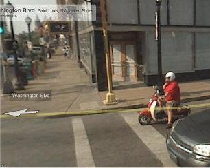
I try to avoid using images from Google’s Street View, but this one of me on my scooter from before my 2/1/2008 stroke is a favorite. Discov
There are very few things I’ve done consistently for a full decade. Who knew when I started blogging on Halloween Day in 2004 I’d still be doing so a decade later? I would’ve laughed then if you’d said I’d be celebrating the 10th anniversary. I almost didn’t make it to the 4th.
I can tell you nothing else I’ve done in my nearly 50 years comes close to the joy & clarity this blog gives me. I’ve learned you can plan all you want but life throws things at you that weren’t anticipated, you’ve got to continually reevaluate and change. St. Louis hasn’t learned this yet, our 1947 Comprehensive Master Plan still guides much of our development patterns nearly seven decades later.
Am I celebrating? Yes, meeting my husband today for lunch, photographing updates for a prior post. If you see me out and about please be sure to say hello!
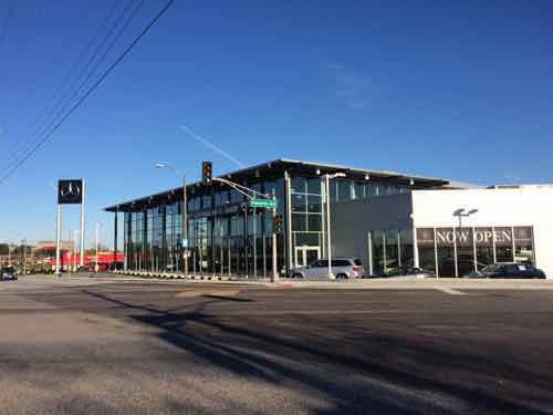
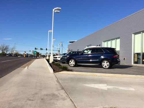
After nearly a two decade absence (see Last Downtown St. Louis Auto Dealership Closed in 1995), a Mercedes-Benz dealership is once again located within the City of St. Louis. Two more exist in the region, one in St. Louis County and one in St. Charles County. None in the Metro East.
The new Mercedes-Benz of St. Louis at Hampton & Clayton
Before we take a closer look at the finished dealership, we need to revisit the before and during.
KTVI’s studios previously occupied the site, not remotely urban. October 2012 photo
By July 2013 the old KTVI building had been razed, the site fenced. August 2013 photo
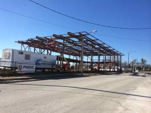
The steel structure for the main showroom going up in February 2014
View looking north along Hampton
View looking east along Clayton
View from near the east-facing showroom entrance, looking down the accessible route to the Clayton Ave public sidewalk. See Mini of St. Louis, it is possible to comply in a graceful way!
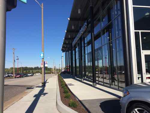
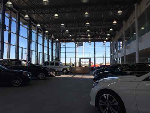
Inside the showroom
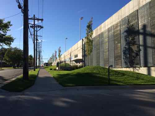
Southern view of dealership along Berthold Ave. Service work is done in the level below the showroom. Customers drop off their cars on the main level though.
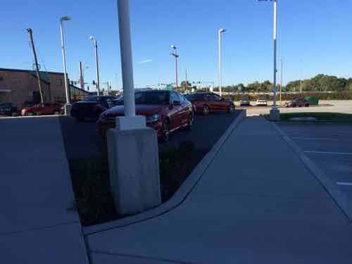
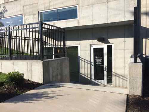
Customers dropping off or picking up their Mercedes-Benz do so up on the main level, but visiting the parts department requires a short flight of stairs that lack handrails. The grade change on Berthed Ave would’ve permitted an accessible entry.
For nearly 20 years this dealership, then called TriStar Imports, was located in suburban Ellisville at 16360 Truman Rd Ellisville, Missouri 63011. Their old location is listed for $4.5 million. The far west county demographics just weren’t what they hoped they’d be.
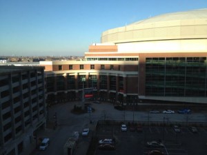
Edward Jones Dome as seen from The Laurel Apartments
A huge majority of readers who voted in the poll last week came to the correct conclusion: the Rams will exit the 30 year lease after just 20 years. Similar to when an apartment lease expires, the Rams will become year to year tenants of the Edward Jones Dome.
Q: At the end of the current NFL season the St. Louis Rams have the right to opt out of the last 10 years of their lease at the Edward Jones Dome. What’ll they do?
Opt out, switching to a year to year lease 78 [83.87%]
Opt in, committing to the last 10 years of the original lease 7 [7.53%]
Unsure/no opinion 6 [6.45%]
Other: 2 [2.15%]
move
new open-air stadium.
This doesn’t mean they’ll move, just that they’ll need to figure out a new facility. In the meantime, they’ll continue playing here. Once they formally opt out they’ll probably be quiet for a while, building support among state & local politicians while also talking with groups in other cities seeking a team. The Raiders are doing the same:
The Raiders and Rams would both be formalizing plans to move to Los Angeles in 2015 if not for NFL intervention and the league’s overriding control of the process, according to numerous sources with knowledge of the situation.
Both franchises continue to devote considerable time, energy and resources toward securing an eventual move. There is no lack of desire or intent by either club, sources said, however there is a fear of running afoul of the league office, which has made it explicitly clear to those clubs that no franchise will secure the 24 necessary votes to facilitate a relocation to LA without its stadium, property and development deals being approved by the NFL.
Both teams, whose current leases expire after the season, continue to actively seek solutions to their hurdles currently preventing them from moving to Southern California, sources said. “There are live discussions involving two clubs potentially relocating there,” as one source put it. (CBS Sports)
In January the LA Times reported Rams owner Stan Kronke bought a stadium-sized parcel of land in the Los Angeles area.
My feeling is if they want a new stadium here let them pay for it, I can think of many more projects to invest tax dollars. I do hope it takes them a while to move, that’ll help reduce the remaining debt on the dome.
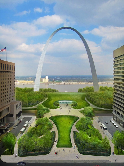
The big 50th anniversary of the day the final piece of the Arch was lowered into place is one year from today. CityArchRiver 2015 has been working for a few years now to complete a big update to the Arch grounds for a huge celebration, but don’t expect to see everything you remember from the winning design completed in the next year. The balance of the work will be finished after this anniversary, well after in some cases (cough: gondola).
Here are some future anniversaries, opportunities to celebrate:
June 10, 2017: 50th anniversary of the Arch opening to the public
May 25, 2018: 50th anniversary of the inauguration by VP Humphrey
May 30, 2022: 75th anniversary of the opening of the design competition
February 18, 2023: 75th anniversary of the jury selecting Saarinen’s design the winner
December 15, 2033: 100th anniversary of the idea for a riverfront memorial
May 28, 2037: 50th anniversary of being listed on the National Register of Historic Places
February 12, 2038: 75th anniversary of the start of construction
October 10, 2039: 100th anniversary of the start of demolition to clear the historic riverfront
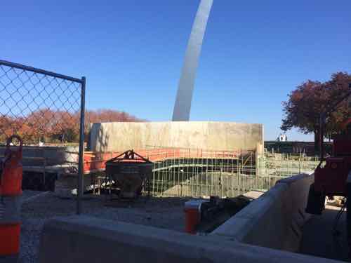
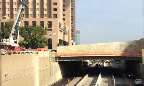
Luther Ely Square will be extended over the highway, but the expanded museum won’t be open until Spring 2017
Work on the highway lid has moved quickly, though it remains a mess currently.
View of the south side of the lid
Lid view from the Arch side
What we’ve known as the entry/exit areas will become exit-only once the new museum opens
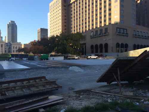
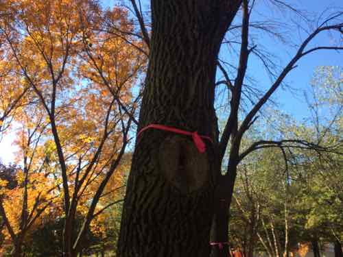
The ash trees will be cut down to be replaced, the grounds are expected to be complete by May 2016
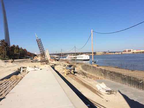
View looking north from south of the Arch
Trees to the south have already been tagged for removal. Click image to see video from May 1982 when these trees were young
Works is progressing on the riverfront, this should be complete by a year from now.
I suspect a year from today I’ll be both impressed and disappointed by what is finished.
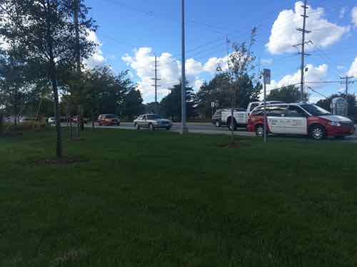
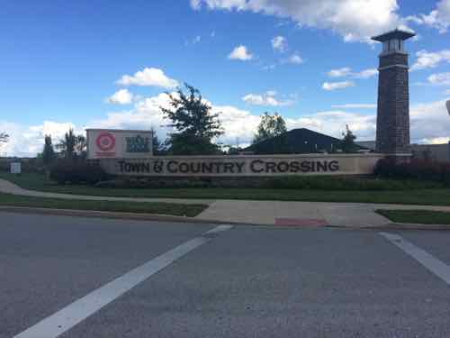
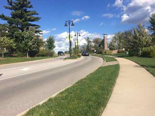
Now I’m very familiar with our public transit system and my husband uses our shared car to get to work. So I took public transit from downtown way out to Town & Country to see the shopping center 6+ years later.
Public Transit:
From our loft Google Maps says the drive to Town & Country Crossing, located at Clayton Rd & Woods Mill Rd., is just over 19 miles, taking 23 minutes via I-64 or 56 minutes if you avoid highways. The 57x is the MetroBus route that runs along Clayton Rd in far west county. How long does it take? From my loft it takes 68- 87 minutes, depending upon departure time and route. The 57x usually heads west from the Brentwood MetroLink station, but a few trips per day leave from the Central West End MetroBus center adjacent to the CWE MetroLink. Interestingly, catching the #10 MetroBus a block from our loft can get me to Town & Country Crossing in 77 minutes, less than some combinations involving MetroLink light rail!
The latest morning arrival weekdays is 7:34am. The next arrival? Not until 2:32pm. Clearly Metro wisely caters to worker’s schedules rather than run buses throughout the day. The 57x also serves Chesterfield.
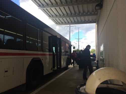
I went out three weeks ago, Monday October 6th. I took MetroLink to the Brentwood station to catch the first afternoon trip 57x westbound.
“Connecting Missouri MetroBus routes at Brentwood-I 64 Station include: #02 Red Line, #59 Dogtown, #158 Ballas-West County, and #57X Clayton Rd Express.” Click image to view station page
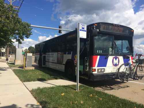
The 57x I took to Town & Country stopping on Clayton Rd. between Woods Mill & Hwy 141. The concrete pad is fairly new, Metro has been working to improve accessibility of bus stops throughout the region
However, the next WB MetroBus stop isn’t good for many people. Town & Country Crossing is visible in the background
For the return trip I had three choices; one across Clayton Rd from where I got off the 57x, and two along the north edge of Town & Country Crossing. Here are the two next to my destination.
For the eastbound 57x the eastern most stop is at a point where the sidewalk is far away from the curb, the sign can be seen next to the red & white taxi
The stop I used was toward the west end of the shopping center, no pad to reach the bus but considerably closer than the other stop.
The 57x I took back to the east stopped at Brentwood MetroLink then continued east to the Central West End MetroBus Center, where I caught the #10 that dropped me off at 16th & Olive, a block from my loft. Because the #57 uses I-64 from Brentwood to Mason Rd the trip is relatively quick.
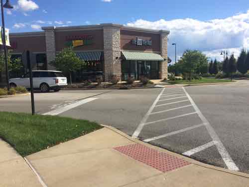
Woods Mill Plaza:
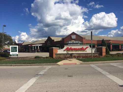
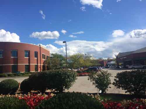
I’d never been to Woods Mill Plaza, located just east of Town & Country Crossing, so I thought I’d take a look while I was in the area. The main anchor is a Schnucks.
Approaching from the traffic island after crossing Clayton Rd
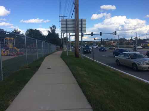
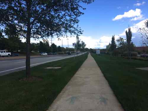
A decent sidewalk runs along Clayton Rd and includes one bus stop I previously mentioned, but no accessible route into the site
View of the various buildings from the public sidewalk. Maybe access is off of Woods Miill?
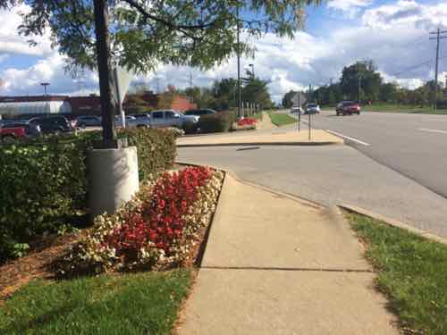
The first auto in/out on Woods Mill not only lacks a pedestrian entry but blocks a straight path. I got the contract info for a Town & Country employee who said Woods Mill Plaza is responsible, he’d contact them about this.
The next entry also lacked a pedestrian route. No other pedestrian route into Woods Mill Plaza was found despite the presence of sidewalks & bus stops.
From property records I learned Woods Mill Plaza was built in 1986, the 2-story office building on the site was built in 1991. If you think this site is somehow “grandfathered” you’d be very wrong:
Because barrier removal under the ADA is a continuing obligation, an accessible route may need to be provided at a later date, if a route for the general public develops or is created, and the provision of an accessible route is readily achievable. For instance, if a new bus stop is established near a site, an accessible route may have to be provided if pedestrians commonly walk between the new bus stop and the entrance to the facility. Similarly, if a sidewalk or walkway is provided between the facility and the new bus stop, an accessible route may be required. (Dept of Justice)
Moving on…
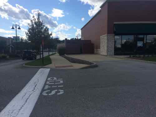
Town & Country Crossing:
As I said at the opening, my only other visit was in July 2008. I’d been impressed with what I saw then but I wanted to return in my wheelchair to see the completed shopping center. I remain impressed but did note some problems in maintenance and design.
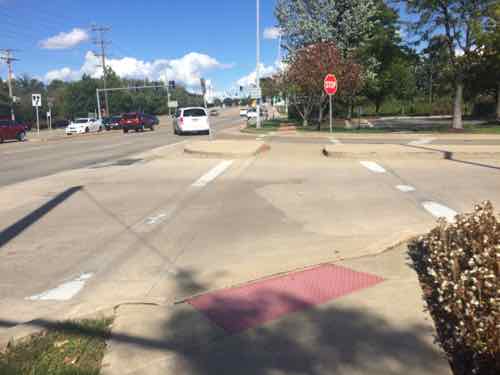
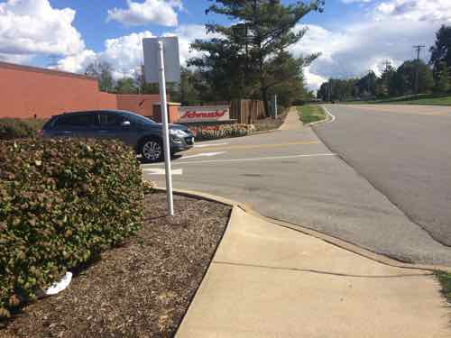
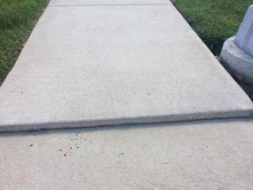
Immediately upon crossing Woods Mill I encountered a situation with a vertical height higher than allowed. This was the only problem like this I encountered in the site.
Moving into the site this was the view toward Woods Mill
And the view toward Clayton Rd.I decided to follow this cute to enter the site.
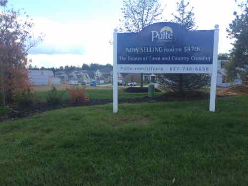
To the immediate west of the Clayton Rd entrance is a new home development. This land was part of the previous AT&T center where Town & Country Crossing is located now. These homes are marketed as being adjacent to the shopping center, especially the Whole Foods.
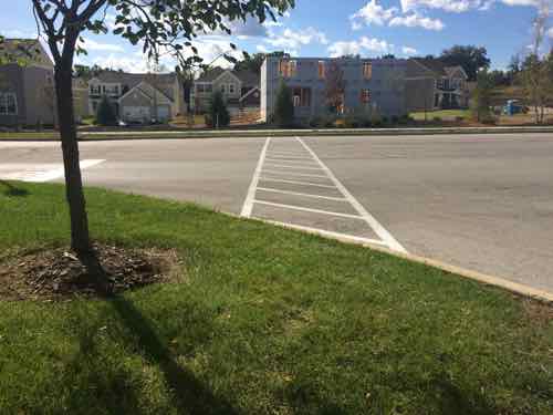
However, the intended connection between the two isn’t accessible.
The Clayton Rd entrance, Town & Country apparently doesn’t allow tall backlit retail signs or the developer realized a more tasteful approach is more visually appealing.
The architects/engineers that originally laid our=t Town & Country Crossing gave a lot of thought to pedestrian accessibility, this is to a small out building on the west edge
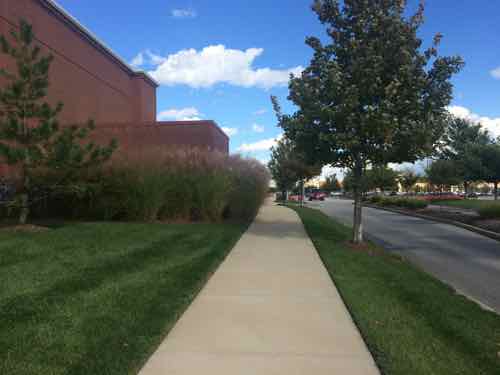
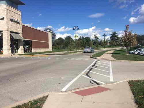
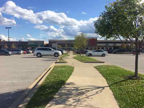
View looking east along the main east-west pedestrian route, which is parallel to the main east-west auto route, the building on the left contains several storefronts and a bank is just beyond that.
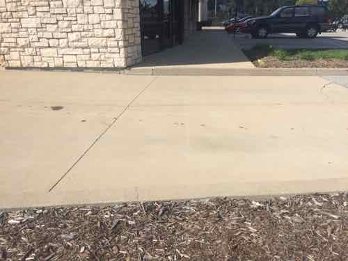
Unfortunately something went wrong here, despite the efforts to make this shopping center fully accessible. This is easily corrected, not sure about to the bank beyond.
Looking back west you can see someone forgot to consider making sure wheelchairs/strollers could cross the driveway leading to dumpsters. Easy mistake , easy fix.
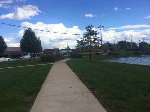
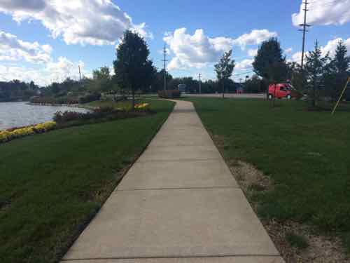
Some buildings facing north toward Clayton Rd look out onto this pond.
South of the Whole Foods the internal sidewalk network heads east toward Woods Mill Rd. (left) or Target (right)
Looking east toward Woods Mill, the Whole Foods ids to the left, Target is behind.
Ahead is Woods Mill Rd. But let’s go back west to the Target
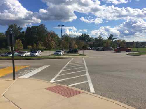
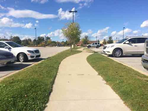
In front of the Target looking north, we can see a path leading out into the parking lot with disabled spots on each side, a common Target feature. .
When we get further out we see it has changed to a sidewalk with regular parking spots on each side
Turning around we see the Target. So how far does this go? It connects with the original east-west sidewalk we used.
The white car id headed west on the main east-west drive, the east-west sidewalk is on the other side of it.
Closing Thoughts:
Town & Country Crossing isn’t perfect, someone dropped the ball when the storefront building & bank was built in the northwest corner. Still, this remains the best example in the St. Louis region of a well connected shopping center. It still largely caters to motorists while being mostly ADA-compliant. They’re not mutually exclusive.
AARP Livibility Index
The Livability Index scores neighborhoods and communities across the U.S. for the services and amenities that impact your life the most
Built St. Louis
historic architecture of St. Louis, Missouri – mourning the losses, celebrating the survivors.
Geo St. Louis
a guide to geospatial data about the City of St. Louis