Celebrating Blog’s 19th Anniversary


  Nineteen year ago I started this blog as a distraction from my father’s heart attack and slow recovery. It was late 2004 and social media & video streaming apps didn’t exist yet — or at least not widely available to the general public. Blogs were the newest means of …

Thoughts on NGA West’s Upcoming $10 Million Dollar Landscaping Project


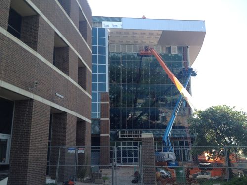
  The new NGA West campus , Jefferson & Cass, has been under construction for a few years now. Next NGA West is a large-scale construction project that will build a new facility for the National Geospatial-Intelligence Agency in St. Louis, Missouri.This $1.7B project is managed by the U.S. Army …

Four Recent Books From Island Press


  Book publisher Island Press always impresses me with thoughtful new books written by people working to solve current problems — the subjects are important ones for urbanists and policy makers to be familiar and actively discussing. These four books are presented in the order I received them. ‘Justice and …

New Siteman Cancer Center, Update on my Cancer


  This post is about two indirectly related topics: the new Siteman Cancer Center building under construction on the Washington University School of Medicine/BJC campus and an update on my stage 4 kidney cancer. Let’s deal with the latter first. You may have noticed I’ve not posted in three months, …

Recent Articles:

Travel: Elevated Highway Removal In Oklahoma City Part 2


Yesterday I ended part 1 with the following photo showing Oklahoma City directing people from downtown, past where the old elevated I-40 was, through a desolate area toward the new I-40 and the Oklahoma River beyond.
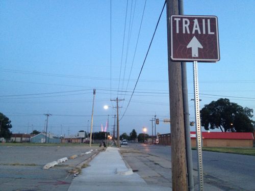
ABOVE: A sign indicates a trail, directing people southward through no-man’s land toward the new highway and the Oklahoma River beyond.

The new I-40 is a half mile south of the Myriad Botanical Gardens, a recently revamped space occupying a superblock made up of four city blocks. The Myriad Gardens now has many spaces along the lines of those at Citygarden, for example, interactive water features. The half mile space between the gardens and the new highway is pretty much a wasteland, long cut off from downtown by the old I-40. The river and waterside trail system is an another half mile south of the new highway, through a very low income neighborhood.
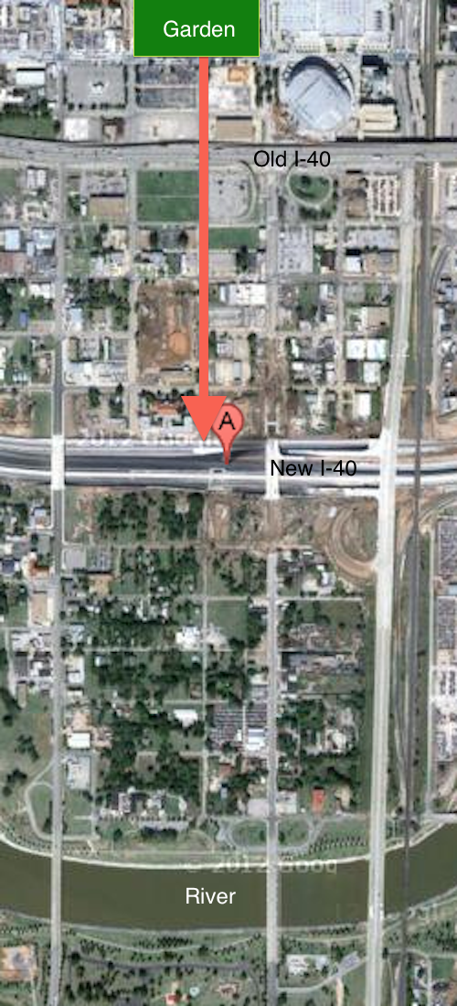
ABOVE: Aerial image showing the location of the Myriad Botanical Gardens at the top center and the suggested route south to reach the river trail, following Harvey Ave. Click image to view in Google Maps.

Does Oklahoma City really think people will walk through these areas? The two nights I did it I saw many people: individuals, couples & families.  In time the half mile zone between the old highway and the new highway will be redeveloped and occupied. The removal of the old elevated highway is allowing development to spread whereas before it was contained. Why are people walking there now you ask? The major roads that cross over the new I-40 all have generous sidewalks but a pedestrian-only bridge was also constructed where Harvey Ave reaches the new highway.
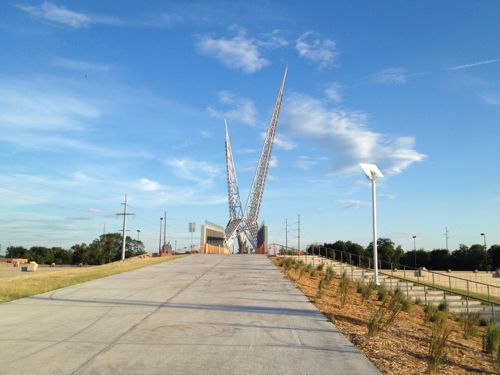
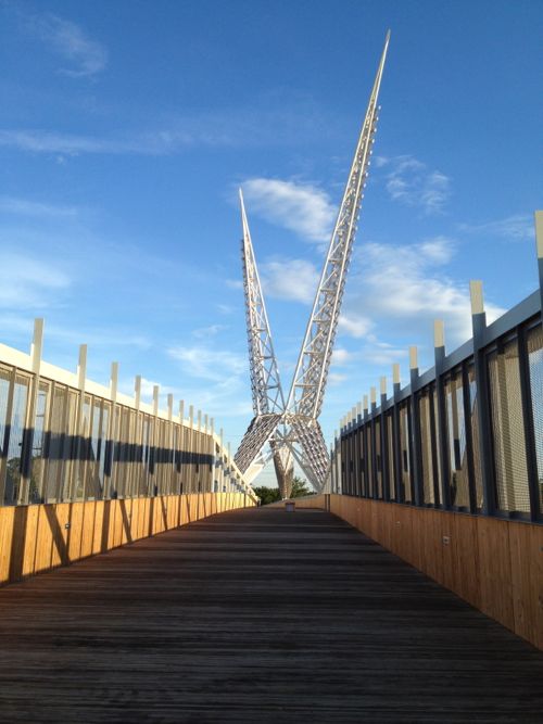
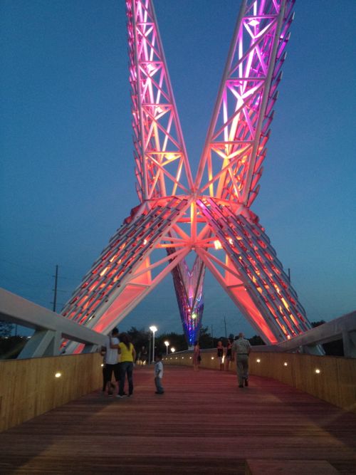
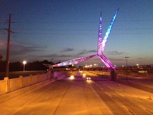
ABOVE: A larger-than-life 105 ton scissor-tailed flycatcher sits on top of the Skydance bridge rising 192 feet above the highway, attracting many pedestrians. Oklahoma City built it interesting and people come.

I saw the pedestrian bridge the first time as my train pulled in a night. At the time I wasn’t sure what it was but I asked my brother right away, it was just too intriguing not to be curious. The next day we drove under it as we returned downtown. The also allowed me to experience the new I-40 alignment.
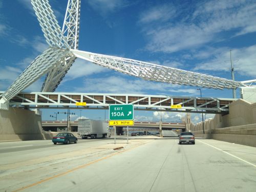
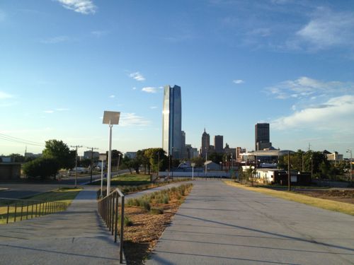
ABOVE: You can’t help but notice the Skydance pedestrian bridge

ABOVE: Looking back north toward the downtown Oklahoma City skyline dominated by the Devon Tower.

ABOVE: The bridge features a wood floor and sides

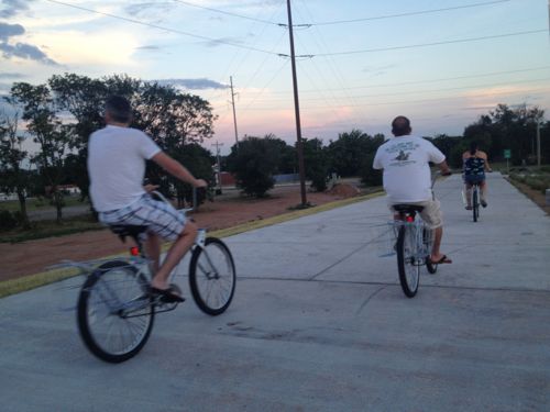
ABOVE: On my first visit a group of four on rental bikes from downtown passed me heading to the river trail.

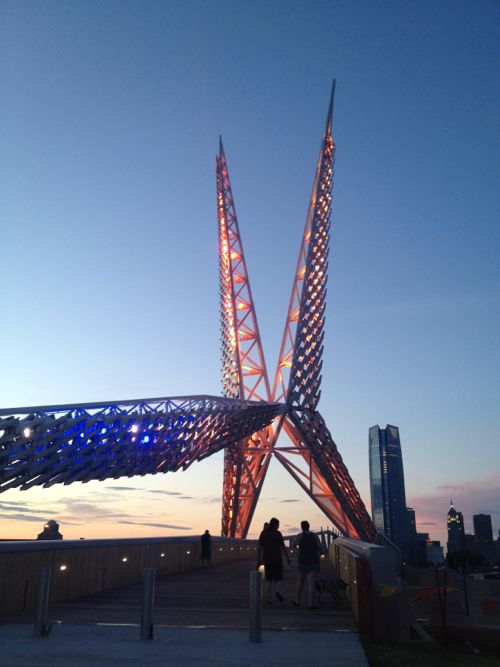
ABOVE: But as the sun goes down the lights come on and the people really start to come out in droves.

ABOVE: Instantly a part of town long written off is THE place to be, to get photographs together with the bridge in the background.

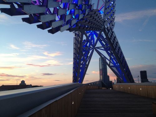
ABOVE: The powerful LED lights change colors so it’s not static

ABOVE: Looking west at the Skydance bridge from the Robinson Ave bridge nearby

I visited two nights in a row and talked with numerous strangers both times. My entire life this area was a “bad” part of town and here I was talking with strangers at night. They’ve successfully begun to change perceptions of an area ignored for decades!

Take a look to see why.
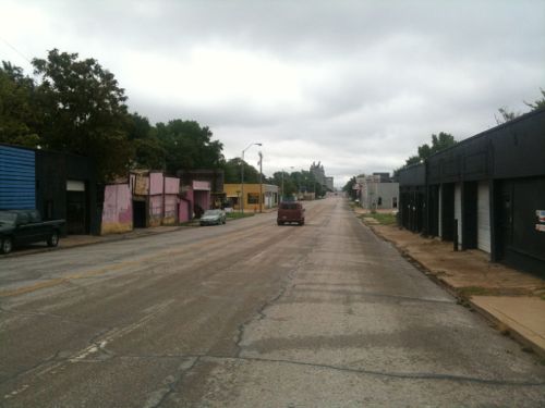
ABOVE: In August 2010 I drove south of the new I-40 construction on Robinson Ave, this was always auto junkyard row.

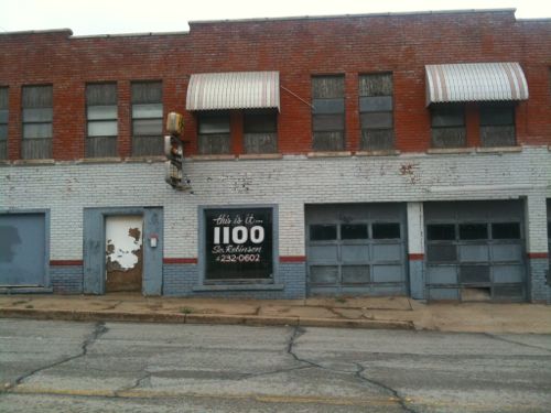
ABOVE: This building at 1100 South Robinson Ave caught my eye in August 2010. This was just south of the construction for the new I-40.

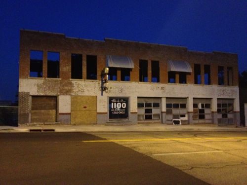
ABOVE: In July 2012 the building has been prepared for rehab. This is a block east of the south end of the pedestrian bridge, a visible location.

ABOVE: South Robinson still has junk yards but it’s a route to the river, the popular skate park and neighborhoods further south so as part of their “core-to-shore” plan it’s getting improved.

I’m still amazed I was exploring this area alone, at night, in a wheelchair!   Their Core to Shore plan was big:

In 2006, the City of Oklahoma City undertook an ambitious planning process to redevelop 750 acres of underutilized land between the core of downtown to the shore of the Oklahoma River.

Envisioned as Core to Shore, efforts are now underway to build and connect a series of neighborhoods, parks, and economic opportunities that will reinvent downtown Oklahoma City, leading to new jobs and a higher quality of life for residents.

Major aspects of the Core to Shore plan include:

  • Creation of a world-class, pedestrian-friendly boulevard
  • Development of a 40-acre central park
  • Development of business, retail and mixed use housing along the central park
  • Building of a Convention Center and Convention Center hotel
  • Relocation of some of the existing businesses and homes in the area

This is a vastly different thinking than the 1960s Pei Plan that led to the destruction of much of downtown and the creation of many superblocks. Financing for this work was part of the Metropolitan Area Projects Plan (MAPS) which began in the early 1990s. The highway move and other recent work was part of the third phase, MAPS3.

Many have been critical of the taxes paid and the cumulative costs of the numerous projects over the last 20 years. But schools have been updated, downtown energized, attracted a winning NBA franchise, saw massive private  investment from major corporations (Chesapeake, Devon, SandRidge, etc.

In the country as a whole, single-family woes are fueling the multifamily surge. Stubbornly persistent foreclosure rates, mortgage bankers’ continued reluctance to lend to any but those with the very best credit and most stable employment history, as well as still-high unemployment in most places, have apartment investors investing in new product.

But here, a healthy local economy — enviable unemployment rates, population growth on the rise — has cautious and seasoned but willing single-family builders building again. (newsok.com)

Investing in your community pays dividends! It doesn’t happen overnight but financing the big ideas gets noticed eventually. Oklahoma City’s 2010 population was 579,999 and the metropolitan area was 1,322,459, half that of Greater St. Louis.

Back to St. Louis:

This is the type of planning St. Louis should’ve been doing to reclaim areas like Pruitt-Igoe and the 22nd Street Interchange, two areas where Paul McKee stepped in to fill the city’s planning absence.

It’s I-70 that currently uses the elevated and depressed highway dividing parts of downtown St. Louis. In 2014 I-70 will cross over into Illinois on the north edge of downtown rather than on the south edge at the Poplar Street Bridge.

— Steve Patterson
Travel: Elevated Highway Removal In Oklahoma City Part 1


Count me among those who think St. Louis needs to remove the elevated section of I-70 north of Washington Ave that cuts off Laclede’s Landing from the rest of downtown. These types of elevated lanes were built during a period where little, if any, consideration was given to pedestrians. The negative consequences weren’t considered at the time but they became apparent later.

As a kid growing up in Oklahoma City we’d have to drive under an elevated highway to get to downtown. I rarely drove on I-40 since it was an east-west route and we lived a few miles directly south of downtown. The few times I did drive across the elevated highway I was nervous doing so, the lanes were narrow and the condition was poor. I never once walked under it.

The Oklahoma City Crosstown is an elevated four mile (6 km) stretch of Interstate 40 that dissects downtown Oklahoma City from Agnew Avenue to Byers Avenue. It is owned and maintained by the Oklahoma Department of Transportation (ODOT). It is the primary east–west artery through Oklahoma City, and serves an unofficial dividing line between north and south Oklahoma City (the official dividing line for address purposes is [Reno Avenue]). While the Crosstown designed to withstand about 76,000 vehicles a day, it is currently used by nearly 120,000 vehicles a day. The Crosstown was completed in the 1960s using an engineering process commonly termed as “fracture critical”, a process that has not been used since the 1970s because it does not provide redundancies. According to Brian Windsor, an ODOT structural engineer, without redundant support, the failure of a single beam creates the risk of total collapse of that section of bridge. The entire stretch of the Crosstown is elevated, and at some points, the elevation is as much as 50 feet (15.2 m). Other safety problems of the existing Crosstown include falling chunks of concrete and a lack of shoulders or breakdown lanes. In an August 2007 poll sponsored by The Oklahoman, nearly ? of respondents indicated that they were “afraid to drive across the Crosstown bridge in Oklahoma City”. (Wikipedia)

It wasn’t a good roadway, nor could it be retrofitted. It had to come down.

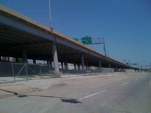
ABOVE: I-40 in Oklahoma City in August 2009

Well, the four mile elevated stretch of I-40 is now closed and is being dismantled. This was years in the planning and before you ask, yes they built a replacement highway in a wide trench a half mile to the south. Part 2 tomorrow will look at the new highway.

As I indicated earlier, I-40 is a major east-west highway:

Interstate 40 (I-40) is the third-longest major east–west Interstate Highway in the United States, after I-90 and I-80. Its western end is at Interstate 15 in Barstow, California; its eastern end is at a concurrency of U.S. Route 117 and North Carolina Highway 132 in Wilmington, North Carolina. Much of the western part of I-40, from Oklahoma City to Barstow, parallels or overlays the historic U.S. Route 66. I-40 intersects with eight of the 10 primary north–south interstates (all except I-5 and I-45) and also with I-24, I-30, I-44, I-77, and I-81. (Wikipedia)

Locals use I-40 but so do many more just passing through Oklahoma.

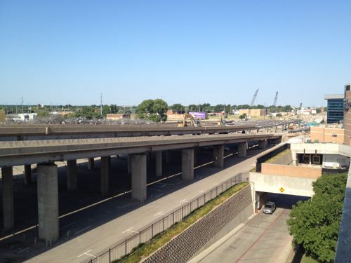
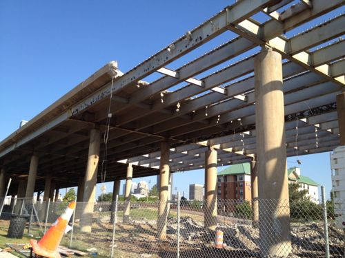
ABOVE: The old I-40 elevated lanes in Oklahoma City being demolished.

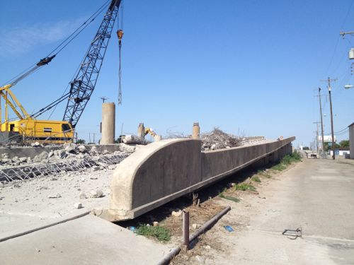
ABOVE: Close-up of old on-ramp to westbound I-40 cutting through the south edge of downtown Oklahoma City as the highway is being removed.

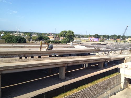
ABOVE: Crews slowly dismantle the old I-40 elevated lanes.

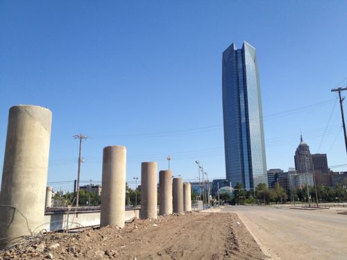
ABOVE: New development (background) can continue to the south once the elevated highway is removed.

ABOVE: Just to the north is the Myriad Botanical Gardens and the new 844ft high Devon Tower, click image for more information. The Gateway Arch is only 630ft tall.

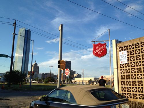
ABOVE: South of the highway was cut off from downtown and investment, places like the Salvation Army were the only ones that would locate there.

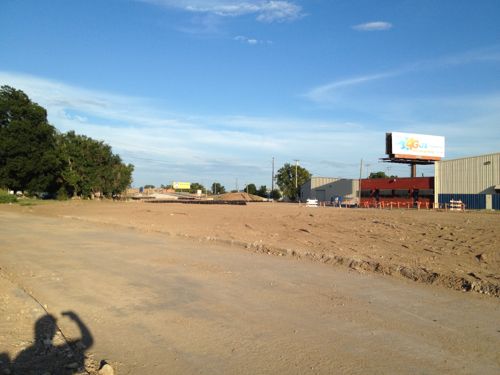
ABOVE: Vacant land where part of the elevated highway has been completely removed.

ABOVE: A new entrance to the Chesapeake Arena, home of the OKC Thunder NBA franchise, is being constructed now that the adjacent highway is being removed.

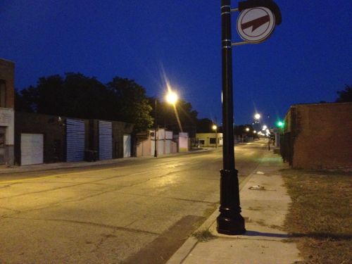
ABOVE: A sign indicates a trail, directing people southward through no-man’s land toward the new highway and the Oklahoma River beyond.

Tomorrow I’ll continue the story with a look at the new I-40 and how to cross it as a pedestrian. I’m excited about visiting Oklahoma City during the coming years as they fill in where the highway was removed.

— Steve Patterson

Poll: Which Race In The August 7th Primary Will Be The Closest?


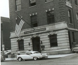
ABOVE: Former offices of the St. Louis Board of Election Commissioners

Often the August partisan primary is rather boring — at least to me some have been. But for 2012 we have hard fought races on the local, state and national level. Incumbents are being challenged from within their own party (Republican & Democrat), redistricting and term limits pits former allies. Fascinating stuff to observe.

The GOP races have candidates fighting to prove who’s the most conservative while Democrats just sling mud at their opponent(s), TV commercials have been non-stop and our mailboxes jammed with slick mailers. I still haven’t decided how I’m going to vote so I’m not making any endorsements.

I want to know which race you think will be the closest in the final vote count, the converse being which will have the biggest spread. Here are the races I’ve picked for this poll, there are others but these are the five I think people are watching closely:

  • MO US Senate (GOP: Akin, Beck, Steelman, Brunner, Memoly, Lodes, Poole, Maldonado)
  • MO US Rep Dist 1 (Dems: Britton, Clay, Carnahan)
  • MO Lt. Gov (GOP: Kulmann, Lager, Kinder, Carter)
  • MO State Senate Dist 5 (Dems: Wright-Jones, Nasheed, Mott-Oxford)
  • STL Treasurer (Dems: Wessels, Wahby, Jones, Boyd)

Included in the poll are answers for “unsure” and “another race.” The poll is in the right sidebar, the answers display in random order in the poll. So vote in the poll and be sure to vote on Tuesday August 7th, the St. Louis Board of Election Commissioners has sample ballots.

— Steve Patterson


World Naked Bike Ride Tonight

July 28, 2012 Bicycling, Events/Meetings, Featured Comments Off on World Naked Bike Ride Tonight
 

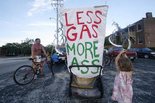
Tonight is the 5th World Naked Bike Ride in St. Louis:

This year’s event starts at 6 p.m. at the South Grand Boulevard parking lot and includes body-painting, live music and “costume” contests. The ride, typically 10 miles, starts at 8 p.m. (stltoday.com)

The St. Louis Facebook page is here.

Source: World Naked Bike Ride in St. Louis

What’s this all about?

World Naked Bike Ride (WNBR) is an international clothing-optional bike ride in which participants plan, meet and ride together en masse on human-powered transport (the vast majority on bicycles, but some on skateboards and inline skates), to “deliver a vision of a cleaner, safer, body-positive world.”

The dress code motto is “bare as you dare”. Full and partial nudity is encouraged, but not mandatory, on all rides. There is no mandate to cover intimate parts; this is a distinguishing feature of WNBR against other cycling events.

Creative expression is also encouraged to generate a fun and immersive atmosphere during the ride, capture the attention and imagination of the public and media, and make the experience more personalized and fulfilling for the riders. Body art, such as body painting, are common forms of creative expression, as well as costumes, art bikes, portable sound reinforcement systems (such as public address systems, bullhorns and boomboxes) and musical instruments or other types of noisemaker. (Wikipedia)

Of course local laws require participants “cover intimate parts.”

— Steve Patterson

Weekend Events: Saturday Jubilee, Vegetapolooza, & City-Wide Open Studio

July 27, 2012 Events/Meetings, Featured Comments Off on Weekend Events: Saturday Jubilee, Vegetapolooza, & City-Wide Open Studio
 

Many events taking place this weekend in and around St. Louis, here are  few I want to share with you:

Saturday July 28th — Saturday Jubilee:

More of our neighbors are experiencing something many never thought possible – hunger.

More than 120,000 individuals in our area rely on food pantries, nearly half are children. Many are seeking help for the first time.

Our local food pantries are struggling to keep up with the increased demand. Saturday Jubilee mobilizes local churches, businesses, civic groups and individuals to participate in a large scale food drive to end hunger.

On Saturday, July 30th more than 1000 volunteers organized into 88 teams will position themselves outside area grocery stores encouraging shoppers to donate non-perishable items. The donated food will be delivered to the Operation Food Search warehouses for distribution to our local food pantries.

Like last year, I’ll be at Culinaria (315 N. 9th Street) for the 9am-11am shift collecting food items to help those in need. Stop by to say hello and to drop a few items into the donation cart.

Saturday July 28th —  Vegetapolooza

On Saturday, July 28 from 9 am to Noon, the North City Farmers’ Market will host Vegetapalooza, a celebration of local produce and healthy habits in the community. Activities will include a salsa-making contest, a strangest vegetable contest, a pie walk, sustainability demos by Gateway Greening, face-painting, and local produce, meats, cheeses, and artisan vendors.

For more info click here.


Saturday & Sunday July 28th-29th — City-Wide Open Studio:

Join us for all of the events at CAM and map out your City-Wide Open Studios itinerary, or take a guided tour. Studios located south of I-44 will be open on Saturday, July 28  (includes Cherokee Street, Tower Grove, The Hill, Soulard, Southampton, Bevo Mill, Southwest Garden, Carondelet, Compton Heights, Benton Park, Fox Park, and McKinley Heights). Studios located north of I-44 will be open on Sunday, July 29  (includes Grand Center, Central West End, Downtown, Old North St. Louis, Lafayette Square, Midtown, Fountain Park, Dogtown, University City, Wydown/Skinker, and Maplewood). (see camstl.org/cwos for more info)

Meet local artists, visit their studios. This is a great annual event where you get to see creative spaces and meet those who work in them.

Have a great weekend!

— Steve Patterson


Advertisement


[custom-facebook-feed]

Archives

Categories

Advertisement


Subscribe