Celebrating Blog’s 19th Anniversary


  Nineteen year ago I started this blog as a distraction from my father’s heart attack and slow recovery. It was late 2004 and social media & video streaming apps didn’t exist yet — or at least not widely available to the general public. Blogs were the newest means of …

Thoughts on NGA West’s Upcoming $10 Million Dollar Landscaping Project


  The new NGA West campus , Jefferson & Cass, has been under construction for a few years now. Next NGA West is a large-scale construction project that will build a new facility for the National Geospatial-Intelligence Agency in St. Louis, Missouri.This $1.7B project is managed by the U.S. Army …

Four Recent Books From Island Press


  Book publisher Island Press always impresses me with thoughtful new books written by people working to solve current problems — the subjects are important ones for urbanists and policy makers to be familiar and actively discussing. These four books are presented in the order I received them. ‘Justice and …

New Siteman Cancer Center, Update on my Cancer


  This post is about two indirectly related topics: the new Siteman Cancer Center building under construction on the Washington University School of Medicine/BJC campus and an update on my stage 4 kidney cancer. Let’s deal with the latter first. You may have noticed I’ve not posted in three months, …

Recent Articles:

The Bottle Undistrict


The soft drink 7-Up was once marketed as the uncola. For years now people have been trying to market the vacant land and a vacant warehouse north of the Edwards Jones Dome as The Bottle District. The first post where I mentioned The Bottle District was in August 2005 (Thoughts on St. Louis’ Proposed Riverfront Makeover, Lid Over I-70 and Mississippi River Bridge).

The Bottle District is a six-block area north of Downtown St. Louis, Missouri that is being redeveloped as a mixed-use entertainment and residential district. The area is located north of the city’s convention center and west of Laclede’s Landing.

The district is located in what was once known as the Kerry Patch neighborhood of the city, which was home to thousands of Irish immigrants in the 19th Century. The neighborhood gradually became more industrial in nature. In the 1920s this area was famous for animal stockyards and bottling companies.

McGuire Moving and Storage Company, a longtime business located in the area, announced plans for redeveloping the district as an entertainment destination in 2004. Noted architect Daniel Libeskind was hired to design the district. The Ghazi Company of Charlotte, North Carolina is the co-developer of the Bottle District.

The first phase of the redevelopment is scheduled to open in 2007. A groundbreaking ceremony was held on September 27, 2005. The first phase will include a Rawlings Sports museum, a Grand Prix Speedways kart-racing center, a boutique bowling alley, 250 residential units, and several restaurants. The first phase of the development is anticipated to cost $290 million and is being funded in part by $51.3 million in tax increment financing.

Several explanations for the origin of the name of the Bottle District have been given. It has been suggested that the name honors the longstanding connection between St. Louis and the brewing and bottling industries. Others have suggested that the name comes from bottles found buried on the property, or the many broken bottles found in the neighborhood. Finally, the site is noted for a decades old, 34-foot-tall (10 m) advertisement for Vess Soda, shaped like a bottle, which the developers intend to restore during the redevelopment. (Wikipedia)

Here we are years later and this district remains anything but a district. To me it’s The Bottle Undistrict.
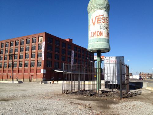
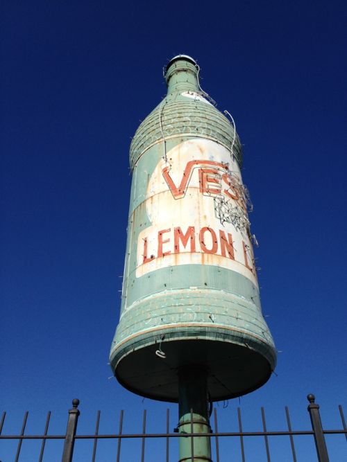
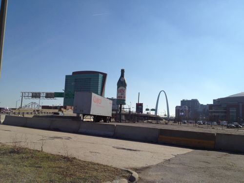
ABOVE: The neon-covered Vess bottle for which the area is named, Vessville didn't have a good ring

ABOVE: The bottle itself isn't looking so refreshing

ABOVE: The bottle with the Arch in the background, both familiar shapes

The problem here is this has been developer-driven planning. Big picture urban planning would have looked at how to develop this land and connect it to the west, the former Cochran public housing project, now the nice mixed-income Cambridge Heights neighborhood and renovated Neighborhood Gardens apartment development from 1935. Developers rarely think beyond the borders of their property, that takes municipal planning to knit together private parcels into a cohesive city.

We should be planning now for when the new I-70 bridge opens to the north, allowing the replacement of the highway lanes with a high volume boulevard instead. This district could then front onto the boulevard and more easily connect to the east. But our leadership doesn’t get it, to them the 1970 way is just fine.

– Steve Patterson
Poll: The St. Louis Question: “Where did you go to school?” is?


“Where did you go to school?” is a very common question around here. Last week the Post-Dispatch had a couple of interesting stories on the topic:

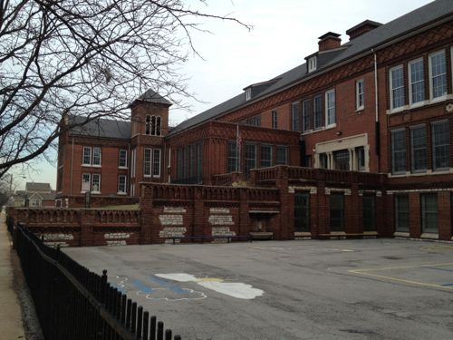
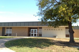
ABOVE: My elementary school

It was while attending a party as newcomers to St. Louis that, for the first time, someone asked Kim Wolterman and her husband where they went to school.

Their answer, “Iowa State,” received blank stares and silence.

“He said, ‘No, I meant high school.’ And I’m thinking, ‘Why do you care where I went to high school?'” Wolterman said.

She didn’t know it then, but Wolterman was bumping into one of St. Louis’ most peculiar quirks — asking complete strangers to name their high school alma mater. (STLtoday.com)

I also used to answer with the college I attended, now I say “not here” or something like that.  The other article  “So, how did ‘the St. Louis question’ start?” has a few theories. What I want to know in the poll this week is 1) how you feel about the question and 2) did you go to high school here or not. The poll is located in the right sidebar.

For the record, I’m a 1985 graduate of Southeast High School in Oklahoma City (aerial). The northwest part of the city was, and is, considered the better part of town. My parents lived in NW OKC before I was born but my dad felt it was too snobbish so when they built a new house they did so in SW OKC  — just two blocks from the east-west dividing line (Santa Fe St. Ave.). My high school (and middle school) both bordered Santa Fe but on the east side, not west side.

– Steve Patterson

New Mission & Neighborhood for Ittner’s Henry School


Last year’s redistricting meant I was now in the 5th ward, rather than the 6th. As such my polling place for voting changed from the senior apartment building on Olive west of Jefferson to Patrick Henry Elementary on North 10th St.

ABOVE: Henry Elementary at 1220 N. 10th, click image to view in Google Maps

It’s official name is now Patrick Henry Downtown Academy:

Nestled in the heart of downtown St. Louis, Patrick Henry Downtown Academy, located at 1220 N. 10th Street, offers a tuition-free world-class urban educational experience for children grades Pre-K-6th. We are beginning the first phase in the implementation of a GREEN School Model. We will emphasize ecological sustainability, environmental health, nutrition, personal responsibility, leadership and a comprehensive, high-quality academic program.

Patrick Henry Downtown Academy will serve as a unique springboard for students who will be at the forefront of the industries and disciplines of the 21st Century. There will be an emphasis on the environmental sciences, energy alternatives and conservation, recycling, organic gardening and the food sciences, and the emerging “green” economy, students will focus on developing the math, science, writing and “hands-on” skills that will make them successful leaders to make a difference in improving the environment for humanity. Our goal is to be the first urban GREEN Model Pilot School in the country! (Saint Louis Public Schools).

The Henry school is one of many designed by architect William B. Ittner (Landmarks Association, Wikipedia). Voters entered through a basement entry to get to the small gym so the areas I saw weren’t grand spaces designed by Ittner. They were nice and clean and students going from class to class were well behaved. School staff were clearly in charge of the students. Those working the polls were helpful.

Last November I voted absentee but I’m glad I went in person on Tuesday, even though I had to walk down numerous steps. The area to the east was the Cochran Gardens high-rise public housing projects. Cochran has been replaced by Cambridge Heights, a mixed income neighborhood. Now that construction is nearly complete I’ll be visiting and posting about the changes, including pictures of the high-rise buildings before they were razed.

– Steve Patterson

One Block of Cherokee Street Took 17 Years to Build


My friend suggested we meet for lunch at Tower Tacos on Cherokee. I knew that meant I’d have to drive there and he could walk, but I rarely pass up lunch on Cherokee.

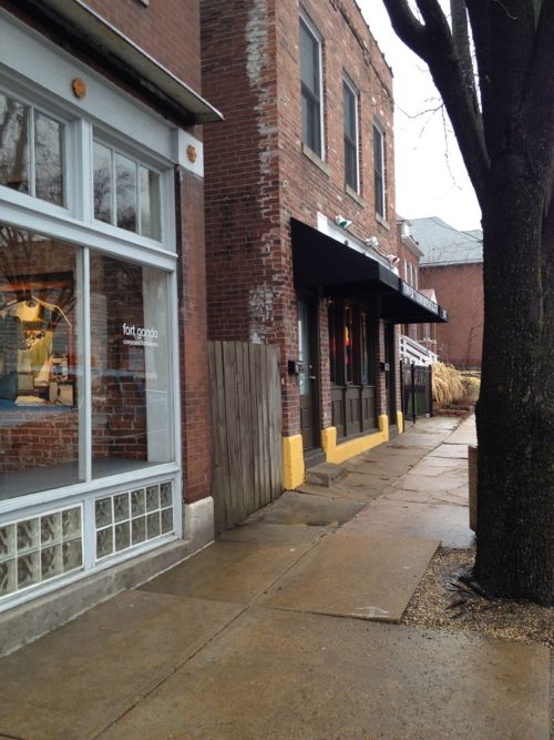
ABOVE: Tower Tacos at 3147 Cherokee is in the middle of a block, click to view in Google Maps

This side of Cherokee between Compton Ave on the west and Michigan Ave on the east contains seven buildings. At a casual glance I didn’t give much thought to them, they all looked like they were from the same period. Out of curiosity I decided to find out using Geo St. Louis, “a guide to geospatial data about the City of St. Louis.” What I found out was these seven buildings were built over a 17-year period (1896-1913):

  1. The first, 3137 Cherokee, was built in 1896 , a two-flat originally. This was the second lot from the east, not the corner.
  2. In 1905 a brick one story house was built to the lot to the west, at 3139 Cherokee. For nine years the other house stood alone, unless previous structures existed on this block.
  3. In 1909 a corner storefront was built next door to the east at 3133 Cherokee. This is the corner at Michigan Ave. Now we’ve got three buildings in a row.
  4. Also in 1909 a 2-story with first floor storefront space was built at 3147 Cherokee. This skipped a lot. This is now Tower Tacos
  5. A year later, 1910,brick 4-family was built at 3143-45 Cherokee filling in the gap left the previous year. Five buildings now in a row.
  6. In 1911 2-story with two storefronts and two flats was built on the next lot at 3151 Cherokee.
  7. Finally in 1913 a large 2-story  building with storefronts & flats was built at 3155-59 Cherokee, finishing the block at Compton Ave.

It’s possible earlier frame or soft brick buildings existed on this block but I have no knowledge of such. The point? Development, residential & commercial, used to be done a building at a time based on demand. The financing package was limited to buying the lot and building a single structure.

Today all 42 buildings on city block 1502 would have been built at once — or at least in the same development package. After the first developer goes under someone else would come in to finish building on the remaining vacant lots. All the buildings would have the same basic look, the exact same brick color and the same setback from the sidewalk. Boring.

The days of people buying lots and building their own home are long gone but in parts of the country it’s not uncommon for a developer to create building lots and then have many builders buy those lots. Some would get built on a speculative basis and some would be custom for a specific buyer. For filling in vacant parts of the city I’d like to see us try the idea of separating the development of build-able lots and the construction of new buildings.

– Steve Patterson

Where Josephine Baker Grew Up


I love the Post-Dispatch’s “A Look Back” series of photographs and articles. I eagerly read the recent story on St. Louis native Josephine Baker (1906-1975) and one sentence stood out:

“She told the Post-Dispatch in 1950 that she began dancing for friends in her home at 2632 Bernard Street, in an area obliterated for Highway 40.” (STLtoday.com)

Anytime I see an address my instinct is to look it up on Google Maps, but it was “obliterated for Highway 40.”  So I went to the University of Missouri’s Digital Library to look it up on the Sanborn Fire Insurance Co maps in their collection.

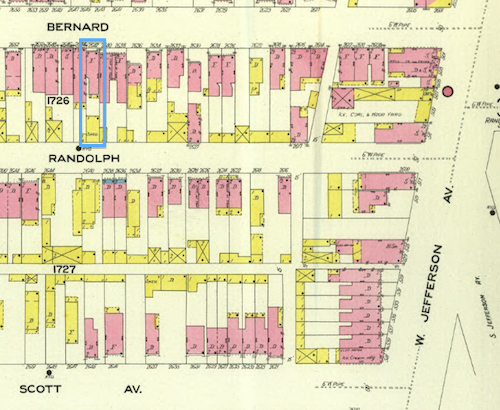
ABOVE: I've highlighted Josephine Baker's childhood flat in blue in the upper left, Sanborn map from University of Missouri Digital Library, click image for access

Jefferson Ave & Scott Ave both still exist (map) but Randolph & Bernard are no longer part of the street grid. But looking at the map it wasn’t clear her house and neighborhood were razed for the highway, it looked just south of the highway.

Next I went to HistoricAerials.com to try to find an aerial photograph prior to demolition. The oldest photo they have for St. Louis is 1958 so I wasn’t certain. But prior to 1967 the expressways from the west merged onto eastbound Market Street near Compton Ave. Sure enough her flat was just south of the highway right-of-way. Like streets next to I-44, Bernard would have only had houses remaining on the south with the north part of the highway. But Baker’s childhood flat was on the south, not the north.  Thus, her flat wasn’t “obliterated for Highway 40” as the Post-Dispatch wrote.

In the 1971 image for the same location looks like

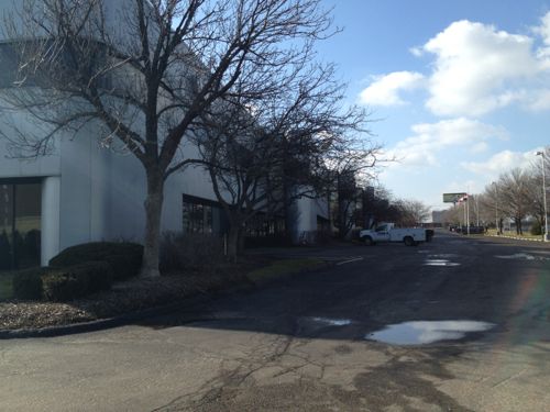
ABOVE: The St. Louis Business Center stands on what was part of Baker's childhood neighborhood

City records show the four buildings of the St. Louis Business Center were built in 1986 — at least 15 years after the area was razed.

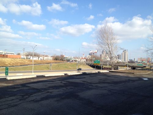
ABOVE: View of highway and downtown from what used to be Baker's street

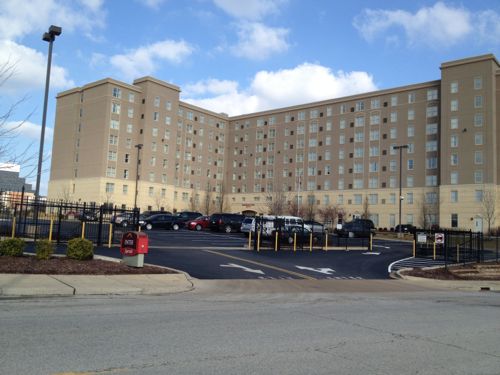
Baker’s flat was probably about on the dividing line between the 80s business center and what’s now a Marriott hotel, built in 2004.

ABOVE: The automobile entrance to the Marriott is off Scott Ave, no pedestrian access is provided, a clear violation of the ADA

Before the Marriott, a Napa auto parts warehouse was located on this site.

So now I’m curious to find out just when the houses on these blocks were razed. Baker was already world famous when the wrecking ball destroyed where she lived.  Did anyone suggest saving her flat as a historic site?  Were St. Louisans upset Baker refused to perform in St. Louis prior to 1952 because she wouldn’t perform for segregated  audiences?

– Steve Patterson

Advertisement


[custom-facebook-feed]

Archives

Categories

Advertisement


Subscribe