This is the fifth post in a series looking at potential development sites along the proposed initial route of the St. Louis Streetcar. The first four parts were:
This post will cover the 0.6 mile stretch of Olive from Jefferson to Compton (map). Let’s start with the North side of Olive at Jefferson:
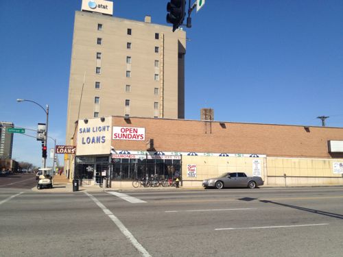
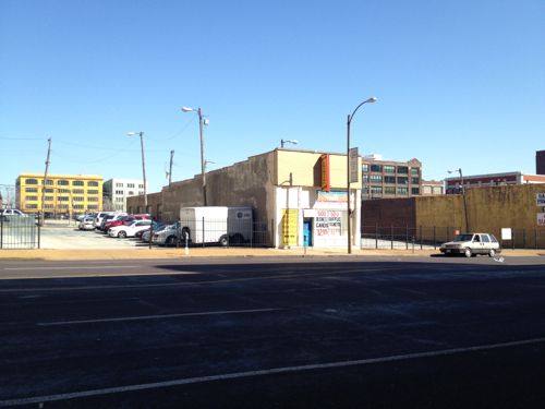
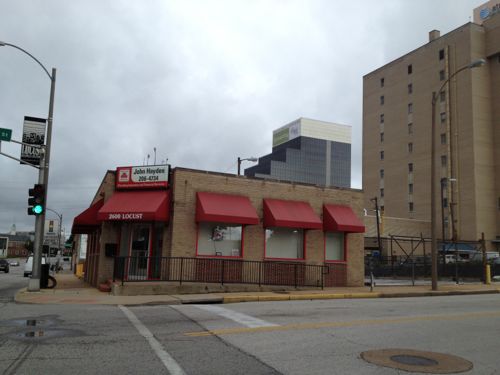
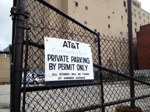
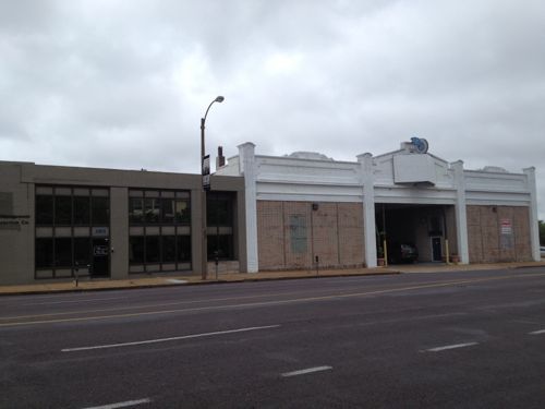
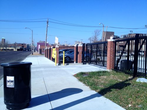
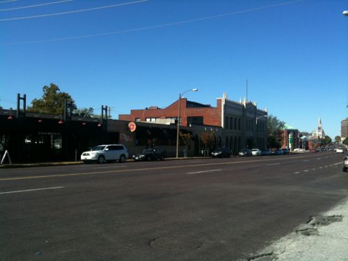
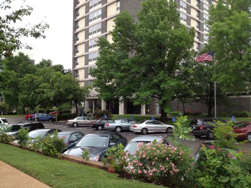
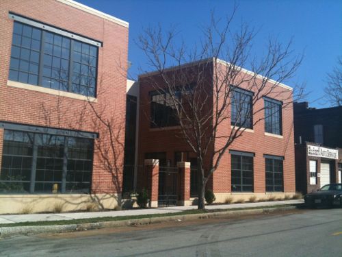
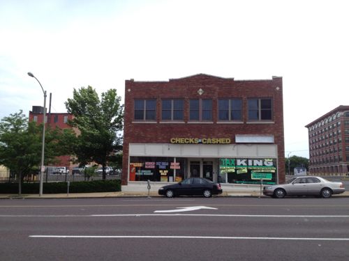
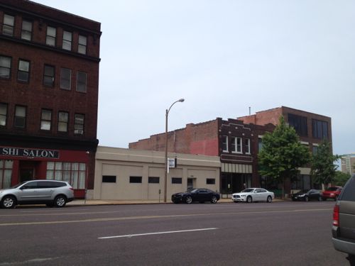
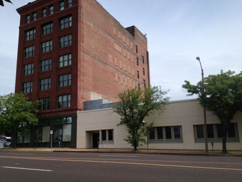
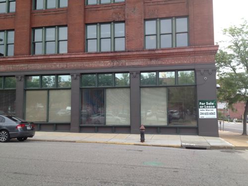
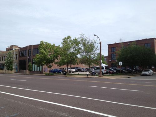
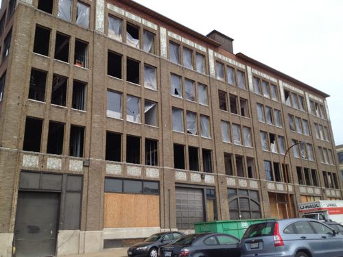
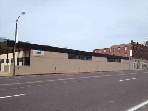
2601 Olive, well known as Sam Light Loans, was built in 1924, according to city records. I wonder if the building got a makeover in the 40s or 50s, it looks too modern foe the 20s.I posted about 2617 Olive in March 2012, it dates to 1883. Click image to see my prior post.AT&T recently built an addition on the long-vacant lot at 2621 OliveThat addition was on the east side of this AT&T Communications building at 2651 OliveThe small insurance office at Locust & Jefferson was built in 1956.AT&T owns much of the block on both sides of Locust, used for parking.Across the street is more AT&T parking on the left. Loft apartments on Washington Ave can be seen in the background.The Wells Fargo lot between Beaumont & Leffingwell could be easily developed if many employees begin riding the streetcar. Perhaps give them the option of a parking pass or a transit pass… More on Wells Fargo when I get to the south side of Olive below.The building on the left is from 1929, the one on the right from 1913. A vacant 30ft lot is to the right @ Leffingwell.2823 Olive was built in 1880, though set back from the street it would be an interesting contrast to keep this structure, while filling in on each side. The side on the left belongs to the next property to the west.This 1925 building at 2831 Olive would look even better with a new glass storefront….and a rooftop restaurantThe Castle Ballroom should get renovated with a streetcar right out front. Click image to see my post from 2011.These buildings in the 29xx block of Olive no longer look like they did 100+ years agoThe Locust Business District recently completed a fenced surface parking lot, this needs to be replaced ASAPThe Treasurer’s parking lot at 3019 Olive also needs a building, not a garage.At Cardinal Ave we have a one story structure from 1997, too new to replace right awayThe last buildings on the north side of Olive before Compton
Some existing buildings aren’t as tall as would be nice but their age/height will be a nice contrast to the new construction we should see go up over the twenty years. In short, lots of opportunities for new construction on vacant land.
OK, let’s cross Olive at Compton and return east to Jefferson. It would be impossible to look at this section of the proposed route without discussing the urban renewal clearance of Mill Creek Valley:
By World War II, Mill Creek’s tenements and faded town houses were home to nearly 20,000 people, many of them poor blacks who had migrated north from the cotton fields. More than half the dwellings lacked running water, and 80 percent didn’t have interior bathrooms.
Tucker proposed knocking over nearly everything and starting over. In 1955, city voters overwhelmingly approved a $10 million bond issue for demolition, on the promise that the federal government would reimburse most of it. The local NAACP endorsed the idea. Work began on Feb. 16, 1959, at 3518 Laclede Avenue, where a headache ball smashed a house that dated to the 1870s.
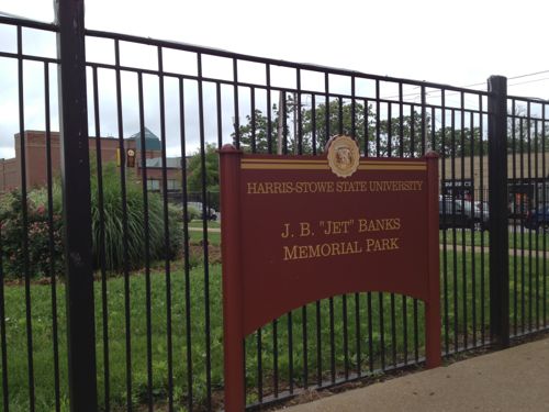
The bulldozers swiftly transformed the city’s “No. 1 Eyesore” into an area derided as “Hiroshima Flats.” Among the few buildings spared was the old Vashon High School, now part of Harris-Stowe State University. When work began in 1961 on University Heights Village apartments, only 20 original families still called Mill Creek home. (stltoday.com – A look back • Clearing of Mill Creek Valley changed the face of the city)
The area from Union Station to Grand was cleared. This area got new construction like the A.G. Edwards HQ, now Wells Fargo Advisors, LaClede Town (razed), Heritage House senior apartments, and the “flying saucer” gas station on Grand at Forest Park, now a Starbucks. n
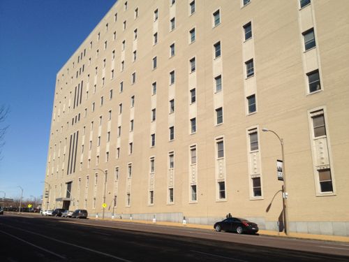
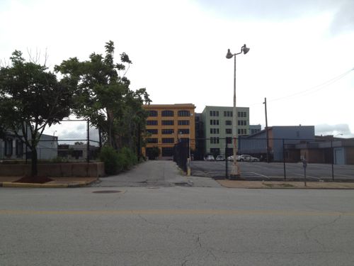
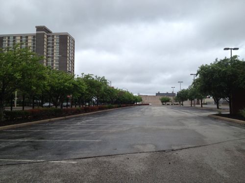
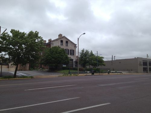
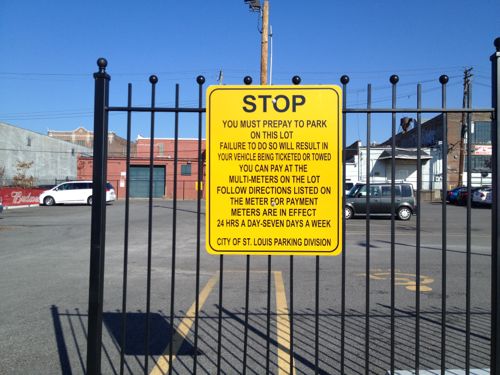
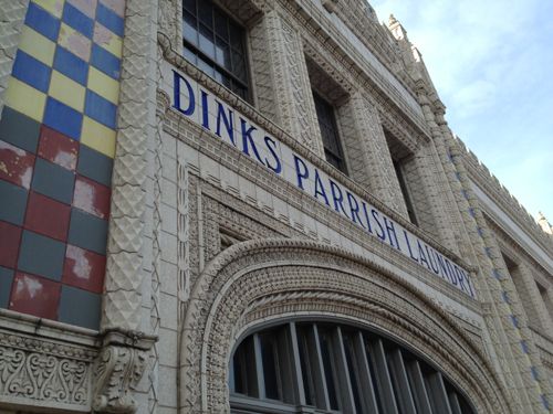
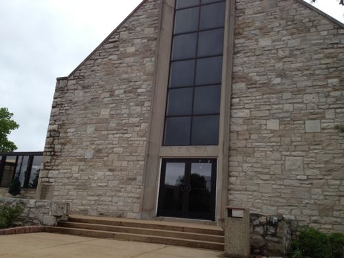
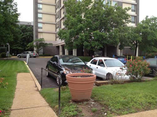
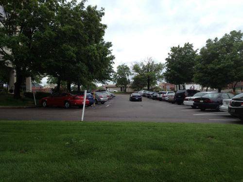
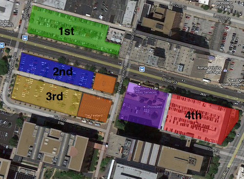
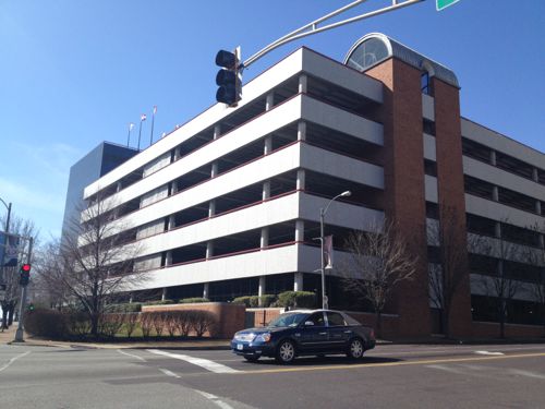
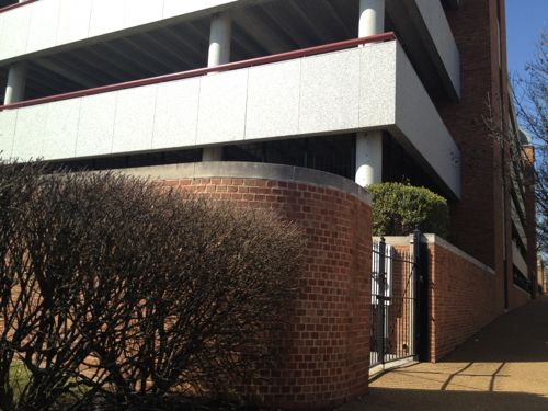
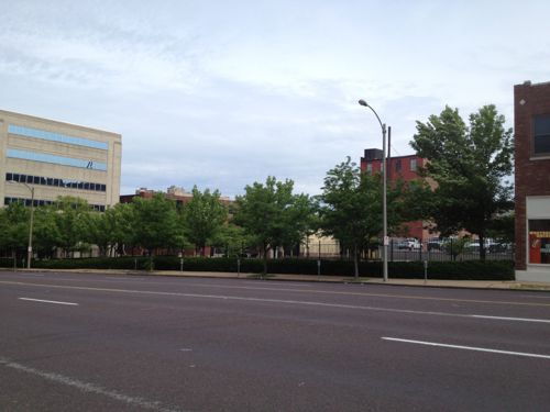
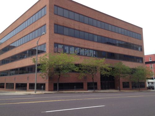
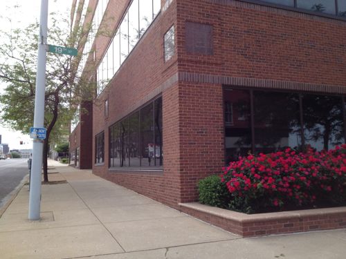
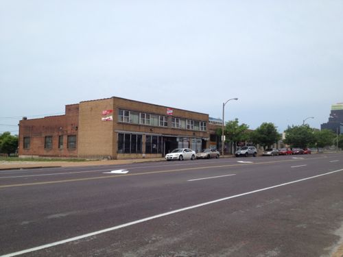
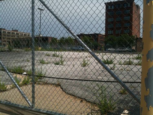
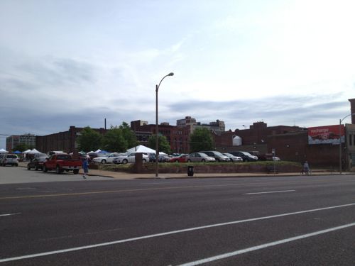
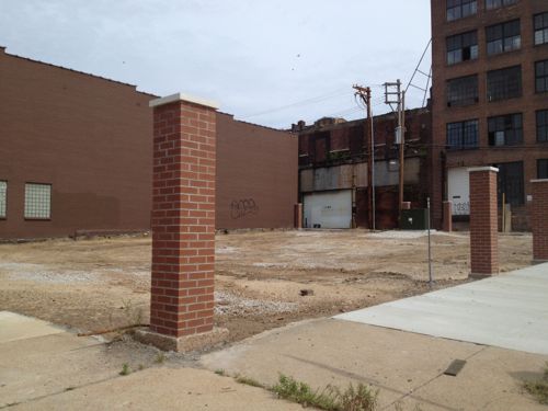
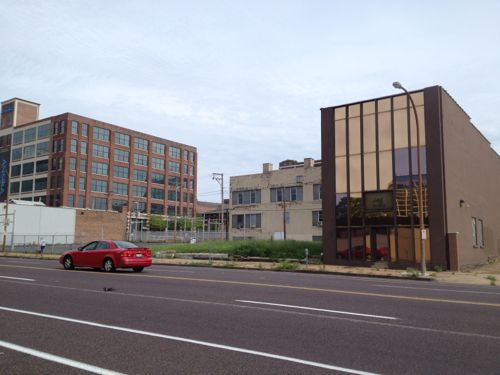
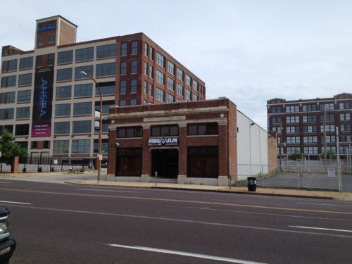
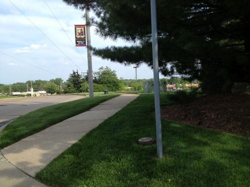
The block between Cardinal & ComptonThis facade was built after the front of the building was removed when Olive was widened. I’d like to see this endureA pocket park along the route would be nice, if it could be accessed.The former Berea Presbyterian Church is now a SLU event spaceThe central glass on the front of this church always looked too modern but I never knew the story.February 1909 Sanborn Map showed the stone (blue) church at 3015 Pine (vacated), between Garrison (vacated) on the east and Cardinal (dead end) on the west. The end facing Olive today was the back! Click image to see more of this map.I’d like to see Pine St replatted from Jefferson to Compton, it would go right through here.Sigma-Aldrich owns the land from the old church to Ewing. Given how the land is platted and fenced it appears they’re leaving a strip along Olive for future development.Ewing Ave looking south toward Market. Wells Fargo Advisors on the left, Sigma-Aldrich on the right. This too-wide street should be lined with storefronts catering to employees of both businesses, as well as students, faculty, & staff at Harris-Stowe, and residents at Heritage House.A non-propfit was formed in 1964 to build & operate low-income senior apartments, Heritage House opened in 1967.The building is well maintained but not well connected to OliveI’d like to see an addition between the sidewalk and tower with underground parking, street-level retail, 2nd floor apartments.An alley remains between Olive & Pine. I can imagine both sides being infilled over the coming decades, see diagram below.My thought of the order Wells Fargo might instill parking lots and finally raze a parking garage. The two orange squares are owned by the Beffa family, the purple by Provident.A parking garage for Wells Fargo Advisers dominates the intersection of Jefferson & Olive.A brick wall sorta hides equipment
I’m excited about the possibly having a modern streetcar line a block away from my loft, but the redevelopment potential in midtown is phenomenal. I’ve been losing sleep for the past week as I picture what this could look like at full build out. The vision must come before the bricks and mortar.
I’m not a preservationist, though I often favor saving old buildings. I do so because they frequently exhibit the urban qualities I think creates a desirable built environment, while new construction rarely has any qualities I find redeeming. Still, new construction is a must. But what should it look like?
[Reporter Tracy] Smith asked Paul Goldberger, architecture critic for Vanity Fair, how we decide what to save: “We want to save the best of every period, ideally,” he replied. “We also want to protect certain kinds of neighborhoods — like Beacon Hill in Boston, or Georgetown in Washington. That’s really important.
The dark underside of historic preservation is that we often preserve not so much because we love what we’re protecting; it’s because we fear what will replace it,” he continued. “And, unfortunately, we’ve been right a lot of the time.” (CBS News)
True, replacements for old urban buildings have often been urban disasters, turning their back on the sidewalk or placing vast surface parking lots between the sidewalk and entrance. In St. Louis if new construction is wrapped in red brick it often gets approved, regardless of form, proportion, etc.
New Town at St. Charles mimics older buildings in St. Charles & St. LouisThis 2008 building at Park Ave & Dolman near Lafayette Park is urban, but not detailed to convince anyone it is old. Or is it?
The CBS story showed new buildings that looked old, well enough to fool many. Some buildings around Lafayette Park are this detailed. Do you think that is good, bad or do you even care?
The poll this week is a rather philosophical one, a question of your aesthetic viewpoint. How do you think new construction should look? The poll is in the right sidebar, you can create your own answer if you don’t like the ones I’ve provided. I’ll present the results on Wednesday June 12th, along with my thoughts on the topic.
In March I posted about a new grocery store on the edge of downtown Springfield IL (map) that anticipated many customers on foot, but they expected these pedestrians to either use the automobile driveways or walk over curbs and through grass & lots of parking. A few days after my post, Springfield Journal-Register columnist Dave Bakke wrote Some criticisms of Springfield justified mentioning my criticism, later Bakke followed up with Critique of Springfield’s image touches nerve.
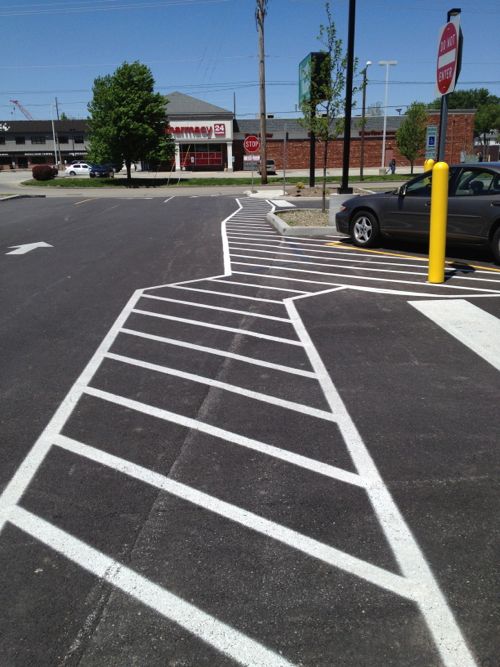
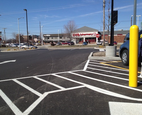
Here’s what customers leaving the entrance facing Carpenter see now.Back in March the New County Market near downtown Springfield didn’t have a route for pedestrians to/from the public sidewalk. The only provision was to reach disabled parking.
From this angle the change isn’t significant, no paint on asphalt will keep a distracted driver from hitting a pedestrian. But look out toward the street and you’ll see new concrete.
From the public sidewalk you can see the new route they added so pedestrians don’t have to compete with cars.
I appreciate the after the fact gesture, but this is a good example why pedestrian access, just like automobile access, must be planned from the beginning. The new concrete walk does not meet ADA guidelines, it is too steep in places. I didn’t have my digital level with me on our Mother’s Day trip, but I could tell by walking it.
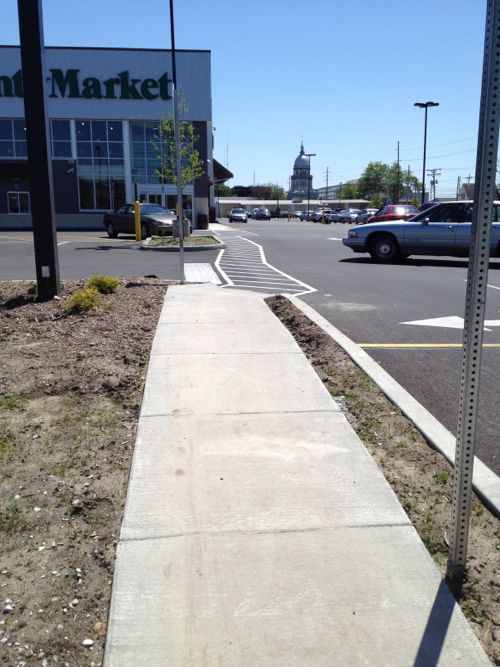
This route shown above is a consolation prize for pedestrians, it connects to Carpenter St only, not to 2nd St. Even if they retrofitted a route to 2nd it still wouldn’t be considered pedestrian-friendly. As I pointed out in my original post, the County Market in Champaign-Urbana is the model that should’ve been built in Springfield. It was built on a corner with direct access from both sidewalks. It also has a parking lot behind the building, with another entrance. Same number of entrances as the Springfield location, just arranged so customers arriving on foot or car are equally accommodated.
From the mezzanine you can see the route able-bodied pedestrians will likely take, cutting across the parking lot at a diagonal.
Springfield, like St. Louis and most cities, should not allow parking between the public sidewalk and buildings in areas where they seek to be pedestrian-friendly. In all other areas where public sidewalks are present/required they should require developers to actually connect to them. Public sidewalks are not window dressing, people actually use them.
If motorists were treated like pedestrians, no parking lot would have a driveway connecting to the public street. You’d be forced to drive over multiple curbs and through grass. All cars could be able to enter & exit, but 4X4 vehicles would have an easier time. While people could use parkings lot this way, they’d soon realize it wasn’t friendly and is potentially damaging their vehicle. Those with high-clearance SUVs wouldn’t understand why a person driving a vintage MG Midget would complain, besides how often do you see one of those on the road… Why build costly driveways for the few people who have low cars?
Municipal zoning & building codes in cities coast to coast go to great lengths to detail every aspect of our arrival at developments by car: driveways, width of aisles, parking space dimensions, number of spaces, etc. Few say a word about arrival on foot.
It is no wonder so few people walk given our built environment.
With the north-south section covered, I’ll resume heading west on Olive starting at 18th. For information on properties I checked city records on GEO St. Louis, it is generally reliable.
1800 Olive, built in 1962, contributes nothing. It is owned by the Salvation Army, which owns the Railton Apartments next door.The one-story White Knight Diner at 1801 Olive dates to 1954, but it makes a positive contribution to the public realm. This place was featured in the 1990 film “White Palace” with Susan Sarandon & James Spader, click image for more information on this film.MERS/Goodwill owns much of this city block
b
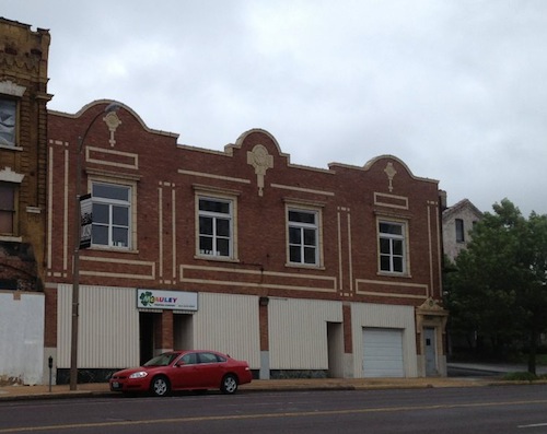
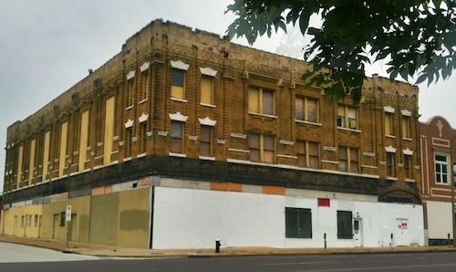
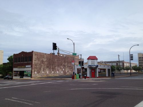
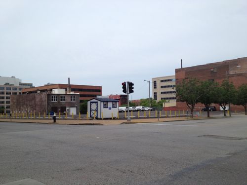
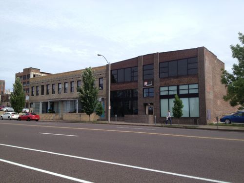
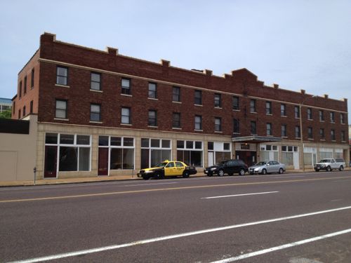
The Currency Exchange owns the building at 1809 Olive, it has no off-street parking despite being surrounded by parking. It was built in 1926.The surface parking lot between the Currency Exchange and 19th Street belongs to the police, came with the building that’ll be the new HQ next year. This reduces development potential unless they can get by with the parking located within the building.This building faces Olive, 19th, & Pine. It was most recently a charter school.It should become occupied and hopefully altered, see below.A doorway could be added to to enter the ground floor from Olive without a need for a ramp or steps. This could be for retail and/or restaurant.Four buildings, four owners. Three from 19th century, one 20th century. The beige one-story building is from 1896, but it has been significantly altered.The large parking lot fronting Olive, 20th & Pine is owned by an out of state entity, it should be more valuable developed.2001 Olive was actually built in 1892, as a one-story building with 4 storefronts facing Olive and 3 facing 20th. By 1909 it was surrounded by taller buildings. Click image to view 1909 Sanborn map.The narrow building at 2011 Olive was built in 1919. The empty lot on the east (right) is owned by the owner of the previous building.This space at 2015 Olive is west of the previous building and has the same owner. This would make s nice patio/beer garden.The rest of this block-face to 21st is these two buildings with the same ownership. The one on the left was built in 1903, the former Hamilton-Brown Shoe Factory. The one-story building on the right is from 1955. A taller building could replace the one on the right.The 3rd floor is for lease but offices occupy the ground floor. The owner occupies much of the building, perhaps they can reconfigure so the ground floor becomes restaurant/retail space.The remaining buildings on the south side of Olive, west of 20th, were built in 1926. This is within another proposed Northside Regeneration job center.The block bounded by Olive, Pine, 21st, & 22nd, was cleared for the unbuilt 22nd Street Parkway. 21st & 22nd were vacated, these should be reopened.St. Louis Brewery, owner of the Tap Room, owns this parking lot at 21st & Olive. Easily developed or turned into a beer garden.Both of these buildings have the same owner and have been renovated within the last 5-10 years. Not sure if additional floors are an option.The State of Missouri owns the vacant land at 22nd, part of the 22nd Parkway right-of-way.I’ve long thought 22000 Locust was ripe for redevelopment. May 2010 photo.It’s getting renovated into apartments right now, click image for more information.Unfortunately the corner lot at 2201 Olive, just cleared of a non-urban building, will become a new surface parking lot for the apartment development.The building at 2209 Olive (right) was built in 1906, but you can’t tell it. Expect lots of changes in this block.The 1922 building at 2231 Olive contributes to the Locust Olive Historic District, click image for nomination.
b
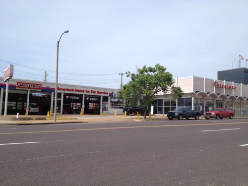
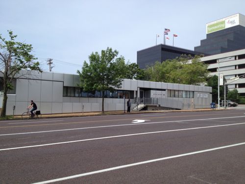
2200 Olive occupies a large parcel of land. The largely blank walls were common in 1963 when it was built.The Lincoln Arms Hotel, built in 1928, provides low rent rooms by the week, serving a niche market. Walk by in the summer and the smell is awful. The physical form is ideal along a streetcar line.Firestone owns this location built in 1964, not sure if they’d cash out the real estate.I’d long assumed this surface parking lot belonged to the company in the building across the alley.This 1968 building at Olive & Jefferson is interesting, but also low-density.
There are many more development sites, to the north & south, between 18th & Jefferson. I expect this to be a high activity area for development.
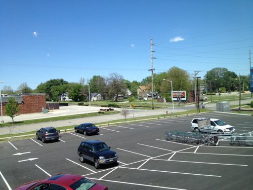
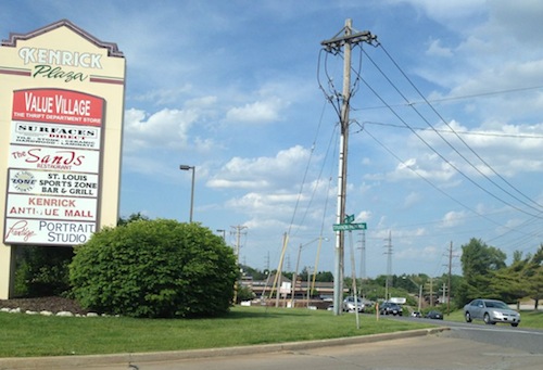
I’m not a fan of Walmart, but this post isn’t an attack on the Walmart business model. Instead the purpose of this post is to show how the redevelopment of Kenrick Plaza (map), proposed by G. J. Grewe, as presented, will not meet the minimum requirements of the Americans with Disability Act of 1990 (ADA).
First let’s take a quick look at the area:
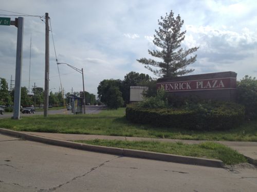
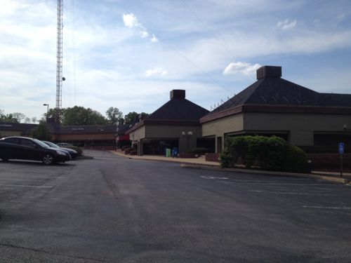
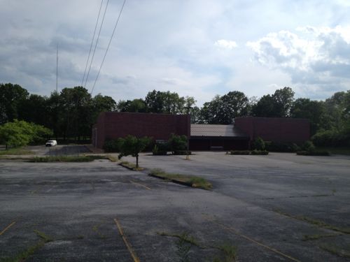
Sign for Kenrick Plaza at Watson Rd and Trianon Parkway Drive, looking eastSign at Trianon Parkway Drive, looking westbThe now-closed Kenrick Cinema is located on the west side of Trianon Parkway.
A report prepared by PGAV details how Kenrick Plaza is in bad physical condition, the layout doesn’t work well (former Burger King blocks views of retail space behind, etc.) and it doesn’t work for people with disabilities.
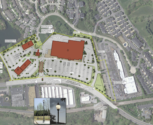
Here’s the proposed site plan, which includes cutting off public access to Watson Rd for many houses, leaving one entrance off of Laclede Station as the sole way in and out, with an exception for cutting through the private “lower Kenrick Plaza” area.
Proposed site plan, click image to view larger version on Scribd.
The Comprehensive Plan for the City of Shrewsbury (the “Comprehensive Plan”) dated March 1970, designates the land use for the Area to be commercial. The Comprehensive Plan, drafted as the Kenrick Seminary lands became open for development, envisioned the land uses immediately adjacent to Watson Road as a commercial corridor that would bring the City’s percentage of commercial land up to 10.4% from a meager 3%. The City was heavily dominated by residential and institutional uses and lacked significant commercial acreage.
The Comprehensive Plan was followed in the original construction of Kenrick Plaza as a commercial district supporting the surrounding residential development that largely lacked retail, entertainment, and restaurant options within close proximity. Also accommodated in the Comprehensive Plan was the construction of one or more television towers. This redevelopment plan maintains the Area as commercial land use consistent with the Comprehensive Plan and accommodates the existing television tower. The map depicting future land use included in the Comprehensive Plan specifically and clearly designates the Area for commercial land use.
Oh good, it complies with the 1970 “Comprehensive Plan”! Apparently nothing in Shrewsbury has changed in the last 43 years. I want to point out a few big red flags about this proposal:
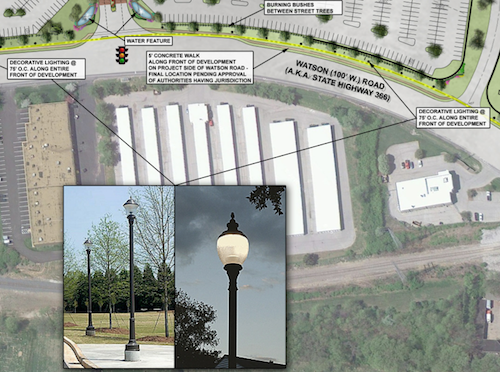
A sidewalk along Watson Rd with “decorative lighting” every 75 feet but you must walk in the auto driveways if you want to shop.Residents used to driving/walking to Watson Rd will no longer be able to do so, nor can they or their kids/grandkids walk to the store to get bread & milk.View looking south toward Watson along Trianon Parkway from the last side side street before access to be cut off.
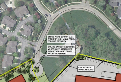
Shrewsbury should be requiring more connections, not fewer.
206 Accessible Routes
206.1 General. Accessible routes shall be provided in accordance with 206 and shall comply with Chapter 4.
206.2 Where Required. Accessible routes shall be provided where required by 206.2.
206.2.1 Site Arrival Points. At least one accessible route shall be provided within the site from accessible parking spaces and accessible passenger loading zones; public streets and sidewalks; and public transportation stops to the accessible building or facility entrance they serve.
EXCEPTIONS:
1. Where exceptions for alterations to qualified historic buildings or facilities are permitted by 202.5, no more than one accessible route from a site arrival point to an accessible entrance shall be required.
2. An accessible route shall not be required between site arrival points and the building or facility entrance if the only means of access between them is a vehicular way not providing pedestrian access.
Advisory 206.2.1 Site Arrival Points. Each site arrival point must be connected by an accessible route to the accessible building entrance or entrances served. Where two or more similar site arrival points, such as bus stops, serve the same accessible entrance or entrances, both bus stops must be on accessible routes. In addition, the accessible routes must serve all of the accessible entrances on the site.
Advisory 206.2.1 Site Arrival Points Exception 2. Access from site arrival points may include vehicular ways. Where a vehicular way, or a portion of a vehicular way, is provided for pedestrian trvel, such as within a shopping center or shopping mall parking lot, this exception does not apply.
206.2.2 Within a Site. At least one accessible route shall connect accessible buildings, accessible facilities, accessible elements, and accessible spaces that are on the same site.
EXCEPTION: An accessible route shall not be required between accessible buildings, accessible facilities, accessible elements, and accessible spaces if the only means of access between them is a vehicular way not providing pedestrian access.
Advisory 206.2.2 Within a Site. An accessible route is required to connect to the boundary of each area of sport activity. Examples of areas of sport activity include: soccer fields, basketball courts, baseball fields, running tracks, skating rinks, and the area surrounding a piece of gymnastic equipment. While the size of an area of sport activity may vary from sport to sport, each includes only the space needed to play. Where multiple sports fields or courts are provided, an accessible route is required to each field or area of sport activity. (2010 ADA Standards)
In short this says it is ok to require pedestrians to use an auto drive to a facility like a Starbuck’s but that exception isn’t applicable to a shopping center. Elsewhere in the same link as above, the term “shopping center” is defined as:
(A) A building housing five or more sales or rental establishments; or
(B) A series of buildings on a common site, either under common ownership or common control or developed either as one project or as a series of related projects, housing five or more sales or rental establishments. For purposes of this section, places of public accommodation of the types listed in paragraph (5) of the definition of “place of public accommodation” in section § 36.104 are considered sales or rental establishments. The facility housing a “shopping center or shopping mall” only includes floor levels housing at least one sales or rental establishment, or any floor level designed or intended for use by at least one sales or rental establishment.
Developer G. J. Grewe and Architect TRi should be ashamed for submitting such a plan, this isn’t 1970 despite the fact Shrewsbury’s comprehensive plan hasn’t been updated.
As I was finishing this post yesterday I received an email from Shrewsbury Mayor Felicity indicating “accessibility is being addressed with sidewalks from the bus stop to the stores.” The site plan on the Shrewsbury website is a preliminary concept. I requested an updated copy but I have not received it.
UPDATE 5/22/2013 @ 3:30pm:
At 3pm I received from Shrewsbury Director of Administration, Jonathan Greever, a PDF copy of “of the current special use permit site plan. This document is limited in that it does not address the entire site and its intended use is not for construction. The purpose for this document is different than that of a fully engineered plan. As stated previously, the final engineered plans have not been generated.” You can view it on Scribd here.
AARP Livibility Index
The Livability Index scores neighborhoods and communities across the U.S. for the services and amenities that impact your life the most
Built St. Louis
historic architecture of St. Louis, Missouri – mourning the losses, celebrating the survivors.
Geo St. Louis
a guide to geospatial data about the City of St. Louis