In the first two parts of this series on development sites along a proposed streetcar route I looked at Olive from 15th-16th and Olive from 16th-18th. In both cases it was a small area and I looked a specific buildings and parcels of land. Heading to N. Florissant Ave. & St. Louis Ave. nearly everything is a development site.
Let’s start downtown and work our way north. At 14th & Olive you have the library on the NE corner and the library administration building & a charter high school on the NW corner. I think the library admin building has office space available for lease.
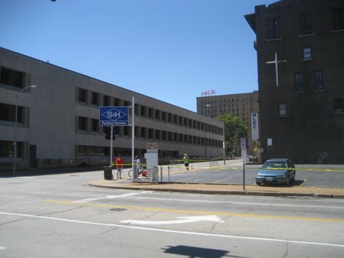
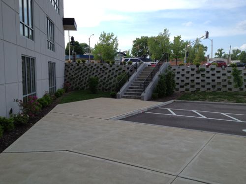
The parking lot at 14th & Locust is privately owned, a good candidate for new construction. Photo is from 2007 before the charter school added another floor to their space on the left.1400 Washington has had numerous development plans, it is now becoming a parking lot, same owner as the previous lot across the alley.I’d like to see these two buildings on Washington Ave west of 14th get renovated, along with a thin wedge between the east wall and 14th. Photo from 2011.
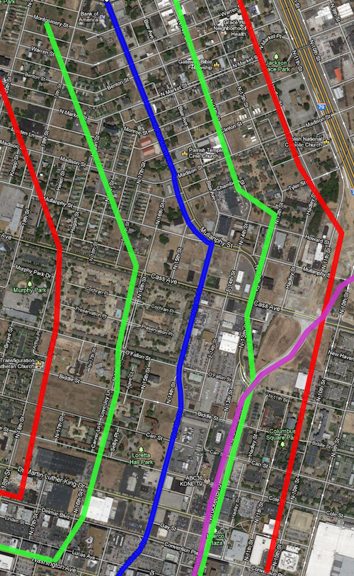
Before we go any further north it makes sense to look at the route on a map along with a development zone on each side of the line. Light rail has stations miles apart, whereas streetcars are more like buses by having more frequent stops along the route.
The blue line is the proposed streetcar route, green about 660ft (1/8th mile) and the red about 1,320ft (1/4 mile). Purple is the new bridge connecting into Tucker. Click to view in Google Maps.
The area between the green lines is the immediate area that I estimate to be part of a special transportation district with slightly higher property taxes, pro-rated based on distance. The red lines are a quarter mile distance, the usual distance a person is willing to walk.
Quite a bit of this area is in what will be one of the Northside Regeneration job centers.
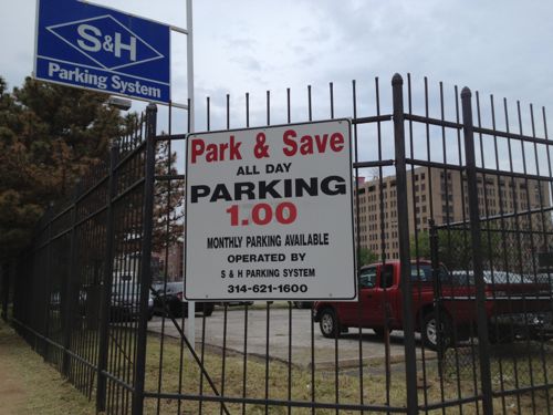
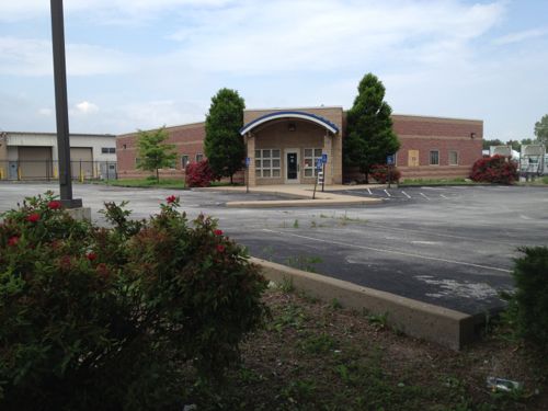
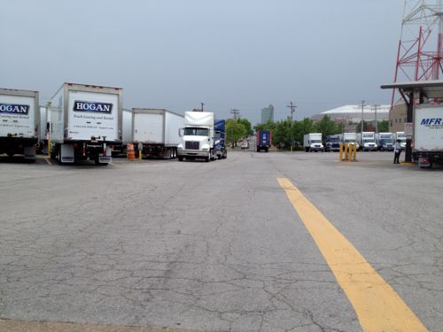
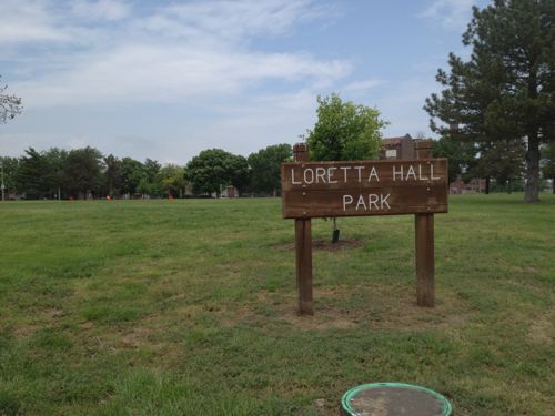
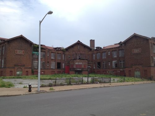
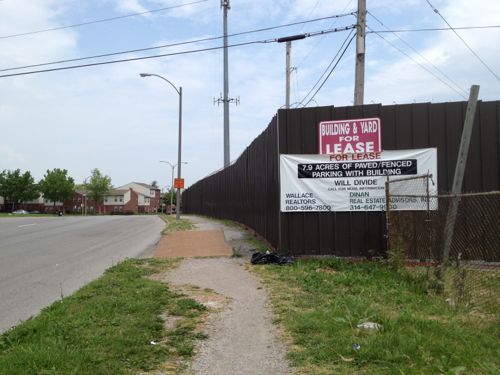
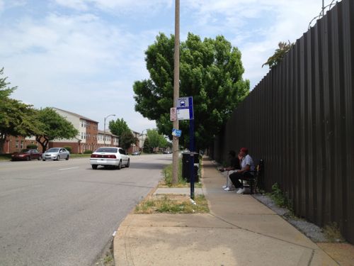
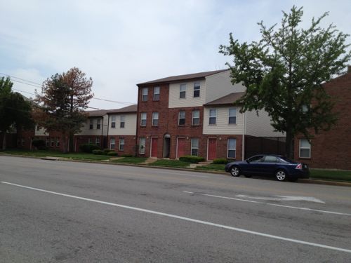
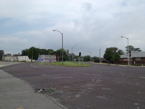
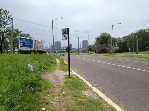
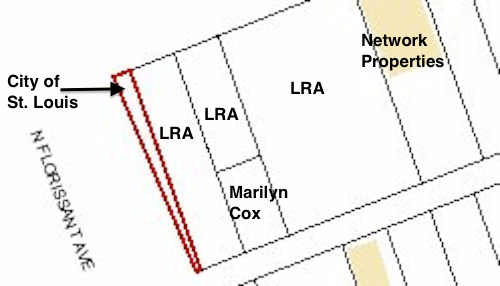
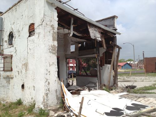
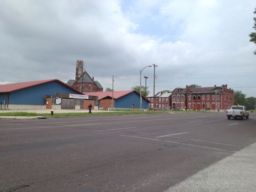
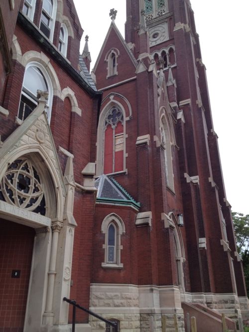
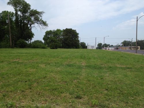
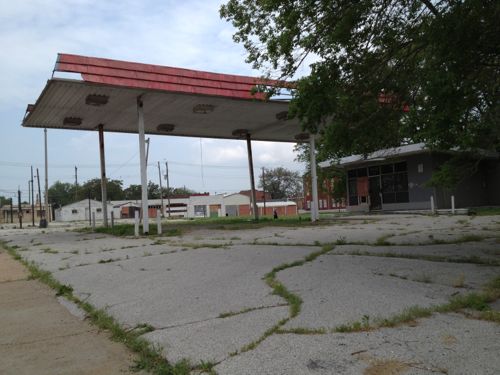
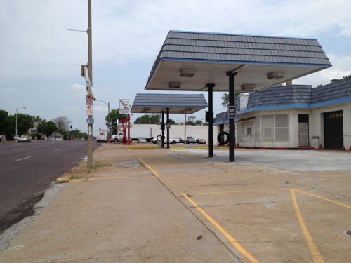
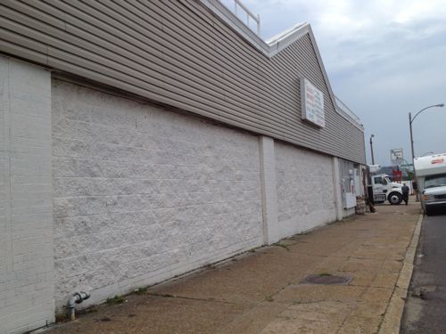
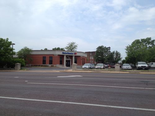
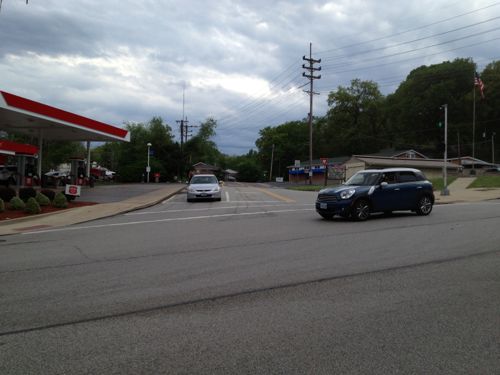
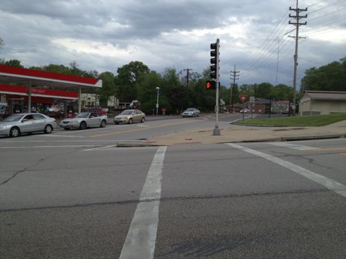
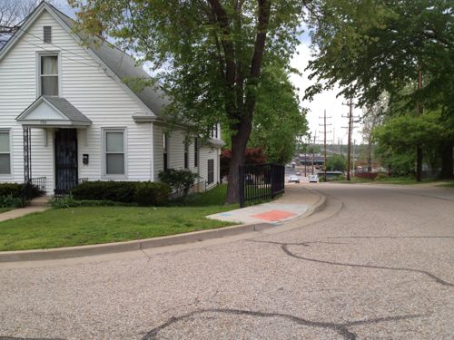
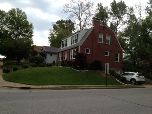
Numerous parking lots occupy significant land north of Washington Ave, ideal candidates for new construction.A former BarnesCare building built in 2001, is now vacant. With no pedestrian access and large setbacks from both MLK & 14th this building should be razed and a new urban building constructed on the site.Hogan Trucking uses two city blocks, Carr St has been vacated. Interestingly the property owner is listed as Hogan Redevelopment Corp.This site must legally remain a public park, as it has been since 1842. Click image for more information.Many would love to see the crumbling Carr School get renovated. Click image for more information on this 1908 structure.7.9 acres ready for development, the original lot boundaries remain since they were never consolidated.The 14th & O’Fallon St bus stop is always busy, but that hasn’t spurred development to date. This stop is currently served by the #32 & #74 MetroBus routesOn the west side of 14th, south of Cass, is the O’Fallon Place Apartments owned by McCormack Baron Salazar.Looking NW on N. Florissant from 14th, vacant land and mostly vacant buildings are all around.The Mullaphy Emigrant Home at 1609 N. 14th could finally get renovated if the streetcar connects the near-north side to downtown. Click image for more information on this historic structure.Looking back toward downtown we see evidence of disinvested in the area along N. Florissant near Madison St. The city says property owners are responsible for sidewalks but in this case the city is the property owner.The City of St. Louis is the legal owner of the 668 sq ft wedge-shaped lot at 1458 Madison St.This small building at 2100 N. Florissant Ave was built in 1906, the owner is in St. Louis County.A bank in Illinois now owns the unfinished daycare at 1501 Clinton & 1500 Monroe. The buildings to the north are owned by several owners, including the LRA & Northside Regeneration.The mostly vacant St. Liborious complex at Hogan & North Market is a city landmark, it is privately owned. Click image for more information.Vast open areas are prime for redevelopment along the proposed streetcar route. This is north of North Market on the west side of North FlorissantThe vacant gas station at 2418 N. Florissant was built in 1972.Two blocks north at 2618 N. Florissant is another vacant gas station, this building has been modified many times since 1938.This building, owned by a person in Atlanta GA, needs to be replaced. The Church’s Chicken could operate out of a storefront in a new building.This building from 1940 should be replaced.This bank was built in 1993 after the urban bank at the corner of N. Florissant & St. Louis Ave was razed, despite neighborhood objections. This should be replaced with an urban building on the corner.The NE corner of N. Florissant & St. Louis Ave. had a cute diner until 1998
With so much vacant land & buildings, this stretch of the proposed streetcar line has the greatest potential for redevelopment. It will also be a challenge initially to get projects funded. Once the line is open and Paul McKee builds one of his job centers near Tucker & Cass things will start to take off. Form-based codes requiring dense urban design will be key to getting the right kind of construction.
It’ll take at least a decade, if not two, for this to be built out.
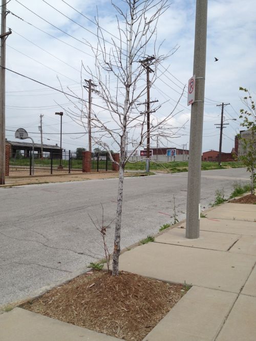
The Crown Food Mart at 1515 N. 13th opened in 2009, with street trees planted on all sides. Few have survived.
Nearly every tree around the property looks like this, completely dead.
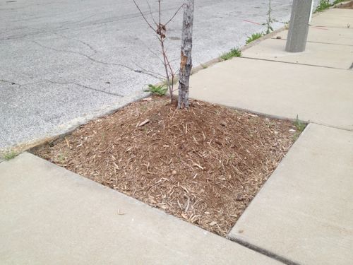
Some will say the city is a harsh environment for street trees, the road salt and chemicals used to clear snow & ice from streets is too much for new trees to handle. Perhaps, but when half the root ball is above the level of the adjacent sidewalk the tree is going to dry out and die. If it happens to survive it will eventually bust the sidewalk as shallow roots seek water.
These trees never had a chance for survival.
How should it be planted? Deeper!
A properly planted tree will have the root ball up to 4″ below the level of the sidewalk. Source: Arlington VA, click to view larger version.
I don’t know if a contractor for the new building or the city planted these trees, whomever it was did a poor job.
Every once in a while I run across a blatant ADA violation, usually when I’m trying to go somewhere in my daily life. This one I discovered purely by accident, while looking for a neighboring property on Google Street View.
From October 2008:
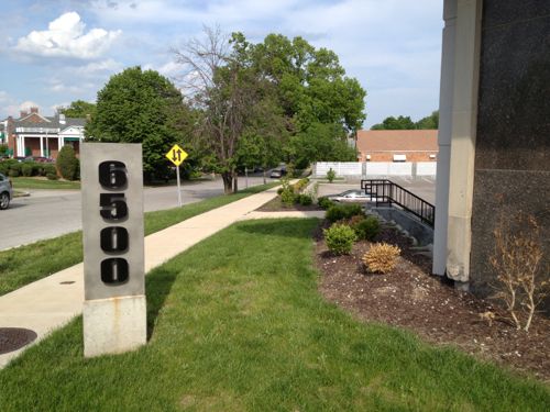
Owners of the vacant St. Louis Hills Office Center at 6500 Chippewa Street last week received preliminary approval from the St. Louis Board of Adjustment to do interior and exterior renovations on the five-story brick building.
In meeting with neighbors, they also have resolved some, but not all of the concerns of surrounding residents about traffic, parking and other issues.
The board required that cars going from the center’s parking lot into an adjacent alley turn right toward Chippewa. There also must be a privacy fence. (Suburban Journal)
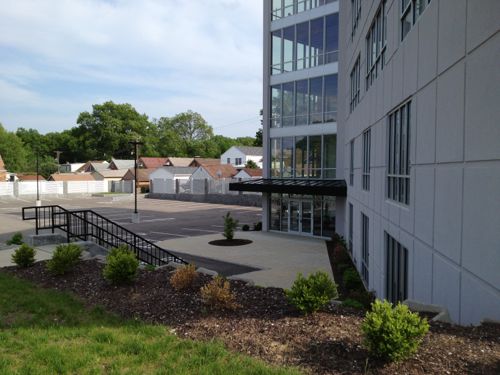
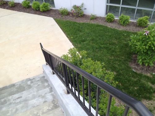
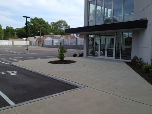
The wing had already been torn off by that point. Let me show you the problem…
The St. Louis Hills Medical Center facade facing Chippewa St.The original 1950s entrance wasn’t accessible to all.A few years ago a deteriorated wing was removed and new entry created.The new entry is accessible if you arrive by car and park in the parking lot.A route was provided for pedestrians to enter the building, but it contains a flight of stairs. No ramp was provided as required by the ADA.View of entry from base of stairsView of pedestrian route from entryView from entry across parking lot to automobile drive off Bancroft Ave.
In case you missed it, the problem is the provided pedestrian route isn’t accessible to everyone. If a pedestrian entrance is provided, everyone must be able to use it.
Presumably a licensed architect was involved in this project, their errors & omissions insurance may be paying for a ramp.
Cupples 2 (left, renovated) and Cupples 7 (right, slated for demolition by the city)
No surprise in the poll last week, readers are opposed to the city razing the Cupples 7 warehouse building, here are the results from the poll last week:
Q: The city plans to raze Cupples 7; support or oppose?
Strongly oppose 65 [44.52%]
Oppose 31 [21.23%]
Support 24 [16.44%]
Unsure/No Answer 10 [6.85%]
Strongly support 9 [6.16%]
Neutral 7 [4.79%]
Nearly half “strongly opposed” to razing the building. If they’re like me, they’d risk collapse while holding out for a developer with deep pockets.
When we simplify the results the contrast becomes even stronger: two-thirds are opposed.
2/3rds of readers were opposed to demolition
Yesterday I met with Treasurer Tishaura Jones and Cupples 7 was one of the topics we discussed. Per the previous treasurer, that office must buy the bank note on the property if the city demolishes the building. Jones told me they don’t have any definitive plans for the site once it is cleared. I suggested a transparent process to get the community involved in brainstorming ideas.
I want to see a building, not parking or green space.
I love rail transit, but a problem with our MetroLink light rail system is getting from the stations to your destination. Last week I attended a meeting hosted by Trailnet at Shrewsbury City Hall, a mile from the station. I could’ve caught a bus that would’ve dropped me off at Murdoch & Shrewsbury Ave but I still would’ve had 4/10ths of a mile to reach city hall. It was decent out and my power chair had a full charge so I decided to “walk” the mile.
But first a little background information.
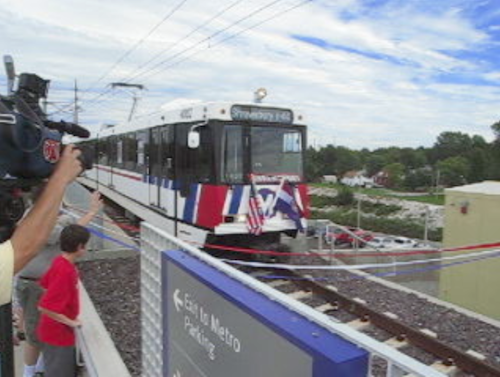
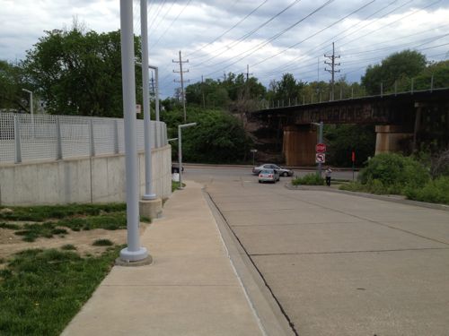
The Shrewsbury MetroLink station opened with the blue line extension on August 26, 2006. Click image to view video of the arrival of the first train pictured above.
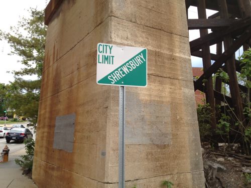
The Shrewsbury MetroLink station is located in the City of St. Louis, but the Shrewsbury city limits is the western edge of the commuter parking lot. The station has been open neatly 7 years now so there’s been time to better connect the surrounding neighborhoods to transit.
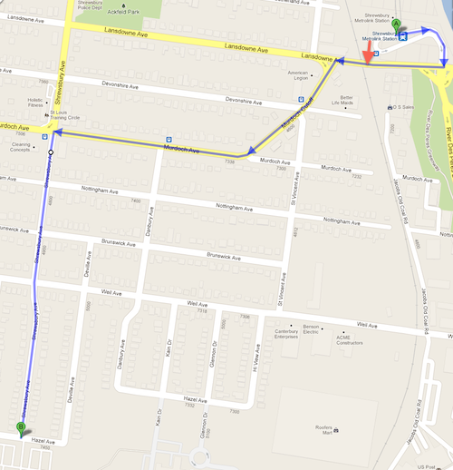
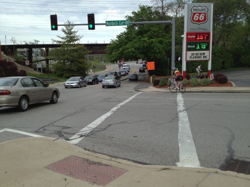
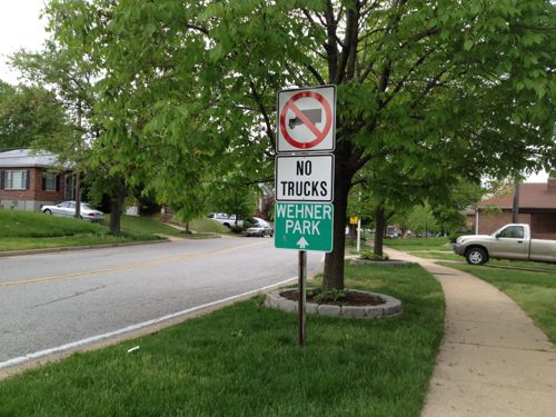
Okay, let’s head to Shrewsbury City Hall located one mile away at 5200 Shrewsbury Ave.
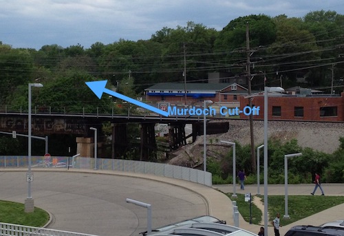
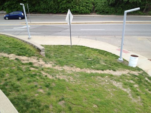
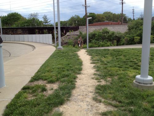
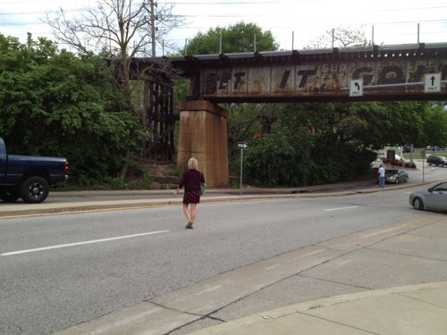
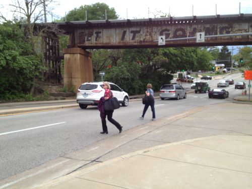
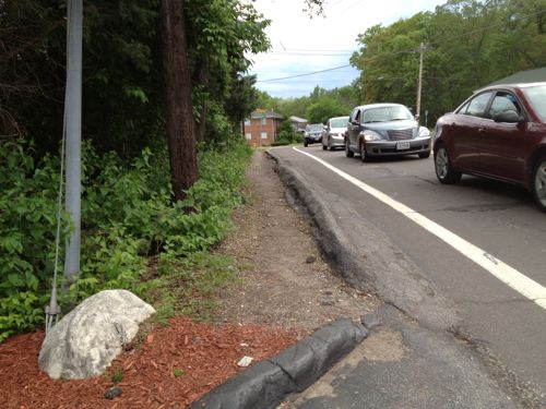
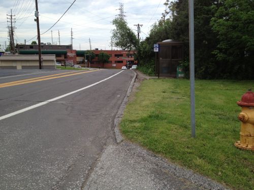
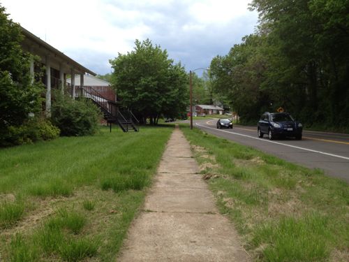
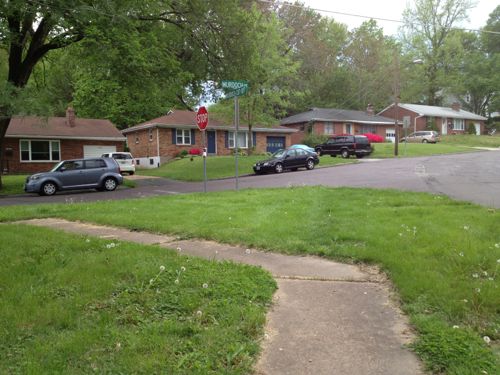
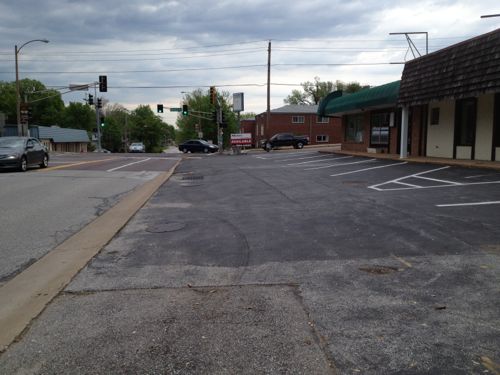
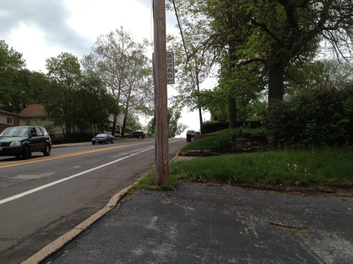
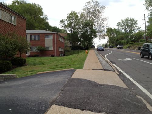
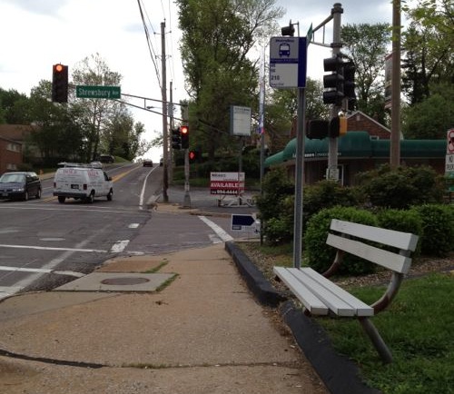
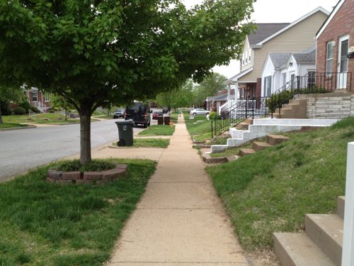
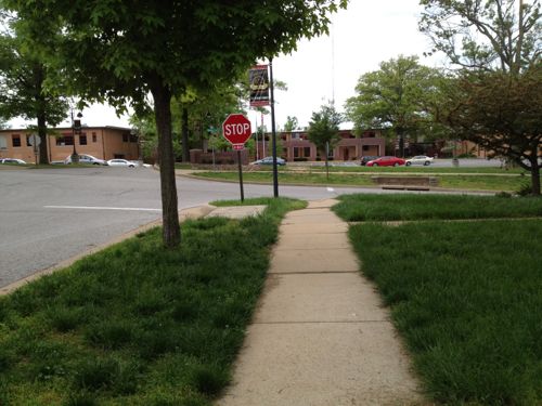
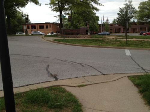
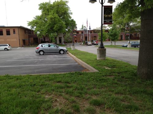
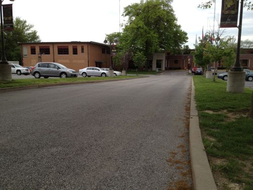
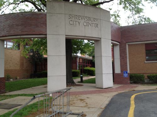
My planned route Lansdowne, Murdoch Cut-Off, Murdoch, Shrewsbury Ave, click map to view in Google MapsFrom the station platform I could see the direction I needed to go to reach the Shrewsbury City Hall.Looks like many walk up/down this hillOthers walk here, but I’d better find a sidewalk I can use.Now I’m headed down toward Lansdowne Ave, sandwiched between the retaining wall on the left and the auto driveway on the right. Not a friendly environment!At Lansdowne Ave I see pedestrians crossing the street without a crosswalk. I couldn’t cross here even if I wanted to because of the numerous curbs.More pedestrians risking getting hit by carsI stick to the north side of Lansdowne Ave and head west under the railroad tracks, the Shrewsbury city limit.I want to cross Lansdowne Ave here but there is no curb cut or crosswalk to allow me to do so.I’m able to use this crosswalk to reach the other side of Murdoch Cut-OffBut there’s no sidewalk on this side of Murdoch Cut-OffSo I returned to the intersection to cross Murdoch Cut-Off to reach the point I originally wanted to reach but couldn’tAfter passing the gas station I discover there’s no sidewalk on this side of Murdoch Cut-Off either. It looks like many pedestrians walk in the narrow dirt path, I had to use the narrow shoulder. This point is about 400 feet from where I left the station property.Looking back from where I’d just traveled you can see a bus stop encouraging pedestrian use of this area.As Murdoch Cut-Off approaches Murdoch a sidewalk does exist.But the sidewalk doesn’t continue, it turns and heads back east. This is about 1/8th of a mile from the station.I head south on St. Vincent Ave, this view is looking back north from Notttingham. Only the west side of St. Vincent Ave has a narrow sidewalk.The streets intersecting with St. Vincent don’t have sidewalks for the first block to Danbury Ave., I cautiously proceed in the street.Once past Danbury Ave sidewalks are availableThat doesn’t mean the sidewalks weren’t blocked at times. This owner had more room on their driveway before their garage door, more than enough to keep the sidewalk clear.After I reached Shrewsbury Ave I went north to Murdoch to see where sou;d’ve been dropped off had I taken a bus. This point is about a third of a mile from the corner of the transit station property.Looking east on Murdoch, the direction I originally thought I’d take. No sidewalk, only shoulder.The north side of Murdoch has a sidewalk next to the apartment buildings only.This is the bus stop heading back toward the MetroLink station, I caught a bus here a couples of hours later to return downtown.Heading back south toward city hall I passed charming houses and the route was paved and easy to navigate. The distance was over a half mile but it was fine, the worst part of the journey was closest to the transit station.Getting closer to city hall and the adjacent Wehner ParkNewer houses mix well with older houses.Almost there!The sidewalk just ends, dumping me into the street. No crosswalk or visible sidewalk into the Shrewsbury City Center complex grounds, just a sidewalk going east & west.No way in on the east side of the auto drive.No pedestrian route on the west side either, so I had no choice but to use the auto drivewayA pedestrian route along the east side of the auto driveway would be a direct path to the main entrance of the Shrewsbury City Center complex. Voters approved a bond in 1991 to pay for the renovations to city hall, the work was completed in 1993 — both after The Americans with Disabilities Act of 1990.Leaving at night via the auto driveway. I’d imagine many neighbors drive here from just blocks away because that’s the message the design suggests.My only other time here was Saturday June 17,2006 for a charrette on connecting St. Louis & Shrewsbury to the open MetroLink line, attended by residents, businesses and elected officials. I drove on that visit.
Given the substantial capital investment made in the MetroLink expansion and the commitment of sales taxes to help fund Metro I find it unacceptable that nothing has been done in nearly 7 years. Well, the sidewalk along one side of St. Vincent looks like it was done in that time frame, but nothing else looks different. Employees & customers should be able to walk from the MetroLink station to the businesses along Murdoch & Murdock Cut-Off. Shrewsbury residents living within a 1/4 mile of the station should have a easy walk, but they don’t.
I suggest the following action steps:
Metro, St. Louis, Shrewsbury, Trailnet, etc. begin to examine ways to improve the pedestrian experience to/from the Shrewsbury MetroLink/MetroBus station.
Shrewsbury begin to evaluate multiple routes from the station to destinations with Shrewsbury, starting with a walking audit. I’d be happy to participate. Dan Burden from the Walkable & Livable Communities Institute would be an outstanding facilitator.
Shrewsbury work to add an ADA-compliant accessible route to the main accessible entrance of the Shrewsbury City Center complex.
I’m emailing various officials at Shrewsbury & St. Louis this morning to try to raise awareness and get some action.
AARP Livibility Index
The Livability Index scores neighborhoods and communities across the U.S. for the services and amenities that impact your life the most
Built St. Louis
historic architecture of St. Louis, Missouri – mourning the losses, celebrating the survivors.
Geo St. Louis
a guide to geospatial data about the City of St. Louis