Retailing isn’t easy, successful brick & mortar retailers hire consultants, question focus groups, and study market trends, to get customers through the door. Store design is an important part of the equation. Many firms specialize in retail design.
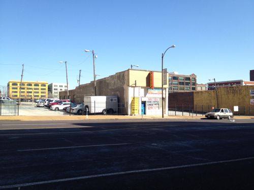
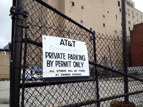
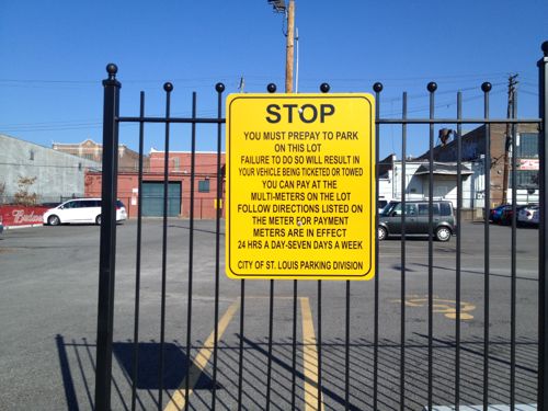
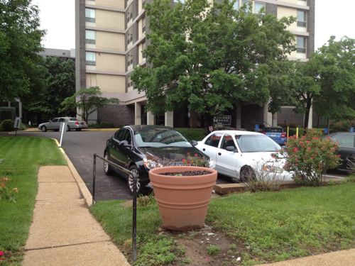
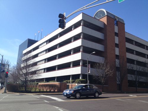
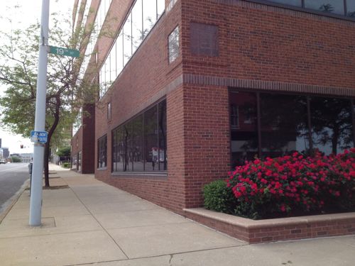
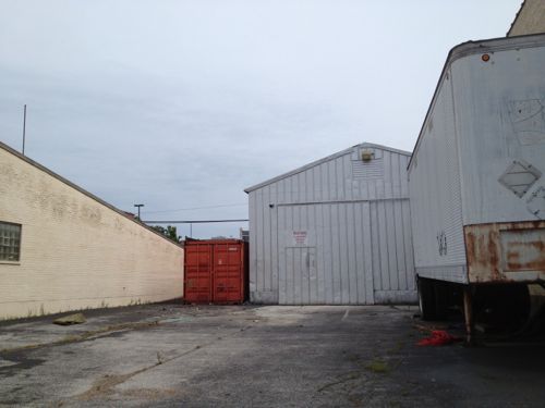
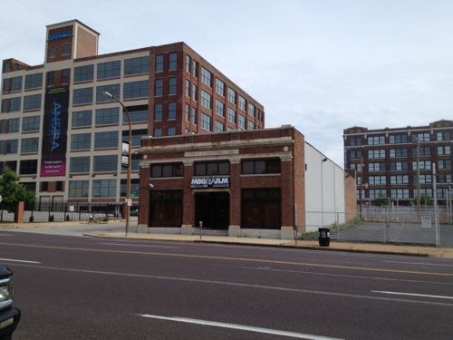
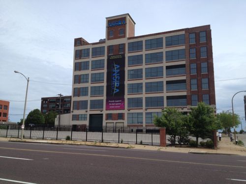
I covered this topic last August after a seeing the transit agency store in Dallas (see Transit Visibility: Metro vs DART). Metro’s MetroRide store on Washington Avenue is pathetic.
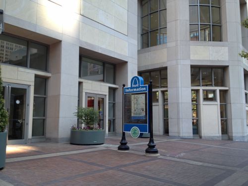
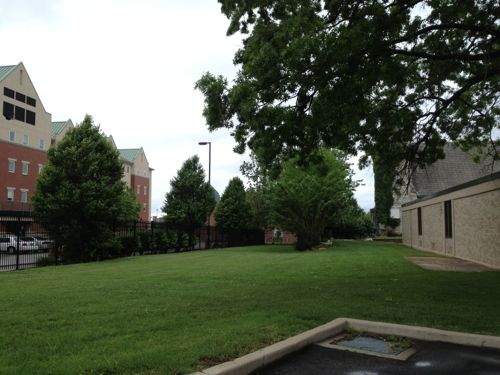
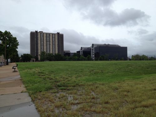
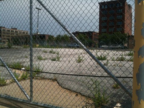
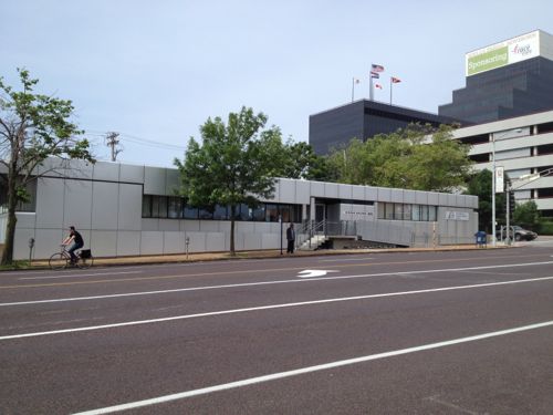
Last August I showed this pic to help illustrate the problem. Which entrance is the transit store?Obviously this one, right?
Each time I visit the MetroRide store to buy transit passes I realize it is the result of a quasi-government agency that has zero competition. Where is the hungry merchant trying to drum up sales to cover the rent payment? It’s like the exclusive restaurant
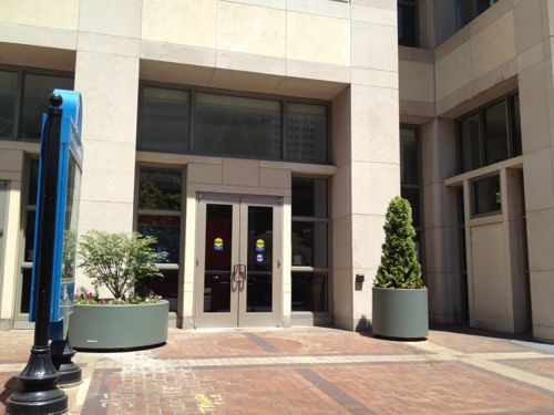
I took this similar pic a few days ago, it was impossible to even tell if the lights were on.
Sure, those of us who seek it out don’t need a big neon sign or even a simple “open” sign in the window, but it might help get the attention of others walking by. Tourists might inquire about the downtown trolley and what else they can see without a car.
I’d like to see Metro make it obvious to anyone walking, or driving, past the MetroRide store to know it is a place to buy transit passes and pick up schedules. As a fan of gift shops, I’d also like to see St. Louis transit-related merchandise: t-shirts, postcards, magnets, calendars, etc. I still have a puzzle of the Philly transit map I bought on vacation in 2001, but I have almost nothing for St. Louis. I’d love a toy MetroBus.
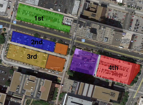
This is the fifth post in a series looking at potential development sites along the proposed initial route of the St. Louis Streetcar. The first four parts were:
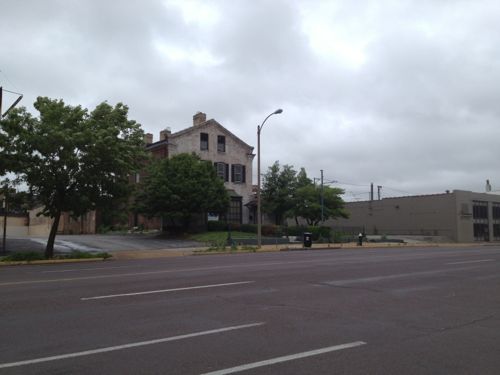
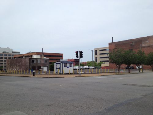
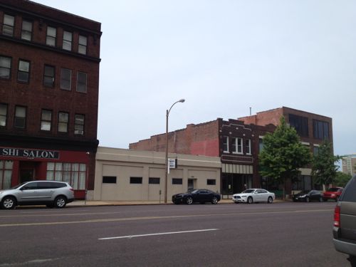
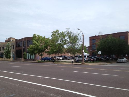
This post will cover the 0.6 mile stretch of Olive from Jefferson to Compton (map). Let’s start with the North side of Olive at Jefferson:
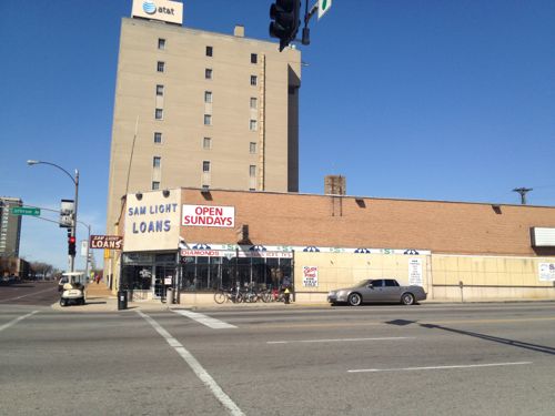
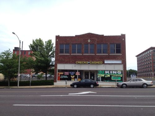
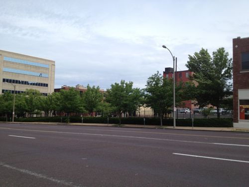
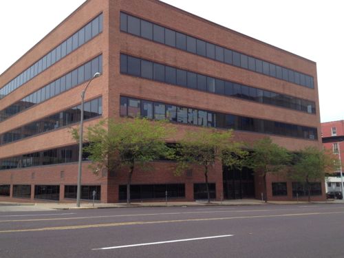
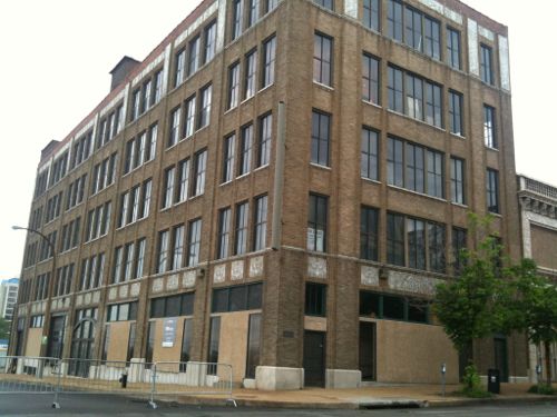
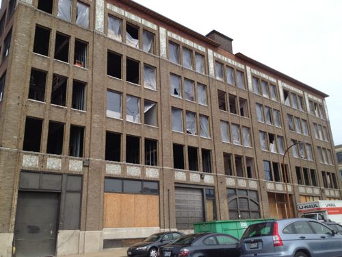
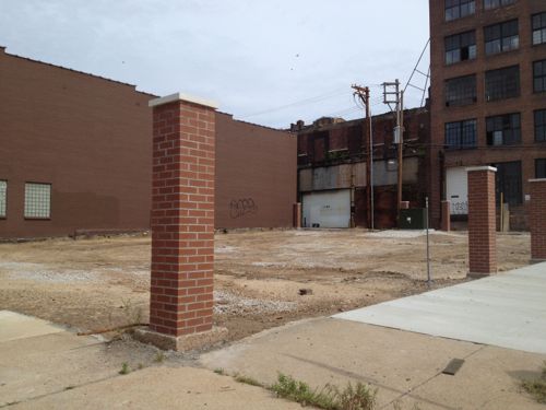
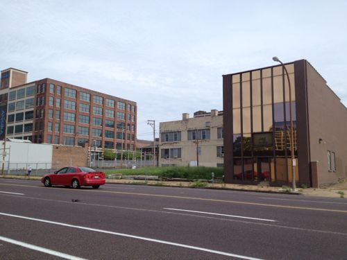
2601 Olive, well known as Sam Light Loans, was built in 1924, according to city records. I wonder if the building got a makeover in the 40s or 50s, it looks too modern foe the 20s.I posted about 2617 Olive in March 2012, it dates to 1883. Click image to see my prior post.AT&T recently built an addition on the long-vacant lot at 2621 OliveThat addition was on the east side of this AT&T Communications building at 2651 OliveThe small insurance office at Locust & Jefferson was built in 1956.AT&T owns much of the block on both sides of Locust, used for parking.Across the street is more AT&T parking on the left. Loft apartments on Washington Ave can be seen in the background.The Wells Fargo lot between Beaumont & Leffingwell could be easily developed if many employees begin riding the streetcar. Perhaps give them the option of a parking pass or a transit pass… More on Wells Fargo when I get to the south side of Olive below.The building on the left is from 1929, the one on the right from 1913. A vacant 30ft lot is to the right @ Leffingwell.2823 Olive was built in 1880, though set back from the street it would be an interesting contrast to keep this structure, while filling in on each side. The side on the left belongs to the next property to the west.This 1925 building at 2831 Olive would look even better with a new glass storefront….and a rooftop restaurantThe Castle Ballroom should get renovated with a streetcar right out front. Click image to see my post from 2011.These buildings in the 29xx block of Olive no longer look like they did 100+ years agoThe Locust Business District recently completed a fenced surface parking lot, this needs to be replaced ASAPThe Treasurer’s parking lot at 3019 Olive also needs a building, not a garage.At Cardinal Ave we have a one story structure from 1997, too new to replace right awayThe last buildings on the north side of Olive before Compton
Some existing buildings aren’t as tall as would be nice but their age/height will be a nice contrast to the new construction we should see go up over the twenty years. In short, lots of opportunities for new construction on vacant land.
OK, let’s cross Olive at Compton and return east to Jefferson. It would be impossible to look at this section of the proposed route without discussing the urban renewal clearance of Mill Creek Valley:
By World War II, Mill Creek’s tenements and faded town houses were home to nearly 20,000 people, many of them poor blacks who had migrated north from the cotton fields. More than half the dwellings lacked running water, and 80 percent didn’t have interior bathrooms.
Tucker proposed knocking over nearly everything and starting over. In 1955, city voters overwhelmingly approved a $10 million bond issue for demolition, on the promise that the federal government would reimburse most of it. The local NAACP endorsed the idea. Work began on Feb. 16, 1959, at 3518 Laclede Avenue, where a headache ball smashed a house that dated to the 1870s.
The bulldozers swiftly transformed the city’s “No. 1 Eyesore” into an area derided as “Hiroshima Flats.” Among the few buildings spared was the old Vashon High School, now part of Harris-Stowe State University. When work began in 1961 on University Heights Village apartments, only 20 original families still called Mill Creek home. (stltoday.com – A look back • Clearing of Mill Creek Valley changed the face of the city)
The area from Union Station to Grand was cleared. This area got new construction like the A.G. Edwards HQ, now Wells Fargo Advisors, LaClede Town (razed), Heritage House senior apartments, and the “flying saucer” gas station on Grand at Forest Park, now a Starbucks. n
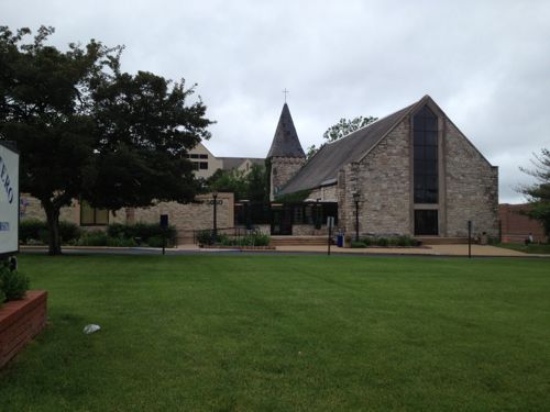
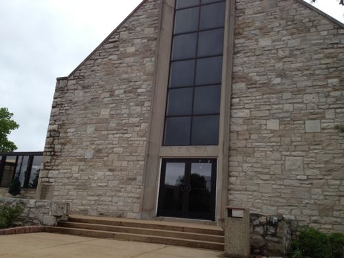
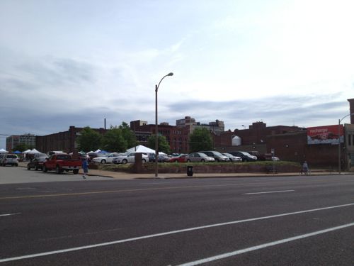
The block between Cardinal & ComptonThis facade was built after the front of the building was removed when Olive was widened. I’d like to see this endureA pocket park along the route would be nice, if it could be accessed.The former Berea Presbyterian Church is now a SLU event spaceThe central glass on the front of this church always looked too modern but I never knew the story.February 1909 Sanborn Map showed the stone (blue) church at 3015 Pine (vacated), between Garrison (vacated) on the east and Cardinal (dead end) on the west. The end facing Olive today was the back! Click image to see more of this map.I’d like to see Pine St replatted from Jefferson to Compton, it would go right through here.Sigma-Aldrich owns the land from the old church to Ewing. Given how the land is platted and fenced it appears they’re leaving a strip along Olive for future development.Ewing Ave looking south toward Market. Wells Fargo Advisors on the left, Sigma-Aldrich on the right. This too-wide street should be lined with storefronts catering to employees of both businesses, as well as students, faculty, & staff at Harris-Stowe, and residents at Heritage House.A non-propfit was formed in 1964 to build & operate low-income senior apartments, Heritage House opened in 1967.The building is well maintained but not well connected to OliveI’d like to see an addition between the sidewalk and tower with underground parking, street-level retail, 2nd floor apartments.An alley remains between Olive & Pine. I can imagine both sides being infilled over the coming decades, see diagram below.My thought of the order Wells Fargo might instill parking lots and finally raze a parking garage. The two orange squares are owned by the Beffa family, the purple by Provident.A parking garage for Wells Fargo Advisers dominates the intersection of Jefferson & Olive.A brick wall sorta hides equipment
I’m excited about the possibly having a modern streetcar line a block away from my loft, but the redevelopment potential in midtown is phenomenal. I’ve been losing sleep for the past week as I picture what this could look like at full build out. The vision must come before the bricks and mortar.
With the north-south section covered, I’ll resume heading west on Olive starting at 18th. For information on properties I checked city records on GEO St. Louis, it is generally reliable.
1800 Olive, built in 1962, contributes nothing. It is owned by the Salvation Army, which owns the Railton Apartments next door.The one-story White Knight Diner at 1801 Olive dates to 1954, but it makes a positive contribution to the public realm. This place was featured in the 1990 film “White Palace” with Susan Sarandon & James Spader, click image for more information on this film.MERS/Goodwill owns much of this city block
b
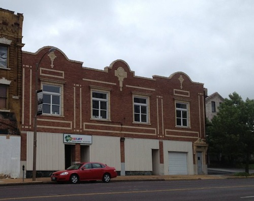
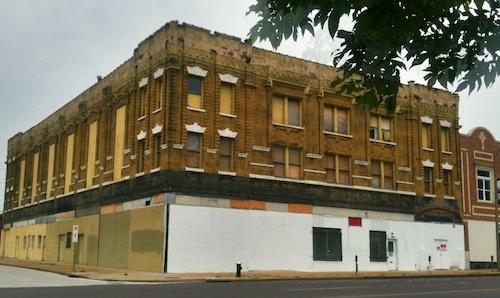
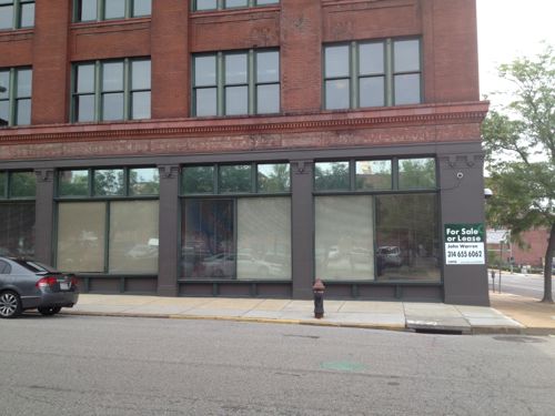
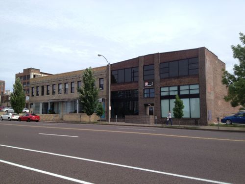
The Currency Exchange owns the building at 1809 Olive, it has no off-street parking despite being surrounded by parking. It was built in 1926.The surface parking lot between the Currency Exchange and 19th Street belongs to the police, came with the building that’ll be the new HQ next year. This reduces development potential unless they can get by with the parking located within the building.This building faces Olive, 19th, & Pine. It was most recently a charter school.It should become occupied and hopefully altered, see below.A doorway could be added to to enter the ground floor from Olive without a need for a ramp or steps. This could be for retail and/or restaurant.Four buildings, four owners. Three from 19th century, one 20th century. The beige one-story building is from 1896, but it has been significantly altered.The large parking lot fronting Olive, 20th & Pine is owned by an out of state entity, it should be more valuable developed.2001 Olive was actually built in 1892, as a one-story building with 4 storefronts facing Olive and 3 facing 20th. By 1909 it was surrounded by taller buildings. Click image to view 1909 Sanborn map.The narrow building at 2011 Olive was built in 1919. The empty lot on the east (right) is owned by the owner of the previous building.This space at 2015 Olive is west of the previous building and has the same owner. This would make s nice patio/beer garden.The rest of this block-face to 21st is these two buildings with the same ownership. The one on the left was built in 1903, the former Hamilton-Brown Shoe Factory. The one-story building on the right is from 1955. A taller building could replace the one on the right.The 3rd floor is for lease but offices occupy the ground floor. The owner occupies much of the building, perhaps they can reconfigure so the ground floor becomes restaurant/retail space.The remaining buildings on the south side of Olive, west of 20th, were built in 1926. This is within another proposed Northside Regeneration job center.The block bounded by Olive, Pine, 21st, & 22nd, was cleared for the unbuilt 22nd Street Parkway. 21st & 22nd were vacated, these should be reopened.St. Louis Brewery, owner of the Tap Room, owns this parking lot at 21st & Olive. Easily developed or turned into a beer garden.Both of these buildings have the same owner and have been renovated within the last 5-10 years. Not sure if additional floors are an option.The State of Missouri owns the vacant land at 22nd, part of the 22nd Parkway right-of-way.I’ve long thought 22000 Locust was ripe for redevelopment. May 2010 photo.It’s getting renovated into apartments right now, click image for more information.Unfortunately the corner lot at 2201 Olive, just cleared of a non-urban building, will become a new surface parking lot for the apartment development.The building at 2209 Olive (right) was built in 1906, but you can’t tell it. Expect lots of changes in this block.The 1922 building at 2231 Olive contributes to the Locust Olive Historic District, click image for nomination.
b
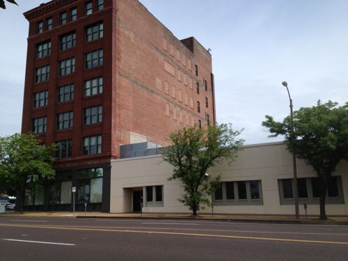
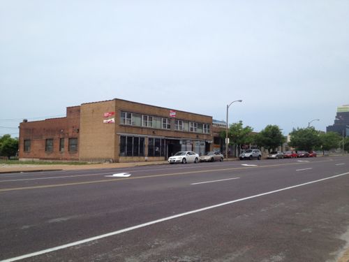
2200 Olive occupies a large parcel of land. The largely blank walls were common in 1963 when it was built.The Lincoln Arms Hotel, built in 1928, provides low rent rooms by the week, serving a niche market. Walk by in the summer and the smell is awful. The physical form is ideal along a streetcar line.Firestone owns this location built in 1964, not sure if they’d cash out the real estate.I’d long assumed this surface parking lot belonged to the company in the building across the alley.This 1968 building at Olive & Jefferson is interesting, but also low-density.
There are many more development sites, to the north & south, between 18th & Jefferson. I expect this to be a high activity area for development.
Last month (April 2013) the exterior of the new law school was basically complete, with new glass elements and a new top floor.The same building in September 2012
But this post isn’t about the alterations to the building, this post is meant to help faculty, staff & students understand how to use the MetroBus system.
The distance between the current law school on the main SLU campus and the new building is 2.3 miles via Lindell/Olive & Tucker. Driving time is 9 minutes end to end, but no parking is available at the ends, so walking time needs to be added.
Taking the #10 (Gravois Lindell) MetroBus is 16 minutes, per Google Maps, including walking time. Time on the bus is 11 minutes plus 5 for walking, so taking the bus is competitive with driving in this example.
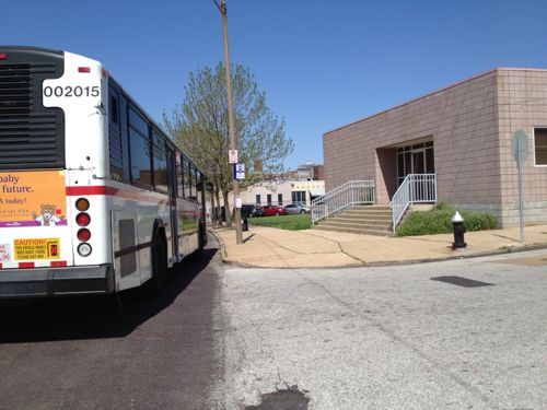
Those going from the main campus can catch the #10 in one of two places: on Lindell east of Spring or Lindell east of Grand. You’ll exit the bus on just after it turns on 14th St., next to the Ford Building.
Riders returning the SLU main campus can catch the #10 at this bus stop at 14th & Pine, the Ford Building at left is the stop for those going to the law school.
In the opposite direction you’ll walk two blocks west along Pine to the stop shown above. You can exit at Grand to Spring for the main campus.
Frequency is every 30 minutes, 40 minutes after 11pm. The #10 line is the bus I use most often, the 30 minute frequency isn’t a problem when you know the schedule. I personally don’t use the printed schedule, I just check the times on the Google Maps iPhone app (or online) as needed.
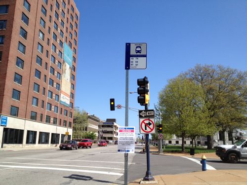
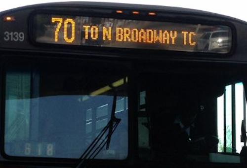
The bus route number is shown on the front left followed by the the final destination. This example is the #70 (Grand) MetroBus heading NB.The route number & destination is also displayed on the curb side of the bus, just behind the door.
Here are some other things to remember:
Make sure you look for your bus, if you are busy reading the bus driver may not realize you want to board and pass you.
Transfers offer a good value. Say you board the bus at 10:30am and pay $3 ($2 fare + $1 transfer), you’ll get a transfer good until 1pm!
Bus drivers can’t offer change, so having $1 bills is a good idea, a monthly pass is $72. Hopefully a new SLU administration will join the Metro campus programs like St. Louis Community College, Washington University, and University of Missouri-St. Louis (UMSL).
Let others get off the bus before boarding, when you exit use the back door rather than the front door. This reduces delays.
You’ll need to pull the cord to signal you want to stop at the next bus stop.
Don’t be afraid to sit toward the back, the front seats must be given up for elderly & disabled passengers.
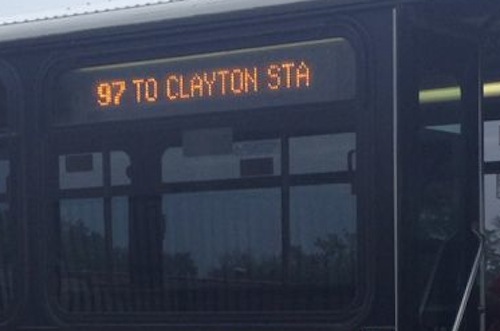
Other MetroBus lines within 2 blocks of the law school include: 30, 41, 74, 94, 97, 99. Four blocks away at 14th & Market adds the 4 & 11.
A majority of readers favor Trailnet’s suggestions to focus on transit, biking, and walking efforts to reduce automobile congestion:
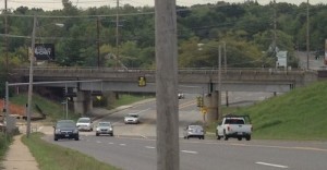
South Hanley ducks under railroad tracks.
Q: How should St. Louis County reduce auto congestion between Hanley & Watson?
Focus on transit, bicycling and walking solutions 60 [57.14%]
Build proposed “South County Connector” partially-elevated roadway 25 [23.81%]
Do nothing 16 [15.24%]
Unsure/no opinion 4 [3.81%]
The pro-Trailnet crowd combined with the “do nothing” group total a whopping 72.38% that didn’t select the built it option.
A public meeting will be held Thursday May 30th.
The South County Connector Draft Environmental Impact Statement (EIS) will be available for public review and comment from Friday, May 3, 2013 to July 19, 2013. During the review period, the St. Louis County Department of Highways and Traffic will host a public hearing for the Draft EIS on Thursday, May 30, 2013 from 4:00 p.m. to 8:00 p.m. at the Shrewsbury City Center (located at 5200 Shrewsbury Avenue, Shrewsbury, Missouri 63119).
The public hearing is an opportunity for interested persons to give testimony concerning the Draft EIS, including potential social, economic, and environmental impacts of the proposed roadway alternatives. Representatives of the South County Connector Study Team will also be available to provide information and answer questions about the Draft EIS at an open house meeting held at the same time as the public hearing. No formal presentation will be made. Display boards and copies of the Draft EIS will be available for review at the open house meeting. (South County Connector)
If you are among those who don’t think this project should move forward please contact all of the following:
AARP Livibility Index
The Livability Index scores neighborhoods and communities across the U.S. for the services and amenities that impact your life the most
Built St. Louis
historic architecture of St. Louis, Missouri – mourning the losses, celebrating the survivors.
Geo St. Louis
a guide to geospatial data about the City of St. Louis