In the first two parts of this series on development sites along a proposed streetcar route I looked at Olive from 15th-16th and Olive from 16th-18th. In both cases it was a small area and I looked a specific buildings and parcels of land. Heading to N. Florissant Ave. & St. Louis Ave. nearly everything is a development site.
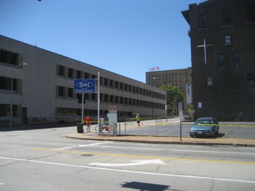
Let’s start downtown and work our way north. At 14th & Olive you have the library on the NE corner and the library administration building & a charter high school on the NW corner. I think the library admin building has office space available for lease.
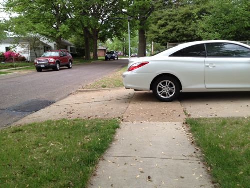
The parking lot at 14th & Locust is privately owned, a good candidate for new construction. Photo is from 2007 before the charter school added another floor to their space on the left.1400 Washington has had numerous development plans, it is now becoming a parking lot, same owner as the previous lot across the alley.I’d like to see these two buildings on Washington Ave west of 14th get renovated, along with a thin wedge between the east wall and 14th. Photo from 2011.
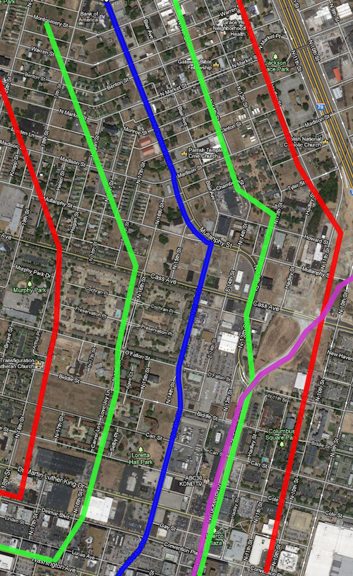
Before we go any further north it makes sense to look at the route on a map along with a development zone on each side of the line. Light rail has stations miles apart, whereas streetcars are more like buses by having more frequent stops along the route.
The blue line is the proposed streetcar route, green about 660ft (1/8th mile) and the red about 1,320ft (1/4 mile). Purple is the new bridge connecting into Tucker. Click to view in Google Maps.
The area between the green lines is the immediate area that I estimate to be part of a special transportation district with slightly higher property taxes, pro-rated based on distance. The red lines are a quarter mile distance, the usual distance a person is willing to walk.
Quite a bit of this area is in what will be one of the Northside Regeneration job centers.
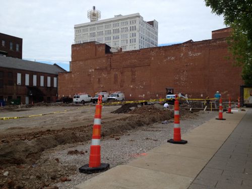
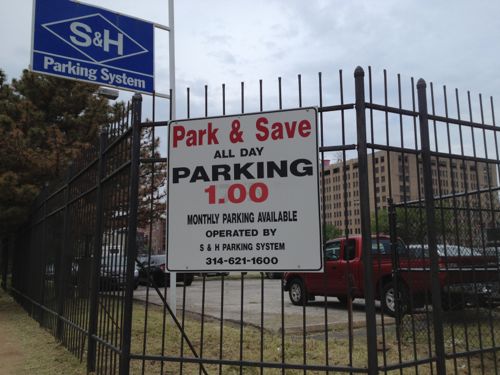
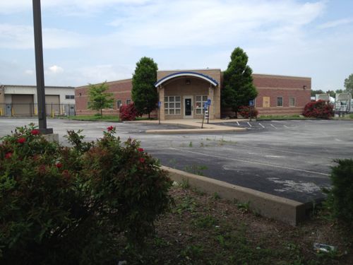
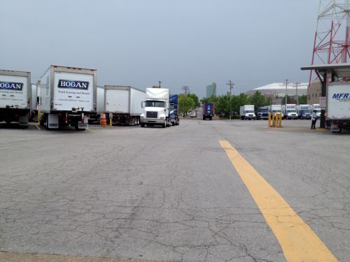
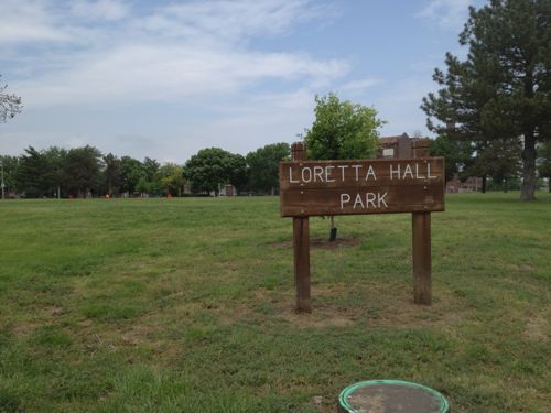
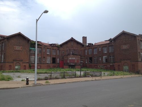
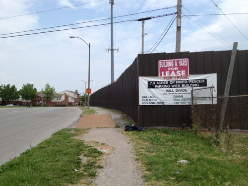
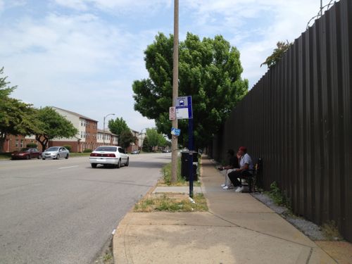
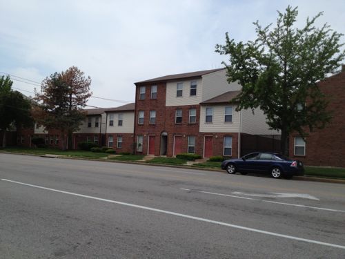
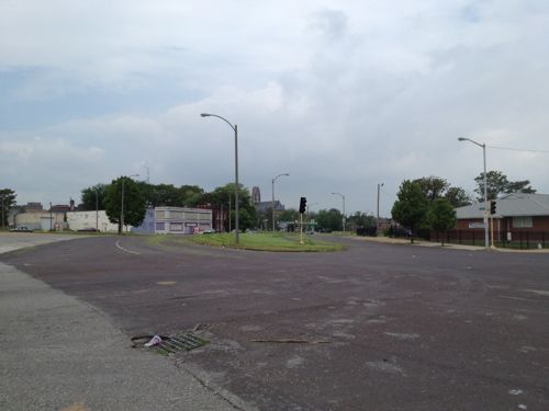
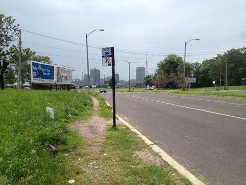
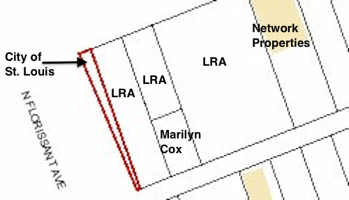
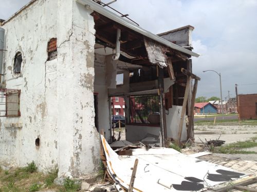
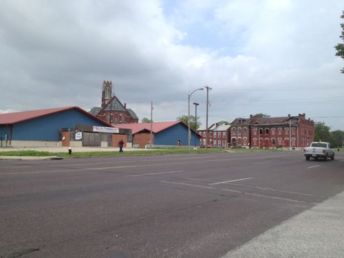
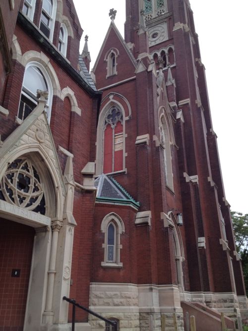
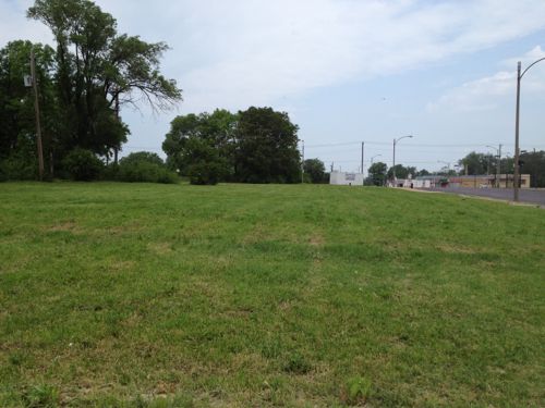
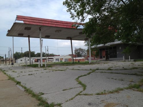
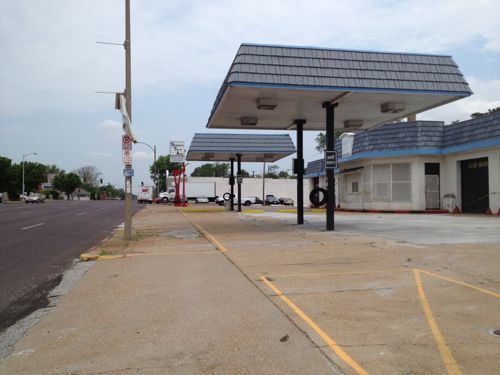
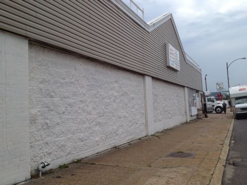
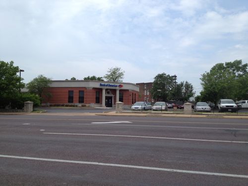
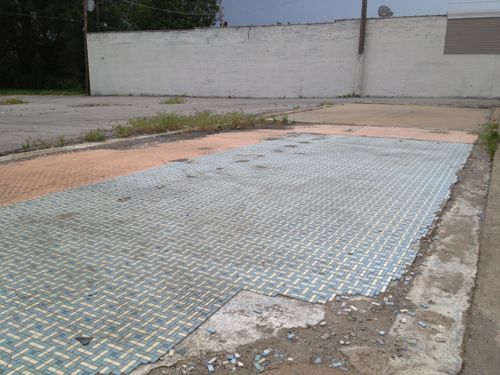
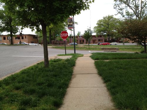
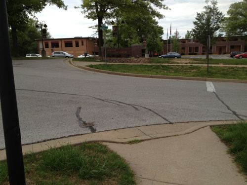
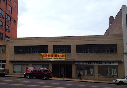
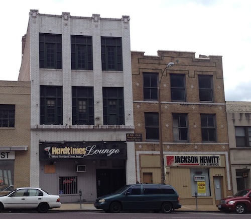
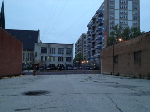
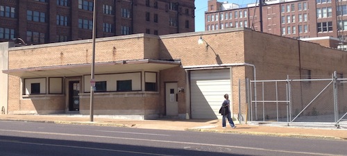
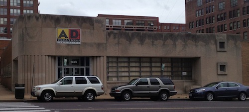
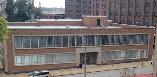
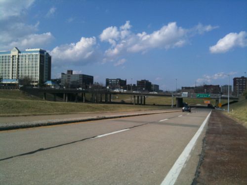
Numerous parking lots occupy significant land north of Washington Ave, ideal candidates for new construction.A former BarnesCare building built in 2001, is now vacant. With no pedestrian access and large setbacks from both MLK & 14th this building should be razed and a new urban building constructed on the site.Hogan Trucking uses two city blocks, Carr St has been vacated. Interestingly the property owner is listed as Hogan Redevelopment Corp.This site must legally remain a public park, as it has been since 1842. Click image for more information.Many would love to see the crumbling Carr School get renovated. Click image for more information on this 1908 structure.7.9 acres ready for development, the original lot boundaries remain since they were never consolidated.The 14th & O’Fallon St bus stop is always busy, but that hasn’t spurred development to date. This stop is currently served by the #32 & #74 MetroBus routesOn the west side of 14th, south of Cass, is the O’Fallon Place Apartments owned by McCormack Baron Salazar.Looking NW on N. Florissant from 14th, vacant land and mostly vacant buildings are all around.The Mullaphy Emigrant Home at 1609 N. 14th could finally get renovated if the streetcar connects the near-north side to downtown. Click image for more information on this historic structure.Looking back toward downtown we see evidence of disinvested in the area along N. Florissant near Madison St. The city says property owners are responsible for sidewalks but in this case the city is the property owner.The City of St. Louis is the legal owner of the 668 sq ft wedge-shaped lot at 1458 Madison St.This small building at 2100 N. Florissant Ave was built in 1906, the owner is in St. Louis County.A bank in Illinois now owns the unfinished daycare at 1501 Clinton & 1500 Monroe. The buildings to the north are owned by several owners, including the LRA & Northside Regeneration.The mostly vacant St. Liborious complex at Hogan & North Market is a city landmark, it is privately owned. Click image for more information.Vast open areas are prime for redevelopment along the proposed streetcar route. This is north of North Market on the west side of North FlorissantThe vacant gas station at 2418 N. Florissant was built in 1972.Two blocks north at 2618 N. Florissant is another vacant gas station, this building has been modified many times since 1938.This building, owned by a person in Atlanta GA, needs to be replaced. The Church’s Chicken could operate out of a storefront in a new building.This building from 1940 should be replaced.This bank was built in 1993 after the urban bank at the corner of N. Florissant & St. Louis Ave was razed, despite neighborhood objections. This should be replaced with an urban building on the corner.The NE corner of N. Florissant & St. Louis Ave. had a cute diner until 1998
With so much vacant land & buildings, this stretch of the proposed streetcar line has the greatest potential for redevelopment. It will also be a challenge initially to get projects funded. Once the line is open and Paul McKee builds one of his job centers near Tucker & Cass things will start to take off. Form-based codes requiring dense urban design will be key to getting the right kind of construction.
It’ll take at least a decade, if not two, for this to be built out.
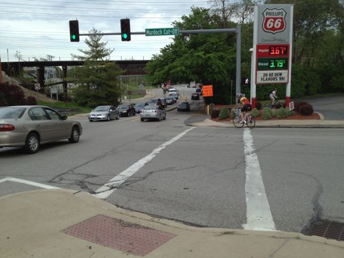
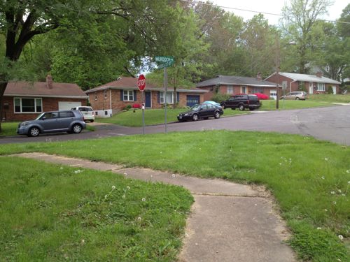
I love rail transit, but a problem with our MetroLink light rail system is getting from the stations to your destination. Last week I attended a meeting hosted by Trailnet at Shrewsbury City Hall, a mile from the station. I could’ve caught a bus that would’ve dropped me off at Murdoch & Shrewsbury Ave but I still would’ve had 4/10ths of a mile to reach city hall. It was decent out and my power chair had a full charge so I decided to “walk” the mile.
But first a little background information.
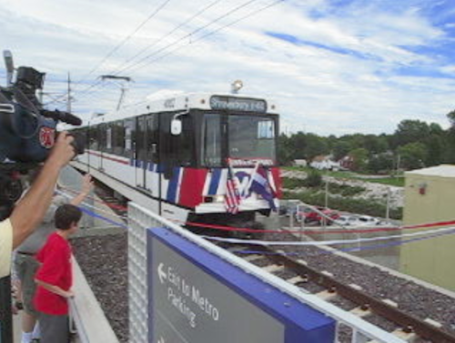
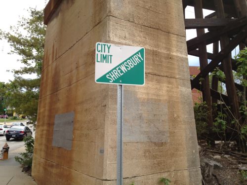
The Shrewsbury MetroLink station opened with the blue line extension on August 26, 2006. Click image to view video of the arrival of the first train pictured above.
The Shrewsbury MetroLink station is located in the City of St. Louis, but the Shrewsbury city limits is the western edge of the commuter parking lot. The station has been open neatly 7 years now so there’s been time to better connect the surrounding neighborhoods to transit.
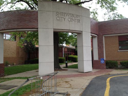
Okay, let’s head to Shrewsbury City Hall located one mile away at 5200 Shrewsbury Ave.
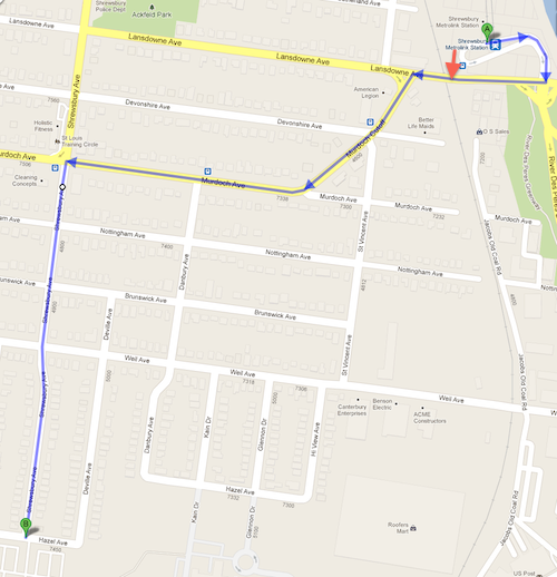
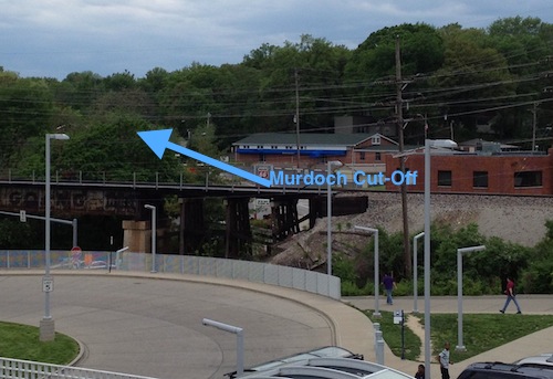
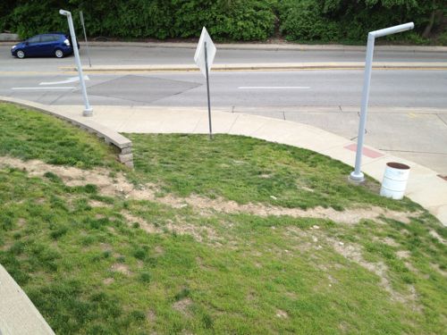
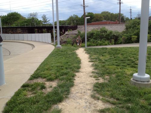
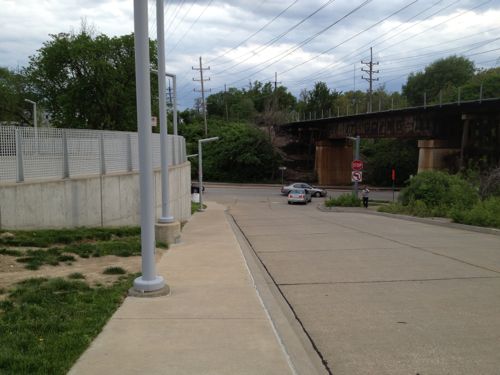
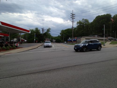
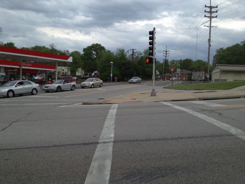
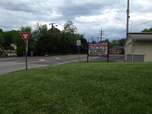
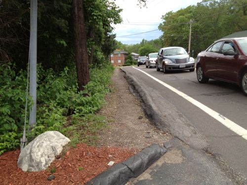
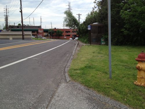
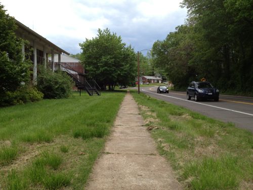
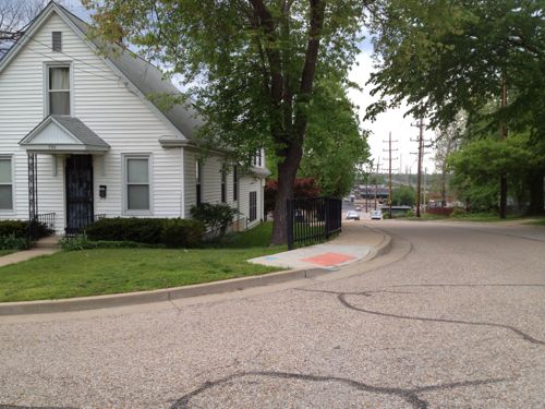
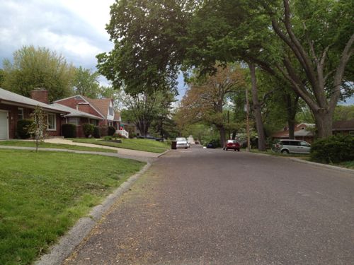
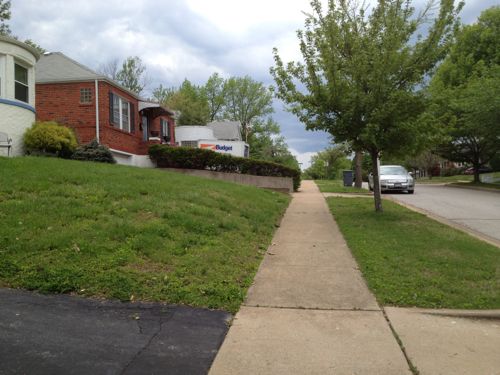
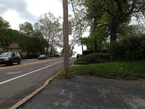
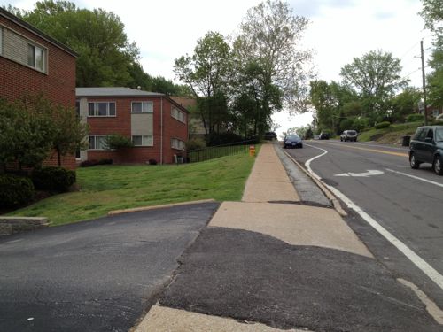
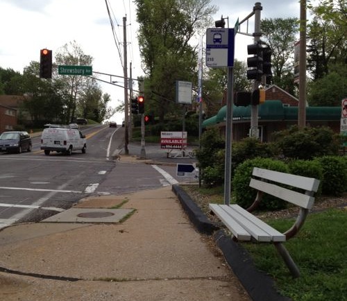
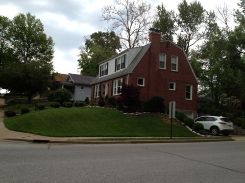
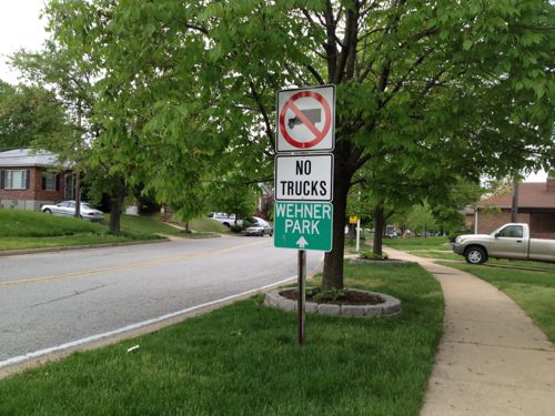
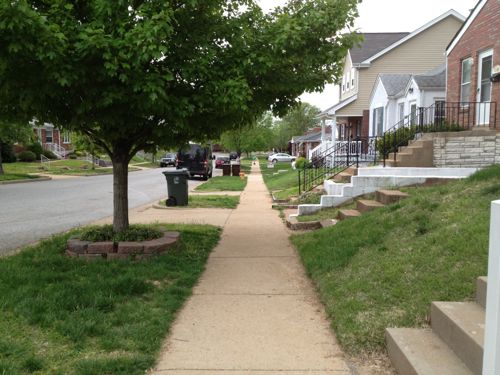
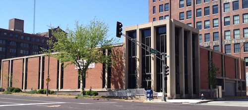
My planned route Lansdowne, Murdoch Cut-Off, Murdoch, Shrewsbury Ave, click map to view in Google MapsFrom the station platform I could see the direction I needed to go to reach the Shrewsbury City Hall.Looks like many walk up/down this hillOthers walk here, but I’d better find a sidewalk I can use.Now I’m headed down toward Lansdowne Ave, sandwiched between the retaining wall on the left and the auto driveway on the right. Not a friendly environment!At Lansdowne Ave I see pedestrians crossing the street without a crosswalk. I couldn’t cross here even if I wanted to because of the numerous curbs.More pedestrians risking getting hit by carsI stick to the north side of Lansdowne Ave and head west under the railroad tracks, the Shrewsbury city limit.I want to cross Lansdowne Ave here but there is no curb cut or crosswalk to allow me to do so.I’m able to use this crosswalk to reach the other side of Murdoch Cut-OffBut there’s no sidewalk on this side of Murdoch Cut-OffSo I returned to the intersection to cross Murdoch Cut-Off to reach the point I originally wanted to reach but couldn’tAfter passing the gas station I discover there’s no sidewalk on this side of Murdoch Cut-Off either. It looks like many pedestrians walk in the narrow dirt path, I had to use the narrow shoulder. This point is about 400 feet from where I left the station property.Looking back from where I’d just traveled you can see a bus stop encouraging pedestrian use of this area.As Murdoch Cut-Off approaches Murdoch a sidewalk does exist.But the sidewalk doesn’t continue, it turns and heads back east. This is about 1/8th of a mile from the station.I head south on St. Vincent Ave, this view is looking back north from Notttingham. Only the west side of St. Vincent Ave has a narrow sidewalk.The streets intersecting with St. Vincent don’t have sidewalks for the first block to Danbury Ave., I cautiously proceed in the street.Once past Danbury Ave sidewalks are availableThat doesn’t mean the sidewalks weren’t blocked at times. This owner had more room on their driveway before their garage door, more than enough to keep the sidewalk clear.After I reached Shrewsbury Ave I went north to Murdoch to see where sou;d’ve been dropped off had I taken a bus. This point is about a third of a mile from the corner of the transit station property.Looking east on Murdoch, the direction I originally thought I’d take. No sidewalk, only shoulder.The north side of Murdoch has a sidewalk next to the apartment buildings only.This is the bus stop heading back toward the MetroLink station, I caught a bus here a couples of hours later to return downtown.Heading back south toward city hall I passed charming houses and the route was paved and easy to navigate. The distance was over a half mile but it was fine, the worst part of the journey was closest to the transit station.Getting closer to city hall and the adjacent Wehner ParkNewer houses mix well with older houses.Almost there!The sidewalk just ends, dumping me into the street. No crosswalk or visible sidewalk into the Shrewsbury City Center complex grounds, just a sidewalk going east & west.No way in on the east side of the auto drive.No pedestrian route on the west side either, so I had no choice but to use the auto drivewayA pedestrian route along the east side of the auto driveway would be a direct path to the main entrance of the Shrewsbury City Center complex. Voters approved a bond in 1991 to pay for the renovations to city hall, the work was completed in 1993 — both after The Americans with Disabilities Act of 1990.Leaving at night via the auto driveway. I’d imagine many neighbors drive here from just blocks away because that’s the message the design suggests.My only other time here was Saturday June 17,2006 for a charrette on connecting St. Louis & Shrewsbury to the open MetroLink line, attended by residents, businesses and elected officials. I drove on that visit.
Given the substantial capital investment made in the MetroLink expansion and the commitment of sales taxes to help fund Metro I find it unacceptable that nothing has been done in nearly 7 years. Well, the sidewalk along one side of St. Vincent looks like it was done in that time frame, but nothing else looks different. Employees & customers should be able to walk from the MetroLink station to the businesses along Murdoch & Murdock Cut-Off. Shrewsbury residents living within a 1/4 mile of the station should have a easy walk, but they don’t.
I suggest the following action steps:
Metro, St. Louis, Shrewsbury, Trailnet, etc. begin to examine ways to improve the pedestrian experience to/from the Shrewsbury MetroLink/MetroBus station.
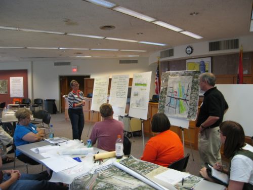
Shrewsbury begin to evaluate multiple routes from the station to destinations with Shrewsbury, starting with a walking audit. I’d be happy to participate. Dan Burden from the Walkable & Livable Communities Institute would be an outstanding facilitator.
Shrewsbury work to add an ADA-compliant accessible route to the main accessible entrance of the Shrewsbury City Center complex.
I’m emailing various officials at Shrewsbury & St. Louis this morning to try to raise awareness and get some action.
This is part 2 of a multipart series looking at potential sites for development along the proposed streetcar line that’d run along Olive/Lindell from downtown to the Central West End and the BJC hospital complex as well as north on 14th Street . In Part 1: Olive 15th-16th a week ago I looked at one city block on the north side of Olive between 15th-16th.
That block is underused surface parking, the Campbell House Museum, YMCA and 100 vacant apartments over the YMCA. Potential for both new construction and rehab. The south side of Olive is the 1950s Plaza Square high rise apartments, these will become more desirable after the streetcar line opens.
For this post I want to look at parts of five city blocks rather than just one; they’re bounded by 16th Street on the east, St. Charles St. on the north 18th on the west and Pine on the south. These blocks have a mix of buildings including rehabbed/occupied, non-rehabbed/occupied, vacant buildings, vacant land, a church, a non-public library building, etc.
I’ve organized them by City Block and listed the property addresses.
City Block 509
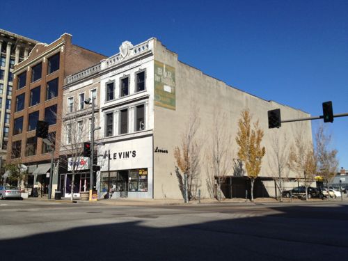
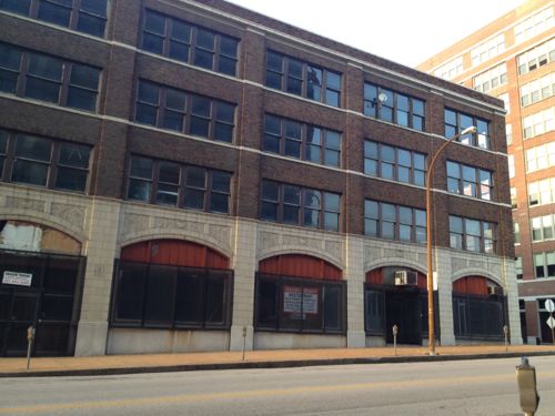
1700-1706 Olive was built in 1918, it is for sale. The facade on the base appears to have been modified later, possibly to fit in with the adjacent buildings. Click image for map.1708 Olive, built in 1951, is less than 24ft wide.1710-1714 Olive was built in 19461718 Olive (left) and 1720 Olive (right) are both occupied. 1718 was built in 1900, 1720 in 1926.1728 Olive was built in 1929
I like variety & scale of the buildings on this block facing Olive, but with the exception of 1700-06 Olive the density is too low to be on a streetcar line and not tall enough relative to the width of Olive. The two 3-story buildings in the middle might be able to be kept with new construction on either side. However, most of these buildings contribute to the Washington Ave national historic district so rehabilitation should be considered.
The rest of the block is surface parking for the Blu Condominium Association and a dumpy 7-11.
Even though the 7-11 faces 17th, the property address is 1701 Pine.
City Block 510
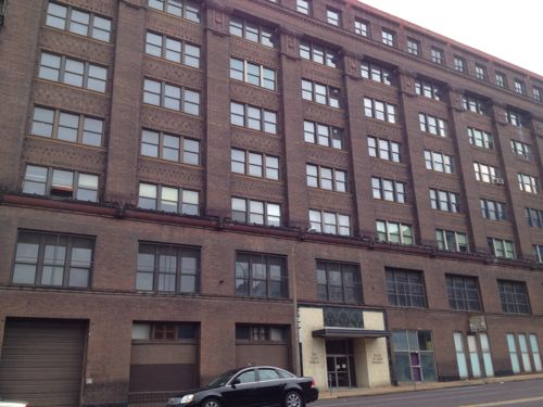
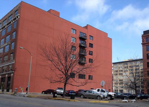
1717 Olive occupies the entire block. Originally the Butler Brothers warehouse built in 1908, later renamed Plaza Square.
The building does have a few business tenants but overall it is in need of a major rehab. Because of the condition, the rents are low. Care should be taken to not price businesses out of the building/neighborhood. On the other hand, those of us living nearby would appreciate it if it was maintained to a higher standard.
This building has potential to house offices and residential.
City Block 511
1601 Olive is a 2-story office building built in 1965, it is vacant and for sale. I’d rather see a larger structure on this corner.1613 Olive is a vacant lot owned by the city, used for parking for the building to the west.1621 Olive is owned by the city, used for parking enforcement offices right now1625 Olive is privately owned and is occupied. Built in 1948, it has an interesting facade. Retain the facade but build up?1624 Locust is part of the St. Louis Library systemThe 2-story building at 1610 Locust was built in 1917, next door is The Leather Trades Artist Lofts.
With the exception of the Leather Trades Artist Lofts, the block to very low in height and density. Although I don’t like the building heights, I do like the facades. Those facing Olive should probably be razed for taller structures.
City Block 828
1601 Locust is a privately-owned surface public parking lot next to Printers Lofts (1611 Locust). Loftworks had planned new construction to attach to Printers. A great site for new construction.
Although I live in the Printers Lofts building, shown above, I don’t know the legality of building on the lot with respect to the four condos and our common space that face east. Presumably this is addressed in our condo documents and in the recorded information on the vacant lot. I’d love to see new construction on this corner, though my neighbors might object. The beautiful Blackwell-Wielandy building occupied the corner until it burned down in 1988.
City Block 829
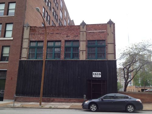
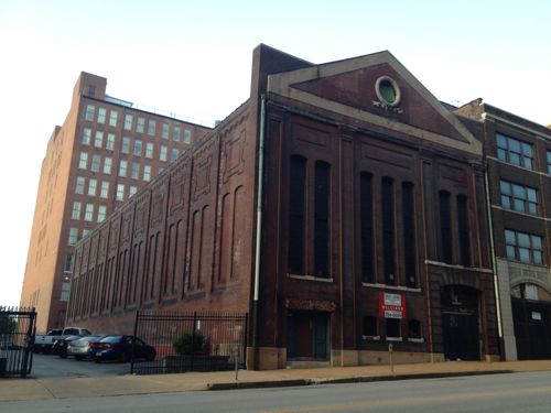
1701 Locust is a handsome 4-story building built in 1926. It has had several owners in the last decade. It is vacant.1711 Locust was built in 1903 as a power substation for a private streetcar company, it is vacant and in disrepair. It was #5 on the Landmark’s 2010 Most Endangered List, click to view
Both of these buildings are among my favorites. The substation is a creative challenge, but I’m sure someone could come up with a creative use for the space.
Closing thoughts…
Just in this small area there is room for lots of potential development over the next 10-20 years. In this type of exercise you look long-term at what the potential is for the coming decades. Some development will open before the streetcar line does, but most will come after that time. Developers will be eyeing the locations I’m highlighting in this series.
St. Louis County is still trying to make it easier to get from Hanley to Watson Rd., now through what’s being called the South County Connector. Various schemes have been around for decades:
A plan for an improved connection from south St. Louis County to central St. Louis County has existed since the late 1950s. The original concept was for a freeway “inner belt expressway” to provide better north-south access through the St. Louis suburbs. This freeway concept became Interstate 170 north of Interstate 64/U.S. Route 40. Originally, Interstate 170 was supposed to continue south into the southern part of St. Louis County to provide improved access between Interstates 44, 64 and 55. After much deliberation, area leaders decided in the 1990s not to pursue a southward extension of Interstate 170 due to public concerns. Although this option was abandoned, St. Louis County, the Missouri Department of Transportation (MoDOT), and other local agencies continued planning efforts to identify potential options for north-south access improvements in south St. Louis County. (source)
Here’s a summary of the current proposal:
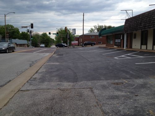
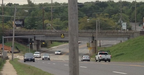
John Hicks, the county’s Transportation Development Analyst, says the county is now presenting two alternatives to the public, but both roughly follow a route from River Des Peres Boulevard at Watson Road, through a portion of the Shrewsbury MetroLink parking lot, across I-44, into Big Bend Industrial Court, crossing Deer Creek Center and ending at Hanley Road near Flora Avenue. (KMOV)
A good portion would be elevated roadway.
South Hanley would be widened where it ducks under railroad tracks near Deer Creek Center.
Proponents say the project is needed to address projected increases in traffic, critics say the focus should be on transit, biking, and walking solutions. They also say the widened/high-speed intersections would be dangerous to bikers and pedestrians.
I want to know what you think about it, the weekly poll is in the right sidebar. Cast your vote and share your thoughts below.
For years I’ve been accused of being a naive dreamer, coming up with big plans without the existing market to implement. I’ve just smiled and continued sharing my long-term vision for St. Louis.
In June 2007 I wrote:
The 22nd Street Interchange, part of an abandoned highway concept from a few decades ago, needs to be ripped out with the land returned to active tax-paying use. The Missouri Dept of Transportation (MoDOT) should rework the interchange at Jefferson Ave to allow for on/off ramps in both directions and therefore eliminating the need for the current ramps at 22nd. MoDot could sell the land to fund the revisions to the highway ramps. (St. Louis Should Abandon Linear Gateway Mall Concept)
Then in December 2008 I wrote:
I picture a new bridge at I-64/40 and Jefferson Ave — one with a single point urban interchange (SPUI) and both East & West on/off ramps. Build that and then remove the 22nd interchange completely. Bring in form-based zoning codes to require a denser urban environment. Make a strong connection through the back of Union Station (between the shed & highway) so that pedestrians from this newly developable land have the opportunity to walk to Metrolink and the 14th street transit station beyond that. The fact that much of this area is already excavated and free of utility lines would simplify the construction of underground parking in new buildings. (MoDOT Needs To Put The 22nd Street Interchange On Any Wish List For Funding)
By May 2009 I noted that St. Louis’ 22nd Street Interchange Part of McKee’s Plan so it elimination would need to be worked out with him. Presumably MoDOT agrees with McKee because they’re replacing the Jefferson bridge over I-64/40 with no plans for on/off ramps to/from the east.
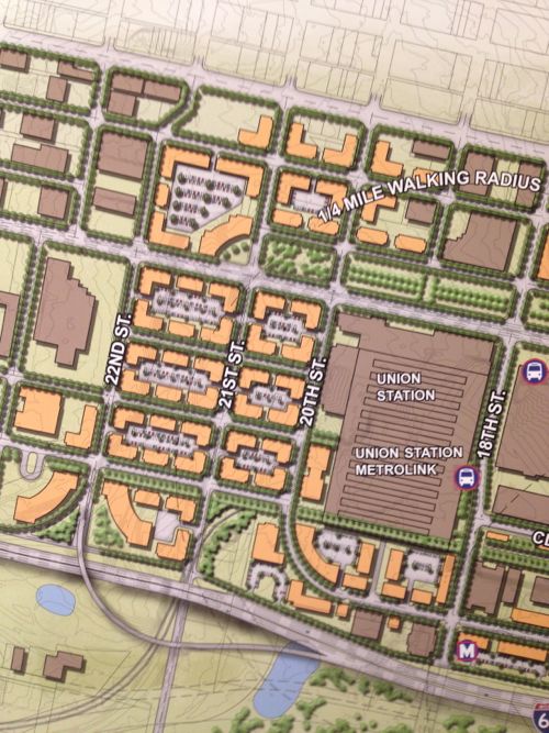
Then, last month, at an St. Louis Regional Transit Oriented Development Study presentation around the Union Station & Civic Center Metrolink stations the Denver-based consulting firm suggested largely what I had outlined years earlier.
Preliminary plan around Union Station, the Drury (former YMCA) and other existing buildings should be shown in the final presentation.
Ok, they still have on/off ramps for I-64/40 to the east, but they are compact and feed into the reconnected street grid I had advocated. The above image is preliminary, I pointed out it was missing buildings like the Drury Inn on 20th, formerly a YMCA and later a gay bar/hotel/bathhouse. Hopefully their final will be more accurate than the draft shown at the last meeting.
Still they see what I and others saw, the need to repair the street grid and fill in the gaps in the urban fabric.
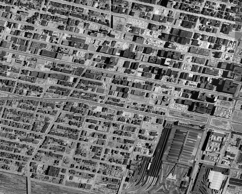
The 22nd Street interchange is just on/off ramps.1958 aerial of the area west & north of Union Station
This is not about trying to recreate the buildings and feel of the area prior to the demolition for the highway interchange. This is a forward-looking vision to create a walkable/urban environment for those interested in such. Some prefer the look & feel of new buildings, new sidewalks, new trees, etc. This is an opportunity to create an entirely new neighborhood largely from scratch yet have access to existing transit.
Per McKee’s plans, a few new employers could anchor the neighborhood. Workers & residents would attract restaurants, dry cleaners, and other services.
None of this is rocket science, it’s Urban Planning 101. St. Louis still needs lots of basics to rebuild the connections that were ripped out in the 20th Century.
AARP Livibility Index
The Livability Index scores neighborhoods and communities across the U.S. for the services and amenities that impact your life the most
Built St. Louis
historic architecture of St. Louis, Missouri – mourning the losses, celebrating the survivors.
Geo St. Louis
a guide to geospatial data about the City of St. Louis